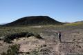
Ubehebe Crater
in Death Valley National Park
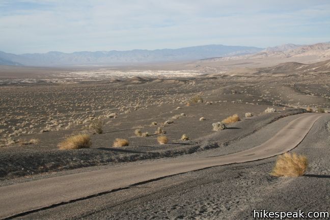
Ubehebe Crater is located in the north end of Death Valley National Park near the Eureka Dunes and Scotty’s Castle. A parking lot along the rim provides a great view of the crater, and three trails offer even more.
The Science
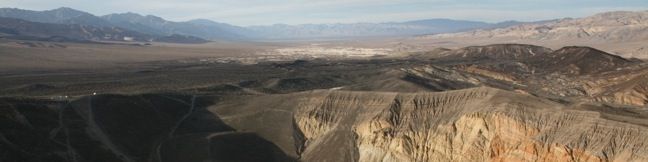
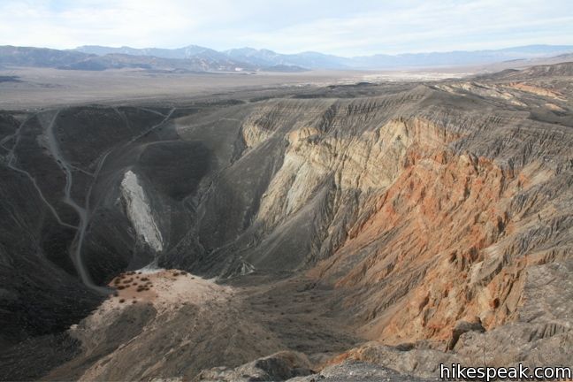
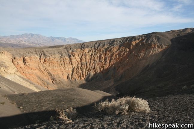
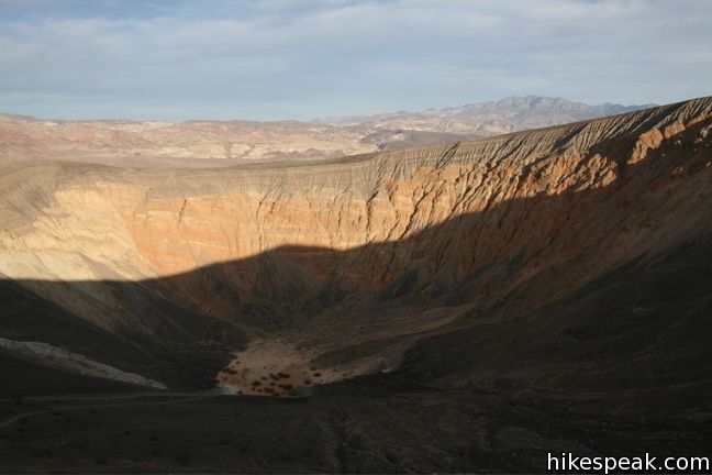
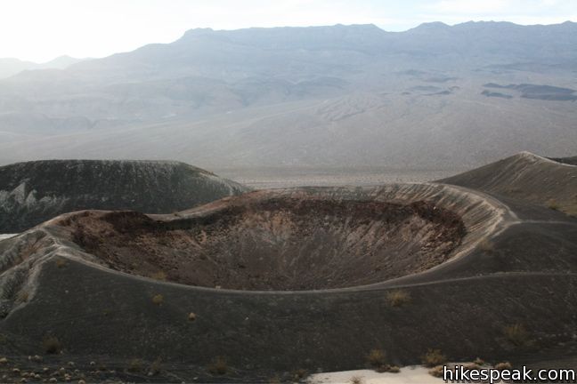
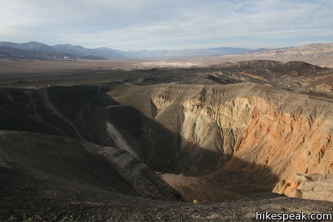
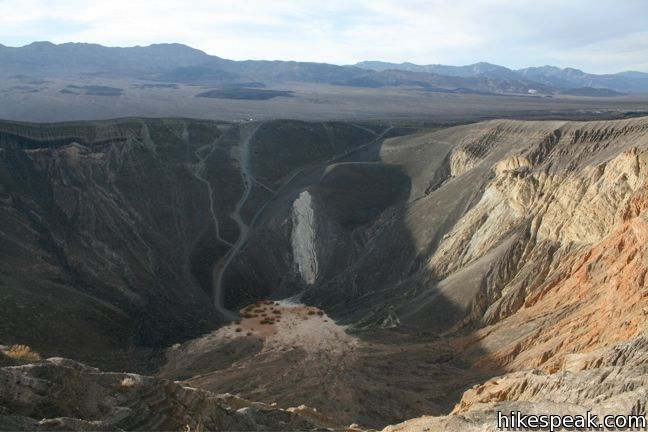
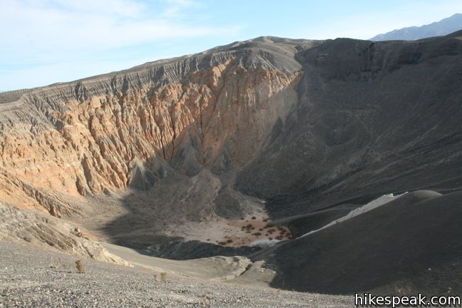
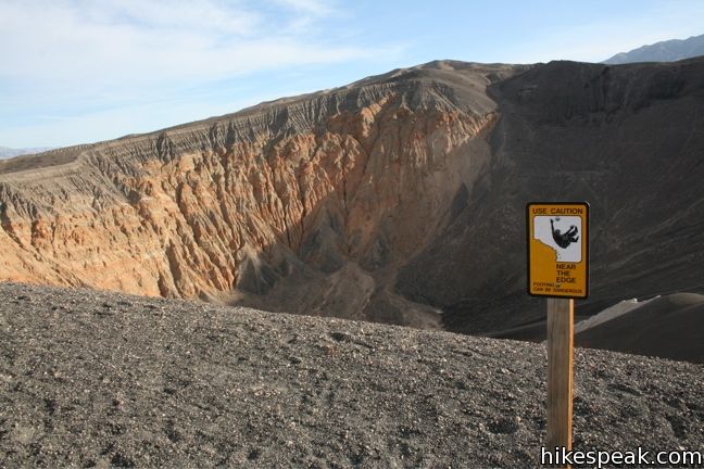
Ubehebe Crater is a maar volcano that was created by a phreatic eruption two to seven thousand years ago. Hot magma converted groundwater into steam, which created an intense pressure and an intense explosion. The result was a half-mile wide crater surrounded by a large cinder field.
The Hikes
Those wanting a different perspective than the one from the parking lot, have three trails to chose from.
Option 1: “Down the crater”
This trail leads off with a quick easy descent to the crater floor, but the steep 600-foot climb back to the rim does not look as enjoyable.
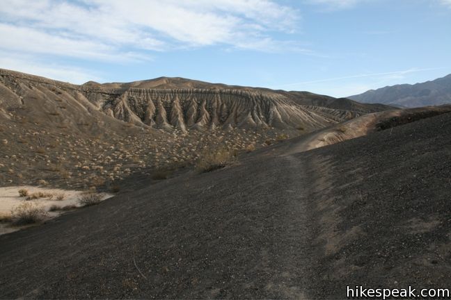
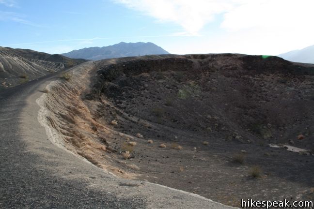
Option 2: “Little Hebe Trail”
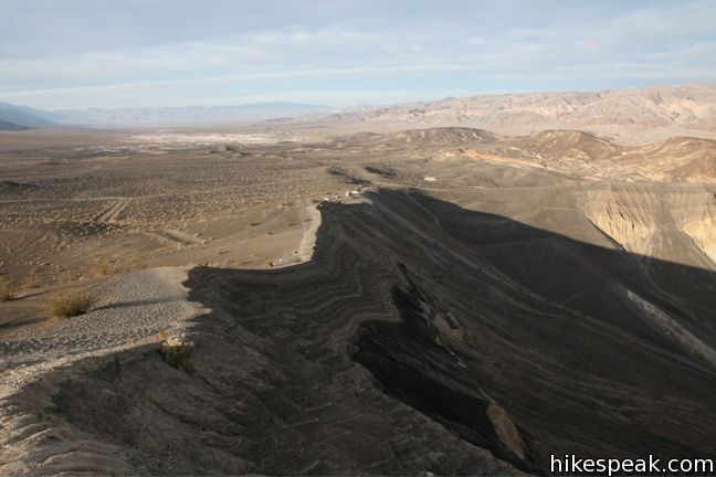
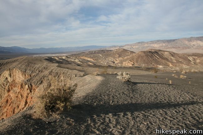
This one-mile out-and-back follows the western rim to a much smaller adjacent crater, Little Hebe. Along the way, hikers get a good view of the fault of yellow and orange stone, which divides the eastern wall of the crater. Beyond the crater, one can see an expansive cinder field darkening the desert floor.
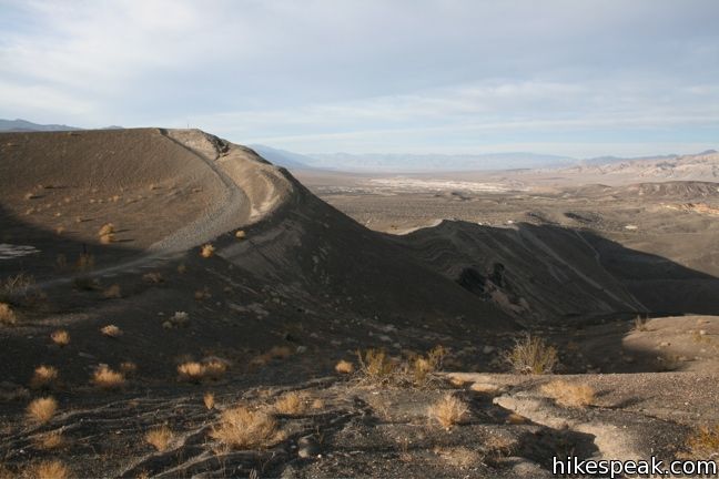
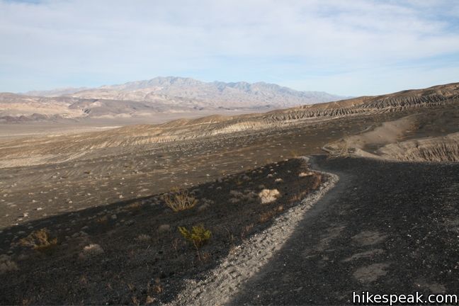
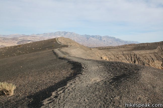
Option 3: “The Rim Trail”
Continue past Little Ubehebe on this 2-mile circuit around the crater back to the parking lot. Much of the sandy rim is level, but the west side of the crater is 270 feet higher. That plus the soft terrain makes this a bit more than a stroll. The views don’t change much between options two and three.
It is often extremely windy along the rim of Ubehebe Crater. Be prepared for cooler temperatures than the desert floor. Death Valley National Park has an entrance fee, but no permit is needed to visit Ubehebe Crater.
Directions to the Trailhead
- From Furnace Creek, take the 190 north for 17 miles to the intersection with Scotty's Castle Road.
- Turn right and continue north for 33.4 miles on Scotty's Castle Road.
- Turn left on Racetrack Road (1.6 miles short of Scotty's Castle) and drive 5.5 miles over gravel to the crater.
Trailhead Location
Trailhead address: Ubehebe Crater, Ubehebe Crater Road, Death Valley National Park, CA 92328
Trailhead coordinates: 37.0108, -117.4549 (37° 00′ 38.9″N 117° 27′ 17.6″W)
View Death Valley National Park in a larger map
Or view a regional map of surrounding California Desert trails and campgrounds.
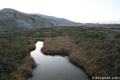 | Salt Creek This easy one mile out-and-back crosses a short boardwalk bordering a little creek. |
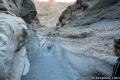 | Mosaic Canyon This 1 to 4-mile hike starts up a smooth marble slot canyon and exposes visitors to plenty of great Death Valley geology. |
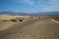 | Mesquite Flat Sand Dunes This 1 + mile hike explores the most visible (but not the largest) sand dunes in Death Valley. |
 | Badwater Basin This is the lowest place in North America -- a required stop for first time visitors to Death Valley. |
 | Other hikes in Death Valley Explore more destinations in Death Valley National Park. |
 | Amboy Crater This 3-mile round trip hike travels up and into this crater adjacent to Mojave National Preserve. |
 | Death Valley Campgrounds Nine campgrounds are spread throughout this large park to facilitate your visit. |
- Ubehebe Crater on wikipedia.org (opens in a new tab)
- Ubehebe Crater on birdandhike.com (opens in a new tab)
- Ubehebe Crater on protrails.com (opens in a new tab)
- Ubehebe Crater on huffingtonpost.com (opens in a new tab)
- The official website for Death Valley (opens in a new tab)
- Death Valley on wikipedia.org (opens in a new tab)
Common Questions about Ubehebe Crater in Death Valley National Park
- Is the trail open?
- Yes. You should expect to find that Ubehebe Crater is open. There are no recent reports of trail closures. If you discover that the trail is closed, please help your fellow hikers by reporting a closure.
- Do I need a permit for this hike?
- Yes. National Park Entrance Fee.
- How much time does this hike take?
- It takes approximately 1 hour to hike Ubehebe Crater. Individual hiking times vary. Add extra time for breaks and taking in the views.
- How long is this hike?
- The hike to Ubehebe Crater is a 2 mile loop with 275 feet of elevation change.
- Are dogs allowed on this trail?
- No, dogs are likely not allowed on Ubehebe Crater. The trail is primarily open to hikers.
- Is Ubehebe Crater good for kids?
- Yes, this hike is likely suitable for children. It is relatively short (2 miles) with manageable elevation gain.
- Where is the trailhead located?
- The trailhead for Ubehebe Crater is located in Death Valley National Park, CA.
Trailhead Address:
Ubehebe Crater Road
Death Valley National Park, CA 92328
Trailhead Coordinates:
37.0108, -117.4549 - What are the driving directions to the start of the hike?
To get to the trailhead: From Furnace Creek, take the 190 north for 17 miles to the intersection with Scotty's Castle Road. Turn right and continue north for 33.4 miles on Scotty's Castle Road. Turn left on Racetrack Road (1.6 miles short of Scotty's Castle) and drive 5.5 miles over gravel to the crater.
View custom Google Maps directions from your current location.
- Are there other trails near Ubehebe Crater?
- Yes, you can find other nearby hikes using the Hikespeak Hike Finder Map.

[…] an uninspiring, overpriced but filling breakfast buffet, we head for Ubehebe Crater in the northern end of the park. The two mountain ranges that form the valley begin to converge […]
https://youtu.be/LwODazmNCuA
Our video of our hike around this super impressive crater!