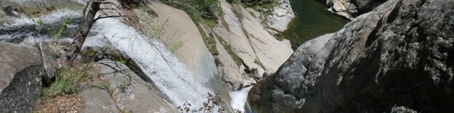
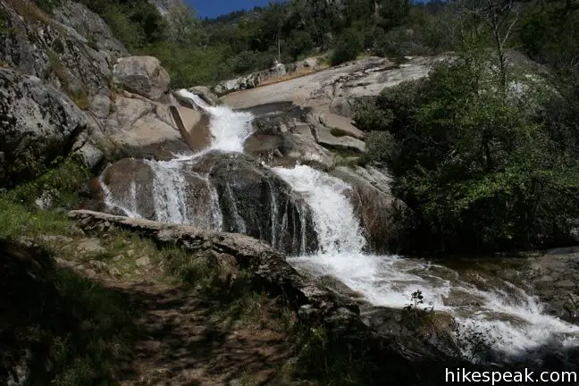
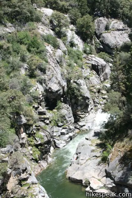
Panther Creek falls one hundred feet down a canyon wall to join the Kaweah River. The Middle Fork Trail passes right above the falls, providing a view straight down the waterfall. Unfortunately, a head on look at the falls cannot be obtained, but the trail is plenty scenic to justify the 6-mile hike (as long as it’s not too hot out).
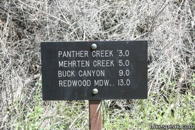
The Middle Fork Trailhead is the foothills gateway to the Sierra. From here, hikers can set out to Redwood Meadow and the High Sierra Trail that runs all the way to Mount Whitney. A wilderness permit is required for those overnight treks, but for day hikers, Panther Creek is three miles away and no trail junctions are in between.
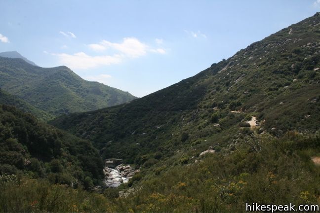
This single track heads east, weaving along the side of the valley hundreds of feet above the Kaweah River. In the spring, the foothills vegetation is lush with Chaparral and wildflowers. The trail offers little shade. On a hot day it can be quite exhausting. For this reason, a higher elevation hike is preferable on a summer scorcher.
From the parking lot, the trail immediately descends to Moro Creek, the first of a few creek crossings. Moro Creek requires the trickiest rock hopping. The rest are quite easy to cross.
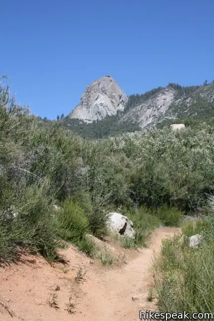
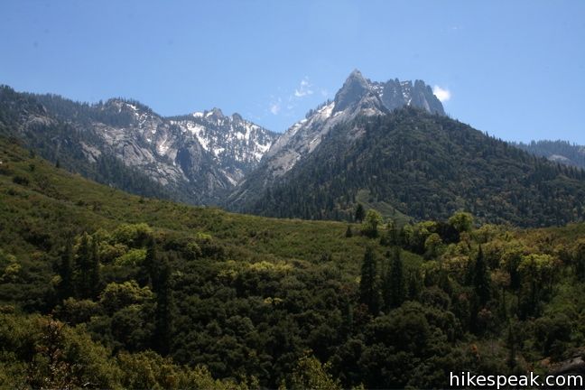
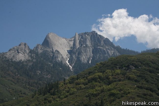
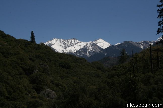
The first mile presents nice views up at Moro Rock, the granite dome that rise out of the canyon 3,000 feet above. Farther on, the views north toward Moro Rock are replaced with even better views south across the canyon at the picturesque pinnacles of Castle Rocks. On occasion, the trail even offers glimpses farther up the canyon toward the snow capped High Sierra.
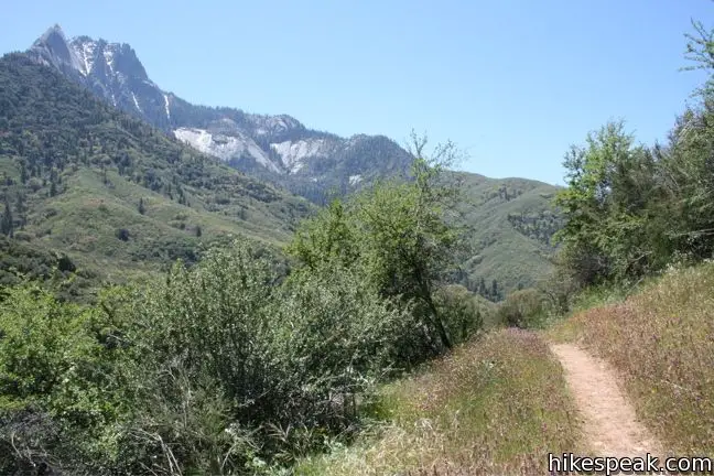
The dusty trail has a few switchbacks. For the most part, the track follows the slope of the canyon on a gradual weaving course toward Panther Creek. When you start to wonder, “how much farther is this creek,” you will enter a wooded area where the trail traverses of a long steep bluff. The canyon dropping drastically to the right is a sign that the dramatic confluence is close ahead.
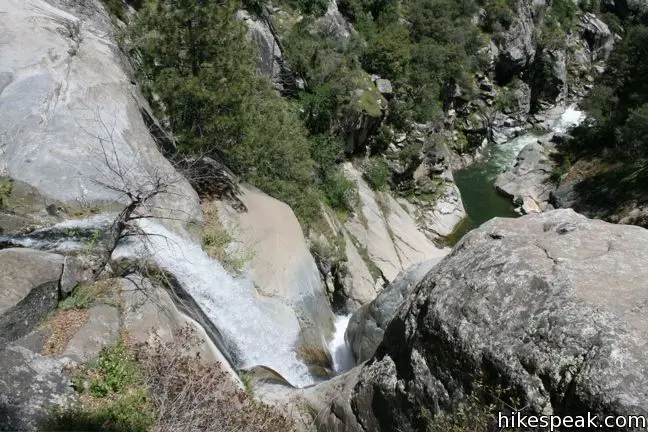
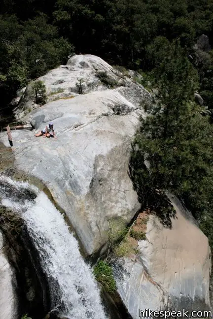
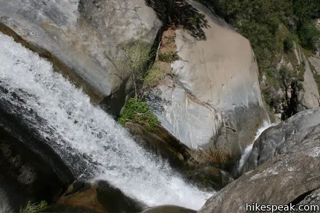
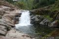
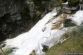
The trail descends to a small pool above the falls. From there the water pours down a narrow shoot to the powerful river below.
Relax along the creek or slip into the cool waters for a dip. The large granite slabs on both sides of the creek offer views of the falls and the river below.
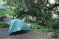
On the opposite side of the creek is a small wilderness campsite with a fire ring and room for a tent or two. From here the trail continues, crossing Mehrten Creek and Buck Creek en route to Bearclaw Meadow. If are not going farther, the trail back is the same as the trail in (just backwards).
The hike starts at 3,325 feet and ends at 3,850, with 750 feet of elevation change between the highs and lows in between. The trail can be unbearably hot in the summer, but quite pleasant in the winter or spring.
To get to the trailhead: Six miles east of the Ash Mountain park entrance, turn off the Generals Highway at Hospital Rock on to the narrow road to Buckeye Flat Campground. After half a mile, when the road turns downhill to the campground, continue straight ahead on a well maintained dirt road for another 1.3 miles to the Middle Fork Trailhead. This road closes in winter, requiring extra millage for those venturing the trail from Hospital Rock. Check with a park ranger for winter road conditions.
Trailhead address: Sequoia National Park, CA 93262
Trailhead coordinates: 36.52755, -118.7513 (36° 31′ 39.2″N 118° 45′ 04.7″W)
View Sequoia National Park in a larger map
Or view a regional map of surrounding Sierra Nevada trails and campgrounds.


 | Paradise Creek This short stroll leaves Buckeye Flat Campground to visit the perfect swimming hole for a hot summer day in the Sierra. |
 | Marble Falls This 8-mile hike takes a flower-lined path up a mountain canyon to a powerful waterfall. |
 | More trails in the Sierra Nevada Mountains Explore other destinations in Sequoia National Park and the rest of the range. |
 | Sequoia and Kings Canyon National Parks Campgrounds Fourteen campgrounds with over 1,000 total sites are spread throughout the park to facilitate your visit. |
In the late-’60s/early-70s, around the time I was ten, my dad, brother and I would spend a few days each spring camping where the trail met Panther Creek, taking day trips up the creek to fish each day. Walking and climbing along those rocks and pools, I believe a portion of my soul was built there. Thanks for the pics, I hope to return some day.
This trail.. while not without beauty, kinda sucks. The only 2 other hikers I came across whole heartedly agreed with me. Basically, it’s a very exposed trail. The parts that aren’t are absolutely swarming with gnats. My ankle came within a foot or so of a very large rattlesnake. And the scenery is average for this park. All in all. Not the greatest trail.
What time of year did you go?
Is there fish in any creek/stream off this trail?