Lunada Canyon Trail
on Palos Verdes Peninsula

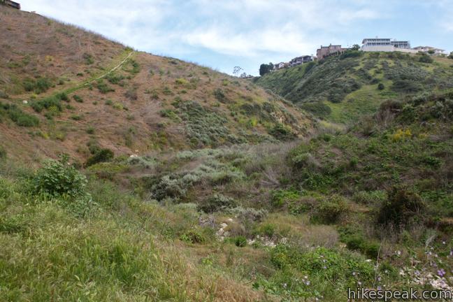
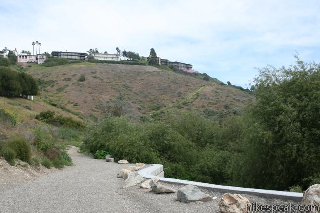
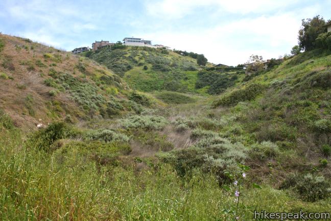
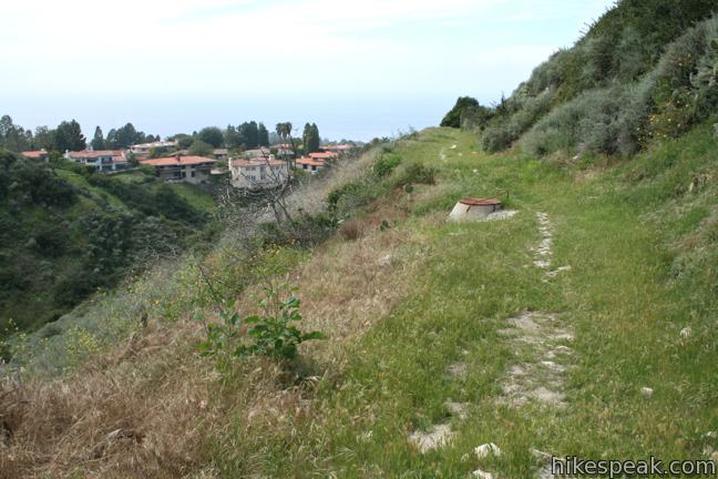
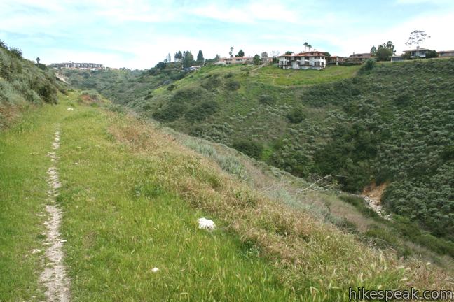
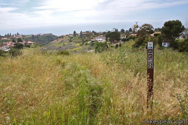
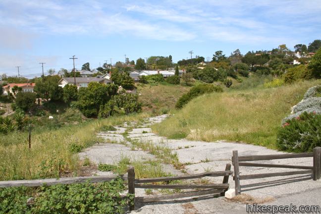
Lunada Canyon is a strip of open space between residential ridges on the Palos Verdes Peninsula. The 0.95-mile trail is accessible from the top and bottom of the canyon, and from another road meeting the trail 0.2 miles from the top. The upper half of Lunada Canyon Trail is overgrown, and the wall of nearby houses make it a less desirable area to hike.
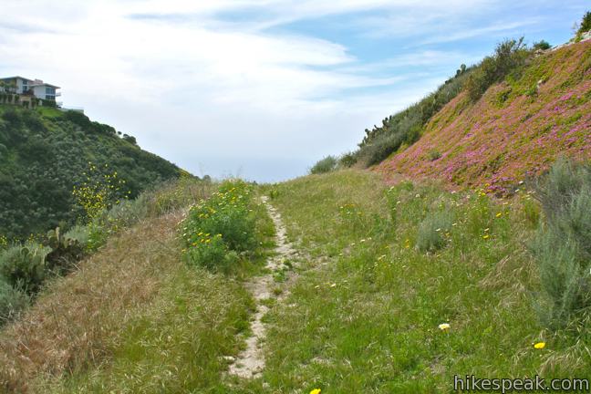
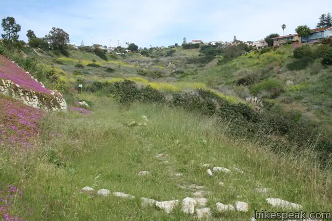
The canyon lies within the 59-acre Agua Amarga Ecological Reserve, and while the trail is straight forward with no junctions, there are a few options to consider. The most obvious option is to hike the full length of Lunada Canyon Trail for a 1.9-mile round trip hike with 550 feet of elevation change. The top 0.2 miles between Posey Way and Rock Park Drive are the least traveled, least scenic, and most overgrown. Unless you really need the exercise, feel free to skip that section, bringing the hike down to 1.5 miles with 400 feet of elevation change.
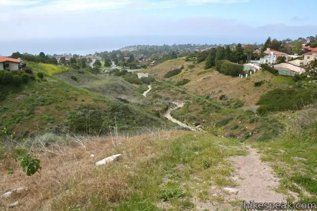
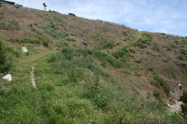
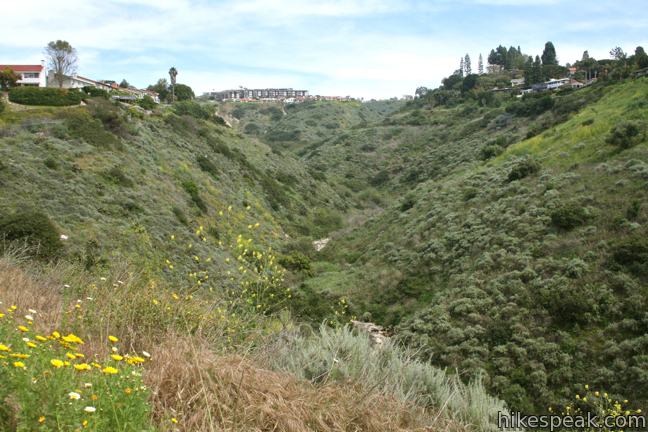
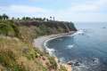
A steep section of trail is 1/4 of a mile from the bottom, so those starting from the top may decide to turn around early for a round trip hike of 1 1/3 miles or 0.93 miles (depending on where you start). The area directly above the steep section is the most stimulating part of the hike, as it overlooks a dramatic confluence with Agua Amarga Canyon, a deep adjoining trench. The area also presents the best ocean view looking out the gully of the canyon toward Lunada Bay.
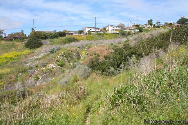
Starting from the bottom of the trail, one could hike 0.55 miles to a trail sign on the left side of the canyon atop the steep section. Above this area, the trail is highly overgrown, especially during the spring green. The trail is very close to houses and provides less of a retreat than you might be looking for. The views along the top half of the trail change very little, so feel free to turn around at the sign for a 1.1-mile round trip hike with 190 feet of elevation gain. Otherwise, follow the trail across the creek bed through a dense thicket, and up to the Rock Park Drive Trailhead. The “trail” continues for 0.2 miles from here to Posey Way, becoming quite thin and difficult to distinguish within the tall grasses.
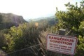
Overall, Lunada Canyon Trail fails to escape civilization or provide views worthy of the trudging. A sewer line shares the same conduit as the trail, adding a few unpleasant smells. Unless you live in the neighborhood, you may be happier hiking elsewhere. No fee or permit is required. Dogs are welcome, as well as bicycles.
Directions to the Trailhead
Lower Lunada Canyon Trailhead:
- From Los Angeles take the 405 or 110 Freeway south to the 405-110 interchange near Carson.
- Continue south on the 110 for 8 miles to the end of the freeway.
- Turn left on Gaffey Street and make the third right on First Street.
- After one mile, turn left on Western Ave (Route 213) and drive 1.7 miles to the intersection with West 25th Street.
- Turn right and drive 1.3 miles on 25th Street until it becomes Palos Verdes Drive.
- Continue 6.7 miles and turn right on to Paseo Lunada, which becomes Via Carrillo after 0.1 miles.
- The trail is located on the left side of Via Carrillo.
- Street Parking is available.
Upper Lunada Canyon Trailhead:
- From Los Angeles take the 405 or 110 Freeway south to the 405-110 interchange near Carson.
- Continue south on the 110 Freeway for 8 miles to the end of the freeway.
- Turn left on Gaffey Street and make the third right on First Street.
- After one mile, turn left on Western Avenue (Route 213) and drive 1.7 miles to the intersection with West 25th Street.
- Turn right and drive 1.3 miles on 25th street until it becomes Palos Verdes Drive.
- Continue 5.3 miles and turn right on Hawthorne Boulevard.
- Drive 2.7 miles inland and make a left onto Verde Ridge Road.
- Drive 0.3 miles and turn right on El Rodeo Road.
- Make the next left on Kings Harbor Road.
- Take the first right onto Posey Way for the very top of the trail, or the second right onto Rock Park Drive for the slightly lower trailhead.
Trailhead Location
Trailhead address: Lower Lunada Canyon Trailhead, 2698 Vía Carrillo, Palos Verdes Estates, CA 90274
Trailhead coordinates: 33.7684, -118.411 (33° 46′ 06.1″N 118° 24′ 39.5″W)
Trailhead address: Upper Lunada Canyon Trailhead, 29201 Posey Way, Palos Verdes Estates, CA 90275
Trailhead coordinates: 33.769138, -118.397569 (33° 46′ 08.89″N 118° 23′ 51.24″W)
View Palos Verdes Peninsula in a larger map
Or view a regional map of surrounding Los Angeles trails and campgrounds.


 | Seascape Trail This level family-friendly 1.5-mile hike explores scenic coastal bluffs north of the historic Point Vicente Lighthouse. |
 | Portuguese Bend Reserve This 5.15-mile double loop explores the scenic coastal hillsides and canyons in Portuguese Bend Reserve on the Palos Verdes Peninsula and can easily be shortened to 3 miles round trip by omitting the lower loop. |
 | Quarry Loop This short loop in Forrestal Nature Reserve delivers lots of ocean views as it circles an old bowl-shaped quarry. |
 | Deane Dana Friendship Park This 1.1-mile loop circles a park with panoramic ocean views over the south end of the Palos Verdes Peninsula. |
 | White Point Nature Preserve This 1 to 2.5-mile hike explores an open space containing a military bunker built to defend the west coast during World War II. |
 | More trails in the Los Angeles Explore other destinations in the Santa Monica Mountains, San Gabriel Mountains, and elsewhere. |
Common Questions about Lunada Canyon Trail on Palos Verdes Peninsula
- Is the trail open?
- Yes. You should expect to find that Lunada Canyon Trail is open. There are no recent reports of trail closures. If you discover that the trail is closed, please help your fellow hikers by reporting a closure.
- Is this trail free to access?
- Yes, Lunada Canyon Trail is free to access. No entrance fee, pass, or permit is required. If you discover that access rules have changed, please provide feedback on your experience.
- How much time does this hike take?
- It takes approximately 1 hour 15 minutes to hike Lunada Canyon Trail. Individual hiking times vary. Add extra time for breaks and taking in the views.
- How long is this hike?
- The hike to Lunada Canyon Trail is a 1.9 mile out and back with 550 feet of elevation change.
- Are dogs allowed on this trail?
- Yes, dogs are allowed on Lunada Canyon Trail. The trail is open to hikers, dogs, bikes.
- Where is the trailhead located?
- The trailhead for Lunada Canyon Trail is located in Palos Verdes Estates, CA.
Trailhead Address:
2698 Vía Carrillo
Palos Verdes Estates, CA 90274
Trailhead Coordinates:
33.7684, -118.411 - What are the driving directions to the start of the hike?
To get to the trailhead: Lower Lunada Canyon Trailhead: From Los Angeles take the 405 or 110 Freeway south to the 405-110 interchange near Carson. Continue south on the 110 for 8 miles to the end of the freeway. Turn left on Gaffey Street and make the third right on First Street. After one mile, turn left on Western Ave (Route 213) and drive 1.7 miles to the intersection with West 25th Street. Turn right and drive 1.3 miles on 25th Street until it becomes Palos Verdes Drive. Continue 6.7 miles and turn right on to Paseo Lunada, which becomes Via Carrillo after 0.1 miles. The trail is located on the left side of Via Carrillo. Street Parking is available.
Upper Lunada Canyon Trailhead: From Los Angeles take the 405 or 110 Freeway south to the 405-110 interchange near Carson. Continue south on the 110 Freeway for 8 miles to the end of the freeway. Turn left on Gaffey Street and make the third right on First Street. After one mile, turn left on Western Avenue (Route 213) and drive 1.7 miles to the intersection with West 25th Street. Turn right and drive 1.3 miles on 25th street until it becomes Palos Verdes Drive. Continue 5.3 miles and turn right on Hawthorne Boulevard. Drive 2.7 miles inland and make a left onto Verde Ridge Road. Drive 0.3 miles and turn right on El Rodeo Road. Make the next left on Kings Harbor Road. Take the first right onto Posey Way for the very top of the trail, or the second right onto Rock Park Drive for the slightly lower trailhead.
View custom Google Maps directions from your current location.
- Are there other trails near Lunada Canyon Trail?
- Yes, you can find other nearby hikes using the Hikespeak Hike Finder Map.

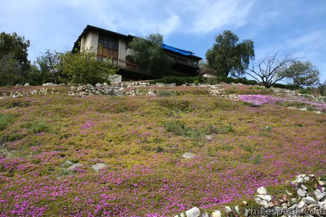
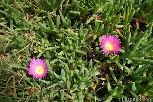
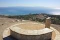
I used to live at the house in pictures #11. Those ice plants were planted by my dad circa 1980, and the “stone ruins” were laid out by my dad and his workers. As a young kid, we used to explore the canyon on our own, but there was really no real trail to speak of. We just bushwacked our way down to the creek. The trail is really the remnant of the sewer access trail constructed for the development above.