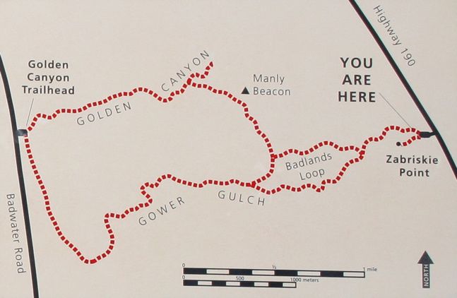
Badlands Loop
in Death Valley National Park
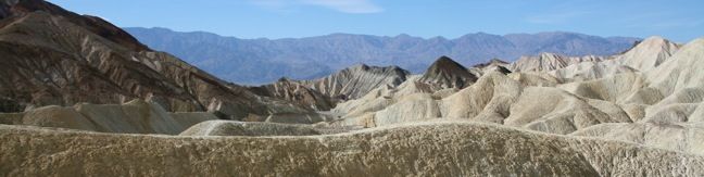
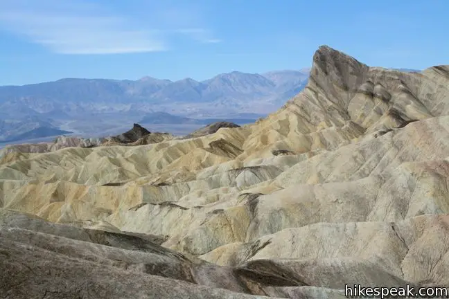
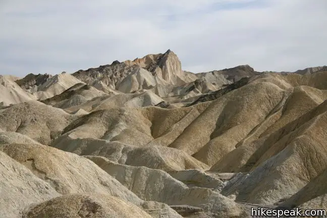
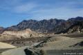
Badlands Loop offers a great immersion into the terrain beneath Zabriskie Point in Death Valley National Park. This 2.5-mile hike is all badlands. Anyone who hiked the Golden Canyon – Gower Gulch Loop and enjoyed the middle section of the trek will love the Badlands Loop.
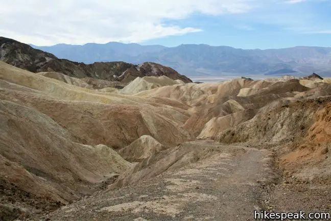
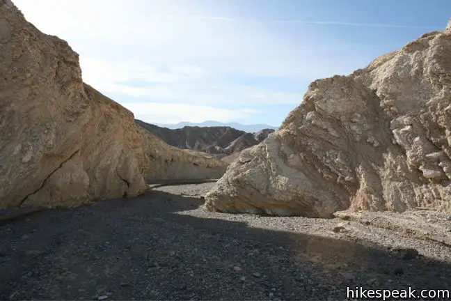
The trail starts down an obvious gully just north of the Zabriskie Point parking lot. The gully expands as it descends, gradually leading hikers into a major artery of Gower Gulch. About half a mile in, a sign marks the start of the circular part of the loop. To the right, the trail climbs out of the wash and up a badlands slope. To the left, the trail continues into Gower Gulch.
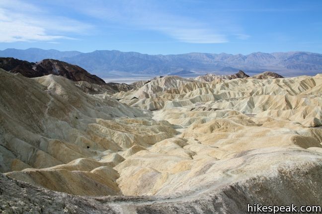
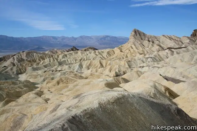
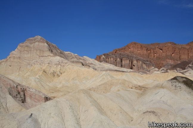
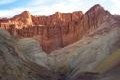
The loop is easiest to follow by turning to the right. March up the dried mudstone and the views of the badlands widen. Manly Beacon and Red Cathedral appear over waves of orange mudstone. The trail puts hikers right in the center of this arid terrain.
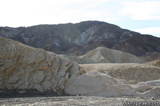
Borax, called white gold by miners, was mined extensively in this region in the 1880s and many mines shafts remain. The Badlands Loop descends a divide past several abandoned Borax mines. They are unstable and not for exploration.
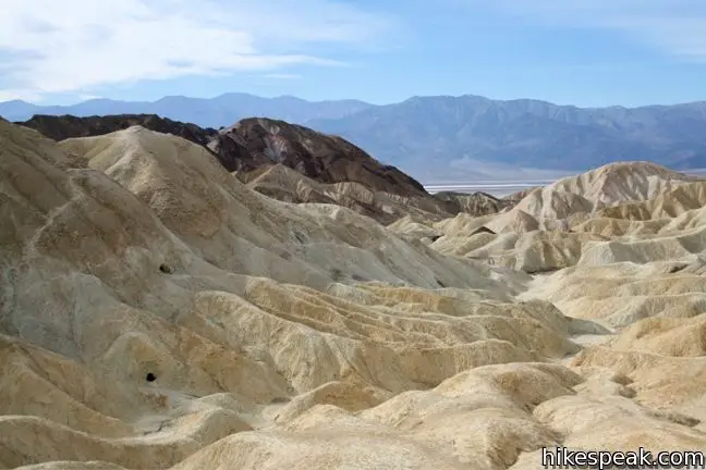
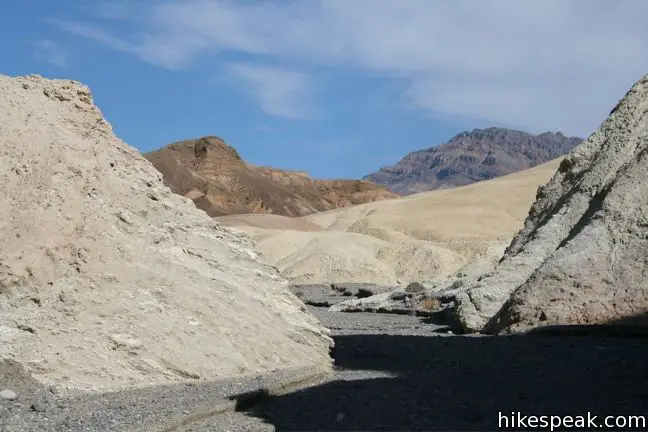
The footpath continues down the badlands, eventually depositing onto a large wash at a marked junction with the Golden Canyon – Gower Gulch Trail.
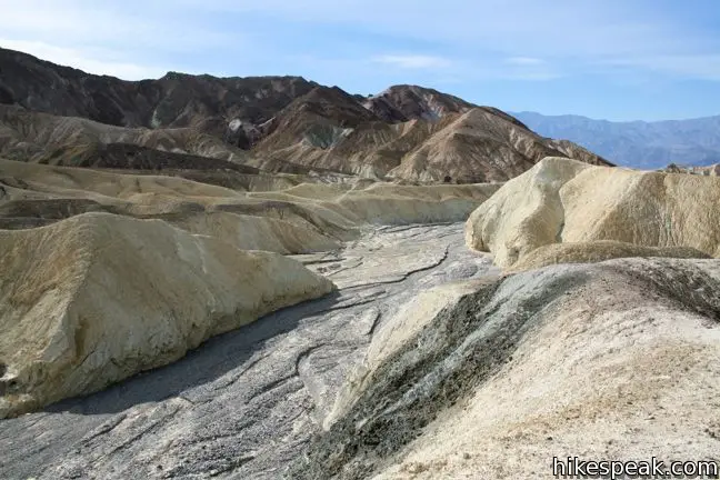
To complete the second half of the Badlands Loop, turn left and follow the wash down to a merger with the wide gravelly mega-drainage known as Gower Gulch. Turn left again and follow Gower Gulch uphill toward Zabriskie Point.
Those who prefer to trek across a bit more of the badlands may cut the corner above the confluence.
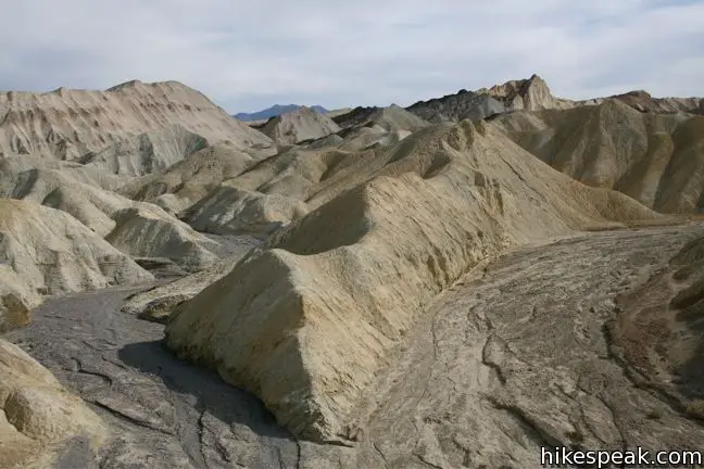
Follow the main channel of Gower Gulch as it curves to the left, leading back to the sign marking the top of the loop. From here, follow the same gully back up the trailhead.
Directions to the Trailhead
- From Furnace Creek, drive southeast on Highway 109 for 4 miles.
- Turn right into the parking lot for Zabriskie Point.
Trailhead Location
Trailhead address: Zabriskie Point, Zabriskie Point Road, Death Valley National Park, Death Valley, CA 92328
Trailhead coordinates: 36.42085, -116.8099 (36° 25′ 15.1″N 116° 48′ 35.6″W)
View Death Valley National Park in a larger map
Or view a regional map of surrounding California Desert trails and campgrounds.


 | Golden Canyon - Gower Gulch Loop This 4-mile loop visits stunning terrain in the badlands region near Furnace Creek. |
 | Zabriskie Point Zabriskie Point offers a stunning panorama of the badlands near Furnace Creek. |
 | Twenty Mule Team Canyon This 2.8-mile one way road is just up the road from Zabriskie Point. The fine canyon that can be experienced right from the driver's seat. |
 | Death Valley Explore more destinations in Death Valley National Park. |
 | Death Valley Campgrounds Nine campgrounds spread are throughout this large park to facilitate your visit. |
Common Questions about Badlands Loop in Death Valley National Park
- Is the trail open?
- Yes. You should expect to find that Badlands Loop is open. There are no recent reports of trail closures. If you discover that the trail is closed, please help your fellow hikers by reporting a closure.
- Do I need a permit for this hike?
- Yes. National Park Entrance Fee.
- How much time does this hike take?
- It takes approximately 1 hour 15 minutes to hike Badlands Loop. Individual hiking times vary. Add extra time for breaks and taking in the views.
- How long is this hike?
- The hike to Badlands Loop is a 2.5 mile loop with 300 feet of elevation change.
- Are dogs allowed on this trail?
- No, dogs are likely not allowed on Badlands Loop. The trail is primarily open to hikers.
- Where is the trailhead located?
- The trailhead for Badlands Loop is located in Death Valley National Park, CA.
Trailhead Address:
Zabriskie Point Road
Death Valley National Park, CA 92328
Trailhead Coordinates:
36.42085, -116.8099 - What are the driving directions to the start of the hike?
To get to the trailhead: From Furnace Creek, drive southeast on Highway 109 for 4 miles. Turn right into the parking lot for Zabriskie Point.
View custom Google Maps directions from your current location.
- Are there other trails near Badlands Loop?
- Yes, you can find other nearby hikes using the Hikespeak Hike Finder Map.

6 Comments on Badlands Loop in Death Valley National Park
What hikers are saying:
✨ Generated summary of user commentsHikers find the stunning rock formations and views from the trail well worth the effort for the easy walking experience. However, the terrain is deceptive, and Nick warns that it is easy to lose the path and run out of water. Carrying a map, compass, or GPS is essential to navigate the area safely.
“Stunning rock formations and views from the trail, and pretty easy walking!” Jump to comment ↓
I managed to get lost on this trek. Ended up down there for 3 hours on my own and ran out of water and almost hope of ever finding my way back. Was close to death…literally..:-(
Please carry a PLB next time and if you can afford it a GPS and a satelite phone. If you know the area atleast use a map and a compass.
I wasn’t really planning to do this hike… but after seeing the view from Zabriskie Point and the trails below, it looked worth making the effort. Glad I did. Stunning rock formations and views from the trail, and pretty easy walking!
https://hikingtheworld.blog/2018/11/11/mini-hikes-in-death-valley/#Zabriskie-Point
[…] for a spectacular panoramic view. And it’s the starting point for several trails, including a 2.5-mile loop hike into the beauty of the […]
[…] The badlands terrain of Zabriskie is full of impressive yellow and grey canyons. It might be one of the most recognizable and certainly one of the most picturesque stops in Death Valley. If you stay longer than for the day, I recommend taking one of the fun hikes that are leading through these scenic canyons. Mapped-out trail suggestions, like the 2.5 mi / 4km Badland’s Loop, are posted at the parking lot info signs, and there is more valuable information here. […]
[…] and walk up a small hill to reach the viewpoint, if you have time, this area is home to the amazing Badlands Trail Loop. It is about two miles and gets you walking through the canyons. However, if you are in a time […]