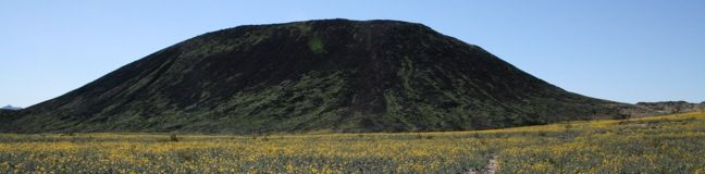
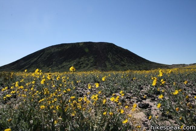
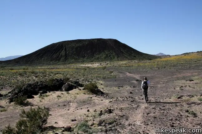
Amboy Crater is nestled halfway between Barstow and Needles, just off historic Route 66. It is located near, but not within, Mojave National Preserve. A visit to Amboy Crater will definitely take you back in time. Ten thousand years ago, this cinder cone volcano erupted, transforming the surrounding landscape. A 3-mile round trip trail leads up and into the crater, connecting to a path around the rim that provides startling views.
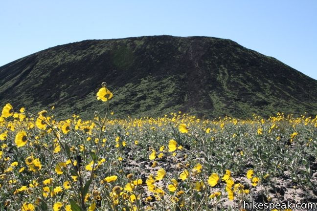
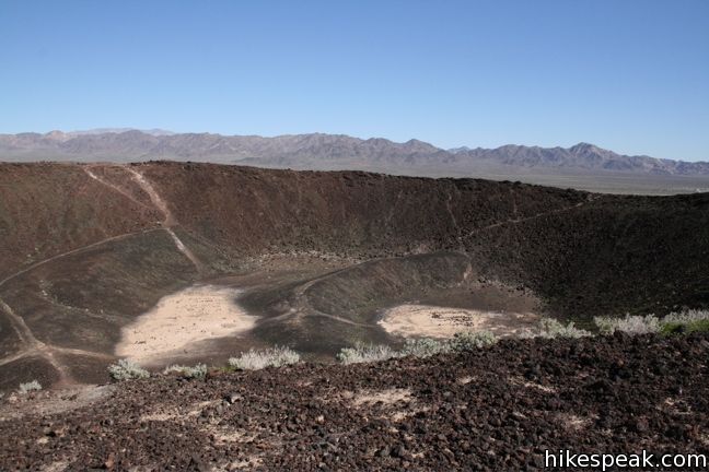
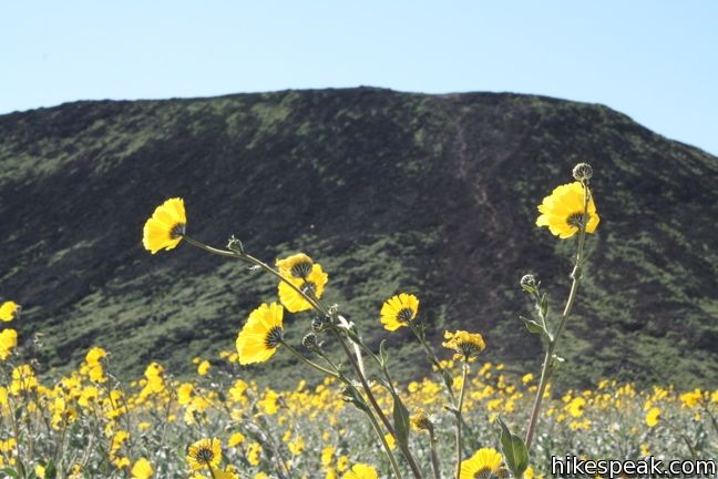
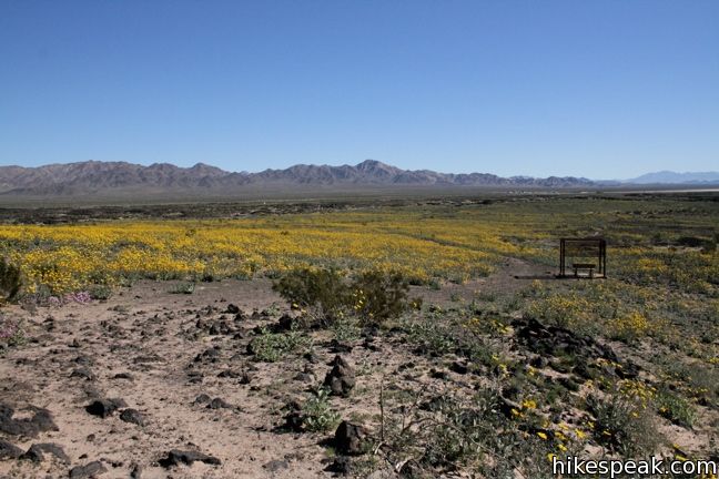
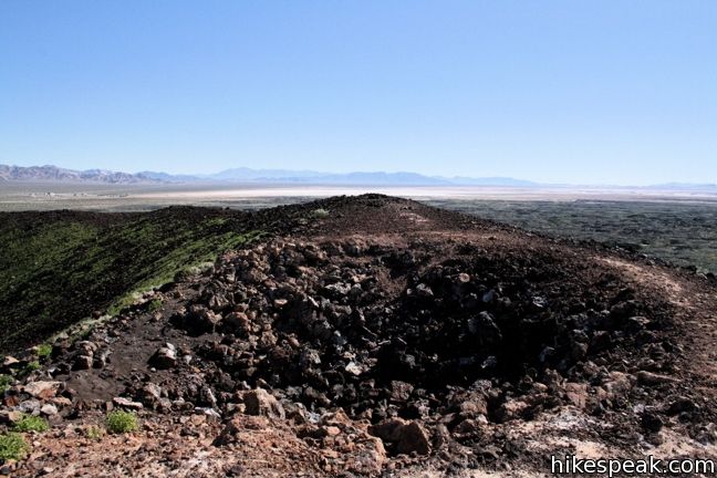
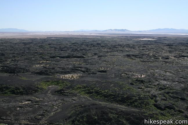
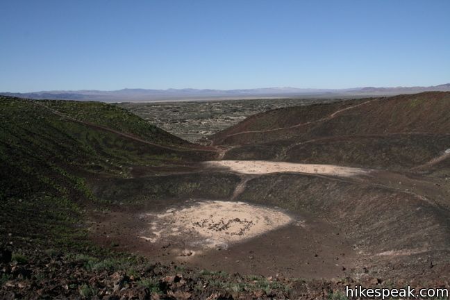
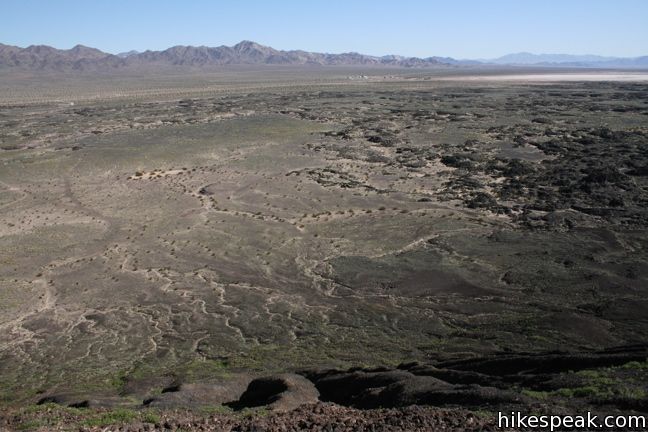
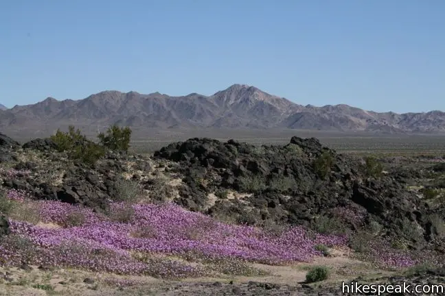
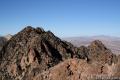
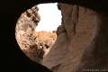
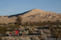
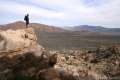
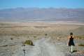
From the parking lot, the trail starts out wide, before narrowing down to a single track. The trail crosses the desert floor, which in the spring time is covered with wild flowers, and swings around the right side of the crater. On the far side, the trail enters through an opening in the rim and climbs across the center to the top. The views from the rim of this 250-foot tall crater show a landscape transformed by volcanic ash.

Amboy Crater is an easy stop for travelers along Interstate 40 and a great detour for those headed from Southern California to Mojave National Preserve. Amboy Crater is on BLM land with no entrance fee. The crater has been protected by Amboy Crater National Natural Landmark since the 1970s, which became part of Mojave Trails National Monument when it was created in February of 2016.
To get to the trailhead: From Barstow, take Interstate 40 west to exit 50. Turn right on Crucero Road and make an immediate left onto Route 66. Take route 66 for 26 miles to the crater.
Trailhead address: Crater Road & Route 66, Amboy, CA 92304
Trailhead coordinates: 34.5572, -115.7814 (34° 33′ 25.9″N 115° 46′ 53″W)
View Mojave National Preserve in a larger map
Or view a regional map of surrounding California Desert trails and campgrounds.


 | Fountain Peak This 5-mile off trail trek summits a peak with commanding views over the Providence Mountains. |
 | Hole-in-the-Wall Rings Trail This 1.5-mile loop takes visitors through a landscape of pocketed rocks. Ringbolts allow fun passage through narrow canyons. |
 | Silver Peak This 8.5-mile hike summits a 6,365-foot peak in the Granite Mountains. |
 | Kelso Dunes This 3-mile round trip hike climbs 470 feet to the highest point in this 45 square mile dune field. |
 | Lava Tube This short 0.6-mile hike drops below the surface into an old lava tube. |
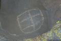 | Petroglyphs near Seventeen Mile Point This quarter-mile path visits ancient engravings in the volcanic rock at the western rim of the cinder fields just off Kelbaker Road. |
 | Teutonia Peak This 3.4 to 4-mile round trip hike crosses the world's densest Joshua tree forest, passing an abandoned silver mine to reach a rocky summit with views of Cima Dome. |
 | Rock Spring Loop Trail This 1 1/3-mile loop visits a rare desert spring, a Rock House built in the 1920s, a miners' mill site, and an old U.S. Army post on a short and scenic circuit. |
 | New York Peak This 7 to 9-mile round trip hike summits the highest point of the New York Range in the northeast corner of the preserve. |
 | Hikes in the California Desert Explore more trails in Death Valley National Park, Joshua Tree National Park, and Mojave National Preserve. |
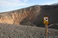 | Ubehebe Crater in Death Valley This 0 - 2 mile hike visits a large crater in the north end of Death Valley. A parking lot along the rim provides a great view of the crater, and there are also three trails to choose from. |
 | Mojave National Preserve There are a few campgrounds and endless roadside camping within the preserve. |
Many years ago I went for a spelunking tour at nearby Pisgah Crater. There are several lava tubes in the area including one that is called Glove Cave not for its shape but because it fit like a glove. There had been great rain that year and the wildflowers were spectacular. Ah, for those days!
In person it is bigger than it looks in pictures. A very scenic nice little short hike. Wear boots because the rim trail has loose volcanic rock.
I saw your video “The Head Of The Metolius”, very cool….I have been there a few times. I was wondering if you have any videos from the “Green Ridge Ranger/Fire Lookout Station” which is very close to The Head Of The Metolius. You can see several peaks from the Cascade Range. The Middle and The North Sister from The Three Sisters (and Little Brother) Range, also visible are Mt. Washington, Three-Fingered Jack, Mt Jefferson (up close and personal), Mt. Hood and on a very rare day I saw Mt. Adams in Washington. Black Butte, just south of Green Ridge, offers a very nice view as well which includes the eastern Oregon grasslands.
No videos. Haven’t been there yet, but thanks for the tip.
[…] Amboy Crater […]