Mueller Hut
in Aoraki Mount Cook National Park
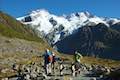
Mueller Hut is one of the most spectacular destinations for a day hike or overnight trek in Aoraki Mount Cook National Park (and perhaps all of New Zealand). Reaching the hut is no simple walk in the park, demanding an ascent of over one thousand meters in just over five kilometers. They truly don’t come much steeper than this and that challenge is part of the trek’s appeal.
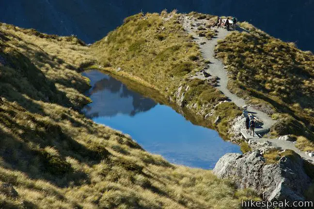
Kick things off by ascending Sealy Tarns Track, which is well maintained with lots of staircases built into the climb up a pair of ponds cradled by a ledge partway up the mountainside. Above Sealy Tarns, the route to Mueller hut is just as steep, but rougher, with only a line of poles to guide you up a rocky slope. Beginning from White Horse Hill Campground, it is 10.5 kilometers round trip to Mueller Hut, including a spur at Sealy Tarns, with 1,045 meters of elevation change (or 6.5 miles round trip with 3,425 feet of elevation change). Because the terrain is so steep, the views and landscapes change dramatically over a relatively short distance. Mueller Hut sits on a rocky ridge at 1,805 meters above sea level. The hut, and the hike to it, has vast, beautiful views of Mount Sefton, Mount Cook, and numerous other peaks, glaciers, and lakes.
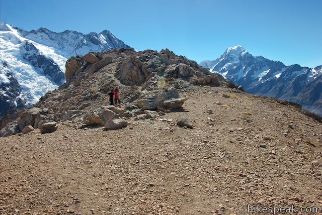
Start from a car park by White Horse Hill Campground and follow Sealy Tarns Track up to Mueller Hut Route. After ascending 540 meters in 2.75 kilometers, you will reach the tarns and a sign for Mueller Hut Route. The maintained track bears right out to a bump in the terrain above the tarns that delivers sweeping views. To reach Mueller Hut, bear left and tackle the rough route that continues up the mountainside.
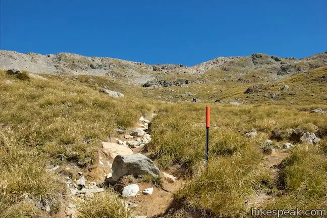
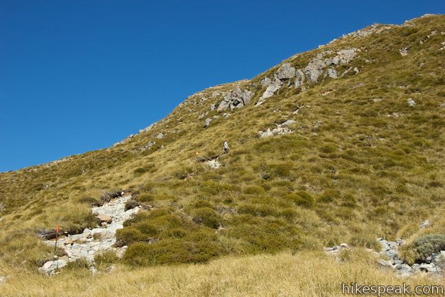
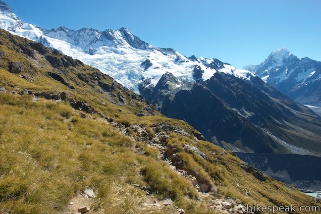
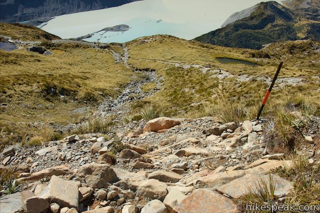
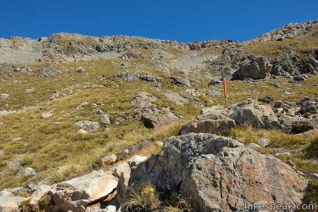
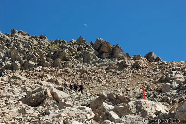
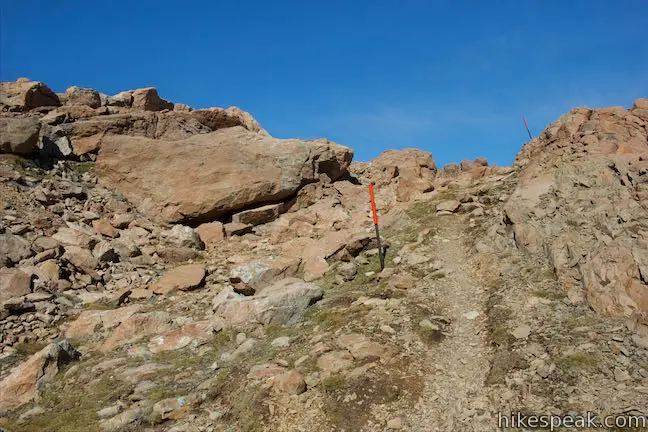
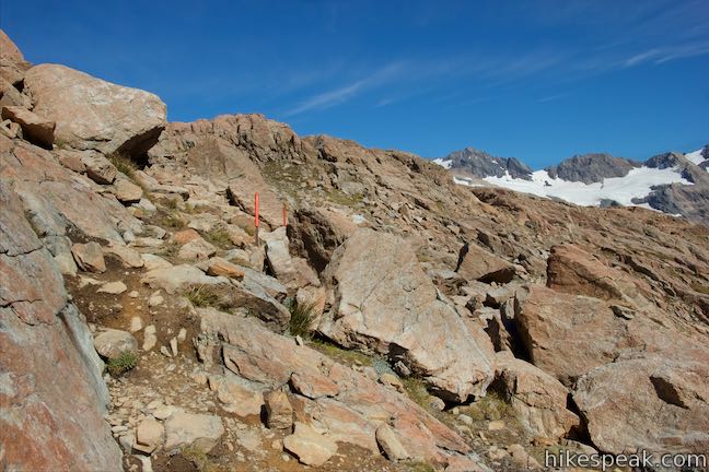
Say goodbye to the refined track you took here, which was full of wooden steps. Now, you’re on a less defined path that goes straight up the rocky mountainside, passing over outcroppings that land in the way. In clear conditions, the route is obvious, thanks to a series of poles with orange tops that mark out the path.
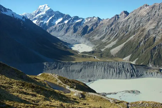
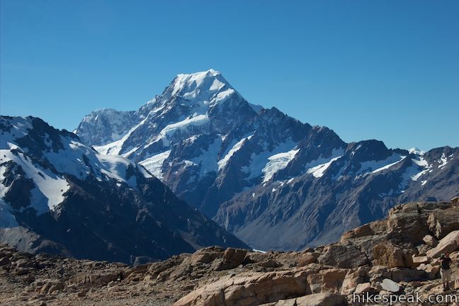
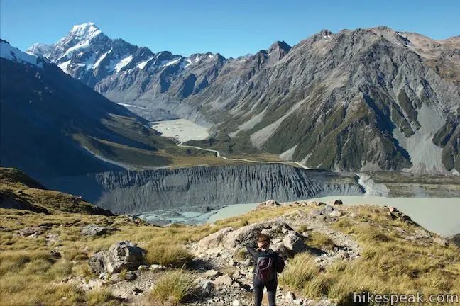
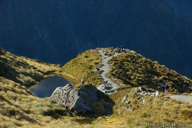
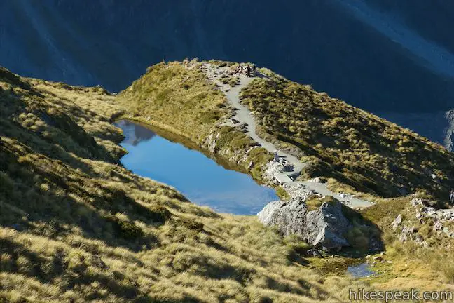
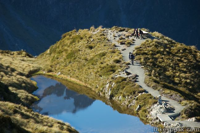
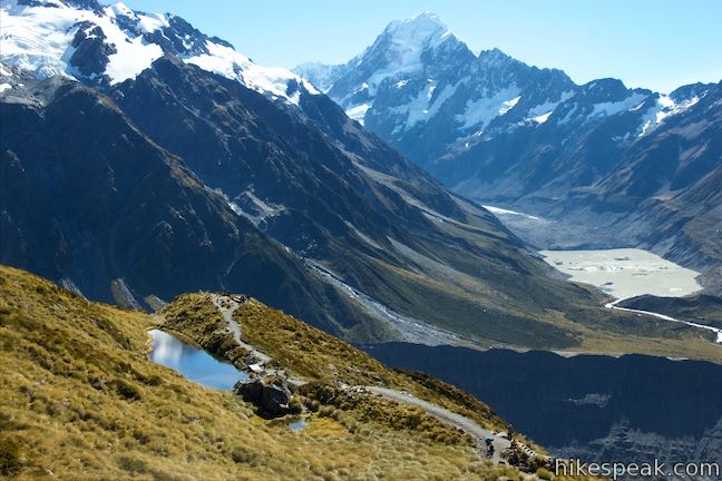
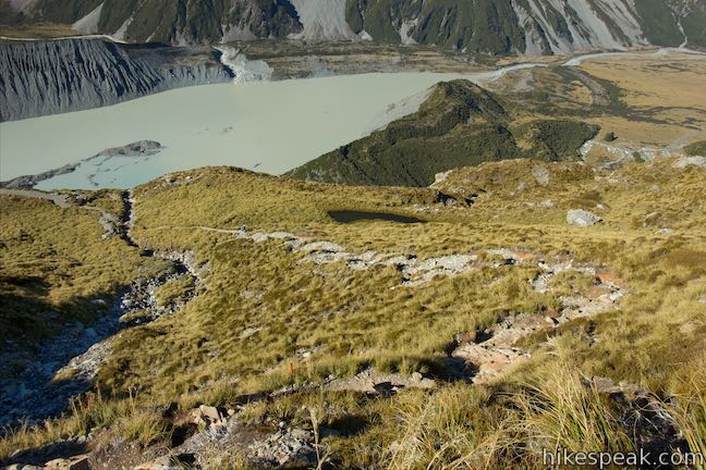
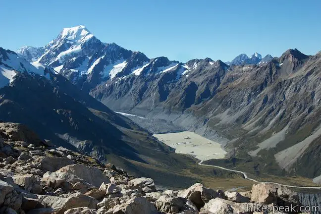
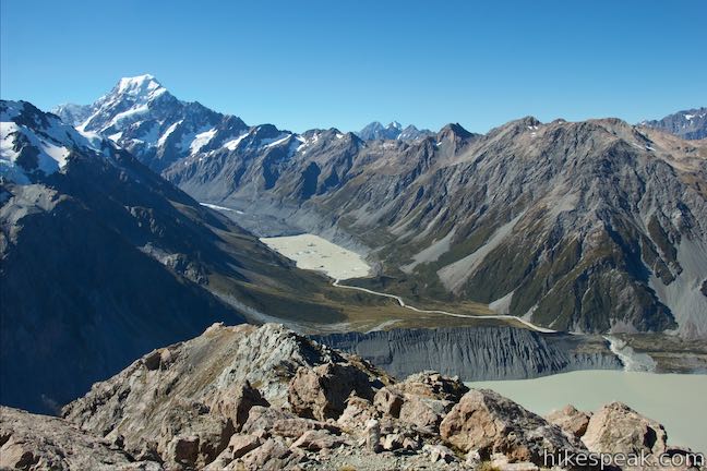
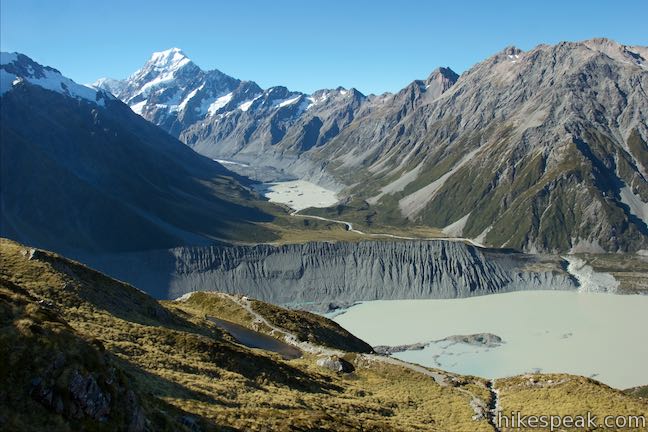
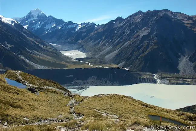
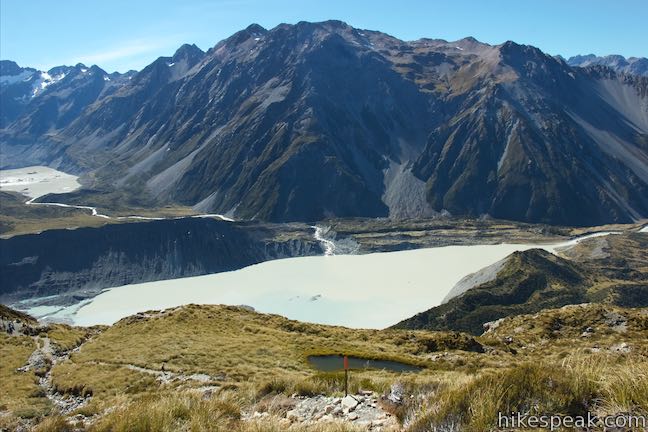
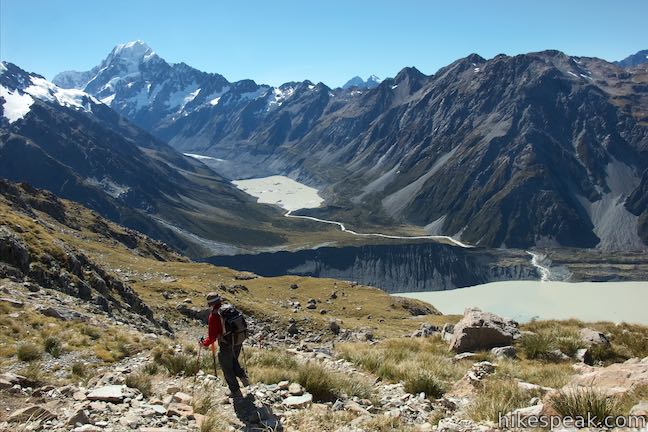
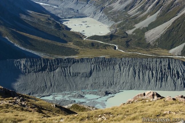
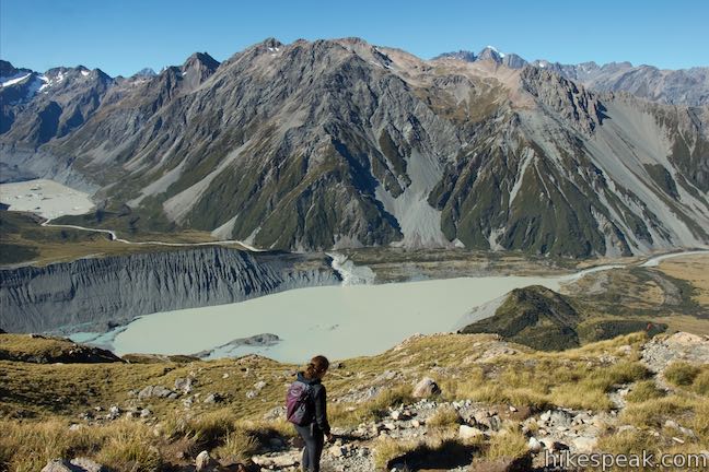
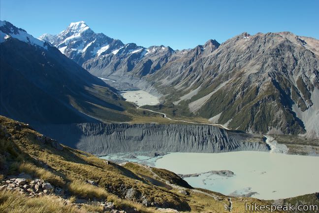
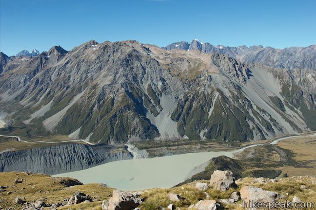
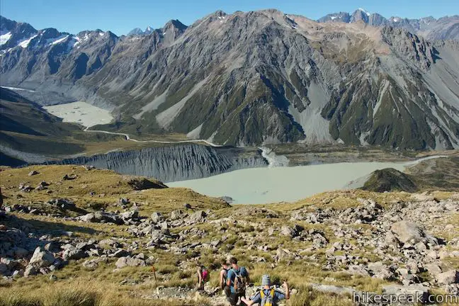
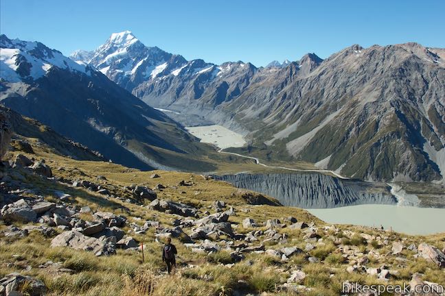
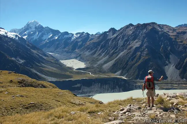
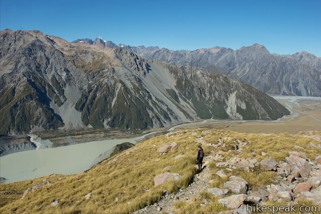
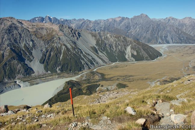
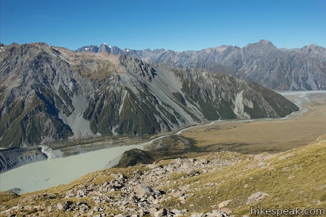
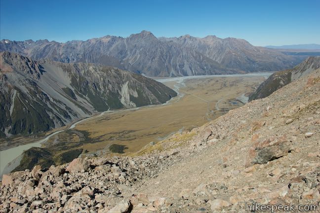
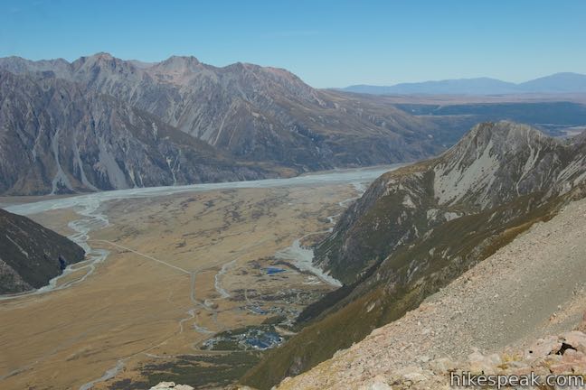
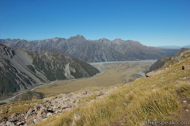
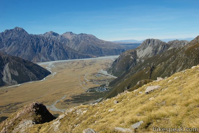
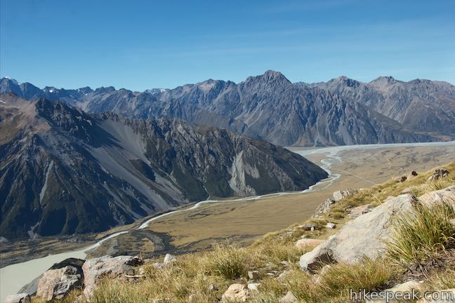
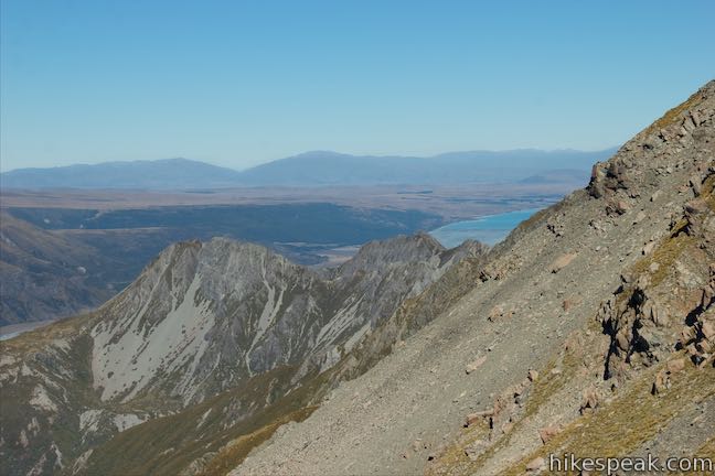
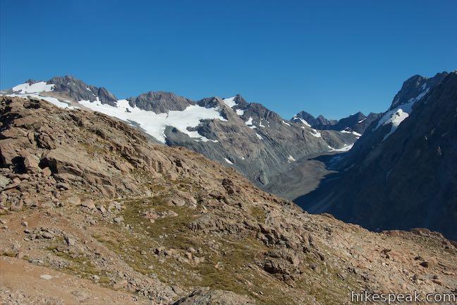
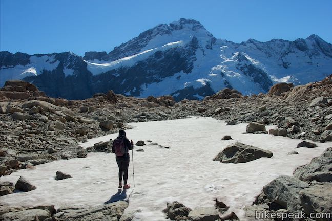
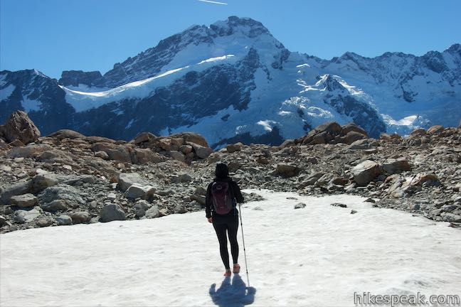
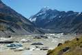
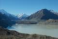
Take a big swing of water and proceed with the C-L-I-M-B. You will pass another small pool on the left, a bonus Sealy Tarn, and head up a slope of rocks and gravel bordered by tussock grasses. Looking over your shoulder, you’ll find nice views over the Sealy Tarns. The small pools reflect the blue of the sky and stand out from the surrounding tussock that is yellow by late summer. Below the tarns (which is behind them from this perspective), you’ll see the larger body of water at the base of the mountains called Mueller Lake. Beyond that, on the opposite side of the valley from the Sealy Range, is the Mount Cook Range or Kirikirikatata. The highest point in that range of course is Aoraki/Mount Cook a dramatic 3,724-meter tall snowcapped mountain that comes to a point above Hooker Valley. Looking into Hooker Valley, you’ll see icebergs on Hooker Lake.
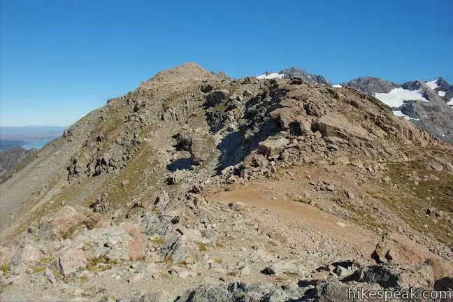
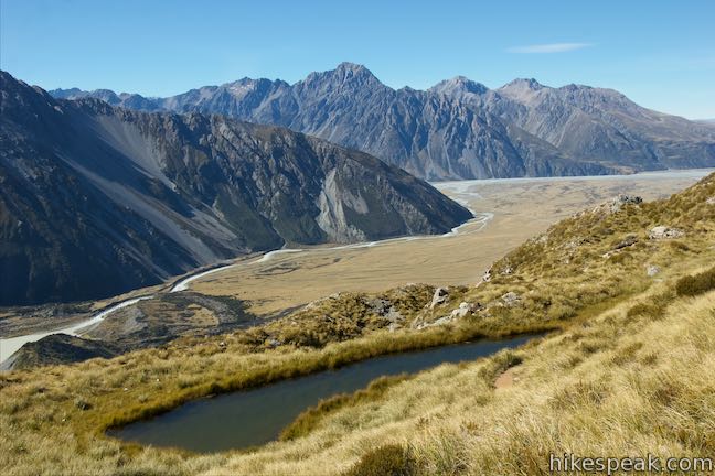
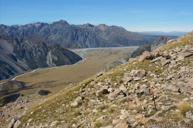
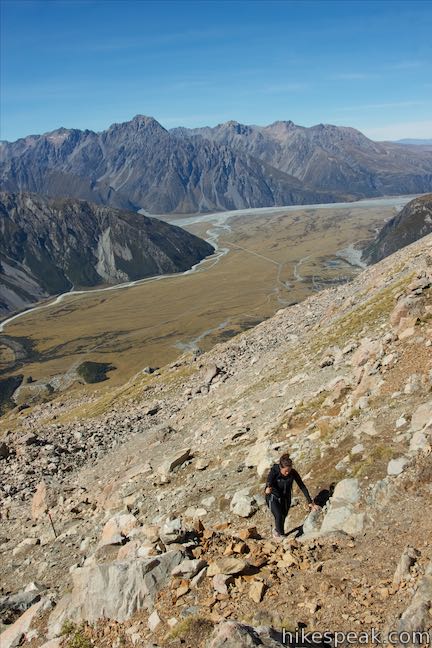
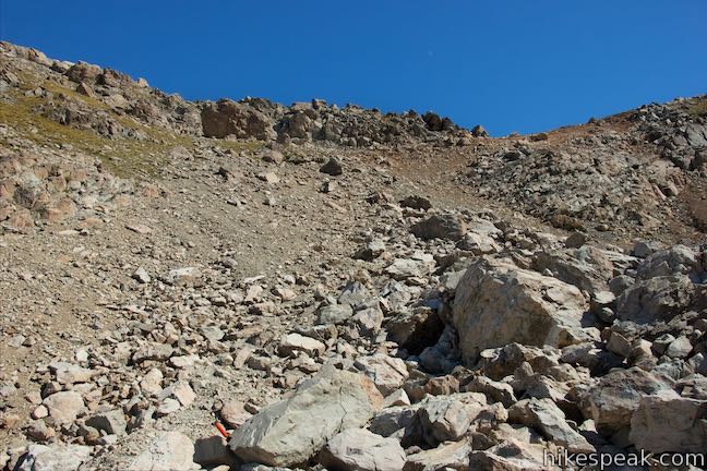
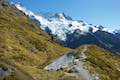
Push up the steep route, where you can plow a straight line or make your own small switchbacks. After about 500 meters, the mountain tilts in and you loose sight of the tarns (although they reappear at certain points higher up). Keep heading higher, bounding over the rocks in your path. Meander through an area of large boulders (following the orange poles) and, at 1.25 kilometers above Sealy Tarns, come to a slope of scree.
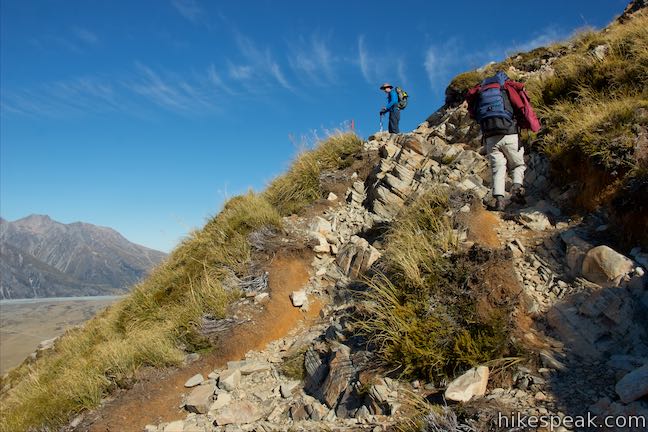
Atop the scree is a rocky crown that you won’t have to cross. Below this rock wall, the route curves to the right toward a notch in the ridge. Past that notch, the ascent becomes more gradual, so this is the last truly steep part of the route. Push your way up the loose slope of rocks and gravel. As you come up below the ridgeline, the line of poles graciously bends to the right, leading up to the notch on the mountainside, 1.45 kilometers above Sealy Tarns.
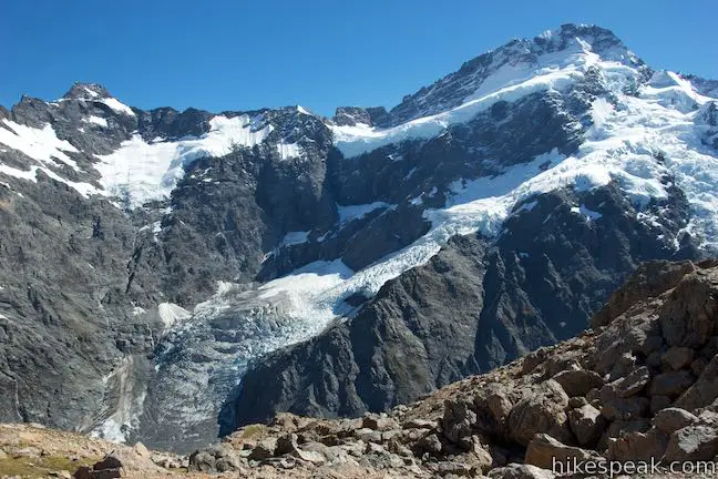
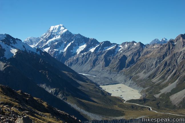
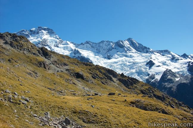
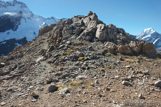
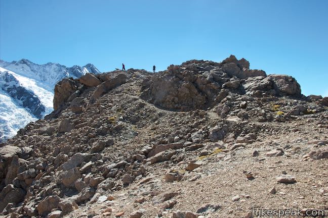
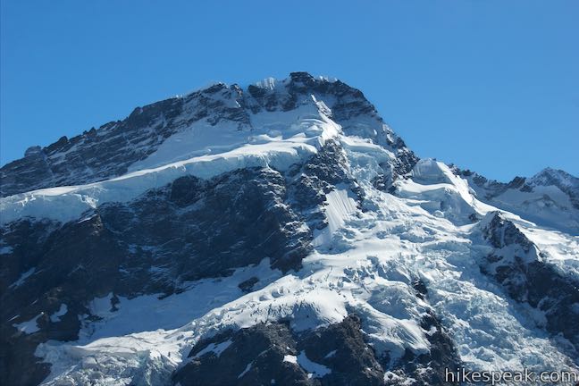
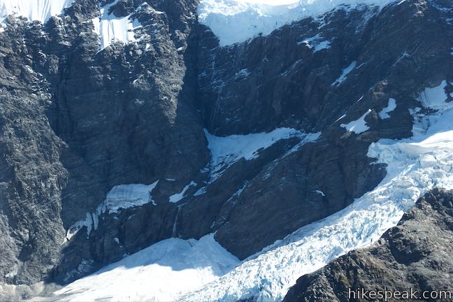
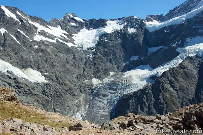
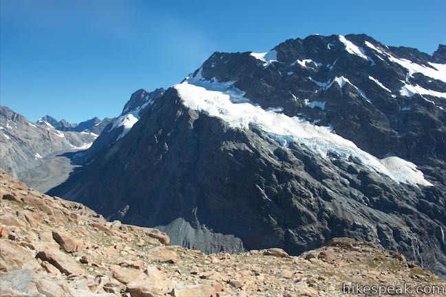
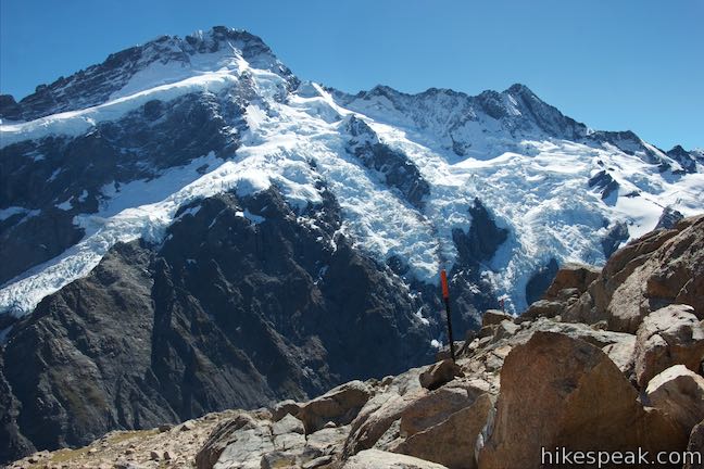
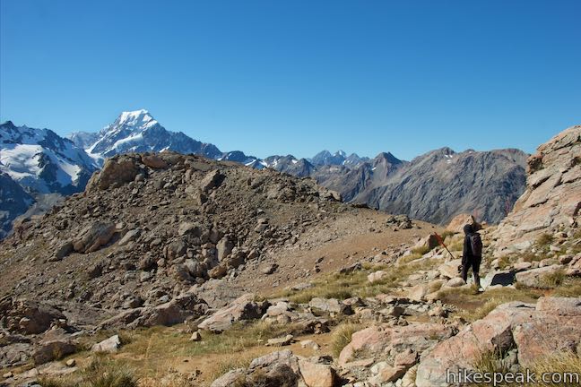
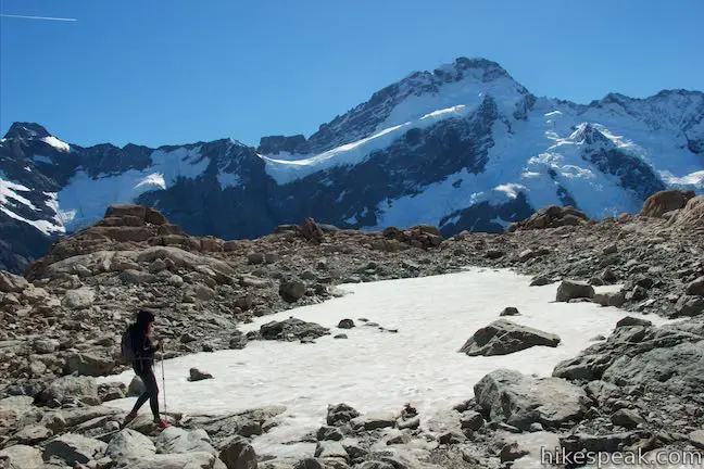
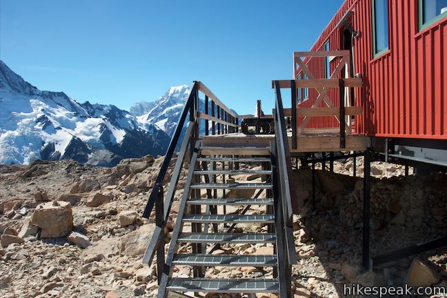
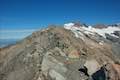
As you step through the gap at the end of the ridge you’ve been climbing, you will face Mount Sefton, which rises directly to the north across a span carved by Mueller Glacier. At an elevation of 1,735 meters, it feels like the massive mountain is on display in front of you. Beyond the saddle, the route makes a sharp left turn to wrap around the end of the ridge and head south for Mueller Hut. A footpath on the right leads out to a rise at the end of the ridge where you can bag some bonus views. In addition to Mount Sefton, this vantage offers views of Mount Cook and the valley to the south. Based on how tired your legs will be, you might decide that the extra viewpoint is not quite worth the additional effort.
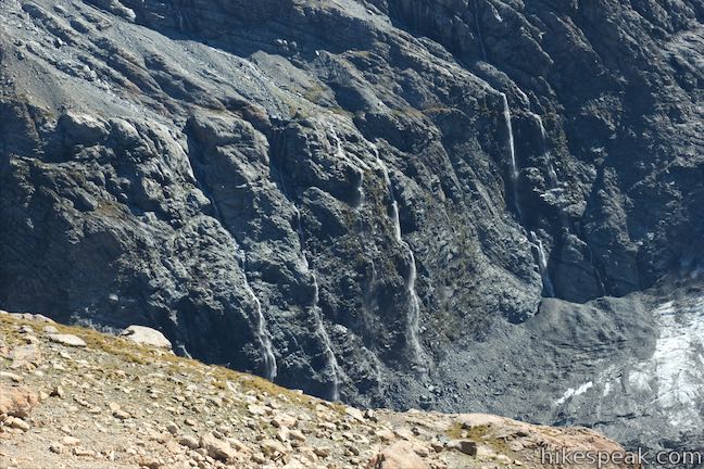
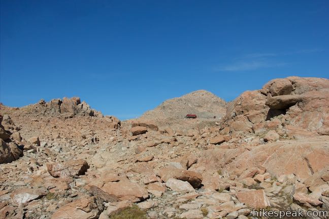
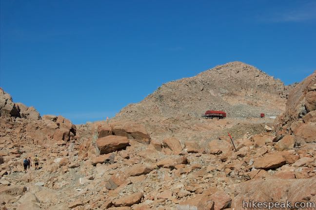
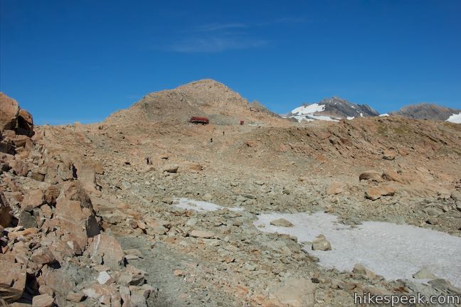
When you are ready to proceed, continue up the route to Mueller Hut, which is now a dirt path passing over and around orange boulders. Straight ahead and to your right, the alpine view is filled with snowfields, waterfalls, and glaciers. The upper end of Mueller Glacier extends a long way to the southwest toward a crescent shaped ridge topped by Mount Burns. A sheer mountain wall rises up across the glacier-carves divide, topping out at Mount Thomson and Mount Brunner, which are just over 2,640 meters tall to the northwest. Smaller glaciers cover the mountainside and you’ll see seasonal waterfalls pouring off the cliffs where the ice is melting. You may see large chunks of ice fall too, echoing across the valley like a crack of thunder.
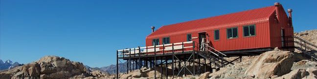
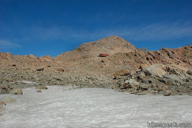
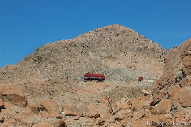
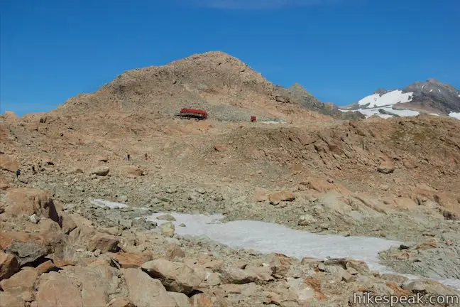
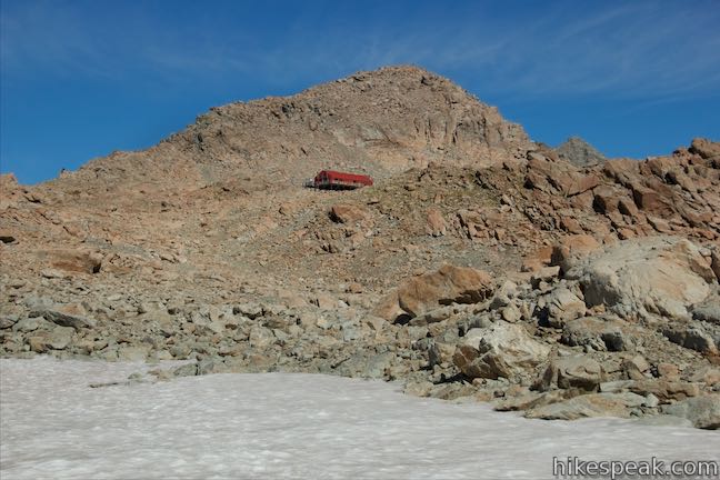
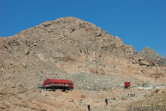
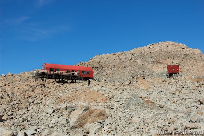
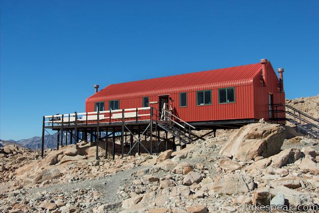
The route continues to curve to the left until the poles orient southward and the path becomes quite gradual (especially compared to what you’ve done so far). Keep the top of the ridge to your left, and make your way toward Mueller Hut – a red building that appears ahead of you below the boulder-covered bulge of Mount Ollivier. Along the path to the hut, you may find fields of snow covering the recesses of the boulder-covered terrain. Only cross the snow if conditions are safe. Otherwise, stick to the exposed rock and make your way up to the hut.
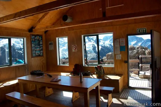
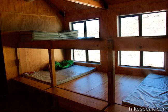
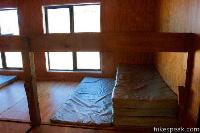
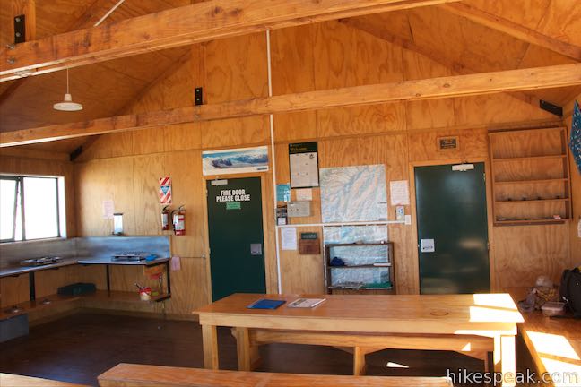
Mueller Hut is on a raised platform, so take metal steps up and into the hut or sit out on the porch, which has benches and broad views. There are bunks for 28 and a communal area with dining tables, counters, gas stoves, water, and solar-powered lights. If you’re not staying overnight, you may just want to step out on the porch to soak in more views of Mount Sefton and Mount Cook. Sunsets and sunrises must be stunning from this spot!
This Mueller Hut was built in 2003, replacing a previous hut. It is not part of the Department of Conservation hut pass system. To stay overnight, you can reserve a bunk online or at the Mount Cook Village Visitor Center. The price for adults is $36 per night for a bunk. For children five to seventeen, the price is $15 per night, and children under five are free (all prices in New Zealand Dollars as of 2015). During winter months, the prices may be slightly lower.
Toilets are available in an outbuilding detached from the hut. These toilets may not be available for use during the winter season when ice axes and crampons are required to reach Mueller Hut (for another adventure entirely). The normal season for Mueller Hut is from mid-November to late March, depending on snow conditions. Avalanche danger along the route is considerable during the winter and spring (April to mid-November). Snow can fall year round, so be prepared for diverse conditions.
Camping is also permitted alongside the hut at a cost of $15 per person. However, the ground around the hut is very rocky, tents need to be tied down, and winds up to 150 km/hour are possible with the area’s rapidly changing condition.

Mueller Hut is 2.35 kilometers from Sealy Tarns and about 5.4 kilometers from the car park by White Horse Hill Campground. Those kilometers are incredibly steep, but as a result, the landscape changes rapidly as you go. Getting to Mueller Hut feels like a great accomplishment (which is probably why there are t-shirts for Mueller Hut and the park visitor center).
Return the way you came for a roughly 10.5-kilometer trek. The hike down is tough on the knees and quads. When it’s all over, you’ll have sore toes and heals. You can also go above and beyond Mueller Hut with an ascent of Mount Ollivier. From Mueller Hut it takes about thirty minutes to get to the top of Mount Ollivier, which is recognized as the first alpine peak on the south Island that Sir Edmond Hillary summited. He reached the 1,933-meter peak in 1939 as his first major climb (which inspired many others).
No permit is required to day hike to Mueller Hut, but you will need to book a spot at the hut to stay overnight. Other than the bunk fee, there is no cost to enter Aoraki Mount Cook National Park and tackle this route. Dogs are not allowed on Sealy Tarns Track and Mueller Hut Route and neither are bikes (not that they could make it if they tried). For more planning information, watch a video about the Mueller Hut Route by the New Zealand Mountain Safety Council.
Directions to the Trailhead
- Take State Highway 8 to State Highway 80 (Mount Cook Road), at the south end of Lake Pukaki.
- Drive north on SH 80 for 54.5 kilometers.
- Before reaching Mount Cook Village, turn right on Hooker Valley Road.
- After 2 kilometers, the road ends at White Horse Hill Campground.
- Day use parking is available in front of the campground on the left where the track begins.
Trailhead Location
Trailhead address: Hooker Valley Road, Aoraki Mount Cook National Park, Canterbury, 7999, New Zealand
Trailhead coordinates: -43.71875, 170.0926 (43° 43′ 07.50″S 170° 05′ 33.36″E)
View Aoraki Mount Cook National Park in a larger map
Or view a regional map of surrounding New Zealand tracks, campgrounds, and lodging.


 | Kea Point Track This easier 3-kilometer round trip walk goes to landing above Mueller Lake with views of Mount Sefton and Mount Cook. |
 | Sealy Tarns Track This incredibly steep and incredibly scenic 5.8-kilometer round trip hike uses a string of staircases to ascend a mountainside to pools that reflect views of Mount Sefton and Mount Cook. |
 | Mount Ollivier This 1,933-meter tall summit can be reached by ascending above Mueller Hut for even grander views. |
 | Hooker Valley Track This superb 11-kilometer round trip hike heads up Hooker Valley to an iceberg-filled lake at the end of an impressive glacier below Mount Cook. |
 | Tasman Glacier View & Blue Lakes This pair of tracks combine for a hike of 1.85 kilometers round trip (or more) with views of small emerald pools and a large milky lake below Tasman Glacier. |
 | More trails in New Zealand Explore other destinations for walking and hiking (as well camping and lodging) in New Zealand. |
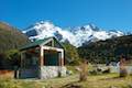 | White Horse Hill Campground This 60-site campground is surrounded by great hiking tracks and just a few kilometers from Mount Cook Village, making it an ideal place to stay during a visit to Aoraki Mount Cook National Park. |
The Department of Conservation webpage for Mueller Hut Route
A brochure for Mueller Hut Route
The Department of Conservation webpage for Mueller Hut
The online booking page for Mueller Hut
A planning video for the Mueller Hut Route from the New Zealand Mountain Safety Council
Mueller Hut on destinationlesstravel.com
Mueller Hut on youngadventuress.com
Mueller Hut on activeadventures.com
The Department of Conservation webpage for Aoraki Mount Cook National Park
Common Questions about Mueller Hut in Aoraki Mount Cook National Park
- Is the trail open?
- Yes. You should expect to find that Sealy Tarns, Mueller Hut, & Mount Ollivier is open. There are no recent reports of trail closures. If you discover that the trail is closed, please help your fellow hikers by reporting a closure.
- Do I need a permit for this hike?
- Yes. Fee for hut. Free to hike..
- How much time does this hike take?
- It takes approximately 4 hours 45 minutes to hike Sealy Tarns, Mueller Hut, & Mount Ollivier. Individual hiking times vary. Add extra time for breaks and taking in the views.
- How long is this hike?
- The hike to Sealy Tarns, Mueller Hut, & Mount Ollivier is a 10.5 km / 6.5 mile out and back return with 1045 meters / 3425 feet of elevation change.
- Are dogs allowed on this trail?
- No, dogs are likely not allowed on Sealy Tarns, Mueller Hut, & Mount Ollivier. The trail is primarily open to hikers.
- Is Sealy Tarns, Mueller Hut, & Mount Ollivier a difficult hike?
- This hike should be considered strenuous. Hikers should be prepared for a workout covering 6.5 miles and 3425 feet of climbing.
- Where is the trailhead located?
- The trailhead for Sealy Tarns, Mueller Hut, & Mount Ollivier is located in Aoraki Mount Cook National Park, Canterbury.
Trailhead Address:
Hooker Valley Road
Aoraki Mount Cook National Park, Canterbury 7999
Trailhead Coordinates:
-43.71875, 170.0926 - What are the driving directions to the start of the hike?
To get to the trailhead: Take State Highway 8 to State Highway 80 (Mount Cook Road), at the south end of Lake Pukaki. Drive north on SH 80 for 54.5 kilometers. Before reaching Mount Cook Village, turn right on Hooker Valley Road. After 2 kilometers, the road ends at White Horse Hill Campground. Day use parking is available in front of the campground on the left where the track begins.
View custom Google Maps directions from your current location.
- Are there other trails near Sealy Tarns, Mueller Hut, & Mount Ollivier?
- Yes, you can find other nearby hikes using the Hikespeak Hike Finder Map.

[…] planned to take the Mueller Track to the Mueller Hut. The morning started with a light mist. We first headed towards Hooker Valley to look at the […]
This has been the best, but also the most exhausting day hike I’ve ever done. Without taking pictures, chilling at the hut or brakes for catching your breath it can be done in 3hrs return, considering you have an almost professional degree of fitness.
My best advice though for everyone is to take your time. Once you went beyond your anaerobic treshold you have a problem for the rest of the hike. So just chose a rythm that is at no time really exhausting. Also dont get dehydrated or with low blood sugar. Either on the rock field or the stairs – they are not dangerous, but you do not want to add dizzyness to your tired legs.
The way down is exausting, too, mentally and physically. Just take the extra step. It’s a demanding, but not dangerous hike. But having an ankle twisted or your acl hurt, you have a serious problem. So take your time and never get too exhausted.
Also make sure you climb at dry weather. I dont see how the hike either up or down is possible if it’s wet.
https://www.hikespeak.com/trails/mueller-hut-aoraki-mount-cook-nz/
Can you please remove the part where it says there are pots and pans at the hut. I called DOC to ask about this and they said the pots and pans have been removed. Can you please update this? Thanks
What an impressive description of the hike to Mueller Hut in the Aoraki/Mount Cook! The panoramic views and the combination of wilderness and pure adventure make this trail a unique experience. The photos and details about the hike really show how rewarding it is to reach the hut and admire the surrounding glaciers and mountains.