Hooker Valley Track to Hooker Glacier Lake
in Aoraki Mount Cook National Park
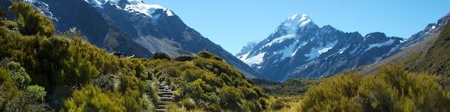
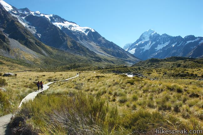
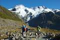
Hooker Valley Track is among the most popular walking tracks in Aoraki Mount Cook National Park and the reasons why are obvious. This 11-kilometer (6.8-mile) round trip hike has non-stop mountain views and the destination is incredible. The track ends at the edge of Hooker Lake, where you can watch icebergs that were set adrift from Hooker Glacier, glide across the water below Aoraki/Mount Cook, the tallest mountain in the Southern Alps. The fun track crosses three swing bridges and several viewpoints. While this hike takes much of the day, it only has 120 meters (400 feet) of elevation change, so it is far less steep than tracks ascending into the area’s mountains.
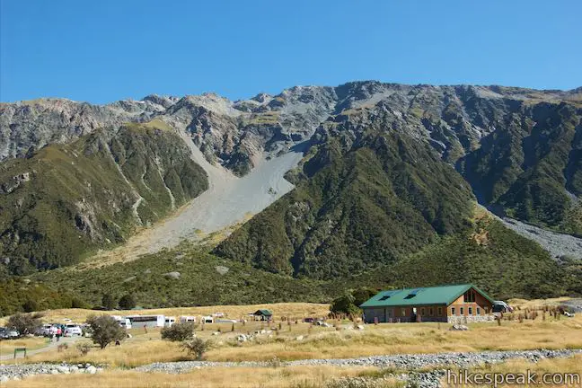
The trek begins from a car park alongside White Horse Hill Campground at the end of Hooker Valley Road, 2.5 kilometers from Mount Cook Village. Head east on paths next to a day shelter that quickly come together. Signs at the start list a few destinations: 5 minutes to Alpine Memorial, 15 minutes to Mueller Lookout, and 1 hour 35 minutes to Hooker Lake.
After 200 meters, the track passes a short spur on the left leading up to a boulder called Freda’s Rock. In December of 1910, Freda du Faur became the first woman to climb Aoraki/Mount Cook, just 15 years after the first men reached the top. Afterward, she posed in front of this boulder and was photographed to commemorate the historic climb. This became the most recognized photo of the mountaineering pioneer.
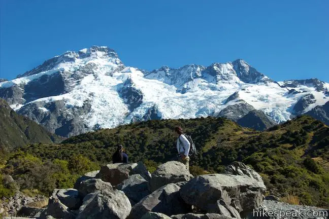
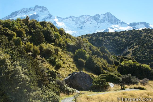
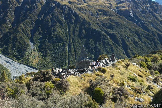
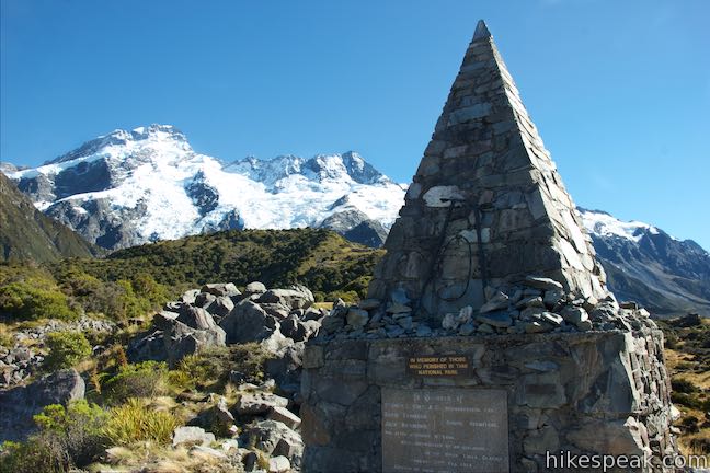
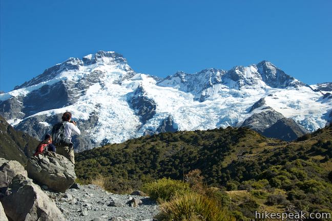
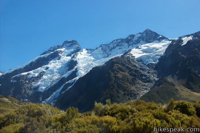
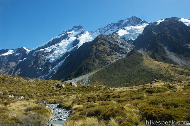
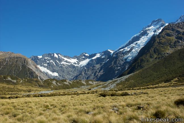
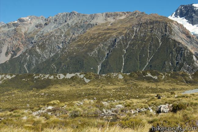
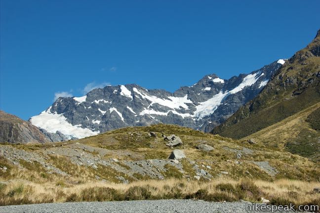
Return to the main track, turn left, and stroll up Hooker Valley Track for another 200 meters to a second spur on the left. Break from the main track again and take stone steps up to the Alpine Memorial, a stone structure covered in plaques honoring mountain climbers that have died in the Southern Alps. The plaques are full of names, dates, and stories that should instill added respect for the dynamic mountains around you. The plaques include remembrances and quotes like, “I am not gone – I am in these mountains, I am in the stars, I am all around you, always near, never far.” Step out onto the rocks above the memorial for a bold view of Mount Sefton, the dominant 3,151-meter tall mountain just to the northwest that is covered in snow, glaciers, and sheer dark cliffs.
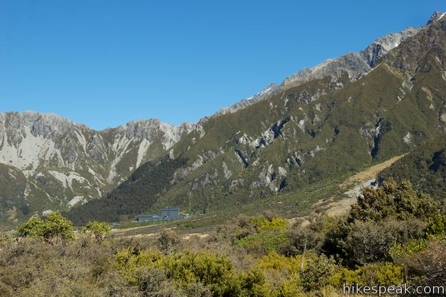
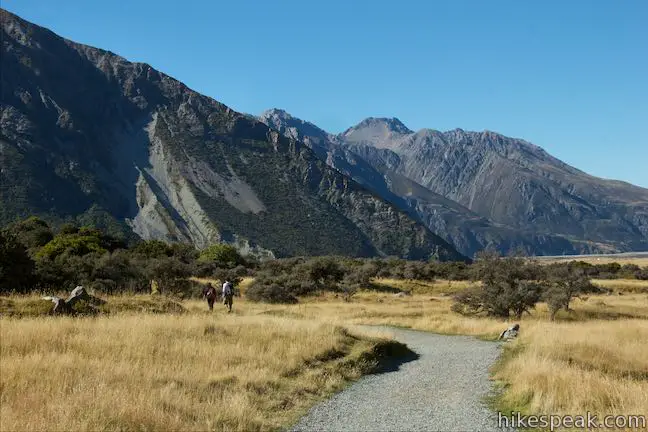
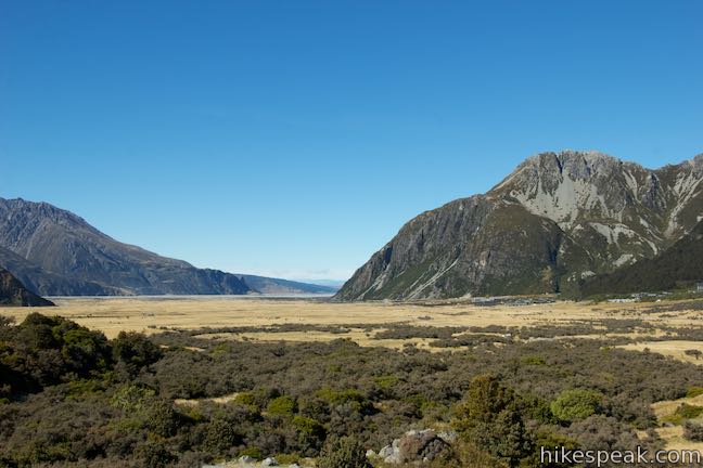
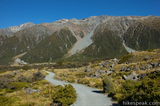
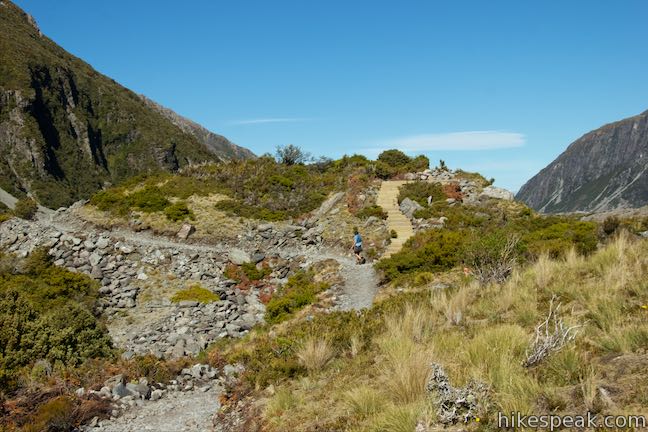
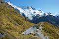
When you turn around and return to the main track, you’ll be facing southeast for another nice perspective, looking down the valley floor framed by steep mountain ridges. Make a left to continue east on Hooker Valley Track, which remains wide, well graded, and level as it approaches another early attraction. At 1.05 kilometers from the start, bear left on a 50-meter long spur up to Mueller Lake Lookout.

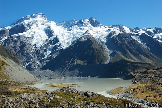
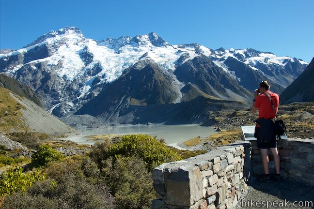
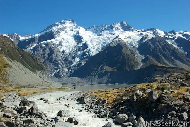
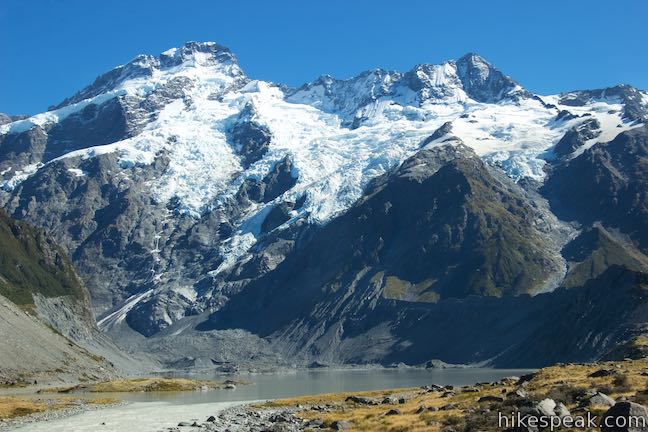
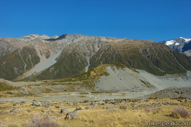
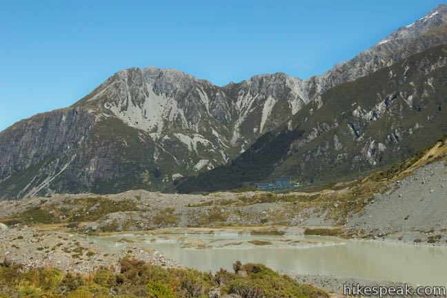
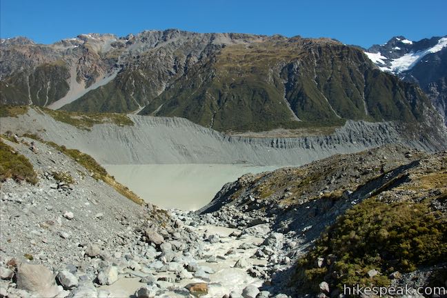
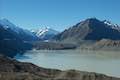
Mueller Lake Lookout has a bench and a stone landing where you can gaze across Mueller Lake, a cream-colored lake below Mueller Glacier, which occupies the ravine below Mount Sefton. Across the lake, you may see and hear ice and rocks falling from the side of the mountain as the landscape evolves. On the right side of the lake is Mueller Lateral Moraine, a rocky wall created by Mueller Glacier when it was much larger. Hooker Valley extends beyond the moraine. A panel at Mueller Lake Lookout describes how the landscape has changed:
A hundred years ago, the Mueller Glacier filled the valley floor. You could have walked onto the glacier from near here. Today, the glacier is all but hidden up the valley. Glacial ice left behind is still visible at the far end of the lake. Piles of rock rubble (moraine) dropped by the glacier mark its past extent.
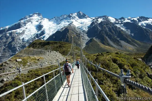
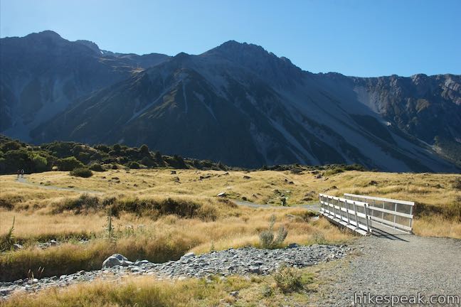
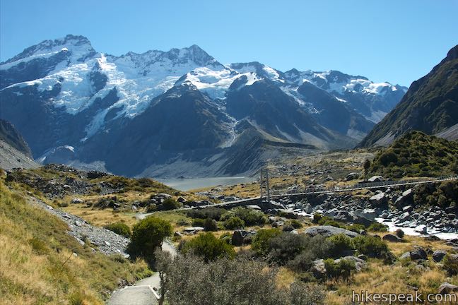
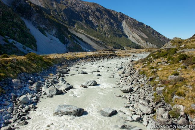
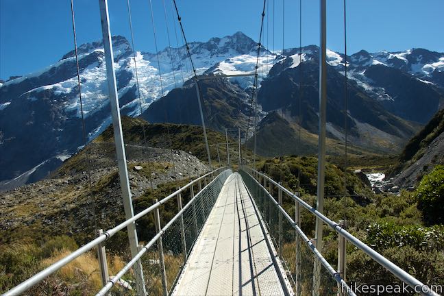
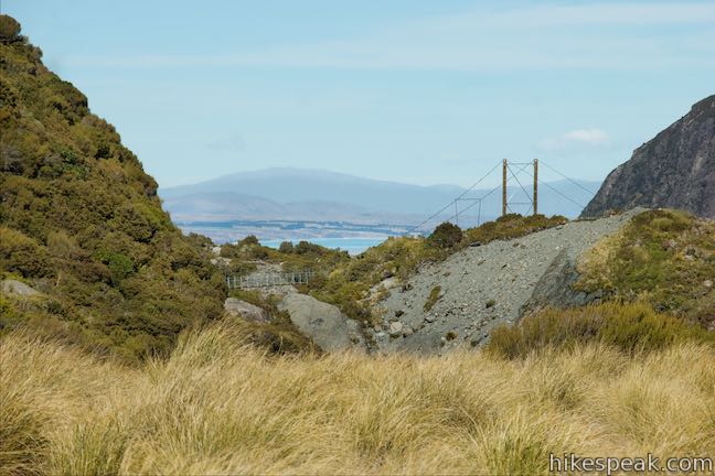
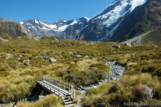
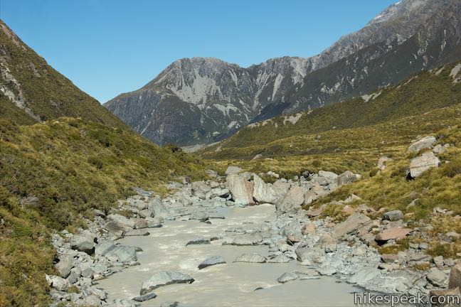
To your right, you can look down on a swing bridge crossing Hooker River below the outlet of Mueller Lake. Head there next. Leave Mueller Lake Overlook, return to Hooker Valley Track, and turn left. The track turns downhill toward the hike’s first swing bridge. Walk down steps and make your way to the long, suspension bridge that comes 1.3 kilometers from the start.
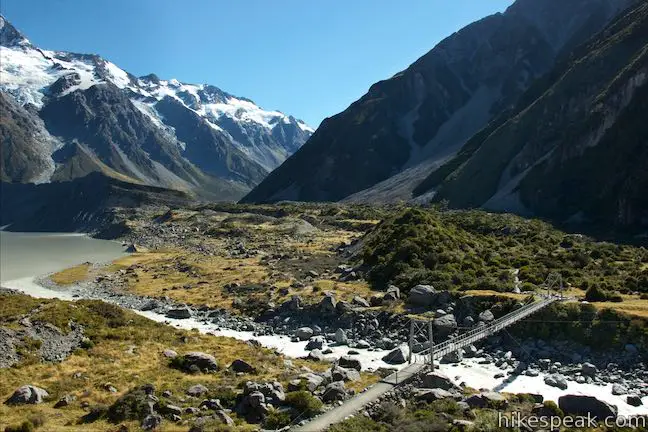
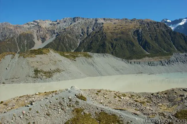
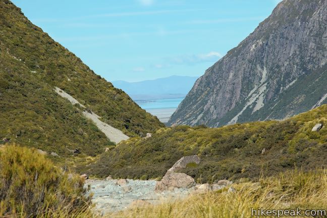
The bridge is a good spot to observe the river. Look up the frothing water toward Mueller Lake and the glacier and mountain beyond. Across the bridge, Hooker Valley Track turns north and runs parallel to the lateral moraine beside Mueller Lake. The views are expansive, and you get a chance to gaze even farther from a viewpoint along the track. At 2.2 kilometers from the start, wooden steps on the left lead to the top of a bump in the moraine. This spur is only about 15 meters long and has rewarding views (just like the rest of the track). Get a broad perspective across Mueller Lake toward Mount Sefton and the Sealy Range. Looking down the valley to the south, you’ll catch a glimpse of the vibrant turquoise water of Lake Pukaki.
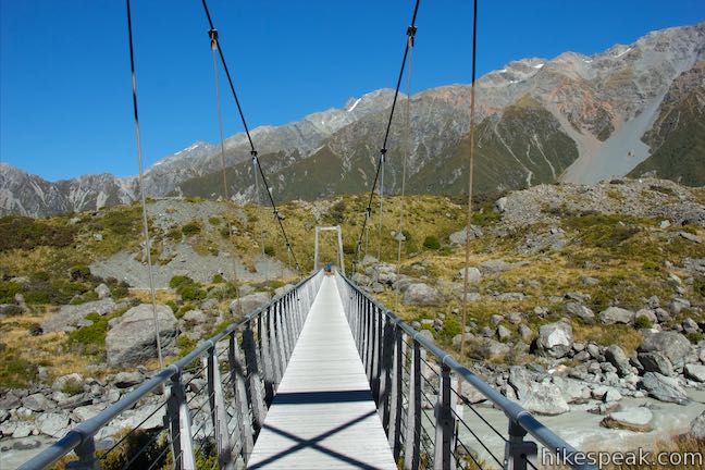
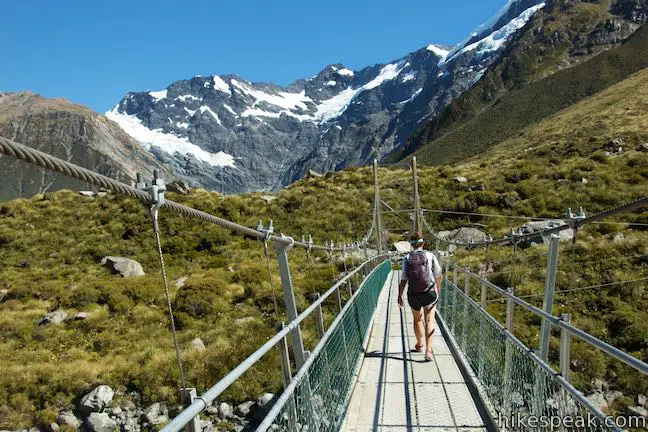
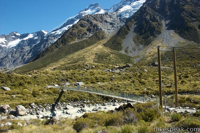
Continue up Hooker Valley Track to the second swing bridge, Hooker Bluff Bridge, crossing it 2.75 kilometers from the start. Below the bridge to the left, you can watch milky rapids tumble into Mueller Lake. To the right, the river bends along the steep wall of the valley, forming a short gorge. Snow-covered mountains straight ahead complete the view from another scenic swing bridge crossing.
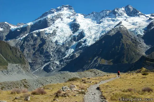
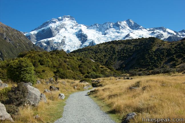
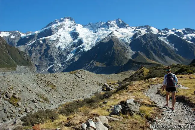
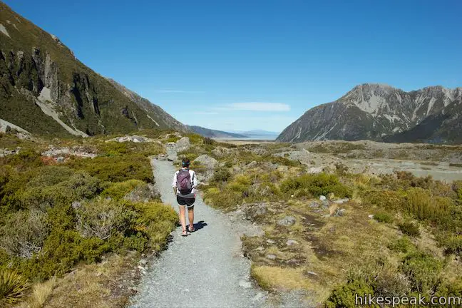
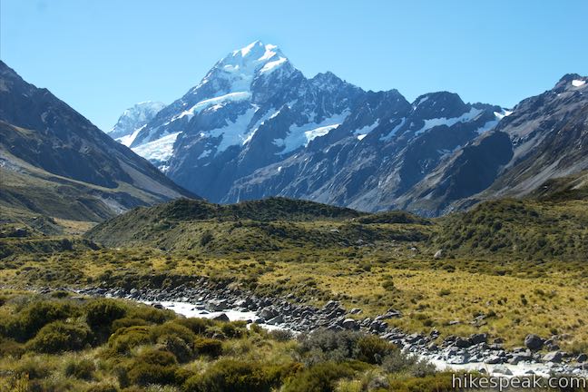
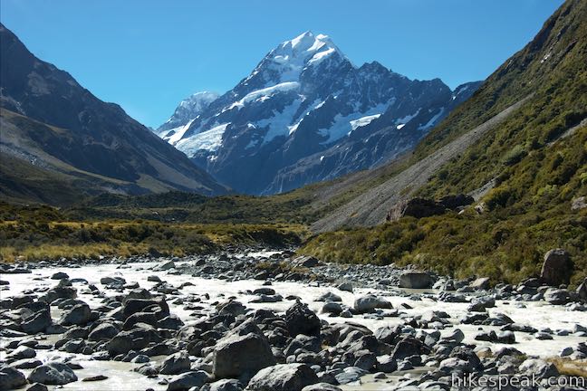
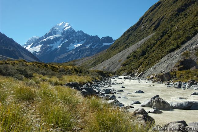
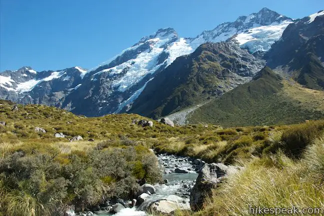
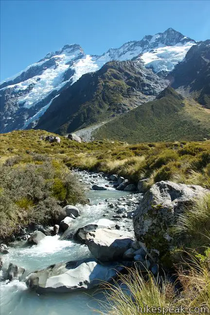
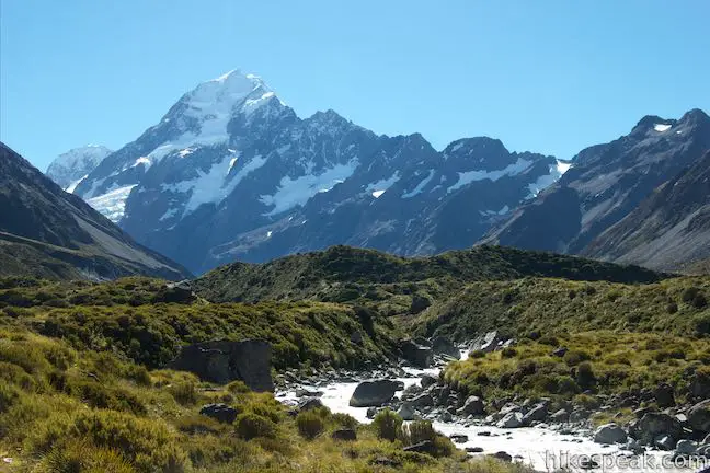
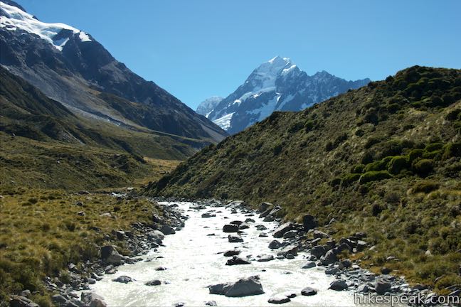
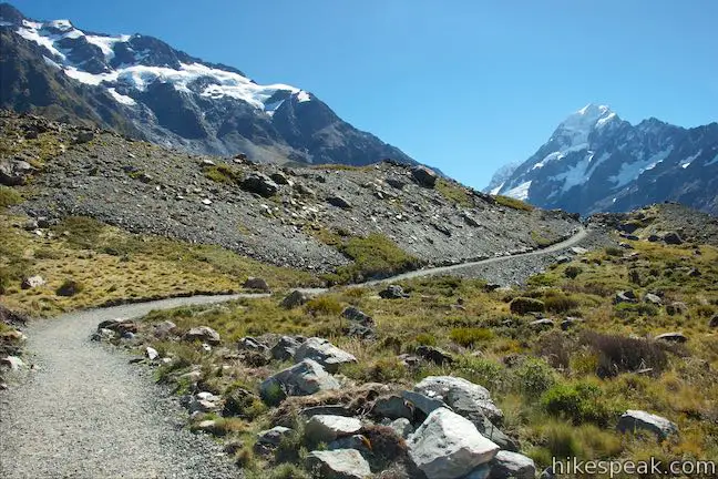
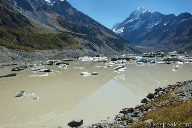
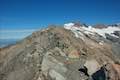
The track borders Hooker River as it proceeds up the valley toward Hooker Lake. Looking upstream, you’ll see Mount Cook, which rises above the rest at 3,724 meters tall. This is the tallest mountain in New Zealand. It was called Aoraki by the Ngāi Tahu that inhabited the area before Europeans arrived, and named Mount Cook by those who came later, both titles are now used for mountain known as Aoraki/Mount Cook.
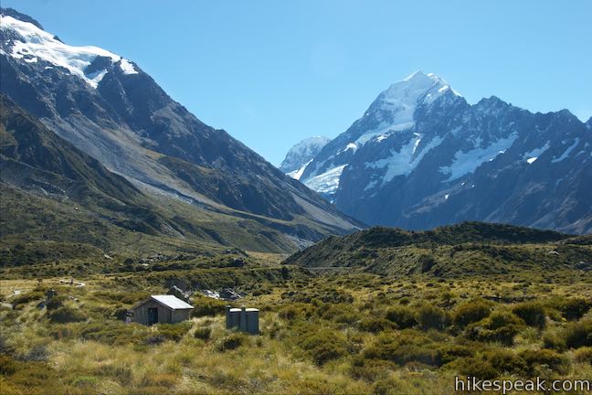
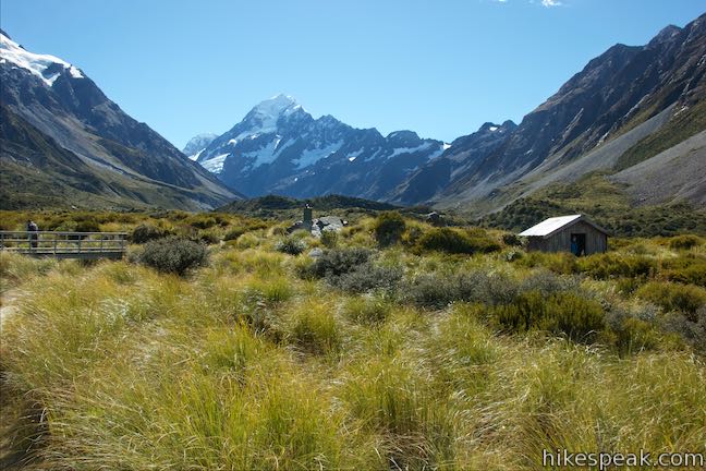
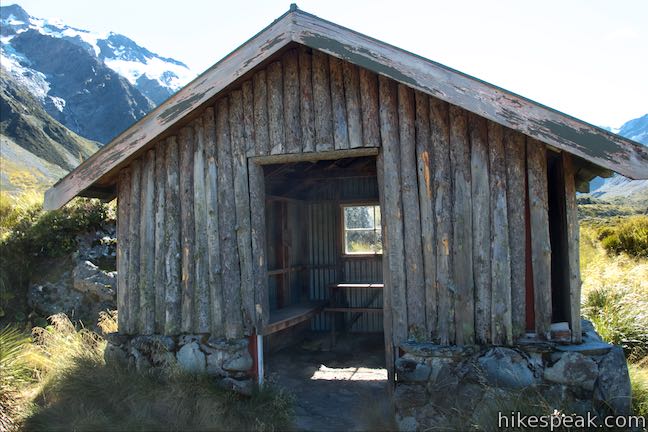
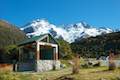
At 3.7 kilometers from the start, a footbridge crosses Stocking Stream. Just across the bridge on the right, a path leads to the Stocking Stream Shelter, a day use shelter that is accompanied by toilets (the only toilets on the track).
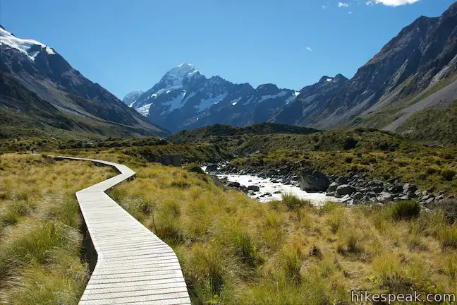
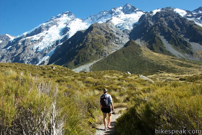
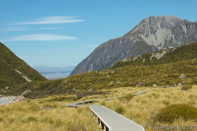
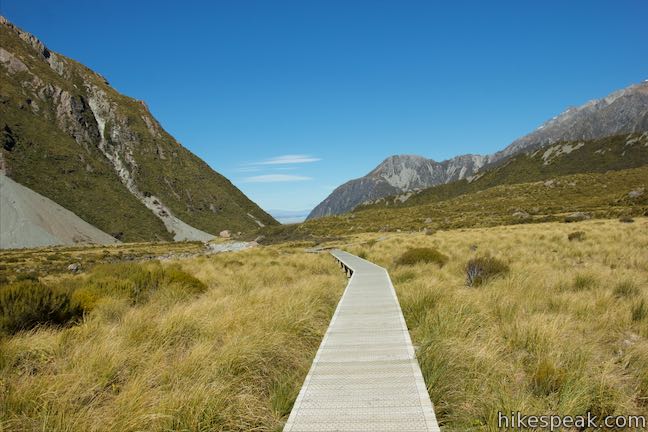
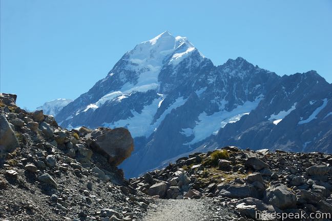
Views of Mount Cook get increasingly inspirational as you walk farther up the wooden boardwalk and gravel path on Hooker Valley Track.
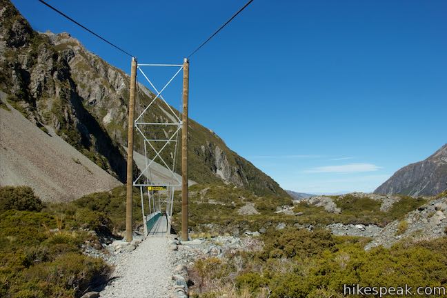
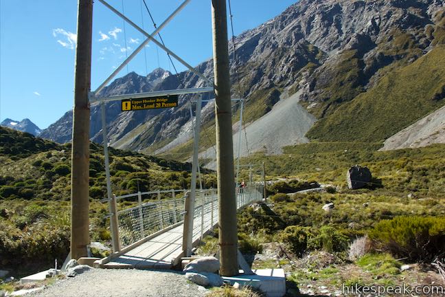
Come to Upper Hooker Bridge, the third and final swing bridge on this hike, at 4.4 kilometers from the start. Cross to the right side of the river for the last push toward Hooker Lake. Looking back over the bridge as you cross, you’re in line for views of Mount Thompson (2,642 meters), Mount Brunner (2,643 meters), and other points on the ridgeline extending southwest from Mount Sefton above Mueller Glacier.
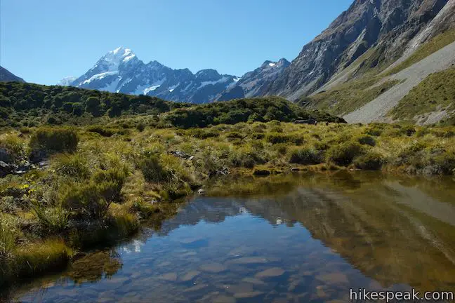
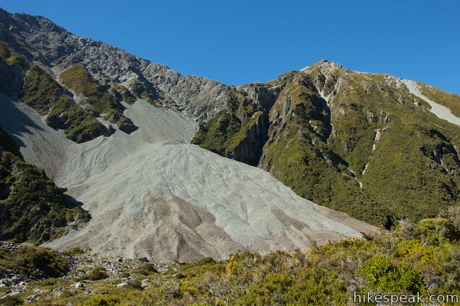
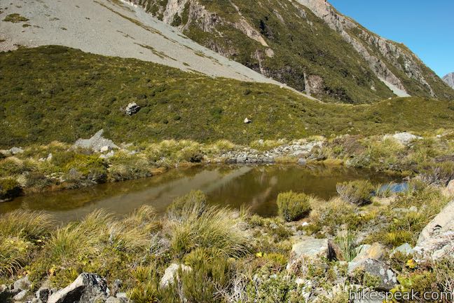
Across the bridge, head east around the moraine at the end of the lake, which offers evidence of the glacier’s former size. At 250 meters past the bridge, a spur breaks off to the right out to a tarn just off Hooker Valley Track. Seeing Mount Cook reflected in the shallow pool is worth the extra bit of the effort, as the spur is only about 60 meters long.
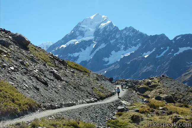
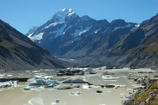
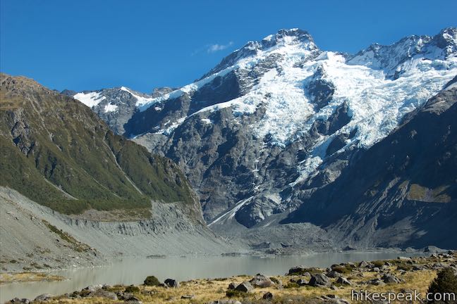
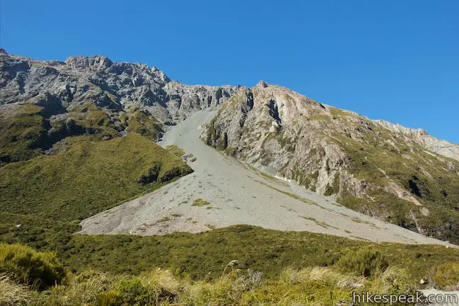
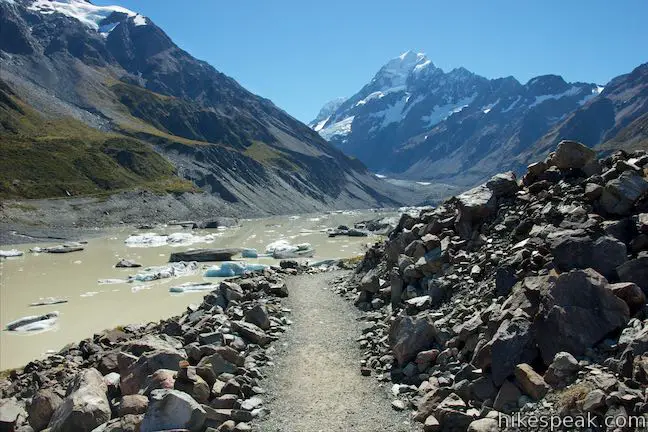
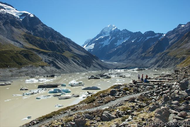
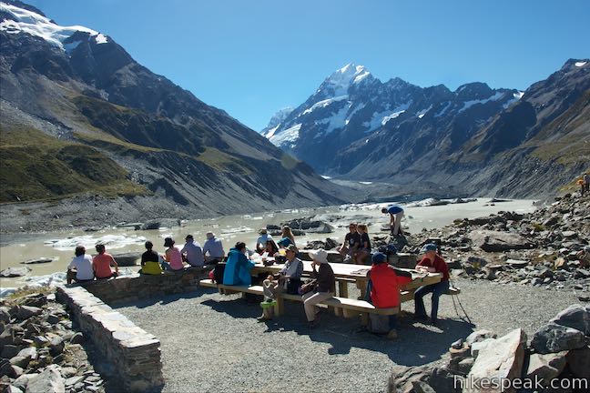
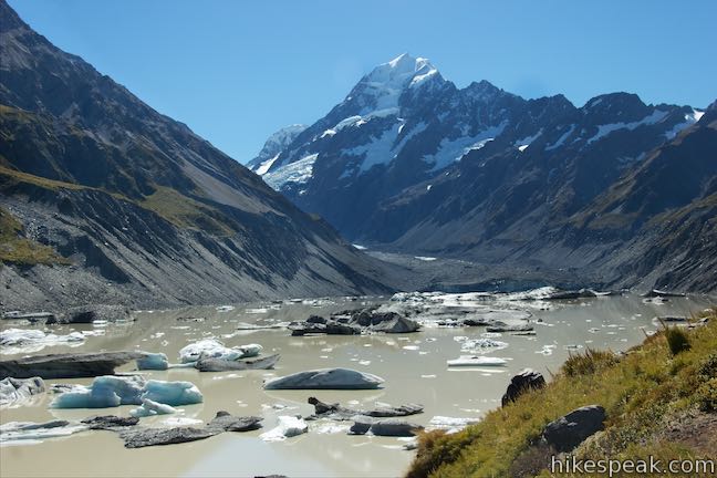
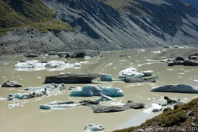
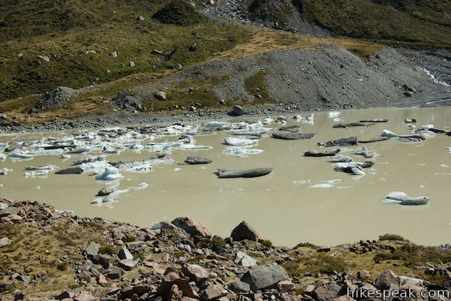
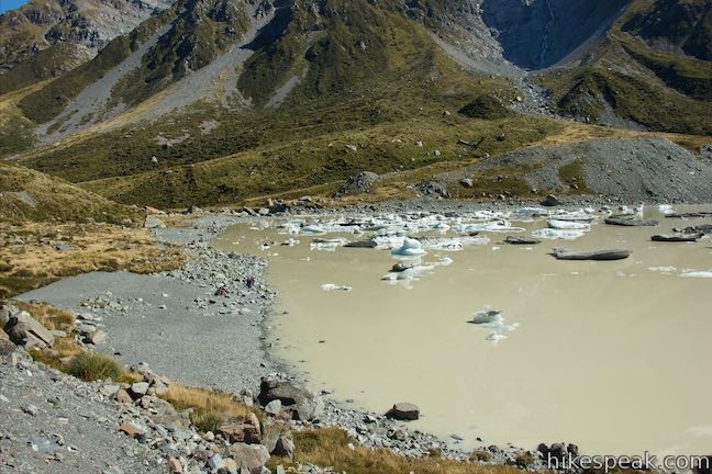
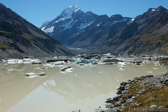
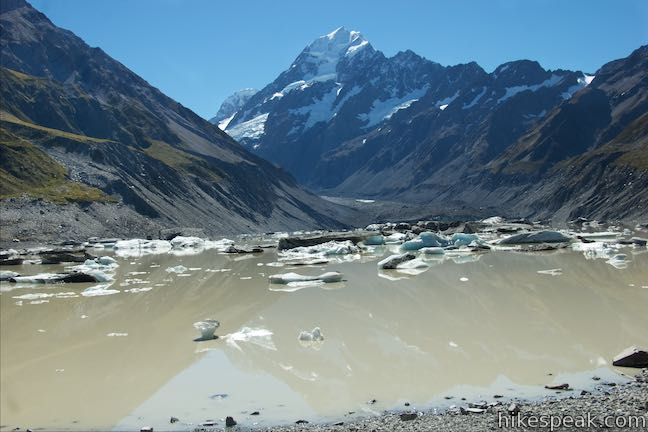
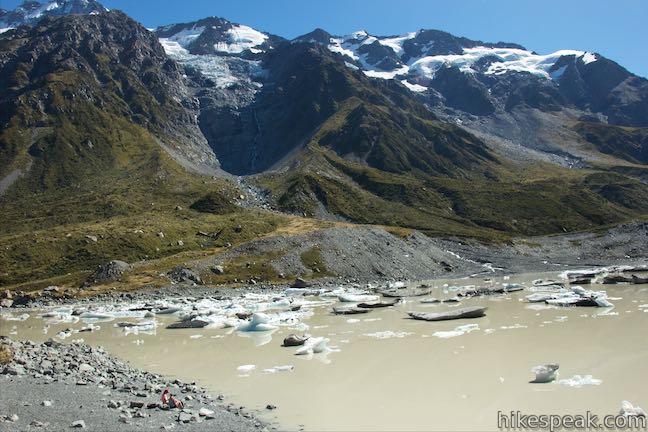
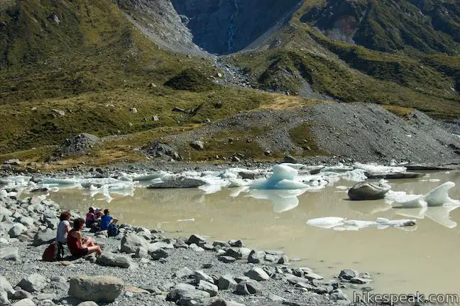
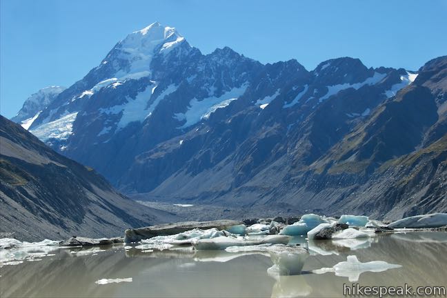
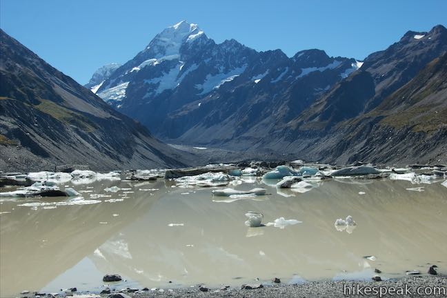
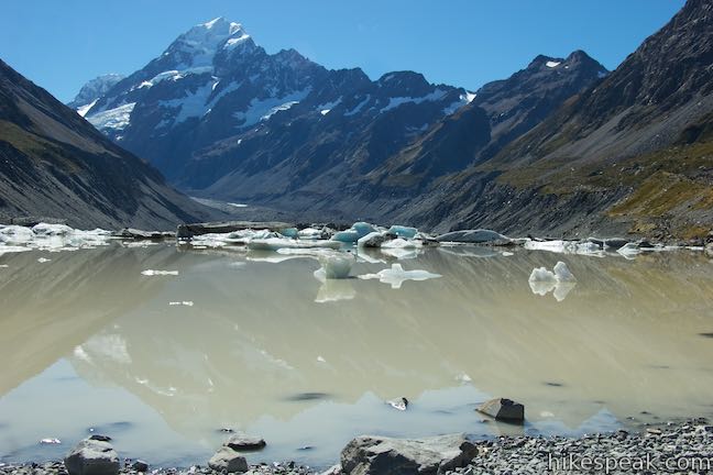
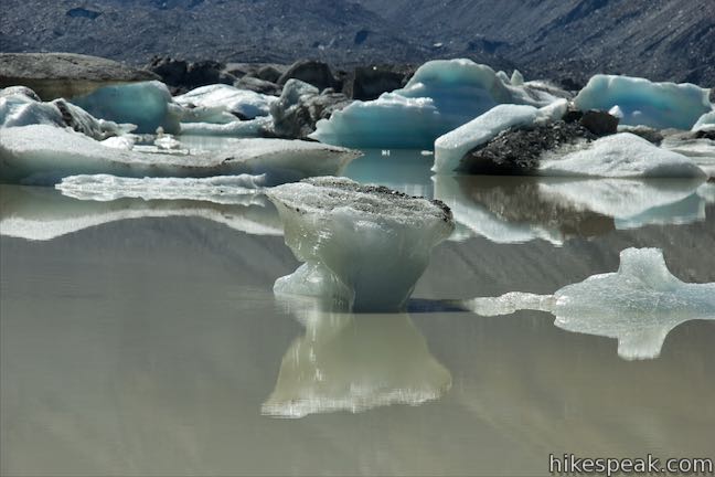
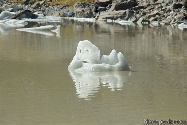
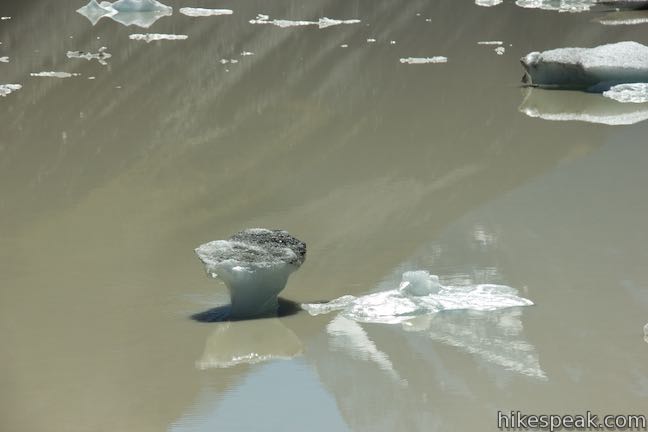
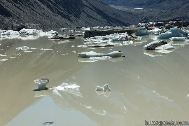
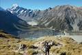
Proceed up Hooker Valley Track, which curves to the right above a small creek. A tapered ascent leads to a gap in the moraine. Pass through the notch and turn downhill toward Hooker Lake, which comes into view as you approach an overlook above the side of the lake with a few picnic tables. A rare and wonderful sight is in front of you now. A flotilla of misshapen icebergs fills the creamy, brown water of Hooker Lake. Looking up the lake, you’ll spot ice cliffs, where the lake meets Hooker Glacier. Beyond that, the iconic mass of Mount Cook (aka Aoraki) rises high. Take a selfie, bust out a sketch pad, or do whatever will help you help preserve this awesome view. They don’t come much better than this!
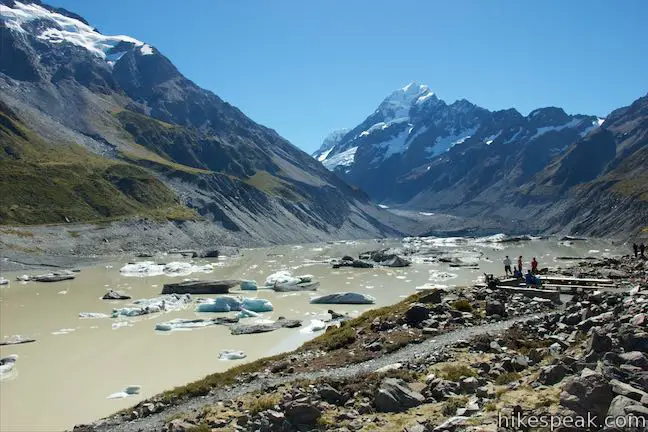
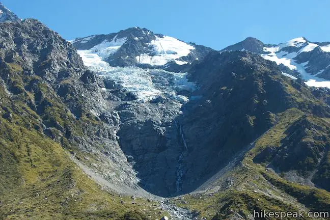
The viewpoint above Hooker Lake is 5.35 kilometers from the start of Hooker Valley Track, but the trek doesn’t have to end here. Make a hard left to follow the track another 150 meters to its terminus at the rocky shore at the south end of Hooker Lake. Sit on the shore at the same level as the icebergs, watching them slowly drift and turn on the lake. When the water is still, you can catch reflections of Mount Cook and the surrounding mountains cast upon the lake. To the west, watch a waterfall flow from a glacier near the top of Cadogan Peak, a 2,449-meter point on the ridge running northeast of Mount Sefton.
The shore of Hooker Lake is an amazing place to spend some time. If you packed lunch, eat it here before hiking back.
Hooker Valley Track is approximately 11 kilometers round trip when the various spurs are explored. The track is completely exposed, so wear sunscreen. Recent work on Hooker Valley Track has made the path very well established.
Dogs are not allowed on tracks in Aoraki Mount Cook National Park. Bikes are also forbidden on Hooker Valley Track (although a cycleway by the same name that borders Hooke Valley Road does naturally allow bikes). No permit is required to hike Hooker Valley Track and the national park has no entry fee, so get out and enjoy!
Directions to the Trailhead
- Take State Highway 8 to State Highway 80 (Mount Cook Road), at the south end of Lake Pukaki.
- Drive north on SH 80 for 54.5 kilometers.
- Before reaching Mount Cook Village, turn right on Hooker Valley Road.
- After 2 kilometers, the road ends at White Horse Hill Campground.
- Day use parking is available in front of the campground on the left.
- Hooker Valley Track begins from a few points on the right.
Trailhead Location
Trailhead address: Hooker Valley Road, Aoraki Mount Cook National Park, Canterbury, 7999, New Zealand
Trailhead coordinates: -43.7187, 170.09315 (43° 43′ 07.31″S 170° 05′ 35.34″E)
You may also view a regional map of surrounding New Zealand tracks, campgrounds, and lodging.


 | Tasman Glacier View & Blue Lakes This pair of tracks combine for a hike of 1.85 kilometers round trip (or more) with views of small emerald pools and a large milky lake below Tasman Glacier. |
 | Kea Point Track This easier 3-kilometer round trip walk goes to landing above Mueller Lake with views of Mount Sefton and Mount Cook. |
 | Sealy Tarns Track This incredibly steep and incredibly scenic 5.8-kilometer round trip hike uses a series of staircases to ascend a mountainside to pools that reflect views of Mount Sefton and Mount Cook. |
 | Mueller Hut Route Ascend past Sealy Tarns on a rough route to a famed hut for a 10.5-kilometer round trip hike with spectacular views. |
 | Mount Ollivier This 1,933-meter tall summit can be reached by ascending above Mueller Hut for even grander views. |
 | More trails in New Zealand Explore other destinations for walking and hiking (as well camping and lodging) in New Zealand. |
 | White Horse Hill Campground This 60-site campground is surrounded by great hiking tracks and just a few kilometers from Mount Cook Village, making it an ideal place to stay during a visit to Aoraki Mount Cook National Park. |
- Hooker Valley Track on en.wikipedia.org (opens in a new tab)
- Hooker Valley Track on hermitage.co.nz (opens in a new tab)
- Hooker Valley Track on mackenzienz.com (opens in a new tab)
- Hooker Valley Track in Aoraki / Mount Cook National Park in New Zealand — Girl Eat World on girleatworld.net (opens in a new tab)
- Hooker Valley Track on dangerous-business.com (opens in a new tab)
- Hooker Valley Track on bootsandabackpack.com (opens in a new tab)
- Hooker Valley Track on bootsandabackpack.com (opens in a new tab)
- Hooker Valley Track on onegirlwholeworld.com (opens in a new tab)
- Hooker Valley Track on hike2hike.com (opens in a new tab)
- The Department of Conservation brochure for walking and cycling in Aoraki Mount Cook National Park (opens in a new tab)
- The Department of Conservation webpage for Hooker Valley Track (opens in a new tab)
- Hooker Valley Track on newzealand.com (opens in a new tab)
- The Department of Conservation webpage for Aoraki Mount Cook National Park (opens in a new tab)
- Aoraki Mount Cook National Park on newzealand.com (opens in a new tab)
Common Questions about Hooker Valley Track to Hooker Glacier Lake in Aoraki Mount Cook National Park
- Is the trail open?
- Yes. You should expect to find that Hooker Valley Track is open. There are no recent reports of trail closures. If you discover that the trail is closed, please help your fellow hikers by reporting a closure.
- Is this trail free to access?
- Yes, Hooker Valley Track is free to access. No entrance fee, pass, or permit is required. If you discover that access rules have changed, please provide feedback on your experience.
- How much time does this hike take?
- It takes approximately 3 hours to hike Hooker Valley Track. Individual hiking times vary. Add extra time for breaks and taking in the views.
- How long is this hike?
- The hike to Hooker Valley Track is a 11 km / 6.8 mile out and back return with 120 meters / 400 feet of elevation change.
- Are dogs allowed on this trail?
- No, dogs are likely not allowed on Hooker Valley Track. The trail is primarily open to hikers.
- Where is the trailhead located?
- The trailhead for Hooker Valley Track is located in Aoraki Mount Cook National Park, Canterbury.
Trailhead Address:
Hooker Valley Road
Aoraki Mount Cook National Park, Canterbury 7999
Trailhead Coordinates:
-43.7187, 170.09315 - What are the driving directions to the start of the hike?
To get to the trailhead: Take State Highway 8 to State Highway 80 (Mount Cook Road), at the south end of Lake Pukaki. Drive north on SH 80 for 54.5 kilometers. Before reaching Mount Cook Village, turn right on Hooker Valley Road. After 2 kilometers, the road ends at White Horse Hill Campground. Day use parking is available in front of the campground on the left. Hooker Valley Track begins from a few points on the right.
View custom Google Maps directions from your current location.
- Are there other trails near Hooker Valley Track?
- Yes, you can find other nearby hikes using the Hikespeak Hike Finder Map.

Hooker Valley Track was one of the best tramps I have made in New Zealand! It was foggy and snowy and all that really added to the unreal scenery! Certainly an unforgettable experience!