Kea Point
in Aoraki Mount Cook National Park
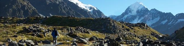
Kea Point offers a captivating vantage point from a perch above a glacier lake. Mighty Mount Sefton rises high in front of the viewpoint and Mount Cook is in sight as well. Kea Point can be reached from Mount Cook Village for a two-hour outing and you can cut that time in half by beginning from a car park next to White Horse Hill Campground for a three-kilometer round trip hike with 95 meters of elevation change (or 1.85 miles round trip with 310 feet of elevation change). Kea Point Track connects to Sealy Tarns Track, making it easy to link this gradual hike to that steeper excursion.
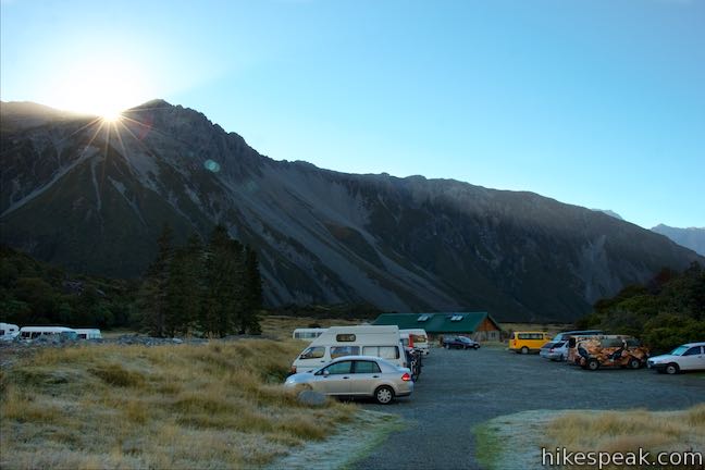
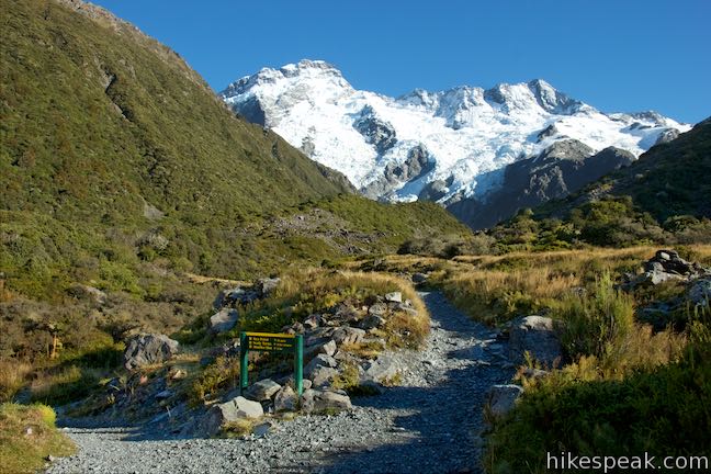
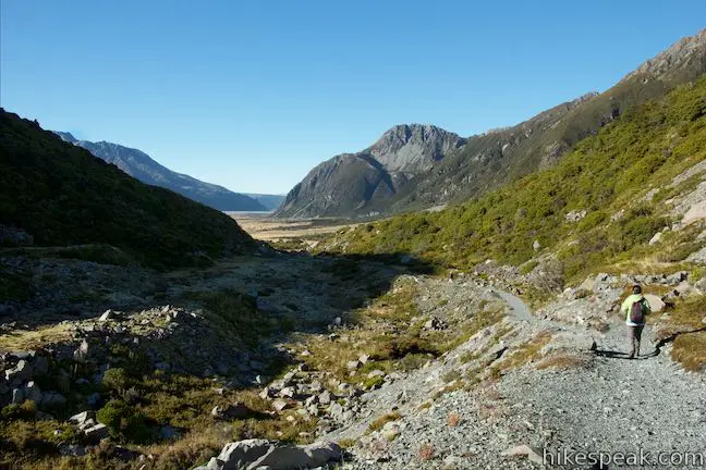
Leave from a car park on at the end of Hooker Valley Road just before White Horse Hill Campground. Set out northwest on a track to Sealy Tarns and Kea Point. A sign at the start puts Kea Point at 30 minutes away. The gradual track goes through subalpine grasses and scrubs, coming to a junction with a track from Mount Cook Village after 550 meters. Unless you’re trying to walk to the village, turn right and follow the arrow for Kea Point, Sealy Tarns, and Mueller Hut.
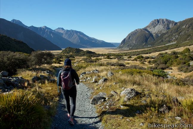
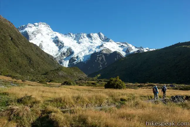
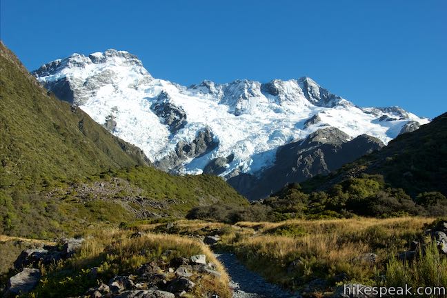
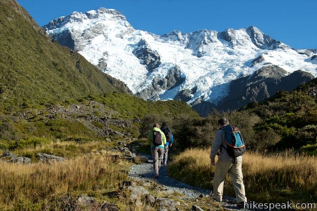
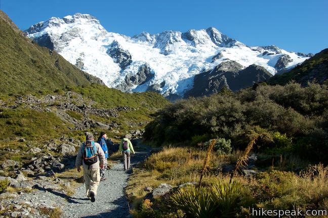
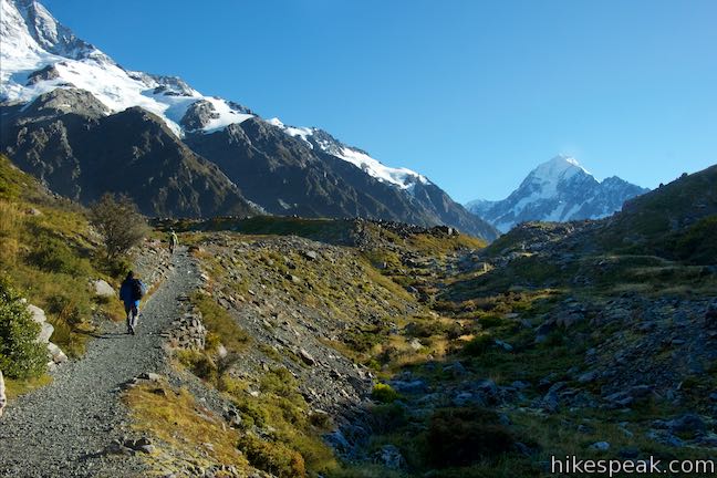
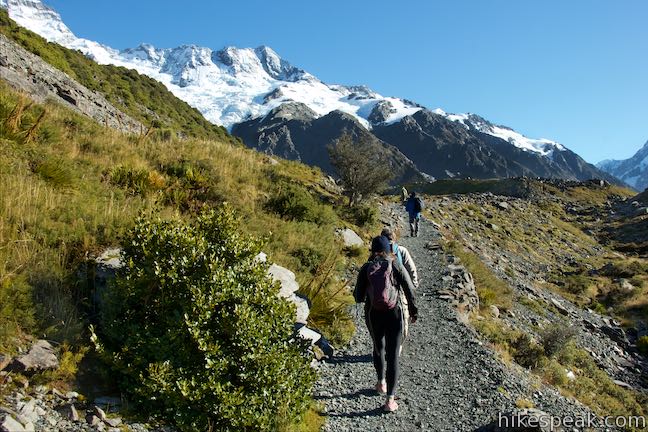
The trail continues up the valley floor, aiming toward White Horse Hill, a short rise above the end of Mueller Lake. Kea Point is on the other side of that hill and out of view. Mount Sefton is very much in view, towering over the hill with an expanse of dark ridges weighted down with snow and ice. To your left, the Sealy Range rises rapidly above the valley.
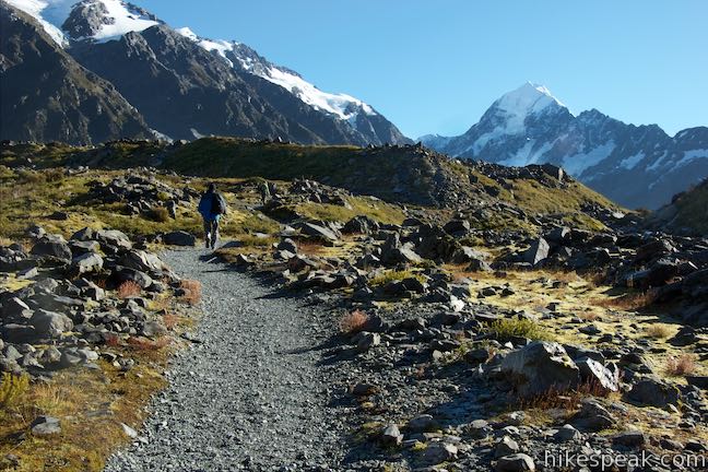
Come to a second junction, 850 meters from the start, where Sealy Tarns Track separates from Kea Point Track. Sealy Tarns and Mueller Hut could be reached by turning left. Stay to the right to keep going to Kea Point. The track proceeds into a gap on the ridge next to White Horse Hill. In 1913, a stream carved out this path from Mueller Glacier, changing the landscape and damaging the original Hermitage site. The stream is long gone, leaving behind a gully that the track follows up to Kea Point. As you approach the viewpoint, Mount Cook appears to the northeast.
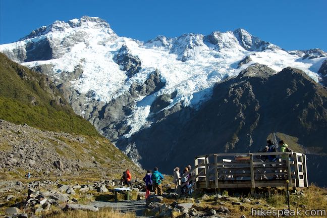
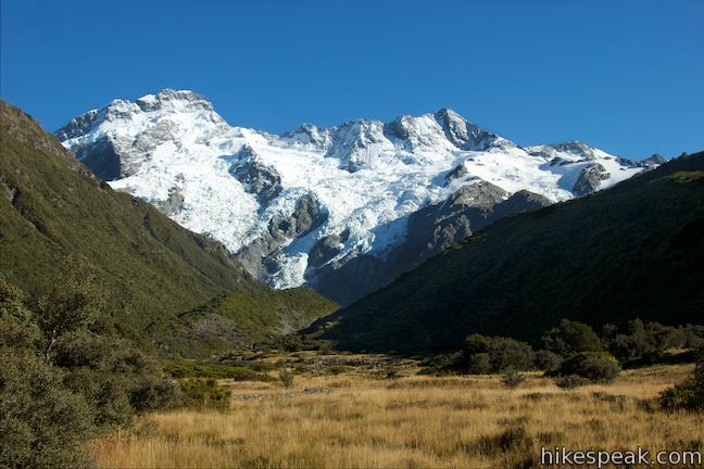
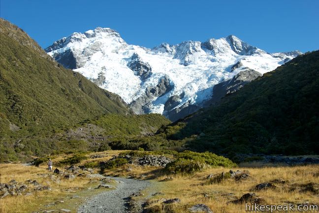
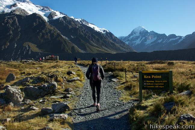
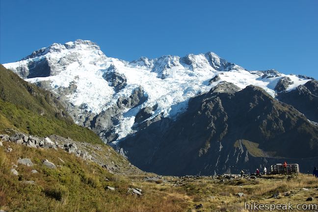
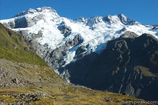
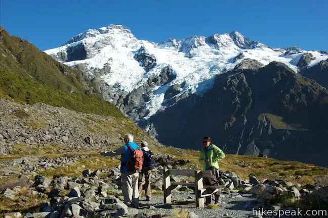
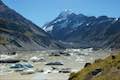
At 1.5 kilometers from the start, the track ends at Kea Point. Have a seat on a bench or walk onto a wooden platform to take in the massive views. Mount Sefton lies straight ahead, a 3,151-meter tall formation of jagged black rock and white ice. Watch as sections of ice shelves shift and fall. Snow gets swept up like tumbling clouds and temporary cascades are created. You can actually watch and hear the mountain being changed. A panel at the overlook tells the story of Mount Sefton’s first ascent:
On 14 February 1895, Edward GitzGerald and Matthias Zurbiggen became the first mountaineers to reach the summit of Mount Sefton. They struggled up the ice cliffs and crumbling rock you can see above you, when hit by a falling boulder, and were almost lost in a crevasse when an ice bridge collapsed. It wasn’t until they reached the summit that they realized the other side of the mountain was not as steep. Today, most climbers approach Mount Sefton from the easier western side.
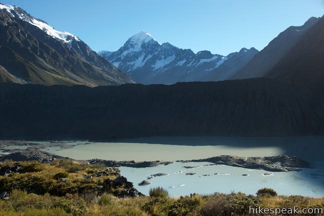
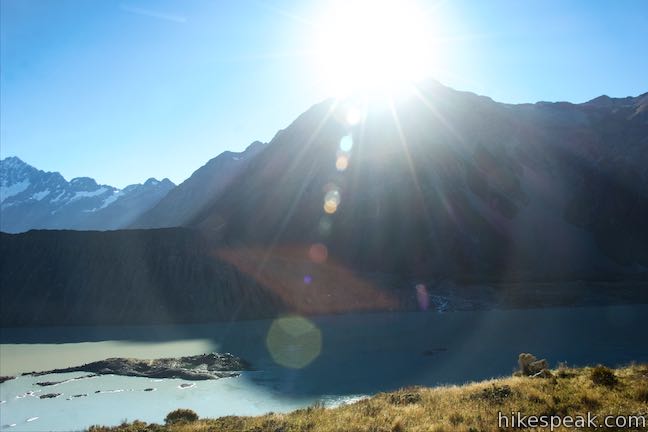
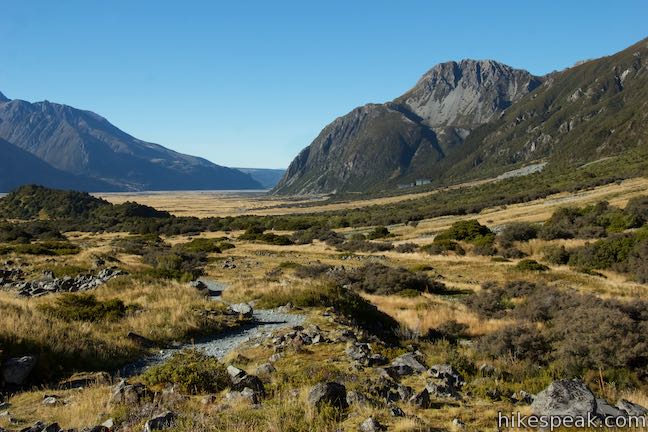
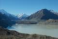
Below Mount Sefton is Mueller Glacier, now mostly out of view and covered in gray rock. A hundred years ago, Mueller Glacier was much larger and filled the valley floor. Mueller Lake is a terminal lake below that glacier and has milky tan and turquoise water. On the far side of the lake, beyond a lateral moraine, rises the highest summit in New Zealand. Named Aoraki by the Ngāi Tahu that inhabited the area before Europeans arrived, and called Mount Cook by those who came later, both titles are now used for the 3,724-meter tall mountain known as Aoraki/Mount Cook.
Not all of the park’s great viewpoints are this easy to reach, so appreciate all the views before heading back the way you came. If you like, bust a right up Sealy Tarns Track for a staggeringly steep ascent (about 500 vertical meters over two kilometers) to pools perched on the mountainside that have greater views of Aoraki Mount Cook National Park. If that sounds like too much to tack on, just walk back to the car park by White Horse Hill Campground for an easy 3-kilometer outing. Dogs are not allowed on tracks in Aoraki Mount Cook National Park. No permit is required to hike to Kea Point and the national park has no entry fee, so get out and enjoy!
Directions to the Trailhead
- Take State Highway 8 to State Highway 80 (Mount Cook Road), at the south end of Lake Pukaki.
- Drive north on SH 80 for 54.5 kilometers.
- Before reaching Mount Cook Village, turn right on Hooker Valley Road.
- After 2 kilometers, the road ends at White Horse Hill Campground.
- Day use parking is available in front of the campground on the left where the track begins.
Trailhead Location
Trailhead address: Hooker Valley Road, Aoraki Mount Cook National Park, Canterbury, 7999, New Zealand
Trailhead coordinates: -43.71875, 170.0926 (43° 43′ 07.50″S 170° 05′ 33.36″E)
You may also view a regional map of surrounding New Zealand tracks, campgrounds, and lodging.


 | Sealy Tarns Track This incredibly steep and incredibly scenic 5.8-kilometer round trip hike uses a string of staircases to ascend a mountainside to pools that reflect views of Mount Sefton and Mount Cook. |
 | Mueller Hut Route Ascend past Sealy Tarns on a rough route to a famed hut for a 10.5-kilometer round trip hike with spectacular views. |
 | Mount Ollivier This 1,933-meter tall summit can be reached by ascending above Mueller Hut for even grander views. |
 | Hooker Valley Track This superb 11-kilometer round trip hike heads up Hooker Valley to an iceberg-filled lake at the end of an impressive glacier below Mount Cook. |
 | Tasman Glacier View & Blue Lakes This pair of tracks combine for a hike of 1.85 kilometers round trip (or more) with views of small emerald pools and a large milky lake below Tasman Glacier. |
 | More trails in New Zealand Explore other destinations for walking and hiking (as well camping and lodging) in New Zealand. |
 | White Horse Hill Campground This 60-site campground is surrounded by great hiking tracks and just a few kilometers from Mount Cook Village, making it an ideal place to stay during a visit to Aoraki Mount Cook National Park. |
- The Department of Conservation brochure for walking and cycling in Aoraki Mount Cook National Park (opens in a new tab)
- Kea Point Walk on rankers.co.nz (opens in a new tab)
- The Department of Conservation webpage for Aoraki/Mount Cook Village Walks (opens in a new tab)
- The Department of Conservation webpage for Aoraki Mount Cook National Park (opens in a new tab)
- Aoraki Mount Cook National Park on wikipedia.org (opens in a new tab)
- Aoraki Mount Cook National Park on newzealand.com (opens in a new tab)
Common Questions about Kea Point in Aoraki Mount Cook National Park
- Is the trail open?
- Yes. You should expect to find that Sealy Tarns Track & Kea Point Track is open. There are no recent reports of trail closures. If you discover that the trail is closed, please help your fellow hikers by reporting a closure.
- Is this trail free to access?
- Yes, Sealy Tarns Track & Kea Point Track is free to access. No entrance fee, pass, or permit is required. If you discover that access rules have changed, please provide feedback on your experience.
- How much time does this hike take?
- It takes approximately 1 hour to hike Sealy Tarns Track & Kea Point Track. Individual hiking times vary. Add extra time for breaks and taking in the views.
- How long is this hike?
- The hike to Sealy Tarns Track & Kea Point Track is a 3 km / 1.85 mile out and back return with 95 meters / 310 feet of elevation change.
- Are dogs allowed on this trail?
- No, dogs are likely not allowed on Sealy Tarns Track & Kea Point Track. The trail is primarily open to hikers.
- Is Sealy Tarns Track & Kea Point Track good for kids?
- Yes, this hike is likely suitable for children. It is relatively short (1.85 miles) with manageable elevation gain.
- Where is the trailhead located?
- The trailhead for Sealy Tarns Track & Kea Point Track is located in Aoraki Mount Cook National Park, Canterbury.
Trailhead Address:
Hooker Valley Road
Aoraki Mount Cook National Park, Canterbury 7999
Trailhead Coordinates:
-43.71875, 170.0926 - What are the driving directions to the start of the hike?
To get to the trailhead: Take State Highway 8 to State Highway 80 (Mount Cook Road), at the south end of Lake Pukaki. Drive north on SH 80 for 54.5 kilometers. Before reaching Mount Cook Village, turn right on Hooker Valley Road. After 2 kilometers, the road ends at White Horse Hill Campground. Day use parking is available in front of the campground on the left where the track begins.
View custom Google Maps directions from your current location.
- Are there other trails near Sealy Tarns Track & Kea Point Track?
- Yes, you can find other nearby hikes using the Hikespeak Hike Finder Map.

Go the extra miles...
Submit a rating of this hike to go with your comment. Contribute to the average trail rating.