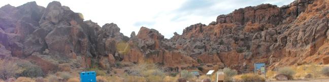
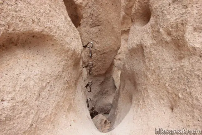
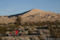
Off Black Canyon Road in Mojave National Preserve, the Hole-in-the-Wall Rings Trail is a must see! The namesake Ringbolts serve as hand holds and steps, granting passage through a couple steep and narrow sections on this 1.5-mile loop (or 0.5-mile out and back hike for those preferring to repeat the most exciting stretch of the hike). The Hole-in-the-Wall Rings Trail delivers a short fun hiking experience for park visitors.
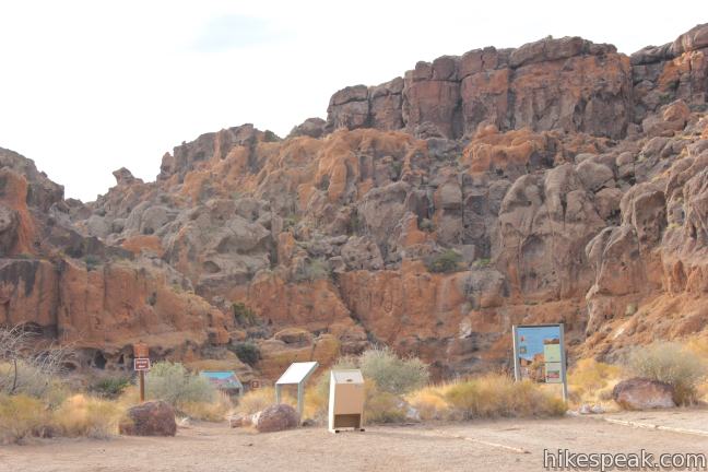
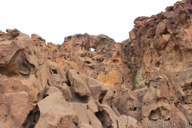
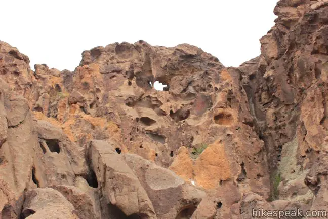
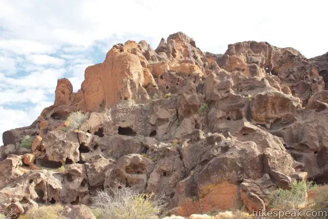
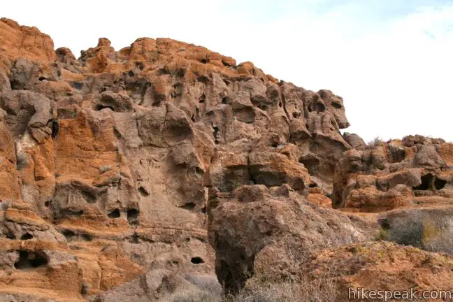
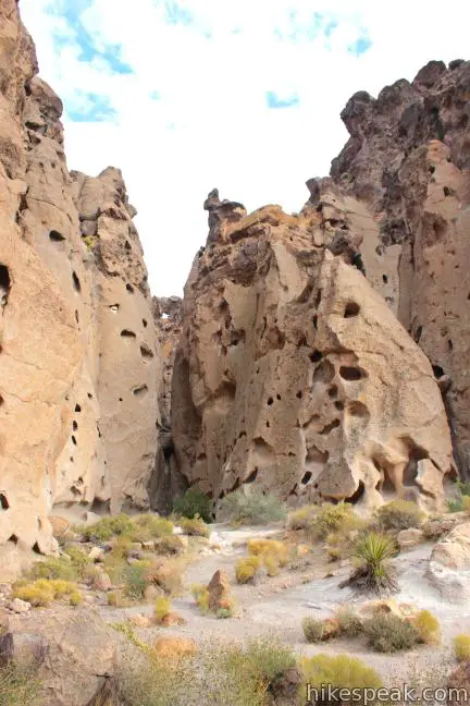
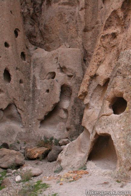
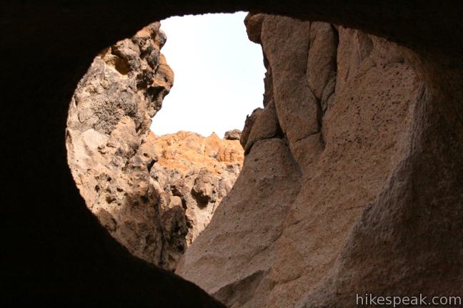
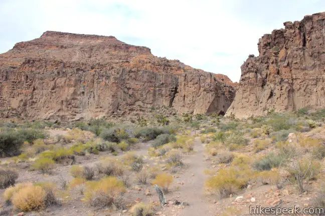
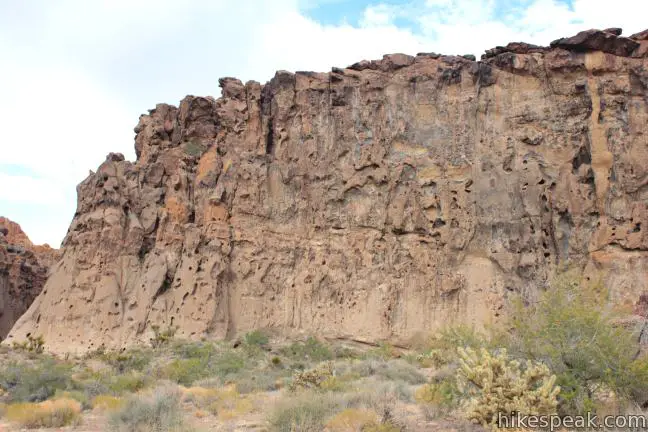
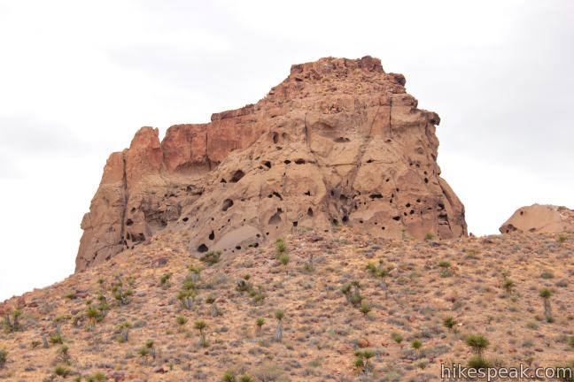
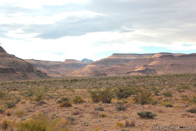
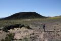
Before setting out on the trail, take a quick detour to fenced-in overlook with a view into one of Hole-in-the-Wall’s unique canyons of pocketed rock walls. Hole-in-the-Wall was created millions of years ago when a nearby volcano erupted, covering the area with a mixture of gas and ash. The ash cooled and the gas dissipated, leaving behind the porous holes in the walls.
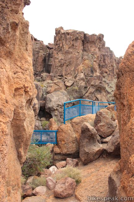
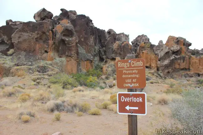
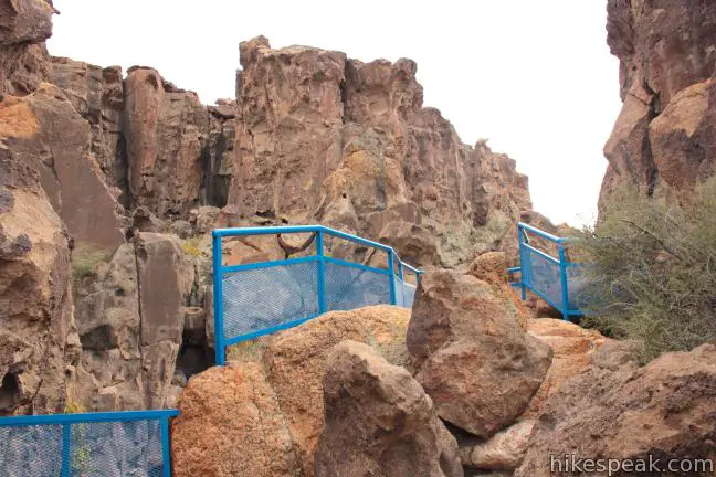
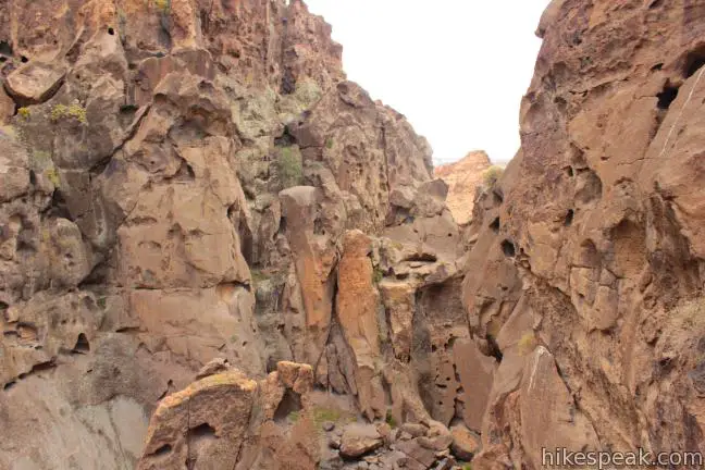
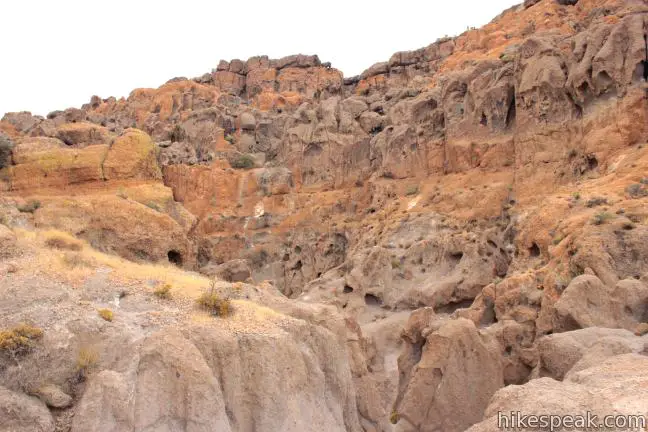
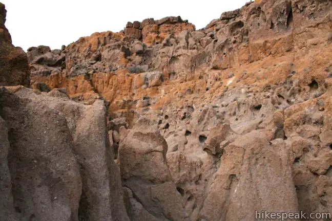
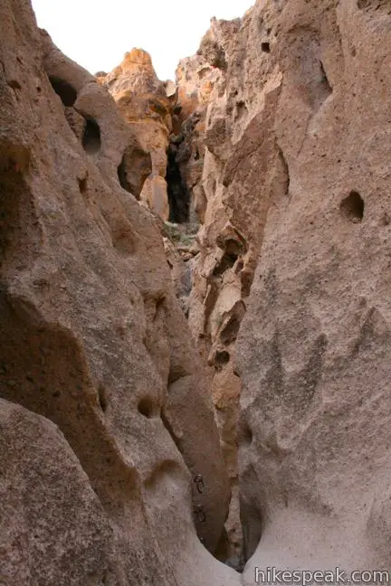
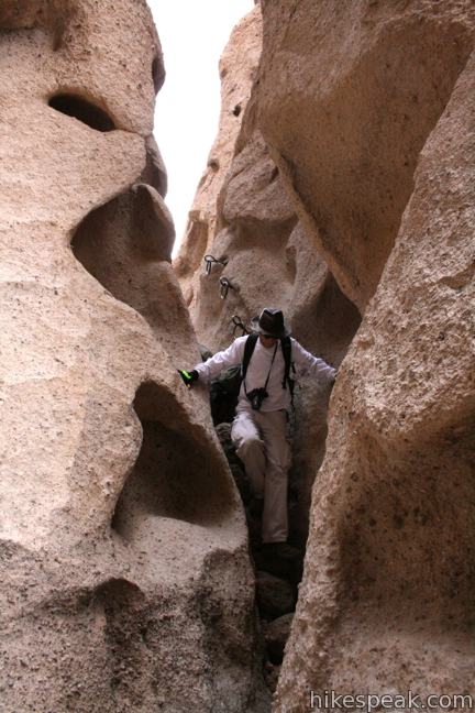
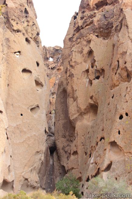
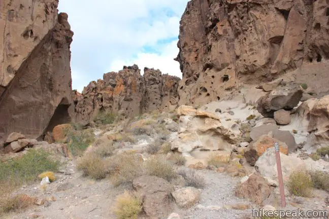
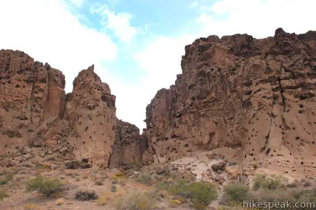
Leave the overlook and follow the Rings Trail down a few boulders into a narrow canyon. The descent into Banshee Canyon crosses two dry falls. Banshee Canyon, the heart of Hole-in-the-Wall, is named for the crying sound that the wind make as it blows through the Swiss Cheese-like rock formations.
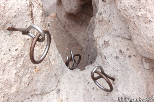
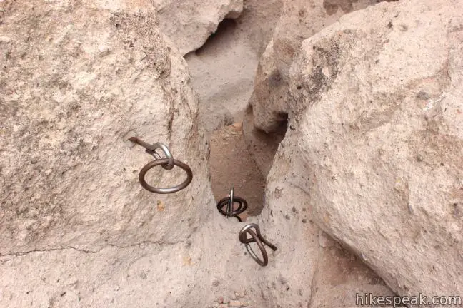
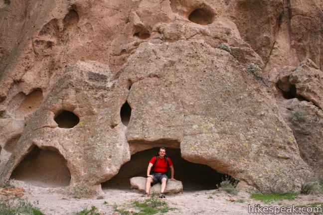
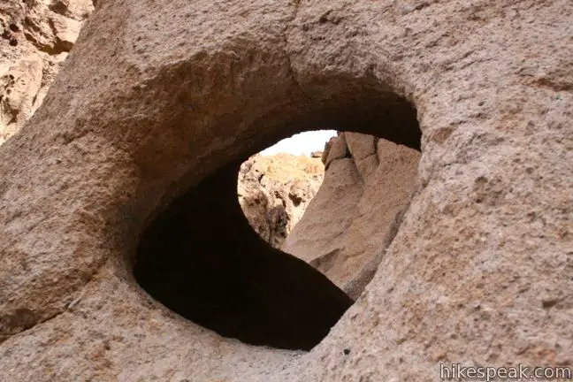
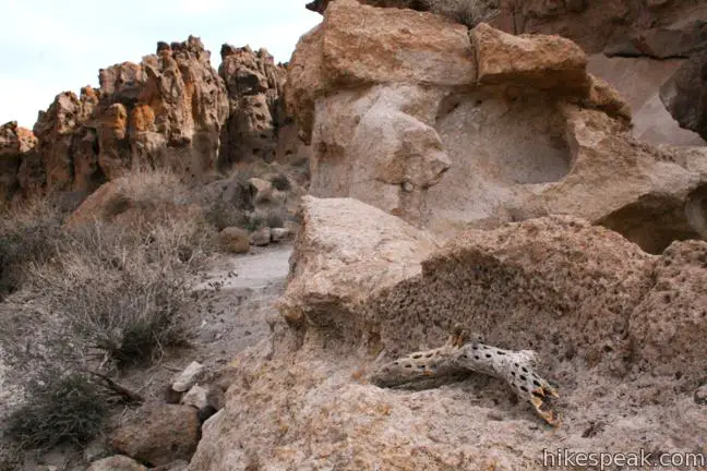
Two sets of rock-mounted ringbolts make it safe for hikers to advance. Use the bolts as hand holds and steps to proceed down to the rocky amphitheater at the bottom of Banshee Canyon. Here you will be lured off trail to poke your head through porthole-sized gaps or climb inside larger pockets in the hundred-foot tall rock face.
The opening quarter-mile stretch of the Rings Trail is the most exciting and hikers may wish to turn around at the bottom of the canyon and hike back up over the rings for a 0.5-mile round trip hike.
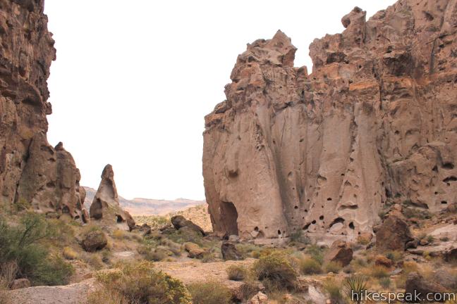
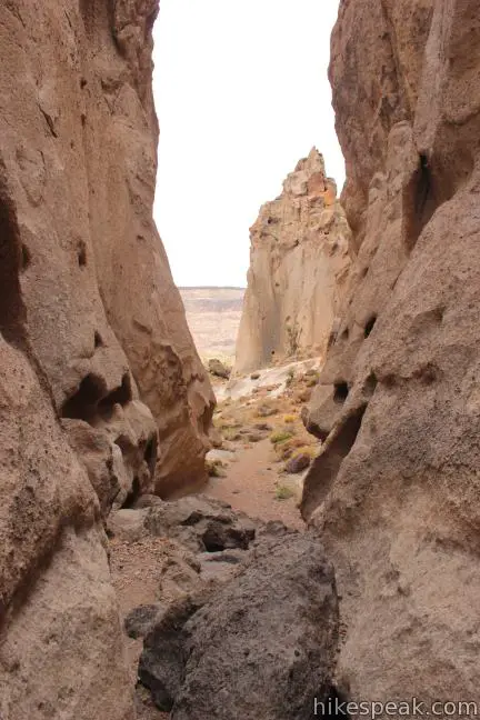
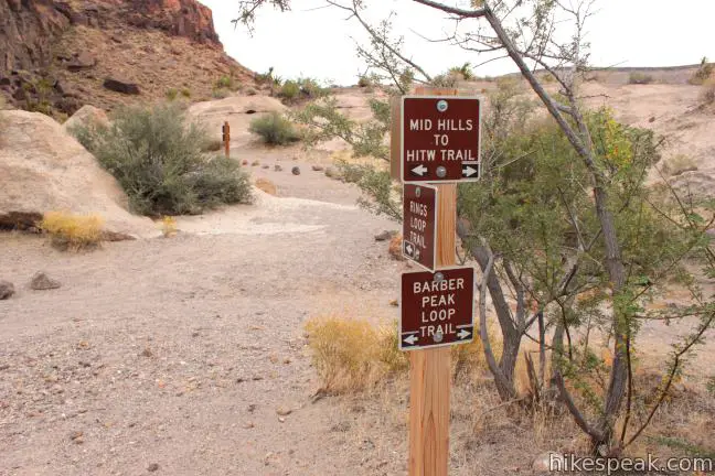
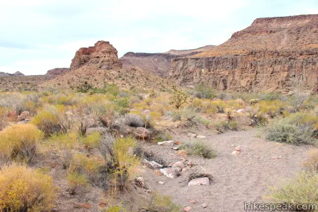
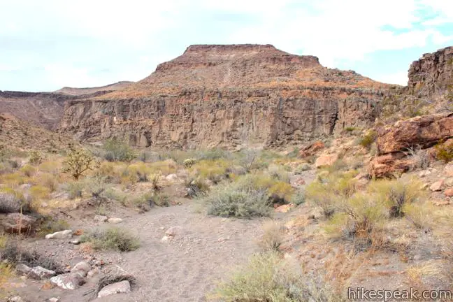
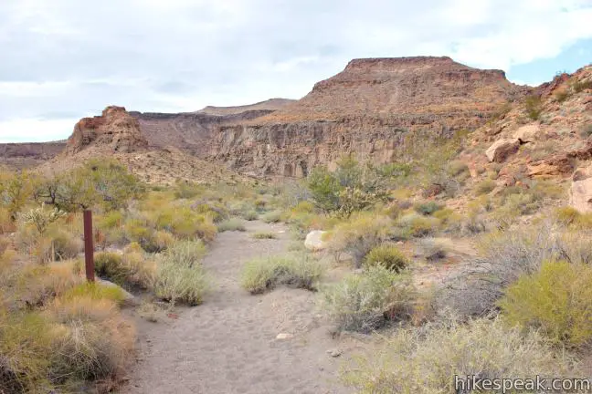
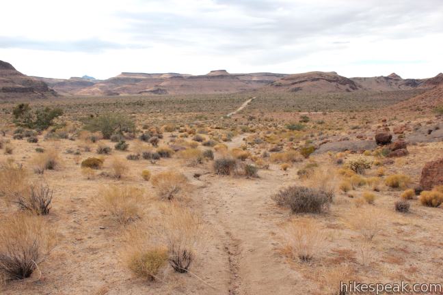
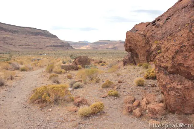
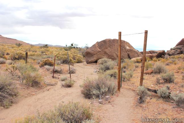
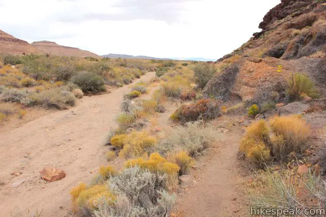
Otherwise, follow the path out the mouth of Banshee Canyon into a broader desert landscape. Reach a junction with Barbour Peak Loop Trail and turn left, continuing along the Rings Trail as it wraps around the south side of a rock wall on a gradual course to a trailhead next to the Hole-in-the-Wall Visitor Center. This easy 1-mile stretch of the loop does not have ringbolts. Pass through two ranching fences to circle back to a alternate trailhead near the visitor center, which is a quarter mile from the starting trailhead for the Rings Trail. To connect the two trailheads, simply walk down the same road you drove in.
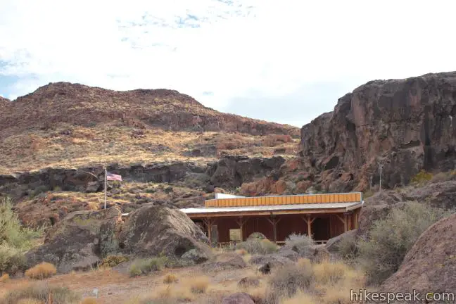
Bathroom and picnic tables are located near the trailhead. No fee or permit is required to hike Hole-in-the-Wall Rings Trail in Mojave National Preserve, so get out and enjoy!
Directions to the Trailhead
- From Barstow, head east on Interstate 40.
- Take exit 100 and head north on Essex Road.
- After 10 miles turn right onto Black Canyon Road and continue north for another 10 miles.
- Hole-in-the-Wall will be on the left.
Trailhead Location
Trailhead address: Hole-in-the-Wall off Black Canyon Road, Mojave National Preserve, CA 92332
Trailhead coordinates: 35.0440, -115.3980 (35° 02′ 38.4″N 115° 23′ 52.8″W)
View Mojave National Preserve in a larger map
Or view a regional map of surrounding California Desert trails and campgrounds.


 | Rock Spring Loop Trail This 1 1/3-mile loop visits a rare desert spring, a Rock House built in the 1920s, a miners' mill site, and an old U.S. Army post on a short and scenic circuit. |
 | Fountain Peak This 5-mile off trail trek summits a peak with commanding views over the Providence Mountains. |
 | Teutonia Peak This 3.4 to 4-mile round trip hike crosses the world's densest Joshua tree forest, passing an abandoned silver mine to reach a rocky summit with views of Cima Dome. |
 | Kelso Dunes This 3-mile round trip hike climbs 470 feet to the highest point in this 45 square mile dune field. |
 | New York Peak This 7 to 9-mile round trip hike summits the highest point of the New York Range in the northeast corner of the preserve. |
 | Silver Peak This 8.5-mile hike summits a 6,365-foot peak in the Granite Mountains. |
 | Amboy Crater This 3-mile round trip hike travels up and into this crater adjacent to Mojave National Preserve. |
 | Hikes in the California Desert Explore more trails in Death Valley National Park, Joshua Tree National Park, Anza-Borrego Desert State Park, and Mojave National Preserve. |
 | Mojave National Preserve There are a few campgrounds and endless roadside camping within the preserve. |
Common Questions about Hole-in-the-Wall Rings Trail in Mojave National Preserve
- Is the trail open?
- Yes. You should expect to find that Hole-in-the-Wall Rings Trail is open. There are no recent reports of trail closures. If you discover that the trail is closed, please help your fellow hikers by reporting a closure.
- Is this trail free to access?
- Yes, Hole-in-the-Wall Rings Trail is free to access. No entrance fee, pass, or permit is required. If you discover that access rules have changed, please provide feedback on your experience.
- How much time does this hike take?
- It takes approximately 45 minutes to hike Hole-in-the-Wall Rings Trail. Individual hiking times vary. Add extra time for breaks and taking in the views.
- How long is this hike?
- The hike to Hole-in-the-Wall Rings Trail is a 1.5 mile out and back / loop with 150 feet of elevation change.
- Are dogs allowed on this trail?
- Yes, dogs are allowed on Hole-in-the-Wall Rings Trail. The trail is open to hikers, dogs.
- Is Hole-in-the-Wall Rings Trail good for kids?
- Yes, this hike is likely suitable for children. It is relatively short (1.5 miles) with manageable elevation gain.
- Where is the trailhead located?
- The trailhead for Hole-in-the-Wall Rings Trail is located in Mojave National Preserve, CA.
Trailhead Address:
Black Canyon Road
Mojave National Preserve, CA 92332
Trailhead Coordinates:
35.0440, -115.3980 - What are the driving directions to the start of the hike?
To get to the trailhead: From Barstow, head east on Interstate 40. Take exit 100 and head north on Essex Road. After 10 miles turn right onto Black Canyon Road and continue north for another 10 miles. Hole-in-the-Wall will be on the left.
View custom Google Maps directions from your current location.
- Are there other trails near Hole-in-the-Wall Rings Trail?
- Yes, you can find other nearby hikes using the Hikespeak Hike Finder Map.

4 Comments on Hole-in-the-Wall Rings Trail in Mojave National Preserve
What hikers are saying:
✨ Generated summary of user commentsThis trail provides a fun environment for families to create lasting memories together. Nature enthusiasts appreciate the opportunity to observe various birds and unique insects throughout the landscape. The proximity to Mitchell Caverns makes this a great area for those looking to extend their outdoor adventure.
[…] is a first-come-first-served, developed campground. It’s also the jumping-off point for the Rings Loop Trail through a stunning canyon flanked by pocketed rock walls. And for the more adventurous families, […]
It’s a short trail, but I was lucky to see several birds and interesting insects. Here is a short film on YouTube:
https://youtu.be/u5x27brfEpY
I used to take my son there every year with his friends. FUN isn’t there a under ground cave tour near by too? Seems there was….but now I am old and confused. It seems there was a ranger who toured us….HELP trying to share this sport with new friends.
Mitchell Caverns – not too far away.