Head of the Metolius
in Deschutes National Forest
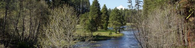
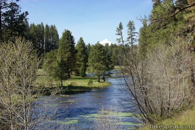
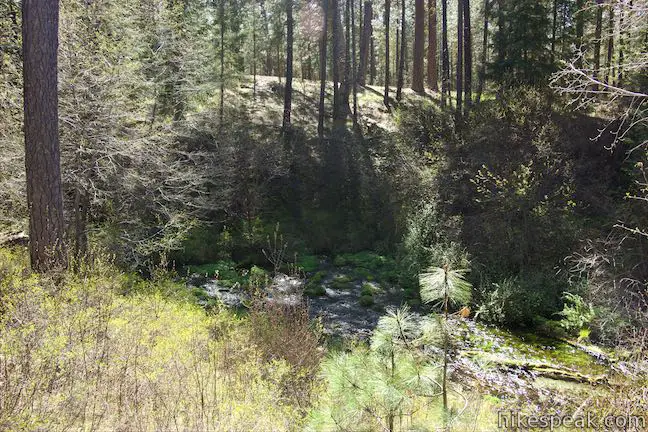
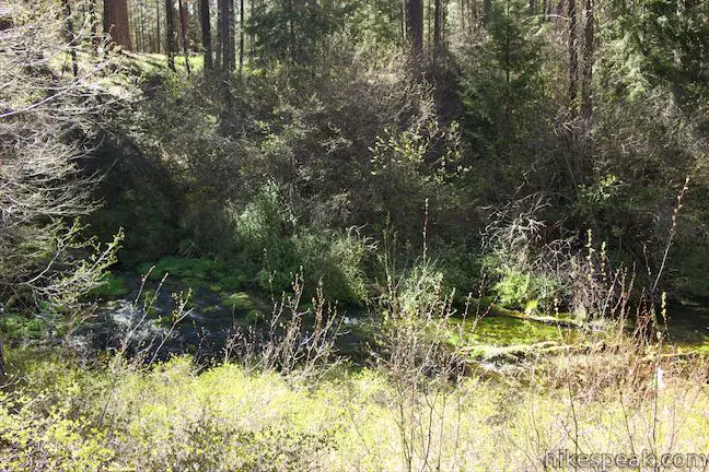
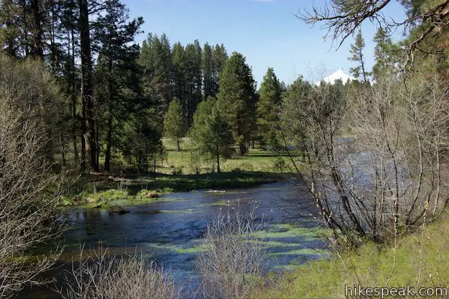
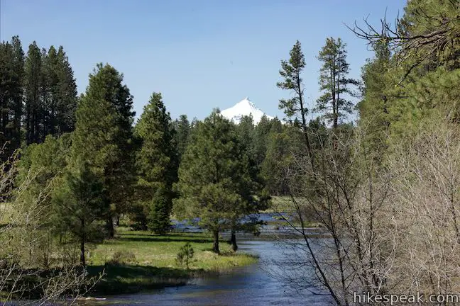
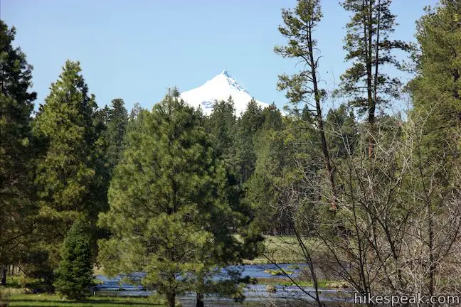
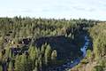
Gaze north from the observation site at the end of Head of the Metolius Trail and you’ll have a beautiful (if traditional) view of a river flowing through a pine forest toward Mount Jefferson. Look in the other direction to see something unexpected. The river springs to live all at once from a surprising, gushing source.
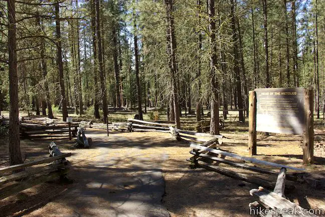
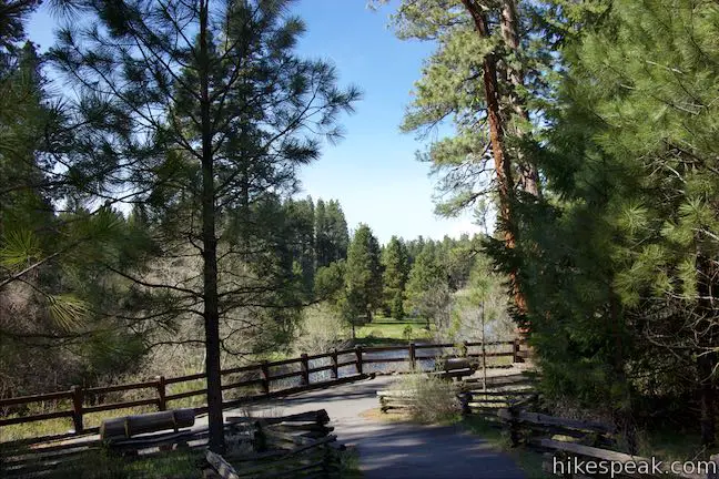
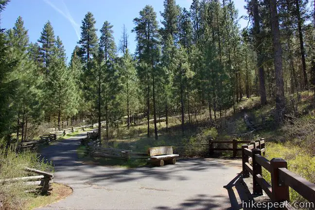
The trail to Head of the Metolius in Deschutes National Forest is a quarter mile long and paved. The hike begins next to Black Butte, north of the town of Sisters in Central Oregon.
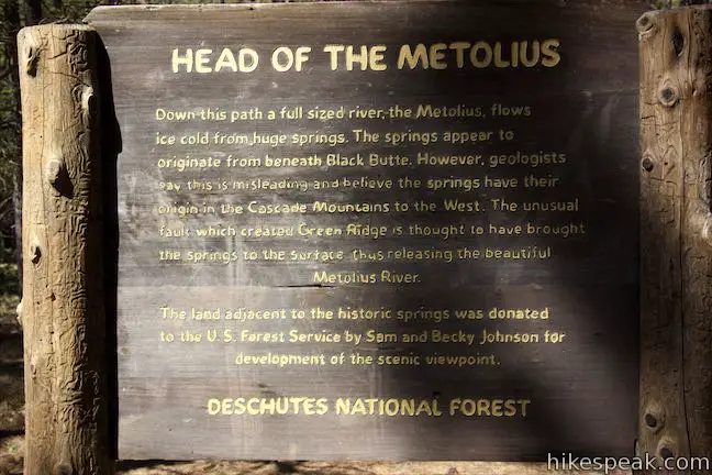
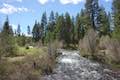
We typically think or rivers forming from smaller streams of water that come together. This is not the origin story from the Metolius River, which emerges suddenly as a full-flowing river. Metolius River is one of the biggest spring-fed rivers in America. A panel at the trailhead explains:
Down this path a full sized river, the Metolius, flows ice cold from huge springs. The springs appear to originate beneath Black Butte. However, geologists say this is misleading and believe the springs have their origin in the Cascade Mountains to the west. The unusual fault that created Green Ridge is thought to have brought the springs to the surface, thus releasing the beautiful Metolius River.

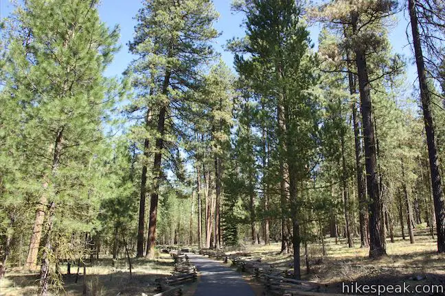
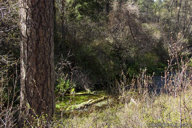
Set out down the paved trail through a forest of ponderosa pines. Enjoy the fragrant pines as you make your way along the easy trail. Eventually, the paved path curves to the right and descends to a viewpoint.
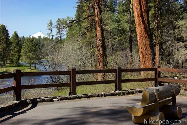
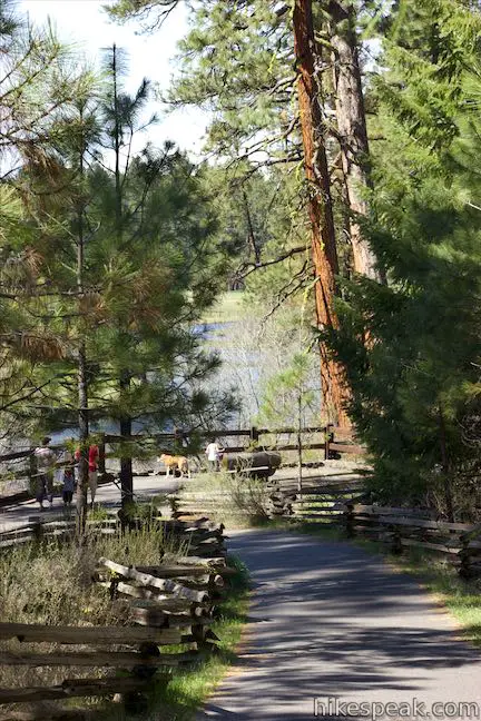
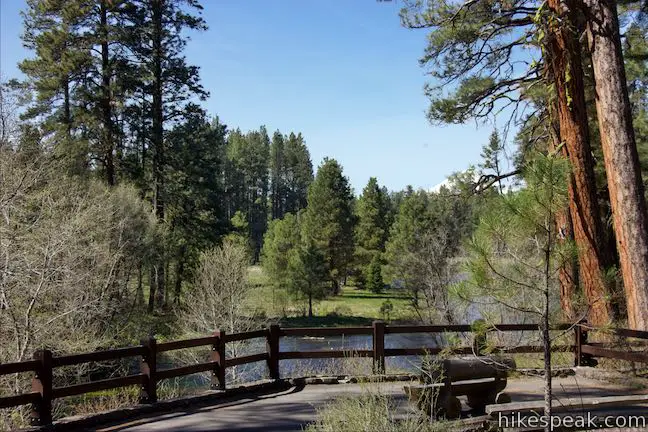
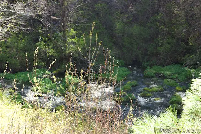
Step up to the railing at the overlook and take in two wonders. To your left, you’ll see and hear water gushing out of Metolius Springs. The water, which seems to come from nowhere, flows at a rate of 50,000 gallons per minute.
Turn to the right and you can watch the freshly minted river flow north through the forest. If you only looked in this direction, you would never imagine the river’s source was so close.
Metolius Springs by hikespeak.
Looking north up the river, you should see the snow-capped summit of Oregon’s second tallest mountain, Mount Jefferson, which rises to a point nearly 10,500 feet tall. Benches are provided at the end of the trail so that you can relax and take in the setting before walking back.
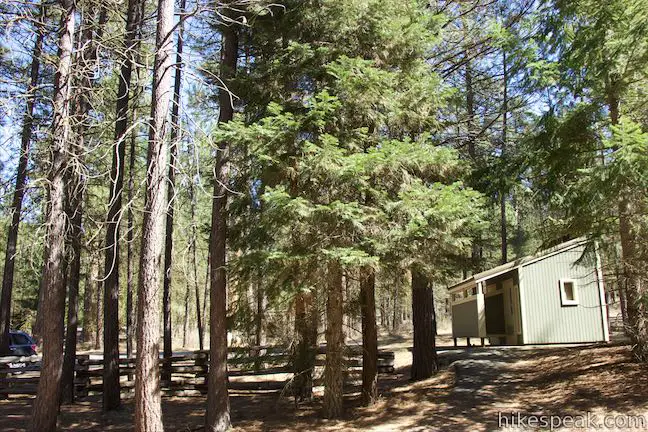
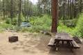
Head of the Metolius Trail is 0.5 miles round trip with 35 feet of elevation change. Dogs and bikes are welcome. Picnic tables and toilets are located at the trailhead. No fee is required to park at the trailhead and a permit is not necessary for this short hike, so get out and enjoy!
The nearby hamlet of Camp Sherman, a little farther down Metolius River, is also interesting to visit. To see another impressive springs on Metolius River, check out nearby West Metolius River Trail.
Directions to the Trailhead
- From Sisters, drive northeast on Route 20 for 9.5 miles to Camp Sherman Road.
- Turn right and take this road along the base of Black Butte.
- Drive 2.7 miles to a split and bear right onto Metolius River Road (National Forest Development Road 14).
- Go another 1.6 miles and turn left into the parking area for the trail.
Trailhead Location
Trailhead address: Head of the Metolius Observation Site, Metolius River Road (National Forest Development Road 14), Camp Sherman, OR 97730
Trailhead coordinates: 44.4341, -121.634 (44° 26′ 02.76″N 121° 38′ 02.4″W)
You may also view a regional map of surrounding Oregon trails and campgrounds.


 | West Metolius River Trail The 5.4-mile hike follows the west bank of the Metolius River to incredible gushing springs and a fish hatchery. |
 | Black Butte The 4-mile hike summits one of the most identifiable peaks in Central Oregon, which has fire lookout towers and panoramic views of the Cascade Mountains. |
 | Clear Lake Loop This charming 5-mile curcuit crosses lava fields and old-growth forests along the shore of a strikingly clear Cascadian lake. |
 | Archie Briggs Canyon Trail This 1.25-mile hike descends a ravine to clifftop views over a dramatic canyon on the Deschutes River. |
 | Shevlin Loop Trail This 4.75-mile tour of Shevlin Park just a few miles east of Bend explores pine forests on both sides of Tumalo Creek. |
 | Pilot Butte This 1.8-mile hike ventures up the dominant landmark in Bend to offer sweeping views of the majestic surroundings. |
 | Terwilliger Hot Springs This 0.9-mile hike leads to a natural hot springs in Willamette National Forest where bathers can soak in a series of terraced pools. |
 | Spencer Butte This 5.2-mile hike crosses a fern-covered forest to reach the crown of Spencer Butte where there are panoramic views to enjoy. |
 | More trails in Oregon Explore other hikes in Oregon outside the Bend area. |
 | Lower Canyon Creek Campground This spacious 7-site campground is sparsely shaded by pines next to the confluence of Canyon Creek and Metolius River. |
Common Questions about Head of the Metolius in Deschutes National Forest
- Is the trail open?
- Yes. You should expect to find that Head of the Metolius Trail is open. There are no recent reports of trail closures. If you discover that the trail is closed, please help your fellow hikers by reporting a closure.
- Is this trail free to access?
- Yes, Head of the Metolius Trail is free to access. No entrance fee, pass, or permit is required. If you discover that access rules have changed, please provide feedback on your experience.
- How much time does this hike take?
- It takes approximately 15 minutes to hike Head of the Metolius Trail. Individual hiking times vary. Add extra time for breaks and taking in the views.
- How long is this hike?
- The hike to Head of the Metolius Trail is a 0.5 mile out and back with 35 feet of elevation change.
- Are dogs allowed on this trail?
- Yes, dogs are allowed on Head of the Metolius Trail. The trail is open to hikers, bikes, dogs.
- Is Head of the Metolius Trail good for kids?
- Yes, this hike is likely suitable for children. It is relatively short (0.5 miles) with manageable elevation gain.
- What mountain range is this trail in?
- Head of the Metolius Trail is located in the Cascade Range.
- Where is the trailhead located?
- The trailhead for Head of the Metolius Trail is located in Camp Sherman, Oregon.
Trailhead Address:
Metolius River Road
Camp Sherman, Oregon 97730
Trailhead Coordinates:
44.4341, -121.634 - What are the driving directions to the start of the hike?
To get to the trailhead: From Sisters, drive northeast on Route 20 for 9.5 miles to Camp Sherman Road. Turn right and take this road along the base of Black Butte. Drive 2.7 miles to a split and bear right onto Metolius River Road (National Forest Development Road 14). Go another 1.6 miles and turn left into the parking area for the trail.
View custom Google Maps directions from your current location.
- Are there other trails near Head of the Metolius Trail?
- Yes, you can find other nearby hikes using the Hikespeak Hike Finder Map.

How old is the water springing up into the metolius
I first visited the Metolius Spring about 1972. Then, there was a outcropping that had a handrail enclosure where you were just 10 feet from the gushing forth of the spring. It didn’t just flow out, it gushed forth with such power like it was being shot out of a hose. I am not sure if I can locate that same spot since the videos I now see just implicate a gentle trickle compared to a glorious and exuberant bursting forth I previously saw.
[…] the left after a couple of miles at the “To Campgrounds” sign) to the Metolius Spring and the Head of the Metolius Day Use Area. A paved trail leads to the river’s bubbling origin with some great views of snow-capped Mount […]
9/20/22 Area around the observation viewpoint is heavily overgrown and springs were not visible. Disappointing since it had been heavily hyped.