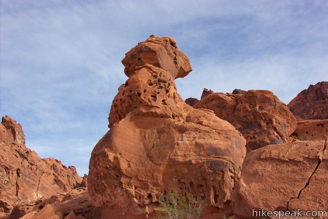
Balancing Rock
in Valley of Fire State Park

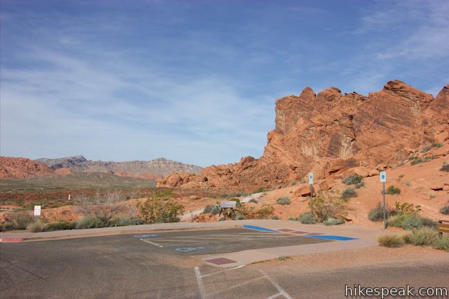
This short hike begins next to the visitor center for Valley of Fire State Park. Hike just a quarter mile round trip to stand below a formation of red sandstone that seems to be standing quite precariously. The short trail is located near the start of White Domes Road and is an easy and convenient addition to any park visit.
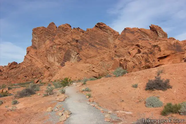
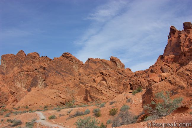
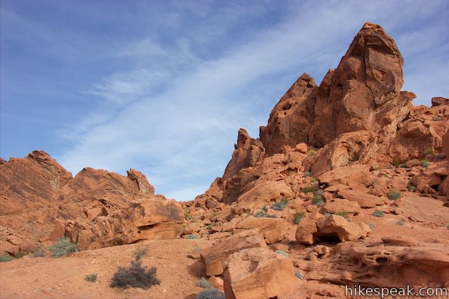
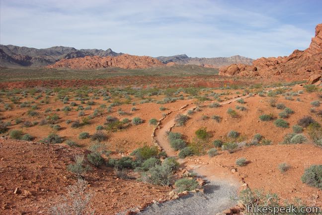
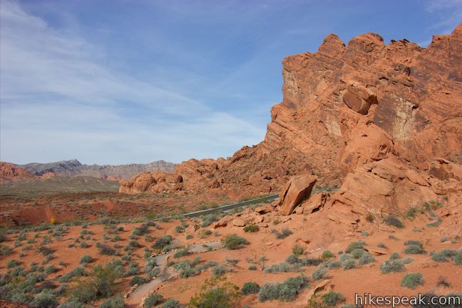
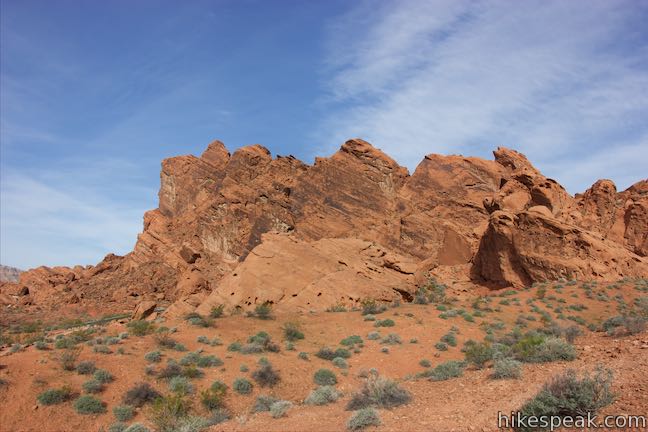
Facing the visitor center, turn to the left to spot the start of the trail. You can also walk inside the visitor center to learn a great deal about the park’s geology, animals, and past human inhabitants. The trail leaves from visitor center and heads west, rolling across a landscape of reds and oranges. Though the trail only has about 10 feet of elevation, it does undulate over crests and dips. Ahead and to the right rise tall cliffs of red sandstone, carved by erosion into interesting shapes. Near the top of one of these cliffs on the right, spot an obelisk-shaped boulder that appears to be leaning away from the rock face, preparing to jump.
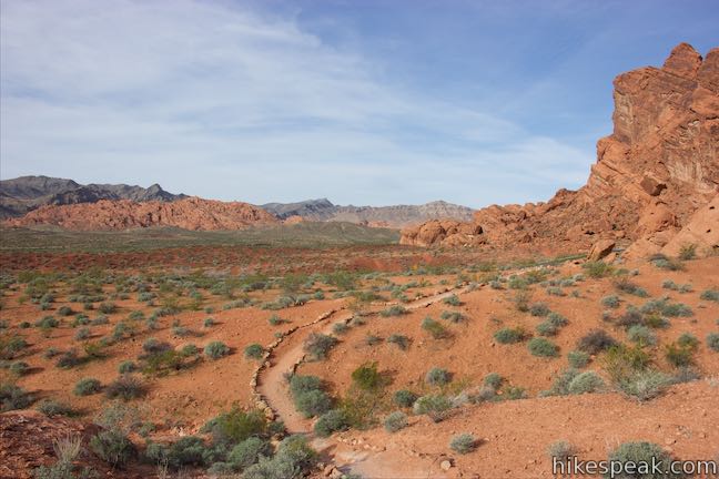
White Domes Road is to your left, and curves north past Balancing Rock to begin a scenic route past many of the park’s most impressive features.
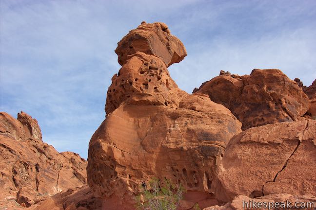
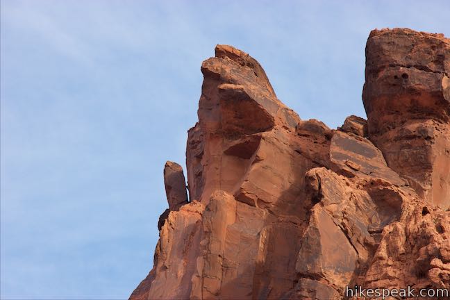
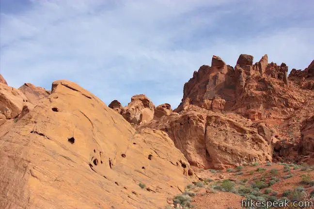
After 1/8 of a mile, come to the trail’s end, just below Balancing Rock. The rock stands in front of you, about 20 feet tall. The “head” of Balancing Rock has an eyelet near the top and a protruding block that looks like a nose. The column of rock even shrinks around the top piece, making it look like it is balancing. If you drive up White Domes Road after this hike, look back at Balancing Rock from the opposite direction and see just how precarious the top of the rock seems to be.
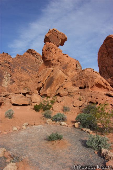
Obviously Balancing Rock is fragile, so do not climb on it. Instead, hike back the way you came to complete this short hike. Valley of Fire State Park has an entrance fee but no permit is required to hike to Balancing Rock. Leashed dogs are allowed on Balancing Rock Trail.
Directions to the Trailhead
- From Las Vegas, take Interstate 15 north for about 35 miles to exit 75 (signs for Valley of Fire State Park and Lake Mead National Recreation Area).
- At the end of the offramp, go southeast on Valley of Fire Highway.
- Reach the park's west entrance after 14.5 miles.
- Drive another 3.5 miles and turn left, following a sign for the visitor center.
- After a tenth of a mile, stay to the right past the start of White Domes Road, drive up to the visitor center and park.
- Arriving from the east, from the intersection of Route 169 and 167 near Lake Mead, drive west on Valley of Fire Highway for two miles to the park's east entrance.
- Drive another 3.3 miles to the intersection by the start of White Domes Road, turn right and drive up to the visitor center.
Trailhead Location
Trailhead address: 29450 Valley of Fire Road, Overton, NV 89040
Trailhead coordinates: 36.42987, -114.51446 (36° 25′ 47.53″N 114° 30′ 52.05″W)
You may also view a regional map of surrounding Nevada trails and campgrounds.


 | Petroglyph Canyon Trail to Mouse's Tank This 0.75-mile hike travels down a sandy path lined with petroglyphs to a natural basin formed in the sandstone. |
 | Rainbow Vista This hike of up to 1.5 miles goes up a sandstone mini-summit with tremendous 360-degree views over multi-colored landscapes and then continues on to Fire Canyon Overlook. |
 | Fire Wave This 1.5-mile hike reaches a sensational striped creation where a slickrock depression is painted in waves of orange and beige. |
 | White Domes This 1.1-mile loop is impressive from start to finish as it explores colorful, intricate rock formations, passes and old film set, and slips through a narrow slot canyon. |
 | Elephant Rock This 0.3-mile hike at the east entrance of Valley of Fire State Park leads to a sandstone formation resembling an elephant with a unique natural arch for a trunk. |
 | Petrified Logs Loop This 0.3-mile hike gets close to petrified logs on the desert floor passing panels that explain how wood is petrified. |
 | Atlatl Rock Step right up to see Native American rock art on this 0.1-mile trail with stairs up a rock face to a collection of petroglyphs. |
 | Hikes in Nevada Explore more trails in Nevada and the picturesque parks around Las Vegas. |
 | Atlatl Rock Campground and Arch Rock Campground Valley of Fire State Park has great places to camp surrounded by formations of red sandstone. |
Common Questions about Balancing Rock in Valley of Fire State Park
- Is the trail open?
- Yes. You should expect to find that Balancing Rock Trail is open. There are no recent reports of trail closures. If you discover that the trail is closed, please help your fellow hikers by reporting a closure.
- Do I need a permit for this hike?
- Yes. State Park Entrance Fee.
- How much time does this hike take?
- It takes approximately 15 minutes to hike Balancing Rock Trail. Individual hiking times vary. Add extra time for breaks and taking in the views.
- How long is this hike?
- The hike to Balancing Rock Trail is a 0.25 mile out and back with 10 feet of elevation change.
- Are dogs allowed on this trail?
- Yes, dogs are allowed on Balancing Rock Trail. The trail is open to hikers, dogs.
- Is Balancing Rock Trail good for kids?
- Yes, this hike is likely suitable for children. It is relatively short (0.25 miles) with manageable elevation gain.
- Where is the trailhead located?
- The trailhead for Balancing Rock Trail is located in Overton, Nevada.
Trailhead Address:
29450 Valley of Fire Road
Overton, Nevada 89040
Trailhead Coordinates:
36.42987, -114.51446 - What are the driving directions to the start of the hike?
To get to the trailhead: From Las Vegas, take Interstate 15 north for about 35 miles to exit 75 (signs for Valley of Fire State Park and Lake Mead National Recreation Area). At the end of the offramp, go southeast on Valley of Fire Highway. Reach the park's west entrance after 14.5 miles. Drive another 3.5 miles and turn left, following a sign for the visitor center. After a tenth of a mile, stay to the right past the start of White Domes Road, drive up to the visitor center and park.
Arriving from the east, from the intersection of Route 169 and 167 near Lake Mead, drive west on Valley of Fire Highway for two miles to the park's east entrance. Drive another 3.3 miles to the intersection by the start of White Domes Road, turn right and drive up to the visitor center.
View custom Google Maps directions from your current location.
- Are there other trails near Balancing Rock Trail?
- Yes, you can find other nearby hikes using the Hikespeak Hike Finder Map.

Have a motorcycle group looking to camp, is there a place to purchase firewood, like a camp store