Eagle Lake Hike Sequoia National Park Trail
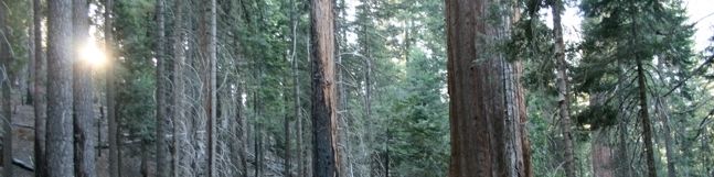
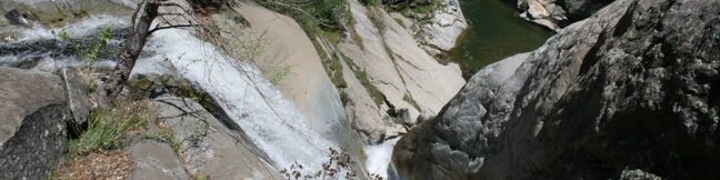
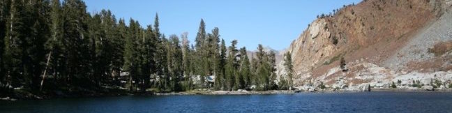
Eagle Lake is nestled within a high-elevation granite cirque in the Mineral King region of Sequoia National Park. The robust hike to the lake climbs 2,200 feet over 3.6 miles and delivers a steady climb with expanding views. Start from Eagle-Mosquito Trailhead at the end of Mineral King Road and commence hiking up the west rim of the valley. Cross the wooden footbridge that has been built over Spring Creek and continue uphill. ...Read more.
My Hikes: Completed hikeA green icon of shows a picture of a landscape with a check mark in the upper right corner, signifying that this is a hike you would like to put on your completed list.OK! Add to trails I've hiked
My Hikes: Want to hikeA green icon of shows a picture of a landscape with a heart in the upper right corner, signifying that this is a hike you would like to put on your to-do list.OK! Add to trails I want to hike
TagsA green icon depicting a tags represents a list of words and phrases that this content is tagged with Tagged with · Lakes · National Parks
Hike DistanceA green icon of a hiker used to label information about the length of the hike Distance: 7.2 miles · Elevation change: 2200 feet
By: Published: April 26, 2010 Last updated: January 10, 2018
Hockett Trail Sequoia National Park Hike Mineral King
Campers at Atwell Mill in the Mineral King region of Sequoia National Park are in a perfect position to take a stroll down Hockett Trail. This forest path descends southeast for 1.5 miles to a footbridge that crosses the East Fork of the Kaweah River. Along the way, the trail passes pines, firs, incense cedars, and the occasional Giant Sequoia. Hockett Trail continues far beyond the bridge, passing through the East Fork Sequoia Grove after another mile. ...Read more.
My Hikes: Completed hikeA green icon of shows a picture of a landscape with a check mark in the upper right corner, signifying that this is a hike you would like to put on your completed list.OK! Add to trails I've hiked
My Hikes: Want to hikeA green icon of shows a picture of a landscape with a heart in the upper right corner, signifying that this is a hike you would like to put on your to-do list.OK! Add to trails I want to hike
TagsA green icon depicting a tags represents a list of words and phrases that this content is tagged with Tagged with · National Parks · Sequoia Groves
Hike DistanceA green icon of a hiker used to label information about the length of the hike Distance: 3 miles · Elevation change: 600 feet
By: Published: April 26, 2010 Last updated: June 5, 2017
Mineral King Camping Atwell Mill Cold Springs Campgrounds Sequoia National Park
The Mineral King region of Sequoia National Park has two serene campgrounds, Atwell Mill Campground and Cold Springs Campground. RVs are not allowed at either of these tent-only campgrounds. Both campgrounds are open from late May through the end of October. Outside of holiday weekends, finding a campsite at these remote havens is hardly a challenge. ...Read more.
TagsA green icon depicting a tags represents a list of words and phrases that this content is tagged with Tagged with · National Parks · Sequoia Groves · Tent Camping
By: Published: April 26, 2010 Last updated: May 13, 2025
Camp Sequoia National Park Campground tent camping Kings Canyon camping Sequoia National Park
Sequoia National Park and Kings Canyon National Park are two large adjoining parks with many camping options. With so much to see, it is definitely worth spending multiple days in these two parks. The campgrounds are a great way to experience the parks after dark. Located near the Giant Forest and Tokopah Falls, Lodgepole Campground is the largest campground in Sequoia National Park with 214 sites. ...Read more.
TagsA green icon depicting a tags represents a list of words and phrases that this content is tagged with Tagged with · National Parks · Tent Camping
By: Published: April 23, 2010 Last updated: July 1, 2025
Panther Creek hike sequoia national park middle fork trail
Panther Creek falls one hundred feet down a canyon wall to join the Kaweah River. The Middle Fork Trail passes right above the falls, providing a view straight down the waterfall. Unfortunately, a head on look at the falls cannot be obtained, but the trail is plenty scenic to justify the 6-mile hike (as long as it's not too hot out). The Middle Fork Trailhead is the foothills gateway to the Sierra. ...Read more.
My Hikes: Completed hikeA green icon of shows a picture of a landscape with a check mark in the upper right corner, signifying that this is a hike you would like to put on your completed list.OK! Add to trails I've hiked
My Hikes: Want to hikeA green icon of shows a picture of a landscape with a heart in the upper right corner, signifying that this is a hike you would like to put on your to-do list.OK! Add to trails I want to hike
TagsA green icon depicting a tags represents a list of words and phrases that this content is tagged with Tagged with · National Parks · Waterfalls
Hike DistanceA green icon of a hiker used to label information about the length of the hike Distance: 6 miles · Elevation change: 750 feet
By: Published: April 22, 2010 Last updated: January 10, 2018