Tumalo Falls Loop
in Deschutes National Forest
Tumalo Falls is the tallest and most beautiful waterfall on Tumalo Creek near Bend, Oregon, but it isn’t the creek’s only waterfall. If you like seeing water tumble, go beyond the half-mile round trip hike to Tumalo Falls and explore a grander 7.4 miles loop that visits half dozen other named waterfalls and perhaps a dozen more unnamed smaller waterfalls and cascades. The loop is formed by connecting North Fork Trail (which passes Tumalo Falls) with Swampy Lakes Trail and Bridge Creek Trail.
The circuit passes through the watershed that the city of Bend draws its drinking water from, so the surrounds are quite pristine. Tumalo Falls Loop has 1,100 feet of elevation change. If that sounds like too much effort, consider hiking up North Forth Trail above Tumalo Falls past Double Falls to Upper Falls and turning around there for a 4.1-mile round trip hike with 550 feet of elevation change.
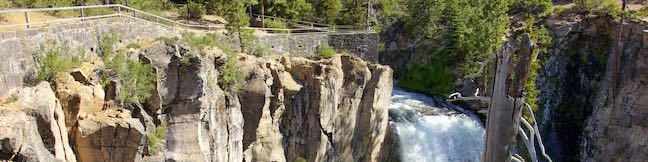
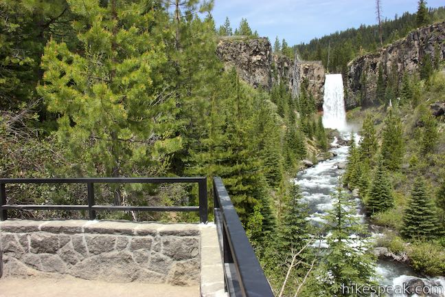
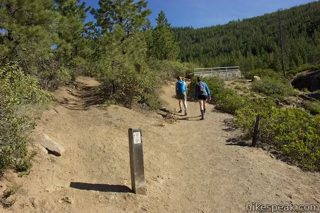
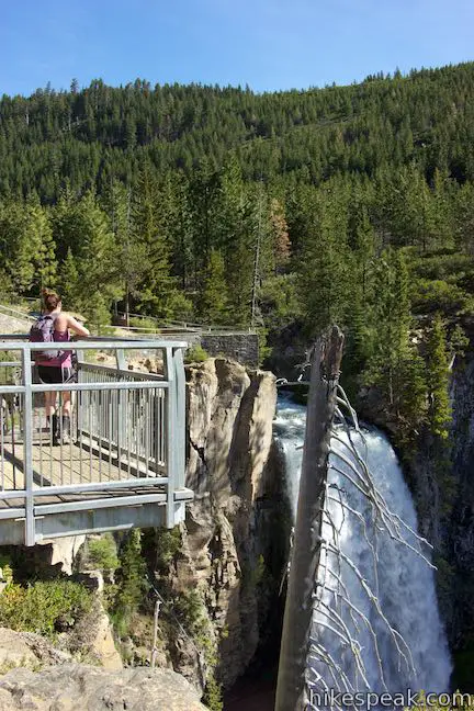
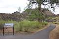
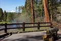
Get started from Tumalo Falls Day Use Area, which is a 14-mile drive from Bend at the end of Tumalo Falls Road (Forest Road 4603). Walk to the trailhead kiosk next to the bathrooms and begin up the trail, which immediately hits a junction. North Fork Trail ascends to the left toward the top of Tumalo Falls. Before going that way, head to the right and walk a hundred feet to Tumalo Falls Viewpoint.
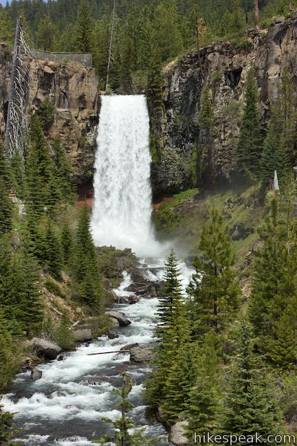
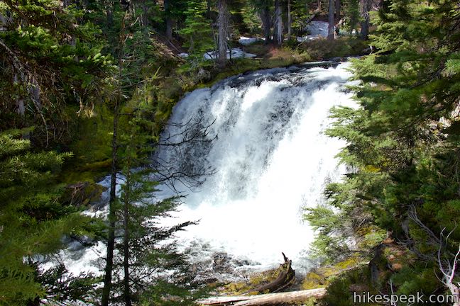
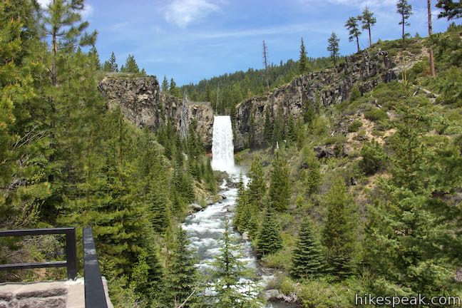
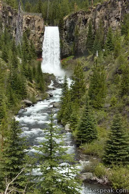
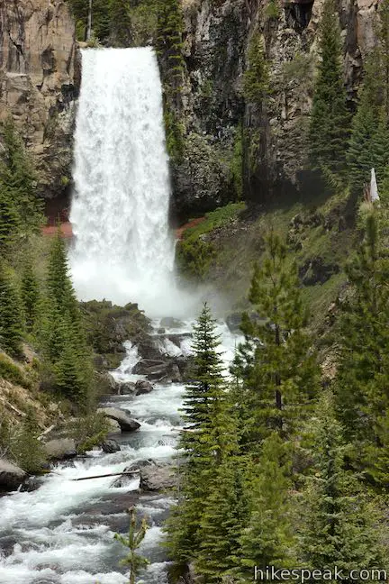
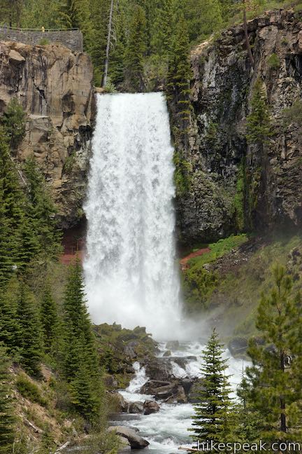
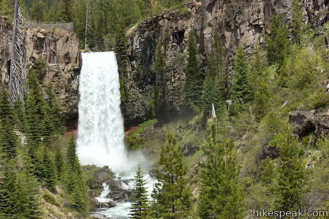
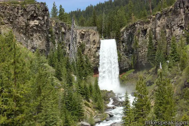
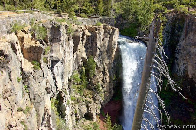
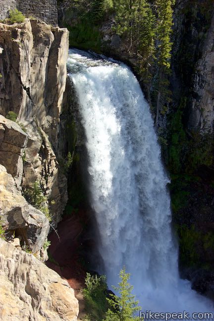
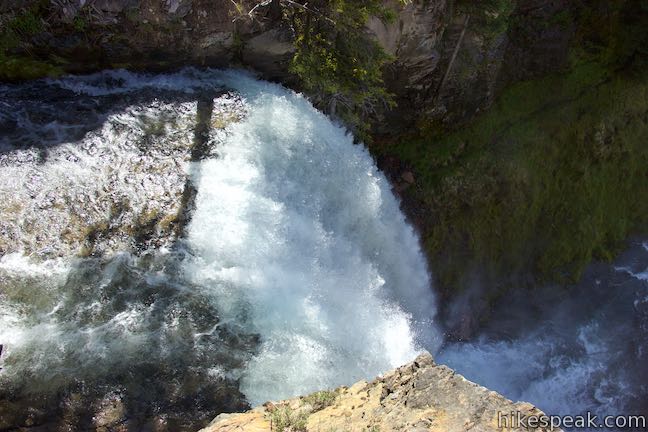
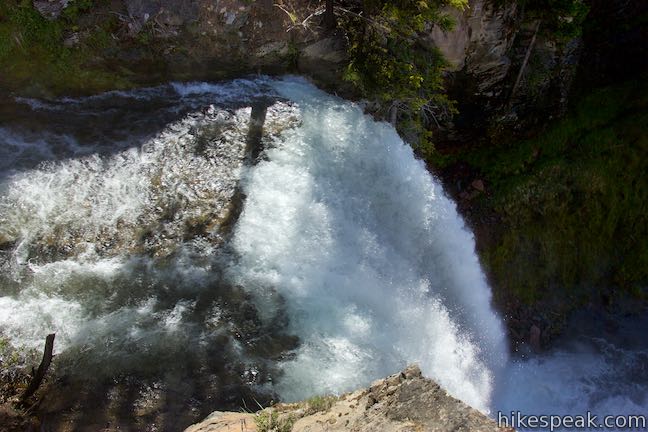
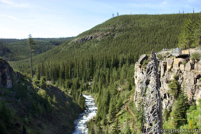
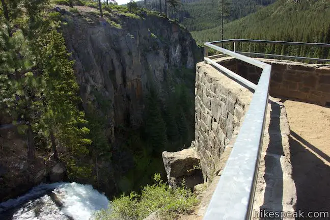
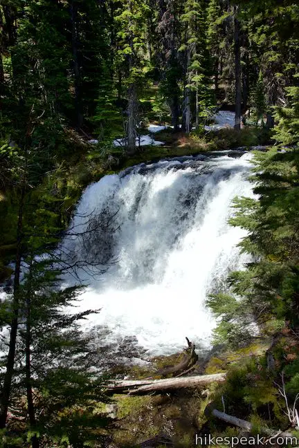
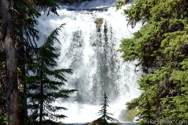
Stand at the viewpoint and look up a pine-covered valley toward Tumalo Falls, which drops in a column of white water from a rock ledge. Tumalo Falls is measured at either 89 or 97 feet tall and both numbers probably under represent the waterfall’s beauty. Above the left side of the waterfall, spot the overlook at the brink of Tumalo Falls, which has a stone wall with a metal railing.
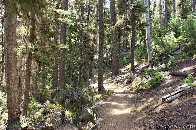
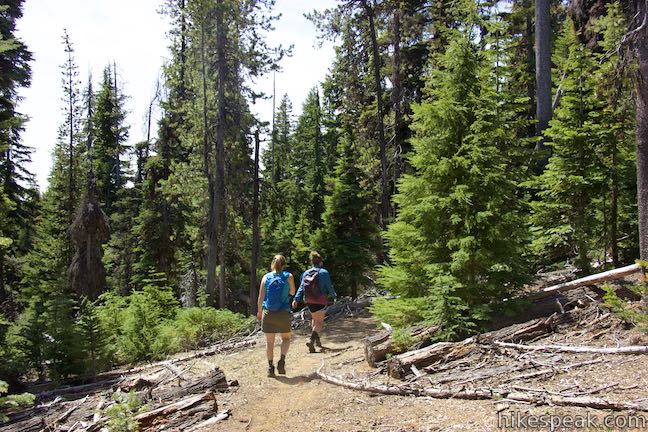
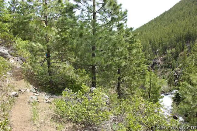
Backtrack to the junction and proceed up North Fork Trail. As the trail rises through ponderosa pines, you will pass a junction with Bridge Creek Trail, which parts to the left through a fence. This is the return route for Tumalo Falls Loop, so you’ll come back to this junction. For now, proceed up North Fork Trail, quickly reaching a split. A waterfall-bypassing branch of North Fork Trail veers to the left. Stay to the right to see the overlook on the cliff’s edge by Tumalo Falls.
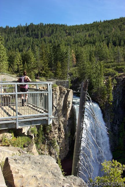
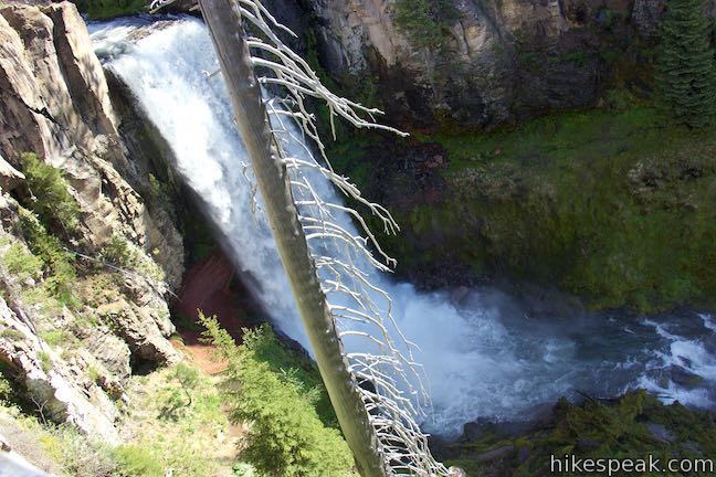
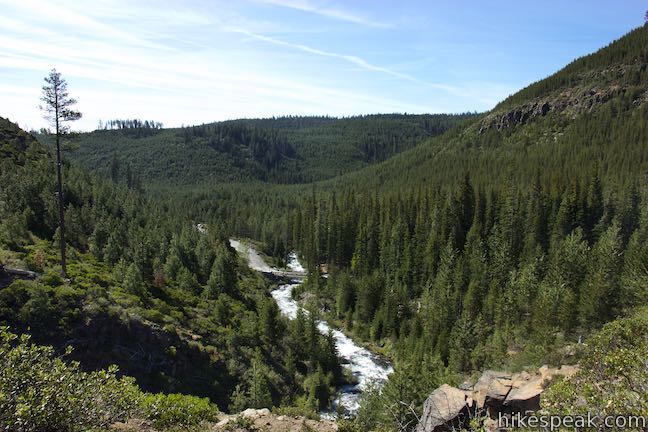
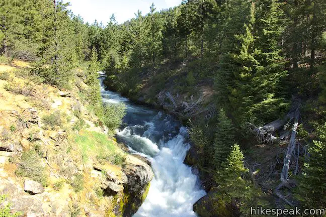
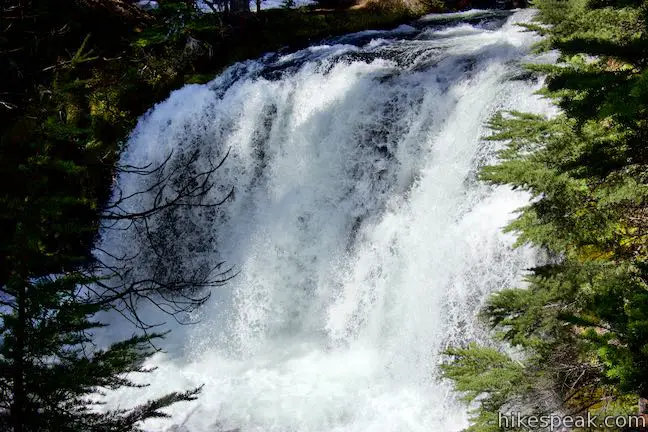
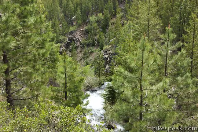
As you walk up to the top of Tumalo Falls, look down the canyon below the waterfall, where conifer-covered ridges frame Tumalo Creek. Approach Tumalo Falls at the brink of its plunge into the valley. The waterfall courses from the cliffs right next to the overlook and swiftly falls away to the ground below. Tumalo Falls is a definite beauty.
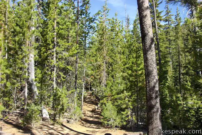
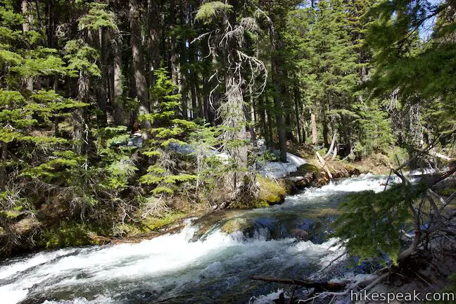
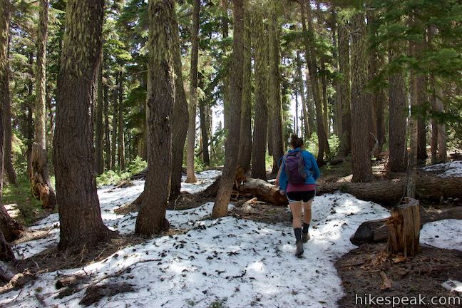
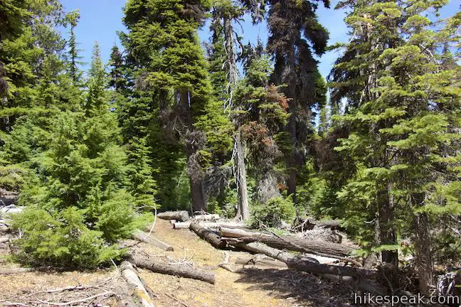
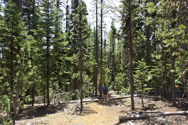
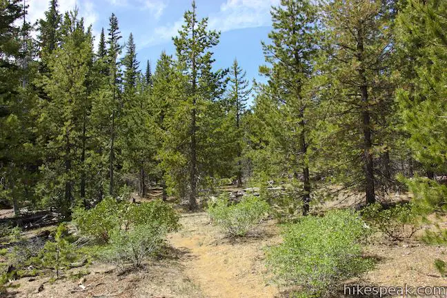
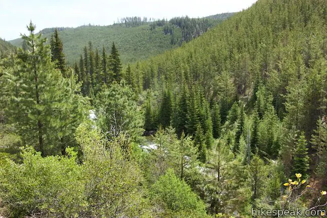
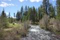
Unless you’re turning around at the overlook for the half-mile round trip Tumalo Falls hike, proceed up North Fork Trail as it ventures farther upstream along the southwest side of Tumalo Creek. The forest along the trail becomes dense with evergreens like white pine, mountain hemlock, and Engelmann spruce. On your right, catch views of Tumalo Creek as it flows through the forest beneath you.
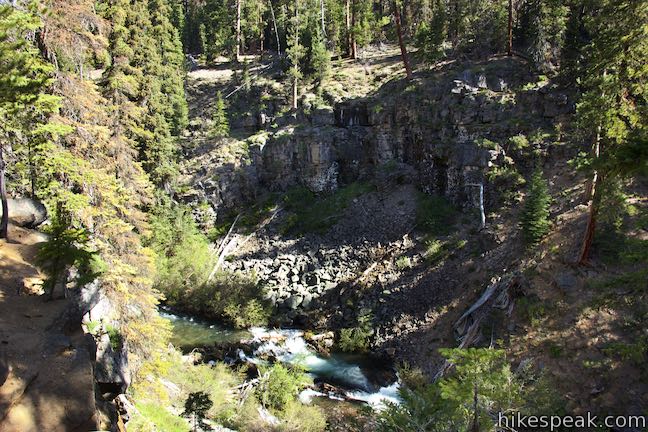
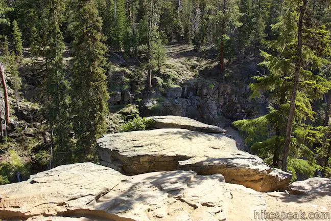
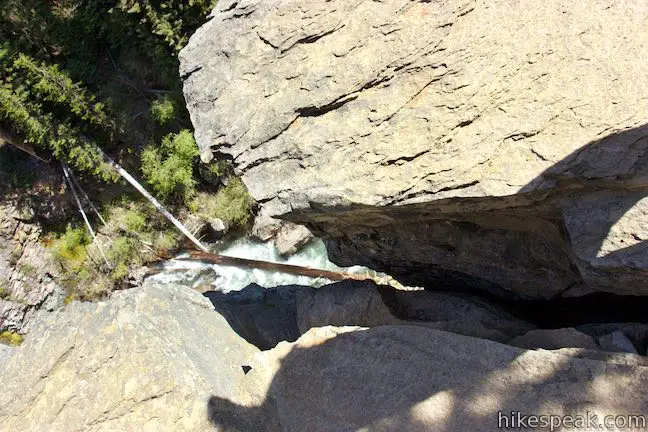
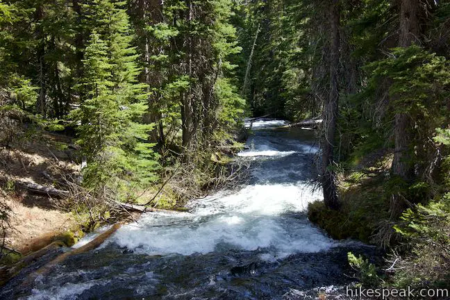
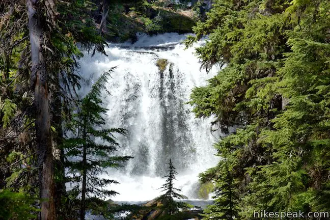
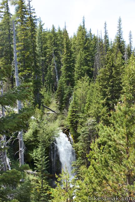
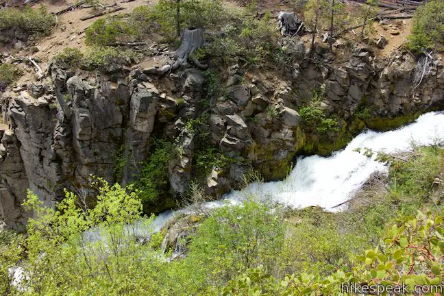
When you’ve hiked 0.85 miles above Tumalo Falls, you’ll come to a viewpoint for Double Falls. A trail marker will point you to the right to step out onto a rock landing, 125 feet above the creek. You’ll notice steeps cliffs on the other side of the canyon across Tumalo Creek as well. Step over a crack that splits the rock outcropping (and offers a dizzying perspective of the water below) to get out onto the landing for an excellent view up the creek toward Double Falls. The waterfall doesn’t get its name for being twice as good as Tumalo Falls, but it is quite lovely. Double Falls flows down a pair of drops one above the other, measuring and 23 and 29 feet.
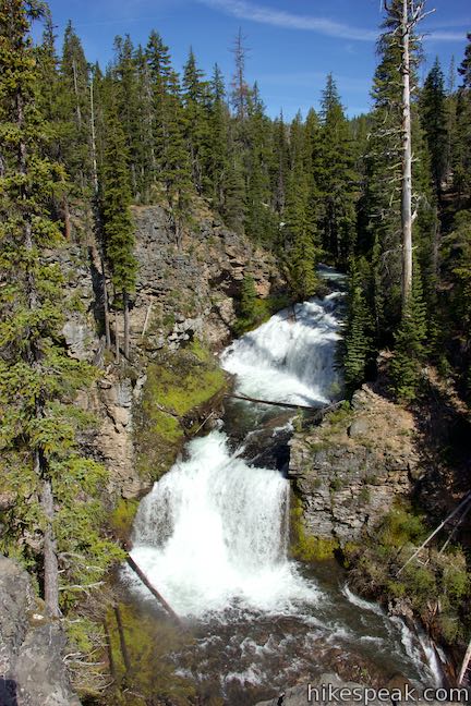
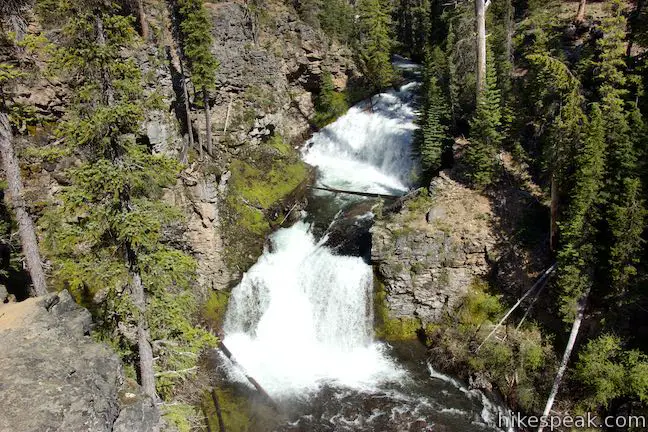
Continue to the left from the overlook as North Fork Trail goes along the cliffs bordering Double Falls. In another tenth of a mile, you’ll hit yet another waterfall, which you could call Upper Double Falls. Find a good viewpoint for this waterfall as well, which is shaped like a Y. Two halves of the creek come together around the sides of an island and pour down a string of frothy steps measuring 37 feet. For hikers turning around here, it is a 1.2-mile hike back to Tumalo Falls Day Use Area, creating a 2.4-mile round trip outing with 350 feet of elevation change.
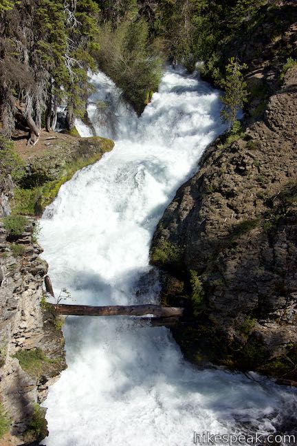
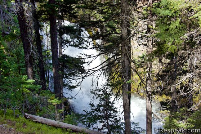
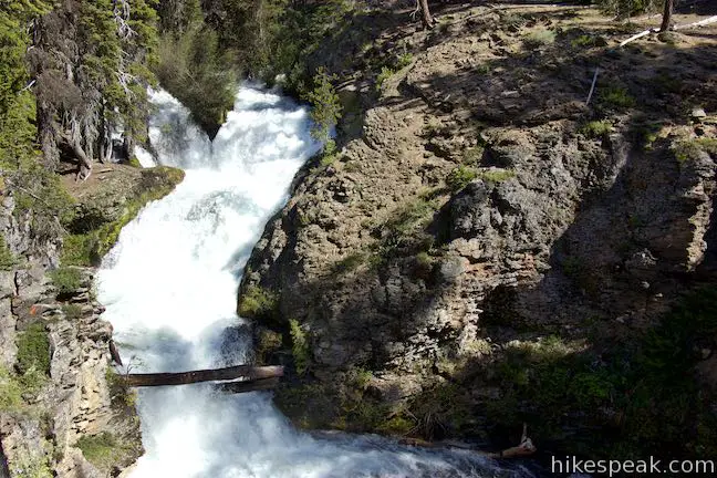
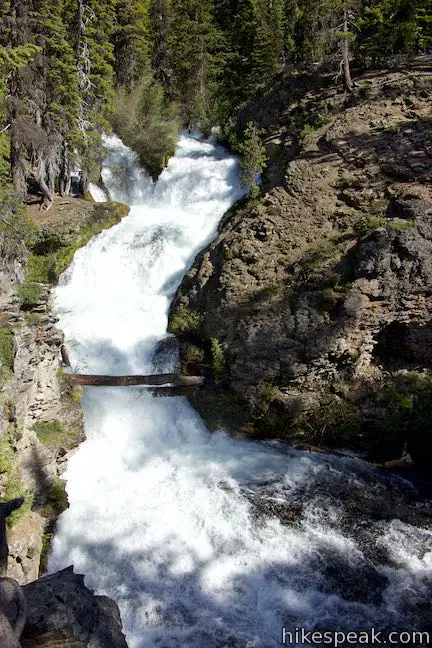
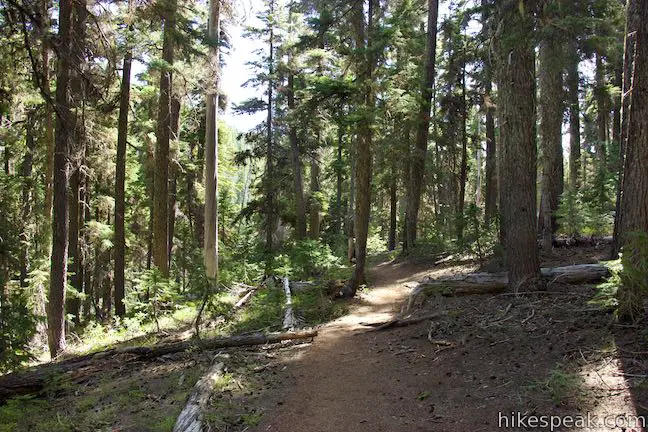
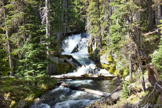
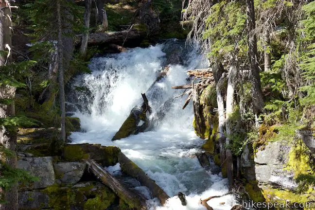
The lure of the next waterfall should draw you farther up North Fork Trail. The trail stays near the creek, passing through evergreens above the water. When you reach another viewpoint sign, you will have arrived at Middle Tumalo Falls, which is also called Upper Falls. Look out through trees toward a powerful waterfall with one major drop measuring 43 feet. Trees between the trail and the waterfall obscure the view, but the waterfall is still quite nice.
Middle Tumalo Falls (or Upper Falls) is just over two miles from Tumalo Falls Day Use Area. As you continue up North Fork Trail, it will be more than half a mile until you glimpse another waterfall, so those looking for a manageable day hike should consider turning back here, creating a 4.1-mile round trip hike with 550 feet of elevation change.
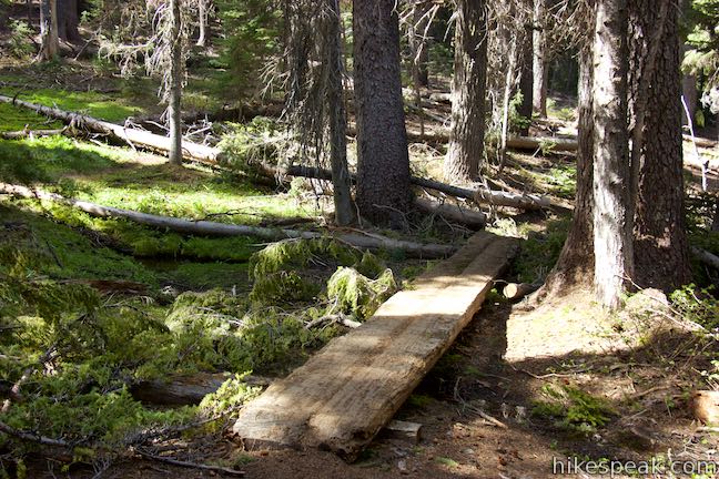
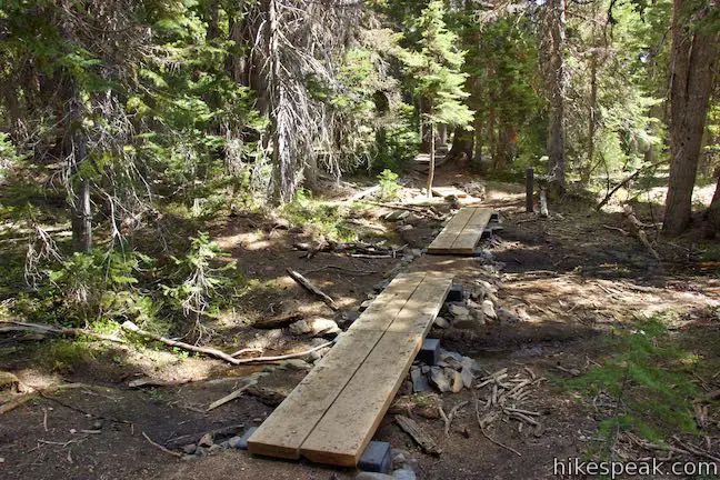
North Fork Trail keeps pushing up through the forest along the creek. A third of a mile after Upper Falls, you’ll pass through a small grassy area with a short wooden bridge over a small stream. This should not be confused with a prominent bridge over the Middle Fork of Tumalo Creek that is just ahead.
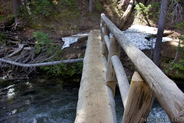
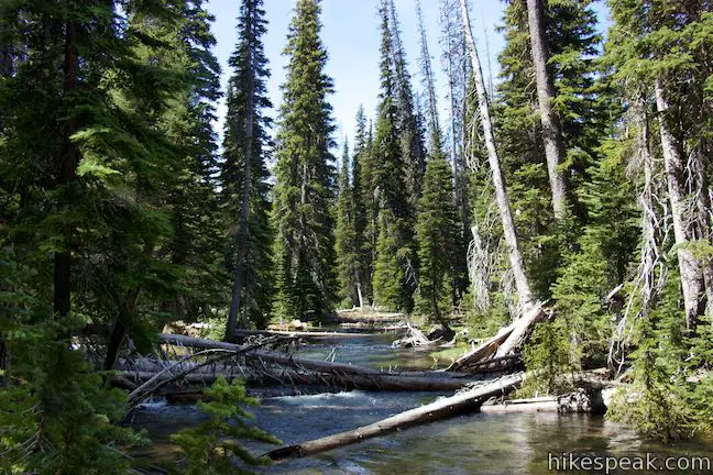
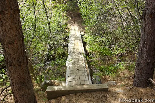
North Fork Trail tips downhill and you’ll pass a sign telling you that Spring Creek Trail is a mile away. The sign isn’t really relevant, but it does mean that you’re approaching Middle Fork Tumalo Creek Footbridge, 2.5 miles up from Tumalo Falls Day Use Area. When the trail was separated from Tumalo Creek, the creek split into two branches. Crossing the bridge, which is a giant log with a nice wooden railing, puts you in between the middle and north branches of Tumalo Creek.
Scope out Middle Fork Tumalo Creek above and below the bridge as you cross. On the other side, the trail works its way uphill through some twists and turns that gather views of both creek forks. Going around the first bend, you’ll catch sight of Lower North Fork Tumalo Falls, which is visible through trees on the other fork of Tumalo Creek. North Fork Trail actually spends more time along the Middle Fork of Tumalo Creek, taking you back to that fork for a view of a short waterfall upstream from moss-covered boulders and downed logs at the edges of the forest.
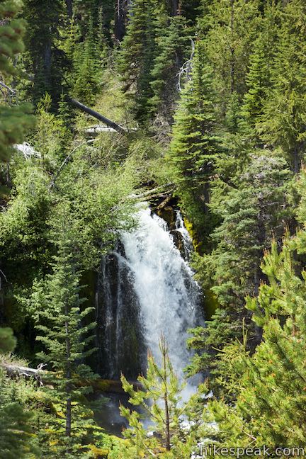
Walk over three short bridges as the trail crosses a few small streams, a quarter mile after Middle Fork Tumalo Creek Footbridge. The trail gains more elevation as you approach two more waterfalls. After 3.15 miles of hiking, the trail passes Lower Middle Fork Tumalo Falls, which has a short but solid single drop. Proceed up the trail and you’ll discover an even taller waterfall on the Middle Fork of Tumalo Creek. Tree-framed views of the waterfall come as you hike up the trail to a short spur on the left that takes you up alongside the waterfall.
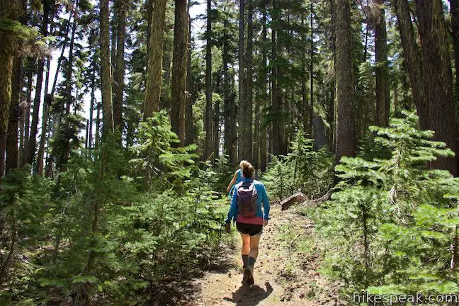
Proceed to the right past the spur to Middle Fork Tumalo Falls and the trail will rise through forest away from the creek. Hike another 0.3 miles to a junction with Swampy Lakes Trail, 3.6 miles from Tumalo Falls Day Use Area. North Fork Trail proceeds to the right, reaching the grassy meadows of Happy Valley in another half mile or so. This appears to be a lovely destination for those looking to cover even more ground. To proceed with Tumalo Falls Loop, turn left on Swampy Lakes Trail.
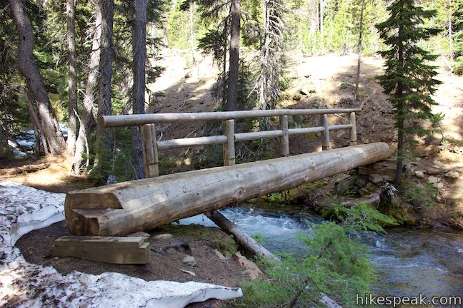
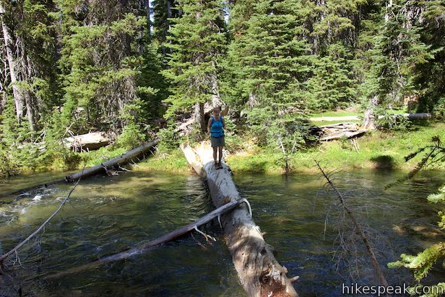
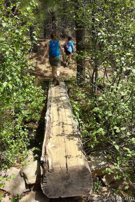
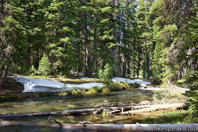
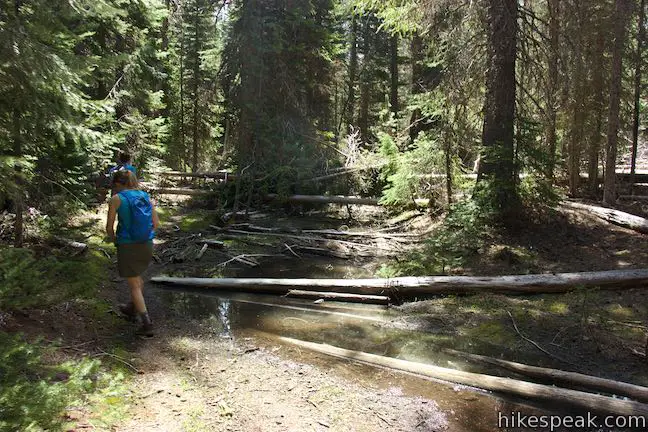
As you begin on Swampy Lakes Trail, you will cross the high point of the loop, 1,100 feet above Tumalo Falls Day Use Area. Make your way back down to the Middle Fork of Tumalo Creek over 1/3 of a mile. When you reach the creek, which flows calmly through level terrain, you will discover that there is no bridge to the other side. Instead of wading through the water, look for a log that you can walk across. Walk a short distance upstream to a big wide log that serves as a bridge for hikers. Carefully make your way across the creek and follow a path down the opposite bank to return to Swampy Lakes Trail and resume hiking on the maintained route.
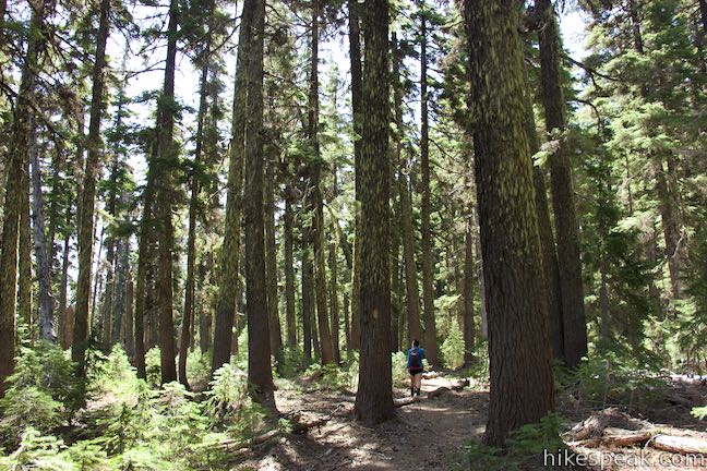
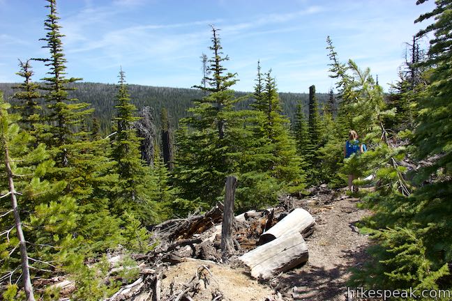
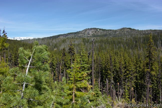
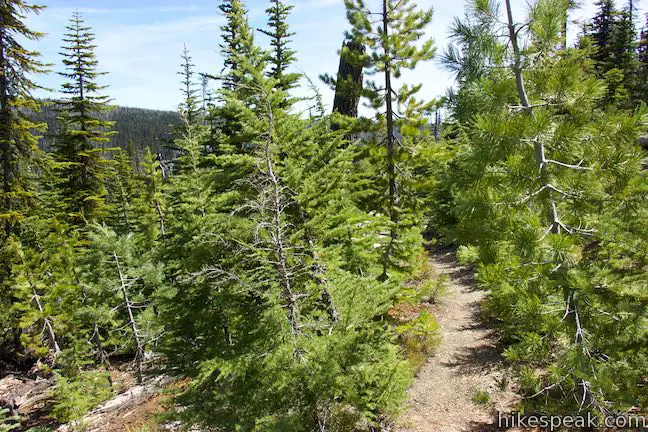
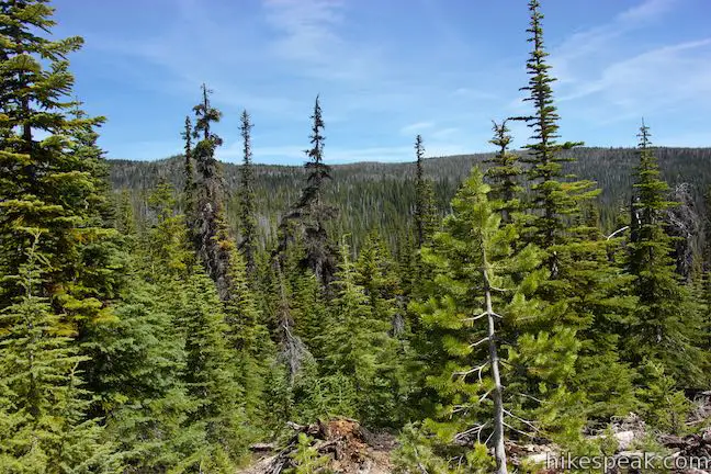
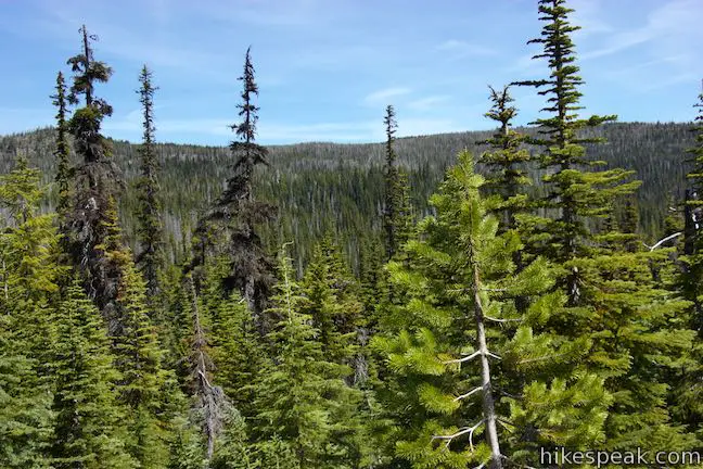
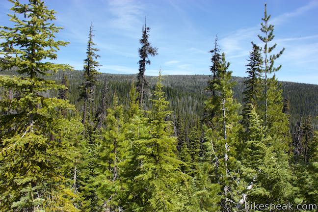
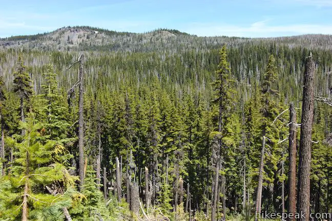
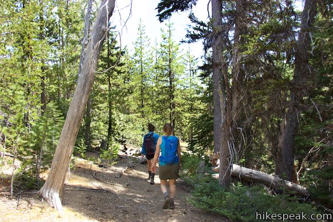
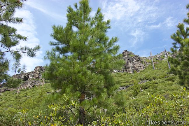
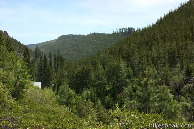
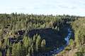
Swampy Lakes Trail heads east on a level course that doesn’t pass any swampy lakes, but instead slips through a forest of tall lichen-covered evergreens. The lovely forest walk lasts for a bit and then the trail tips downhill on a slope covered in shorter conifers. About a mile from North Fork Trail, you’ll find views over the treetops across the valley carved by Tumalo Creek to the north. Nice ridges frame the other side of the valley. See if you can spot snow above the top of the valley to the left near Broken Top. These are some of the broadest views of the hike, so pause to appreciate the surroundings.
A third of a mile farther down the trail, you will come to a trail register at the boundary of the City of Bend Watershed. You are now roughly 2/3 of the way through the loop and most of the remaining 2.45 miles are within this watershed that Bend sources its drinking water from. To preserve water quality, the watershed area in Deschutes National Forest is open for day use only. Dogs and bikes are not allowed. When you enter, you must fill out a form at the permit station at the watershed boundary. Leave a copy in the box and take the other with you. Complete that task and continue down Swampy Lakes Trail.
In another half mile, Swampy Lake Trail draws parallel to Spring Creek, which feeds into Bend’s water supply. Use a collection of logs to hop across this small creek and continue on Swampy Lake Trail. As you hike through more forest, the trees grow in stature. About 0.4 miles from the creek crossing, Swampy Lakes Trail passes through a depression in the terrain that houses muddy pools of standing water. The mosquitoes, which can be aggressive everywhere along this loop, seem to be extra ferocious in this area. Briskly pass through a final stretch of the trail, going over a rise to a junction with Bridge Creek Trail. After 2.5 miles on Swampy Lakes Trail and a total of 6.1 miles of hiking, turn left to begin the last 1.3 miles.
Before you can say, “we’re on the home stretch,” you’ll hit another junction. A new section of Swampy Lakes Trail parts to the right, crosses a bridge over Bridge Creek, and travels 4.4 miles to Swampy Lakes Sno-Park. Proceed straight on Bridge Creek Trail to head back toward Tumalo Falls. Hike across a slope above Bridge Creek, which is most often obscured by trees. About 0.4 miles from Swampy Lakes Trail, you’ll cross a log bridge over Spring Creek. Notice how the creek has grown a bit since you crossed it upstream on the previous trail.
After the log bridge, the trail curves to the right and gives you a view of Bridge Creek Falls, which is just upstream and takes a 25-foot plunge. This waterfall is partially obscured by trees, but you should be able to shrug that off without too much disappointment after seeing so many waterfalls on North Fork Trail.
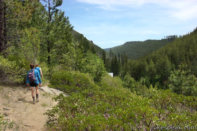
Bridge Creek Trail passes below tall cliffs on the ridge to the north. On the opposite side of the trail, look down into the shallow canyon carved by Bridge Creek. Pass alongside a flume-like string of cascades. You’ll then find views looking down the canyon toward the place where the hike began. The roof of the water intake building for the city of Bend will poke out of the forest, letting you know that you’re almost out of the woods.
After a 1.2-mile run, Bridge Creek Trail comes to an end at a T-junction with North Fork Trail. If you turned left, you could hike this loop all over again. Instead, turn right and hike downhill for a tenth of a mile to the Tumalo Falls Day Use Area. Rather than breezing past the short spur to Tumalo Falls Viewpoint, consider taking a few extra steps to revisit the view of Tumalo Falls. A few hours will have passed since you started your trek and the lighting on the waterfall may look quite different.
With all the waterfalls behind you, return to the day use area and close out this 7.4-mile loop with 1,100 feet of elevation change. Dogs are allowed on North Fork Trail but are not allowed on Swampy Lakes Trail and Bridge Creek Trail through the City of Bend Watershed.
Bike traffic on North Fork Trail is permitted in one direction only, going uphill. Bikes are prohibited from passing through the watershed area on the other two trails.
A $5 day use fee is required to park at either trailhead in Deschutes National Forest (price as of 2016). A Northwest Forest Pass or America the Beautiful public lands pass can be used in place of the day use fee. Tumalo Falls Road and Tumalo Falls Day Use Area close down during the winter and spring months due to snow. The trailhead is typically accessibly from May through October. The only permit required for Tumalo Falls Loop is freely acquired at the boundary of the City of Bend Watershed.
Directions to the Trailhead
- Take Route 97 to exit 138 in Bend, following signs for downtown and Mount Bachelor.
- At the end of the offramp, head west on Colorado Avenue (Cascade Lakes National Scenic Byway).
- Drive one mile, crossing the Deschutes River.
- At the traffic circle that follows, take the first exit (like a right turn) onto Simpson Avenue.
- Drive three blocks and go through the traffic circle at the intersection of Century Drive to stay on Simpson Avenue.
- Drive 0.6 miles to the next traffic circle and take the first exit (like a right turn) onto Mount Washington.
- Drive 0.8 miles and reach another traffic circle at the intersection with Skyliners Road.
- Take the third exit (which would be like a left turn and a standard intersection) and proceed west on Skyliners Road.
- Drive 8.8 miles up this road and bear right at an intersection.
- The road becomes unpaved and crosses Tumalo Creek.
- On the other side, turn left up Tumalo Falls Road (National Forest Road 4603) and drive 2.4 miles up to Tumalo Falls Day Use Area at road's end.
Trailhead Location
Trailhead address: Tumalo Falls Road, Bend, OR 97701
Trailhead coordinates: 44.032, -121.56635 (44° 01′ 55.19″N 121° 33′ 58.85″W)
View Tumalo Falls in a larger map
Or view a regional map of surrounding Oregon trails and campgrounds.


 | Tumalo Falls See Bend's best waterfall on a short walk to a downstream viewpoint or a half-mile round trip hike to an overlook by the top of the falls. |
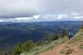
 | Pilot Butte This 1.8-mile hike ventures up the dominant landmark in Bend to offer sweeping views of the majestic surroundings. |
 | Archie Briggs Canyon Trail This 1.25-mile hike descends a ravine to clifftop views over a dramatic canyon on the Deschutes River. |
 | Shevlin Loop Trail This 4.75-mile tour of Shevlin Park just a few miles east of Bend explores pine forests on both sides of Tumalo Creek. |
 | Lava Butte This hike explores a cinder cone with a fire lookout tower and a crater-circling trail that offer panoramic views over Lava Butte Lava Flow and the Cascade Mountains. |
 | Trail of the Molten Land This 1.1-mile long paved partial loop cuts through Lava Butte Lave Flow and is packed with information and views. |
 | Trail of the Whispering Pines This interpretive botanical trail explores high desert plants on the edge of Lava Butte Lava Flow on a quarter-mile long path. |
 | Lava River Cave This underground hike explores a lava tube south of Bend that is filled with fascinating volcanic features. |
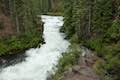 | Deschutes River Trail to Benham Falls This 1.9-mile hike follows a leisurely trail along the Deschutes River to aggressive cascades called Benham Falls where the river churns and tumbles through a gap between cliffs. |
 | Black Butte The 4-mile hike summits one of the most identifiable peaks in Central Oregon, which has fire lookout towers and panoramic views of the Cascade Mountains. |
 | Head of the Metolius This 0.5-mile hike visits the surprising source of the Metolius River, a gushing spring accompanied by views of Mount Jefferson. |
 | West Metolius River Trail The 5.4-mile hike follows the west bank of the Metolius River to incredible gushing springs and a fish hatchery. |
 | More trails in Oregon Explore other hikes in Central Oregon, the Columbia River Gorge, and elsewhere. |
- Tumalo Falls on oregon.com (not the official state website) (opens in a new tab)
- Tumalo Falls on waterfallsnorthwest.com (opens in a new tab)
- Tumalo Falls on wikipedia.org (opens in a new tab)
- Tumalo Falls and North Fork Trail on cascadehikingadventures.com (opens in a new tab)
- Tumalo Falls on alltrails.com (opens in a new tab)
- Tumalo Falls on takemytrip.com (opens in a new tab)
- Tumalo Falls on oregonhiking.com (opens in a new tab)
- Tumalo Falls Loop on thirddoor.com (opens in a new tab)
- Tumalo Falls Loop on outdoorproject.com (opens in a new tab)
- A national forest map of the Tumalo Trail System (opens in a new tab)
- The official Deschutes National Forest webpage for Tumalo Falls Day Use Area (opens in a new tab)
Common Questions about Tumalo Falls Loop in Deschutes National Forest
- Is the trail open?
- Yes. You should expect to find that Tumalo Falls Loop is open. There are no recent reports of trail closures. If you discover that the trail is closed, please help your fellow hikers by reporting a closure.
- Do I need a permit for this hike?
- Yes. National Forest Fee.
- How much time does this hike take?
- It takes approximately 3 hours 45 minutes to hike Tumalo Falls Loop. Individual hiking times vary. Add extra time for breaks and taking in the views.
- How long is this hike?
- The hike to Tumalo Falls Loop is a 7.4 mile loop with 1100 feet of elevation change.
- Are dogs allowed on this trail?
- No, dogs are likely not allowed on Tumalo Falls Loop. The trail is primarily open to hikers.
- Will I see a waterfall on this hike?
- Yes, Tumalo Falls Loop features a waterfall.
- What mountain range is this trail in?
- Tumalo Falls Loop is located in the Cascade Range.
- Where is the trailhead located?
- The trailhead for Tumalo Falls Loop is located in Bend, Oregon.
Trailhead Address:
Tumalo Falls Road
Bend, Oregon 97701
Trailhead Coordinates:
44.032, -121.56635 - What are the driving directions to the start of the hike?
To get to the trailhead: Take Route 97 to exit 138 in Bend, following signs for downtown and Mount Bachelor. At the end of the offramp, head west on Colorado Avenue (Cascade Lakes National Scenic Byway). Drive one mile, crossing the Deschutes River. At the traffic circle that follows, take the first exit (like a right turn) onto Simpson Avenue. Drive three blocks and go through the traffic circle at the intersection of Century Drive to stay on Simpson Avenue. Drive 0.6 miles to the next traffic circle and take the first exit (like a right turn) onto Mount Washington. Drive 0.8 miles and reach another traffic circle at the intersection with Skyliners Road. Take the third exit (which would be like a left turn and a standard intersection) and proceed west on Skyliners Road. Drive 8.8 miles up this road and bear right at an intersection. The road becomes unpaved and crosses Tumalo Creek. On the other side, turn left up Tumalo Falls Road (National Forest Road 4603) and drive 2.4 miles up to Tumalo Falls Day Use Area at road's end.
View custom Google Maps directions from your current location.
- Are there other trails near Tumalo Falls Loop?
- Yes, you can find other nearby hikes using the Hikespeak Hike Finder Map.

[…] visited Tumalo Falls, which is a short drive from Bend in Dechutes National Forest. Tuamalo Creek Trail to Tumalo Falls […]
[…] went to Tumalo Falls Park to hike. We tried to hike it a few years ago in the winter and it was too windy. It was nice […]