Mud Volcano Area
in Yellowstone National Park
When explorers first discovered Mud Volcano in the 19th century, the rumbling eruptions could be heard half a mile away. Mud Volcano shook the ground and flung mud into the treetops. The volcano later blew itself apart and is not as active for today’s visitors to Yellowstone National Park. Fortunately, Mud the Volcano Area still has several interesting hydrothermal features to witness.
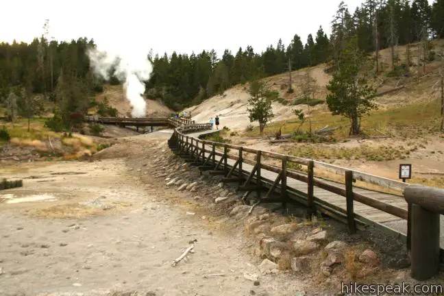
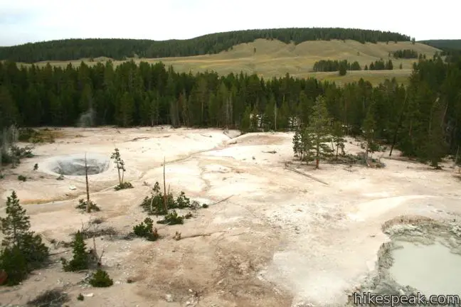
You can hike a short (less than a quarter mile long) boardwalk to see Dragon’s Mouth Spring and what remains of Mud Volcano. With more time, explore a longer 0.7-mile loop past hydrothermal features with fun names like Grizzly Fumarole, Sour Lake, Black Dragon’s Caldron, Churning Caldron, Sizzling Basin, and Cooking Hillside. The longer boardwalk laves the shorter trail after the two big attractions for a hike that is 0.85 miles round trip with 100 feet of elevation change.
Across the road from the Mud Volcano Area is an overlook for Sulphur Caldron, one of the most acidic springs in all of Yellowstone. No matter how much time you decide to spend in the Mud Volcano Area, your visit is sure to be action packed.
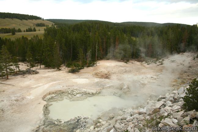
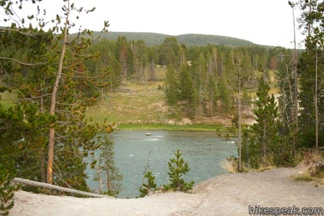
As you step out of your vehicle at the trailhead along the Yellowstone River, you won’t be greeted by pine fresh mountain air. Instead you’ll be smacked in the face by a rotten egg smell caused by the hydrogen sulfide gas that escapes from the ground in this area, atop a resurgent dome in the magma chamber of the Yellowstone Caldera. It is worth tolerating the smell to see all that the Mud Volcano Area has to offer. The longer loop begins at the left (south) side of the turnout and starts by passing between Mud Geyser and Mud Caldron. If you are hiking the longer loop, it is recommended that you start here and do the loop in a clockwise direction, ending by Mud Volcano and Dragon’s Mouth Spring. For those with less time, a shorter boardwalk loop passes those two notable landmarks.
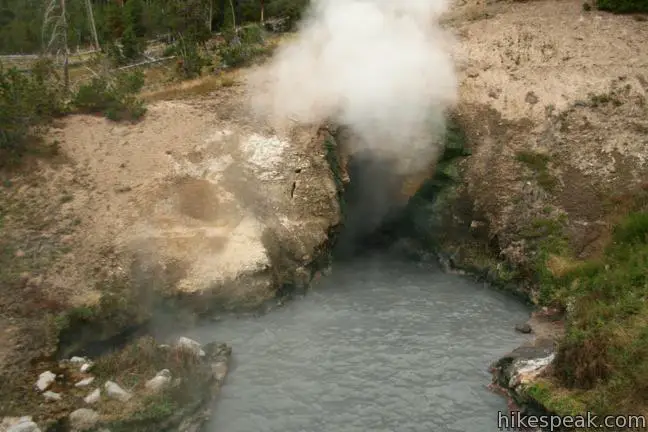
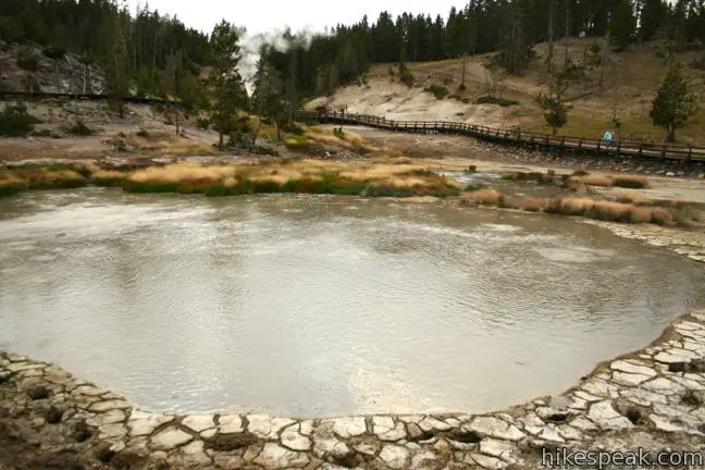
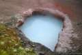
Dragon’s Mouth Spring is a small pool backed up against a hillside where a water and steam spew out of a cave, producing a roaring sound. A sign at Dragon’s Mouth Spring reads:
An unknown park visitor named this feature around 1912, perhaps due to the water that frequently surges from the cave like the lashing of a dragon’s tongue. Until 1994, this dramatic wave-like action often splashed water as far as the boardwalk. The rumbling sounds are caused by steam and other gasses exploding through the water, causing it to crash against the walls of the hidden caverns.
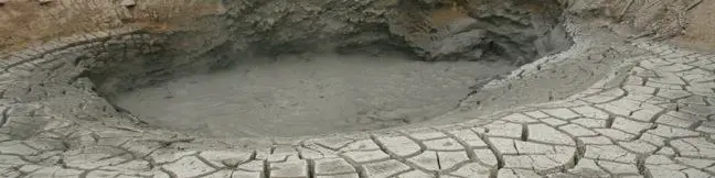
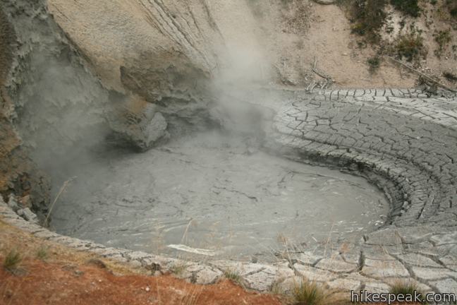
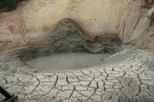
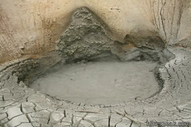
At the nearby Mud Volcano, you’ll see a smaller pool of bubbling muddy water surrounded by cracked dry mud. When discovered by explorers in 1870, the Mud Volcano was much more impressive. It had a tall cone from which it would erupt, shaking the earth, and shooting mud into the air.
By 1872, Mud Volcano had ruptured and blown itself apart from all the activity. Today you will not see a cone, but rather a steaming muddy pool framed by a crater-shaped wall that was once the interior of the cone.
In 1870, Nathaniel Langford explored the area with General Washburn, and published this account of Mud Volcano:
Dense volumes of steam shot into the air with each report, through a crater thirty feet in diameter. The reports, through irregular, occurred as often as every five seconds, and could be distinctly heard half a mile [away]. Each alternate report shook the ground a distance of two hundred yards or more, and the massive jets of vapor which accompanied them burst forth like the smoke of gunpowder.
What an experience Mud Volcano must have been in 1870 when explorers watched the violent cone shoot mud hundreds of feet into the air.
When you are ready to leave the Mud Volcano Area, walk or drive up the road a few hundred feet to a turnout on the opposite side of the road for Sulphur Caldron. Here the sulfur smell is even stronger.
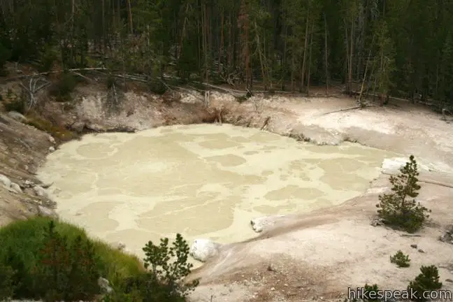
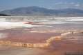
Beneath the road you will see a treeless slope above the Yellowstone River that is marked by the foaming muddy pools of Sulphur Caldron. The ripe-smelling caldron is nearly as acidic as battery acid and ten times as acidic as lemon juice. Even so, some microorganisms have found a way to live in this environment. A sign at the overlook explains:
Billions of thermoacidophiles live in Sulphur Caldron. They convert the pool’s hydrogen sulfide gas into sulfuric acid. The sulfuric acid breaks soil and rock into mud, making this pool a very muddy home.
Sulphur Caldron is no place you would ever want to take a mud bath.
No permit is required to hike through the Mud Volcano Area, but Yellowstone National Park has an entrance fee. It is illegal and dangerous to leave the boardwalk. Do not approach or provoke bison if they roam into the Mud Volcano Area. Pets, food, and beverages are not allowed on the walkway. Do not touch (or throw objects into) the hydrothermal features.
To get to the trailhead: Drive 5.8 miles north of Yellowstone Lake at Fishing Bridge on Grand Loop Road and pull into the parking area for the Mud Volcano Area on the west side of the road. The trailhead is 9.5 miles south of the intersection with Norris Canyon Road.
Trailhead address: Grand Loop Road, Yellowstone National Park, WY 82190
Trailhead coordinates: 44.6249, -110.4336 (44° 37′ 29.6″N 110° 26′ 01″W)
View Yellowstone National Park in a larger map
Or view a regional map of surrounding Wyoming trails and campgrounds.


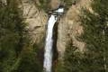 | Tower Fall in Yellowstone National Park This 1-mile hike starts with a head-on view of a 132-foot waterfall. Unfortunately, the final leg of the trail to the base of Tower Fall is closed due to damage from rock and mud slides. |
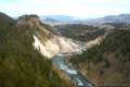 | Calcite Springs Overlook in Yellowstone National Park This 0.25-mile loop overlooks a dramatic section of the Yellowstone River lined by bleached cliffs and steam venting hydrothermal springs. |
 | Artists' Paintpots Trail in Yellowstone National Park This 1.1-mile hike circles a hillside hydrothermal area, passing bursting mudpots, bubbling hot springs, and mesmerizing milky blue pools. |
 | Monument Geyser Basin This 2.8-mile hike reaches a rarely visited hydrothermal area that is boardwalk-free and fun to explore. |
 | West Thumb Geyser Basin This 2/3 of a mile loop explores a hydrothermal area on the shore of Yellowstone Lake. |
 | Riddle Lake This level 5-mile out and back hike crosses the Continental Divide to a backcountry lake with a small beach. |
 | More trails in Yellowstone Explore other hikes to waterfalls and hydrothermal hot spots in Yellowstone National Park. |
 | Yellowstone National Park Campgrounds Twelve developed campgrounds with over 2,000 total sites are spread throughout Yellowstone. |
[…] See the following link for a nice description of the area https://www.hikespeak.com/trails/mud-volcano-area-yellowstone/ […]
[…] next stop was the Mud Volcano, where there was a short boardwalk that went past the Dragon’s Mouth Spring. It does indeed […]