West Thumb Geyser Basin
in Yellowstone National Park
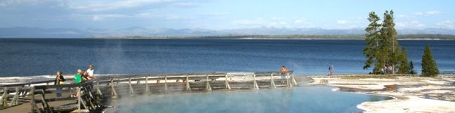
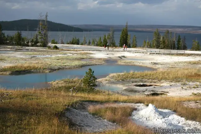
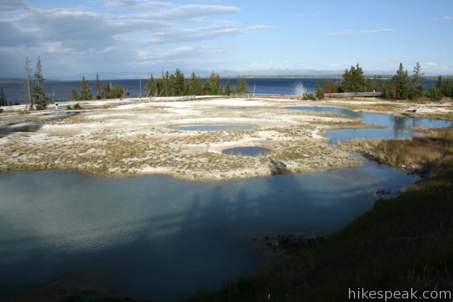
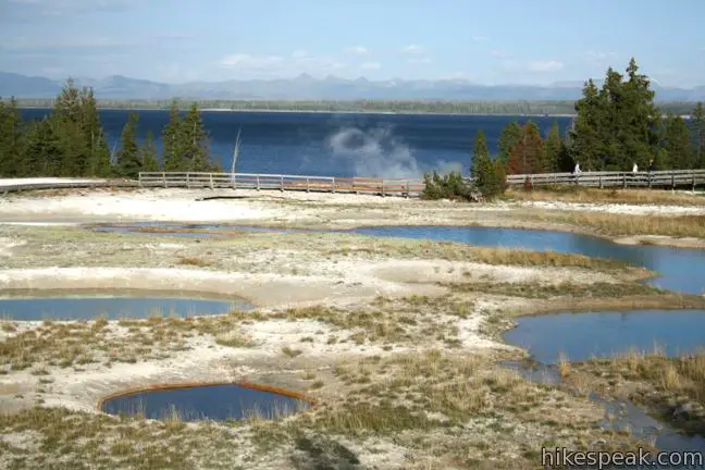
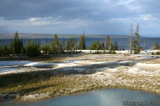
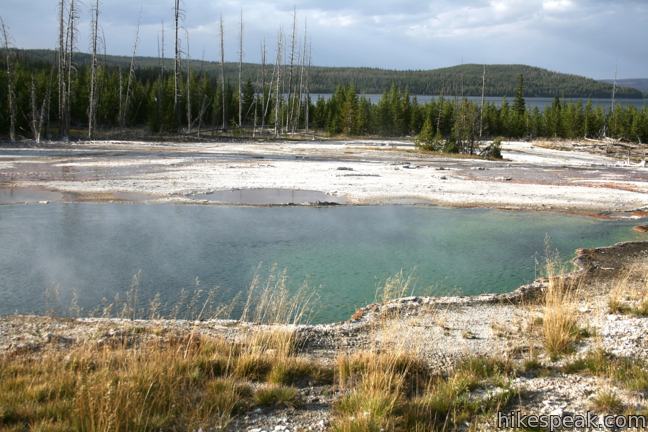
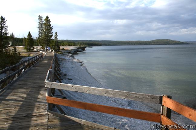
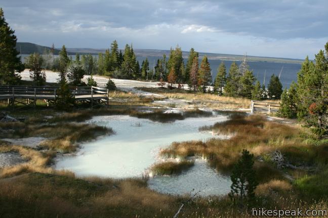
There are several hydrothermal areas in Yellowstone National Park. West Thumb Geyser Basin stands out because it is on the edge of, and partially submerged by, Yellowstone Lake, which creates a dramatic backdrop for the dynamic geysers, pools, and springs. A dirt trail and wooden boardwalk loops through the geyser basin, offering a 2/3 of a mile long wheelchair-friendly stroll.
The trailhead is located on the west side of Yellowstone Lake near the Grant Village Visitor Center at the south end of Yellowstone National Park. The stair-free loop exploring West Thumb Geyser Basin is 2/3 of a mile long, and there is a second trail cutting across the basin down the center of the loop. Overlooks along the way provide great views of all the different hydrothermal features.
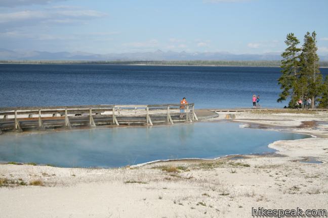
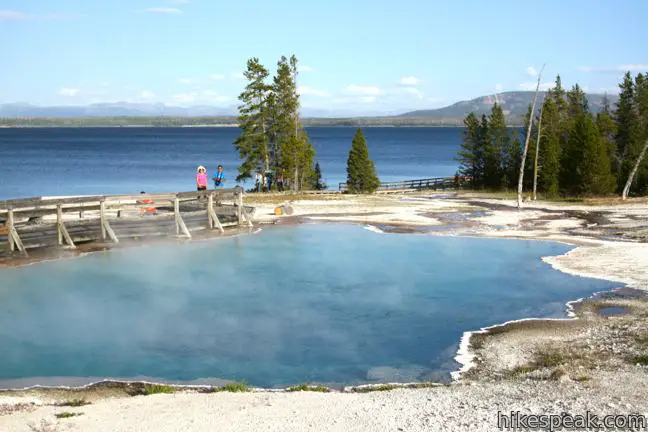
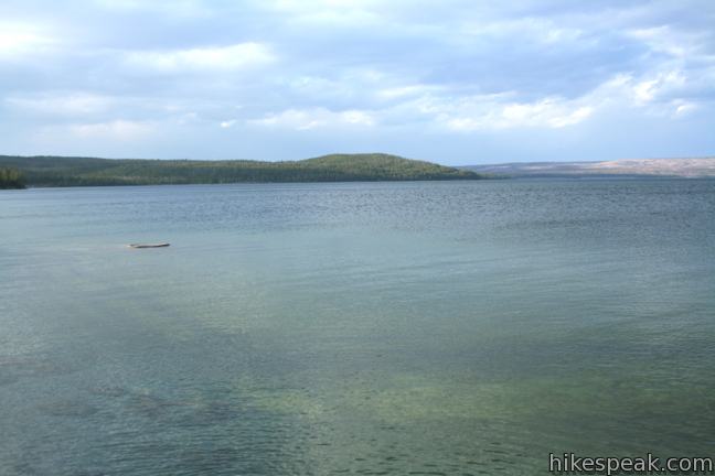
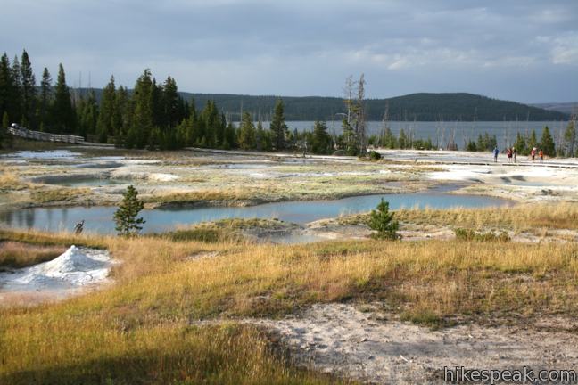
From the large parking area for the trailhead, take either of two trails leading northeast toward the loop. Turn left to hike the loop in a clockwise direction. You will start with a nice overview of the geyser basin and the lake beyond. Yellowstone Lake is “the largest lake at a high elevation in North America.” The deep blue water sits at 7,733 feet above sea level. It is 20 miles long and covers 132 square miles. On the opposite side of the lake across from the West Thumb, rise the Absaroka Mountains. The lake and peaks create a postcard view that would be satisfying even if there weren’t strange misty pools on the ground all around you.
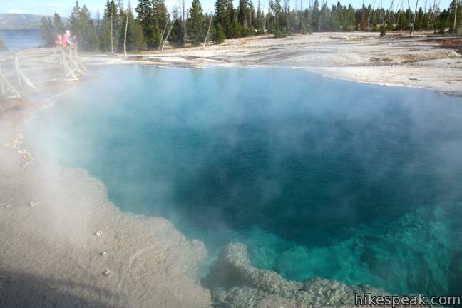
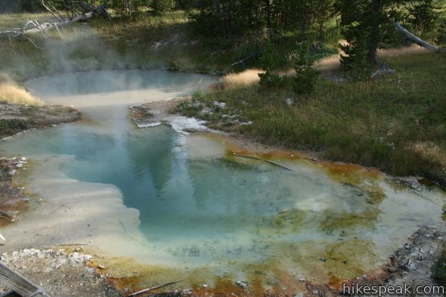
The trail leads to Abyss Pool on the left. Abyss Pool is one of the deepest hydrothermal pools in all of Yellowstone. The turquoise water goes down over 50 feet.
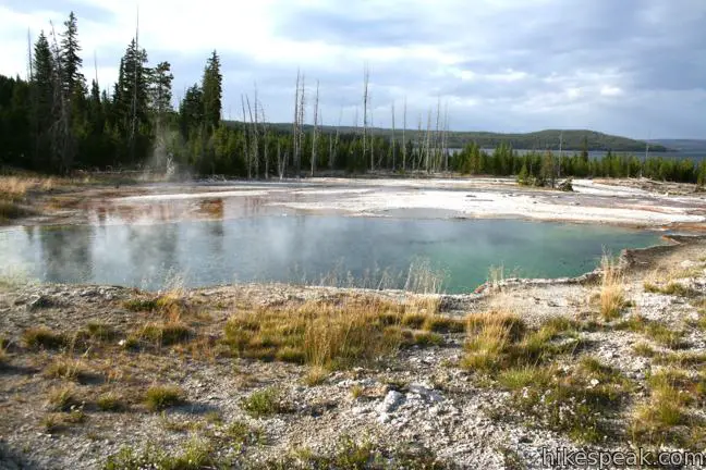
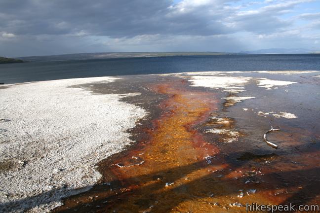
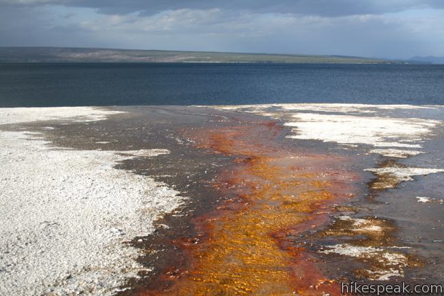
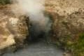
Next the boardwalk passes Black Pool on the right. Black Pool isn’t black! The misty pool has vibrant blue water today, but prior to hydrothermal activity in 1991, the pool was much cooler and hospitable to black and brown thermophiles. Thermophiles are microorganisms that love heat. They are responsible for the vivid colors in Yellowstone’s hydrothermal features. Yellow marks the hottest pools, while greens and blues mark pools that are usually below 140 degrees Fahrenheit.
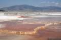
Across from Black Pool, an orange thermophile-colored stream pours down to the edge of Yellowstone Lake. West Thumb Geyser Basin adds about 3,000 gallons of water to Yellowstone Lake each year, but the roasting runoff does little to affect the overall temperature of the frigid mountain lake.
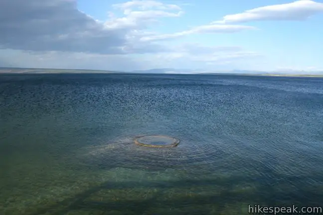
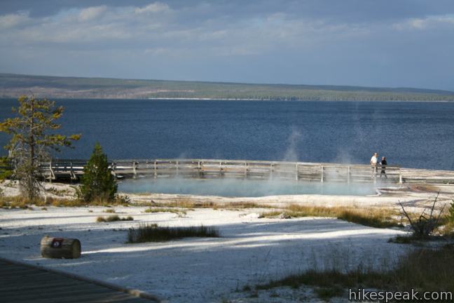
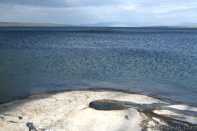
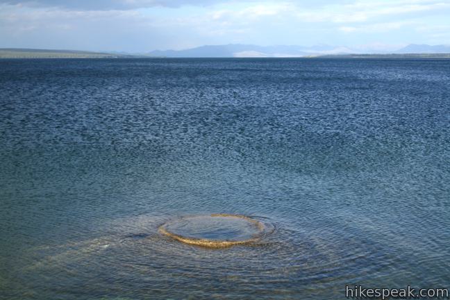
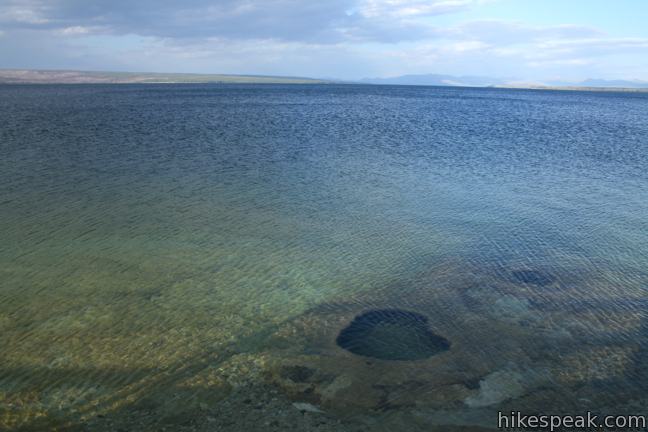
After Black Pool, the boardwalk passes directly along the edge of Yellowstone Lake. When water levels are high, some hydrothermal features end up below the surface. One such feature is Fishing Cone. Despite being right on the edge of Yellowstone Lake, Fishing Cone percolates at near-boiling temperatures. Part of the early lore of Yellowstone was that it was the only place in America where you could catch a fish and cook it while it was still on the line. Of course, fishing is no longer allowed near Yellowstone’s hydrothermal features, and there are health risks associated with cooking in a geyser.
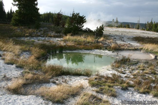
The boardwalk passes Lakeshore Geyser, which also spends part of the year operating below the surface. When exposed, the geyser can spout water a few feet high. Farther offshore, there are more hot springs and hydrothermal vents along the bottom of the West Thumb. A sign along the trail explains how the West Thumb of Yellowstone Lake was created:
West Thumb’s shoreline has suspiciously crater-like contours. Its underwater profile is dramatically deeper than the rest of Yellowstone Lake. Only a massive explosion could have formed West Thumb. … This bay is a crater within a crater—a volcanic eruption and violent collapse within the larger, earlier, Yellowstone caldera.
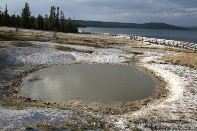
After the boardwalk leaves the lake, you will pass Seismograph Pool and the Thumb Paint Pots. While not as colorful as the surrounding pools, the paint pots are an interesting feature with muddy puddles and cone-shaped clay chimneys. The water in the Thumb Paint Pots is more acidic than nearby pools. Hydrogen sulfide gas from underground sources creates sulfuric acid, which eats away at the surrounding stone to create gray satiny clay. When the Thumb Paint Pots are actively bubbling and spitting mud, they put on quite a show.
After the Thumb Paint Pots, you may turn right to cut across the basin past more springs and pools, or continue straight to complete the loop. Because the ground throughout West Thumb Geyser Basin is unstable, and there can be boiling water just below the surface, it is important to stay on the trail at all times. There is an entrance fee for Yellowstone National Park, but no permit is required to hike through West Thumb Geyser Basin.
Directions to the Trailhead
- From the south entrance of Yellowstone National Park, drive 19.5 miles north on South Entrance Road.
- Pass the turnoff for the Grant Village Visitor Center and continue 1.7 miles to Grand Loop Road.
- Turn right and drive a few hundred feet to the trailhead for West Thumb Geyser Basin on the right.
- Coming from the north, the trailhead is 20 miles south of Fishing Bridge at the north end of Yellowstone Lake.
Trailhead Location
Trailhead address: Grand Loop Road (Route 20), Yellowstone National Park, WY 82190
Trailhead coordinates: 44.415605, -110.57362 (44° 24′ 56.17″N 110° 34′ 25.03″W)
View Yellowstone National Park in a larger map
Or view a regional map of surrounding Wyoming trails and campgrounds.
 | Riddle Lake This level 5-mile out and back hike crosses the Continental Divide to a backcountry lake with a small beach. |
 | Mud Volcano Area This hike of up to 2/3 of a mile visits a collection of sulfur-scented muddy springs. |
 | More trails in Yellowstone Explore other hikes to waterfalls and hydrothermal hot spots in Yellowstone National Park. |
 | Yellowstone National Park Campgrounds There are 12 developed campgrounds with over 2,000 total sites spread throughout Yellowstone. |
- The Inside Yellowstone video for West Thumb Geyser Basin on nps.gov (opens in a new tab)
- West Thumb Geyser Basin on enjoyyourparks.com (opens in a new tab)
- West Thumb Geyser Basin on wikipedia.org (opens in a new tab)
- West Thumb Geyser Basin on yellowstonenationalpark.com (opens in a new tab)
- West Thumb Geyser Basin on yellowstoneparknet.com (opens in a new tab)
- An online tour of West Thumb Geyser Basin on nps.gov (opens in a new tab)
- West Thumb and Grant Village Area on nps.gov (opens in a new tab)
- The official website for Yellowstone National Park (opens in a new tab)
Common Questions about West Thumb Geyser Basin in Yellowstone National Park
- Is the trail open?
- Yes. You should expect to find that West Thumb Geyser Basin Trail is open. There are no recent reports of trail closures. If you discover that the trail is closed, please help your fellow hikers by reporting a closure.
- Do I need a permit for this hike?
- Yes. National Park Entrance Fee.
- How much time does this hike take?
- It takes approximately 15 minutes to hike West Thumb Geyser Basin Trail. Individual hiking times vary. Add extra time for breaks and taking in the views.
- How long is this hike?
- The hike to West Thumb Geyser Basin Trail is a 0.65 mile loop with 25 feet of elevation change.
- Are dogs allowed on this trail?
- No, dogs are likely not allowed on West Thumb Geyser Basin Trail. The trail is primarily open to hikers.
- Is West Thumb Geyser Basin Trail good for kids?
- Yes, this hike is likely suitable for children. It is relatively short (0.65 miles) with manageable elevation gain.
- Is this trail wheelchair accessible?
- Yes, West Thumb Geyser Basin Trail is designated as wheelchair-friendly.
- Where is the trailhead located?
- The trailhead for West Thumb Geyser Basin Trail is located in Yellowstone National Park, Wyoming.
Trailhead Address:
Route 20
Yellowstone National Park, Wyoming 82190
Trailhead Coordinates:
44.415605, -110.57362 - What are the driving directions to the start of the hike?
To get to the trailhead: From the south entrance of Yellowstone National Park, drive 19.5 miles north on South Entrance Road. Pass the turnoff for the Grant Village Visitor Center and continue 1.7 miles to Grand Loop Road. Turn right and drive a few hundred feet to the trailhead for West Thumb Geyser Basin on the right. Coming from the north, the trailhead is 20 miles south of Fishing Bridge at the north end of Yellowstone Lake.
View custom Google Maps directions from your current location.
- Are there other trails near West Thumb Geyser Basin Trail?
- Yes, you can find other nearby hikes using the Hikespeak Hike Finder Map.

Go the extra miles...
Submit a rating of this hike to go with your comment. Contribute to the average trail rating.