Artists’ Paintpots
in Yellowstone National Park
Artists’ Paintpots Trail is located 3.7 miles south of the Norris Geyser Basin (home of the world’s tallest geyser) on the west side of Yellowstone National Park. A 1.1-mile loop circles a hillside hydrothermal area, passing bursting mudpots, bubbling hot springs, and mesmerizing milky blue pools. There is 125 feet of elevation gain along this fun and easy lollipop loop with plenty to see.
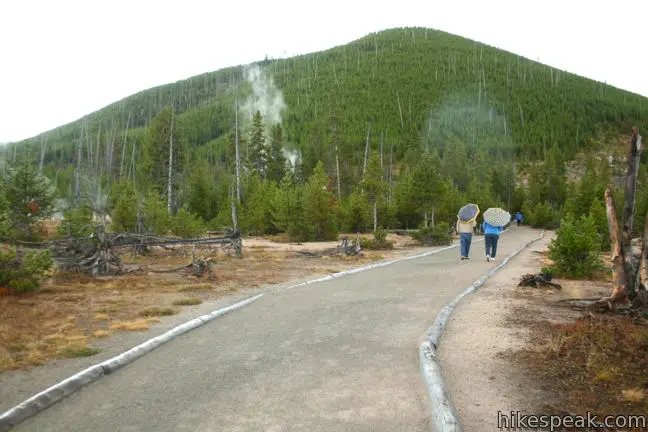
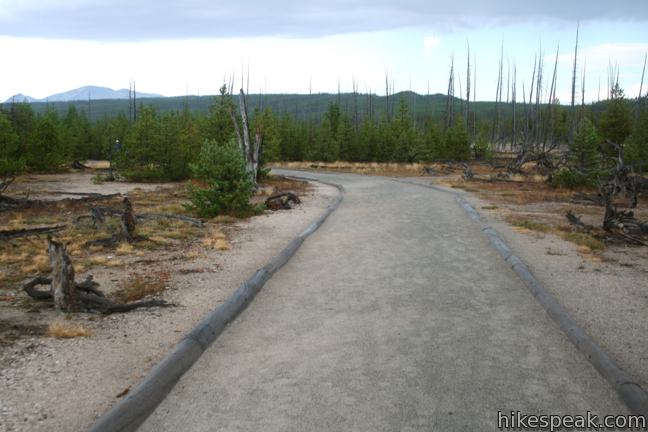
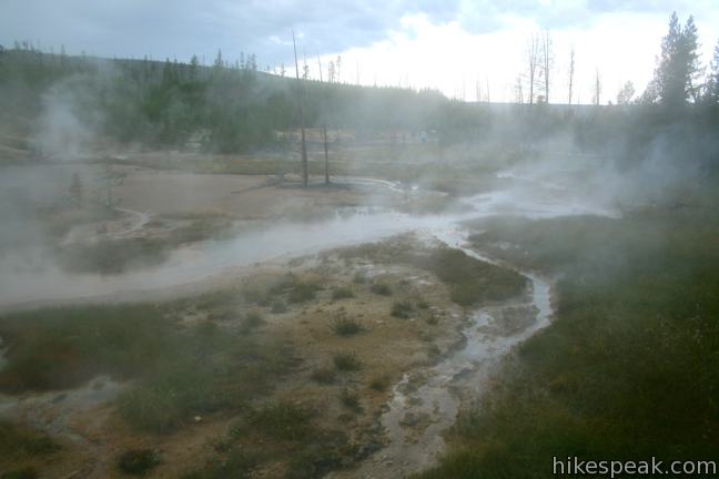
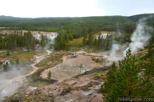
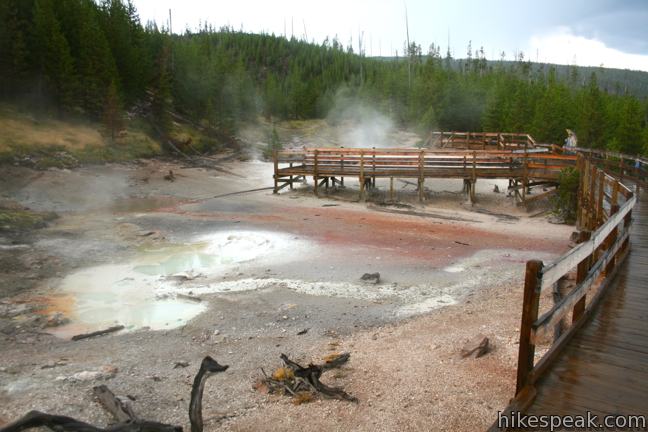
Begin by hiking a third of a mile over a level dirt trail leading to the circle through the hydrothermal area. This relaxing start passes through a lodgepole pine forest that is recovering from a wildfire that scorched this area in 1988. When the trail splits, you can head either direction around the loop. The dirt trail turns into a boardwalk that climbs up the side of Paintpot Hill.
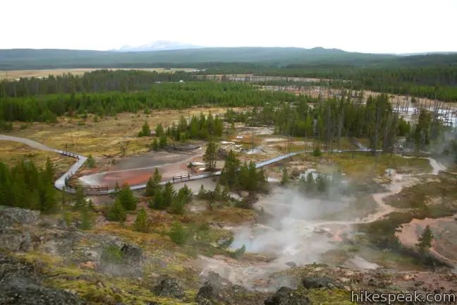
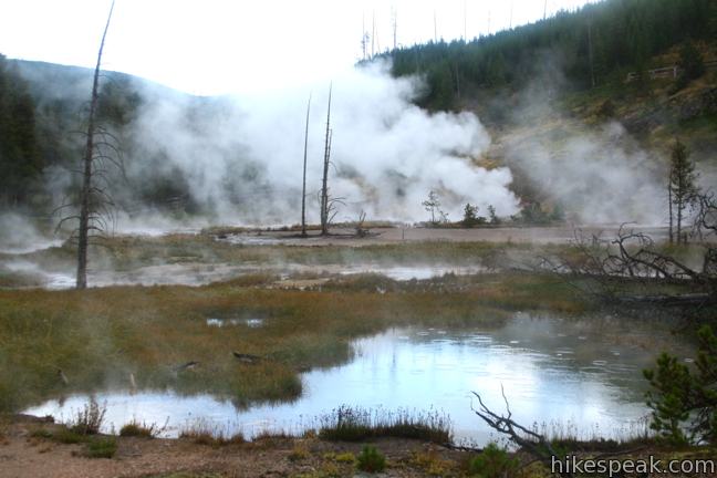
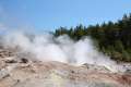
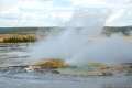
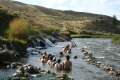
Heading to the left first for a clockwise tour, you will pass steaming water pouring down from hot springs at the base of the slope. Mist hovers over the streams of boiling water, which will eventually flow into the nearby Gibbon River.
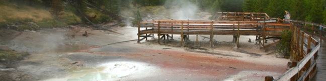
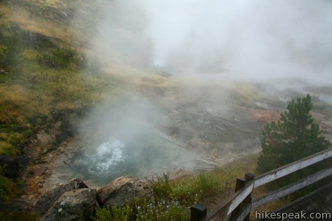
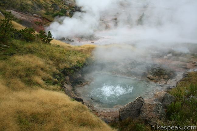
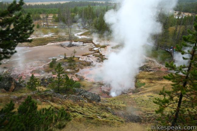
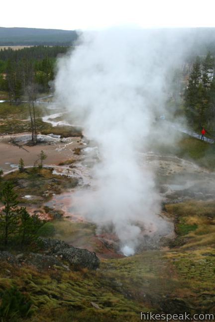
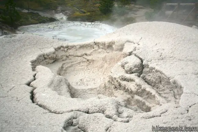
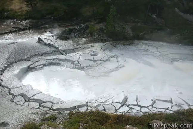
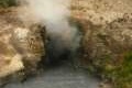
Head up a few flights of stairs past erupting hot springs. At the top of the loop, you can look down over the hydrothermal hillside, and over the pine forest to the north toward Mount Holmes. Next you’ll get an intimate view of a line of mudpots named the Artists’ Paintpots.

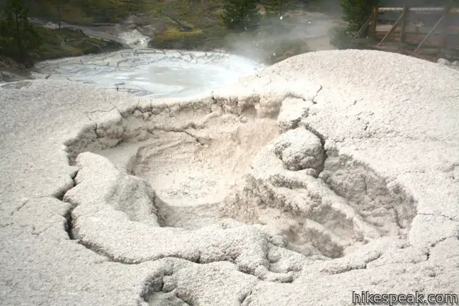
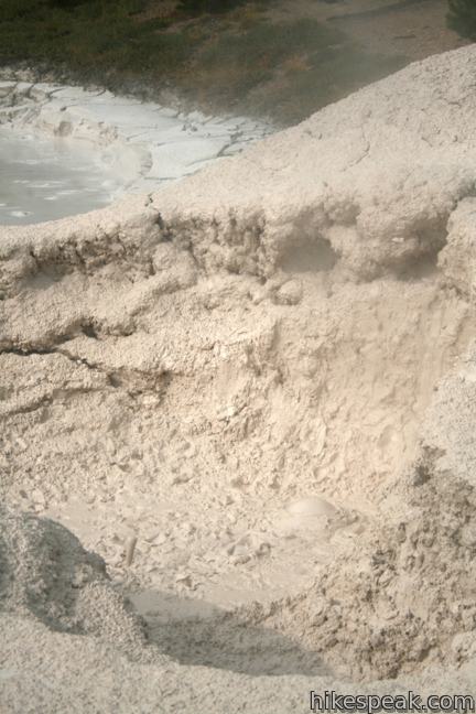
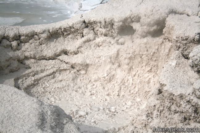
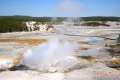
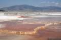
Because this hydrothermal area is built into a hillside, the highest ground has different features than the terrain below. As you rise above the boiling pools, the hydrothermal features have less water to work with and mudpots are created. Sulfuric acid derived from hydrogen sulfide gas that is emitted from an underground source, breaks down the surrounding rhyolite stone into grey clay.
The muddy pools bulge and burst as gas bubbles erupt on the surface. Mud can spit several feet up into the air. It is quite entertaining.
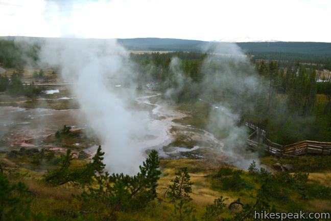
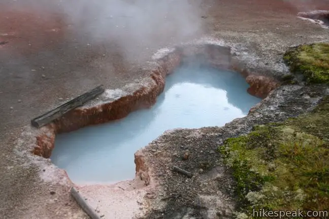
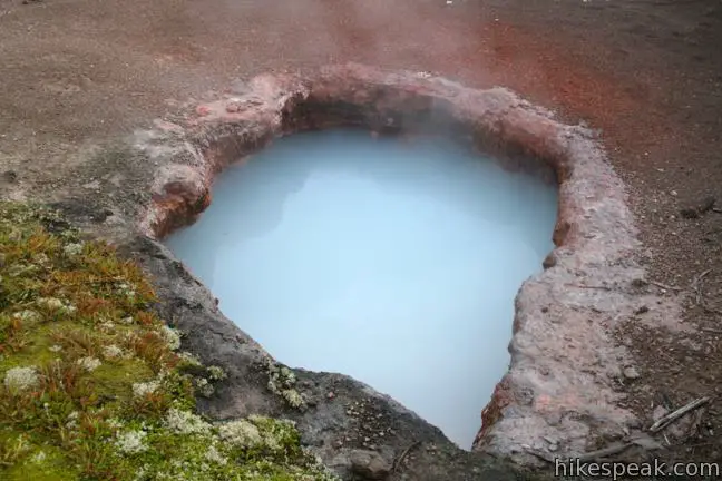
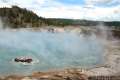
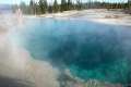
Descending to the west end of the loop, you will pass holes in the rusty geothermal crust that reveal blue pools just below the surface. After closing the loop, hike out the way you came in. The easy hike passes a variety of features in a short time, making it a fun excursion. There in an entrance fee for Yellowstone National Park. No permit is required to hike this trail, so paint your way to Artists’ Paintpots.

Directions to the Trailhead
- Drive 3.7 miles south of Norris Canyon Road on Route 89 (Grand Loop Road) and turn left (east) into the parking area for Artists' Paintpots Trail.
Trailhead Location
Trailhead address: Grand Loop Road (Route 89), Yellowstone National Park, WY 82190
Trailhead coordinates: 44.696237, -110.741095 (44° 41′ 46.45″N 110° 44′ 27.94″W)
You may also view a regional map of surrounding Wyoming trails and campgrounds.


 | Monument Geyser Basin This 2.8-mile hike reaches a rarely visited hydrothermal area that is boardwalk-free and fun to explore. |
 | Back Basin of Norris Geyser Basin This loop passes Steamboat Spring, the world's largest geyser, and several other hydrothermal features. |
 | Porcelain Basin of Norris Geyser Basin This pair of loops explores a stark basin with an impressive collection of geysers and hot springs. |
 | Fountain Paint Pot This half-mile loop in Lower Geyser Basin passes geysers, hot springs, mudpots, and fumaroles - all of the hydrothermal features found in Yellowstone. |
 | Midway Geyser Basin This 0.8 mile walkway passes Excelsior Geyser and Grand Prismatic Spring, the largest hot springs in Yellowstone. |
 | Biscuit Basin Loop This 2/3 of a mile loop explores hydrothermal features in Upper Geyser Basin like Black Opal Pool, Sapphire Pool, and Black Pearl Geyser. |
 | Mammoth Hot Springs This series of boardwalks explores a park highlight, a collection of colorful hot springs terraces. |
 | Boiling River This 1.25-mile round trip hike follows a riverbank to a natural hot tub where a stream of water cooked by nearby hydrothermal features mixes with the river. |
 | Mud Volcano Area This hike of up to 2/3 of a mile visits a collection of sulfur-scented muddy springs. |
 | More trails in Yellowstone Explore other hikes to waterfalls and hydrothermal hot spots in Yellowstone National Park. |
 | Yellowstone National Park Campgrounds There are 12 developed campgrounds with over 2,000 total sites spread throughout Yellowstone. |
- An official national park video for the Artists' Paintpots (opens in a new tab)
- Madison Area (including Artists' Paintpots) on nps.gov (opens in a new tab)
- Artists' Paintpots on summitpost.org (opens in a new tab)
- Artists' Paintpots on Brian and Ashley's Hiking Blog (opens in a new tab)
- Artists' Paintpots on americansouthwest.net (opens in a new tab)
- Yellowstone hydrothermal areas on wikipedia.org (opens in a new tab)
- The official website for Yellowstone National Park (opens in a new tab)
Common Questions about Artists’ Paintpots in Yellowstone National Park
- Is the trail open?
- Yes. You should expect to find that Artists' Paintpots Trail is open. There are no recent reports of trail closures. If you discover that the trail is closed, please help your fellow hikers by reporting a closure.
- Do I need a permit for this hike?
- Yes. National Park Entrance Fee.
- How much time does this hike take?
- It takes approximately 30 minutes to hike Artists' Paintpots Trail. Individual hiking times vary. Add extra time for breaks and taking in the views.
- How long is this hike?
- The hike to Artists' Paintpots Trail is a 1.1 mile loop with 125 feet of elevation change.
- Are dogs allowed on this trail?
- No, dogs are likely not allowed on Artists' Paintpots Trail. The trail is primarily open to hikers.
- Is Artists' Paintpots Trail good for kids?
- Yes, this hike is likely suitable for children. It is relatively short (1.1 miles) with manageable elevation gain.
- Where is the trailhead located?
- The trailhead for Artists' Paintpots Trail is located in Yellowstone National Park, Wyoming.
Trailhead Address:
Grand Loop Road
Yellowstone National Park, Wyoming 82190
Trailhead Coordinates:
44.696237, -110.741095 - What are the driving directions to the start of the hike?
To get to the trailhead: Drive 3.7 miles south of Norris Canyon Road on Route 89 (Grand Loop Road) and turn left (east) into the parking area for Artists' Paintpots Trail.
View custom Google Maps directions from your current location.
- Are there other trails near Artists' Paintpots Trail?
- Yes, you can find other nearby hikes using the Hikespeak Hike Finder Map.

Thanks for sharing the Artists’ Paintpots Trail. I have a trip planned for Yellowstone in the spring and plan on hiking as many trails as possible in 8 days.