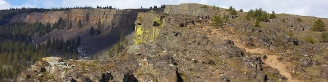
Hikes in Mount Saint Helens National Volcanic Monument

When Mount Saint Helens erupted in in 1980, it instantly became America's most well known Volcano. Over 200 square miles of forest were scorched, 250 homes were burned, and 57 people were killed. Evidence of the powerful eruption and previous volcanic activity can be witnessed on trails around Mount Saint Helens. Two years after the eruption, Mount Saint Helens National Volcanic Monument was established to help preserve this area and monitor its recovery. ... Read more.
Coyote Wall in Columbia River Gorge National Scenic Area
Take a drive through the Columbia River Gorge and you're sure to be impressed by a diagonal band of cliffs on the Washington side of the gorge that rise from the river toward the mountains above. These grand and daunting cliffs are called Coyote Wall or the Syncline. A network of single-track trails and old jeep roads extend up alongside the columnar basalt ledge. ...Read more.
Distance: 5.8 miles · Elevation change: 1575 feet
By: Published: July 28, 2017 Last updated: April 18, 2026
Camping in Beacon Rock State Park
Tucked into the Washington side of the Columbia River Gorge, Beacon Rock State Park has great places camp and kick back after a day of traveling in the gorge or hiking Hamilton Mountain and Beacon Rock. Main Campground In the forest up the road from Hamilton Mountain Trailhead, you'll find the park's main campground spread around a single loop. A mossy ledge of basalt rises over one side of the campground. ...Read more.
By: Published: July 10, 2017 Last updated: April 10, 2026
Hamilton Mountain Loop in Beacon Rock State Park
Only hike Hamilton Mountain Trail if you like charming forests, bold waterfalls, and awesome cliff-top views. Hamilton Mountain Trail passes a viewpoint for the Pool of the Winds, where Rodney Falls plunges into a rock-wrapped punchbowl. The trail rises to a summit along the Columbia River Gorge, ascending 2,025 feet on a 7.75-mile lollipop loop. Some of Hamilton Mountain's best views come from a perch below the summit and a saddle after the summit. ...Read more.
Distance: 7.75 miles · Elevation change: 2025 feet
By: Published: July 9, 2017 Last updated: April 25, 2026
Beacon Rock Trail in Beacon Rock State Park
Beacon Rock rises like a stone tower with sheer cliffs dropping to the Columbia River. Beacon Rock Trail could be the Columbia River Gorge relative of Moro Rock Trail in Sequoia National Park. The trail is built right up the side of the basalt monolith, using over fifty switchbacks and at least a dozen cliff-straddling bridges to reach a pointed summit. ...Read more.
Distance: 1.6 miles · Elevation change: 600 feet
By: Published: June 24, 2017 Last updated: April 25, 2026
Guler Ice Cave in Gifford Pinchot National Forest
The Cascade Range is home to many caves including volcanic lava tubes and glacier ice caves. The Guler Ice Cave south of Mount Adams offers a sample of both. Through the early summer this cave contains impressive ice features like frozen stalactites and stalagmites. You will see the most ice if you visit in April and May. As the season warms the cave loses its ice, but remains fun to explore throughout the year. ...Read more.
Distance: 0.25 miles · Elevation change: 25 feet
By: Published: September 7, 2016 Last updated: December 5, 2025