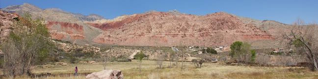
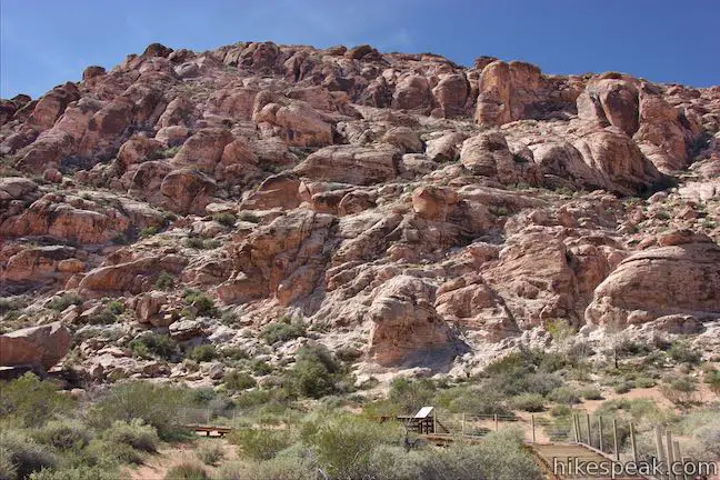
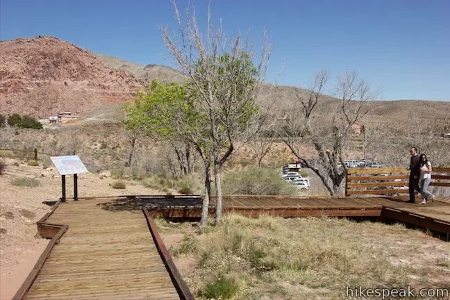
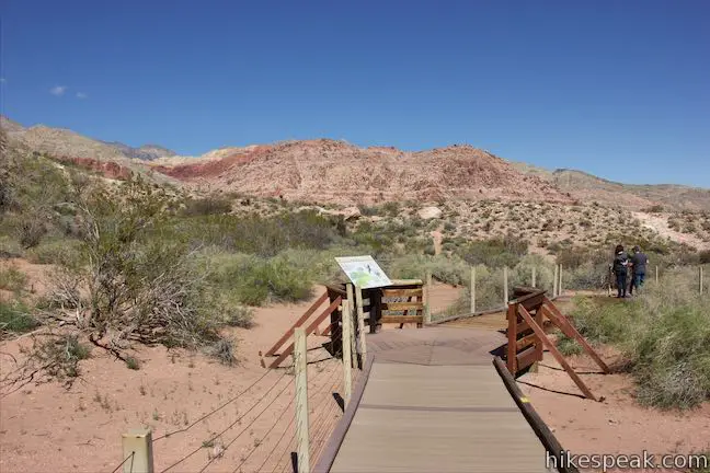
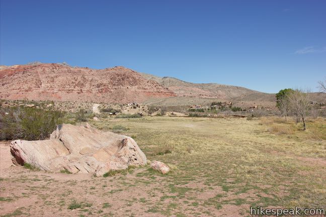
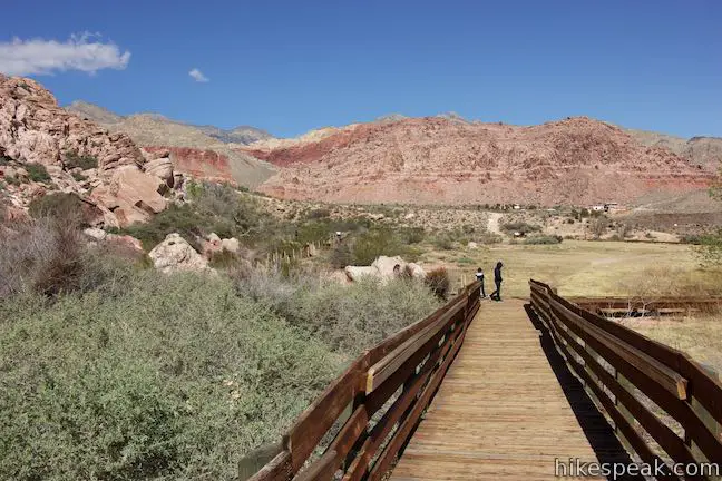
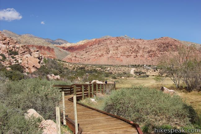
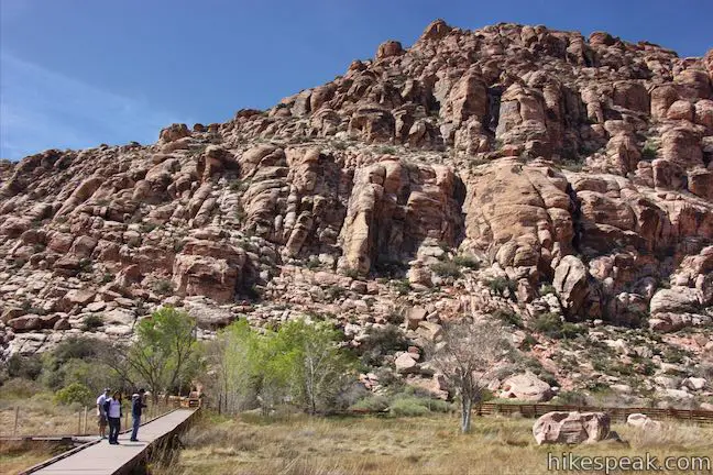
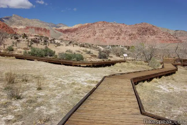
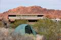
How significant is water in the desert? Head to Read Spring to find out, where a 0.55-mile boardwalk circles an out-of-place meadow fed by a small spring. Red Spring spills from the base of the Calico Hills beneath a ridge of wildly shaped sandstone. While most of the trails in Red Rock Canyon NCA begin along the Scenic Drive, Red Spring Boardwalk sets out from a picnic area off Calico Basin Road on the east side of the park closest to Las Vegas. Red Spring is a good place to enjoy a picnic and a quick stroll.
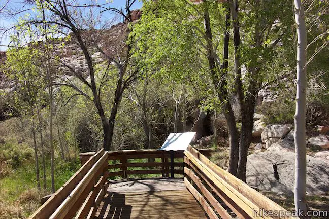
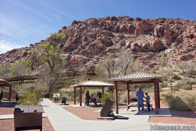
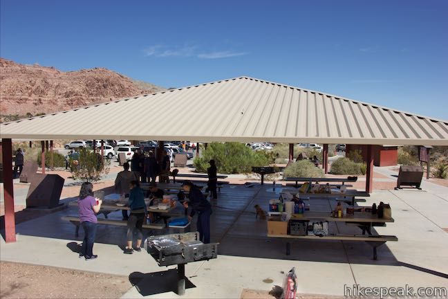
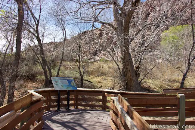
Red Spring Picnic Area has shade pavilions, barbecue grills, and a dozen picnic tables. Walk south through the picnic area to a wooden boardwalk. A panel in front of the boardwalk puts Red Spring in context:
Springs in the desert are rare and precious. Their waters allow a diverse community of plants and animals to thrive that are very different than those of the surrounding desert. For thousands of years, both wildlife and people have depended upon Red Spring for its lush vegetation, abundant food, and permanent water. As you walk along the boardwalk, observe the plant and animal diversity. Imagine the early people that visited the spring before you. Think about your place in the natural world and why Red Spring is special to you.
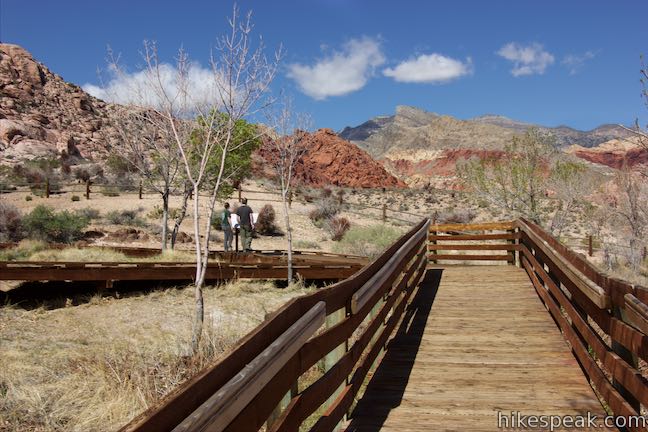
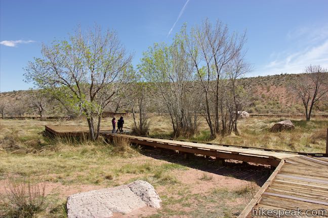
The boardwalk rises through a cluster of ash trees to a bend that hosts the first of a dozen info panels. This panel describes and depicts the area’s birds, like red-tailed hawks, black-tailed gnatcatchers, common nighthawks, phainopepla, great horned owls, canyon wrens, and the unfortunately named common poorwill (which is actually far from common and slips into near-hibernation to survive the winter without migrating). Later in the boardwalk, you’ll learn about the other animals and plants found around Red Spring.
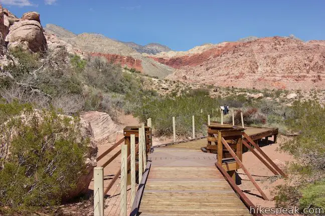
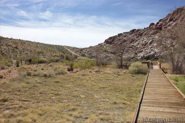
After a tenth of a mile, come to a split at the start of a loop that borders a level green meadow. You can hike the loop in either direction, but the panels along the boardwalk seem to be laid out in a counter-clockwise direction. Turn right to walk the loop in this direction.
Quickly reach the loop’s second panel, which describes the area’s geology and offers a timeline of major transformations leading to the present state of Calico Basin. The long origin story probably doesn’t begin where you expect:
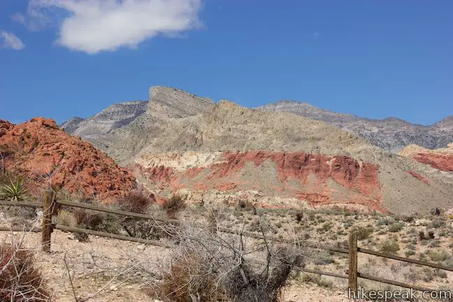
Warm Tropical Seas (600-250 million years ago) – The land that is now Red Spring was once near the equator under a warm, shallow, tropical sea. The marine waters left behind calcium-rich sediments that became the gray limestones and dolostones of the Spring Mountains.
Braided Streams (250-180 million years ago) – After the sea retreated, a vast system of braided streams and mud flats stretched as far east as present-day Texas. The sands, silts, and gravels deposited by these rivers eventually became the sandstone, shale, and conglomerate layers we see today.
Giant Dunes (180-60 million years ago) – As the climate became more arid, winds created giant sand dunes that deposited sand over 2,000 feet deep. Over time, this sand was compressed and cemented into colorful Aztec sandstone that we see today.
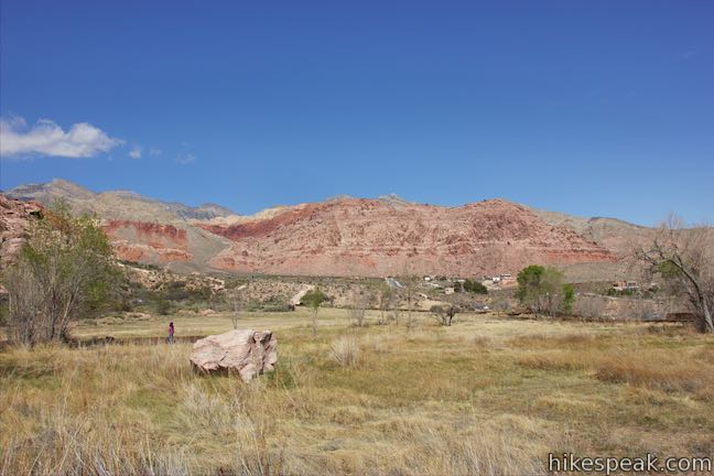
As a reference point, small dinosaurs were roaming the earth during the period of the giant dunes. In the last couple million years, the climate was cooler and wetter, supporting forests. After the last ice age, the climate became arid and desert took over. Springs of water like Red Spring became rare and precious resources.
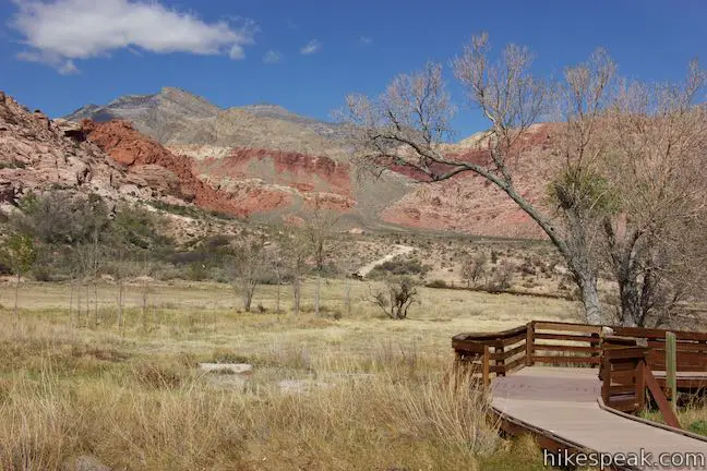
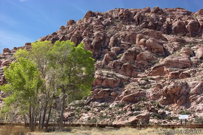
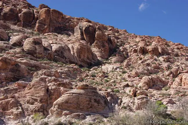
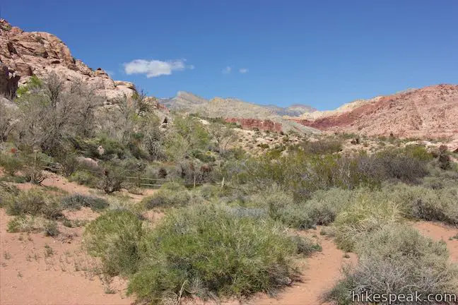
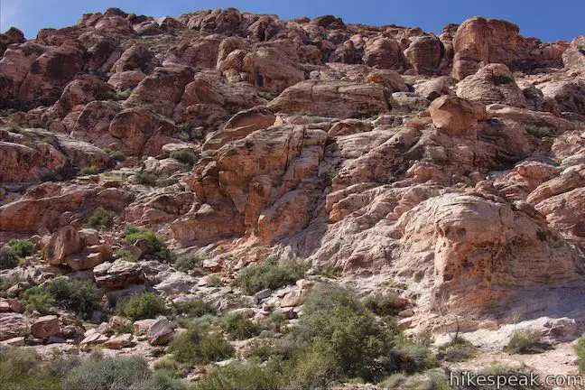
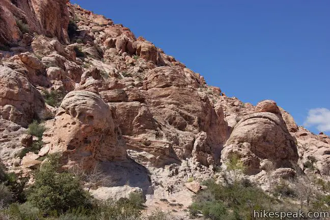
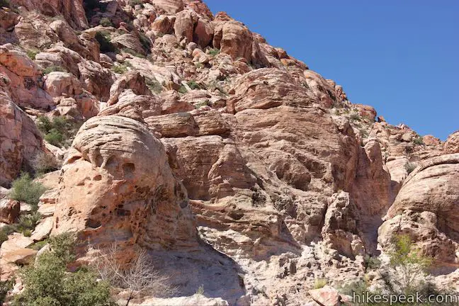
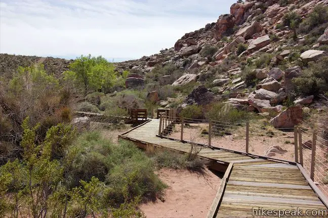
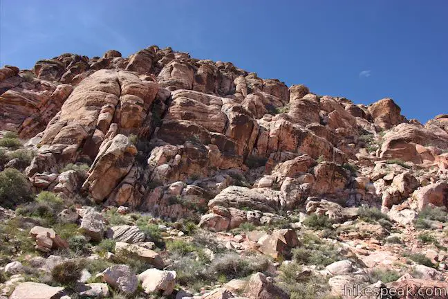
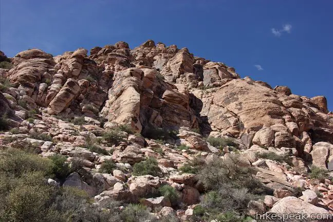
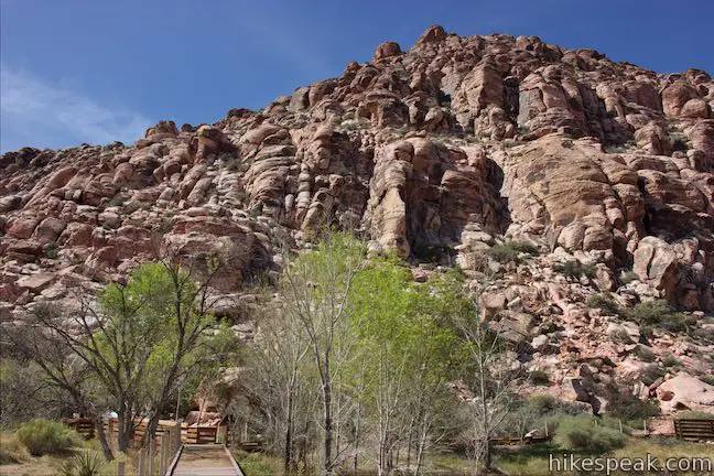
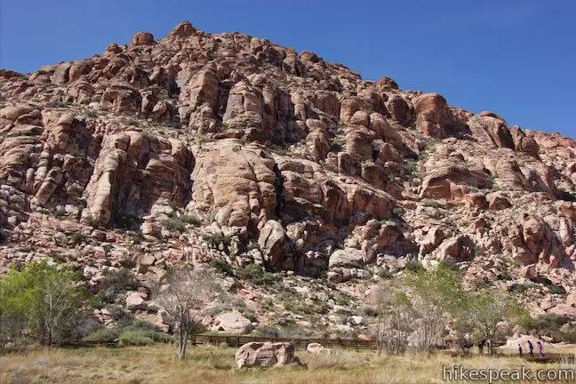
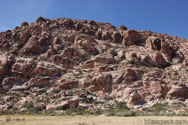
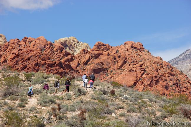
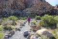
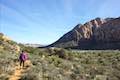
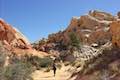
As your proceed beyond the geology panel, you’ll have good views toward Turtlehead Mountain and darker ridges of red sandstone. However, there’s no need to gaze off into the distance to see cool rocks because Red Spring Boardwalk goes right up to a slope covered in strangely shaped boulders of Aztec sandstone.
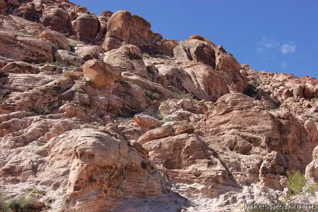
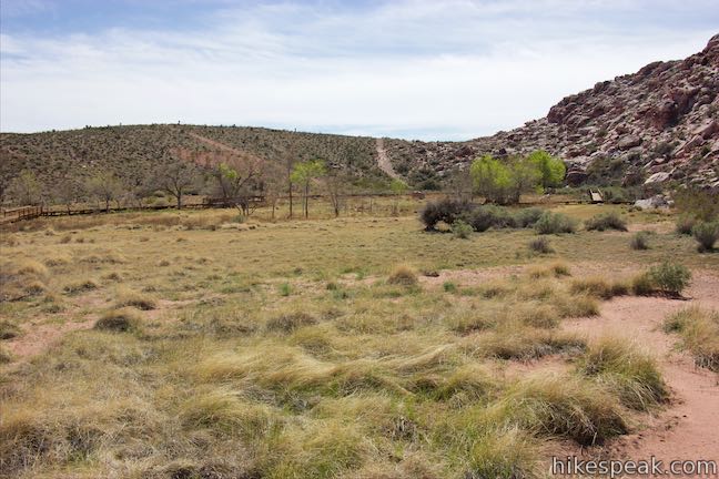
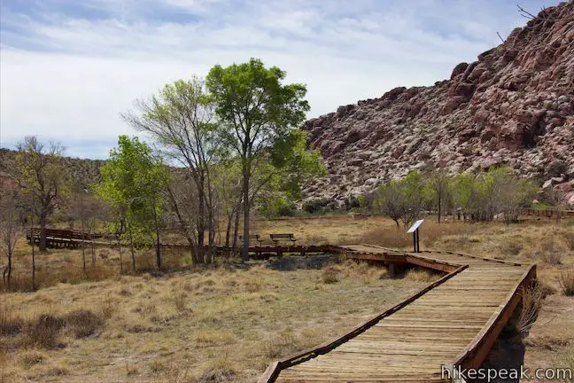
The boardwalk curves to the left along the base of the Calico Hills, allowing you to look up at the sandstone formations from a few angles. On the left side of the trail is a grass-covered area that does not resemble the desert surrounding, benefiting from regular watering from Red Spring. Ash trees sprout up along the edges of the meadow around the boardwalk. Pass a spur on the left that pushes into the meadow and continue up the boardwalk.
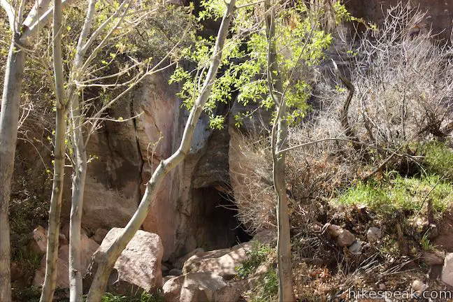
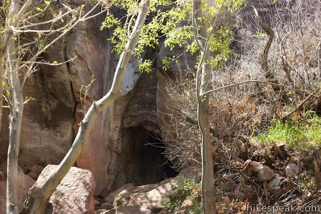
After 0.3 miles of effort, you’ll come to a spur on the right that leads to the spring itself. Look through trees toward a perched spring near the base of the rocky slope. There’s probably less water than you might expect and not much to see. Nevertheless, with so much dry desert in every direction, Red Spring is special. A panel explains where the water in Red Spring comes from:
Water’s journey to Red Spring begins as snow or rain on the limestone peaks of the Spring Mountains. The water soaks in and moves downward through the permeable rock toward the valley floor. The flow of water continues downward until it reaches an impermeable layer of rock such as shale. This water-resistant layer forces the water into a more concentrated stream that emerges at the base of a hillside as a perched spring.
Leave the spring and proceed with the boardwalk. Pass a trail on the right that exits the meadow and connects to Red Spring Boulder Trail, which heads west around the bottom of the Calico Hills. The boardwalk curves to the left to head north along the meadow. Pass tall ash trees and benches, where you can have a seat and look across the meadow toward gnarled cliffs of Aztec sandstone.
Close the loop and turn right to return to the picnic area. If you read all the signs along the trail, you will be quite familiar with the area’s birds, geology, plant adaptation, desert partners, red rocks, early people, ancient spring, animals, aquatic life, recent history, restoration, and public lands. That’s a lot of information for a 0.55-mile walk!
Red Spring Boardwalk is located at the southeast end of the Calico Hills and is less than twenty miles from Las Vegas. No fee is required to park in the large lot at Red Spring Picnic Area. The picnic area has bathrooms and dogs are allowed on the boardwalk.
Update: Red Spring Boardwalk has reopened after structural repairs were made to the boardwalk from 2018-2019. More information.
Directions to the Trailhead
- Red Spring Picnic Area is located off Calico Basin Road, just north of State Route 159, 1.4 miles east of the Scenic Drive in Red Rock Canyon National Conservation Area.
- From Las Vegas, take Interstate 15 to exit 42 and follow Route 95 west for 5 miles (heading toward Reno).
- Take exit 81A for Summerlin Parkway and drive 6.5 miles, using a ramp on the right to get on Clack County Route 215 South.
- Drive 2.2 miles, taking exit 26 to reach an intersection with Route 159 (Charleston Boulevard).
- Turn right and drive 3.7 miles to Calico Basin Road.
- Turn right and drive 1.2 miles to the picnic area parking lot, which will be up a road to the left.
Trailhead Location
Trailhead address: Red Spring, Calico Basin Road, Red Rock Canyon National Conservation Area, Las Vegas, NV 89161
Trailhead coordinates: 36.14652, -115.4191 (36° 08′ 47.47″N 115° 25′ 08.76″W)
You may also view a regional map of surrounding Nevada trails and campgrounds.


 | Calico I and Calico II This hike of 0.8 to 2.75 miles or more explores dramatically shaped and colored sandstone formations in the Calico Hills near the start of Scenic Drive. |
 | Calico Tanks This 2.5-mile hike ventures up a colorful canyon to a pond in a sandstone-framed basin alongside a grand view of Las Vegas. |
 | Lost Creek Canyon This short hike visits Lost Creek Waterfall, a seasonal waterfall in a steep canyon above Red Rock Wash. |
 | Willow Springs Loop This 1 to 1 1/3-mile circuit travels along Red Rock Wash, exploring desert landscapes, Native American rock art, and potentially a seasonal waterfall. |
 | Hikes in Nevada Explore more trails in Nevada and the picturesque parks around Las Vegas. |
 | Red Rock Canyon Campground Red Rock Canyon National Conservation Area has one developed campground with 72 sites that have shade ramadas, picnic tables, fire rings, barbecue grills, drinking water spigots, and vault toilets. |
 | Atlatl Rock Campground and Arch Rock Campground Valley of Fire State Park has great places to camp surrounded by formations of red sandstone. |
- Red Spring Boardwalk on birdandhike.com (opens in a new tab)
- Red Rock Canyon National Conservation Area on wikipedia.org (opens in a new tab)
- The official website for Red Rock Canyon Interpretive Association (opens in a new tab)
- The official website for Red Rock Canyon National Conservation Area (opens in a new tab)
Common Questions about Red Spring Boardwalk in Red Rock Canyon National Conservation Area
- Is the trail open?
- Yes. You should expect to find that Red Spring Boardwalk is open. There are no recent reports of trail closures. If you discover that the trail is closed, please help your fellow hikers by reporting a closure.
- Is this trail free to access?
- Yes, Red Spring Boardwalk is free to access. No entrance fee, pass, or permit is required. If you discover that access rules have changed, please provide feedback on your experience.
- How much time does this hike take?
- It takes approximately 15 minutes to hike Red Spring Boardwalk. Individual hiking times vary. Add extra time for breaks and taking in the views.
- How long is this hike?
- The hike to Red Spring Boardwalk is a 0.55 mile loop with 50 feet of elevation change.
- Are dogs allowed on this trail?
- Yes, dogs are allowed on Red Spring Boardwalk. The trail is open to hikers, dogs.
- Is Red Spring Boardwalk good for kids?
- Yes, this hike is likely suitable for children. It is relatively short (0.55 miles) with manageable elevation gain.
- Where is the trailhead located?
- The trailhead for Red Spring Boardwalk is located in Las Vegas, Nevada.
Trailhead Address:
Calico Basin Road
Las Vegas, Nevada 89161
Trailhead Coordinates:
36.14652, -115.4191 - What are the driving directions to the start of the hike?
To get to the trailhead: Red Spring Picnic Area is located off Calico Basin Road, just north of State Route 159, 1.4 miles east of the Scenic Drive in Red Rock Canyon National Conservation Area. From Las Vegas, take Interstate 15 to exit 42 and follow Route 95 west for 5 miles (heading toward Reno). Take exit 81A for Summerlin Parkway and drive 6.5 miles, using a ramp on the right to get on Clack County Route 215 South. Drive 2.2 miles, taking exit 26 to reach an intersection with Route 159 (Charleston Boulevard). Turn right and drive 3.7 miles to Calico Basin Road. Turn right and drive 1.2 miles to the picnic area parking lot, which will be up a road to the left.
View custom Google Maps directions from your current location.
- Are there other trails near Red Spring Boardwalk?
- Yes, you can find other nearby hikes using the Hikespeak Hike Finder Map.

5 Comments on Red Spring Boardwalk in Red Rock Canyon National Conservation Area
What hikers are saying:
✨ Generated summary of user commentsHikers appreciate the newly installed boardwalk at Calico Basin, which provides a great way to experience the landscape. Staying on designated paths is essential to protect fragile meadow vegetation and rocks from long-term damage. Respecting the posted signs ensures the environment remains preserved for everyone to enjoy.
[…] parking area (in case you want to eat al fresco) and above that you’ll see the entrance to the boardwalk area of the […]
We went to this trailhead 2/24/18 and we walk up to the board walk and see that it is closed off. My best friend flew in from Michigan wanting to go see this area. She uses a wheelchair, therefore we couldn’t do any of this. Why is this not posted on the site? It says it is currently accessible, however it is not.
Thanks for the information. I’ll add an update. Birdandhike.com reports that the boardwalk is expected to remain closed until mid-2018.
https://www.spl.usace.army.mil/Media/Images/igphoto/2002217670/
Red Springs boardwalk was redesigned and constructed by S&B Christ Consulting, then was reopened in Nov. of 2019.
I was at Calico Basic yesterday evening (10/9/2020). The new boardwalk the BLM installed since the last time I was out there is great.
There were several professional photographers there taking photos. Unfortunately, they were posing their models in the meadow, laying them down on the vegetation, and having them climb on the rocks. The damage they have caused will take years to recover. Despite signs being posted about every 30 feet reminding people to stay on the boardwalk and trails.
I wish the BLM had the budget to station their rangers in the high use areas, in and around Red Rock.