Lost Creek Canyon
in Red Rock Canyon National Conservation Area

This short hike ventures into a canyon to Lost Creek Waterfall, a seasonal desert falls. Cross through a riparian area below tall cliffs in the Spring Mountains of Red Rock Canyon National Conservation Area. Lost Creek Canyon Trail is 0.35 miles long and can be done as a 0.7-mile out and back hike with 165 feet of elevation change. Form a circuit with Lost Creek Children’s Discovery Loop Trail to explore surrounding rock formations (including a pictograph) on a 0.8-mile hike. Willow Springs Loop also connects to the Lost Creek Trail System, allowing Lost Creek Waterfall to be visited on that loop for a 1 1/3-mile hike.
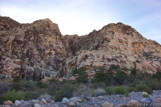
Start from a trailhead along Rocky Gap Road between Red Rock Canyon’s Scenic Drive and Willow Springs Picnic Area. Two trails part from the south side of the road. Children’s Discovery Loop Trail ventures west and is the longer trail to Lost Creek Waterfall. For the direct route to the falls, take the trail to the left (east side of the parking area) and hike southwest. Tall cliffs rise ahead of you, penetrated by the narrow gap of Lost Creek Canyon.

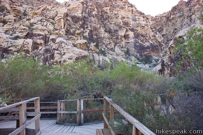
Lost Creek Trail begins as a gravel track lined by larger rocks. Bear right at a junction, 0.05 miles from the start, passing SMYC Trail. Slip through desert brush and make your way to a wash, 0.15 miles from the start. Cross the wash and continue into trees that grow around a water source at the bottom of Lost Creek Canyon. A boardwalk lifts the trail off the ground to protect the fragile grasses in this riparian area and probably makes it easier to appreciate. A panel explains how this area has been restored:
Heavy visitor use of this area has compacted soils, trampled plants, and destroyed much of the fragile riparian habitat (habitat associated with water). Concerned about the loss of habitat, the Bureau of Land Management developed a restoration plan. Trampled areas were replanted and an elevated boardwalk was constructed by volunteers. The boardwalk provides visitors with a way to continue enjoying this special place and helps protect the fragile spring habitat.

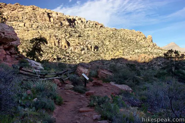
On the left side of the boardwalk, you can watch water from the spring flow through the thicket. At the end of the short boardwalk, a rocky dirt trail resumes. Cross a boundary to Rainbow Mountain Wilderness Area and come to an unmarked junction, a quarter mile from the start. The loop trail is to the right. Stay to the left to venture another tenth of a mile up the canyon to the waterfall.
Lost Creek Canyon Trail drops across a creek bed where you will see water if you’re really lucky. Take steps up the other side and make your way through a tunnel formed by a pair of boulders. Just ahead, you will arrive at the base of the waterfall.

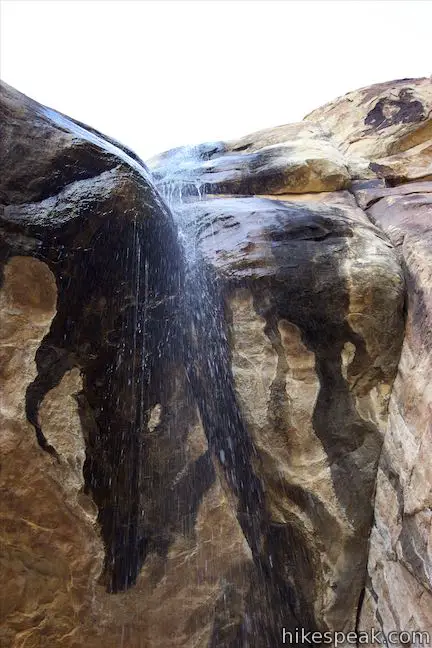
Lost Creek Falls is a seasonal waterfall flushed by rain and melted snow that flows in the winter and spring. The waterfall pours from an overhang at the back of the box canyon and can run strong or run dry. If the waterfall isn’t gushing, but rather dripping like a shower (as shown), walk right up under the waterfall for some natural refreshment.

With tall cliffs all around, there is no way to proceed up the canyon. Only a use trail, which branches off Willow Springs Loop above Children’s Discovery Loop Trail and crosses the ledge bordering Lost Creek Canyon, can be used to access the area above the waterfall.
After soaking up Lost Creek Waterfall, head back down the trail. You can return by the same route or make a left at the unmarked junction before reaching the boardwalk. Taking the longer route, you will pass numbered markers descending from five to one. Pass a large boulder and come up along a wooden fence on the left side of the trail. Marker 4 is at this site, along with a panel titled “Seasons of the People.” Look up at the rocks above the fence and see if you can spot a pictograph resembling a person with their hand raised. What message was the Native American sending who created this rock art?

Continue along Children’s Discovery Loop Trail below the cliffs that border Lost Creek Canyon. You will have nice views out and across the wash below. Next to marker three, pass a sign for Willow Springs Loop by a faint trail up a slope to the left toward a gap between boulders. To return to Lost Creek Trailhead, keep curving to the right down Children’s Discovery Loop Trail. At the base of the slope, you’ll make a sharp left turn.
The trail levels out and crosses a west-to-east running wash (the same one that you crossed on the first section of this loop). Hike straight across the wash and stroll through low desert brush to the end of the trail at the west end of the trailhead parking area. Hiking back via this route only extends the trek slightly, from 0.7 to 0.8 miles.

Dogs are allowed on the trails to Lost Creek Waterfall and other trails in Red Rock Canyon National Conservation Area. This hike begins from a trailhead just off the park’s scenic loop drive, requiring that a park entrance fee be paid to reach the trailhead. No permit is necessary to hike to Lost Creek Waterfall, so get out and enjoy!
To get to the trailhead: From Las Vegas, take Interstate 15 to exit 42 and follow Route 95 west for 5 miles (heading toward Reno). Take exit 81A for Summerlin Parkway and drive 6.5 miles, using a ramp on the right to get on Clack County Route 215 South. Drive 2.2 miles, taking exit 26 to reach an intersection with Route 159 (Charleston Boulevard). Turn right and drive 5.2 miles to the start of Scenic Drive in Red Rock Canyon. Turn right, pay the entrance fee, and drive 7.2 miles up the road, passing several trailheads and viewpoints. Turn right onto Rocky Gap Road, following a sign for Willow Springs Picnic Area and Lost Creek Trail. Drive a quarter mile and pull into a small parking area for the trailhead on the left.
Trailhead address: Rocky Gap Road, Red Rock Canyon National Conservation Area, Las Vegas, NV 89161
Trailhead coordinates: 36.15735, -115.49373 (36° 09′ 26.46″N 115° 29′ 37.42″W)
You may also view a regional map of surrounding Nevada trails and campgrounds.
 | Willow Springs Loop This 1 to 1 1/3-mile circuit travels along Red Rock Wash, exploring desert landscapes, Native American rock art, and potentially a seasonal waterfall. |
 | Calico Tanks This 2.5-mile hike ventures up a colorful canyon to a pond in a sandstone-framed basin alongside a grand view of Las Vegas. |
 | Calico I and Calico II This hike of 0.8 to 2.75 miles or more explores dramatically shaped and colored sandstone formations in the Calico Hills near the start of Scenic Drive. |
 | Red Spring Boardwalk This easy 0.55-mile nature trail circles a meadow at the base of the Calico Hills and visits a small but relied upon spring. |
 | Hikes in Nevada Explore more trails in Nevada and the picturesque parks around Las Vegas. |
 | Red Rock Canyon Campground Red Rock Canyon National Conservation Area has one developed campground with 72 sites that have shade ramadas, picnic tables, fire rings, barbecue grills, drinking water spigots, and vault toilets. |
 | Atlatl Rock Campground and Arch Rock Campground Valley of Fire State Park has great places to camp surrounded by formations of red sandstone. |
Lost Creek in Afoot and Afield: Las Vegas and Southern Nevada by Brian Beffort
A trail guide for Children's Discovery Loop Trail from the Bureau of Land Management
Lost Creek Canyon Trail on birdandhike.com
Lost Creek on redrockcanyonlv.org
Lost Creek on lastadventurer.com
Red Rock Canyon National Conservation Area on wikipedia.org
The official website for Red Rock Canyon Interpretive Association
The official website for Red Rock Canyon National Conservation Area


[…] Lost Creek Trail […]