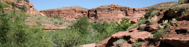
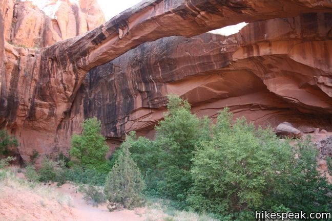
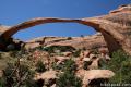
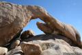
This 4.65-mile round trip hike starts above the banks of the Colorado River east of Moab, Utah, and travels up a scenic canyon alongside a much smaller stream. The trek terminates at a stunning 243-foot long natural bridge, the sixth largest natural rock span in America. The level dirt trail to Morning Glory Bridge ascends just 300 feet and offers plenty of serenity along the way.
Previously, this trail was called Negro Bill Canyon Trail, but it is now referred to as Grandstaff Canyon. William Grandstaff was an African American prospector who settled in Moab in 1877, becoming the first non-Caucasian pioneer to do so. He had success ranching in the area that now bears his name. William Grandstaff Campground adjacent to the trailhead inherited his given name, while intially Negro Bill Canyon did not. Change came eventually. Grandstaff Canyon has a nice ring to it!
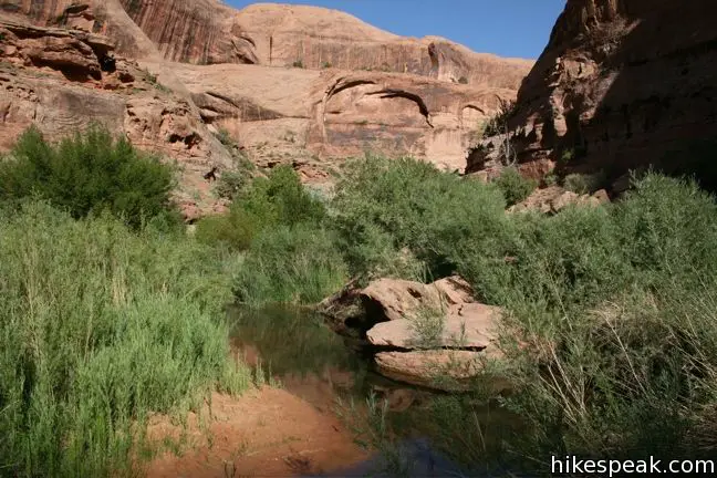
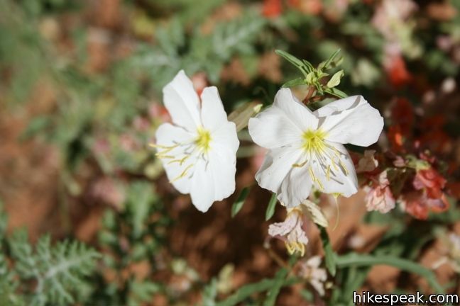
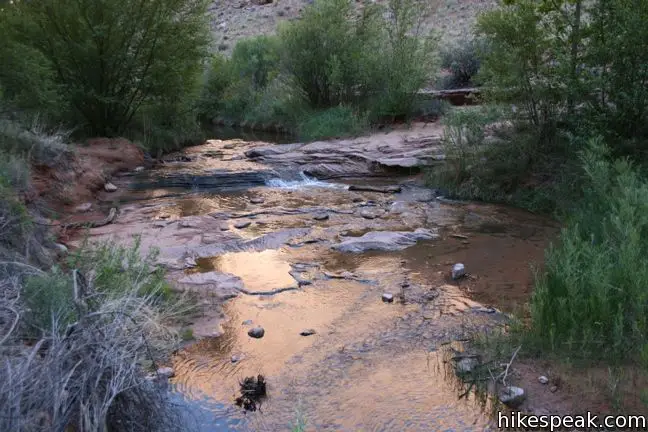
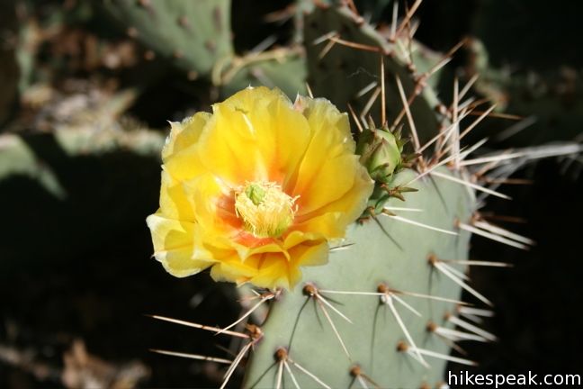
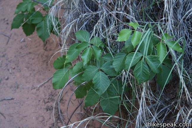
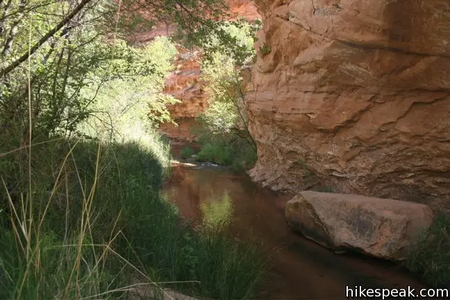
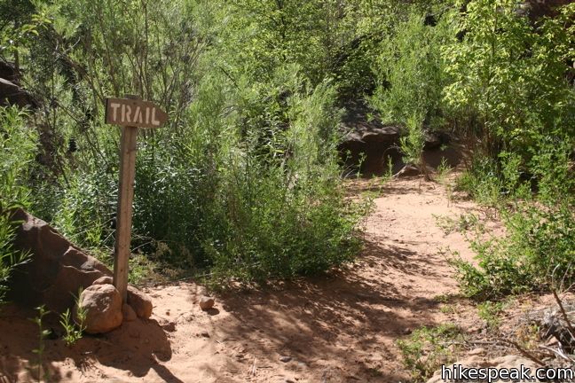
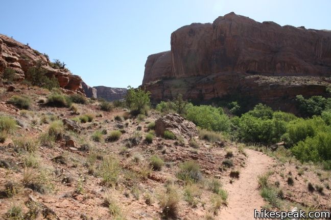
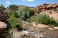
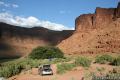
This single-track trail begins to the left of a year-round stream that produces plentiful plant life in Grandstaff Canyon, including poison ivy. Be on the lookout for those irritating leaves-of-three, especially if you venture off trail. The start of the hike is remarkably level allowing quick movement into this beautiful canyon. The steep walls of this north-south running trench provide good early morning and late afternoon shade.
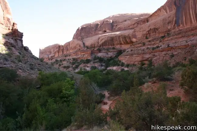
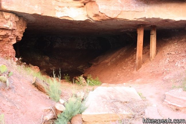
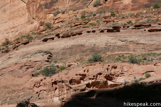
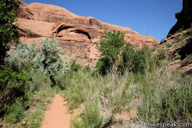
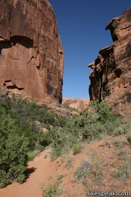
The trail widens 1/3 of a mile from the start, showing evidence that the canyon was previously open to 4X4 vehicles. An outcropping on the left side of the trail looks as though it may have once been inhabited or at least used for storage. Continue along the east bank of the shallow creek. the first noticeable elevation is gained around the half mile mark, as you ascend a short rise in the canyon floor. Enjoy the nice views up and down canyon, and continue toward Morning Glory Bridge.
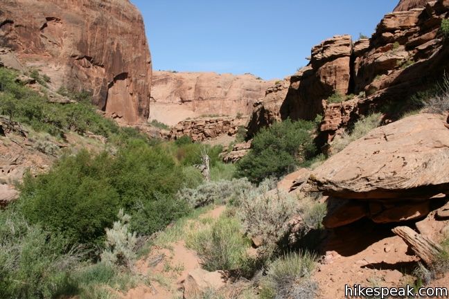
At 0.85 miles from the start, a path spurs off to the left, traveling a short distance into an indentation in the canyon wall. Green hanging gardens give the bump-out an alluring look, and this is a great place to test your echo (if you are interested in that sort of thing). Be on the look out for poison ivy if you trek this way.
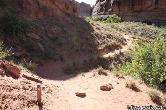
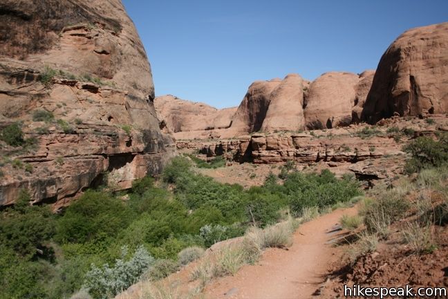
The main trail continues south into the canyon. A mile from the start, you will cross the shallow creek for the first time. Get used to rock hopping. There are nine more crossings to come. Signs mark the trails as it flip-flops back and forth across the creek. Nevertheless, determining the proper path is tricky at times. If you end up on a false trail, simply backtrack to the correct route and continue upstream.
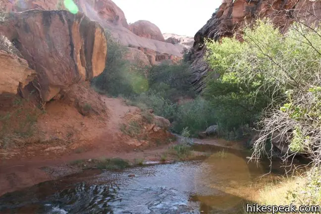
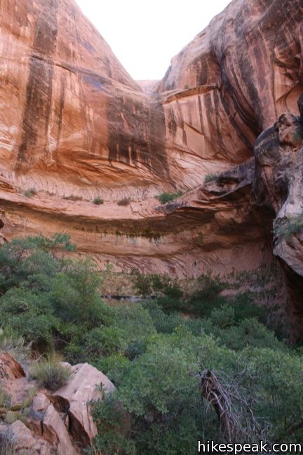
Halfway through the creek crossings, the canyon bends to the left, and a side canyon heads off to the right. This is not the side-canyon containing Morning Glory Bridge, so proceed up the main channel. After 1.85 miles, at a more prolific Y in Grandstaff Canyon (Negro Bill Canyon), cross the creek for a tenth and final time. The trail now embarks up the side canyon to the right, ascending the final 150 feet to Morning Glory Bridge.

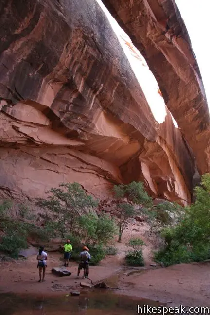
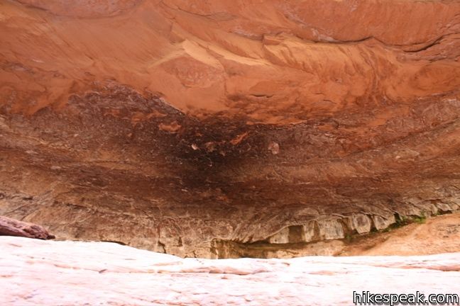
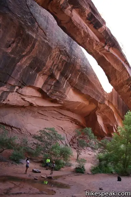
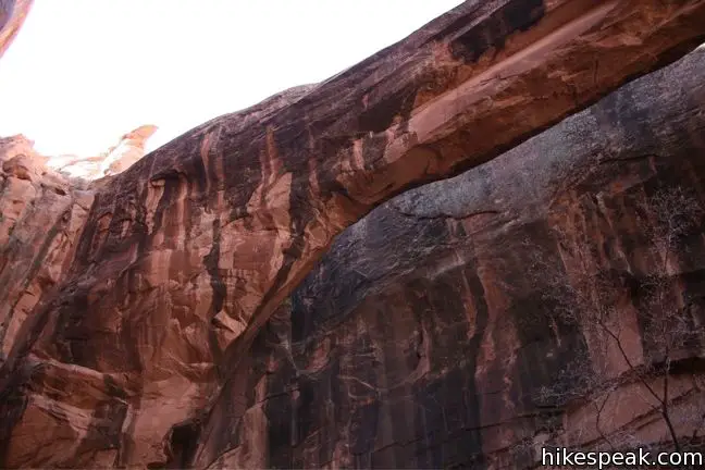
The natural bridge crosses the back of the canyon, narrowly separated from the rock wall behind it. This makes the landmark less prominent from a distance, but quite dramatic up close.
Morning Glory Bridge is sometimes called Morning Glory Arch by those who believe it to be an alcove arch rather than a natural bridge. That debate is for geologists and erosion enthusiasts, but no matter how you label the impressive span, it is one monumental sight.
Another curious feature lies just below the arch. A stream of water can be seen and heard flowing directly out of a fracture in the rock face. This adds to the magic of the spot. After taking a moment to relax beneath the sandstone bridge, return the way you can for a 4.65-mile round trip trek. Grandstaff Canyon (Negro Bill Canyon) is protected by the Bureau of Land Management, and no fee or permit is required to hike to Morning Glory Bridge.
Directions to the Trailhead
- From Highway 191 in the city of Moab, head east on Scenic Byway 128 along the Colorado River.
- After three miles, turn right into the marked parking lot for Grandstaff Trailhead.
- There is a bathroom and an information kiosk near the start of the trail.
Trailhead Location
Trailhead address: Utah Route 128, Moab, UT 84532
Trailhead coordinates: 38.6098, -109.5336 (38° 36′ 35.3″N 109° 32′ 01″W)
View Grandstaff Trail to Morning Glory Arch in a larger map
Or view a regional map of surrounding Utah trails and campgrounds.


 | Mill Creek This half-mile hike visits a swimming hole that offers refreshing escape from Utah's summer scorchers. |
 | More trails in Utah Explore other hikes in Zion, Canyonlands, and Arches National Parks. |
 | Landscape Arch in Arches National Park This level 2.5-mile hike visits the longest natural arch in the world along with two other enjoyable arches. |
 | Double Arch in Arches National Park This 0.8-mile hike visits a pair of connected arches in the Windows region of Arches National Park. |
 | Mesa Arch in Canyonlands National Park This 0.7-mile loop visits a picturesque arch spanning across the mesa's edge. |
 | Arch Rock in Joshua Tree This short hike leads to a natural arch in the granite formations by White Tank Campground. |
 | BLM Campgrounds There are 25 campgrounds operated by the Bureau of Land Management surrounding Moab, Utah outside Arches and Canyonlands National Park. |
Common Questions about Grandstaff Trail to Morning Glory Bridge in Moab, Utah
- Is the trail open?
- Yes. You should expect to find that Grandstaff Trail is open. There are no recent reports of trail closures. If you discover that the trail is closed, please help your fellow hikers by reporting a closure.
- Is this trail free to access?
- Yes, Grandstaff Trail is free to access. No entrance fee, pass, or permit is required. If you discover that access rules have changed, please provide feedback on your experience.
- How much time does this hike take?
- It takes approximately 2 hours 15 minutes to hike Grandstaff Trail. Individual hiking times vary. Add extra time for breaks and taking in the views.
- How long is this hike?
- The hike to Grandstaff Trail is a 4.65 mile out and back with 300 feet of elevation change.
- Are dogs allowed on this trail?
- Yes, dogs are allowed on Grandstaff Trail. The trail is open to hikers, dogs.
- Where is the trailhead located?
- The trailhead for Grandstaff Trail is located in Moab, Utah.
Trailhead Address:
Utah Route 128
Moab, Utah 84532
Trailhead Coordinates:
38.6098, -109.5336 - What are the driving directions to the start of the hike?
To get to the trailhead: From Highway 191 in the city of Moab, head east on Scenic Byway 128 along the Colorado River. After three miles, turn right into the marked parking lot for Grandstaff Trailhead. There is a bathroom and an information kiosk near the start of the trail.
View custom Google Maps directions from your current location.
- Are there other trails near Grandstaff Trail?
- Yes, you can find other nearby hikes using the Hikespeak Hike Finder Map.

[…] it’s a fairly easy guide, Hikespeak has wonderfully detailed instructions to guide you along the […]
[…] activities we did. I started the morning off with an hour long trail run at Negro Bill Canyon, which was incredibly gorgeous, and shaded. When its already 90 degrees at 8 in the morning, shade […]
Nice blog post! I was looking around at others blogs about this hike right after I posted mine, and came across yours. Looks like you went when it was nice and green! We went yesterday and it was overcast and the trail still had quite a bit of snow. -Alicia @ http://www.girlonahike.com
Can we camp back in the by the Arch or at any point along the trail?
I would wonder the same thing!
No, there are signs forbidding camping. There are campsites along the road nearby
[…] after lunch we headed to Negro Bill Canyon Trail. See my post from yesterday about the story of how we found out about this trail. Well by now […]
The first time I did this trail, in 2009, the sand was too hot for my dog’s paws so I waded the creek instead. The canyon and trail were still called Negro Bill, which I thought was an odd name for a BLM-managed trail. I did this trail again at 7am a few days ago to avoid the hot sun as I was with my two dogs, who appreciated the creek nearby. It hasn’t changed much since my first hike, although there are more trail markers. I also wore my Keen sandals to make fording the creek easier, although there are stones to hop on for those with hiking boots on. The trail and canyon were renamed the William Granstaff trail and canyon and new signs at the trailhead reflect the change. This is definitely a must-do hike while in Moab and I highly recommend staring this hike early as parking is limited!
can you take a bicycle down the trail
[…] Morning Glory Bridge: This is one of my favorite hikes, I even mentioned it in my last post. Morning Glory Bridge is an easy hike with some river crossing. It’s great in the summer because it is mostly shaded. Be warned, your dog will come back happy and muddy from this hike, so be sure to bring along some towels for the drive back. […]
Hi! I’m headed to Moab tomorrow and have this trail on my list for the weekend and was wondering if there is a lot of snow on the trail?
Thanks!
Negro Bill canyon name has been changed to “Grandstaff canyon trail”
This was one of my favorite hikes while staying in Moab for 3 months. I hiked this beautiful trail on multiple occasions from the end of March through the end of June. I always discovered something new and saw the flowers bloom and foliage change. Bottling up some spring water at the end of the trail is an added bonus. You do walk through the creek multiple times, so having my hiking in my keens was perfect. The next time I visit, this will be my first hike.
Can someone tell me if the water that runs through there is safe for dogs to drink??
I drank a cup from the the spring today. I will let you know how I feel tomorrow. LOL
Are you allowed to fish along this trail as long as you have your license?
[…] hike’s destination is the Morning Glory Natural Bridge which is the sixth longest natural bridge in the U.S. On this trail you will find a mix of […]
[…] Hikespeak – Morning Glory Bridge. Detailed trail description, photos, GPS map, and directions from experienced hiking guide […]