Monument Geyser Basin
in Yellowstone National Park
Monument Geyser Basin is an active hydrothermal area that most visitors to Yellowstone National Park won’t get to see. That’s because most visitors won’t pursue the 2.8-mile round trip hike required to reach the basin. There is 700 feet of elevation gain standing in the way, as the trail climbs a pine-covered mountainside with views of Mount Holmes and a snaking section of the Gibbon River. Unlike more notable geyser basins in the park, no boardwalk restricting where visitors are allowed to walk at Monument Geyser Basin. This gives hikers the freedom to carefully explore the steam vents and pools as they wish.
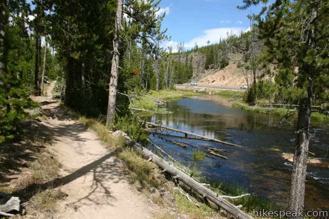
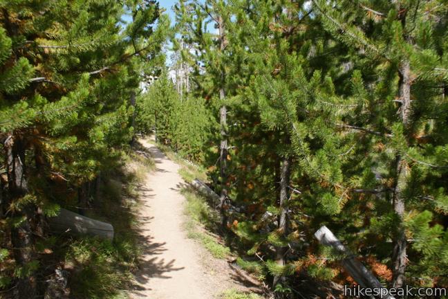
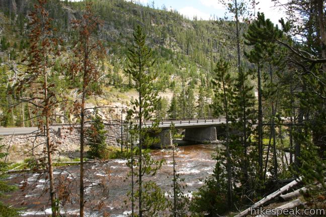
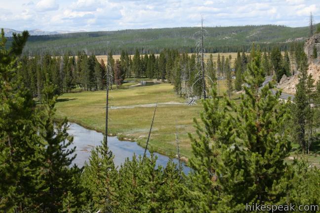
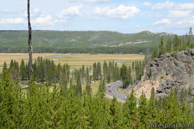
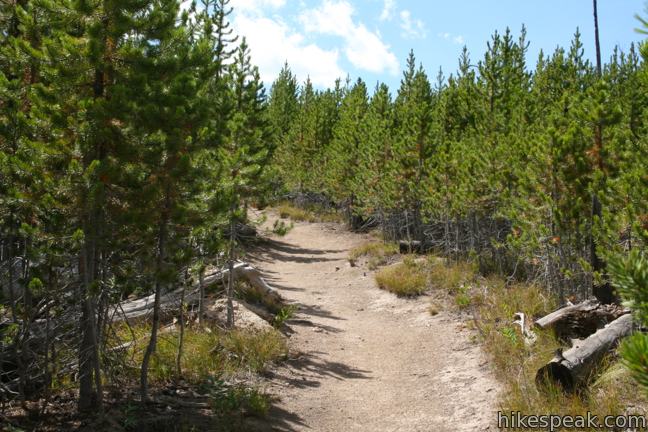
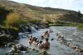
The trail is level at the start, allowing you to warm up for the upcoming ascent. For almost half a mile, the trail travels beneath a canopy of pines along the west bank of the Gibbon River. Grand Loop Road (the route to the trailhead) follows the east bank, and is the only manmade intrusion in sight.
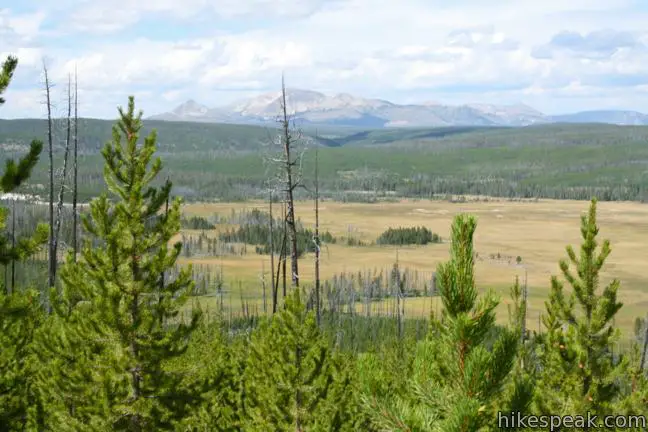
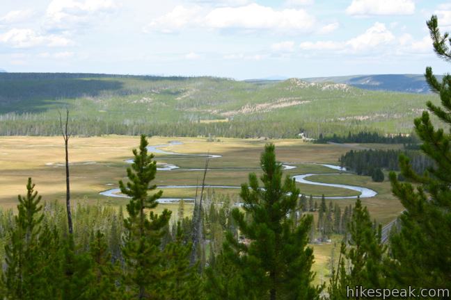
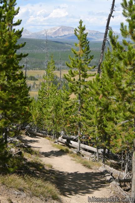
After heading north up a relatively straight stretch of the river, the trail turns west and shoots uphill, climbing 650 feet over the next 0.8 miles to reach Monument Geyser Basin. The steep dirt track passes through a forest of shorter pines that are regrowing from a past wildfire. The young lodgepoles allow over-the shoulder views of the Gibbon River as it weaves through a meadow to the north, looking quite like a snake. Norris Geyser Basin is partially visible in the forest farther north, and Mount Holmes rises to the northwest. This gives you plenty to look at whenever you stop to catch your breath.
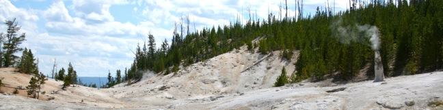
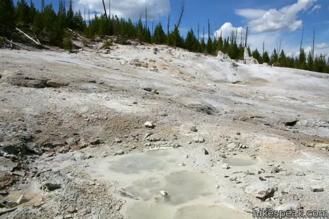
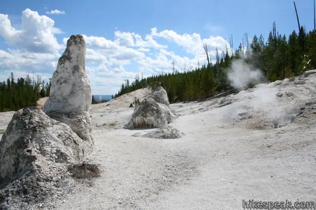
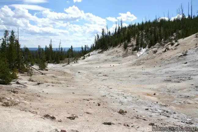
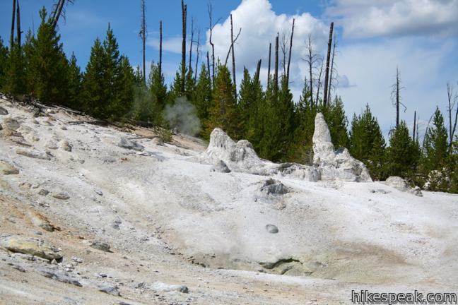
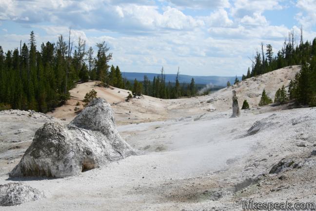
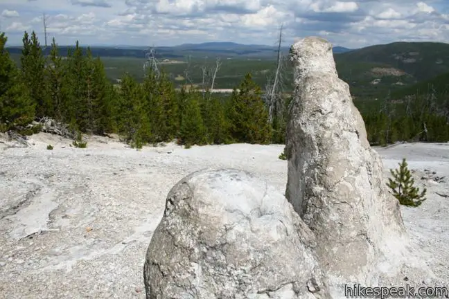
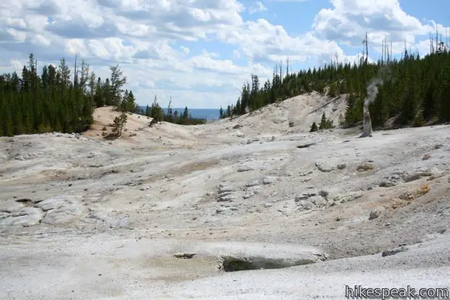
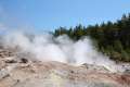
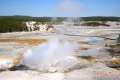
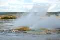
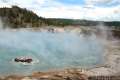
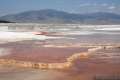
About a tenth of a mile before Monument Geyser Basin, the trail tapers out and offers a new view to the south down a rocky trench toward a lower (and less wavy) section of the Gibbon River. Soon after, the forest parts and you will find yourself standing on bleached rocks with steam gushing out of the ground in front of you. You have arrived at Monument Geyser Basin.
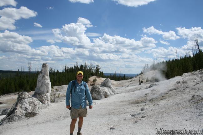
See anyone else? There’s a good chance you will have to place to yourself, and the surprising privacy adds to the enjoyment as you explore this bewildering landscape.
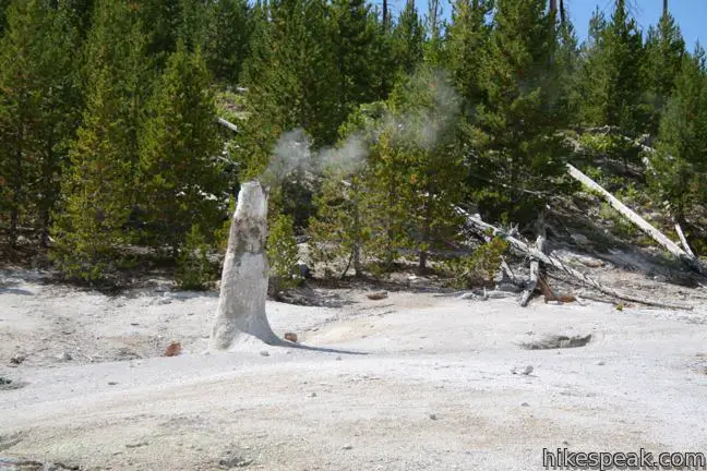
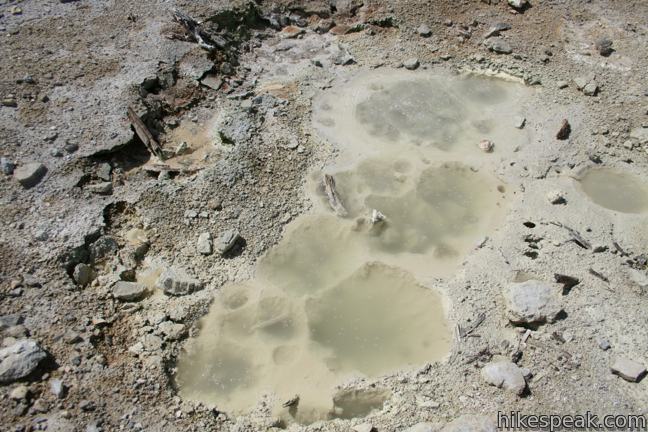
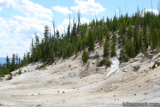
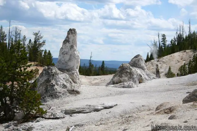
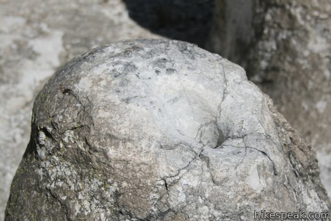
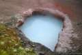
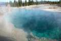
Steam rises from scattered vents in the ground. The white billows fluctuate in intensity, and one could imagine a dragon’s lair within the mountainside. Clusters of dormant geyser cones are dispersed along the pale ground, and some chimneys are still churning out steam. Water bubbles up in shallow pools and flows down the mountainside. Parts of the basin are welcoming, while other parts are foreboding. Your safety is your responsibility. Avoid thin crusts, which you could fall though and get burned, and stay away from other fragile features that you could damage. By being a respectful visitor, you can safely explore Monument Geyser Basin and get up close to a lot of interesting features.
Monument Geyser Basin does not have mesmerizing colorful pools, but the destination stands out because it allows hikers to escape the crowds and have a more intimate interaction with a hydrothermal attraction. Return the way you came. It is downhill all the way! Yellowstone National Park has an entrance fee, but no permit is required to hike to Monument Geyser Basin. The nearby Artists’ Paintpots are another fun hydrothermal area to visit, with spitting mudpots and milky blue pools.
Directions to the Trailhead
- Drive 4.7 miles southwest of Norris Canyon Road on Grand Loop Road (Route 89).
- Just after a bridge over the Gibbon River, turn right into a turnout for the trail to Monument Geyser Basin.
- Coming from the other direction, the trail is 8.6 miles northeast of Madison Junction.
Trailhead Location
Trailhead address: Grand Loop Road (Route 89), Yellowstone National Park, WY 82190
Trailhead coordinates: 44.683667, -110.744519 (44° 41′ 01.20″N 110° 44′ 40.26″W)
View Yellowstone National Park in a larger map
Or view a regional map of surrounding Wyoming trails and campgrounds.


 | Artists' Paintpots This 1.1-mile hike circles a hillside hydrothermal area, passing bursting mudpots, bubbling hot springs, and mesmerizing milky blue pools. |
 | Back Basin of Norris Geyser Basin This loop passes Steamboat Spring, the world's largest geyser, and several other hydrothermal features. |
 | Porcelain Basin of Norris Geyser Basin This pair of loops explores a stark basin with an impressive collection of geysers and hot springs. |
 | Fountain Paint Pot This half-mile loop in Lower Geyser Basin passes geysers, hot springs, mudpots, and fumaroles - all of the hydrothermal features found in Yellowstone. |
 | Midway Geyser Basin This 0.8 mile walkway passes Excelsior Geyser and Grand Prismatic Spring, the largest hot springs in Yellowstone. |
 | Biscuit Basin Loop This 2/3 of a mile loop explores hydrothermal features in Upper Geyser Basin like Black Opal Pool, Sapphire Pool, and Black Pearl Geyser. |
 | Mammoth Hot Springs This series of boardwalks explores a park highlight, a collection of colorful hot springs terraces. |
 | Boiling River This 1.25-mile round trip hike follows a riverbank to a natural hot tub where a stream of water cooked by nearby hydrothermal features mixes with the river. |
 | Wraith Falls This easy 0.8-mile round trip hike climbs 100 feet to a ghostly 100-foot cascade. |
 | More trails in Yellowstone Explore other hikes to waterfalls and hydrothermal hot spots in Yellowstone National Park. |
 | Yellowstone National Park Campgrounds Twelve developed campgrounds with over 2,000 total sites are spread throughout Yellowstone. |
Common Questions about Monument Geyser Basin in Yellowstone National Park
- Is the trail open?
- Yes. You should expect to find that Monument Geyser Basin Trail is open. There are no recent reports of trail closures. If you discover that the trail is closed, please help your fellow hikers by reporting a closure.
- Do I need a permit for this hike?
- Yes. National Park Entrance Fee.
- How much time does this hike take?
- It takes approximately 1 hour 30 minutes to hike Monument Geyser Basin Trail. Individual hiking times vary. Add extra time for breaks and taking in the views.
- How long is this hike?
- The hike to Monument Geyser Basin Trail is a 2.8 mile out and back with 700 feet of elevation change.
- Are dogs allowed on this trail?
- No, dogs are likely not allowed on Monument Geyser Basin Trail. The trail is primarily open to hikers.
- Where is the trailhead located?
- The trailhead for Monument Geyser Basin Trail is located in Yellowstone National Park, Wyoming.
Trailhead Address:
Grand Loop Road
Yellowstone National Park, Wyoming 82190
Trailhead Coordinates:
44.683667, -110.744519 - What are the driving directions to the start of the hike?
To get to the trailhead: Drive 4.7 miles southwest of Norris Canyon Road on Grand Loop Road (Route 89). Just after a bridge over the Gibbon River, turn right into a turnout for the trail to Monument Geyser Basin. Coming from the other direction, the trail is 8.6 miles northeast of Madison Junction.
View custom Google Maps directions from your current location.
- Are there other trails near Monument Geyser Basin Trail?
- Yes, you can find other nearby hikes using the Hikespeak Hike Finder Map.

Encouraging hikers to get close and look at steam vents is not a good idea. The park fences the thermal areas to protect the public as well as the thermal features. The ground can be very unstable and may crack underneath a footstep, subjecting the hiker to a steam burn.
Strenuous but beautiful hike.