Clear Lake Loop
in Willamette National Forest
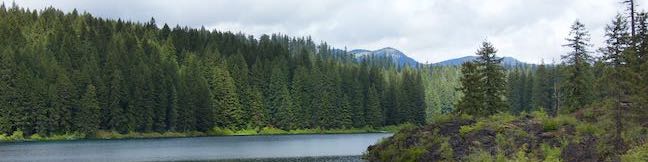
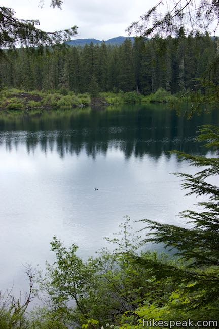
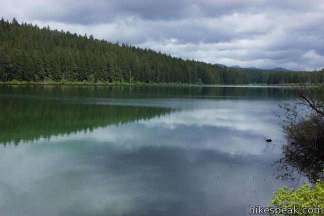
The pristine Cascadian jewel called Clear Lake, was forged in the fires of a volcanic eruption, 3,000 years ago. The lave flow that dammed the lake still occupies stretches of the shoreline. A loop trail around Clear Lake weaves through resilient old growth forests and fields of volcanic rock, offering beautiful lake views around almost every turn. The 5-mile loop hike combines Clear Lake Trail with McKenzie River Trail and has 75 feet of rolling elevation change.
It is possible to start Clear Lake Loop from a couple different places. Those staying at Coldwater Cove Campground, on the east side of the lake, will find it simpler to set out from an adjacent trailhead at the end of Forest Route 770. The easiest trailhead for day hikers to reach is Clear Lake Resort and Picnic Area, on the west side of the lake just off McKenzie Highway. The directions offered here begin from Clear Lake Resort and go through the loop in a counterclockwise direction.
The basic directions for Clear Lake Loop are:
- Hike south from Clear Lake Resort on Clear Lake Trail (0 miles)
- Cross a bridge over McKenzie River at the outlet of the lake (1 mile)
- Turn left onto McKenzie River Trail (1.1 miles)
- Enter the lava field on the east side of the lake (1.5 miles)
- Pass the Coldwater Cove Boat Ramp and trailhead (1.7 miles)
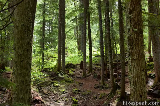
- Transition from lava field to old-growth forest (2.6 miles)
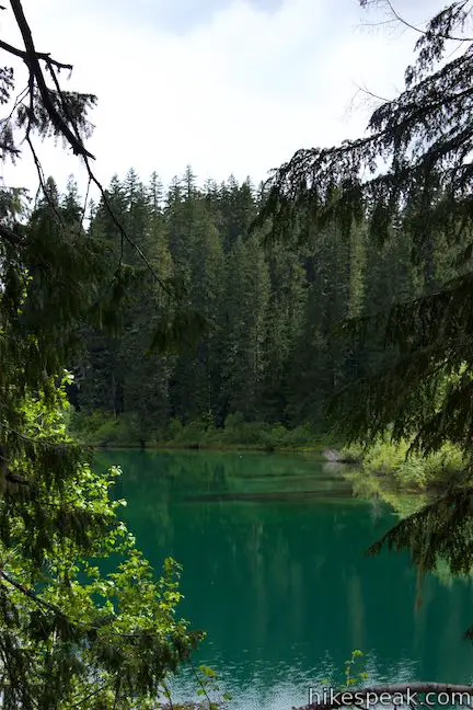
- Pass Great Spring, headwaters of the McKenzie River (2.9 miles)
- Cross a bridge over Fish Lake Creek and turn left onto Clear Lake Trail (3.4 miles)
- Turn left at the end of Clear Lake Trail and walk back through the resort (4.8 miles)
- Return to the trailhead by the picnic pavilion to complete the loop (5 miles)
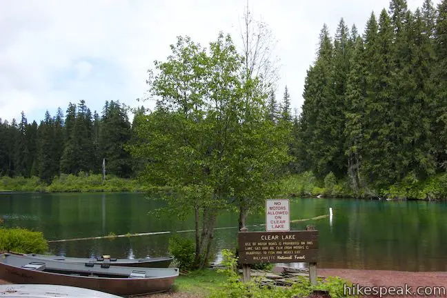
Algae warning: Willamette National Forest cautions against swimming, or allowing dogs to swim, in Clear Lake. Drinking the water presents health risks due to toxic blooms of blue-green algae. If swallowed, toxic algae can cause cramps, diarrhea, dizziness, fainting, nausea, numbness, and paralysis. Dogs can even die from swallowing toxic algae. Stay out of the water (and keep pets away) when algae blooms take place.
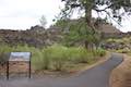
Numbered markers along the northeast side of the trail correspond with a trail guide that enriches the experience of the hike. The trail guide also provides a good primer on the history of Clear Lake, explaining how the tranquil waters are contrasted by a violent origin story:
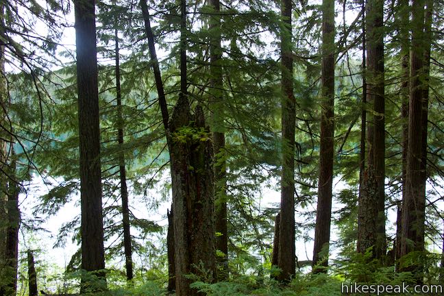
As you hike along the Clear Lake Trail, you’ll discover a diverse landscape. This landscape, though, is very different from what it was 3,000 years ago. At that time, there was no lake here, only a densely forested drainage dissected by a rumbling white-water river. About 1,000 B.C., Sand Mountain erupted. Lava flowed out toward the McKenzie River and burned the forest as it moved. When the lava reached the river and struck the cold water, it stopped. The McKenzie quickly backed up behind the wall of lava, and Clear Lake was formed. The forest that had lined the riverbank was submerged under 120 feet of water. Remnants of these trees still stand today, incredibly preserved in the depths of the near-freezing lake.
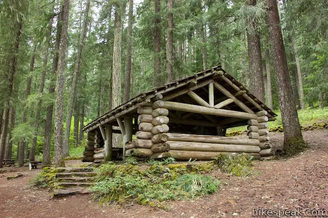
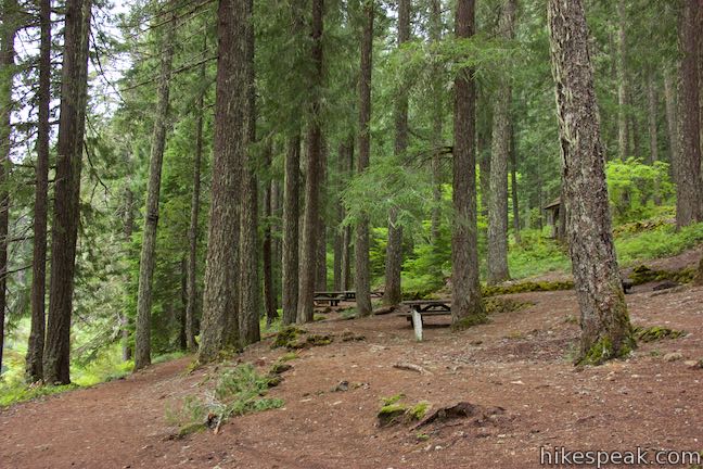
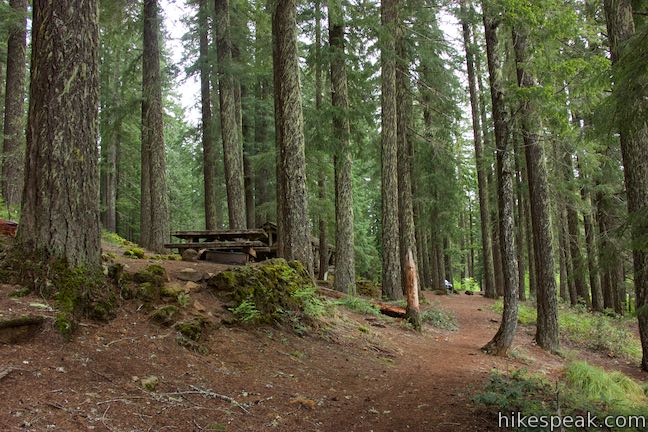
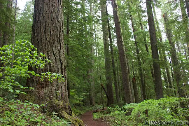
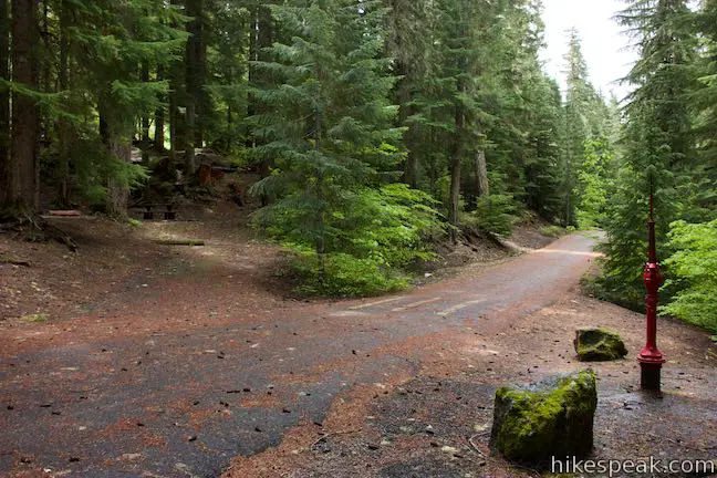
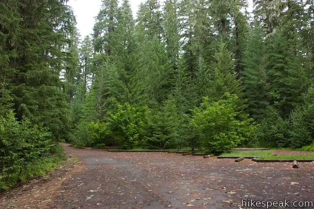
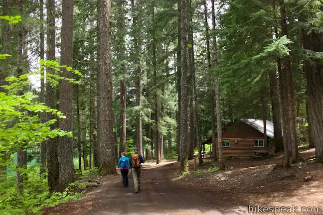
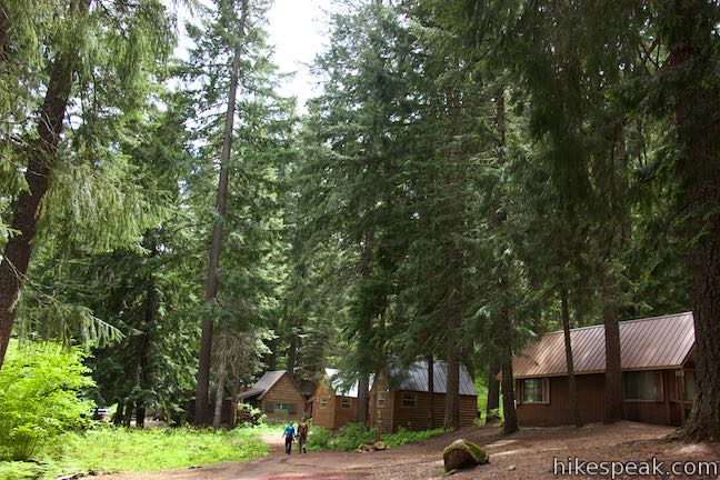
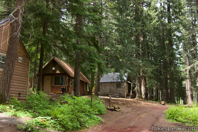
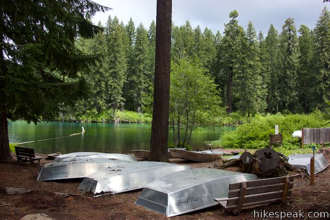
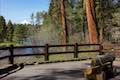
Start from the picnic area on the south side of Clear Lake Resort, beside a log cabin-style picnic shelter that was built in 1937 by the Civilian Conservation Corps, an endeavor that helped lift America out of the great Depression and created lasting enhancements to the nation’s parks. A few picnic tables are spread out in the forest near the shelter.
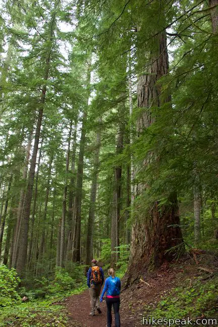
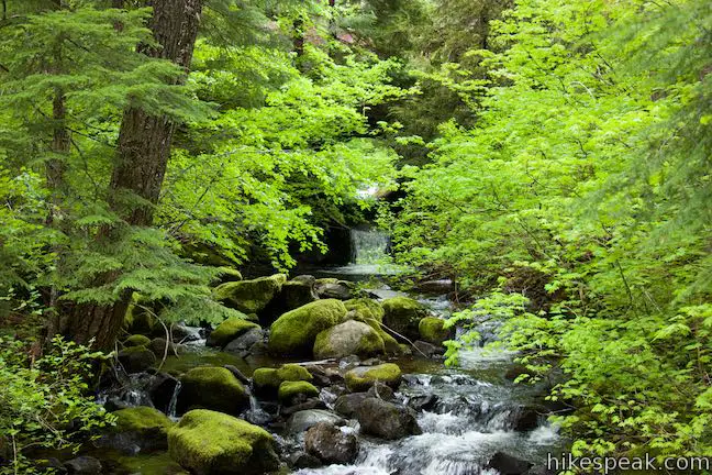
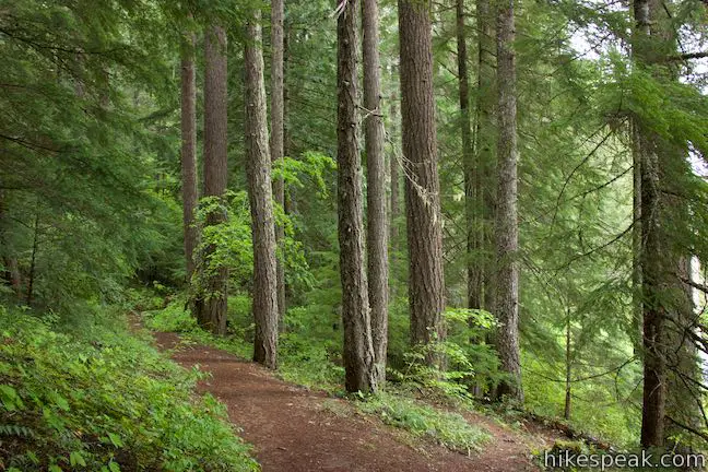
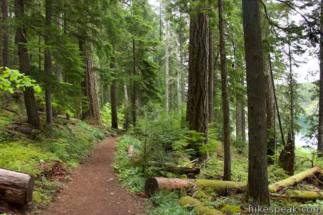
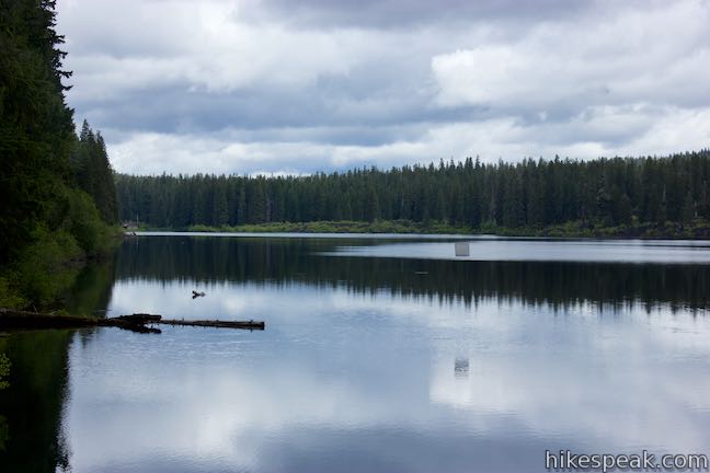
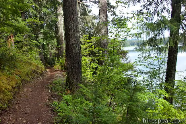
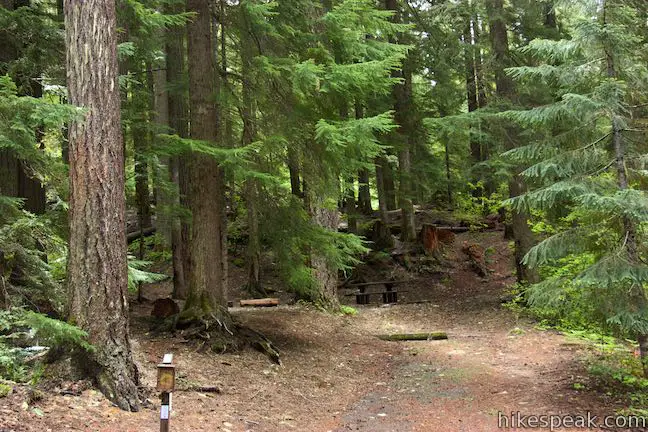
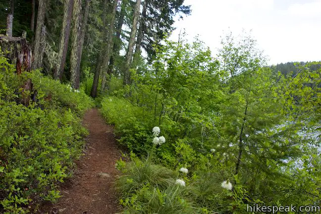
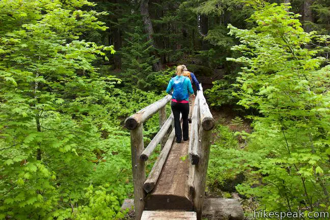
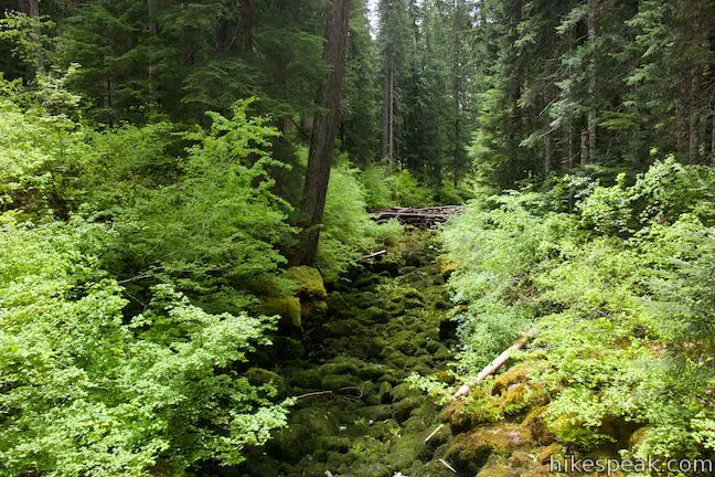
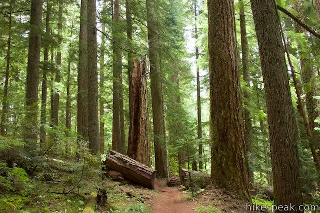
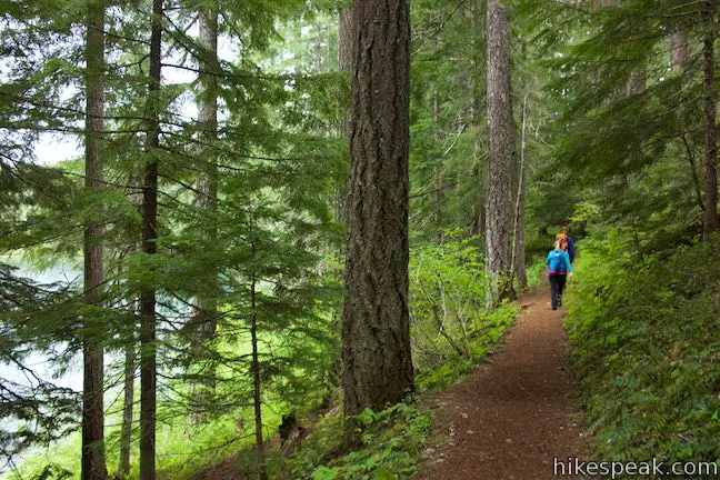
Set out on a trail just below the shelter, hiking south across a wooded bank just above Clear Lake. The fairly level trail passes through lots of greenery. Big, tall cedars rise above the rest of the forest. Bunchberry fill the forest floor, flashing flowers similar to those on dogwood trees each spring.
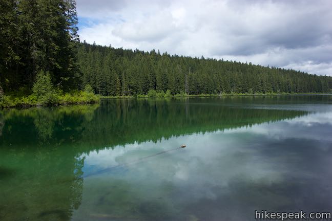
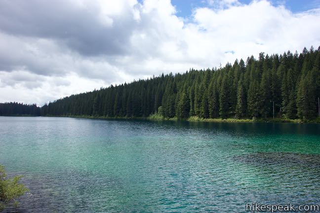
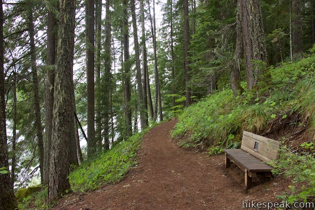
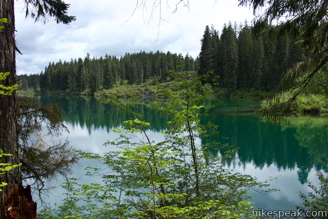
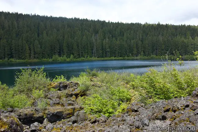
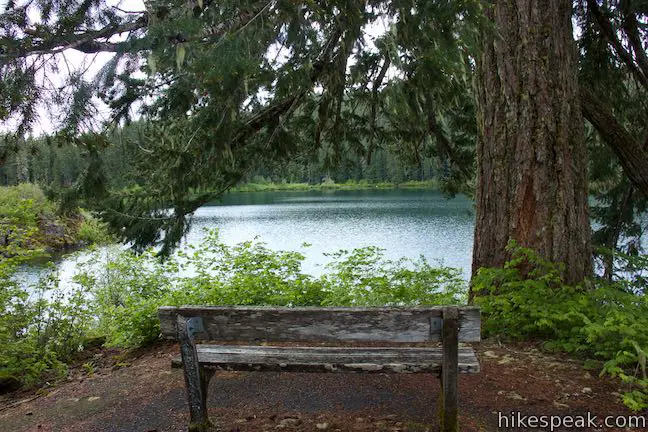
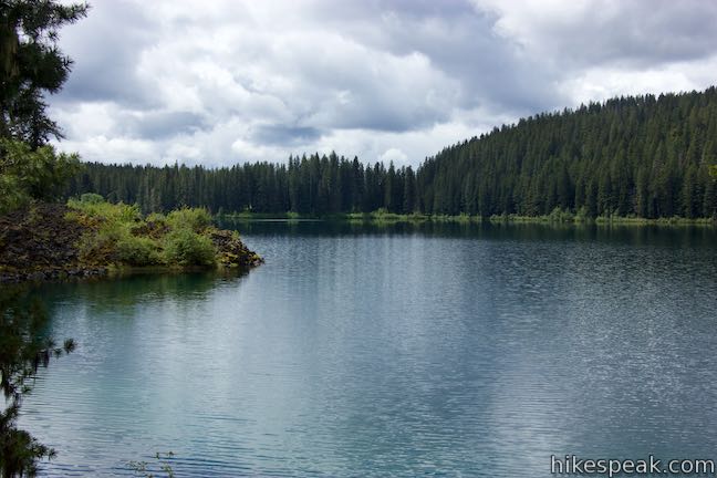
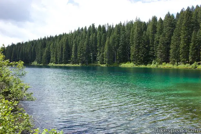
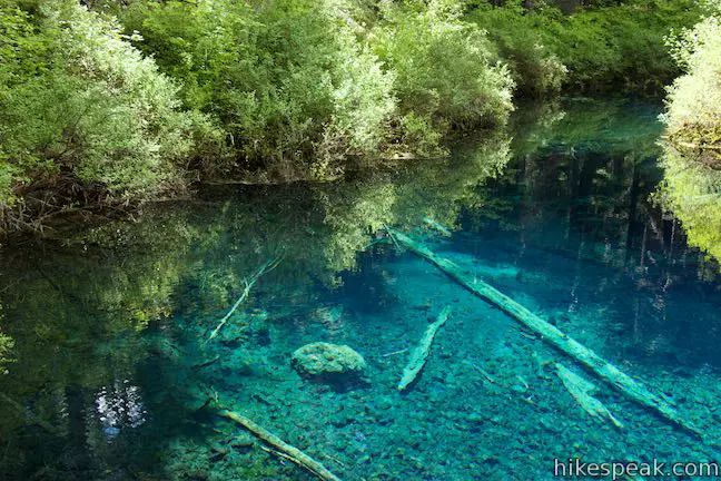
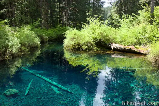
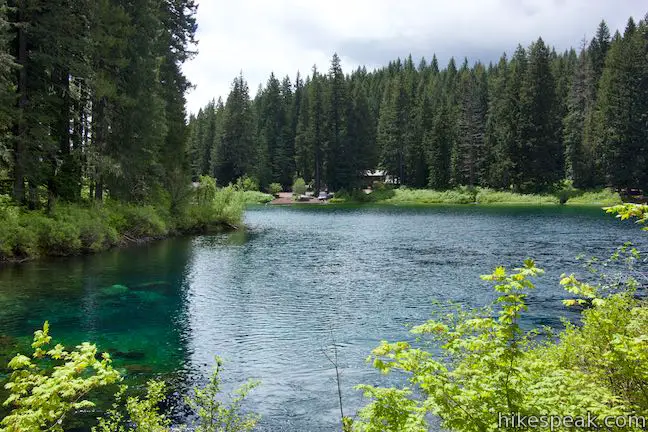
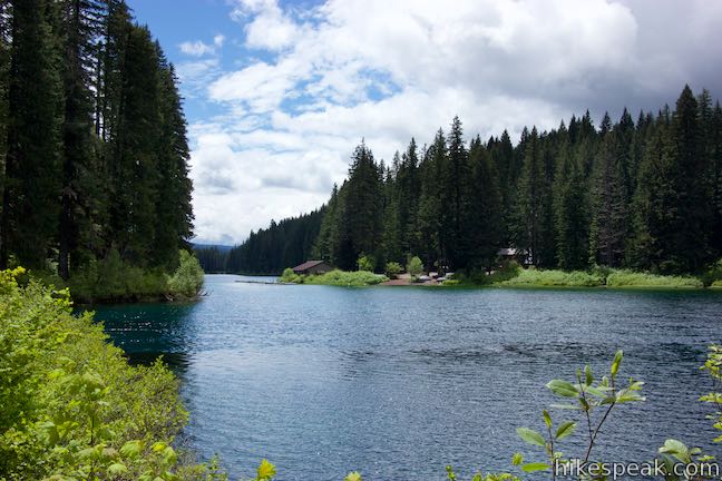
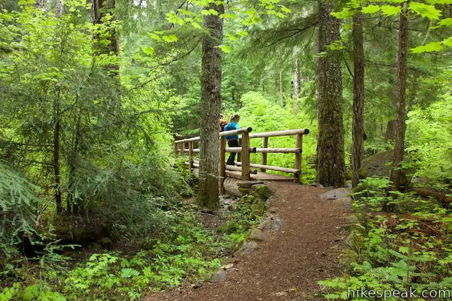
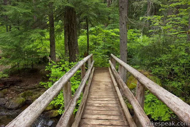
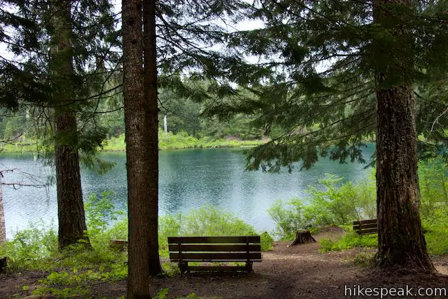
Benches throughout the loop provide shaded places to rest and look out over the lake and its surroundings. Cross a wooden footbridge over a tumbling stream (that isn’t McKenzie River) before coming to a larger bridge at the 1-mile mark. Pass another bench and swing left across this bridge spanning McKenzie River at the outlet of Clear Lake. The water below offers strikingly visibility and may have a mesmerizing blue-green color thanks to the algae.
Return to forest on the other side of the bridge and make your way to a nearby junction with McKenzie River Trail. This long regional trail, with the more formal name McKenzie River National Scenic Trail, can be used to explore even more of the area. To continue Clear Lake Loop, bear left on McKenzie River Trail and make your way north up the east side of the lake.
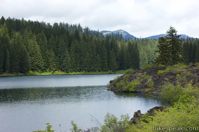
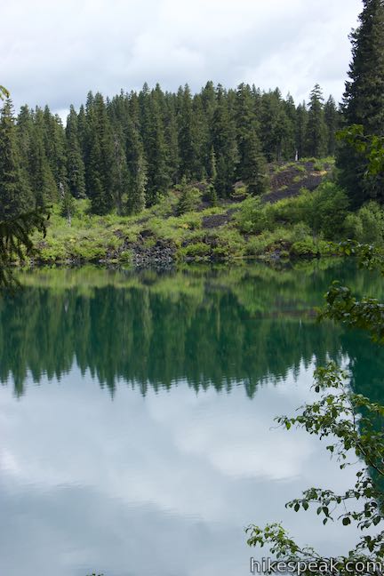
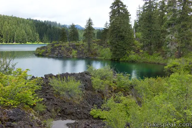
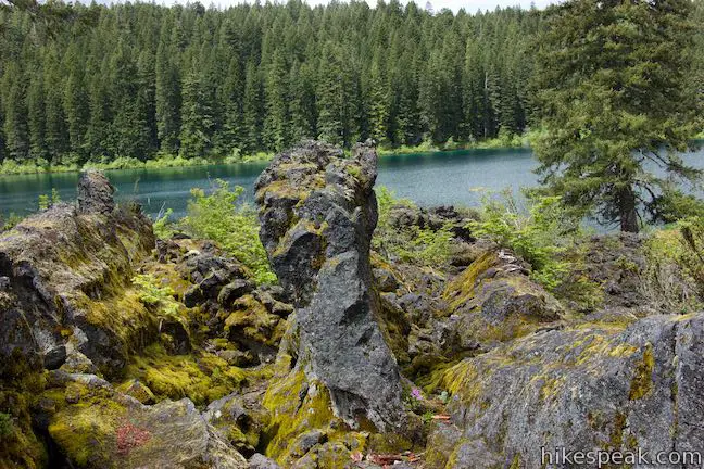
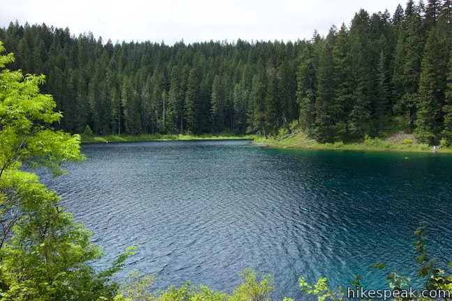
McKenzie River Trail weaves through trees and rocky formations near the edge of the lake. The trail wraps around a cove at the southeast corner of Clear Lake, where you’ll find nice views across the water toward the western shore (that you crossed through to start the hike). At the back of the cove, the trail passes just below a guardrail on NF 770, the seasonal road to Coldwater Cover Campground, which is beside the trail in another 0.2 miles.
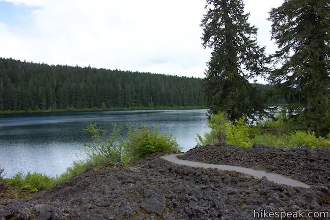
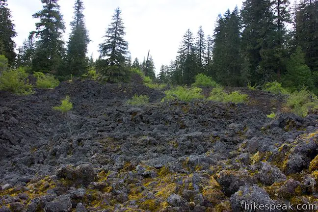
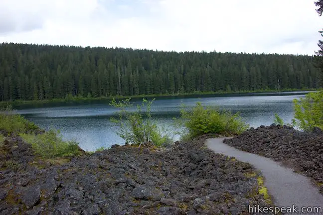
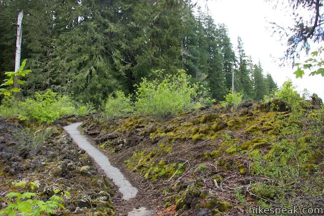
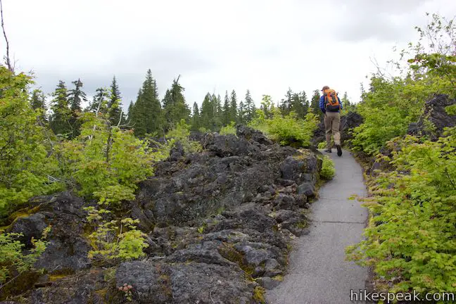
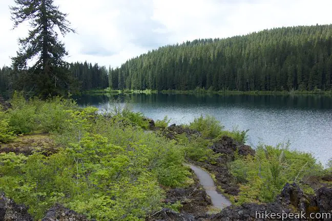
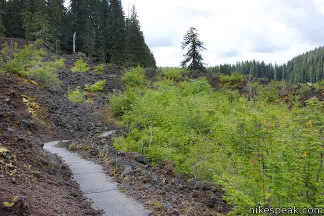
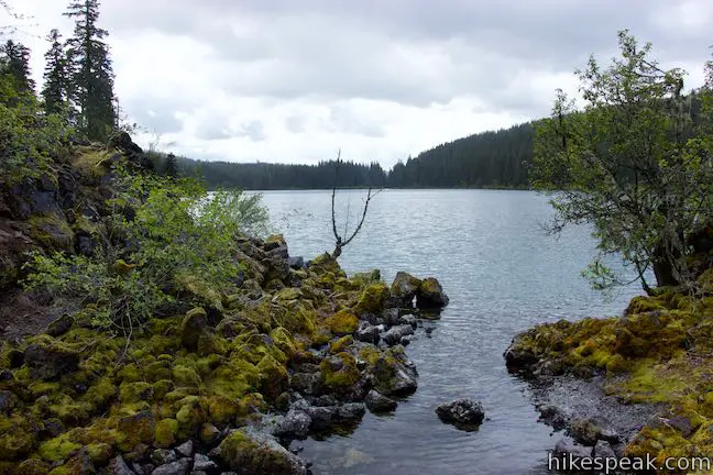
Ease up the shore past well-placed benches with lake views that should cause you to stop and linger at several points. A few footpaths will join the trail, coming down from some of Coldwater Cove Campground’s 34 sites. The trail transitions from dirt to pavement as your surroundings radically transform from forest to ‘a‘a lava field, 1.5 miles from the start of the hike.
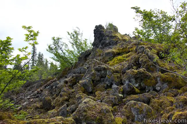
Your hiking boots will appreciate that this stretch of McKenzie River Trail is paved as it weaves through mounds of rough volcanic boulders. This misshapen landscape is far different from the forest over the start of the hike. Dark volcanic rock slopes past the trail and right down to the edge of the lake. Moss, lichens, and plants grow in patches of this tough landscape, along a few determined trees.
After a tenth of a mile, the trail leaves the lava field and returns to forest. The trail remains paved as it approaches the Coldwater Cove Trailhead, where a parking area is joined by a boat ramp and a fish cleaning station (motorized boats are not allowed on Clear Lake). Leaving this east side trailhead, McKenzie River Trail is unpaved again, passing numbered markers for the trail guide. The first entry explains why Clear Lake is so transparent:
The reason it is so clear is the frigid temperature, which hovers just above freezing all year long. Not many organisms can survive in such cold water, so it is low in organic nutrients that could make it cloudy.
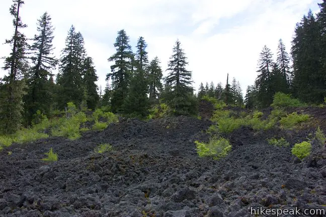
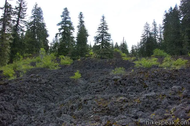
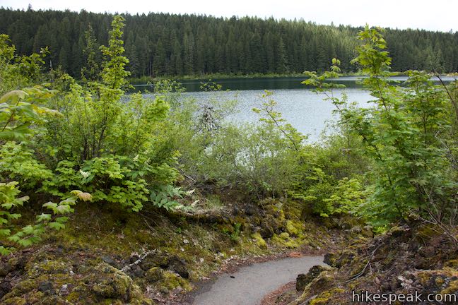
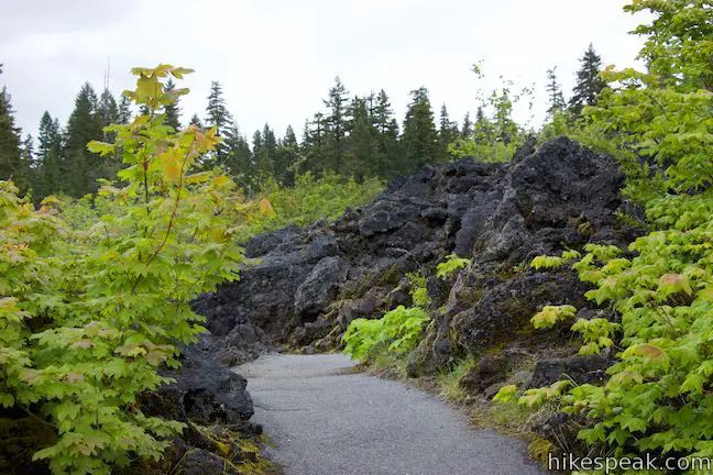
Enjoy a walk through forest for another tenth of a mile, until the lava flow cuts through the trees again (and the trail surface becomes paved). This area of the lava field is larger than the first, with bigger ridges of volcanic rock that force the trail to take on a more wandering path. The lava field extends out to points on the shore of the lake.

The fourth entry in the trail guide describes an animal that enjoys living on the old lava flow:
Stop and listen for a moment. Can you hear high-pitched squeaking that seems to be coming right out of the lave? It is the voice of a relative of rabbits known as the pika. Pikas live in rocky fields where there are many holes and caverns that allow them to move around safely. This highly porous lava fields is an ideal home.
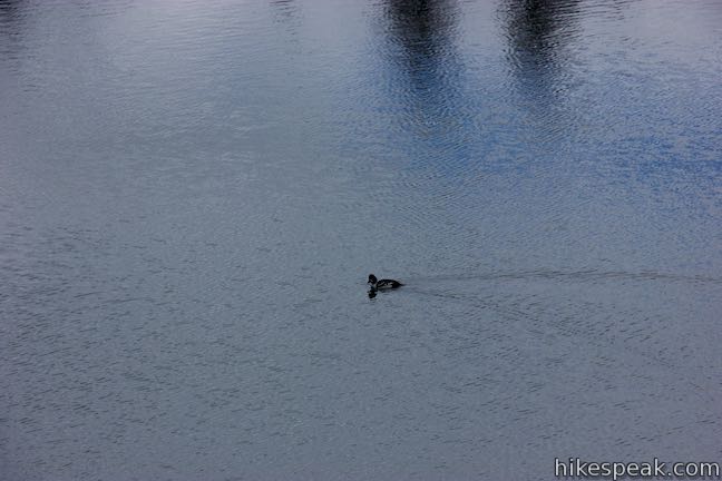
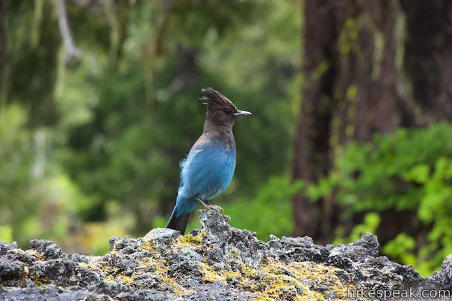
Addition entries in the guide explain that ospreys, bald eagles, bats, and tree swallows also enjoy the Clear Lake Area. Look for nests in the isolated trees within the lava field, or watch osprey flying over the lake to fish. Tree swallows are the swift, smaller birds that you might see swooping across the lake to feed on insects.
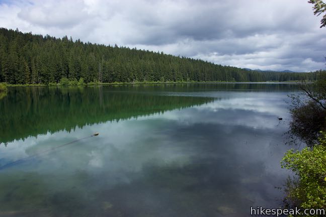
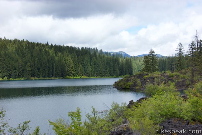
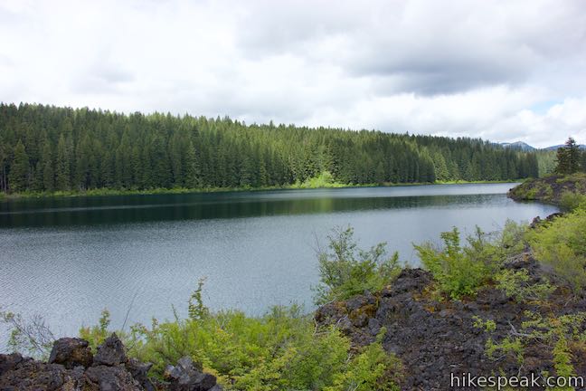
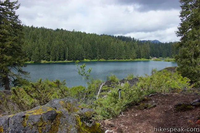
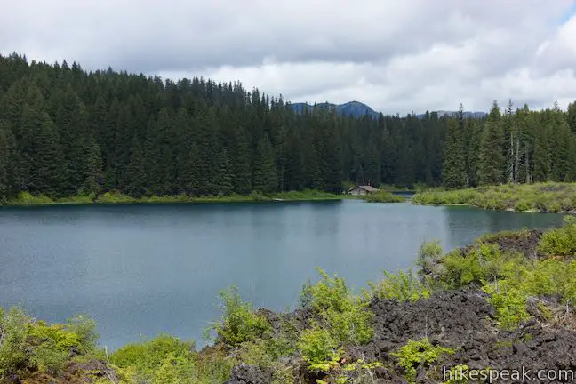
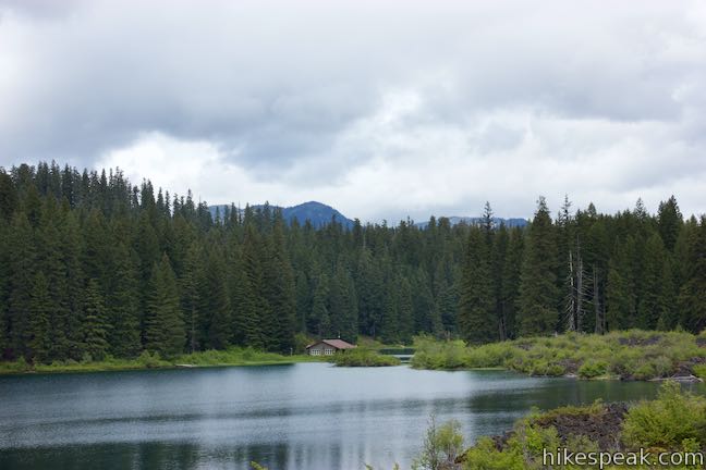
After walking across the lava field for nearly half a mile, the stark landscape is again broken up by forest. Enjoy some time in the shade before the trail returns to lava for a third and final time, taking an impressive route along the shore below masses of volcanic rock. Clear Lake bottlenecks in the area in front of you and the trailhead is just a short distance across the lake, as the swallow flies. The boathouse for Clear Lake Resort sits on the opposite shore too. Although you’ve hiked around most of Clear Lake, that distance is deceptively because the hike is only half over. The north end of Clear Lake has a few fingers that will take you another 2.5 miles to walk around.
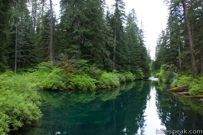
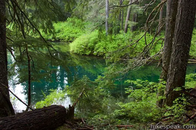
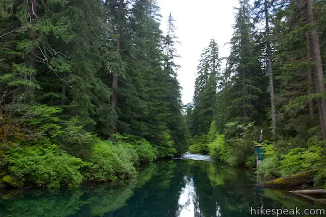
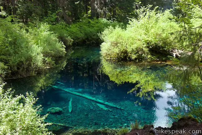
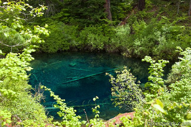
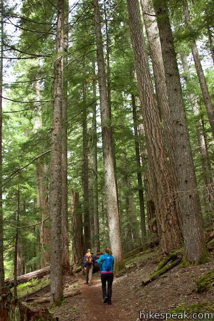
Say so long to the lava field and slip back into the trees. The old-growth forest over the next quarter mile may be the nicest of the entire loop. Enjoy bountiful shade in this ferny forest. The trail travel up the north side of the lake and curves around an awesome spot called the Great Spring.
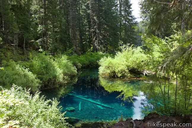
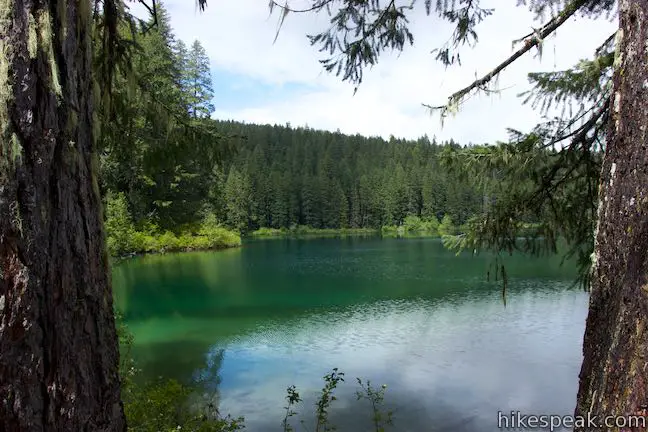
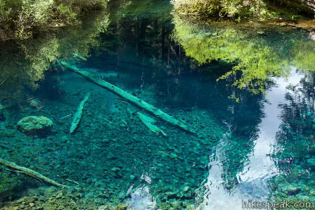
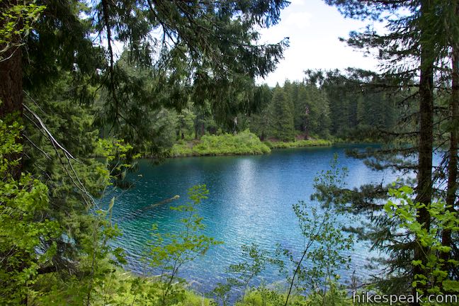
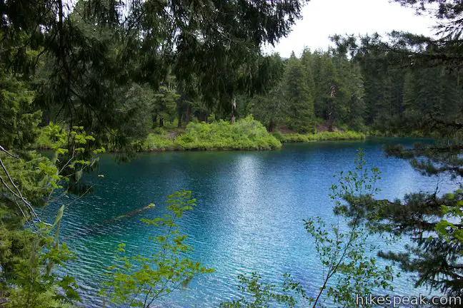
The pool beside the trail is emerald blue, but transparent enough for the bottom to be perfectly visible. The spring has a magical feel. The trail guide details how Great Spring, which is the source of the McKenzie River, gets its color from silica:
The turquoise-blue color of the pool is caused by the remains of many generations of fresh-water plants called diatoms. Diatoms are mostly made of white silica, which covers the bottom of the spring. The brilliant color comes from the light reflecting off the silica layer and back through the water.
A few feet below the trail, you’ll find water flowing right out of the ground from several sources that fill the pool at Great Spring, pushing water out the other side to start the McKenzie River. Water from the spring maintains a constant temperature in the high thirties (Fahrenheit), which keeps Clear Lake cold, but prevents the lake from freezing.

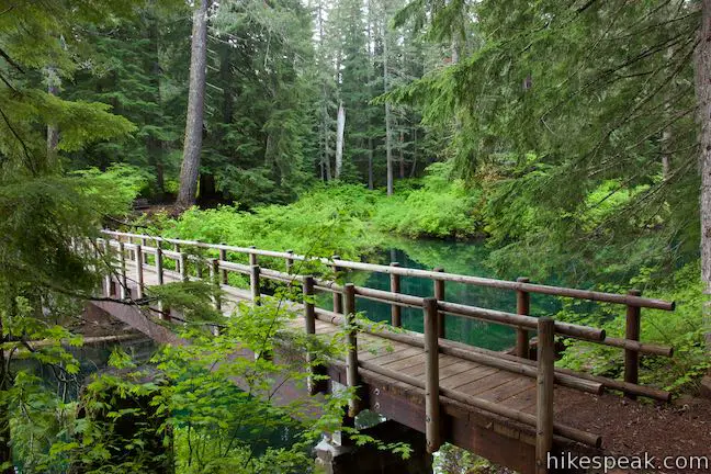
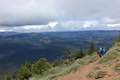
Make your way around Great Spring and follow the water from the source down to Clear Lake. The amount of water flowing out of the beautiful spring is surprising (not unlike nearby Head of the Metolius). As the trail crosses the lake shore, enjoy views toward Clear Lake Resort. If visibility is good, look for mountains like the Three Sisters rising up beyond the lake.
After a few bends, the trail leaves the lake and heads inland through forest, leading you to a bridge over Fish Lake Creek. Below the bridge, you’re likely to find a channel of dry boulders. Fish Lake Creek only flows during winter runoff. The creek carries water south from Fish Lake, but Fish Lake dries to a meadow in the summer, so the creek gets water only when the lake is formed and overflowing.
Cross the wooden bridge over Fish Lake Creek and come to a marked junction on the other side. McKenzie River Trail turns to the right and continues to the north. To complete the final 1.6 miles of Clear Lake Loop, turn left onto Clear Lake Trail.
If the surroundings aren’t calm and quiet, you can blame the cicadas for filling the forest with noise. Proceed south along a peninsula-like ridge between two fingers of Clear Lake. Reach the lake and curve across the shore past stellar south-facing views. The bend continues, leading you past a grassy inlet fed by Ikenick Creek.
It will feel like you are heading in the wrong direction for a while as the trail travels a long way back from the lake, crossing the forest above Ikenick Creek. Finally the trail curves to the west and passes an opening in the forest just below McKenzie Highway where a campsite has been set up. Cross a footbridge over the narrow, tumbling course of Ikenick Creek. Having hiked 4.1 miles, you are now in the last mile of the loop.
The trail heads south back to Clear Lake. Walk through forest that slopes down to the shore and is graced by more tall cedars.
Clear Lake Trail comes to and end and hits a dirt road through Clear Lake Resort. Bear left to follow the road between cabins and the lakeshore for 0.2 miles back to the trailhead parking area. Along the way, you will pass the boathouse, where you may be tempted to rent a rowboat to explore the lake even more. After the boathouse, walk uphill on the road to the picnic area where the hike began.
Clear Lake Loop may be inaccessible during winter conditions from December to April. Clear Lake Trail and McKenzie River Trail are open to dogs on leashes (keep them out of the lake). Bikes can used the trails too. Bathrooms are located next to the picnic area at the start of Clear Lake Trail. A Northwest Forest Pass is not required to park at Clear Lake Picnic Area, which means that no fee or permit is needed for Clear Lake Loop.
Directions to the Trailhead
- From Sisters, take Route 20 northwest for 26 miles to Santiam Junction.
- At the split with Route 22, bear left to stay on Route 20, following signs for Albany.
- After another 3 miles, turn left onto Route 126 (McKenzie Highway).
- Follow this road for 3.7 miles and turn left onto NF 775, by a national forest sign for Clear Lake Resort and Picnic Area.
- Drive half a mile down to the picnic area and trailhead, which are on the right next to the resort.
- From Interstate 5 in Salem, follow Route 22 Southeast for 80 miles to Santiam Junction.
- Turn left onto Route 20 and follow the directions above.
Trailhead Location
Trailhead address: Clear Lake Lodge, NF-775, Sisters, OR 97759
Trailhead coordinates: 44.3735, -121.9985 (44° 22′ 24.6″N 121° 59′ 54.4″W)
View Clear Lake Loop in a larger map
Or view a regional map of surrounding Oregon trails and campgrounds.


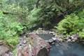 | Terwilliger Hot Springs This 0.9-mile hike leads to a natural hot springs in Willamette National Forest where bathers can soak in a series of terraced pools. |
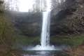 | Trail of Ten Falls This 7.9-mile loop passes ten acclaimed waterfalls in Silver Falls State Park on a picturesque and exciting hike that actually goes behind four of the waterfalls. |
 | West Metolius River Trail The 5.4-mile hike follows the west bank of the Metolius River to incredible gushing springs and a fish hatchery. |
 | Head of the Metolius This 0.5-mile hike visits the surprising source of the Metolius River, a gushing spring accompanied by views of Mount Jefferson. |
 | Black Butte The 4-mile hike summits one of the most identifiable peaks in Central Oregon, which has fire lookout towers and panoramic views of the Cascade Mountains. |
 | More trails in Oregon Explore other hikes in Oregon outside the Bend area. |
Clear Lake Loop on hikeoregon.net
Clear Lake Loop on outdoorproject.com
Clear Lake Loop on hikingproject.com
Clear Lake Loop on hikingproject.com
Clear Lake Loop on hikingcentraloregon.wordpress.com
Clear Lake Loop on alltrails.com
Clear Lake Resort on linnparks.com
The official Willamette National Forest webpage for Clear Lake Loop Trail
The official Willamette National Forest webpage for Clear Lake Day Use Area
Common Questions about Clear Lake Loop in Willamette National Forest
- Is the trail open?
- Yes. You should expect to find that Clear Lake Loop is open. There are no recent reports of trail closures. If you discover that the trail is closed, please help your fellow hikers by reporting a closure.
- Is this trail free to access?
- Yes, Clear Lake Loop is free to access. No entrance fee, pass, or permit is required. If you discover that access rules have changed, please provide feedback on your experience.
- How much time does this hike take?
- It takes approximately 2 hours 15 minutes to hike Clear Lake Loop. Individual hiking times vary. Add extra time for breaks and taking in the views.
- How long is this hike?
- The hike to Clear Lake Loop is a 5 mile loop with 75 feet of elevation change.
- Are dogs allowed on this trail?
- Yes, dogs are allowed on Clear Lake Loop. The trail is open to hikers, dogs, bikes.
- Is there a lake on this hike?
- Yes, Clear Lake Loop visits a lake.
- What mountain range is this trail in?
- Clear Lake Loop is located in the Cascade Range.
- Where is the trailhead located?
- The trailhead for Clear Lake Loop is located in Sisters, Oregon.
Trailhead Address:
NF-775
Sisters, Oregon 97759
Trailhead Coordinates:
44.3735, -121.9985 - What are the driving directions to the start of the hike?
To get to the trailhead: From Sisters, take Route 20 northwest for 26 miles to Santiam Junction. At the split with Route 22, bear left to stay on Route 20, following signs for Albany. After another 3 miles, turn left onto Route 126 (McKenzie Highway). Follow this road for 3.7 miles and turn left onto NF 775, by a national forest sign for Clear Lake Resort and Picnic Area. Drive half a mile down to the picnic area and trailhead, which are on the right next to the resort.
From Interstate 5 in Salem, follow Route 22 Southeast for 80 miles to Santiam Junction. Turn left onto Route 20 and follow the directions above.
View custom Google Maps directions from your current location.
- Are there other trails near Clear Lake Loop?
- Yes, you can find other nearby hikes using the Hikespeak Hike Finder Map.

[…] you can do are hiking Mary’s Peak, which takes you to the highest point on the coastal range, Clear Lake Loop, or Spencer Butte. To be frank though, any state park, national forest, or riverfront park in the […]
can we go boating here at clear lake and is there a place we can buy food?