Hikes in Mount Rainier National Park
When the sky is blue and summer lupines are booming across the alpine grasses, Mount Rainier is one of the most beautiful places in the world. The park is often blanketed in fog, so if you see the park on a clear day, consider yourself very lucky. There is a lot to see. The 14,411-foot volcano is covered with more glaciers than any other mountain in the lower 48. It is the highest summit in the Cascade Mountain Range and all of Washington.
Highlights of Mount Rainier National Park


Mount Rainier National Park
On a visit to Mount Rainier, you can see old-growth forests, meadows of wildflowers, and fields of snow, all at the base of a dauntingly beautiful mountain. According to wikipedia:
[Mount Rainier] is the most topographically prominent mountain in the contiguous United states … [and] is considered one of the most dangerous volcanoes in the world.
The nearest trailheads to Mount Rainier are called Paradise and Sunrise,accompanied by historic lodges and visitor centers. To summit Mount Rainier requires technical climbing and is best attempted through a guide service. Mount Rainier National Park was the nation’s fifth national park, born on March second, 1899. The park protects 368 square miles of Central Washington and offers hundreds of miles of hiking trails. Campgrounds are available inside Mount Rainier National Park as well as within the surrounding national forest.
Mount Rainier National Park Hiking
This collection of trails in Mount Rainier National Park lists hikes from north to south. The table may also be sorted alphabetically or by distance to help you pick your next hike. Each trail links to its own report complete with photos, GPS maps, elevation profiles, directions, and all the other information needed to locate and enjoy these hikes. Below the table is an interactive map showing the location of each hike.
Trail | Description | Distance | Location |
|---|---|---|---|
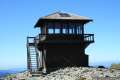 550 550 | Mount Fremont Lookout Trail This out and back hike visits a fire lookout tower near the summit of Mount Fremont with incredible views over Mount Rainier and the surrounding mountains. | 6 miles 800 feet | 46.914598, -121.642045 |
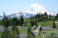 600 600 | Naches Peak Loop Trail This colorful loop crosses fields of summer wildflowers, passes subalpine lakes, and offers great views of Mount Rainier. | 3.75 miles 575 feet | 46.869727, -121.520033 |
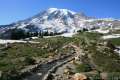 650 650 | Skyline Trail This tremendously scenic loop on the slopes of Mount Rainier is considered the park's must-do hike. | 5.5 miles 1,625 feet | 46.786691, -121.734536 |
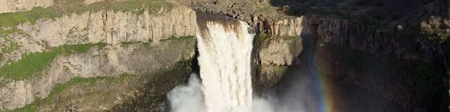
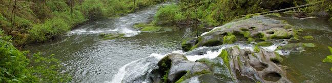
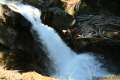 700 700 | Silver Falls Loop Trail This loop travels through an old-growth forest to a waterfall on Ohanapecosh River in the southeast corner of the park. | 3 miles 300 feet | 46.7362, -121.5664 |
Or explore hikes around Mount Rainier National Park on the Hike Finder Map