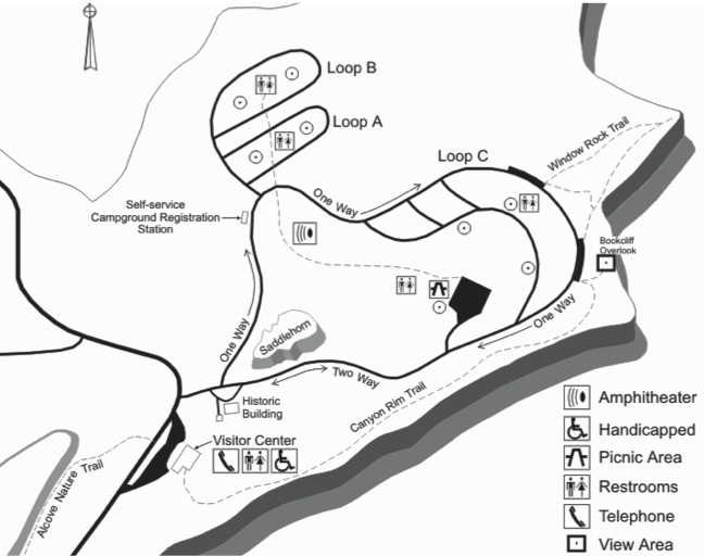
Window Rock Trail
in Colorado National Monument

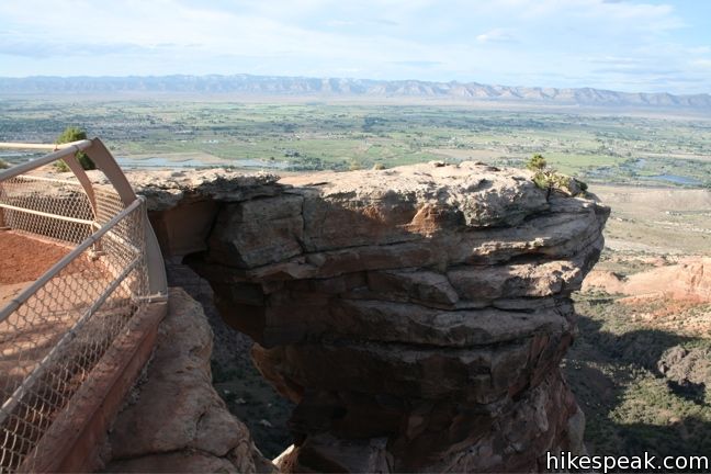
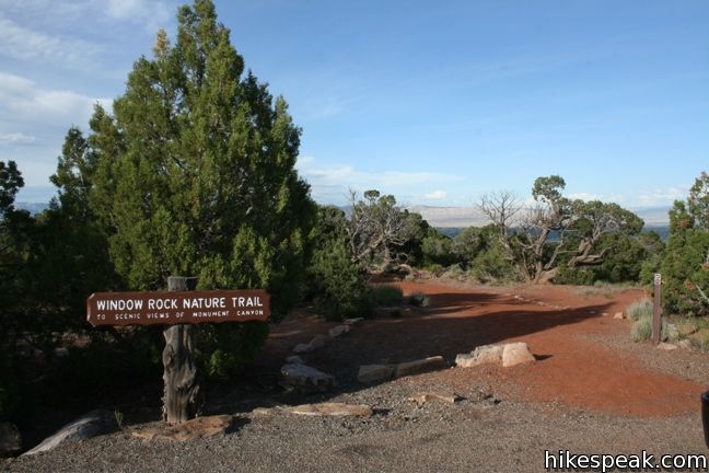
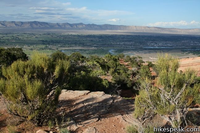
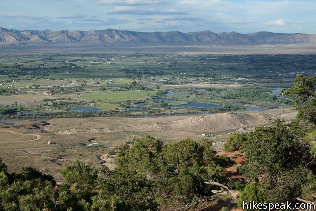
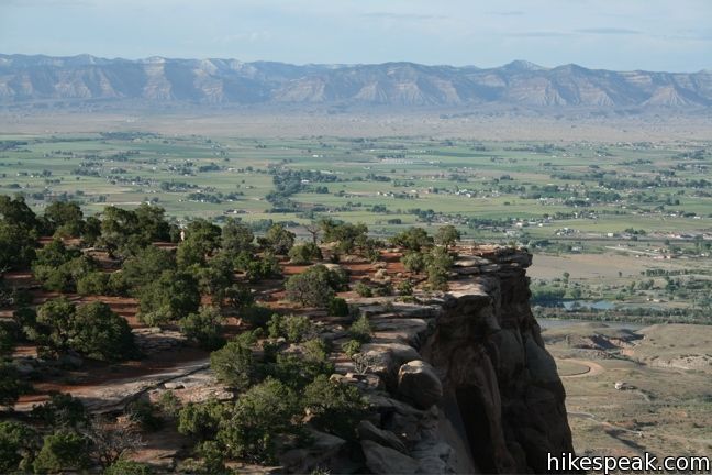
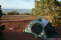
Window Rock Trail begins next to Bookcliff Shelter, not far from Saddlehorn Campground. The trail looks south into Monument Canyon and north over the cities below. This 1/3-mile round trip hike ends at a distinct point at the north end of the western wall of Monument Canyon where a natural window pierces the top of the cliff.
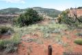
Window Rock Trail is wide and easy to follow, descending gradually about 60 vertical feet through a forest of Pinyon pines and Utah junipers. There are no junctions to worry about, leaving you free to enjoy the sights along the way.
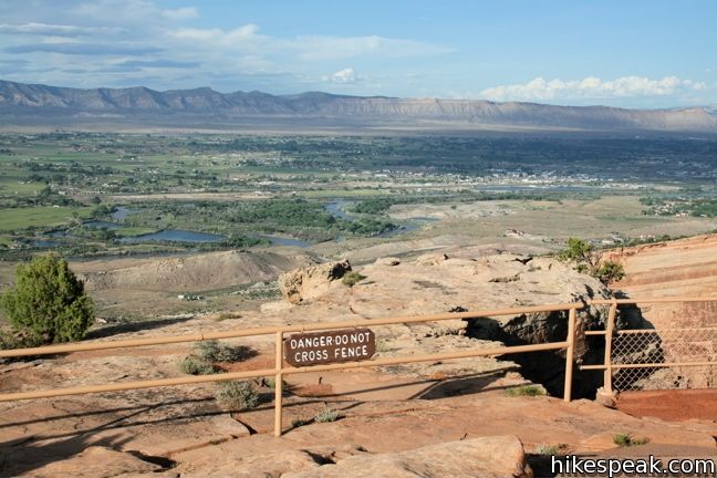
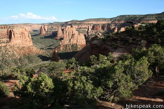
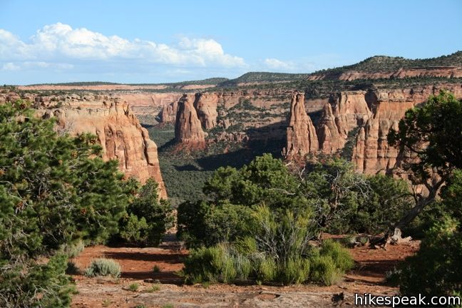
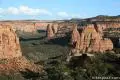
Up canyon, the park’s major monoliths are all in sight. Independence Monument, Praying Hands, Kissing Couple, and other formations make up a postcard view. The canyon is most picturesque in the late afternoon when the sandstone is illuminated orange.

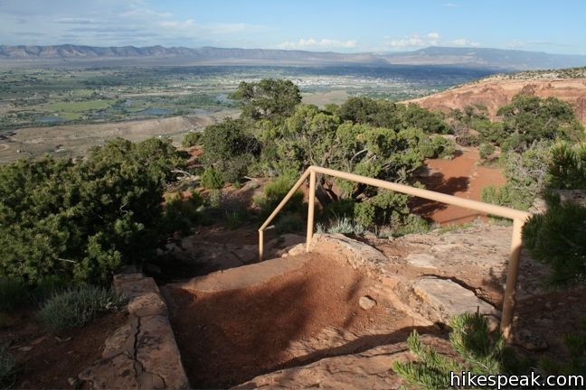
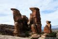
A yellow railing marks the safe viewing area at the end of the trail. The natural window a few feet down makes hiking to the tip the point dangerous. There is plenty to see from behind the railing, including a view of the window itself. After safely enjoying Window Rock, simply return the way you came.
To expand this hike, combine it with Canyon Rim Trail. Begin at Saddlehorn Visitor Center and hike half a mile to Book Cliff View and the start of Window Rock Trail. The views are great from both trails.
Directions to the Trailhead
- From Saddlehorn Visitor Center, drive north on Rim Rock Drive and make an immediate right toward Saddlehorn Campground.
- Make a left after a short distance and continue half a mile around the one way circle to the trailhead just before Bookcliff Shelter.
Trailhead Location
Trailhead address: Unnamed Road, Colorado National Monument, Grand Junction, CO 81507
Trailhead coordinates: 39.10478, -108.7284 (39° 06′ 17″N 108° 43′ 42.2″W)
View Colorado National Monument in a larger map
Or view a regional map of surrounding Colorado trails and campgrounds.
 | Canyon Rim Trail This one-mile round trip hike begins at Saddlehorn Visitor Center and travels along the cliffs edge overlooking Monument Canyon. |
 | Alcove Nature Trail This one-mile round trip hike is less scenic than others in the park but offers information about the plants, animals, and geology of the park. |
 | Otto's Trail This 0.75-mile round trip hike visits an overlook near the Pipe Organs with an excellent view of Independence Monument and Monument Canyon. |
 | More trails in Colorado Explore other destinations in Colorado National Monument. |
 | Saddlehorn Campground This 80-site campground is the only designated camping area in Colorado National Park, conveniently located near Saddlehorn Visitor Center. |
- NPS brochure for Window Rock Trail (opens in a new tab)
- Window Rock on protrails.com (opens in a new tab)
- Colorado National Monument on wikipedia.org (opens in a new tab)
- Colorado National Monument on summitpost.org (opens in a new tab)
- The official website for Colorado National Monument (opens in a new tab)
Common Questions about Window Rock Trail in Colorado National Monument
- Is the trail open?
- Yes. You should expect to find that Window Rock Trail is open. There are no recent reports of trail closures. If you discover that the trail is closed, please help your fellow hikers by reporting a closure.
- Do I need a permit for this hike?
- Yes. National Monument Entrance Fee.
- How much time does this hike take?
- It takes approximately 15 minutes to hike Window Rock Trail. Individual hiking times vary. Add extra time for breaks and taking in the views.
- How long is this hike?
- The hike to Window Rock Trail is a 0.35 mile out and back with 60 feet of elevation change.
- Are dogs allowed on this trail?
- No, dogs are likely not allowed on Window Rock Trail. The trail is primarily open to hikers.
- Is Window Rock Trail good for kids?
- Yes, this hike is likely suitable for children. It is relatively short (0.35 miles) with manageable elevation gain.
- Where is the trailhead located?
- The trailhead for Window Rock Trail is located in Colorado National Monument, Colorado.
Trailhead Address:
Colorado National Monument
Colorado National Monument, Colorado 81507
Trailhead Coordinates:
39.10478, -108.7284 - What are the driving directions to the start of the hike?
To get to the trailhead: From Saddlehorn Visitor Center, drive north on Rim Rock Drive and make an immediate right toward Saddlehorn Campground. Make a left after a short distance and continue half a mile around the one way circle to the trailhead just before Bookcliff Shelter.
View custom Google Maps directions from your current location.
- Are there other trails near Window Rock Trail?
- Yes, you can find other nearby hikes using the Hikespeak Hike Finder Map.

Go the extra miles...
Submit a rating of this hike to go with your comment. Contribute to the average trail rating.