Naches Peak Loop Trail
in Mount Rainier National Park
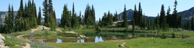
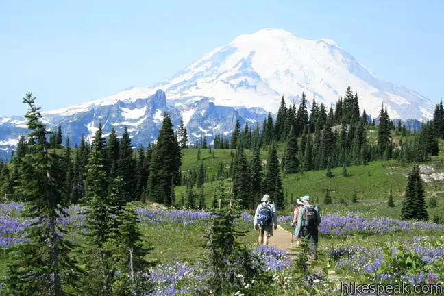
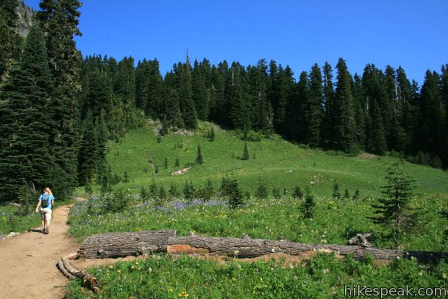
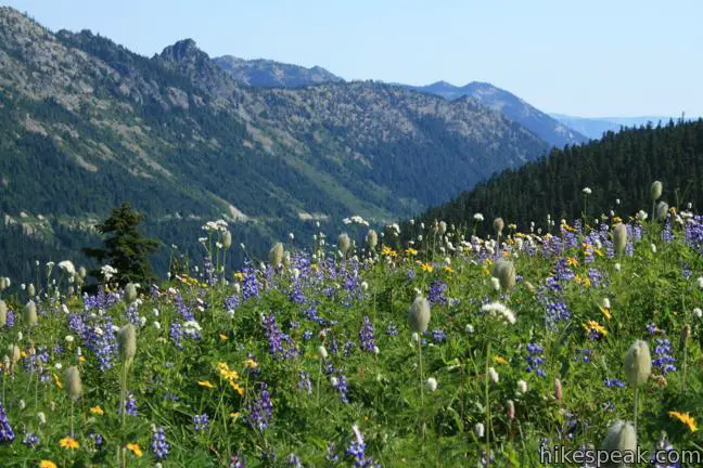
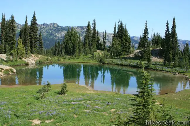
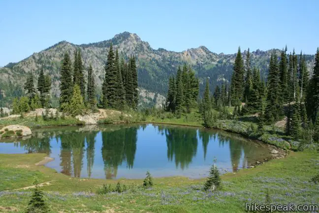
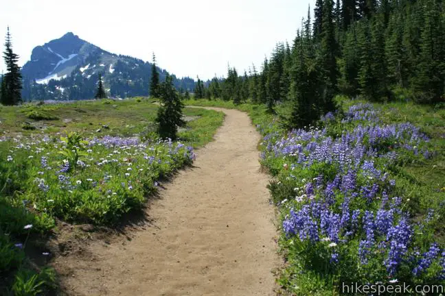
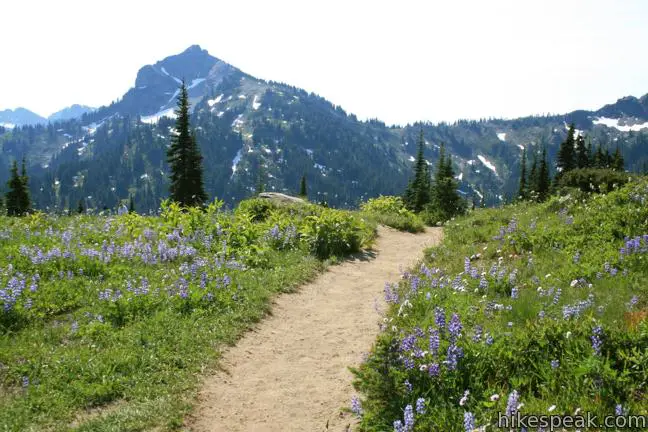
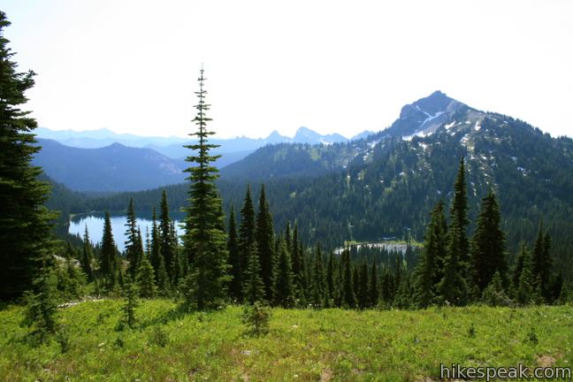
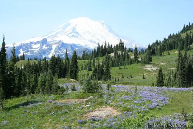
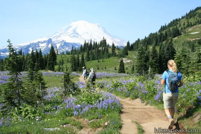
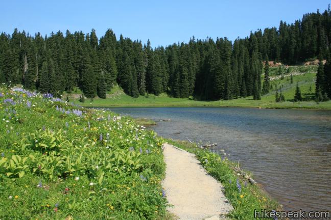
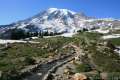
The bloom of wildflowers on Naches Peak Loop is the #1 draw to this trail. An extraordinary carpet of purple lupines and other colorful flowers appearing along this trail each summer. The fact that Naches Peak Loop stands out among other trails in Mount Rainier National Park, which has lots of great places to see wildflowers, tells you that this trail is something special. The 3.75-mile hike with 575 feet of gradual elevation gain passes more than just flowers. There are streams, subalpine lakes, and views of snow-capped Mount Rainier. Loop it up!
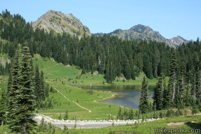
Make your way to the eastern boundary of Mount Rainier National Park and begin hiking along the banks of Tipsoo Lake, a crystal clear pool so alluring some hikers never make it up the trail. Naches Peak Loop is best attempted in a clockwise direction to avoid hiking with Mount Rainier over your shoulder.
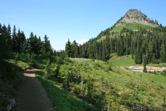
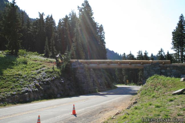
Take the single track north up the grassy slope to the left of the lake. Pass through a belt of trees to reach a trail junction alongside Route 410. Turn right and cross the road, joining the Pacific Crest Trail as it heads east out of Mount Rainier National Park. The trailhead is also along Route 410, below a horseshoe bend in the road. The trail crosses the road above the bend at Chinook Pass.
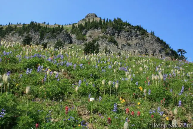
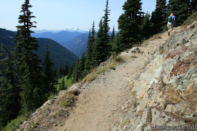
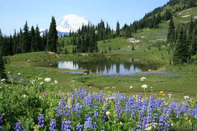
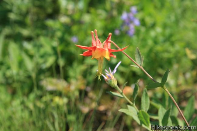
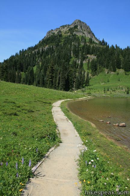
Follow the Pacific Crest Trail into Wenatchee National Forest and William O. Douglas Wilderness. Streams pour over the trail throughout the next mile as you cross a mountainside with loads and loads of bright flowers like western columbine, indian paintbrush, subalpine daisies, pasqueflower and the almost omnipresent broadleaf lupine.
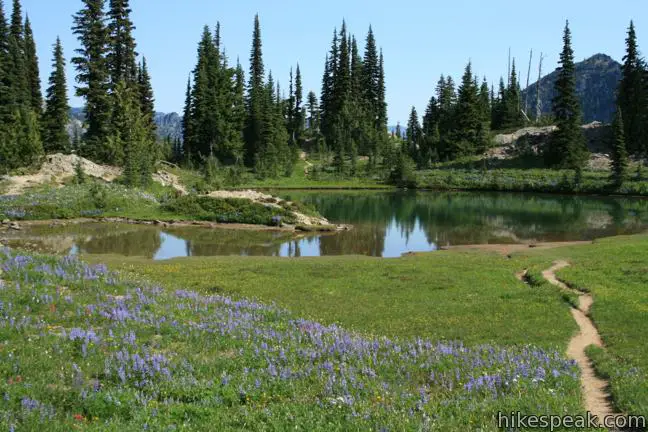
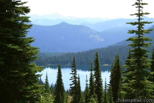
Beyond a pond bordered by boulders and pines, the trail progresses southward, climbing around Naches Peak for a view of Dewey Lake, cradled in an evergreen valley to the east.
The loop swings west and reenters the national park as Mount Rainier appears. The snow-topped volcano hovers on the horizon for the rest of the loop. Look at the mountain or look at the flowers, it’s your choice over the final 1.75 miles. Descend back to Tipsoo Lake, cross Route 410, and walk down the lakeside path to return to the trailhead.
The trailhead has picnic tables and bathrooms. Wildflower picking is prohibited. An entrance fee may be charged to access Naches Peak Loop in Mount Rainier National Park, but no permit is required to hike the trail.
Directions to the Trailhead
- From Sunrise, drive 15 miles down the mountain on Sunrise Road, turn south on Route 140 and drive 3.5 miles to the junction with Route 123 at Cayuse Pass.
- From the intersection with Route 123, Continue east for 2.9 miles on Route 410 (Mather Memorial Parkway) to the Tipsoo Lake Picnic Area on the left.
- The picnic area is on the north side of the road half a mile southwest of Chinook Pass.
- Coming from Paradise or Ohanapecosh, take Route 140 to the intersection with Route 123 at Cayuse Pass, which is 11 miles north of Stevens Canyon Road.
- From the intersection with Route 123, Continue east for 2.9 miles on Route 410 to the Tipsoo Lake Picnic Area on the left.
- The picnic area is on the north side of the road half a mile southwest of Chinook Pass.
Trailhead Location
Trailhead address: Washington Route 410, Mount Rainier National Park, Enumclaw, WA 98022
Trailhead coordinates: 46.869727, -121.520033 (46° 52′ 11.01″N 121° 31′ 12.11″W)
View Mount Rainier National Park in a larger map
Or view a regional map of surrounding Washington trails and campgrounds.


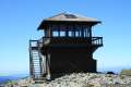 | Mount Fremont Lookout This picturesque 6-mile trail visits a fire lookout tower near the summit of Mount Fremont, with incredible views over Mount Rainier and the surrounding mountains. |
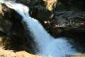 | Silver Falls Loop Trail This 3-mile loop travels through an old-growth forest to a waterfall on Ohanapecosh River in the southeast corner of Mount Rainier National Park. |
 | Skyline Trail This tremendously scenic loop on the slopes of Mount Rainier is considered the park's must-do hike. |
 | More trails in Washington Explore other hikes in the Evergreen State, including Mount Saint Helens National Volcanic Monument. |
 | Camping in and around Mount Rainier Information on the developed campgrounds in Mount Rainier National Park as well as places to camp in the surrounding national forest. |
Common Questions about Naches Peak Loop Trail in Mount Rainier National Park
- Is the trail open?
- Yes. You should expect to find that Naches Peak Loop Trail is open. There are no recent reports of trail closures. If you discover that the trail is closed, please help your fellow hikers by reporting a closure.
- Do I need a permit for this hike?
- Yes. National Park Entrance Fee.
- How much time does this hike take?
- It takes approximately 2 hours to hike Naches Peak Loop Trail. Individual hiking times vary. Add extra time for breaks and taking in the views.
- How long is this hike?
- The hike to Naches Peak Loop Trail is a 3.75 mile loop with 575 feet of elevation change.
- Are dogs allowed on this trail?
- No, dogs are likely not allowed on Naches Peak Loop Trail. The trail is primarily open to hikers.
- Is this a good hike for wildflowers?
- Yes, Naches Peak Loop Trail is known for its seasonal wildflower displays.
- Is there a lake on this hike?
- Yes, Naches Peak Loop Trail visits a lake.
- What mountain range is this trail in?
- Naches Peak Loop Trail is located in the Cascade Range.
- Where is the trailhead located?
- The trailhead for Naches Peak Loop Trail is located in Enumclaw, Washington.
Trailhead Address:
Washington Route 410
Enumclaw, Washington 98022
Trailhead Coordinates:
46.869727, -121.520033 - What are the driving directions to the start of the hike?
To get to the trailhead: From Sunrise, drive 15 miles down the mountain on Sunrise Road, turn south on Route 140 and drive 3.5 miles to the junction with Route 123 at Cayuse Pass. From the intersection with Route 123, Continue east for 2.9 miles on Route 410 (Mather Memorial Parkway) to the Tipsoo Lake Picnic Area on the left. The picnic area is on the north side of the road half a mile southwest of Chinook Pass.
Coming from Paradise or Ohanapecosh, take Route 140 to the intersection with Route 123 at Cayuse Pass, which is 11 miles north of Stevens Canyon Road. From the intersection with Route 123, Continue east for 2.9 miles on Route 410 to the Tipsoo Lake Picnic Area on the left. The picnic area is on the north side of the road half a mile southwest of Chinook Pass.
View custom Google Maps directions from your current location.
- Are there other trails near Naches Peak Loop Trail?
- Yes, you can find other nearby hikes using the Hikespeak Hike Finder Map.

Is this trail accessible year round? I am interested in exploring a trail near the Whistling Jack restaurant on high way 410.
Thank you for your help,
Sylvia
Chinook Pass is one of several access points to the Pacific Crest Trail. You can hike either north or south on the PCT, but for a variety of scenery the Naches Loop is recommended. Hiking clockwise is also recommended— the window of opportunity to hike this trail without running into snow is limited, and in late July or early August you may still find lingering snow on the east slopes of Naches Peak. If in doubt, take an ice ax, or begin the loop counterclockwise and turn back if you hit significant snow. In late July, come for the flowers. In September, come for the fall colors and berries. Or come anytime Chinook Pass is open.
I planned to visit tipsoo lake on 11th May 2014, but 410 was closed.
I intend to visit it next weekend again. Is there any other route that will take me to Tipsoo lake or where should I call to confirm if 410 is open? Do you recommended it visiting in spring or should I wait until summer.
Chinook pass open labor day weekend
Here is a video I recorded while hiking Naches Peak Loop Trail on August 9, 2014.
http://www.youtube.com/playlist?list=PLivOnxNHfOCcwWDXo8VHR_1MIczB3JK73
i two friends hiked the trail yesterday, its really difficult due snow and there are a lot of soon to be slide areas but worst of all we were confronted by grunting then we came up on a fresh tracks of a big black bear going about 8 inches into the snow, if you hike the trail be careful eyes open at all times stay in a group and don’t run, best weapon is bear spray.
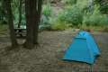
Is there a campsite near by Naches Peak Loop Trail?