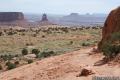
Mesa Arch is an easy to visit landmark in the Island in the Sky region of Canyonlands National Park. This pothole arch spans across the mesa’s edge, framing a scenic canyon vista. A 0.7-mile loop trail brings you right up to Mesa Arch, one of the park’s most popular points of interest.
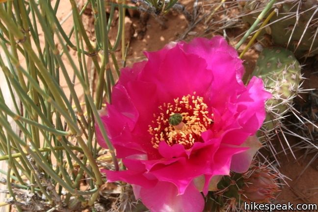
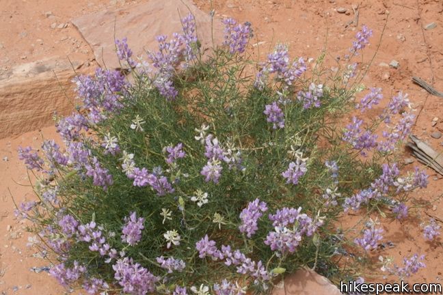
A nature guide is available at the trailhead, and can be used to learn more about park vegetation and geology. The guide is quick to remind you to stay on the trail, a point you will see repeated through Canyonlands and Arches National Parks. This is because stray footsteps can damage the cryptogamic soil just off trail. This black crust on the ground forms the foundation for desert ecosystems. The vital mixture of lichens, moss, fungus and algae prevents soil erosion and helps support larger plants.
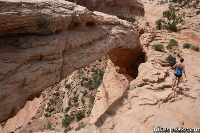
Just beyond the parking lot, the trail comes to a Y. Both routes lead to Mesa Arch, and the loop is equally enjoyable in both directions. As you hike, keep and eye on the edge of the mesa for sneak peaks of the iconic arch.
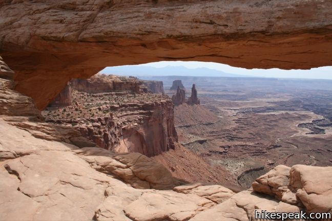
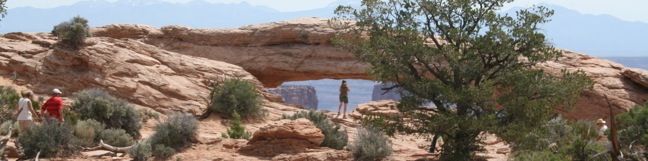
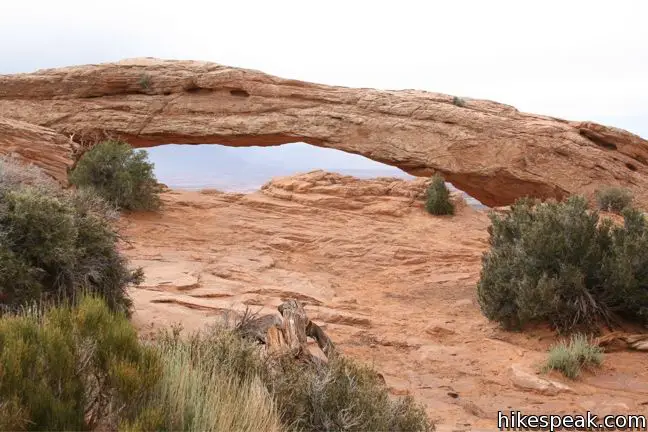
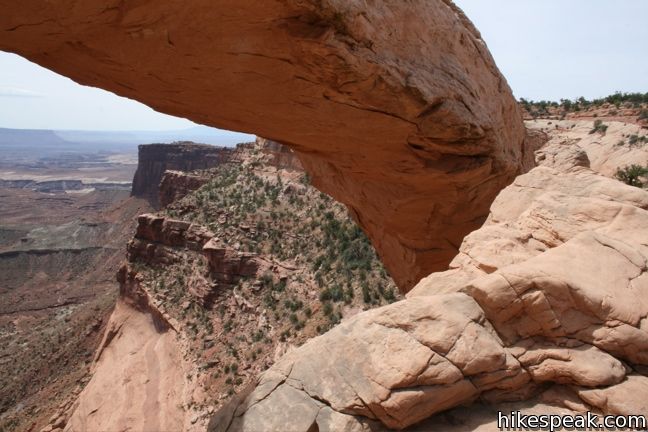
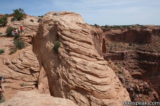
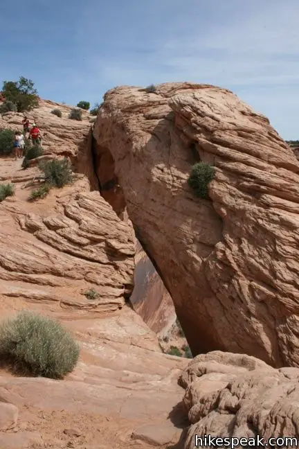
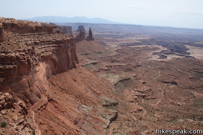
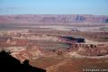
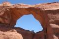
The trail ends in front of an elegant stone that spans fifty feet across the top of a 500-foot vertical cliff. Mesa Arch is classified as a pothole arch because it was formed by surface water that pooled on the sandstone behind the arch, slowly eroding the rock. The result is an arch that dangles across the mesa’s edge.
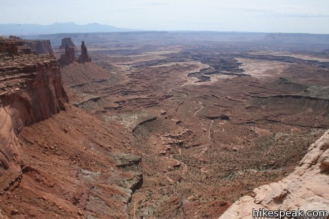
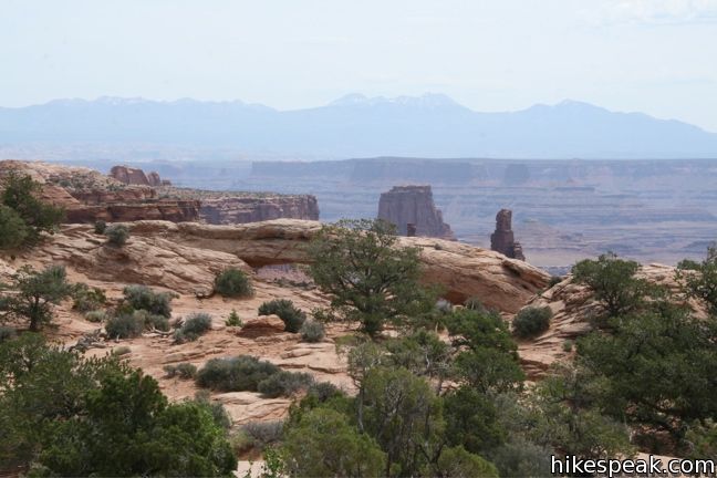
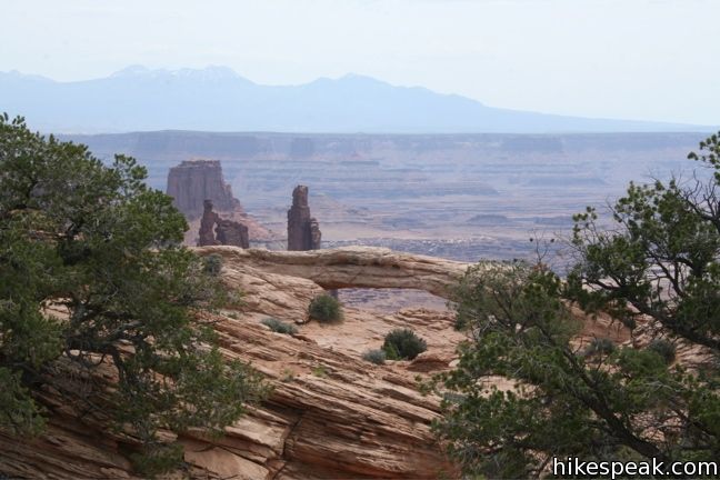
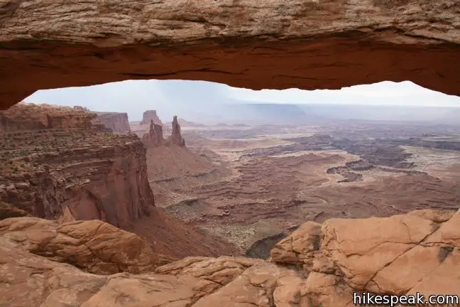
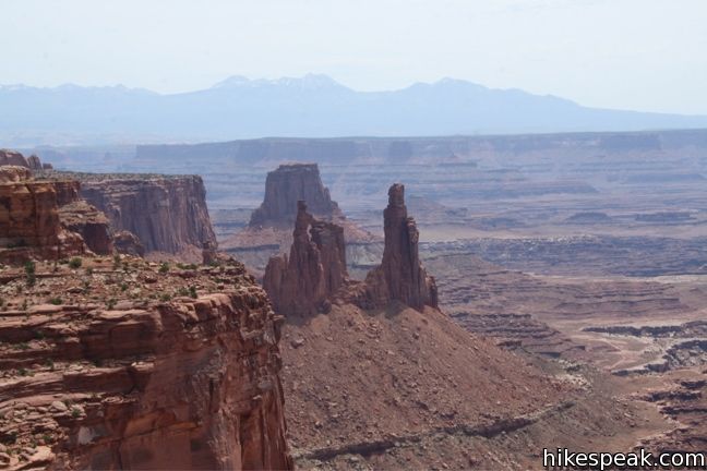
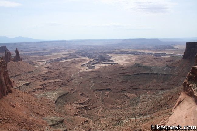
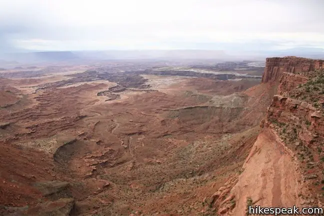
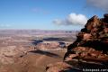
Geology aside, the arch provides the frame for a stunning Utah landscape. Along the mesa to the east is another arch, named Washing Woman Arch. Below the mesa is the prominent white rim of spectacular canyons carved by the Colorado River. Rounding out the view, the snow-capped peaks of the La Sal Mountains meet the sky at the horizon.
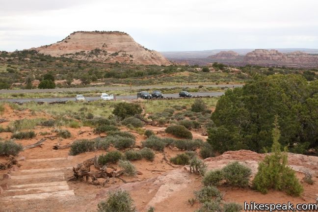
The arch is beautiful any time of day, but if you end up here around sunrise or sunset, you will likely be in for a beautiful show. After leaving the arch, complete the loop to return to the trailhead for a 0.7-mile hike with 75 feet of elevation. On the way back, you will have a nice view of Aztec Butte rising above the mesa beyond the parking lot.
Directions to the Trailhead
- From the Island in the Sky Visitor Center, drive south for 6.3 miles and turn left into the parking area for Mesa Arch.
- If you reach the intersection with Upheaval Dome Road, you have gone too far.
Trailhead Location
Trailhead address: Grand View Point Road, Canyonlands National Park, Moab, UT 84532
Trailhead coordinates: 38.38915, -109.8681 (38° 23′ 20.9″N 109° 52′ 05.2″W)
You may also view a regional map of surrounding Utah trails and campgrounds.


 | Aztec Butte This is a 1.8 -mile hike ascends a dome-shaped butte that houses Puebloan granaries and offers nice views of Taylor Canyon. |
 | Upheaval Dome This 1.7-mile hike visits two overlooks along the rim of a puzzling three-mile wide crater. |
 | Whale Rock This one-mile hike ascends a whale-shaped sandstone formation near Upheaval Dome. |
 | Murphy Point This 3.6-mile hike visits a west-facing point on the Island in the Sky overlooking canyons carved by the Green River. |
 | More trails in Utah Explore other hikes in Canyonlands National Park and elsewhere. |
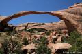 | Landscape Arch in Arches National Park This level 2.5-mile hike visits the longest natural arch in the world along with two other enjoyable arches. |
 | Skyline Arch in Arches National Park This short 0.4-mile hike ends below a wide arch near the top of a sandstone fin. |
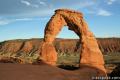 | Delicate Arch in Arches National Park This 3-mile hike visits this most iconic arch in the world, a beautiful span that should not be missed. |
 | Double Arch in Arches National Park This 0.8-mile hike visits a pair of connected arches in the Windows region of Arches National Park. |
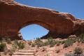 | Window Arches in Arches National Park This one-mile loop presents three arches in close proximity, the North and South Windows and Turret Arch. |
 | Morning Glory Bridge in Moab This 6-mile round trip hike travels through a scenic canyon to a 243-foot long natural bridge. |
 | Arch Rock in Joshua Tree This short hike leads to a natural arch in the granite formations by White Tank Campground. |
Common Questions about Mesa Arch in Canyonlands National Park
- Is the trail open?
- Yes. You should expect to find that Mesa Arch Trail is open. There are no recent reports of trail closures. If you discover that the trail is closed, please help your fellow hikers by reporting a closure.
- Do I need a permit for this hike?
- Yes. National Park Entrance Fee.
- How much time does this hike take?
- It takes approximately 15 minutes to hike Mesa Arch Trail. Individual hiking times vary. Add extra time for breaks and taking in the views.
- How long is this hike?
- The hike to Mesa Arch Trail is a 0.7 mile loop with 75 feet of elevation change.
- Are dogs allowed on this trail?
- No, dogs are likely not allowed on Mesa Arch Trail. The trail is primarily open to hikers.
- Is Mesa Arch Trail good for kids?
- Yes, this hike is likely suitable for children. It is relatively short (0.7 miles) with manageable elevation gain.
- Where is the trailhead located?
- The trailhead for Mesa Arch Trail is located in Moab, Utah.
Trailhead Address:
Grand View Point Road
Moab, Utah 84532
Trailhead Coordinates:
38.389084, -109.868143 - What are the driving directions to the start of the hike?
To get to the trailhead: From the Island in the Sky Visitor Center, drive south for 6.3 miles and turn left into the parking area for Mesa Arch. If you reach the intersection with Upheaval Dome Road, you have gone too far.
View custom Google Maps directions from your current location.
- Are there other trails near Mesa Arch Trail?
- Yes, you can find other nearby hikes using the Hikespeak Hike Finder Map.

[…] 5am I headed off to Canyonlands N.P. and Mesa Arch for the sunrise shot. With some clearing on the horizon, I was hoping I would get the photo that so […]
[…] so recently I was in Canyonlands National Park for a sunrise shoot through Mesa Arch. There were a number of other photographers there before sunrise. What was a surprise was the […]
[…] 45 minutes to Canyonlands National Park, Island in the Sky District. Stroll to Mesa Arch (0.7 mile loop), then take the steps out to Grand View Point (2 miles RT). Drive 2 hours down to […]