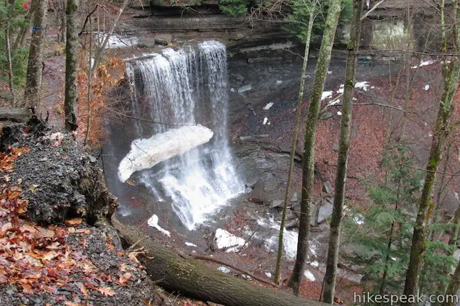
For a soaring view over Labrador Hollow Unique Area, a state forest in Central New York, take a hike up Jones Hill to a scenic overlook at a Hang Glider Launch Site. There are two overlapping routes to the launch site from the trailhead for Tinker Falls Trail (a short hike to a lovely waterfall). Onondaga Sky Line Trail is a wide dirt road offering a 1.2-mile route to the overlook marked with orange blazes. North County National Scenic Trail uses parts of Sky Line Trail and stretches of single tracks for a 1.3-mile route to the overlook marked with blue blazes. The routes to the Hang Glider Launch Site overlap for 0.6 miles, and can be combined for a 2.5-mile hike with 650 feet of elevation gain.
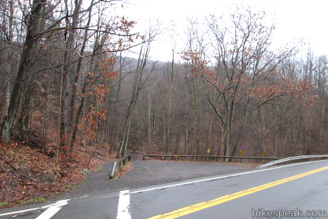
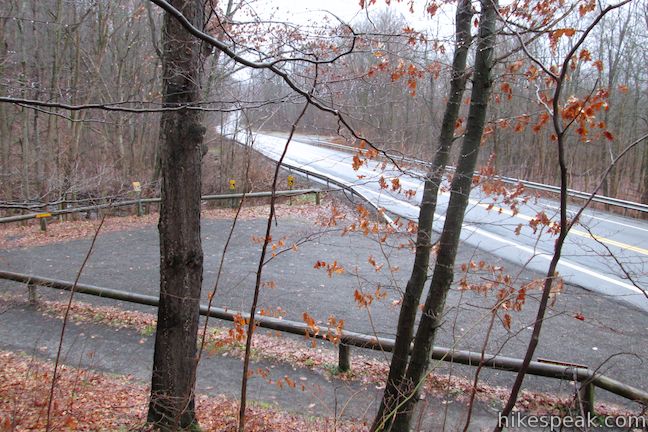
Start from a trailhead along Route 91 in Labrador Hollow Unique Area, just south of the Onondaga – Cortland County Line. Handicapped parking is on the east side of the road (Tinker Falls Trail is wheelchair-friendly) and a larger parking area is on the west side of the road.
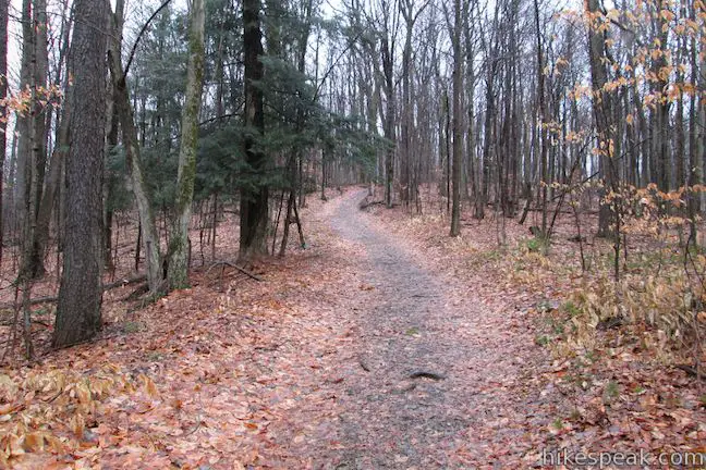
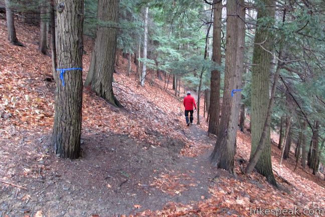
The wide trail heading east along Tinker Falls Creek reaches Tinker Falls in a quarter mile. To reach the Hang Glider Launch Site, turn left up a dirt single track just before the trailhead kiosk.
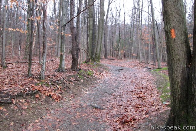
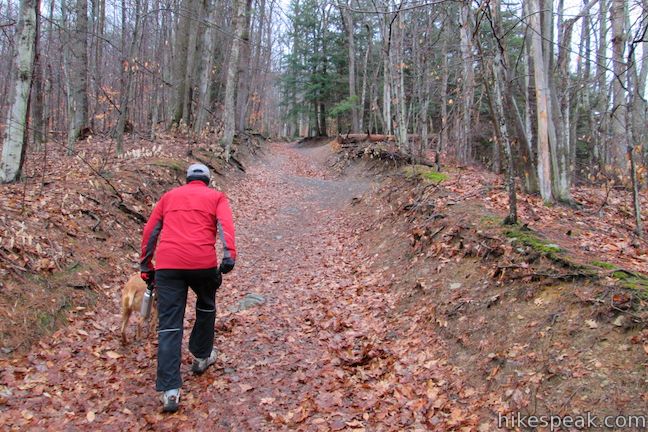
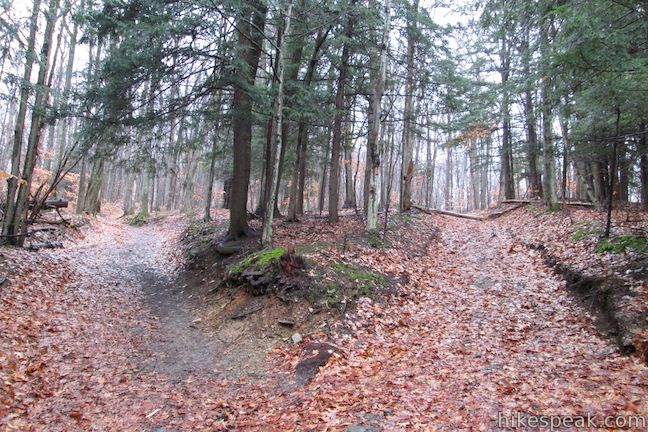
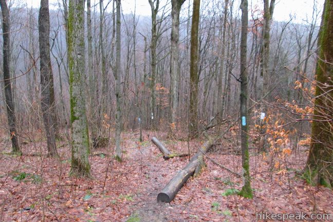
The trail goes north, climbing above the parking area for a few hundred feet to a T-junction with a wide dirt road, Onondaga Sky Line Trail. Turn right. (On the hike down, look for a wooden sign with an arrow directing you back down the path to the trailhead.) After a hundred feet, stay to the left past a connector trail on the right that descends to Tinker Falls Trail. Hike a quarter mile up the steep opening of Sky Line Trail, which rapidly gains 200 feet. Not long after you pass a path on the right that ventures out to the brink of Tinker Falls, you will arrive at a pronounced split in the road.
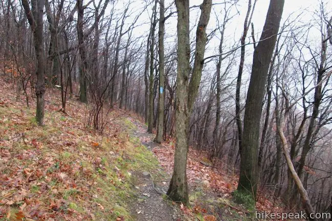
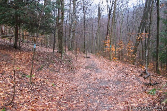
Onondaga Sky Line Trail continues to the left at the split, marked by orange blazes. When it crosses, and at times becomes, North County National Scenic Trail, there will be blue blazes. If you wish to take the wide trail to the top, stay to the left at the split and hike 0.95 miles to the Hang Glider Launch Site. Along the way, you will pass through three junctions with North County National Scenic Trail. First, after 0.2 miles, North County Trail will join Sky Line Trail from the right. Then after another 0.35 miles, the trail will depart to the right. The single-track will then go straight across Sky Line Trail about 0.15 miles before you reach the large grassy clearing at the Hang Glider Launch Site.
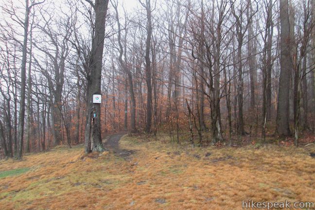
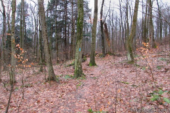
To hike up North County National Scenic Trail, turn right at the split on Sky Line Trail (just above the side trail to the brink of Tinker Falls). Walk less than a tent of a mile up the wide trail to a junction with a single track marked by blue blazes on its neighboring trees. The trail goes in both directions, descending toward Tinker Falls to the right, and ascending toward the Hang Glider Launch Site to the left. Turn left to take the single track up to the scenic overlook.
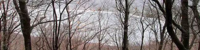
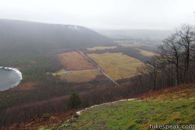
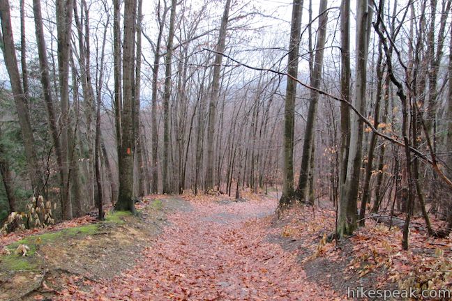
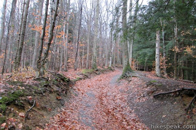
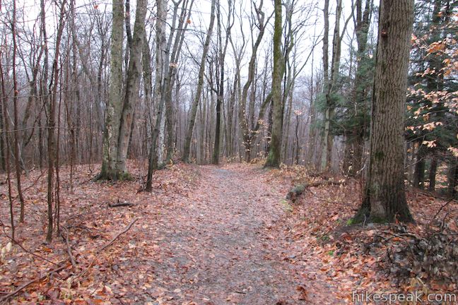
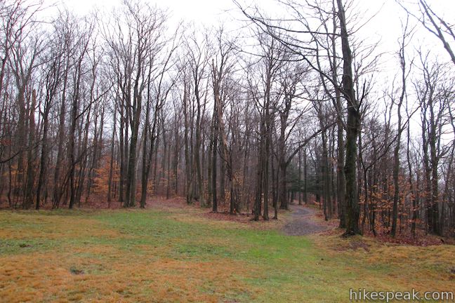
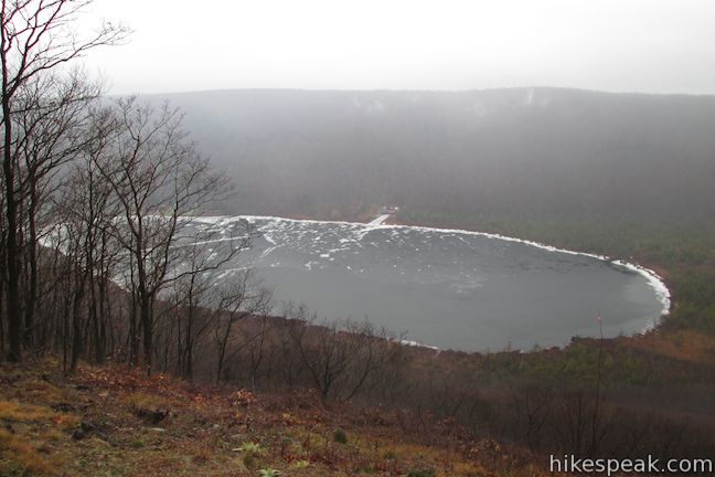
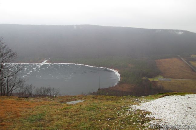
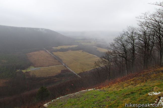
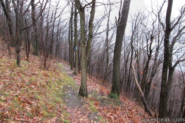
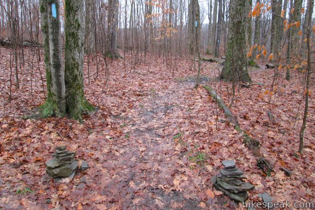
North County National Scenic Trail weaves through a forest of conifers and mixed hardwoods like America beech and red maples. After a third of a mile, the trail meets back up with Sky Line Trail. Turn right up the unified trail. After 0.35 miles, the single-track North County Trail breaks off to the right again. Take the trail for 0.15 miles, when it will cross Sky Line Trail before continuing 0.15 miles to the Hang Glider Launch Site. This last leg of the trail presents views through the trees toward Labrador Pond. The mountainside below the trail is quite steep as you approach the launch site, contributing to the great thermal updrafts that hang gliders enjoy.
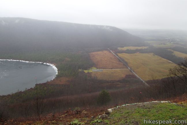
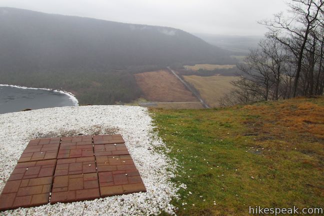
Take a break at the scenic overlook at the Hang Glider Launch Site and enjoy the views. Look down on Labrador Pond and across the valley toward Labrador Hill, or look up the valley toward the farmland around Tully. On the north side of the Hang Glider Launch Site, North County National Scenic Trail resumes, venturing northeast down to Spruce Pond in Morgan Hill State Forest.
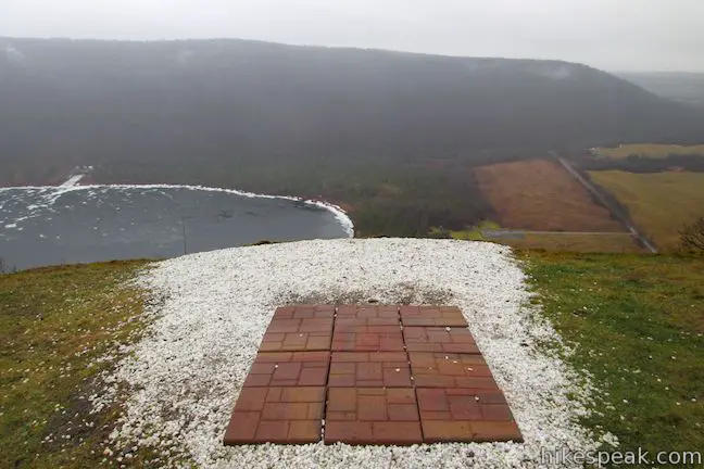
If you’re not hiking beyond the Hang Glider Launch Site, venture back down Jones Hill to the Tinker Falls Trailhead for a 2.5-mile hike. Add Tinker Falls Trail and a side trail to the top of Tinker Falls to the hike to extend things to 3.2 miles round trip. Dogs are welcome on trails in Labrador Hollow Unique Area. Non-motorized hang-gliding is allowed by permit only. For a short hike to the shore of nearby Labrador Pond, check out Labrador Hollow Boardwalk. No fee or permit is required to hike to the Hang Gilder Launch Site, so get out and enjoy!
Directions to the Trailhead
- Take I-81 to exit 14 in Tully.
- At the end of the offramp, turn east on Route 80 and drive 4.2 miles to Route 91 (Apulia-Truxton Road).
- Turn right and drive south for 3.3 miles.
- Just after crossing into Cortland County (and 1.2 miles past Labrador Crossroad) pull off and park in the turnout on the right.
- Walks across Route 91 to find the start of Tinker Falls Trail on the east side of the road.
Trailhead Location
Trailhead address: New York 91 & Tinker Falls Trail, Tully, NY 13159
Trailhead coordinates: 42.780094, -76.03589 (42° 47′ 32.53″N 76° 02′ 35.97″W)
View Labrador Hollow Unique Area in Central New York in a larger map
Or view a regional map of surrounding New York trails and campgrounds.


 | Tinker Falls This gradual 0.5-mile hike follows Tinker Falls Creek to the base of a lovely 50-foot waterfall. A trail to the top of Tinker Falls can be added to create a 1.3-mile trek in Labrador Hollow Unique Area. |
 | Labrador Hollow Boardwalk This 0.5-mile boardwalk loop takes your through evergreens and wetlands to the shore of Labrador Pond in the heart of Labrador Hollow Unique Area. |
 | Green Lake & Round Lake This easy 3.25-mile loop explores a pair of aquamarine glacial lakes in Green Lakes State Park in Central New York. |
 | Cliff Trail – Long Trail – Mildred Faust Trail Loop This 1.95 miles loop crosses limestone cliffs above a glacial lake and combines several trails to explore Clark Reservation State Park. |
 | Southern Exposure Snowshoe Trail This 2.2-mile snowshoe trail loops south through a winter wonderland from the visitor center at Beaver Lake Nature Center (where you can rent snowshoes). |
 | More hikes in New York Explore other hikes in the Empire State, including Central New York and the Adirondack Mountains. |
Common Questions about North County National Scenic Trail to the Hang Glider Launch Site in Labrador Hollow Unique Area
- Is the trail open?
- Yes. You should expect to find that Hang Glider Launch Site Hike is open. There are no recent reports of trail closures. If you discover that the trail is closed, please help your fellow hikers by reporting a closure.
- Is this trail free to access?
- Yes, Hang Glider Launch Site Hike is free to access. No entrance fee, pass, or permit is required. If you discover that access rules have changed, please provide feedback on your experience.
- How much time does this hike take?
- It takes approximately 1 hour 30 minutes to hike Hang Glider Launch Site Hike. Individual hiking times vary. Add extra time for breaks and taking in the views.
- How long is this hike?
- The hike to Hang Glider Launch Site Hike is a 2.5 mile out and back/loop with 650 feet of elevation change.
- Are dogs allowed on this trail?
- Yes, dogs are allowed on Hang Glider Launch Site Hike. The trail is open to hikers, dogs.
- Where is the trailhead located?
- The trailhead for Hang Glider Launch Site Hike is located in Tully, New York.
Trailhead Address:
New York 91
Tully, New York 13159
Trailhead Coordinates:
42.780094, -76.03589 - What are the driving directions to the start of the hike?
To get to the trailhead: Take I-81 to exit 14 in Tully. At the end of the offramp, turn east on Route 80 and drive 4.2 miles to Route 91 (Apulia-Truxton Road). Turn right and drive south for 3.3 miles. Just after crossing into Cortland County (and 1.2 miles past Labrador Crossroad) pull off and park in the turnout on the right. Walks across Route 91 to find the start of Tinker Falls Trail on the east side of the road.
View custom Google Maps directions from your current location.
- Are there other trails near Hang Glider Launch Site Hike?
- Yes, you can find other nearby hikes using the Hikespeak Hike Finder Map.

I want to know more about the hang gliding here. My wife wants to do this for her birthday this summer. Any feedback on it? Does anyone know a number that I can call to find out more and reserve a date for this? Thanks!
I am a PPG pilot who would love to be able to take off and land at the Hang Glider Landing area in the Labrador Unique area…. are there any restrictions?
You need a special permit and only non-motorized gliders are legal.
DEC Region 7 Cortland Office (M-F, 8:00 AM – 4:00 PM), (607) 753-3095
Forestry@dec.ny.gov
We have been wondering the same thing. There seems to be too many people to launch safely on a good day. And the old launch pad has been dug up. We asked a DEC guy in Labrador Hollow and he had no information other than the landing site was now ” privately owned” in. Field to left of parking lot for labrador lake.
Non-motorized hang-gliding is allowed by
special permit only.
DEC Region 7 Cortland Office (M-F, 8:00 AM – 4:00 PM), (607) 753-3095
Forestry@dec.ny.gov