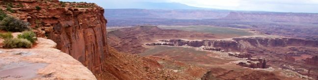
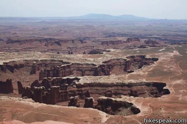
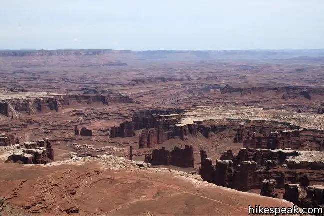
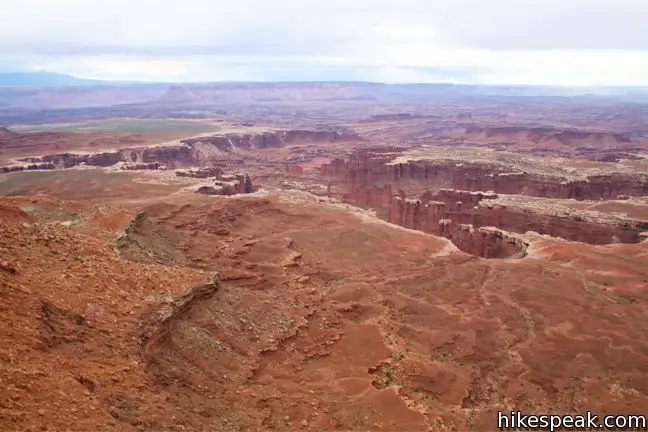
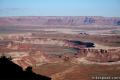
As the name implies, this is a hike with near endless views. Grand View Point is the southern-most spot on Canyonland’s high mesa, the Island in the Sky. Laid out below is a complex network of canyons carved by the converging Colorado and Green Rivers. This 2-mile round trip hike leaves from Grand View Overlook and travels down the mesa’s edge for as far as you can go without running out of real estate.
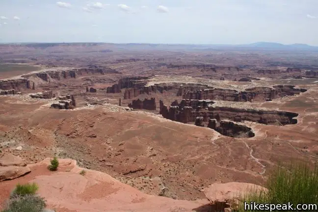
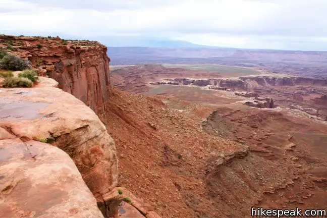
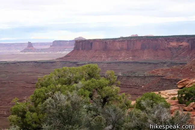
Panels at Grand View Overlook provide an illustration of the geological layers that make up Canyonlands National Park. The Colorado River is the powerful landscaper, carving a thousand-foot trench into the earth. The next layer is the White Rim. This striking ornamentation runs along the top of the canyons, taking its coloration from salt deposited in the soil. A thousand feet above the rim is the top of the mesa, where you can look out over it all.
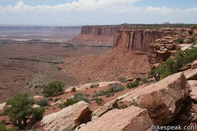
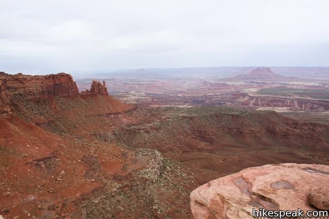
Leave the overlook and take the trail to the right along the edge of the bluff. Head southwest, following the contours of the mesa, and enjoy the inspiring views to the east across Monument Basin toward the La Sal Mountains. When the trail moves inland, let the cairns be your guide. The single-track crosses firm sandstone, losing just eighty feet of elevation as it progresses to the 6,000-foot point.
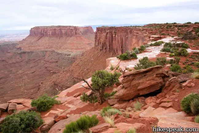
The trail cliffs-out to the right of a fifteen-foot tall boulder formation. For the grandest view of all, give them a climb and have a look around. Grand View Point offers tremendous views to the east, south, and west.
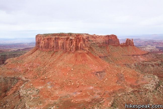
Junction Butte, located just to the south, somehow enhances the scale of the view. Beyond lie the two other explorable regions of Canyonlands National Park, the Needles and Maze districts. You could quite easily be inspired to visit these other areas of Canyonlands based on this sight alone. When you’ve had your fill, take the same trail back to return to the parking lot at Grand View Overlook.
Directions to the Trailhead
- From the Island in the Sky Visitor Center, drive south for 12 miles to road's end at Grand View Overlook.
Trailhead Location
Trailhead address: Grand View Point Road, Canyonlands National Park, Moab, UT 84532
Trailhead coordinates: 38.3108, -109.8566 (38° 18′ 38.9″N 109° 51′ 23.8″W)
View Canyonlands National Park in a larger map
Or view a regional map of surrounding Utah trails and campgrounds.


 | Murphy Point This 3.6-mile hike visits a west-facing point on the Island in the Sky overlooking canyons carved by the Green River. |
 | White Rim Overlook This gradual 1.8-mile hike visits the end of a peninsula in the Island in the Sky with 300-degree views of the canyons below. |
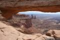 | Mesa Arch This 0.7-mile loop visits a picturesque arch spanning across the mesa's edge. |
 | More trails in Utah Explore other hikes in Canyonlands National Park and elsewhere. |
Common Questions about Grand View Point in Canyonlands National Park
- Is the trail open?
- Yes. You should expect to find that Grand View Trail is open. There are no recent reports of trail closures. If you discover that the trail is closed, please help your fellow hikers by reporting a closure.
- Do I need a permit for this hike?
- Yes. National Park Entrance Fee.
- How much time does this hike take?
- It takes approximately 45 minutes to hike Grand View Trail. Individual hiking times vary. Add extra time for breaks and taking in the views.
- How long is this hike?
- The hike to Grand View Trail is a 2 mile out and back with 80 feet of elevation change.
- Are dogs allowed on this trail?
- No, dogs are likely not allowed on Grand View Trail. The trail is primarily open to hikers.
- Is Grand View Trail good for kids?
- Yes, this hike is likely suitable for children. It is relatively short (2 miles) with manageable elevation gain.
- Where is the trailhead located?
- The trailhead for Grand View Trail is located in Moab, Utah.
Trailhead Address:
Grand View Point Road
Moab, Utah 84532
Trailhead Coordinates:
38.3108, -109.8566 - What are the driving directions to the start of the hike?
To get to the trailhead: From the Island in the Sky Visitor Center, drive south for 12 miles to road's end at Grand View Overlook.
View custom Google Maps directions from your current location.
- Are there other trails near Grand View Trail?
- Yes, you can find other nearby hikes using the Hikespeak Hike Finder Map.

what road do i take to get there from Moab?
Take 191 North to 313 West. Here is a link to directions from Moab.
[…] Grand View Point, Island in the Sky District of Canyonlands National Park […]
[…] hike (more like a walk, just 1 mile and flat) to Grand View Point was one of the most unique trails I’ve ever been on. Right by the parking area is a […]
[…] the Grand View Point was the better of the two. A 1.8 mile hike out on Grand View Point Trail is worth every moment. […]
[…] the name implies, Grand View Point is one of the spots with the most attractive views on Island in the Sky. The canyon view carved out […]
[…] Grand View Point Overlook […]