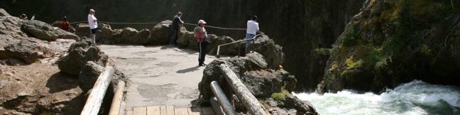
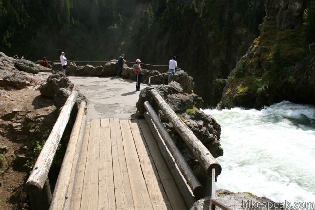
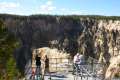
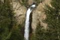
Brink of the Upper Falls Trail on the Grand Canyon of the Yellowstone River in Yellowstone National Park
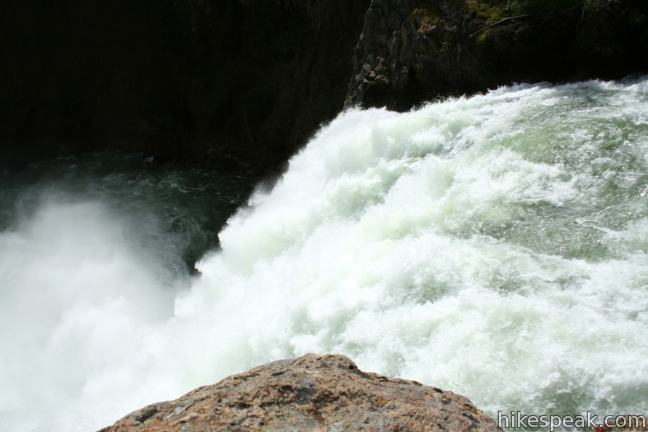
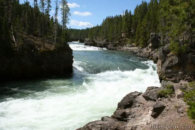
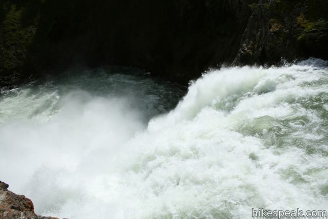
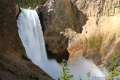
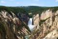
The Grand Canyon of the Yellowstone River begins at Upper Falls, cutting a 20-mile long, 1,000-foot deep gash across Yellowstone National Park. Walk right up to the edge of the dramatic tumbler on Brink of the Upper Falls Trail and stare down the thundering 109-foot waterfall. You can visit the Brink of the Upper Falls as a spur off North Rim Trail or as a short standalone hike from a parking area just uphill from the waterfall. From the parking area, it is 0.25 miles round trip to the Brink of the Upper Falls with 75 feet of elevation change.
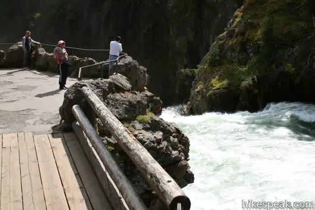
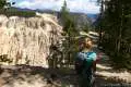
Start from the lower of two parking lots for the Brink of the Upper Falls and pick up the southbound end of North Rim Trail (you could also hike this trail for three miles in the other direction heading northeast to Inspiration Point). After a short distance on North Rim Trail, turn left at a marked junction, hiking down toward the Yellowstone River. After a couple flights of stairs, you will near the bank of the Yellowstone River and walk out to a fenced-in overlook on a rocky outcropping at the top of the Upper Falls.
Yellowstone Falls is split into two tiers separated by a quarter mile. Due to a bend in the river, the longer 308-foot Lower Falls is not visible from the Upper Falls. Still there is an intimate encounter with the violent plunge that begins from the Brink of the Upper Falls. The amount of water flowing over Upper Falls varies throughout the year. It is estimated that a minimum of 5,000 gallons of water flow over the waterfall each second during the dry fall season, and over 60,000 gallons per second fly over the Upper Falls during peak spring runoff. If the volume of the waterfall intimidates you, look for calming rainbows that appear in the swirling mist.
After absorbing the power of the Upper Falls, return the way you came. There is an entrance fee for Yellowstone National Park, but no permit is required to hike to the Brink of Upper Falls, so get out and enjoy!
Directions to the Trailhead
- From Canyon Junction, where Norris Canyon Road and Grand Loop Road meet, drive 1.6 miles south.
- Turn left onto a spur road heading east toward the Brink of the Upper Falls (the unnamed road is 0.4 miles south of North Rim Drive and 0.7 miles north of South Rim Drive on Grand Loop Road).
- Proceed another quarter mile to the trailhead parking area.
Trailhead Location
Trailhead address: Grand Loop Road, Yellowstone National Park, WY 82190
Trailhead coordinates: 44.714572, -110.500698 (44° 42′ 52.45″N 110° 30′ 02.51″W)
You may also view a regional map of surrounding Wyoming trails and campgrounds.

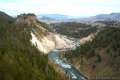
 | North Rim Trail on the Grand Canyon of the Yellowstone This trail follows the north wall of the canyon past several exceptional views between Inspiration Point and the Brink of the Upper Falls. |
 | Lookout Point on the Grand Canyon of the Yellowstone This short spur off North Rim Trail (which you can also drive right up to) achieves an impressive view of Lower Falls in the Grand Canyon of the Yellowstone River. |
 | Inspiration Point on the Grand Canyon of the Yellowstone This jutting point is one of the premier vistas along the Grand Canyon of the Yellowstone River, reachable at the bottom of a flight of stairs from a parking area at the east end of North Rim Trail. |
 | Uncle Tom's Trail on the Grand Canyon of the Yellowstone This 0.7-mile round trip hike descends a steel staircase clinging to the south wall of the canyon to a viewing platform with spectacular views of Lower Falls. |
 | Artist Point on the Grand Canyon of the Yellowstone This viewpoint delivers one of the most photographed views in Yellowstone, a memorable perspective of the 308-foot Lower Falls. |
 | Point Sublime on the Grand Canyon of the Yellowstone This 3-mile hike explores the south rim of the Grand Canyon of the Yellowstone River, passing Artist Point toward more excellent views. |
 | Tower Fall This 1-mile hike starts with a head-on view of a 132-foot waterfall. Unfortunately, the final leg of the trail to the base of Tower Fall is closed due to damage from rock and mud slides. |
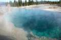
 | Calcite Springs Overlook This 0.25-mile loop overlooks a dramatic section of the Yellowstone River lined by bleached cliffs and steam venting hydrothermal springs. |
 | More trails in Yellowstone Explore other hikes to waterfalls and hydrothermal hot spots in Yellowstone National Park. |
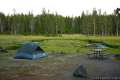 | Yellowstone National Park Campgrounds There are 12 developed campgrounds with over 2,000 total sites spread throughout Yellowstone. |
Common Questions about Brink of the Upper Falls Trail on the Grand Canyon of the Yellowstone River in Yellowstone National Park
- Is the trail open?
- Yes. You should expect to find that Brink of the Upper Falls Trail is open. There are no recent reports of trail closures. If you discover that the trail is closed, please help your fellow hikers by reporting a closure.
- Do I need a permit for this hike?
- Yes. National Park Entrance Fee.
- How much time does this hike take?
- It takes approximately 15 minutes to hike Brink of the Upper Falls Trail. Individual hiking times vary. Add extra time for breaks and taking in the views.
- How long is this hike?
- The hike to Brink of the Upper Falls Trail is a 0.4 mile out and back with 75 feet of elevation change.
- Are dogs allowed on this trail?
- No, dogs are likely not allowed on Brink of the Upper Falls Trail. The trail is primarily open to hikers.
- Is Brink of the Upper Falls Trail good for kids?
- Yes, this hike is likely suitable for children. It is relatively short (0.4 miles) with manageable elevation gain.
- Will I see a waterfall on this hike?
- Yes, Brink of the Upper Falls Trail features a waterfall.
- Where is the trailhead located?
- The trailhead for Brink of the Upper Falls Trail is located in Yellowstone National Park, Wyoming.
Trailhead Address:
Grand Loop Road
Yellowstone National Park, Wyoming 82190
Trailhead Coordinates:
44.714572, -110.500698 - What are the driving directions to the start of the hike?
To get to the trailhead: From Canyon Junction, where Norris Canyon Road and Grand Loop Road meet, drive 1.6 miles south. Turn left onto a spur road heading east toward the Brink of the Upper Falls (the unnamed road is 0.4 miles south of North Rim Drive and 0.7 miles north of South Rim Drive on Grand Loop Road). Proceed another quarter mile to the trailhead parking area.
View custom Google Maps directions from your current location.
- Are there other trails near Brink of the Upper Falls Trail?
- Yes, you can find other nearby hikes using the Hikespeak Hike Finder Map.

[…] Point, plus Brink of the Upper Falls and Brink of the Lower […]