Biscuit Basin
in Yellowstone National Park
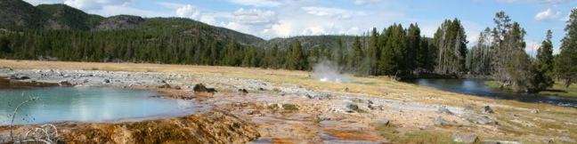
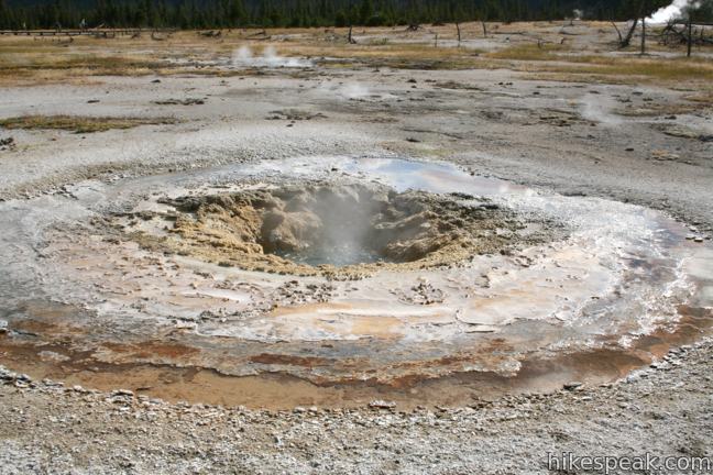
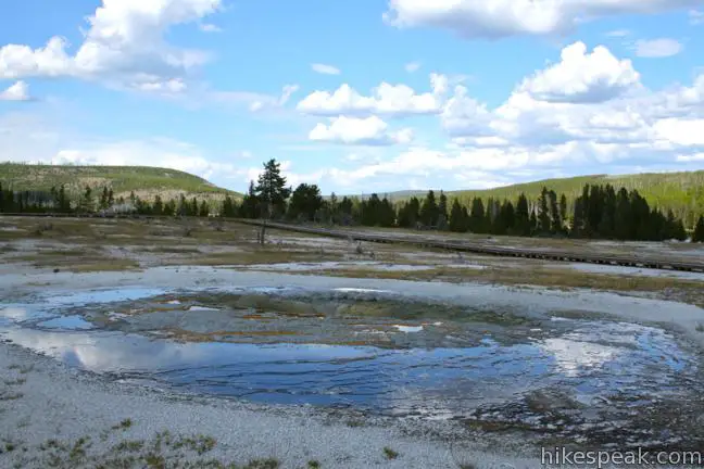
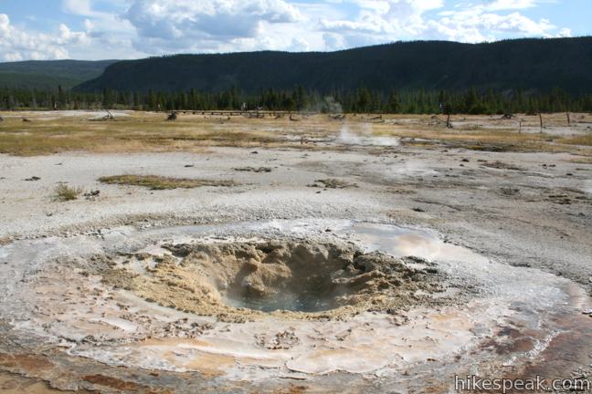
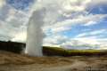
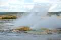
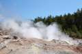
Biscuit Basin Loop offers a 2/3 of a mile lollipop-loop hike in Yellowstone National Park’s Upper Geyser Basin. Even through the boardwalk is short, there are plenty of hydrothermal features to see. Highlights include colorful hot springs and spurting geysers like Black Opal Pool, Sapphire Pool, Jewel Geyser, Shell Spring, Avoca Spring, Mustard Spring, and Black Pearl Geyser.
A sign at the trailhead describes how this active hydrothermal area got its name:
This thermal basin is particularly volatile, unpredictable. On August 17. 1959, an earthquake recorded at 7.5 on the Richter scale had its epicenter just a few miles to the northwest. Four days later, Sapphire Pool began to erupt violently, blowing away the large rock biscuits around the crater. Biscuit Basin was named for those biscuit-shaped mineral formations.
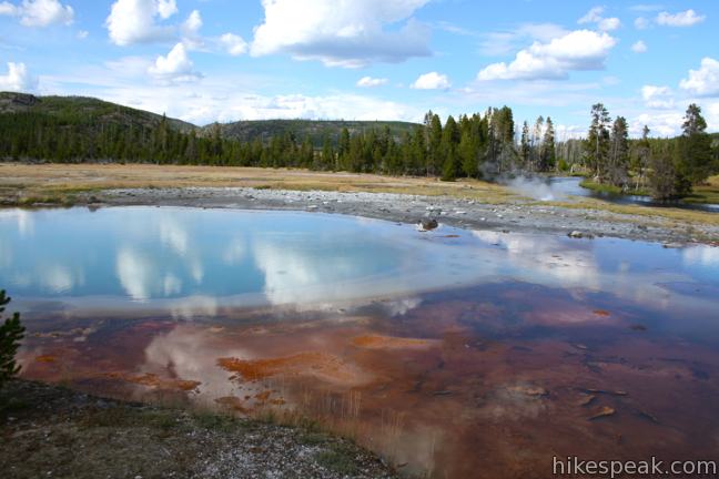
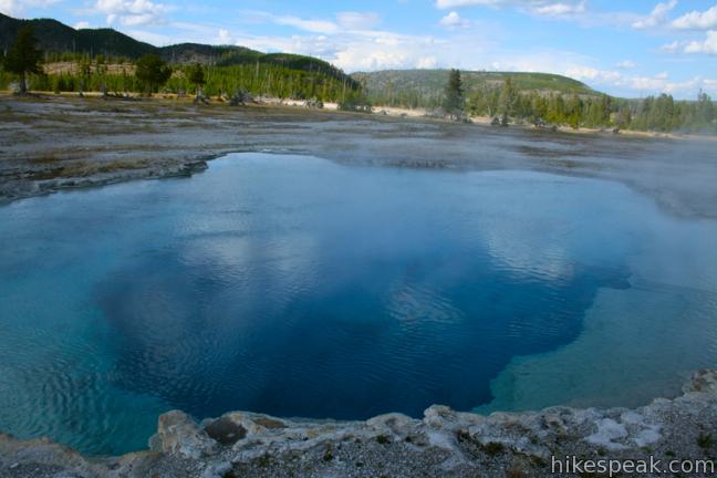
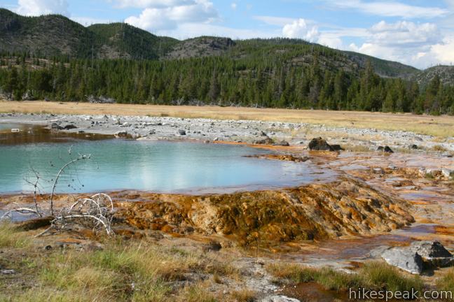
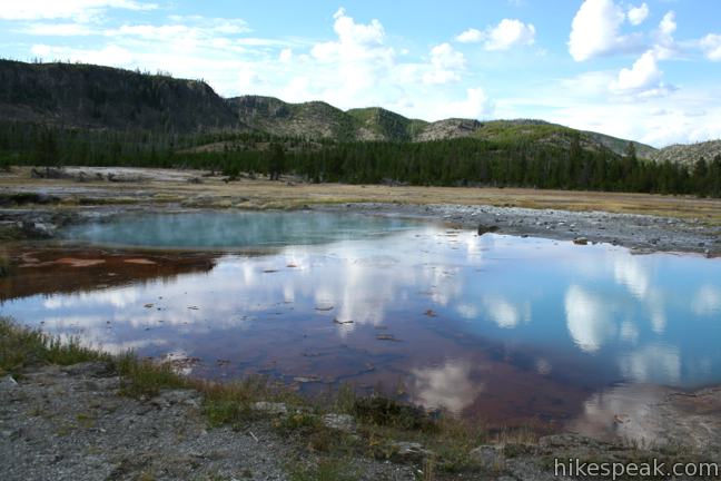
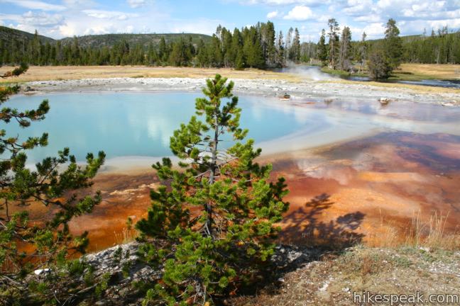
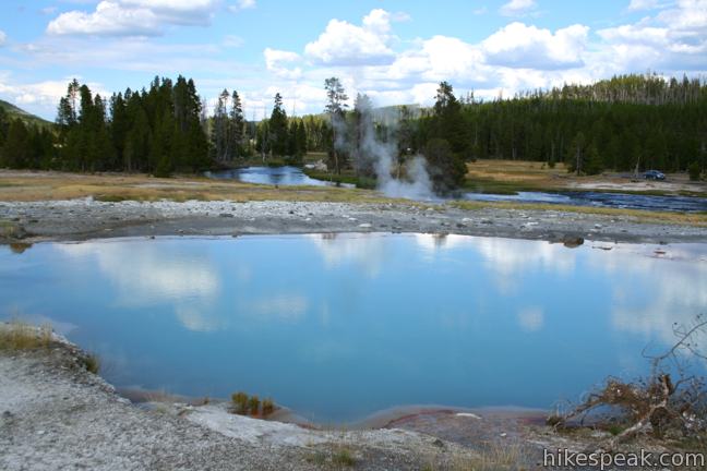
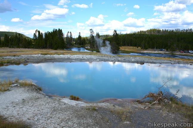
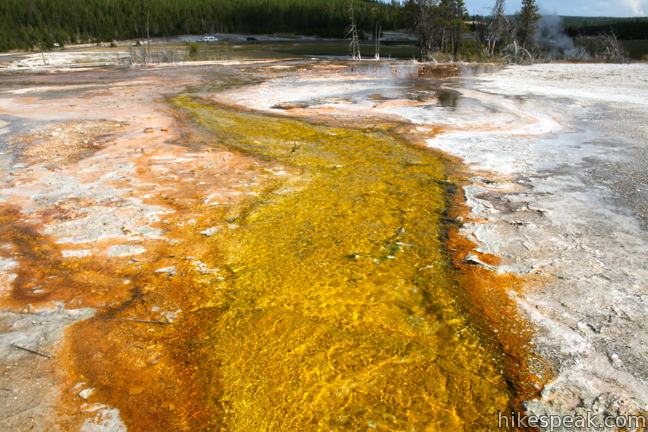
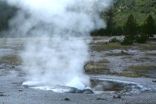
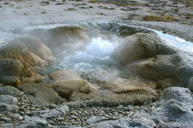
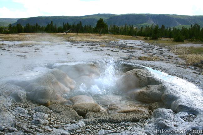
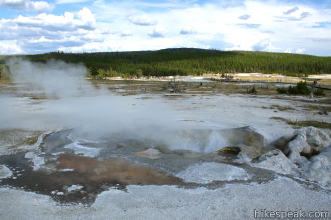
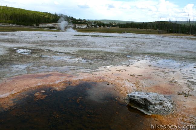
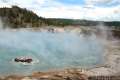
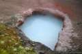
The pools will likely be calm during your visit, with a few bubbling and steaming springs surrounded by mellow reflective pools that send rippling runoff over vibrant orange bacterial mats.
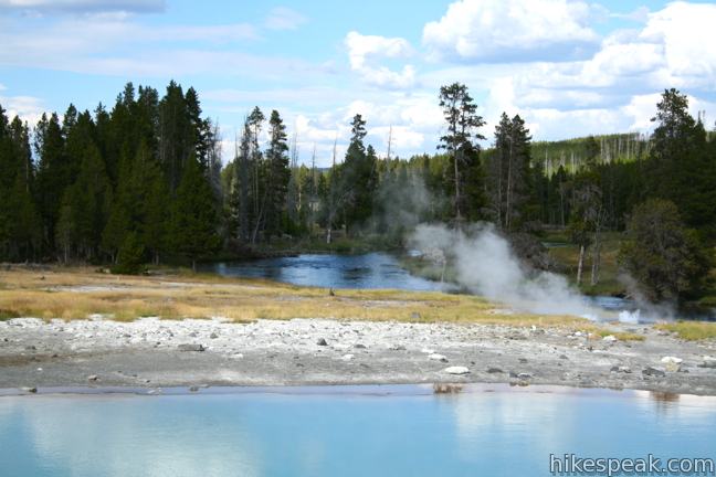
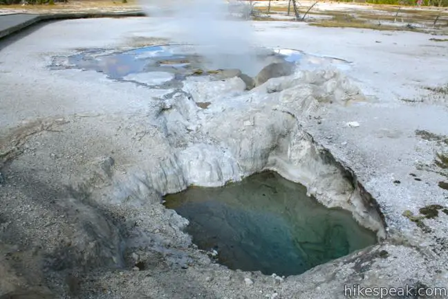
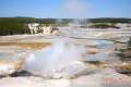
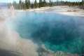
Start by walking across a wooden bridge over the Firehole River, which is fed by water from Biscuit Basin, and surrounding hydrothermal springs. You will walk straight past Black Opal Pool, Wall Pool, and Sapphire Pool to reach the start of the loop. These beautiful pools are colored by mats of thermophiles, extreme microorganisms that can survive in the hot water running off from the springs. Thermophiles are responsible for the rainbow of shades found in each of Yellowstone’s hydrothermal areas.
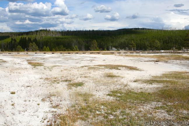
When you get to the loop, you can head left or right. Neither direction is better than the other and you are sure not to get lost. You will pass numerous hydrothermal features on both sides of the boardwalk. Walk slow and take in the surroundings.
A trail junction on the far west side of the loop allows for extensions beyond Biscuit Basin toward other Yellowstone attractions like Mystic Falls, Observation Point, Summit Lake, and Fairy Creek Trail. If you only have limited time to check out Upper Geyser Basin, you can see a lot on Biscuit Basin Loop. If you have more time, you can explore the adjoining trails and see even more.
Biscuit Basin Loop is a good 15-minute hike not far from Old Faithful. There is an entrance fee for Yellowstone National Park, but no permit is required to hike through Biscuit Basin. Stay on the boardwalk and do not touch any hydrothermal features (or throw anything in).
Directions to the Trailhead
- From Old Faithful, drive 2.5 miles north on Grand Loop Road (Route 89).
- Turn left (west) into the parking area for Biscuit Basin.
- From the other directions, from Madison Junction on Grand Loop Road, drive 14 miles south to reach the trailhead.
- The parking area for Biscuit Basin is on the right (west) side of the road.
- Biscuit Basin is 3.5 miles south of the trailhead for Midway Geyser Basin and 5.5 miles south of the trailhead for Fountain Paint Pot Trail.
Trailhead Location
Trailhead address: Grand Loop Road (Route 89), Yellowstone National Park, WY 82190
Trailhead coordinates: 44.485048, -110.85255 (44° 29′ 06.17″N 110° 51′ 09.18″W)
You may also view a regional map of surrounding Wyoming trails and campgrounds.


 | Old Faithful Geyser The tall, frequent eruptions of Yellowstone's most famous geyser have been dazzling visitors for over a century and are easy to witness today. |
 | Midway Geyser Basin This 0.8 mile walkway passes Excelsior Geyser and Grand Prismatic Spring, the largest hot springs in Yellowstone. |
 | Fountain Paint Pot This half-mile loop in Lower Geyser Basin passes geysers, hot springs, mudpots, and fumaroles - all of the hydrothermal features found in Yellowstone. |
 | Artists' Paintpots This 1.1-mile hike circles a hillside hydrothermal area, passing bursting mudpots, bubbling hot springs, and mesmerizing milky blue pools. |
 | Monument Geyser Basin This 2.8-mile hike reaches a rarely visited hydrothermal area that is boardwalk-free and fun to explore. |
 | Back Basin of Norris Geyser Basin This loop passes Steamboat Spring, the world's largest geyser, and several other hydrothermal features. |
 | Porcelain Basin of Norris Geyser Basin This pair of loops explores a stark basin with an impressive collection of geysers and hot springs. |
 | More trails in Yellowstone Explore other hikes to waterfalls and hydrothermal hot spots in Yellowstone National Park. |
 | Yellowstone National Park Campgrounds There are 12 developed campgrounds with over 2,000 total sites spread throughout Yellowstone. |
- Biscuit Basin Loop on yellowstonenationalpark.com (opens in a new tab)
- Biscuit Basin Loop in Upper Geyser Basin on americansouthwest.net (opens in a new tab)
- A map of Biscuit Basin Loop in Upper Geyser Basin on americansouthwest.net (opens in a new tab)
- The official website for Yellowstone National Park (opens in a new tab)
Common Questions about Biscuit Basin in Yellowstone National Park
- Is the trail open?
- Yes. You should expect to find that Biscuit Basin Trail is open. There are no recent reports of trail closures. If you discover that the trail is closed, please help your fellow hikers by reporting a closure.
- Do I need a permit for this hike?
- Yes. National Park Entrance Fee.
- How much time does this hike take?
- It takes approximately 15 minutes to hike Biscuit Basin Trail. Individual hiking times vary. Add extra time for breaks and taking in the views.
- How long is this hike?
- The hike to Biscuit Basin Trail is a 0.65 mile loop with 50 feet of elevation change.
- Are dogs allowed on this trail?
- No, dogs are likely not allowed on Biscuit Basin Trail. The trail is primarily open to hikers.
- Is Biscuit Basin Trail good for kids?
- Yes, this hike is likely suitable for children. It is relatively short (0.65 miles) with manageable elevation gain.
- Where is the trailhead located?
- The trailhead for Biscuit Basin Trail is located in Yellowstone National Park, Wyoming.
Trailhead Address:
Grand Loop Road
Yellowstone National Park, Wyoming 82190
Trailhead Coordinates:
44.485048, -110.85255 - What are the driving directions to the start of the hike?
To get to the trailhead: From Old Faithful, drive 2.5 miles north on Grand Loop Road (Route 89). Turn left (west) into the parking area for Biscuit Basin.
From the other directions, from Madison Junction on Grand Loop Road, drive 14 miles south to reach the trailhead. The parking area for Biscuit Basin is on the right (west) side of the road. Biscuit Basin is 3.5 miles south of the trailhead for Midway Geyser Basin and 5.5 miles south of the trailhead for Fountain Paint Pot Trail.
View custom Google Maps directions from your current location.
- Are there other trails near Biscuit Basin Trail?
- Yes, you can find other nearby hikes using the Hikespeak Hike Finder Map.

How high (mile wise) is the overlook at Biscuit Basin ? Really did enjoy the climb but feel it was farther than .7 miles!!
[…] Biscuit Basin you can enjoy views of Black Opal Pool, Jewel Geyser, and several springs but the real beauty is […]