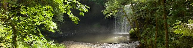
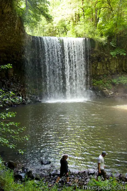
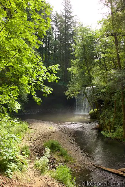
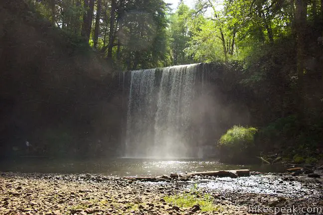
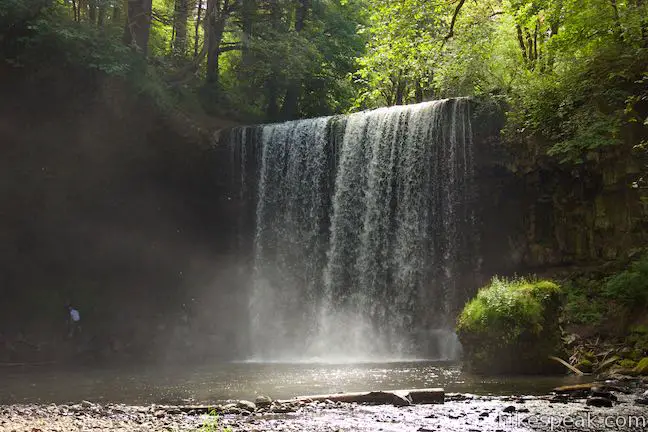
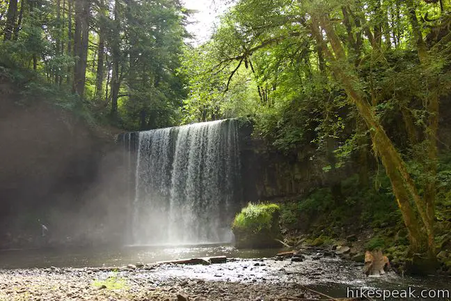
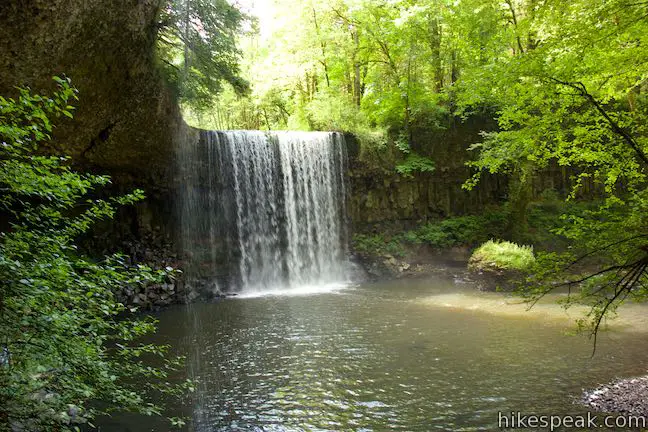
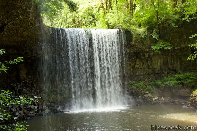
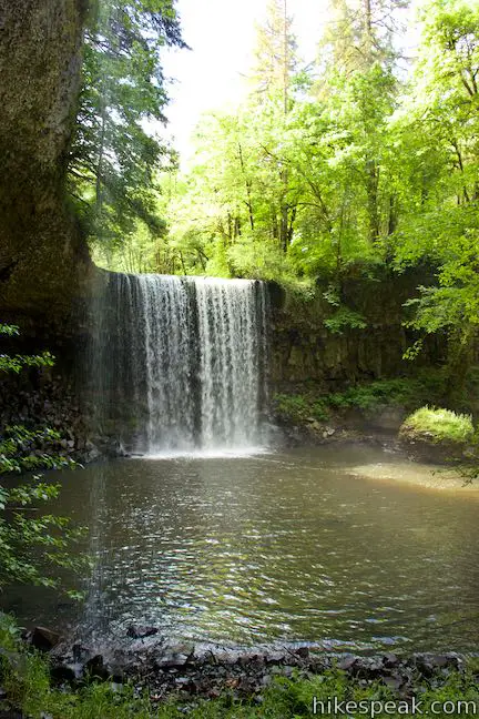
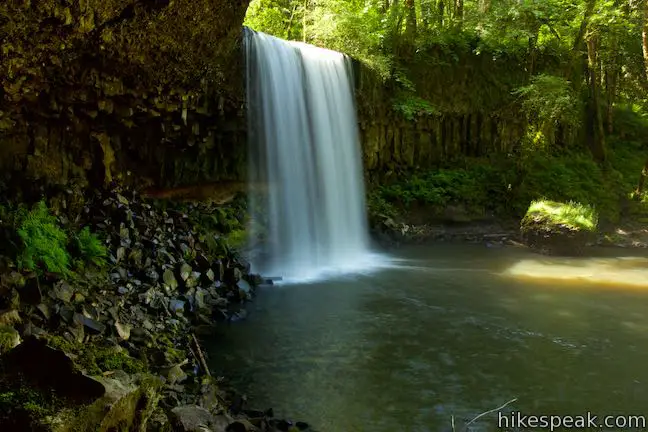
Just off Route 30 between Portland and Astoria, travelers can gush over a short hike to a lovely waterfall. Beaver Falls (a.k.a. Beaver Creek Falls) takes a single-drop plunge off a basalt ledge. The waterfall is nearly 50 feet tall and swells to 40 feet wide. This quick delight of a hike descends 100 feet through forest for a 0.7-mile round trip outing. Add this Columbia County waterfall to the itinerary for your trip to the Oregon Coast!
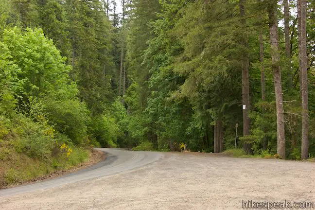
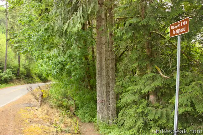
The adventure departs from a large dirt turnout along Beaver Falls Road, just 3.6 miles off Route 30 (and 75 minutes from Portland). Walk a few steps east along the road to a sign reading “Beaver Falls Trailhead” where the hike begins.
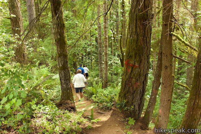
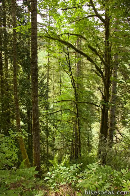
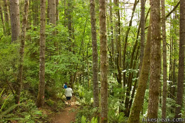
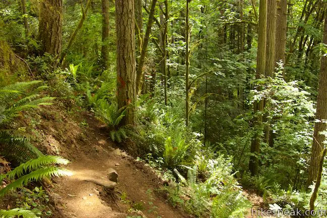
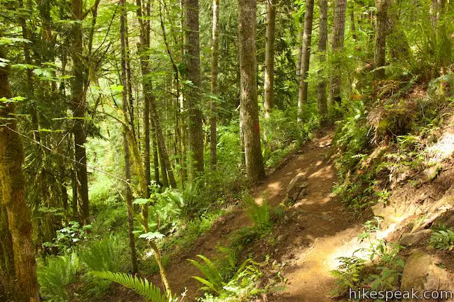
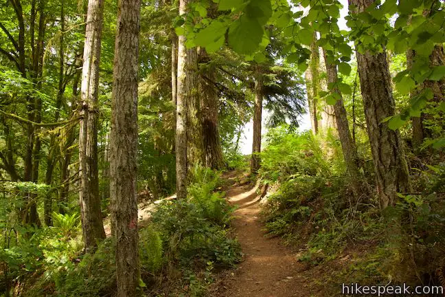
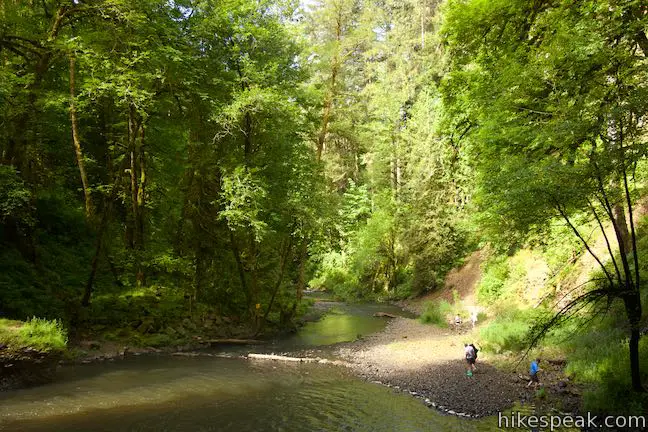
The single-track trail descends a couple switchbacks right off the bat, entering a forest above Beaver Creek. Cedars, firs, hemlock, and maples wrap the trail in a lush canopy. Oregon grapes and ferns line the rocky, uneven trail. Although this hike is short, sure footing is required.
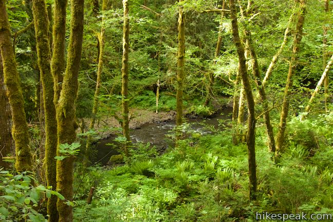
Beaver Falls Trail is mostly downhill, sacrificing 100 feet. The trail does have a few undulations where it passes rocky cliffs. Arrows are spray painted on tree trunks and rocks, in case there was any way to get off course. Through the trees, catch glimpses of Beaver Creek, flowing west as you travel east.
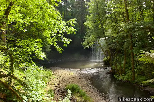
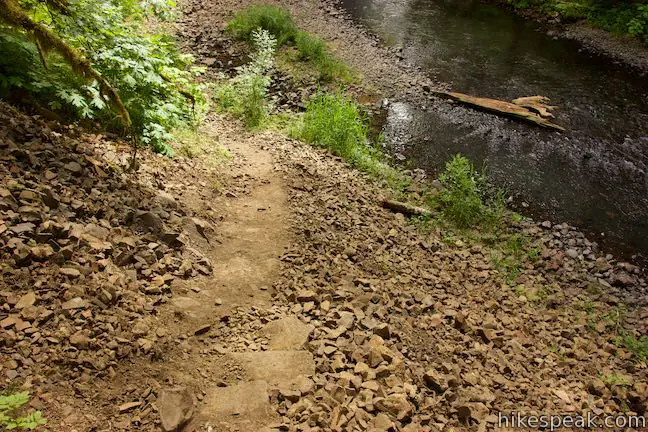
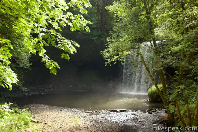
After 0.3 miles, the trail exits the forest and drops to the side of Beaver Creek, offering your first view of Beaver Falls. Walk up the creek to a rocky bank across from the waterfall. Now stop to admire the beauty.
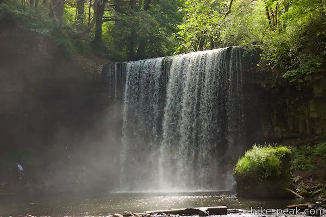
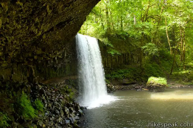
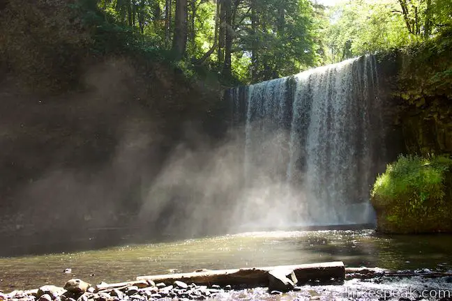
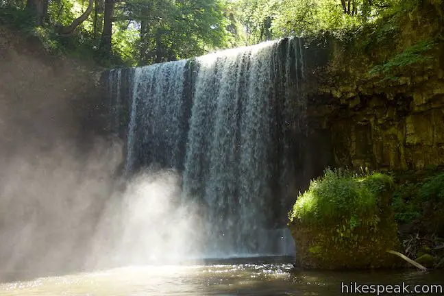
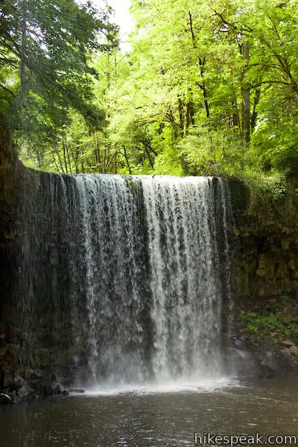
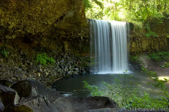
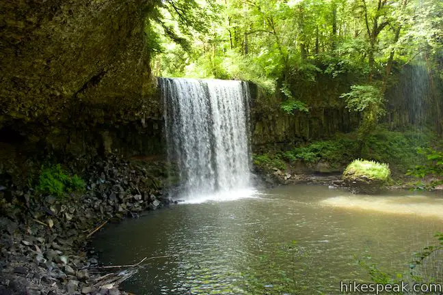
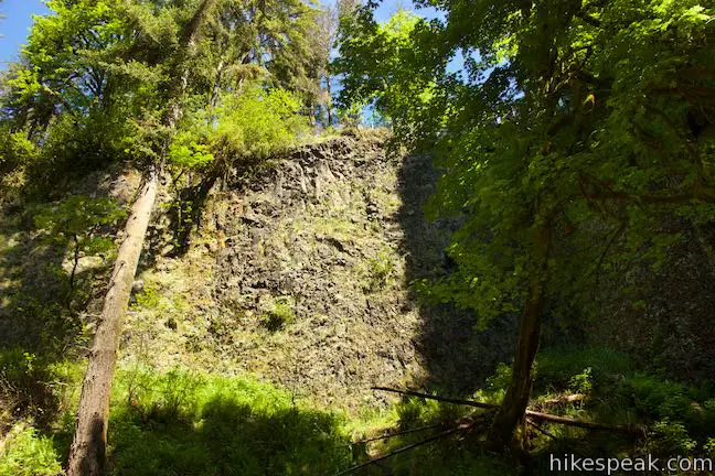
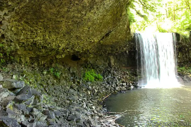
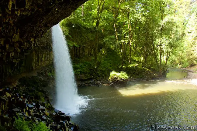
Beaver Falls is broad and full with an impactful single drop. Small droplets of mist spread out from the base of the waterfall. Hexagonal columns of basalt form a wall to the right of the Beaver Falls and a bigger overhang in the basalt cliffs has been carved out behind the waterfall and to the left.
You might spot the fender of a car on the rocky beach next to you. You can also look for the frame of a car in the pool in front of the waterfall, having crashed down from Beaver Falls Road (atop the cliffs to the left).
You could turn back when you get to the Beaver Falls amphitheater for a 0.6-mile hike, or press on to explore behind the waterfall.
A bridge of rock and logs crossing the creek to the right may allow you to form a loop behind the waterfall. Once across the creek, you can also venture upstream for a look down over the falls.
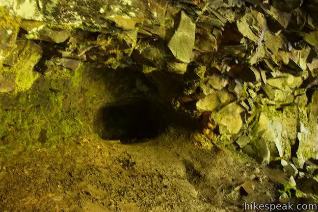
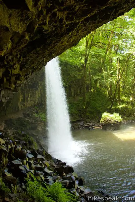
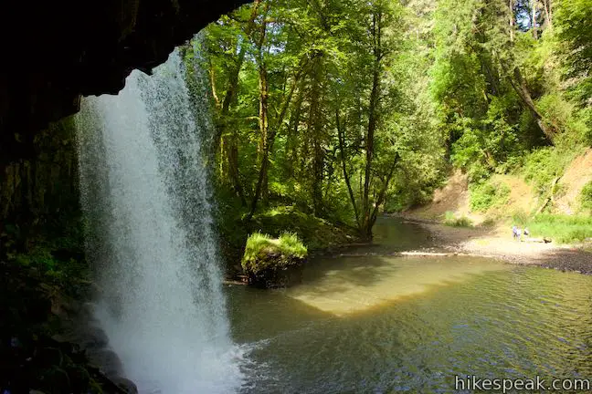
The more obvious path is to continue along the left side of the creek and pass under the overhang to the back of the waterfall. Cross a jumble of rocks below the basalt cliffs as you ease closer to the waterfall. The rocks become wetter, muddier, and slipperier as you go, so be careful. Pass a dark recess in the back of the overhang that looks like a cave but is quite shallow.
Approach the back of the overhang, watch the water fall, and gaze downstream. You can turn around at any point behind Beaver Falls or continue all the way around in a loop if the creek is low enough to rock hop across and return to the end of the trail.
Hike back up the way you came for a short trek that is just 0.7 miles round trip with minimal elevation change (but rough terrain). Dogs are welcome, but Beaver Falls Trail is not appropriate for bikes. No permit or fee is required to hike to Beaver Falls, so get out and enjoy!
- To see the tallest Oregon waterfall west of the Willamette, check out Munson Creek Falls Trail.
Directions to the Trailhead
- From Portland, take Route 30 northwest for 52 miles to Beaver Falls Road.
- The right turn onto Beaver Falls Road comes 4.8 miles past the interchange with Route 433 near Longview, Washington.
- Drive 3.6 miles up Beaver Falls Road and pull into the large dirt turnout on the left, just past the start of Beaver Falls Trail.
- From Astoria, drive east on Route 30 for 34 miles to the town of Clatskanie.
- Turn left onto North Nehalem Street.
- Drive a couple blocks to an awkward intersection and turn onto the second street on the left, which is NW 5th Street.
- Drive 6 miles from here to the trailhead, which will be on the right (5th Street becomes Beaver Falls Road after half a mile).
Trailhead Location
Trailhead address: Beaver Falls Road, Clatskanie, OR 97016
Trailhead coordinates: 46.10394, -123.1298 (46° 06′ 14.2″N 123° 07′ 43.7″W)
View Beaver Falls in a larger map
Or view a regional map of surrounding Oregon trails and campgrounds.


 | Saddle Mountain Trail This 5-mile round trip hike rises through fir forests and wildflower-filled slopes up to a summit with panoramic coastal views. |
 | Ecola Point to Indian Beach This 2 2/3-mile round trip hike explores a wild and beautiful section of Oregon Coast Trail between Ecola Point and Indian Beach in Ecola State Park. |
 | Cape Meares Lighthouse & Octopus Tree This easy 0.8-mile hike in Cape Meares State Park visits a beautiful lighthouse and an equally impressive tree, exploring a coastal cape with tall cliffs and big ocean views. |
 | Oceanside Beach to Tunnel Beach This 0.8-mile beach walk comes with an adventurous twist, a man-made tunnel through a cliff that leads from one beautiful beach to a second, more secluded beach. |
 | Munson Creek Falls Trail This short hike near Tillamook travels up a forest canyon to the tallest waterfall in Coastal Oregon. |
 | Whalen Island Loop Trail This 1.5-mile hike explores a lovely island-like park in Sand Lake Estuary with ocean and wetland views. |
 | Cape Lookout Trail This 5-mile round trip hike ventures down a promontory on the Oregon Coast with beautiful ocean views. |
 | Cape Kiwanda This short beach hike explores tide pools and sand dunes at a rugged headland on Oregon's coast near Pacific City. |
 | Trails in Oregon Explore more hikes throughout the state of Oregon. |
 | Whalen Island County Campground This 33-site campground is a nice camping option on Whalen Island with easy access to estuary beaches and a loop hike. |
 | Cape Lookout State Park Campground This grand, oceanfront campground has over 200 sites right behind a big, beautiful beach. |
Common Questions about Beaver Falls in Clatskanie, Oregon
- Is the trail open?
- Yes. You should expect to find that Beaver Falls Trail is open. There are no recent reports of trail closures. If you discover that the trail is closed, please help your fellow hikers by reporting a closure.
- Is this trail free to access?
- Yes, Beaver Falls Trail is free to access. No entrance fee, pass, or permit is required. If you discover that access rules have changed, please provide feedback on your experience.
- How much time does this hike take?
- It takes approximately 15 minutes to hike Beaver Falls Trail. Individual hiking times vary. Add extra time for breaks and taking in the views.
- How long is this hike?
- The hike to Beaver Falls Trail is a 0.7 mile out and back with 100 feet of elevation change.
- Are dogs allowed on this trail?
- Yes, dogs are allowed on Beaver Falls Trail. The trail is open to hikers, dogs.
- Is Beaver Falls Trail good for kids?
- Yes, this hike is likely suitable for children. It is relatively short (0.7 miles) with manageable elevation gain.
- Will I see a waterfall on this hike?
- Yes, Beaver Falls Trail features a waterfall.
- Where is the trailhead located?
- The trailhead for Beaver Falls Trail is located in Clatskanie, Oregon.
Trailhead Address:
Beaver Falls Road
Clatskanie, Oregon 97016
Trailhead Coordinates:
46.10394, -123.1298 - What are the driving directions to the start of the hike?
To get to the trailhead: From Portland, take Route 30 northwest for 52 miles to Beaver Falls Road. The right turn onto Beaver Falls Road comes 4.8 miles past the interchange with Route 433 near Longview, Washington. Drive 3.6 miles up Beaver Falls Road and pull into the large dirt turnout on the left, just past the start of Beaver Falls Trail.
From Astoria, drive east on Route 30 for 34 miles to the town of Clatskanie. Turn left onto North Nehalem Street. Drive a couple blocks to an awkward intersection and turn onto the second street on the left, which is NW 5th Street. Drive 6 miles from here to the trailhead, which will be on the right (5th Street becomes Beaver Falls Road after half a mile).
View custom Google Maps directions from your current location.
- Are there other trails near Beaver Falls Trail?
- Yes, you can find other nearby hikes using the Hikespeak Hike Finder Map.

I have been trying to find the information about the Witch that used to live in the wooded area of Beaver Falls. I grew up with the stories of her and my grandfather even went out on a call to Beaver Falls when he was part of the volunteer Sheriff’s Department in Clatskanie. Down at the falls they found severed chicken heads and feet and blood circles and sigil drawn on the rocks and behind the falls. It was said that she had a cabin in the woods but was never found. Any information would be much appreciated.
I’m extremely interested to speak with you about this! Please email me at genniferhayes2019@icloud.com!
Is it still opened even in this pandemic?
Yes, it is open during this plandemic. You are far less likely to catch the virus here than you are at Wal-mart. This is a primitive park – no facilities, trash cans, or hand rails.
Omg. I only just realized that Marty McFly is a boomer.
Can I swim in the waterfall?
No, waterfalls falls through the air so there is nothing to support you if you tried to swim in it.
Haha
If I were to go swimming how deep would it be?