Waikato

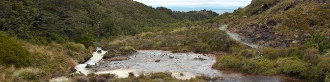
Waikato is a region on the North Island of New Zealand. It includes the cities of Hamilton, Cambridge, Te Awamutu, Tokoroa, and Taupo. At the south end of the region is Lake Taupo, the largest lake in New Zealand by surface area. Huka Falls near Lake Taupo is New Zealand's most visited scenic reserve. A small piece of Tongariro National Park lies within the Waikato Regions, which is full of other opportunities for outdoor recreation. ... Read more.
Silica Rapids in Tongariro National Park
Silica Rapids Track explores improbable landscapes in Tongariro National Park, where cream-colored streams cascades over terraces of silica. The 5.15-kilometer (3.2-mile) long track starts from Whakapapa Village and ends two kilometers farther up Bruce Road, allowing it to be explored as a point-to-point hike with the assistance of a vehicle or a 7. ...Read more.
Distance: 5.15 kilometers / 3.2 miles · Elevation change: 190 meters / 625 feet
By: Published: March 4, 2015 Last updated: December 6, 2025
Taranaki Falls in Tongariro National Park
Taranaki Falls Track is an impressive 6.45-kilometer (4-mile) loop starting from Whakapapa Village in Tongariro National Park. The track crosses alpine grasslands, beech forests, and other landscapes shaped by incredible nearby volcanoes. Around the midpoint of the loop, the track reaches Taranaki Falls, which plunges nearly twenty meters (65 feet) from volcanic cliffs into a pleasant pool. ...Read more.
Distance: 6.45 kilometers / 4 miles · Elevation change: 115 meters / 375 feet
By: Published: March 2, 2015 Last updated: December 6, 2025
Waitonga Falls in Tongariro National Park
It's pretty obvious that Waitonga Falls Track goes to a waterfall, which is actually the tallest waterfall in Tongariro National Park. The track's other offerings may surprise you though, like a boardwalk across alpine wetlands with pools that hold a mirror to Mount Ruapehu, the biggest volcano in New Zealand. Indeed, you'll get big enjoyment from this 4-kilometer (2. ...Read more.
Distance: 4 kilometers / 2.5 miles · Elevation change: 110 meters / 360 feet
By: Published: January 25, 2015 Last updated: December 5, 2025
Rimu Walk in Tongariro National Park
Not all trails in Tongariro National Park cross dramatic volcanic landscapes. At the south end of Tongariro National Park near the town of Ohakune, you'll find a short nature trail through a dense forest, typical of those found throughout New Zealand. Panels along the 0.8-kilometer walk describe the trees and other plants in the area. There are no big views or volcanic features along Rimu Walk, so its real appeal is as a peaceful walk with information about vegetation. ...Read more.
Distance: 0.8 kilometers / 0.5 miles · Elevation change: 8 meters / 25 feet
By: Published: January 12, 2015 Last updated: December 5, 2025
Mangawhero Campground in Tongariro National Park
For camping on the south side of Tongariro National Park, check out Mangawhero Campsite. This campground near the town of Ohakuna has twelve sites spread over two loops and offers views of Mount Ruapehu, which looks stunning from the campground at sunrise and sunset. Mangawhero Campground is a standard Department of Conservation campsite with twelve sites suitable for tents and campervans. ...Read more.
By: Published: November 5, 2014 Last updated: April 15, 2026