
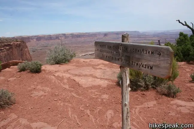
The Island in the Sky district of Canyonlands National Park is renowned for elevated views of immense canyons. One of the best east-facing vistas is White Rim Overlook, which offers sweeping 300-degree views from the mid-point a 1.8-mile round trip hike.
From the picnic area a mile from the end of Grand View Road, hike east down the trail for a tenth of a mile and turn right at the junction. To the left, Gooseberry Trail drops off the side of the mesa down to Buck Canyon. The journey to White Rim Overlook is far less challenging, descends just 170 feet while still delivering knockout views. Take the single track to the right for a gradual hike to a scenic peninsula in the Island in the Sky.
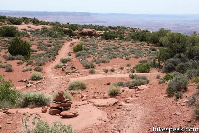
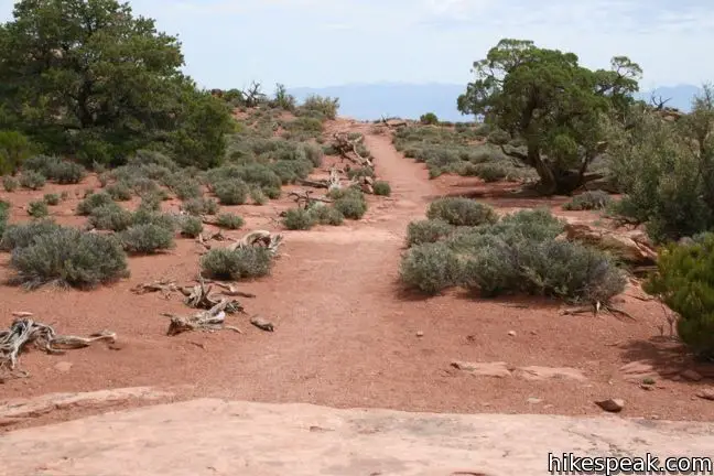
The trail starts out as a gravel track, but transforms into a cairn-lined path over exposed sandstone. Simply continue down the middle of the point until you can’t hike any farther. Wow, what a view!
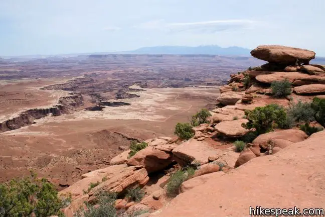
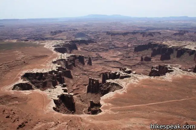
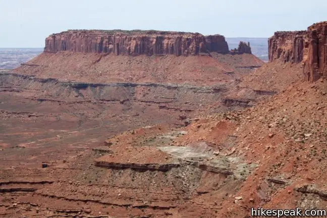
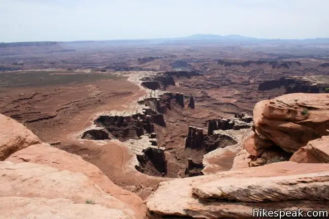
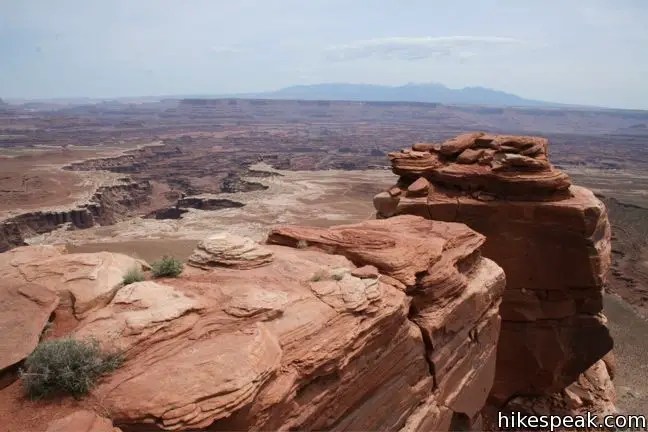
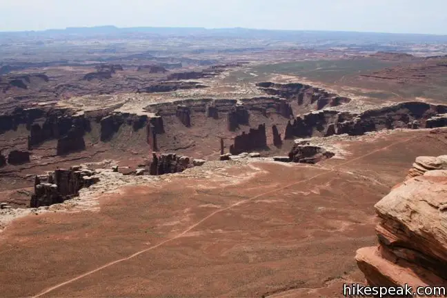
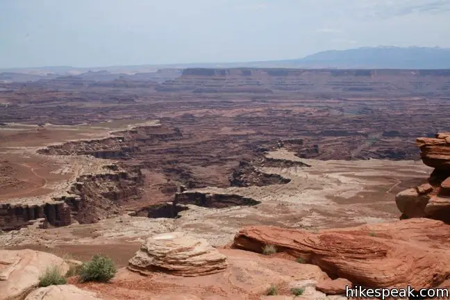
The transformative work the Colorado River lies below, a mesmerizing expanse of canyons. Along the canyon rim is layer of white rock. This thick salt deposit stands out from the surrounding stone, giving the landscape an ethereal look. To the southeast, in an area known as Monument Basin, the White Rim balances strikingly atop stubborn buttes and hoodoos that the river could not carry away. Jeeps can be seen touring White Rim Road along the edge of the canyon, a thousand feet below. An old mining road is visible as well, but that is as much human impact as you are likely to see.
The snow-capped La Sal Mountains form the horizon to the east. To the southwest, you can look down to the end of the mesa toward Grand View Point and Junction Butte. White Rim Overlook has a grand view of its own, and you could spend quite some time contently staring off from this peaceful spot.
To get to the trailhead: From the Island in the Sky Visitor Center, drive south for 11 miles and turn left into picnic area. As you drive through the picnic area, the trailhead will be on the right.
Trailhead address: Grand View Point Road, Canyonlands National Park, Moab, UT 84532
Trailhead coordinates: 38.3228, -109.8495 (38° 19′ 21.5″N 109° 50′ 58.2″W)
View Canyonlands National Park in a larger map
Or view a regional map of surrounding Utah trails and campgrounds.


 | Grand View Point This 2-mile hike travels along the mesa's edge from Grand View Overlook to the southernmost point on the Island in the Sky. |
 | Murphy Point This 3.6-mile hike visits a west-facing point on the Island in the Sky overlooking canyons carved by the Green River. |
 | Mesa Arch This 0.7-mile loop visits a picturesque arch spanning across the mesa's edge. |
 | More trails in Utah Explore other hikes in Canyonlands National Park and elsewhere. |
White Rim Overlook in Best Easy Day Hikes: Canyonlands and Arches by Bill Schneider
Utah's National Parks by Ron Adkison
50 Best Short Hikes in Utah's National Parks by Greg Witt
Best Canyonlands National Park Hikes by Rob Martinez
Canyonlands National Park on Utah.com
[…] carved out by the Colorado River, were as majestic as promised. The following photographs of the White Rim Overlook portion of the Canyonlands offer only an exceedingly small glimpse of the wonders on display; […]
[…] off the day by hiking to White Rim Overlook (1.8 miles RT) and Upheaval Dome (1.7 miles RT). (If you want to shorten the hikes, skip Upheaval […]
[…] next stop was the White Rim Overlook Trail. This short walk brought us to a spectacular view of the intersection of the Green and Colorado […]
[…] White Rim Overlook is a short, easy trail with a stunning scenic view at the end. […]
[…] For an afternoon hike, the 1.8-mile White Rim Overlook trail delivers more spectacular views, this time of the Colorado River winding its way through the vast and layered landscape carved by time, as well as Monument Basin and the snow-capped La Sal Mountains […]