Pebble Creek Trail
in Yellowstone National Park
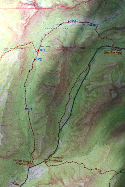
Starting just inside Yellowstone’s northeast entrance near Cooke City, Montana, there is an interstate trail traveling through a beautiful backcountry meadow boxed in by 10,000-foot peaks. Pebble Creek Trail is often ventured as a top-to-bottom 12-mile long through hike ending at Pebble Creek Campground. There are five trail camps along Pebble Creek Trail for backpackers. Even if you can’t arrange a vehicle shuttle to hike the full trail, it is still worthwhile to hike out and back to the meadow over the first leg of the trail for a 5 to 7 mile trek.
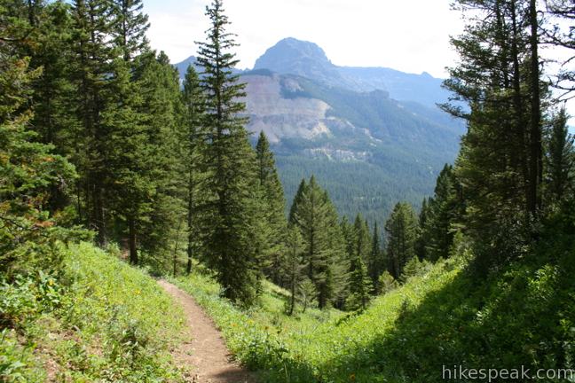
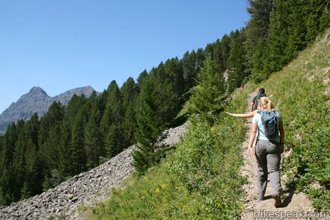
Of Pebble Creek Trail’s twelve miles, about ten miles offer gradual downhill hiking. This is not the case at the beginning, when the single track attacks a pine, spruce, and fir covered ridge, gaining nearly 1,000 feet over the first 1.25 miles.
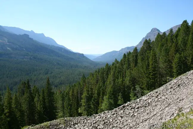
To motivate the effort, you will reach grand views down the valley of Soda Butte Creek about 2/3 of a mile from the start. Abiathar Peak (10,928 feet) and Amphitheater Mountain can be seen rising above the forest on the south side of the valley.
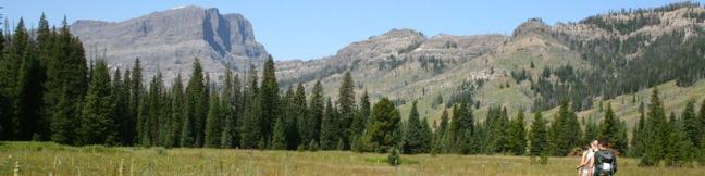
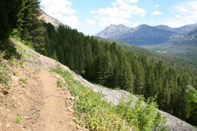
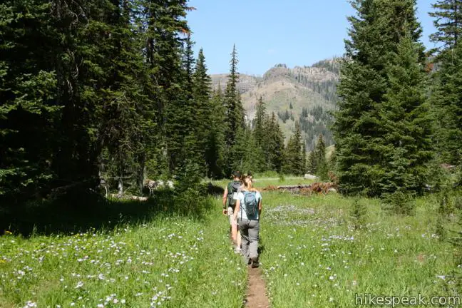
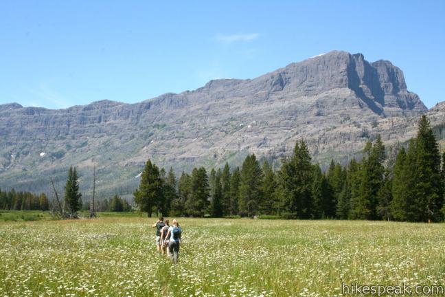
The northwest-headed trail tapers out as it crosses the top of the ridge and eventually turns downhill, making a quick descent to the edge of a sublime high elevation meadow, 1.8 miles from the start. To the delight of through hikers, it is nothing but gradual predominantly downhill travel from this point on.
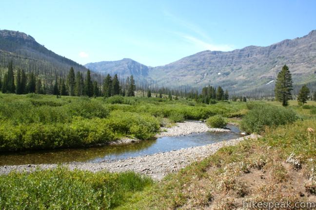
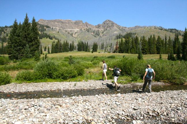
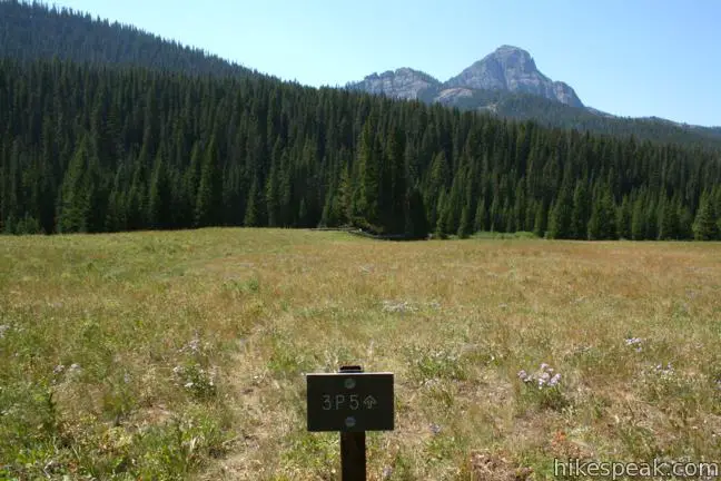
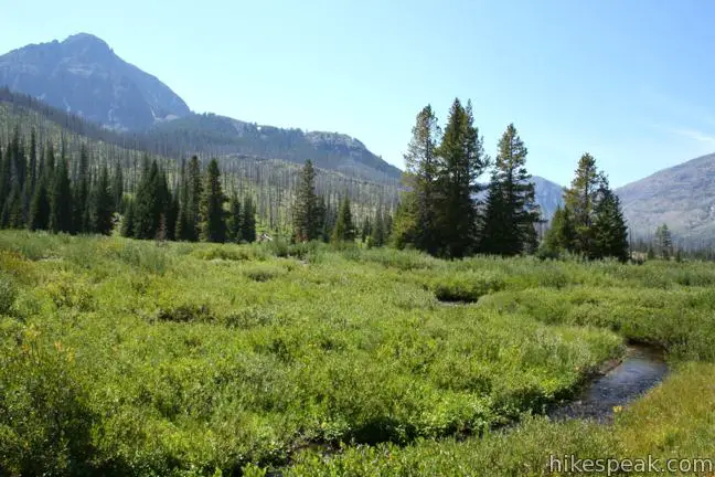
When you reach the cold mountain waters of Pebble Creek, rock hop or wade to the other side and continue up the trail another 0.2 miles to a spur trail on the left leading to Trail Camp 3P5, the first of five backcountry camp sites along Pebble Creek Trail (2.15 miles from the start).
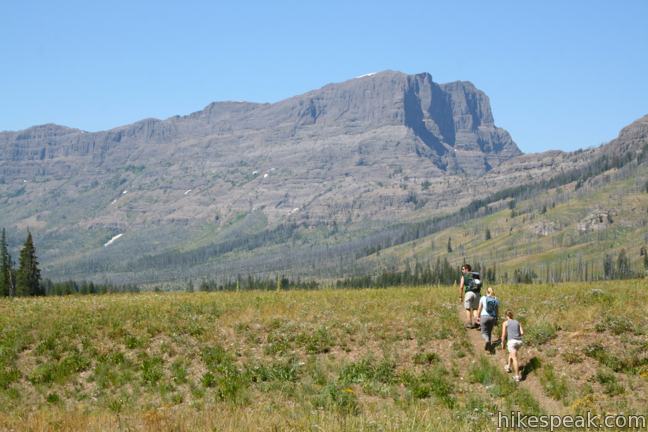
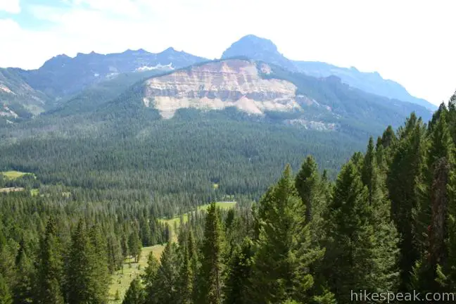
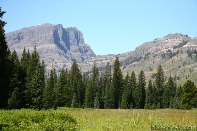
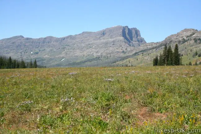
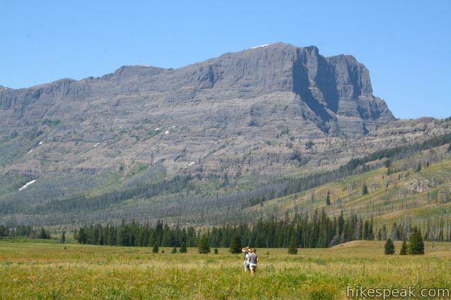
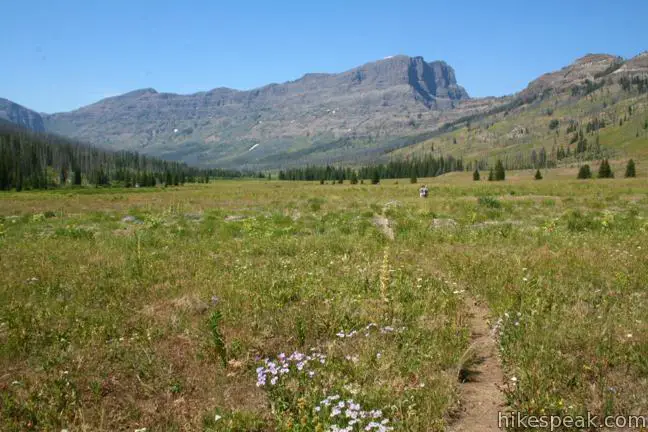
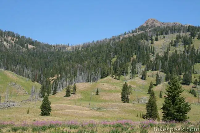
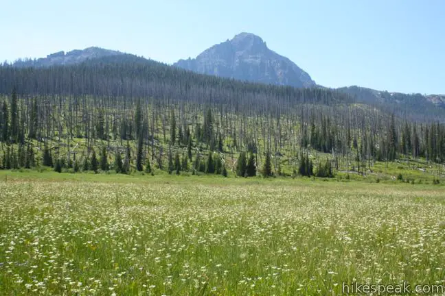
Pebble Creek Trail continues down the pristine meadow through a colorful summer display of lupines and other wildflowers. As you hike west through part of Yellowstone that resides in Montana, you’ll be treated to dramatic mountain views. To the west is Cutoff Mountain, a boxy 10,695-foot summit, whose sheer walls dominate the horizon as you hike across the grassy meadow. If you turn around and look east, you’ll see Meridian Peak (10,538 feet), pointing up beyond the upper end of the meadow.
The next trail camp, 3P5, comes 1.1 miles after 3P4, and 3.25 miles from the start. If you aren’t hiking all the way through to Pebble Creek Campground, 8.75 miles ahead, this is a good place to turn around for a manageable 6.5-mile day hike. If you head back here, there will be 375 feet of elevation gain as you retrace your steps back to the top of the ridge, followed by a speedy descent to the initial trailhead.
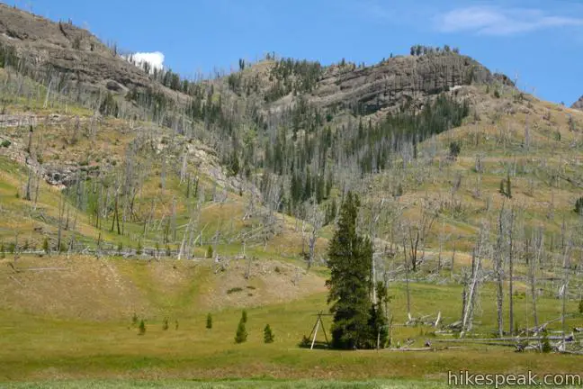
Those continuing beyond 3P4 will pass three more trail camps en route to the second trailhead at the lower end of Pebble Creek Trail near Pebble Creek Campground. Pebble Creek Trail descends 1,000 feet between 3P4 and the lower trailhead, offering a gradual romp across beautiful mountain meadows. The only junction on the trail comes 5.5 miles from the start (shortly after entering Wyoming), where Pebble Creek Trail passes Bliss Pass Trail.
No permit is required to day hike on Pebble Creek Trail, but a Backcountry Use Permit is required for any overnight treks. The permit may be obtained less than 48 hours in advance of your trip from one of nine visitor centers and ranger stations within the park. The reservation fee for a backcountry permit is $25. There is also an entrance fee for Yellowstone National Park.
Directions to the Trailhead
- From the gate at the northeast entrance of Yellowstone National Park near Cooke City, Montana, drive 1.25 miles west on Northeast Entrance Road and turn right into the trailhead parking area on the north side of the road.
- Coming from the opposite direction, the trailhead is 27 miles east of Tower Junction (and 8 miles past Pebble Creek Campground).
- There is a map at the trailhead and a sign that reads, Warm Creek Trailhead 3K4.
Trailhead Location
Trailhead address: Northeast Entrance Road (Route 212), Yellowstone National Park, Silver Gate, MT 59081
Trailhead coordinates: 45.005477, -110.034372 (45° 00′ 19.71″N 110° 02′ 03.73″W)
View Yellowstone National Park in a larger map
Or view a regional map of surrounding Wyoming trails and campgrounds.


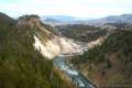 | Calcite Springs Overlook This 0.25-mile loop overlooks a dramatic section of the Yellowstone River lined by bleached cliffs and steam venting hydrothermal springs. |
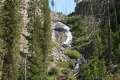
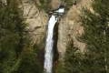 | Tower Fall This 1-mile hike starts with a head-on view of a 132-foot waterfall. Unfortunately, the final leg of the trail to the base of Tower Fall is closed due to damage from rock and mud slides. |
 | Wraith Falls This easy 0.8-mile round trip hike climbs 100 feet to a ghostly 100-foot cascade. |
 | Mammoth Hot Springs This series of boardwalks explores a park highlight, a collection of colorful hot springs terraces. |
 | Boiling River This 1.25-mile round trip hike follows a riverbank to a natural hot tub where a stream of water cooked by nearby hydrothermal features mixes with the river. |
 | More trails in Yellowstone Explore other hikes to waterfalls and hydrothermal hot spots in Yellowstone National Park. |
 | Yellowstone National Park Campgrounds There are 12 developed campgrounds with over 2,000 total sites spread throughout Yellowstone. |
Common Questions about Pebble Creek Trail in Yellowstone National Park
- Is the trail open?
- Yes. You should expect to find that Pebble Creek Trail is open. There are no recent reports of trail closures. If you discover that the trail is closed, please help your fellow hikers by reporting a closure.
- Do I need a permit for this hike?
- Yes. National Park Entrance Fee.
- How much time does this hike take?
- It takes approximately 5 hours 30 minutes to hike Pebble Creek Trail. Individual hiking times vary. Add extra time for breaks and taking in the views.
- How long is this hike?
- The hike to Pebble Creek Trail is a 12 mile through hike with 950 feet of elevation change.
- Are dogs allowed on this trail?
- No, dogs are likely not allowed on Pebble Creek Trail. The trail is primarily open to hikers.
- Is Pebble Creek Trail a difficult hike?
- This hike should be considered strenuous. Hikers should be prepared for a workout covering 12 miles and 950 feet of climbing.
- Where is the trailhead located?
- The trailhead for Pebble Creek Trail is located in Silver Gate, Montana.
Trailhead Address:
Northeast Entrance Road
Silver Gate, Montana 59081
Trailhead Coordinates:
45.005477, -110.034372 - What are the driving directions to the start of the hike?
To get to the trailhead: From the gate at the northeast entrance of Yellowstone National Park near Cooke City, Montana, drive 1.25 miles west on Northeast Entrance Road and turn right into the trailhead parking area on the north side of the road. Coming from the opposite direction, the trailhead is 27 miles east of Tower Junction (and 8 miles past Pebble Creek Campground). There is a map at the trailhead and a sign that reads, Warm Creek Trailhead 3K4.
View custom Google Maps directions from your current location.
- Are there other trails near Pebble Creek Trail?
- Yes, you can find other nearby hikes using the Hikespeak Hike Finder Map.

How can I arrange shuttle service at upper pebble in yellow stone? I. E. phone numbers ect.
How can I get a ride from silvergate MT to trailhead slough creek? One way hiking? Cost/ reliable ? thanks