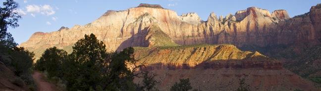
Hikes in Arches National Park
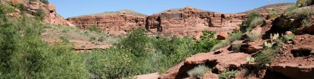
Looking through the arches in this national park is like peering into a world of magic, where gravity is defied by elegance and resilience. Over 2,000 natural arches are spread throughout the 120 square miles protected by Arches National Park. It is hard to believe that so many amazing arches can exist in one place, but they do, and arches are more numerous here then anywhere else on the planet. The sandstone spans draw over one million visitors a year to Arches, which became a national park in 1971.
Highlights of Arches National Park


Hiking Arches National Park
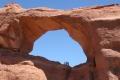
Arches National Park is so compact that it is possible to hike to several stunning arches in just one day. Landscape Arch is longest arch in the world, and Delicate Arch might be the most beautiful. Don’t leave Arches without seeing this famous arch, which you will recognize from the Utah license plate.
Arches National Park has a single entrance, where a $30 vehicle fee is charged (price as of 2019). The entrance is located a couple miles from Moab, Utah. From the entry point, a road continues into the park for eighteen miles, accessing many excellent trails.
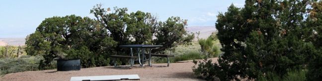
Camping in Arches National Park
The 52-site Devils Garden Campground is the only campground in the park. Located at the north end of the Park Avenue, the $25 per night campground is adjacent to Devils Garden Trailhead, which is used to reach Landscape Arch). While camping inside the park is limited, camping is plentiful at nearby Bureau of Land Management campgrounds.
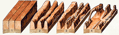 Arch Formation:
Over 150 million years ago, sand deposited here on the Colorado Plateau atop a dry seabed. The sediment eventually hardened into sandstone. Uneven pressure from below created cracks in the surface of the sandstone. Erosion widened the cracks to form fins. From there, chemical weathering carved the arches standing today.
Arches National Park Hikes
This collection of trails in Arches National Park lists hikes from north to south. The table may also be sorted alphabetically or by distance to help you pick your next hike. Each trail links to its own report complete with photos, GPS maps, elevation profiles, directions, and all the other information needed to locate and enjoy these hikes. You can also view hikes around Arches National Park on the Hike Finder Map.
Trail | Description | Distance | Location |
|---|---|---|---|
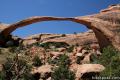 600 600 | Landscape Arch This level out and back hike visits the longest natural arch in the world along with other enjoyable arches. | 2 - 7.2 miles 130 feet | 38.78285, -109.5951 |
 610 610 | Skyline Arch This short out and back hike ends below a wide arch near the top of a sandstone fin. | 0.4 miles 40 feet | 38.772, -109.59095 |
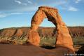 620 620 | Delicate Arch This out and back hike visits this most iconic arch in the world, a beautiful span that should not be missed. | 3 miles 480 feet | 38.73565, -109.5206 |
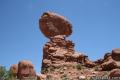 630 630 | Balanced Rock This short loop circles a perilous block of sandstone balancing near the center of Arches National Park. | 0.33 miles 50 feet | 38.70176, -109.56605 |
 640 640 | Double Arch This out and back hike visits a pair of connected arches in the Windows region of Arches National Park. | 0.8 miles 125 feet | 38.68825, -109.5384 |
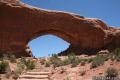 650 650 | Window Arches This loop presents three arches in close proximity, the North and South Windows and Turret Arch. | 1 mile 150 feet | 38.68715, -109.53675 |