Upheaval Dome
in Canyonlands National Park
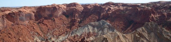
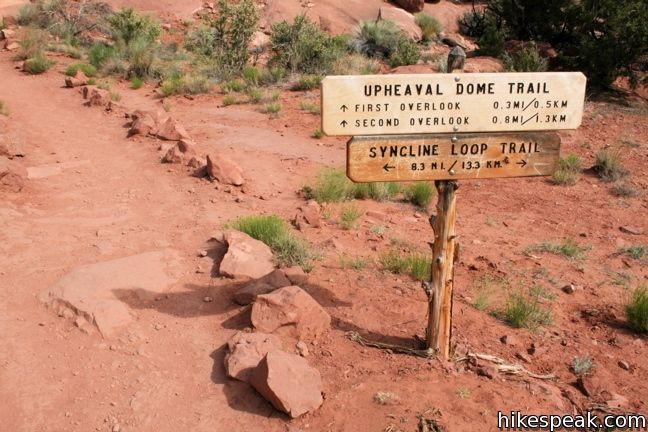
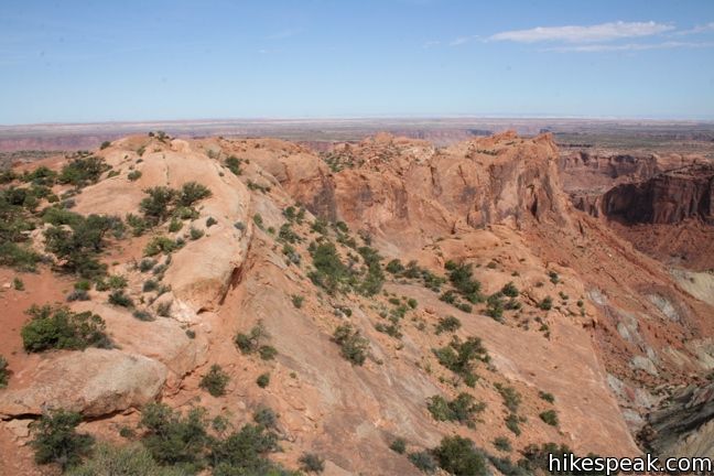
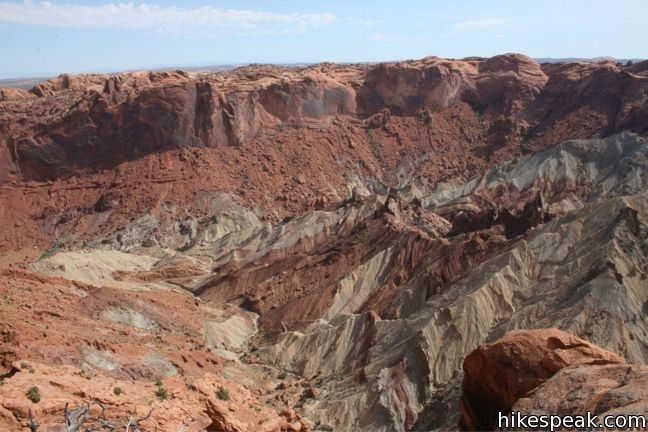
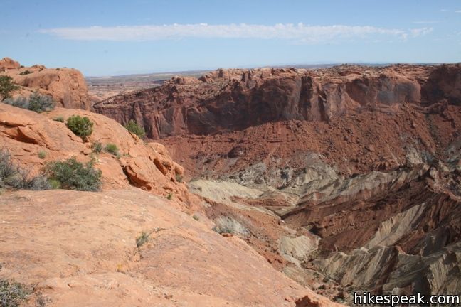
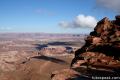
Upheaval Dome in the most puzzling geological feature in Canyonlands National Park. A 1.7-mile hike visits two overlooks along the rim of this three-mile wide 1,000-foot deep crater. Geologists have two possible theories for what caused Upheaval Dome, which you can learn about along the trail.
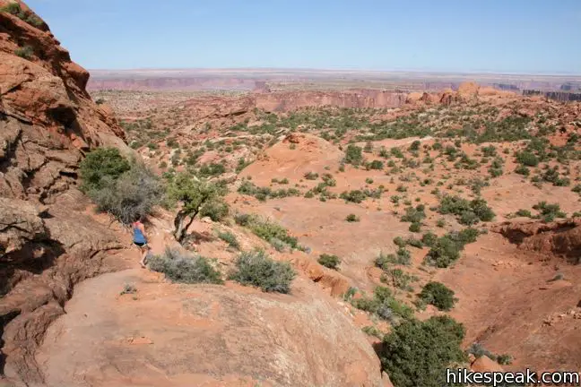
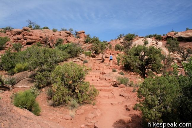
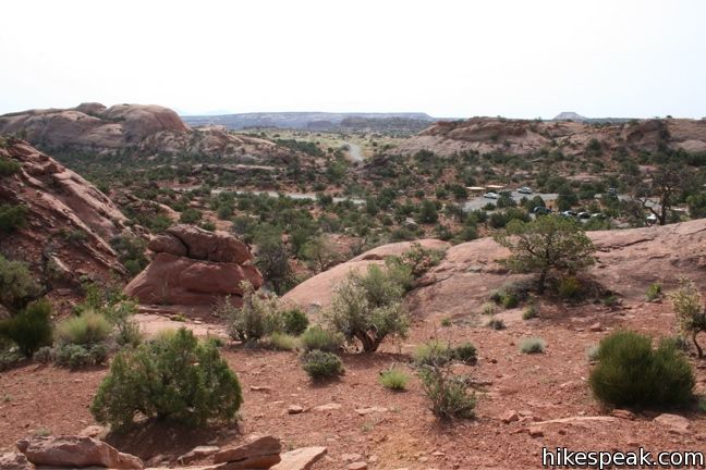
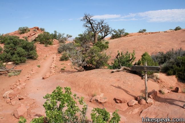
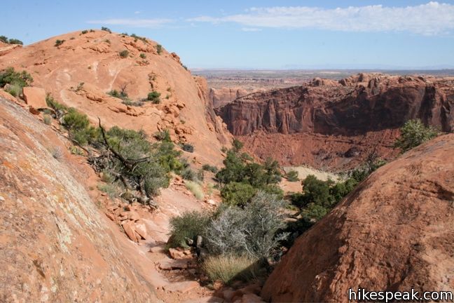
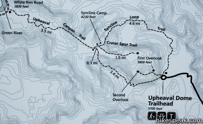
From the trailhead, a wide track heads to the right before turning uphill toward the crater. Built-in stone steps aid with the ascent of 150 feet over 0.3 miles. When the trail comes to a junction, turn right and you will quickly reach the first overlook of Upheaval Dome.
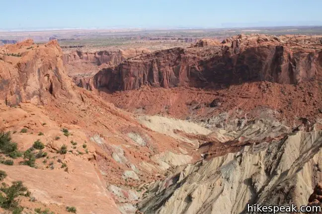
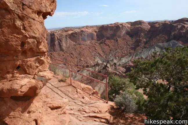
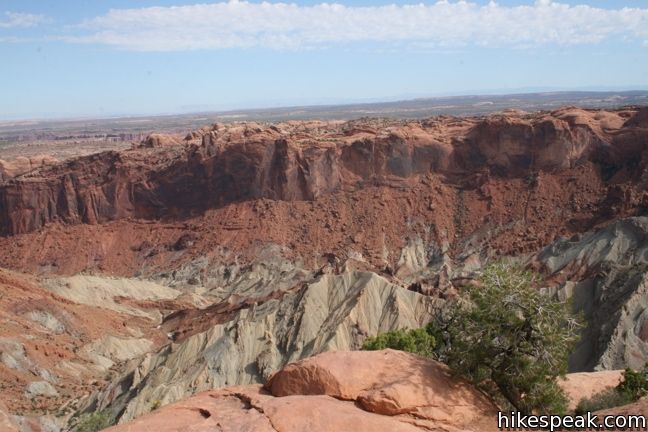
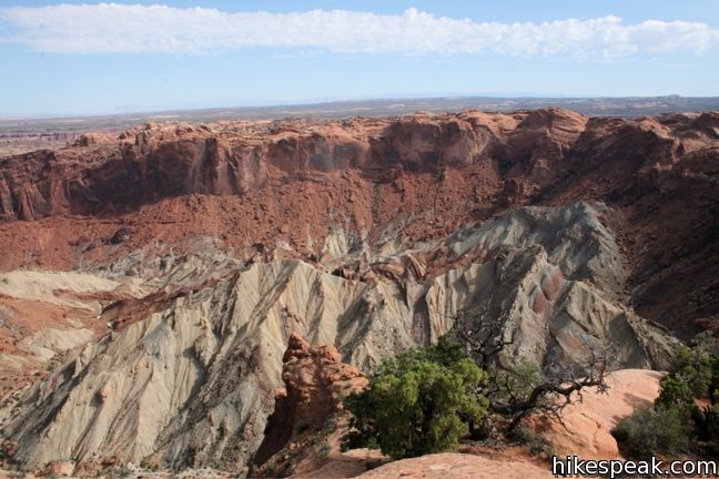
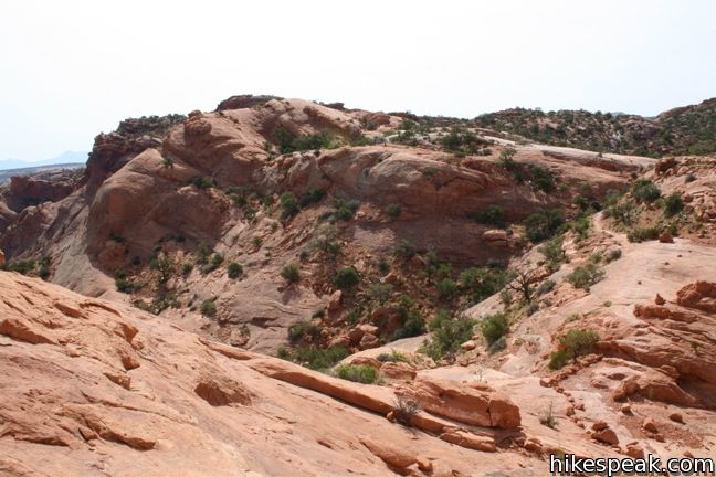
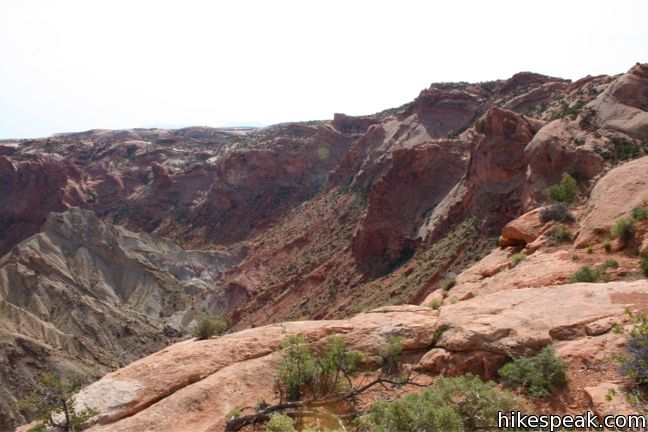
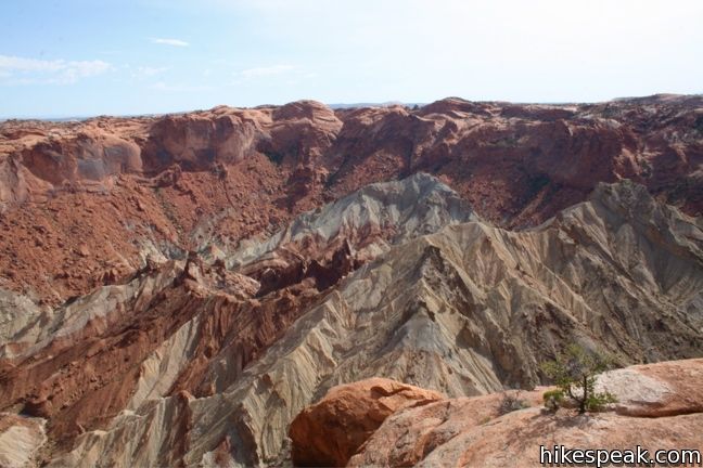
Have a look into this wide rough crater, and see if you can you figure out how it was created. Geologists have two competing theories. Illustrated panels at the overlook describe both the newfangled meteorite theory and the more traditional salt dome theory.
The salt dome theory
It all began 300 million years ago when an inland sea covered this entire area. Climate chance caused the water to evaporate, leaving a thick salt deposit behind. Over time, layers of sediment built up on top of the salt and hardened into sandstone. The heavy rock pushed down on the salt, creating uneven pressure that led to a budge in the salt layer. This caused a dome to appear on the surface, an upheaval dome. The crater seen today is simply the eroded remains of that dome.
The meteorite theory
The other school of thought is that a meteor crash landed on this spot 60 million years ago. The crater left behind was unstable. Some areas collapsed while other spaces filled from below by rock and salt moving up into the sudden opening in the earth.
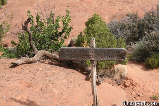
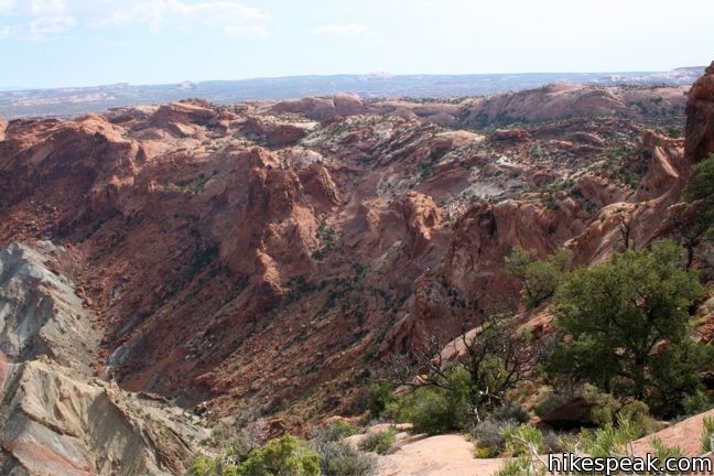
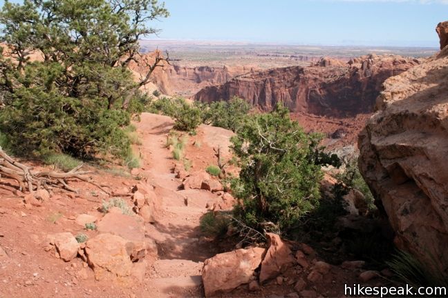
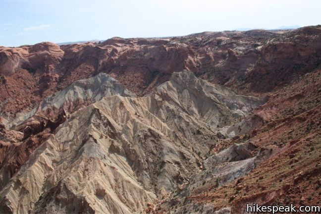
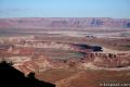
Was it a great upheaval or a coming down to earth that caused the crater? Scientists are now fairly certain Upheaval Dome was created by a meteor. If you need time to think things over, the trail continues for another 0.6 miles, descending around the jagged sandstone rim to a second overlook. On the return, you will have to hike back up 180 feet of elevation. This is worth keeping in mind because the views from the second overlook to no reveal much more than the first. If you decided to conserve your time and energy for another trail, you would be forgiven for not going the full way.
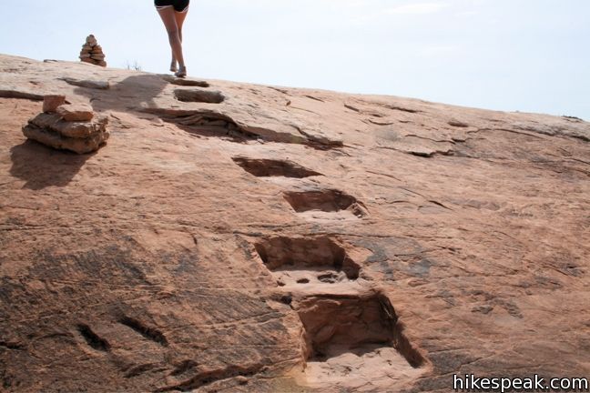
The obvious gravel trail disappears along the way to the second overlook. Instead, follow the line of cairns and steps carved into the sandstone. The placement of the second overlook seems a bit arbitrary, as the views are not completely dissimilar to the upper overlook and other points along the way.
After enjoying the overlook, head back up the sandstone rim. This hike to both overlooks is a 1.7 miles round trip, but that can be cut down to 0.6 miles if you only visit the first overlook.
Directions to the Trailhead
- From the Island in the Sky Visitor Center, drive south for 6.5 miles.
- After passing the Mesa Arch turnoff, turn right onto Upheaval Dome Road.
- Drive 5 miles to the end of the road.
- The trailhead has bathrooms and picnic tables.
Trailhead Location
Trailhead address: Upheaval Dome Road, Canyonlands National Park, Moab, UT 84532
Trailhead coordinates: 38.4263, -109.9261 (38° 25′ 34.7″N 109° 55′ 34″W)
View Canyonlands National Park in a larger map
Or view a regional map of surrounding Utah trails and campgrounds.

 | Whale Rock This one-mile hike ascends a whale-shaped sandstone formation near Upheaval Dome. |
 | Aztec Butte This is a 1.8 -mile hike ascends a dome-shaped butte that houses Puebloan granaries and offers nice views of Taylor Canyon. |
 | Mesa Arch This 0.7-mile loop visits a picturesque arch spanning across the mesa's edge. |
 | Murphy Point This 3.6-mile hike visits a west-facing point on the Island in the Sky overlooking canyons carved by the Green River. |
 | More trails in Utah Explore other hikes in Canyonlands National Park and elsewhere. |
- Upheaval Dome trail brochure on nps.gov (opens in a new tab)
- Upheaval Dome geology on nps.gov (opens in a new tab)
- Upheaval Dome in Best Easy Day Hikes: Canyonlands and Arches National Parks by Bill Schneider (opens in a new tab)
- Upheaval Dome on wikipedia.org (opens in a new tab)
- A report on the formation of Upheaval Dome on utahgeology.org (opens in a new tab)
- Upheaval Dome on summitpost.org (opens in a new tab)
- Canyonlands National Park on Utah.com (opens in a new tab)
- The official website for Canyonlands National Park (opens in a new tab)
Common Questions about Upheaval Dome in Canyonlands National Park
- Is the trail open?
- Yes. You should expect to find that Upheaval Dome Trail is open. There are no recent reports of trail closures. If you discover that the trail is closed, please help your fellow hikers by reporting a closure.
- Do I need a permit for this hike?
- Yes. National Park Entrance Fee.
- How much time does this hike take?
- It takes approximately 45 minutes to hike Upheaval Dome Trail. Individual hiking times vary. Add extra time for breaks and taking in the views.
- How long is this hike?
- The hike to Upheaval Dome Trail is a 1.7 mile out and back with 200 feet of elevation change.
- Are dogs allowed on this trail?
- No, dogs are likely not allowed on Upheaval Dome Trail. The trail is primarily open to hikers.
- Is Upheaval Dome Trail good for kids?
- Yes, this hike is likely suitable for children. It is relatively short (1.7 miles) with manageable elevation gain.
- Where is the trailhead located?
- The trailhead for Upheaval Dome Trail is located in Moab, Utah.
Trailhead Address:
Upheaval Dome Road
Moab, Utah 84532
Trailhead Coordinates:
38.4263, -109.9261 - What are the driving directions to the start of the hike?
To get to the trailhead: From the Island in the Sky Visitor Center, drive south for 6.5 miles. After passing the Mesa Arch turnoff, turn right onto Upheaval Dome Road. Drive 5 miles to the end of the road. The trailhead has bathrooms and picnic tables.
View custom Google Maps directions from your current location.
- Are there other trails near Upheaval Dome Trail?
- Yes, you can find other nearby hikes using the Hikespeak Hike Finder Map.

Is metal detecting allowed?
[…] off the day by hiking to White Rim Overlook (1.8 miles RT) and Upheaval Dome (1.7 miles RT). (If you want to shorten the hikes, skip Upheaval Dome and either Whale Rock or […]