Otto's Trail Colorado National Monument Ottos Trail Hike

Otto’s Trail in Colorado National Monument

Hike DistanceA green icon of a hiker used to label information about the length of the hike 0.75 miles (out and back) Elevation ChangeA green icon of a graph depicting the elevation change along the hike 85 feet of elevation change Hiking TimeA green icon of a clockface with a curved line on one side, representing the approximate duration of the hike Approx. 15 minutes of hiking time Who can use the trailA green icon of a two people representing groups allowed on the trail, such as dogs and bikers, in addition to hikers Open to hikers Fees and PermitsA green icon resembling a paper receipt that represents the potential fees or permits required to go on the hike National Monument Entrance Fee Hike LocationA green icon of a location pin representing the city or park where the hike is found Colorado National Monument, Colorado Directions to the trailA green icon of a signpost with arrowed signs representing the turn-by-turn directions to get to the trailhead Read directions to the trailheadTrail Map and Elevation ProfileA green icon of location marker rising from a box with a mountain profile cut across the bottom, representing the interactive map and elevation profile where you can plot this trek View photo gallery & interactive trail map Trail VicinityA green icon of a square with three folds that looks like a paper map, representing searching the region around this hike for nearby adventures Explore — Colorado NMColorado Trail Write-up Reading TimeA green icon of a ligned page with a clockface in front of it, representing the reading time of this article Reading time: About 2 minutes

Otto's Trail Colorado National Monument

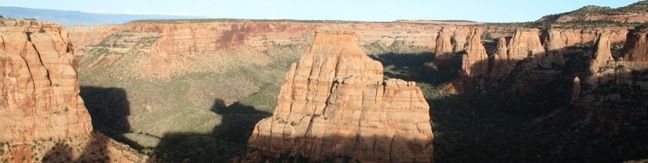
Otto’s Trail is one of the shorter hikes along Rim Rock Drive in Colorado National Monument. Like Window Rock Trail, this 0.75-mile stroll descends gradually to a cliff overlooking Monument Canyon. The view showcases Independence Monument, the tallest freestanding formation in the canyon, and a point of fascination for visitors dating back to the first park supervisor, John Otto, for whom this trail is named.

From the turnout on Rim Rock Drive one mile south of Saddlehorn Visitor Center, head east on Otto’s Trail. The wide dirt track heads slightly downhill, sacrificing 85 vertical feet. The best views come at the end of the trail, so in the words of Bob Barker, come on down!

Otto's Trail
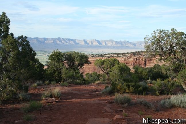
Otto’s Trail descends gradually to the overlook

The panoramic vista overlooks Independence Monument, Praying Hands, and Sentinel Spire. The Pipe Organs, a series of cylindrical formation similar to Coke Ovens, are just ahead, adorning the side of the canyon.

Otto's Trail Independence Monument
The Pipe Organs

The trail is named for John Otto, the eponymous park supervisor who dedicated his life to preserving the land that became Colorado National Monument.

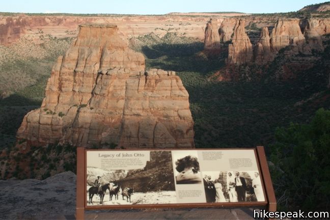
Panels at the end of the trail depict Otto’s wedding ceremony, which took place in the canyon below Independence Monument. The marriage did not last however, because Otto’s other great love came between them – Colorado National Monument. His wife is quoted as saying.

I tried hard to live his way, but I could not do it. I could not live with a man to whom even a cabin was an encumbrance.

Fortunately, Otto’s stewardship of the park was more enduring. Many of the trails he built during his thirty year stint as inaugural park supervisor remain in use today.

Otto's Trail
A panel below the view of Independence Monument

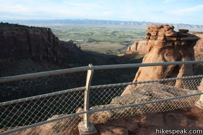
There are no junctions to worry about along the way, so when you are through enjoying the view, simply return the way you came. The meager elevation change makes Otto’s Trail a breeze for hikers of all abilities.

To get to the trailhead: From Saddlehorn Visitor Center, drive south on Rim Rock Drive for one mile and turn left into the turnout for Otto’s Trail.

Trailhead address: Rimrock Drive, Colorado National Monument, Grand Junction, CO 81507
Trailhead coordinates: 39.09594, -108.73274 (39° 05′ 45.4″N 108° 43′ 57.9″W)

Make your own directions

Navigation DirectionsA green icon of navigation arrow representing custom Google Maps directions from your location to the trailhead Open custom Google Maps directions, starting from your current location

Discover more about this hike

Trail MapA green icon representing a trail map displaying a dashed track line and a map marker Explore the trail map (where you can display your location and plot your progress while you hike)Trail Elevation ProfileA green icon of a graph representing the elevation profile of the hike Examine the elevation ProfileTrail Photo GalleryA green icon representing a gallery of landscape photos from the hike Browse the photo gallery Nearby Trails and InfoA green icon representing a person in front of a direction sign representing nearby trails and additional information Survey nearby trails and additional info

Save this hike to your to-do list or add it to your collection of completed hikes

My Hikes: Completed hikeA green icon of shows a picture of a landscape with a check mark in the upper right corner, signifying that this is a hike you would like to put on your completed list.OK! Add to trails I've hiked

My Hikes: Want to hikeA green icon of shows a picture of a landscape with a heart in the upper right corner, signifying that this is a hike you would like to put on your to-do list.OK! Add to trails I want to hike

TagsA green icon depicting a tags represents a list of words and phrases that this content is tagged withTagged with · Desert Canyons · Fruita · Grand Junction

Add CommentA green icon of a speech bubble with a hilly landscape inside that marks the start of the form to add comments Ask a question or share your experience

Your email address will not be published. Required fields are marked *