Pacific Crest Trail and Foot Trail Loop
in Vasquez Rocks Natural Area Park
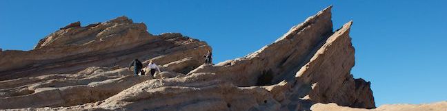
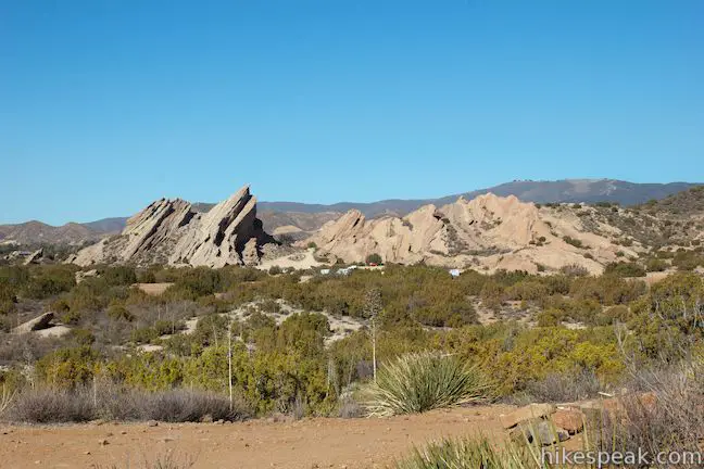
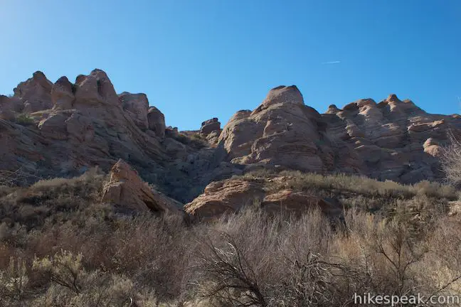
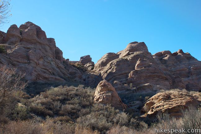
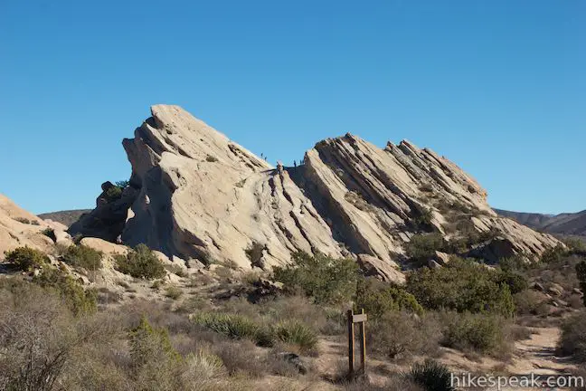
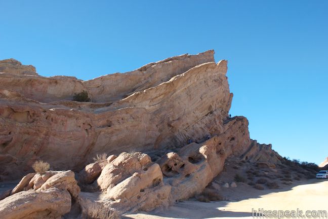
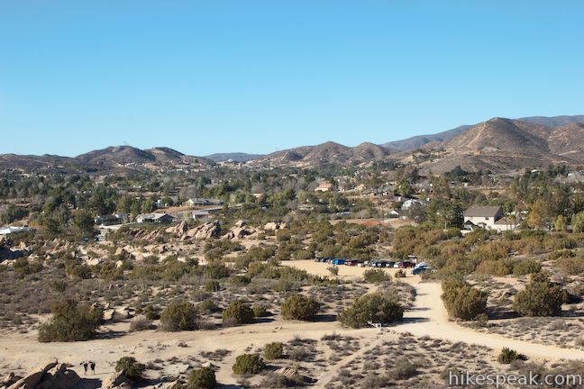
Vasquez Rocks Natural Area Park is a dramatic desert wonderland, with striking rock formations that point skyward at a 45-degree angle. This 932-acre Los Angeles County Park delivers a scenic desert backdrop for hikers, and is just a quick drive from LA. This pairing of unique beauty and convenience has made Vasquez Rocks a popular location for the film industry and the park has a long list of credits, including Star Trek, Blazing Saddles, and The Flintstones.
Several hikes are possible in Vasquez Rocks Natural Area Park. For something short, enjoy a half-mile exploration of Famous Rocks, the most recognizable rock formation in the park. The Pacific Crest Trail crosses the park and can be connected with a Foot Trail to form a 3.4-mile loop with 325 feet of elevation change. The loop passes through impressive sandstone formations and presents great views of the park. The loop can be extended by continuing down more of the Pacific Crest Trail through an interesting canyon to reach a tunnel beneath Route 14 where the PCT exits the park. Combine the loop and the extension for a 5.3-mile hike with 375 feet of elevation change. When you’re done, climb around the Famous Rocks at the heart of the park to bring the day’s trek to 5.9 miles round trip (or 4 miles without the extension to the tunnel).
A leaflet and trail map available at the visitor center describes Vasquez Rocks as “one of California’s most famous geological wonders.” Over twenty million years ago, rock formations were shaped by earthquakes along the Elkhorn Fault, a branch off the San Andreas Fault. The leaflet explains:
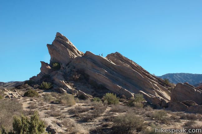
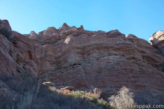
The ancient rock layers have slowly been compressed, folded, and tilted, while erosion has gradually stripped away the soil from around the rocks, leaving spectacular jetting slabs. These intriguing rock outcroppings consist of coarse-grained, yellow-gray sandstone bed several feet thick. May areas have beds of shale, basalt, and reddish-brown conglomerate layered between the sandstone formations. Today the rock slabs sit tilted at angles of as much as 50 degrees, and the largest outcropping sweeps up to a peak nearly 150 feet high.
In addition to trail maps and other information about the park’s history and features, the visitor center has a large raised-relief map of the park to help you visualize the journey.
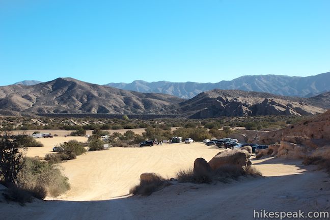
The park has three clear places to leave your vehicle and begin exploring. Start from the visitor center just off Escondido Canyon Road to check out two park trails not described here, Geology Trail and History Trail. A dirt road from the Visitor Center leads to a large dirt parking area below the Famous Rocks. Partway down the dirt road to the Famous Rocks is another parking area on the left and a trailhead for the Pacific Crest Trail. Start here to hike the loop through Vasquez Rocks Natural Area Park.
Pacific Crest Trail – Foot Trail Loop
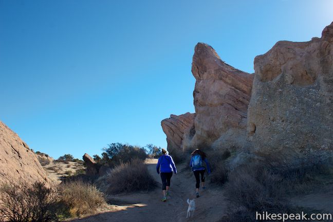
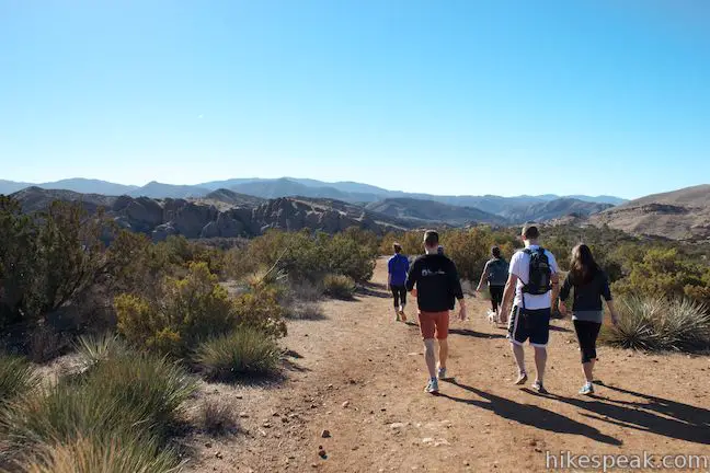
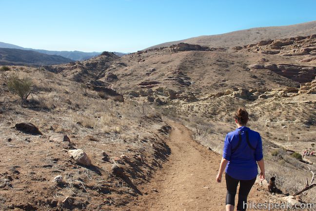
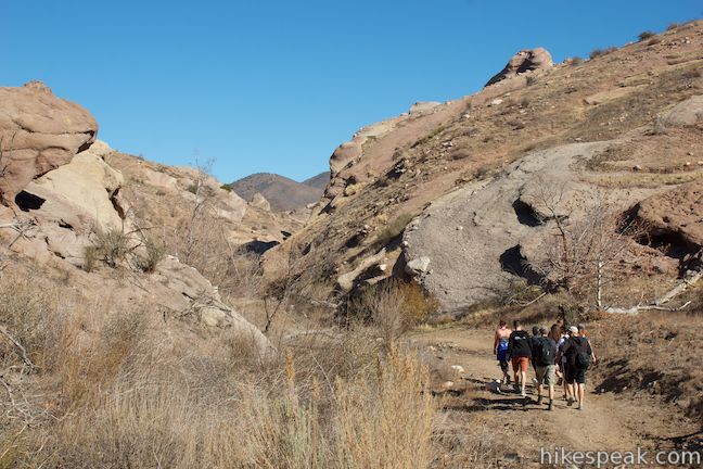
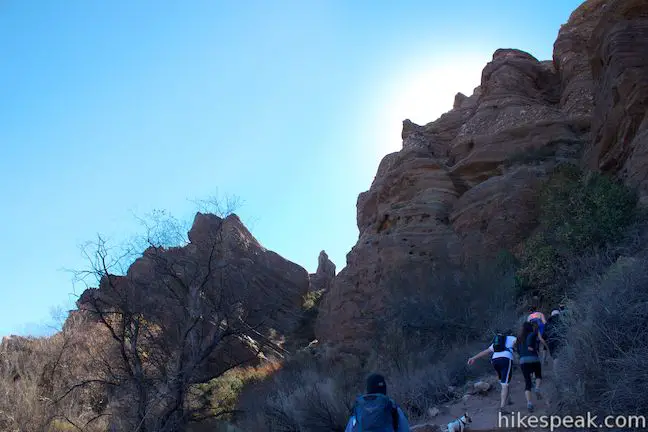
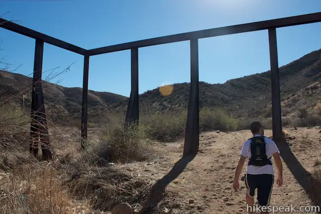
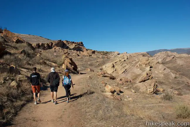
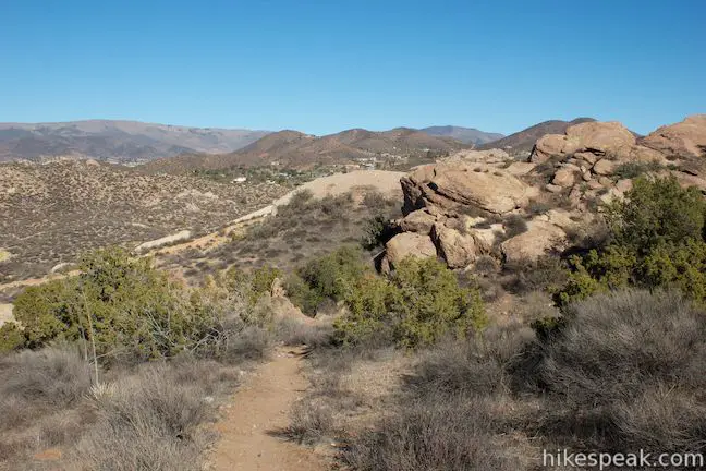
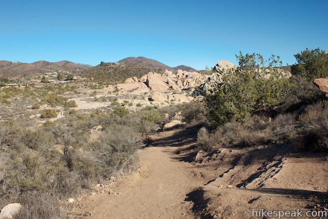
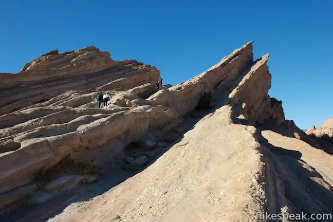
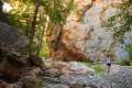
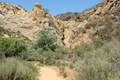
A dirt trail heads north from the parking area for a couple hundred feet, coming to a T-junction with the Pacific Crest Trail. Only turn left if you want to follow the PCT toward Canada. For the loop through Vasquez Rocks Natural Area Park, turn right. The Pacific Crest Trail gains about 100 feet heading up a dirt incline behind some of Vasquez Rocks marquee formations. Juniper trees add a bit of shade on the way up. At the top of this rise, peer through the outcroppings for a good view of the Famous Rocks just to the south, surrounded by other impressive formations. While the hike is barely underway, you could easily be drawn off trail to climb up some of the rocks.
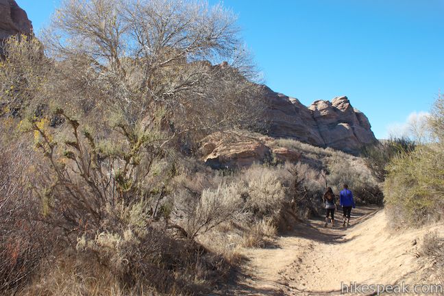
Continuing down the backside of the hill, the PCT passes through the shadow of a tilted rock wall. Bear right at a junction below the rocks to stay on the Pacific Crest Trail as it crosses a picnic area east of the Famous Rocks. Proceed east through the picnic area (if you end up south of the parking area below the Famous Rocks, you’ve strayed from the PCT) and cross a clump of juniper to come to a junction with a dirt 4X4 road. Turn right down this wide dirt road, following markers for the Pacific Crest Trail.
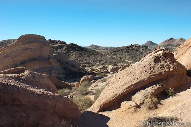
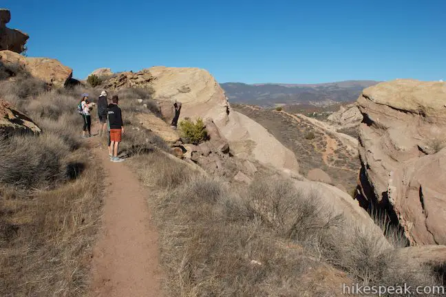
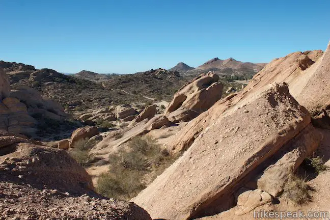
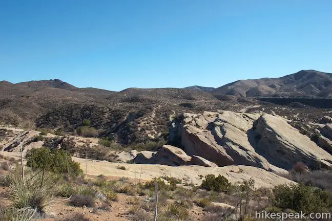
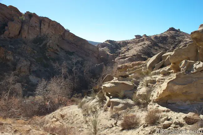
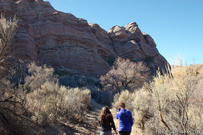
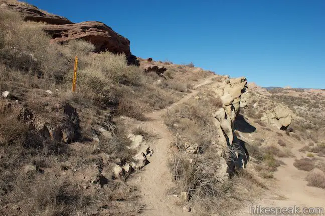
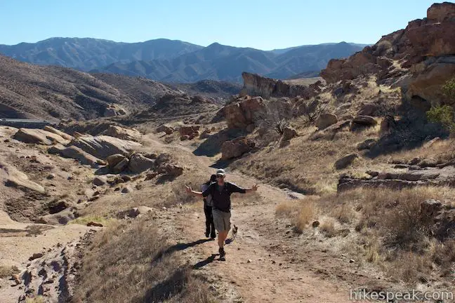
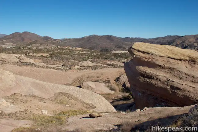
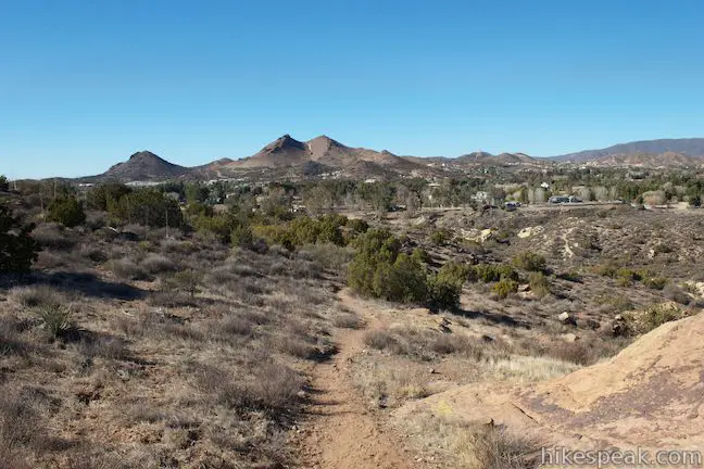
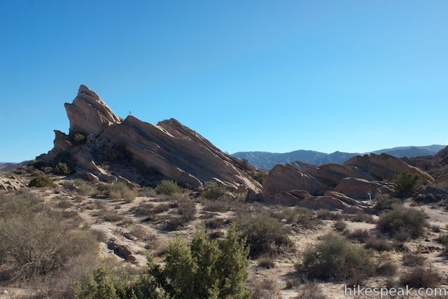
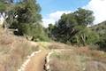
The trail traces the top of a low, rounded ridge, presenting good views of the surroundings. To the west are the Famous Rocks, which continue to transform as they are seen from new angles. To the east is a canyon with red sandstone formations reminiscent of the desert in Utah.
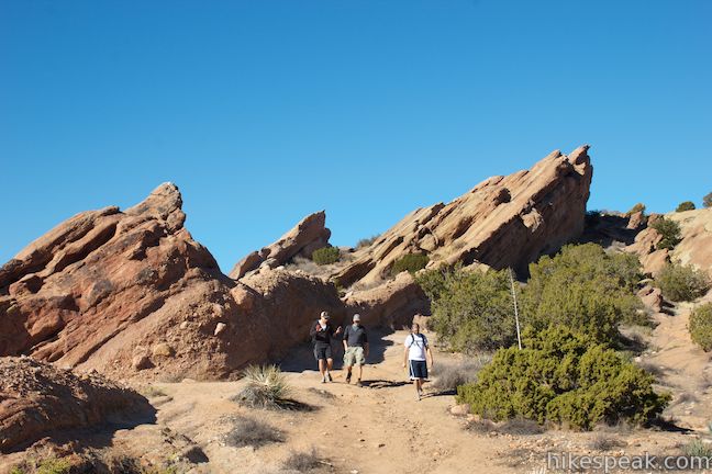
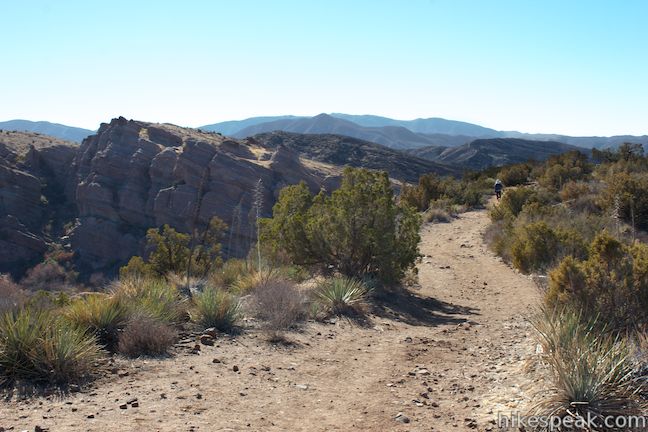
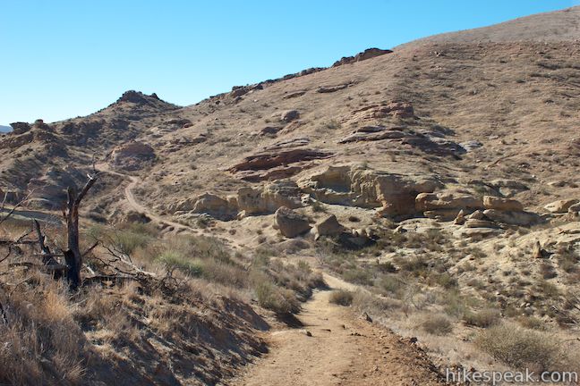
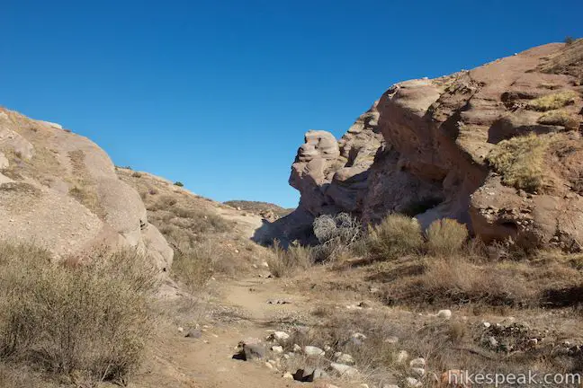
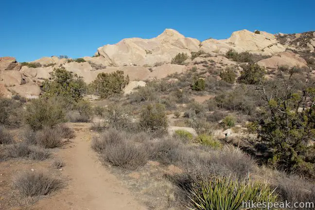
Proceed down this ridge for 0.55 miles, staying to the right when the PCT is joined by another path from the Famous Rocks Area. A sign marks the edge of a wildfire that hit this area in 2007. A trail marker leads down the right (west) side of the ridge. Take this trail and descend into a V-shaped gap in the terrain. Fins of sandstone jut out of the ridge on the other side.
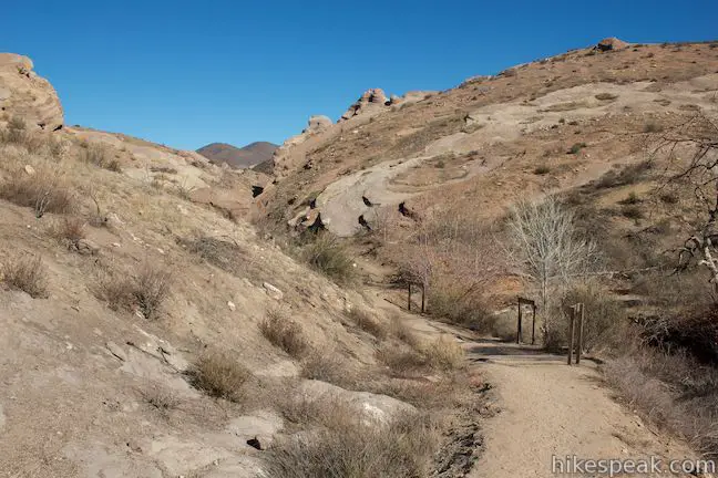
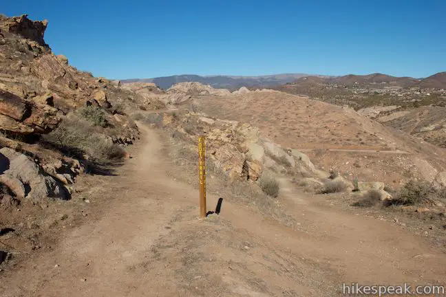
Stay to the left through a junction with another path coming down from the Famous Rocks Area. Proceed a couple hundred feet farther to an important T-junction, 1.4 miles from the start, that is marked with a large wooden trail sign. This is the point where the loop hike leaves the Pacific Crest Trail. However, if you’re not ready to leave the PCT just yet, you can take it for another 0.85 miles to a tunnel at the park boundary (or keep on hiking until you get to Mexico). Even if you don’t want to hike all the way to the tunnel, it is still worth hiking a short distance down the PCT to examine interesting rock formations in the canyon below. To proceed with the 3.4-mile loop, turn right.
Pacific Crest Trail Extension
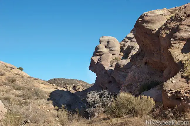
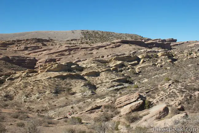
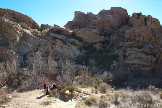
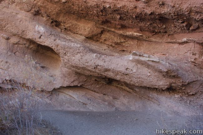
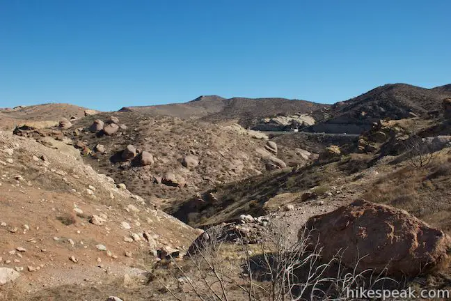
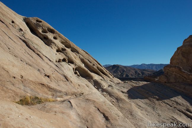
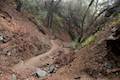
Turn left at the T-junction to stay on the PCT as it heads for the tunnel at the east end of Vasquez Rocks Natural Area Park. The trail quickly descends to the bottom of the canyon where an arroyo is lined by a few cottonwood trees. The trail curves left, heading up the canyon to the northeast. The walls of the canyon hang over the trail in strange shapes, including a large bulbous overhang of red rocks with layers of conglomerates and small cave-like depressions.
The park is named after a famous bandit named Tiburcio Vasquez, who evaded law enforcement by hiding in the caves in this area. Looking at the surroundings, it is easy to see how someone could disappear in these rocks. Like Juaquin Murietta, Vasquez sent stolen money to Mexico, where he was considered to be a Robin Hood-like figure. Eventually, the law won. Vasquez was shot and wounded while hiding in this area. Two sheriff’s posies ensnared his gang and a shootout ensued. When it was all over Vasquez had escaped once more. Apparently, he could not hide as well outside the rocks that now bear his name because he was later captured near Cahuenga Pass, put to trial in San Jose, and hanged.
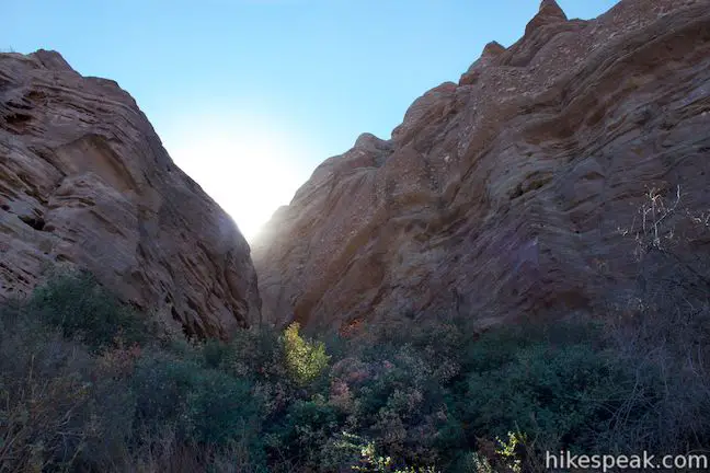
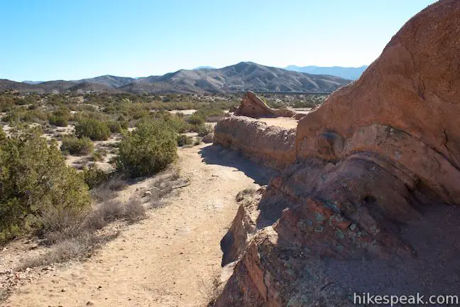
After passing below the tall outcropping, the Pacific Crest Trail hugs the steep cliffs on the wall of the canyon, staying to the right and the canyon splits and widens. When the trail moves away from the canyon wall after about 0.6 miles, the trail becomes less interesting, so this is a good time to consider turning around.
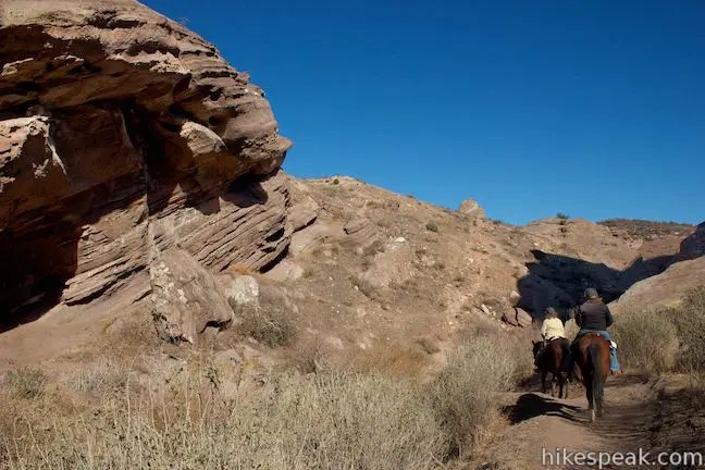
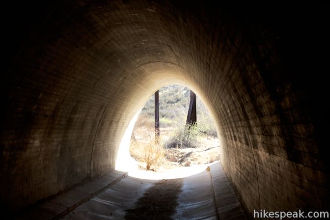
At 0.7 miles from the T-junction, come to a split in the trail. Stay to the right following signs for the Pacific Crest Trail and, after another 0.15 miles, arrive at a long tunnel below Route 14. To see what’s on the other side, hike a tenth of a mile through the tunnel, watching out for the horse poop that collects in the center of the tunnel. Unless you are backpacking farther down the PCT, turn around at the tunnel and hike back up the Pacific Crest Trail.

From Pacific Crest Trail to Foot Trail
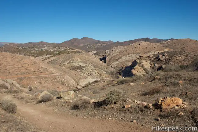
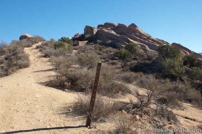
Return to the junction where the loop continues. Stay to the left through the junction (what would have originally been a right turn) and head south across a dip in the terrain. Head uphill on the other side, passing a ledge of sandstone to come to a marked junction on the right with the Horse Trail. If you’ve only got two feet, proceed another quarter mile up the trail to a junction with the Foot Trail. Turn right here to begin looping back to the start.
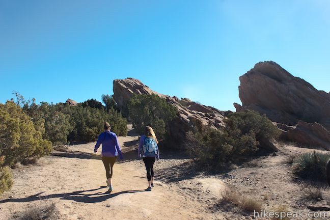
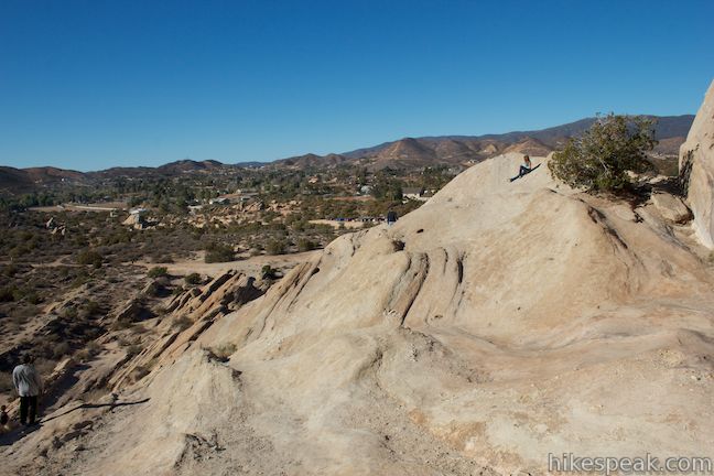
The Foot Trail goes up and over the sandstone formations at the top of Vasquez Rocks. Get up close to interesting outcroppings and take in panoramic overviews of the surroundings.
After hiking 0.45 miles on the Foot Trail, come to an unmarked split. To continue on the Foot Trail, bear left. If you are short on time, you could bear right and follow a path down to the Horse Trail on a slightly shorter route back to the trailhead. Staying to the left on the Foot Trail, cross a ledge alongside a rock formation that juts out like a pier.
After rising to the high point of the loop, around 2,650 feet, the trail turns downhill, passing through less rock and more high desert vegetation like juniper, chamise, and yucca. The trail narrows and fades in places, so remain attentive as the Foot Trail makes a wide C-shaped curl to the right to come to a couple more junctions.
After 1.3 miles on the Foot Trail, bear left through a junction with the Horse Trail. The Foot Trail then crosses a gully alongside more rock formations and comes to a crest that has a marked intersection with the Horse Trail, 1.45 miles from the start of the Foot Trail. Continue straight down the other side of the ridge where the Famous Rocks and the starting parking area are in view. Cross through another junction after a tenth of a mile to come to the end of the 1.6-mile journey on the Foot Trail.
The Foot Trail ends at the dirt road between the visitor center and the Famous Rocks. Turn left to hike 0.05 miles back to the original parking area to complete the 3.4-mile loop (5.3 miles if you ventured down to the tunnel). You may not be ready to leave the park until you’ve climbed around on the Famous Rocks. To cap things off, turn right at the end of the Foot Trail and follow the dirt road along the north side of the sharp rock rising 150 feet.
The Famous Rocks
No established trail ascends to the top of the Famous Rocks. When you reach the parking area at the end of the road, you can step out on the slanted rock on the west side of the formation. Follow this sandstone incline east into a gap below the top of the rocks. If you’ve got shoes with good traction and are feeling adventurous, you can climb up to the very top of the rocks.
Be careful. Your safety is your responsibility. Even if you don’t climb to the very top, there are nice ledges on the Famous Rocks where you can take in your surroundings. Return the way you came or scramble down the east side of the Famous Rocks to head back to your vehicle.
Vasquez Rocks Natural Area Park is open from sunrise to sunset and dogs are welcome. The visitor center is closed on Mondays and open Tuesday through Sunday from 8 a.m. to 4 p.m. No fee or permit is required to hike in Vasquez Rocks Natural Area Park, so get out and enjoy!
The basic directions for this hike through Vasquez Rocks Natural Area Park are:
- Start from the trailhead for the Pacific Crest trail along the dirt road to the Famous Rocks (0 miles)
- Turn right onto the Pacific Crest Trail (0.05 miles)
- Bear right to stay on the Pacific Crest Trail (0.45 miles)
- Bear right down the ridge (0.7 miles)
- Stay to the left past a path on the right (1.05 miles)
- Follow the trail off the right side of the ridge (1.25 miles)
- Stay to the left past another path down from the Famous Rocks (1.37 miles)
- Reach the junction where the loop leaves the Pacific Crest Trail (1.4 miles)
For the extension off the loop:
- Turn left and drop into the interesting canyon (1.4 miles)
- After passing through canyon, bear right following a sign for the PCT (2.1 miles)
- Reach the tunnel below Route 14 (2.25 miles)
- Walk through the tunnel (2.25 miles)
- Backtrack to the junction for the loop (3.3 miles)
- Continue the loop by heading south from the junction – original right turn (1.4/3.3 miles)
- Pass the Horse Trail (1.5/3.4 miles)
- Turn right up the Foot Trail (1.75/3.65 miles)
- Bear left at unmarked junction with a path that drops down to the Horse Trail (2.2/4.1 miles)
- Cross through an unmarked junction with the Horse Trail and bear left (3.05/4.95 miles)
- Cross a marked junction with Horse Trail (3.2/5.1 miles)
- Reach the dirt road to the Famous Rocks (3.35/5.25 miles)
- Turn left to finish the hike at the trailhead for the Pacific Crest Trail (3.4/5.3 miles)
Or… Turn right to reach the parking area below the Famous Rocks (3.55/5.45 miles) - Climb over the Famous Rocks and return to trailhead for the Pacific Crest Trail (4/5.9 miles)
To get to the trailhead: Drive up the 5 Freeway to Newhall Pass and take exit 162 for Route 14. Drive 14.3 miles north on Route 14 (Antelope Valley Freeway) and take exit 15 for Agua Dulce Canyon Road. Turn left at the bottom of the ramp and drive north for 16 miles on Agua Dulce Canyon Road to a sharp right hand turn in the road. Take it, and continue up Agua Dulce Canyon Road, which becomes Escondido Canyon Road after 0.2 miles. At 0.8 miles from the turn, make a right hand turn into Vasquez Rocks Natural Area Park. Inside the park, turn right at the split to stop by the visitor center, or proceed to the left down the dirt road toward the Famous Rocks and trailhead for the Pacific Crest Trail.
Trailhead address: 10700 West Escondido Canyon Road, Agua Dulce, CA 91350
Trailhead coordinates: 34.489244, -118.317197 (34° 29′ 21.27″N 118° 19′ 01.90″W)
View Vasquez Rocks Natural Area Park in a larger map
Or view a regional map of surrounding Los Angeles trails and campground.


 | Los Pinetos Waterfall This 5.33-mile round trip hike in Placerita Canyon Natural Area follows Canyon Trail to the ruins of Walker Ranch and Waterfall Trail to an elusive falls in a sylvan canyon. |
 | Ecology Trail This 2/3 of a mile lollipop loop will introduce you to numerous local plants along with views of Placerita Canyon. |
 | Fish Canyon Narrows This hike of ten miles or more explores an enchanting narrow canyon on the east side of the Angeles National Forest in the Sierra Pelona Mountains, a small mountain range north of Santa Clarita. |
 | Towsley View Loop Trail This 5.4-mile loop explores two canyons and scenic ridges in the Santa Susana Mountains, passing the narrows of Towsley Gorge in Towsley Canyon. |
 | More trails in the Los Angeles Explore other destinations in the Santa Monica Mountains, San Gabriel Mountains, and elsewhere. |
Vasquez Rocks Natural Area Park in Afoot and Afield: Los Angeles County by Jerry Schad
Vasquez Rocks Natural Area Park in California's Desert Parks: A Day Hiker's Guide by John McKinney
Vasquez Rocks Natural Area Park in Best Hikes with Dogs: Southern California by Allen Riedel
Vasquez Rocks Natural Area Park on socalhiker.net
Vasquez Rocks Natural Area Park on modernhiker.com
Vasquez Rocks Natural Area Park on Brian and Ashely's Hiking Blog
Vasquez Rocks Natural Area Park on santaclaritaguide.com
The IMDB filming locations page for Vasquez Rocks Natural Area Park
So the visitor center is closed on Mondays but can we go hike on our own?
Yes
Is cycling allowed on the trail or anywhere in the Vasquez Rock Park ?
Can we hike on New Year’s Day?
Definitely. Enjoy!
Is it good for taking sunrise photos? Does that park open so ealry?