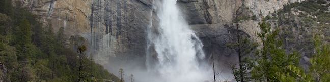
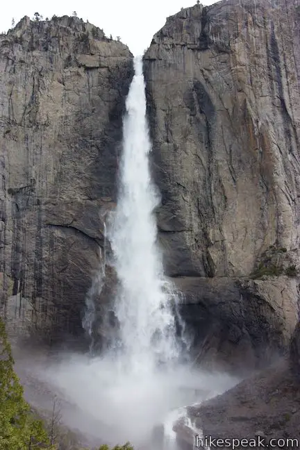
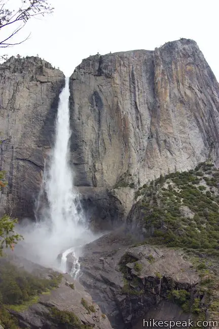
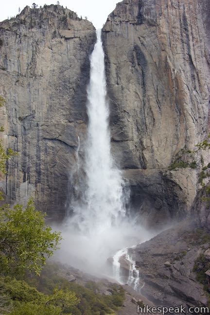
Yosemite Falls is incredibly beautiful and incredibly big. It is the tallest waterfall in North America, the 5th tallest waterfall in the world, and a star along the north wall of Yosemite Valley. Hiking to Yosemite Falls is one of the greatest things visitors can do in Yosemite National Park.
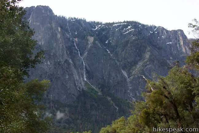
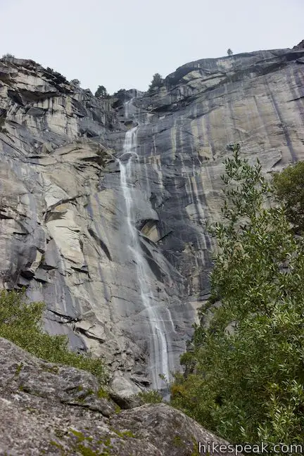
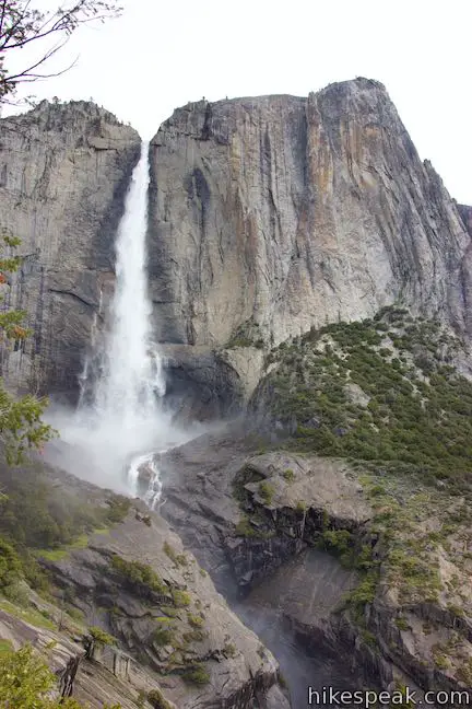
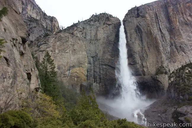
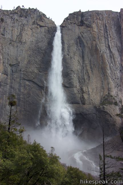
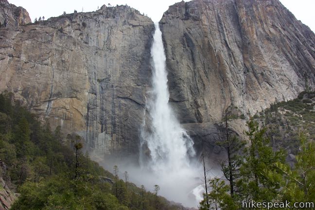
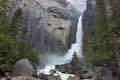
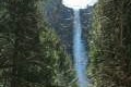
Yosemite Falls drops a total of 2,425 feet, beginning with the cliff-leaping 1,430-foot Upper Fall. Next come the vivacious Middle Cascades, measuring 675 feet tall, leading to the punchy Lower Fall’s 320-foot plunge. Hikers can get a good look at the bottom of Yosemite Falls on the easy-going Lower Yosemite Fall Trail. For head-on views of the Upper Fall and a top-down view of the entire waterfall, set out on the more challenging Yosemite Falls Trail (also known as Upper Yosemite Fall Trail). Yosemite Falls Trail is one of the more challenging day hikes in Yosemite Valley, but the views are fantastic. Wow!
Yosemite Falls Trail presents a few hiking options:
- Turn around at Columbia Rock for a 2.2-mile round trip with 985 feet of elevation change (with views across Yosemite Valley but not of Yosemite Falls)
- Turn around in front of Upper Yosemite Fall for a roughly 3.5-mile round trip hike with 1,200 feet of elevation change
- Hike all the way to an overlook at the top of Yosemite Falls for a 7-mile round trip hike with 2,715 feet of elevation change
- Make the day even longer by visiting Yosemite Point or Eagle Peak
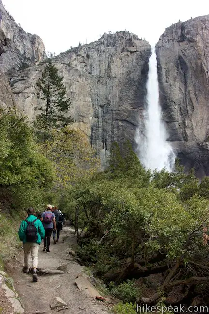
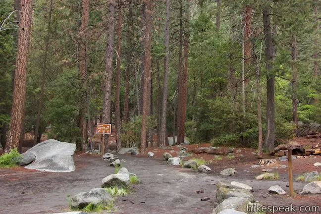
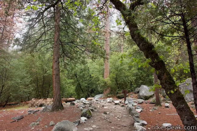
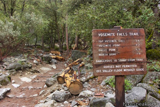
Yosemite Falls Trail begins from Camp 4, a walk-in campground near Yosemite Valley Lodge. Those not staying at the campground can reach the trailhead by taking the Yosemite Valley Shuttle to the stop for Camp 4. Walk to the trailhead at the north end of the campground parking area.
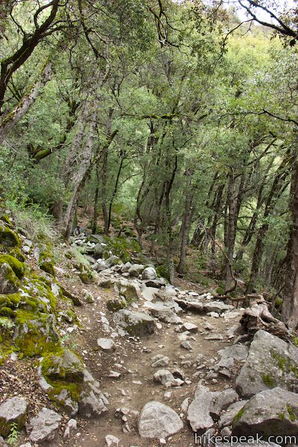
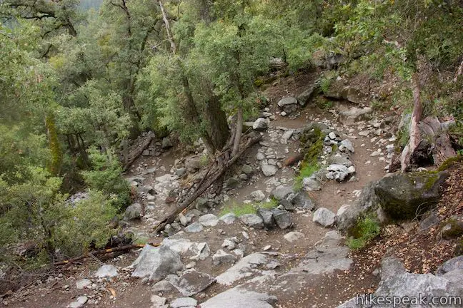
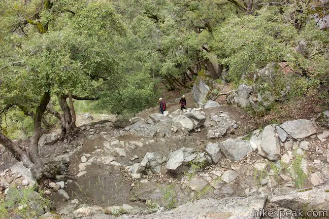
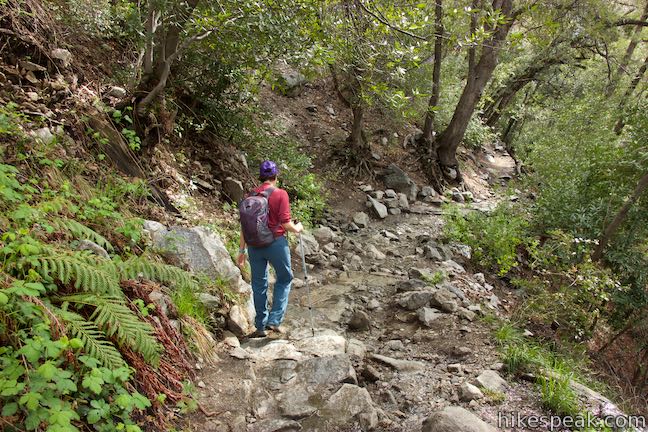
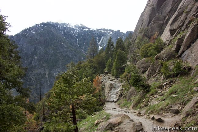
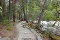
Yosemite Falls Trail enters the woods and comes to an intersection with Valley Loop Trail, which meanders around the edges of Yosemite Valley. Make a left and an immediate right to proceed up Yosemite Falls Trail. Past the junction, the trail launches up the north wall of Yosemite Valley. Ease around a large boulder (one of many that fell from the steep wall above) and pass a sign for the Yosemite Wilderness boundary.
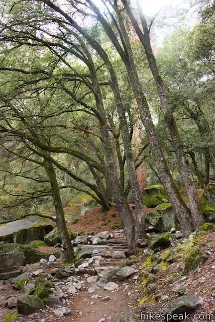
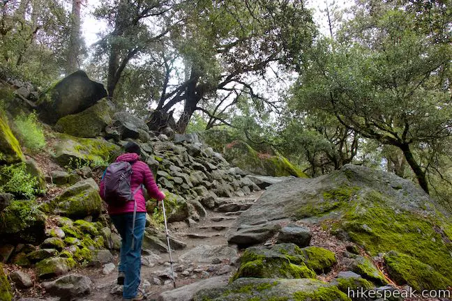
The switchbacks begin on Yosemite Falls Trail
Yosemite Falls Trail has two major sections of switchbacks. This first section rises to Columbia Rock. The second section goes up the side-canyon beside Upper Yosemite Fall to the top of the trail.
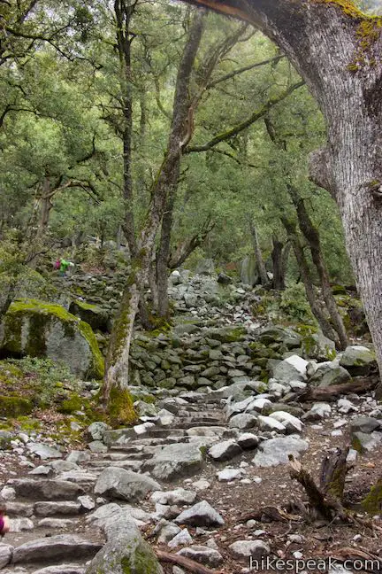
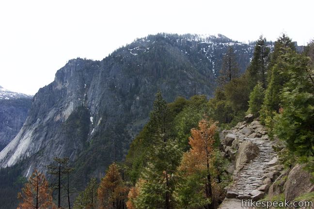
Ascend a talus slope shaded by a forest of live oaks that grow among the boulders. Admire the craftsmanship of the stone steps as you twist and turn up five dozen switchbacks. A sign at the bottom of the trail explains that John Conway laid out this route in the 1870s. John Muir called John Conway the master trail-builder of Yosemite Valley in his book, The Yosemite. Although the trail has certainly been improved in the last 150 years, the number of switchbacks may not have changed.
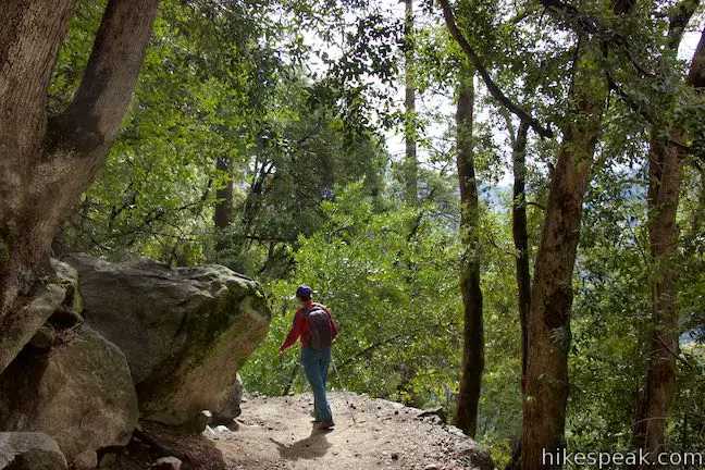
March up the steep steps, rising even higher up the side of the valley. Ponderosa pines, incense cedars, and bays laurels add variety to the oak-dominated forest.
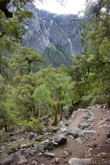
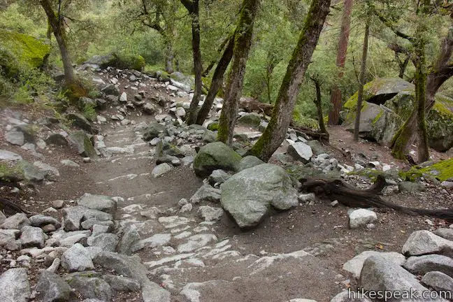
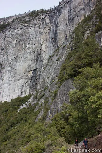
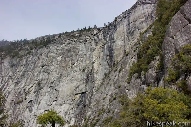
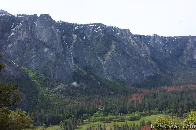
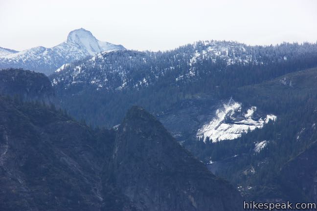
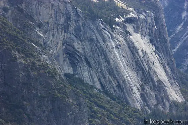
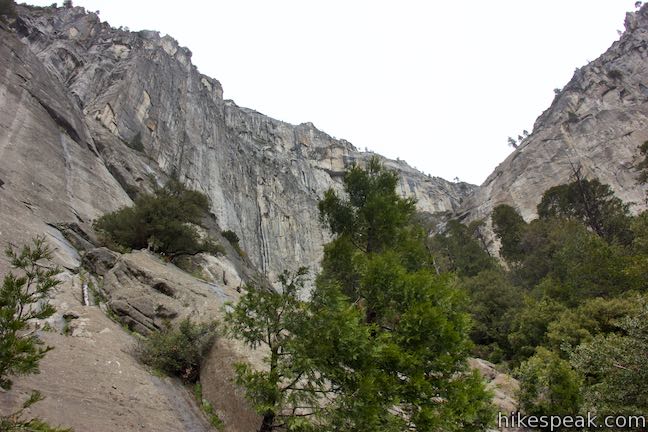
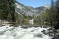
As the train gains in altitude, it finally reaches some broader views. Cross a rocky area, 0.6 miles from Camp 4 where a seasonal stream flows over the trail during the spring snowmelt. Looking up, you may see an ephemeral waterfall sliding down the cliffs above, draining a small basin on the east side of Eagle Peak. This fleeting waterfall does not seem to have an official name (Conway Falls or Columbia Falls could be appropriate titles if none exists). The creek crossing the trail creates a gap in the forest, allowing you to look out across Yosemite Valley toward the rugged granite on the south wall. During spring months when the snow is melting along Glacier Point Road, you can watch Sentinel Falls drop like a white staircase on the opposite side of the valley, sliding 2,000 feet from the rim to the valley floor.
As a break from the dizzying switchbacks, the trail gets straighter for a stretch. After another tenth of a mile, an even bigger window opens through the trees looking out over Yosemite Valley.
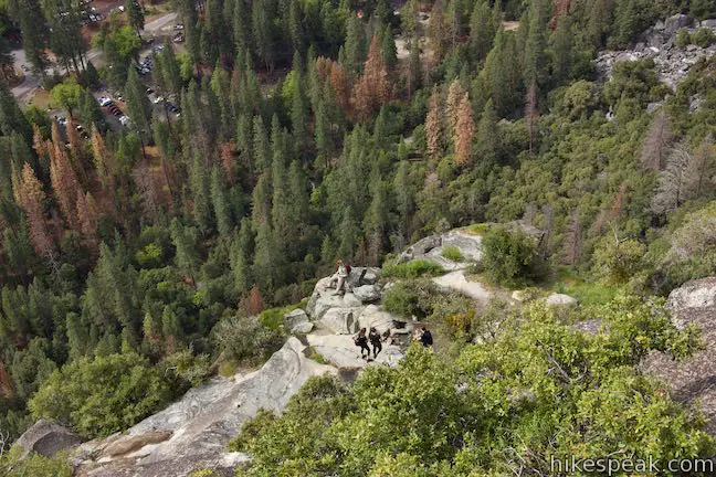
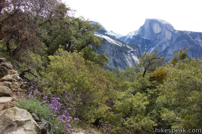
Columbia Rock offers the best perspective yet, so proceed up another cluster of switchbacks. After a mile of hiking, you may spot some people on a rocky bench below the trail. This is not Columbia Rock, but seems to serve as an alternative – by choice or confusion. Just continue up the trail through a few more twists and turns to find an obvious spur on the right to Columbia Rock.
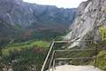
Columbia Rock Viewpoint
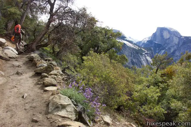
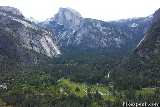
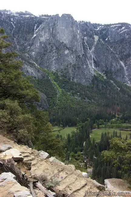
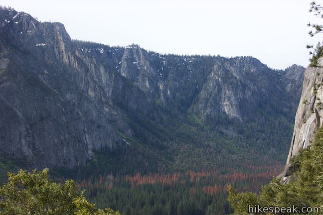
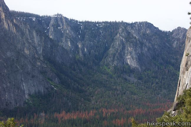
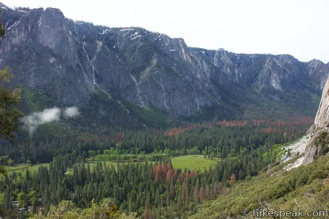
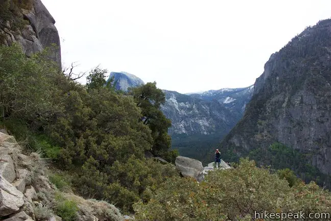
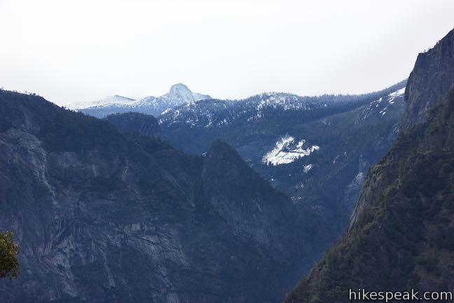
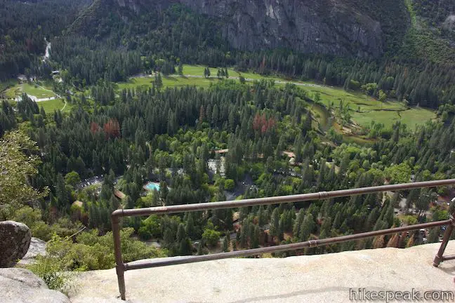
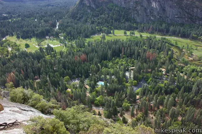
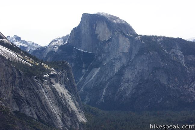
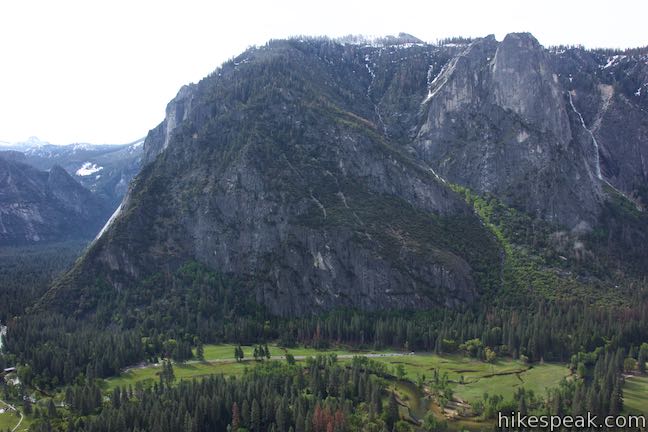
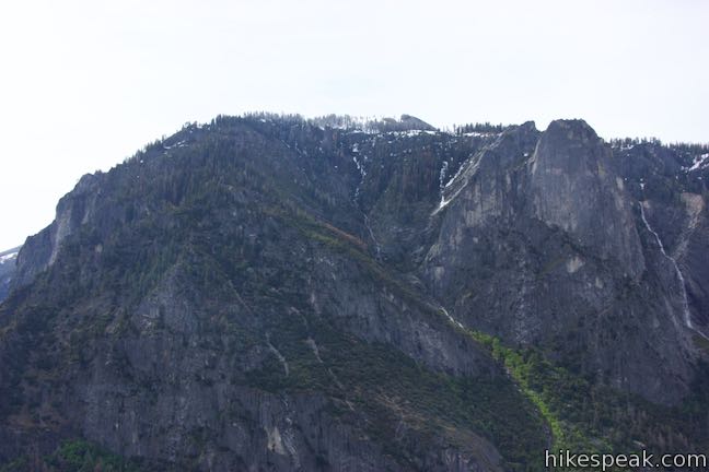
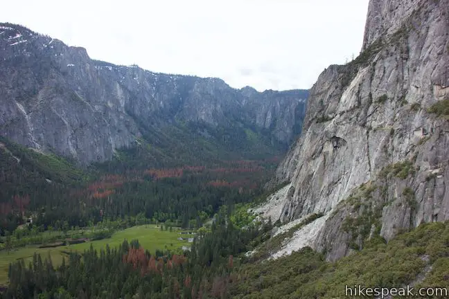
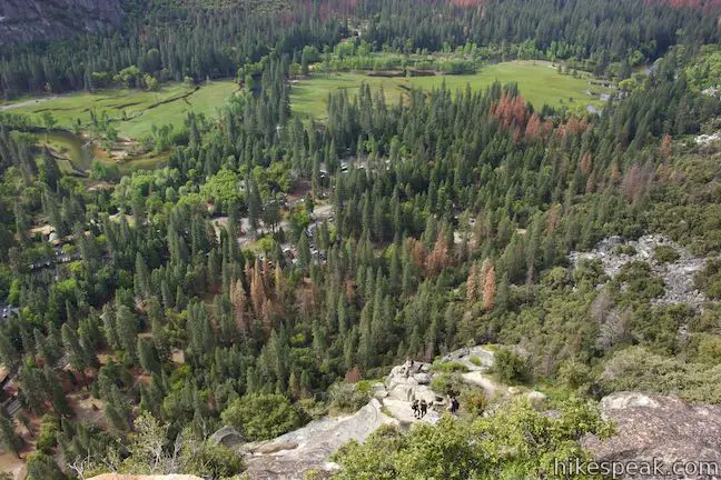
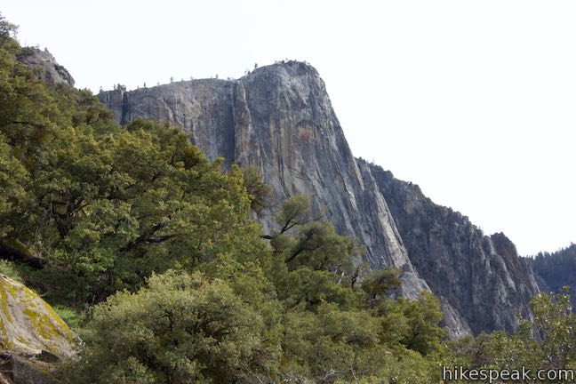
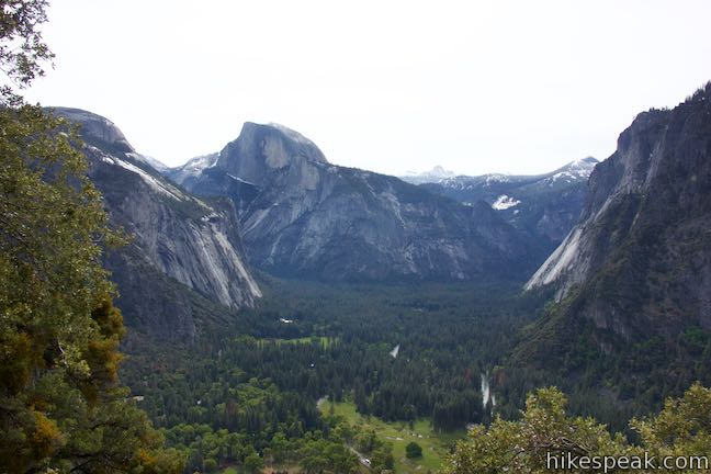
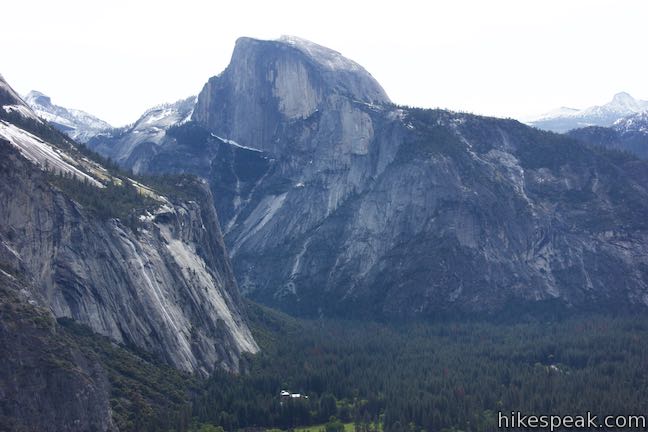
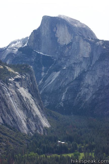
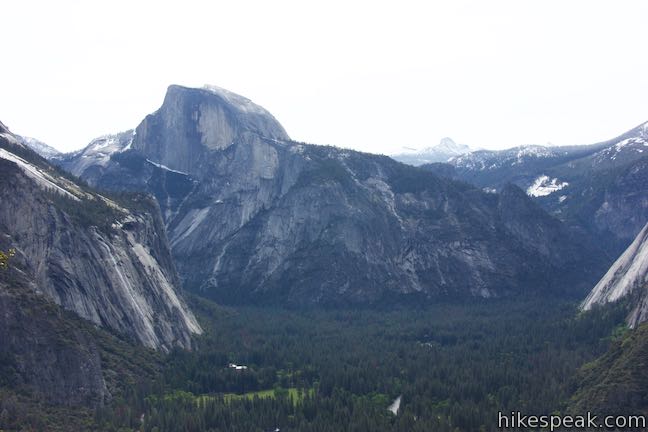
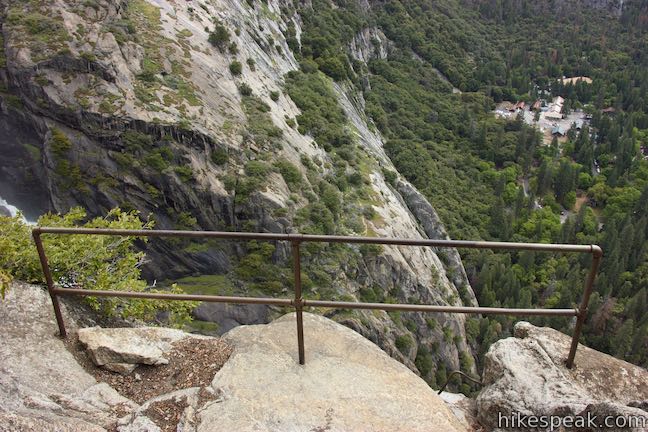
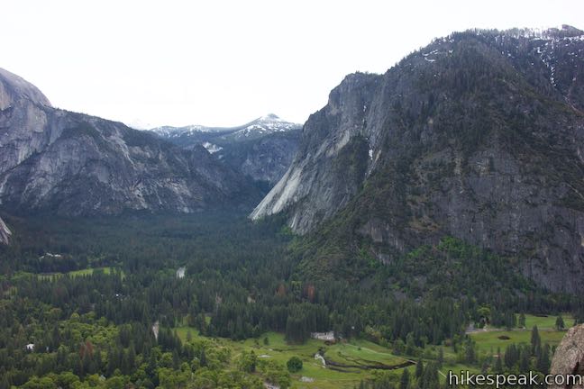
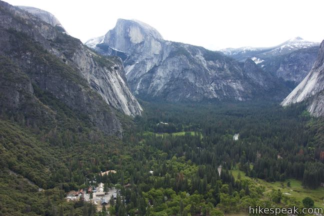
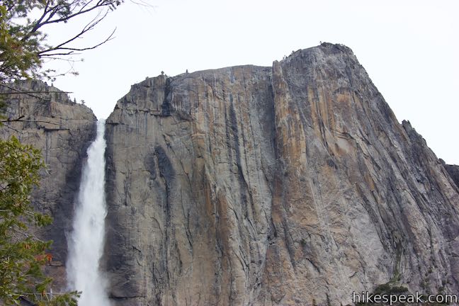
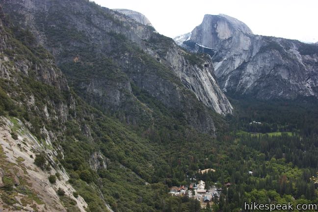
Step up to the metal railing at Columbia Rock and have a look out over a full sweep of Yosemite Valley. Initially, your eyes will be drawn east toward mighty Half Dome. The sheer face is dramatically exposed from this perspective. To the south of Half Dome, Mount Clark rises to a point among the more distant mountains. Across the valley, the towering south wall rises to Sentinel Dome near Glacier Point. Sentinel Falls tumbles down one of the creases in the wall to the southwest. Farther to the west, the south wall gets more jagged at the Cathedral Rocks. To your right, the El Capitan-like face of Eagle Peak rises from the north side of the valley, blocking views of the real El Capitan.
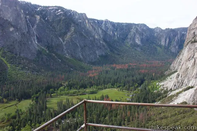
Yosemite Village is spread out below Columbia Rock, and a green forest-wrapped meadow stretches to the west end of Yosemite Valley. Things sure look small down there, which make sense since you’ve already climbed nearly a thousand feet. Columbia Rock is at around 4,975 feet of elevation and Yosemite Valley is at 4,000 feet.
Yosemite Falls isn’t visible from Columbia Rock, but the 180-degree view from the side of Yosemite Valley makes this perch a definite highlight along Yosemite Falls Trail. The Columbia Rock perspective of Half Dome towering over Yosemite Valley is so fulfilling that it seems sufficient enough to satisfy the many hikers who turn around at Columbia Rock (enjoying 2.2-mile round trip hikes with 985 feet of elevation change). If you appreciate waterfalls, it would be a real shame not to continue for at least another 2/3 of a mile up the tapering trail to the foot of Upper Yosemite Fall.
Columbia Rock to views of Upper Yosemite Fall
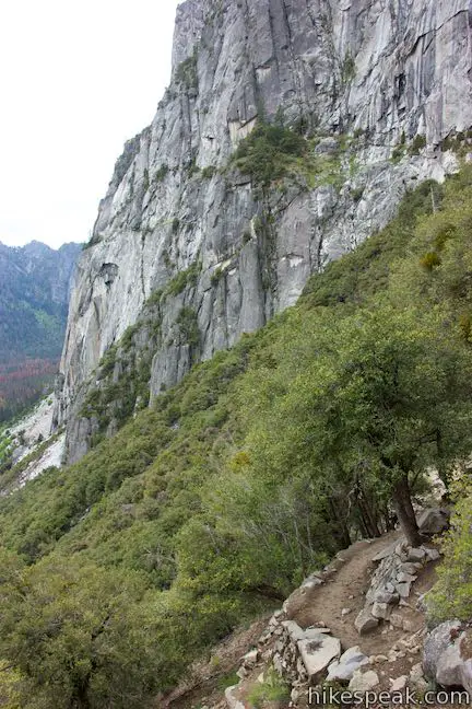
Did someone tell you that the switchbacks stopped at Columbia Rock? Sorry. Yosemite Falls Trail launches through a couple steep bends as it rises above Columbia Rock. However, it doesn’t take long for the trail to ease up and straighten out, crossing a wooded ledge on side of valley.
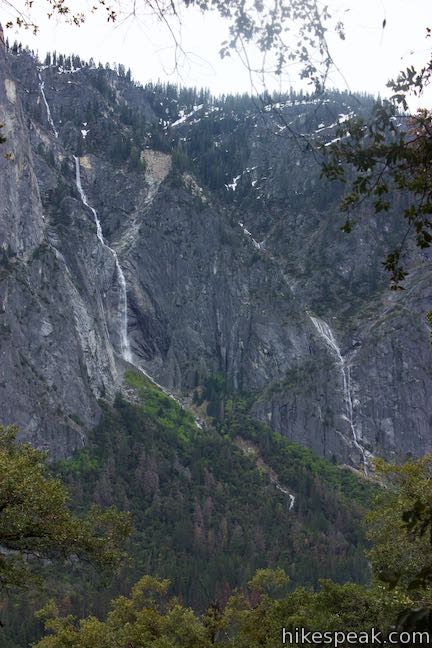
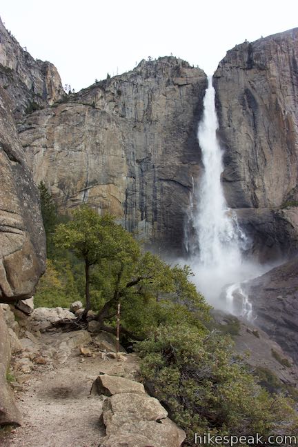
After rising to 5,200 feet, a quarter mile past Columbia Rock, Yosemite Falls Trail actually heads downhill for a stretch. Catch your breath and catch some shade as the trail crosses a pair of seasonal springs, 1.4 and 1.45 miles from the trailhead. Inevitably, the respite ends and the trail angles uphill again through a forest dappled by sunlight. March up more steps to get your first look at Upper Yosemite Fall, finally coming into view from a crest in the trail, 1.6 miles from the start.
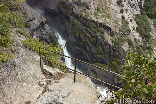
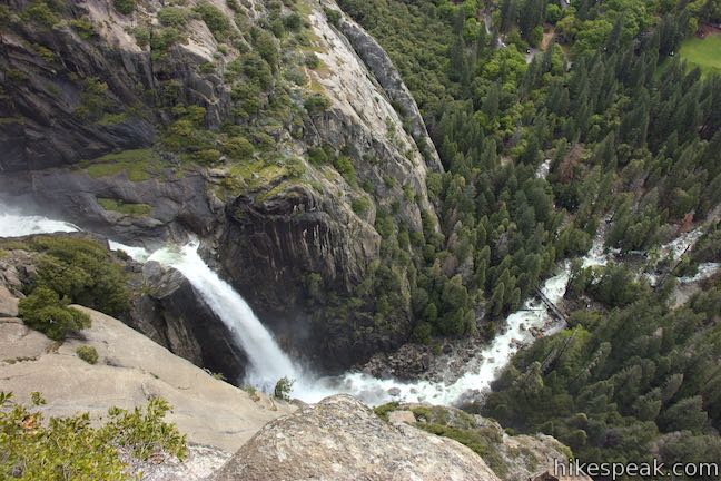
The instant you see the waterfall, look to your right to spot an unmarked path descending from the trail (you may need to back up ten feet or so once you see the waterfall to find the start of this path). This short spur leads down to a little-visited overlook above Lower Yosemite Fall. Want to explore an old side trail?
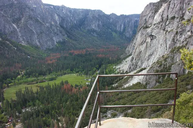
Bonus overlook: Taking the short path down from Yosemite Falls Trail, you will come to a precarious viewpoint at the top of a cliff facing Lower Yosemite Fall. Like Columbia Rock, this viewpoint has a metal railing, which you should definitely stay behind. (A slip from these cliffs would be deadly. Your safety is your responsibility).
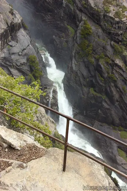
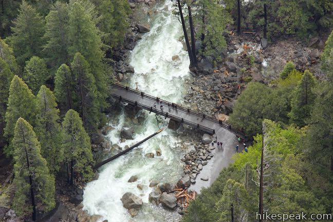
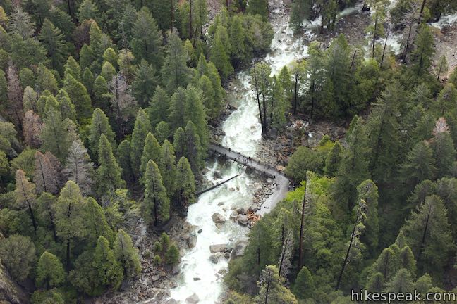
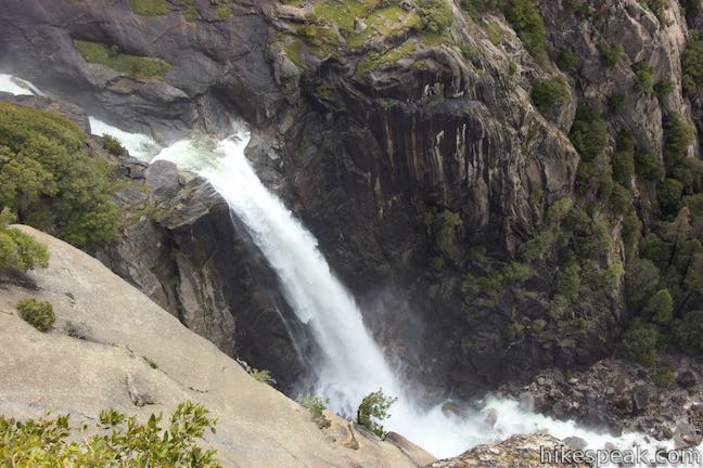
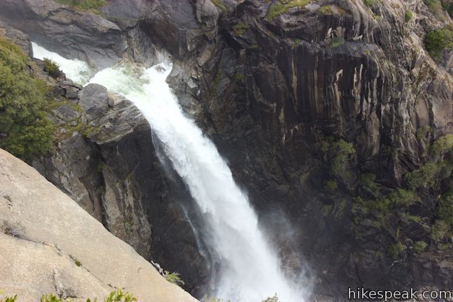
This viewpoint appears on century old maps, when Yosemite Falls Trail was known as Eagle Peak Trail, but the perch seems to have been largely forgotten by modern visitors. The overlook offers a rare perspective of all three sections of Yosemite Falls. Clutch the railing with white knuckles and look down Lower Yosemite Fall. Spot tiny hikers on Lower Yosemite Fall Trail, crossing the bridge below the waterfall. Gaze out across Yosemite Valley for another inspiring perspective of Half Dome.
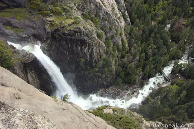
Looking left from the overlook, observe a rare perspective up the Middle Cascades, where Yosemite Creek pours through a series of wild punchbowls, racing down a deep chasm of dark rock. Above the cascades is the mighty Upper Yosemite Fall. Although obscured by a tree branch or two, nothing can diminish the impression of this extraordinary waterfall.
Leave the daunting one-of-a-kind overlook and ascend back to Yosemite Falls Trail. This side excursion adds about a tenth of a mile to the length of your hike.
Carrying On: You might see hikers stopping and turning around at the first spot where Upper Yosemite Fall comes into view. Don’t cut things that short. Proceed up the trail as it bends north and descends through a couple twists leading to even better views of Yosemite Falls.
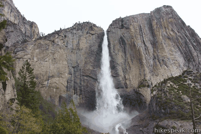
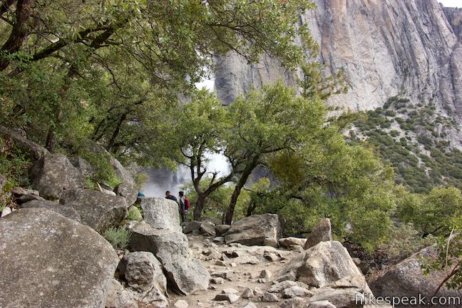
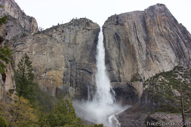
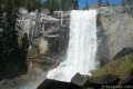
The trail is relatively level for the next 0.2 miles, with nearly constant views of Upper Yosemite Fall. The trail crosses a bowl-shaped recess carved into the wall of Yosemite Valley. A mist of water droplets fills the air, issued by the collision of water and rock at the foot of the falls.
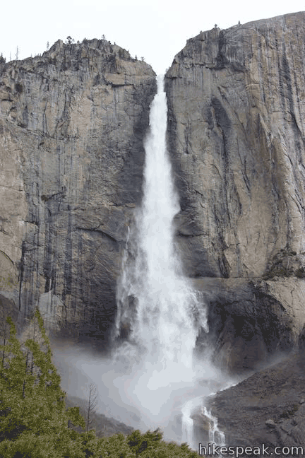
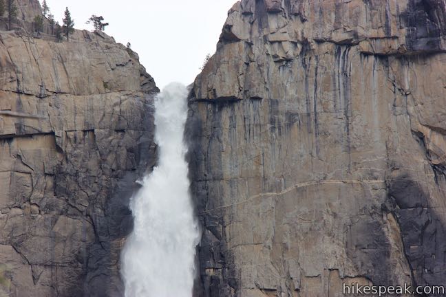
The 1,430-foot single drop of Upper Yosemite Fall is so enormous that it is hard to fathom (or effectively capture in photographs). Upper Yosemite Fall has a long, tapered drop that fans out toward the base. The river springs from a cataract at the top of a sheer granite cliff. Looking through the mist at the bottom of the waterfall, you can watch free-falling charges strike the dark granite. Streams form and merge back into a channel that careens into the Middle Cascades. Fully-grown trees near the base of the waterfall provide a reference for the waterfalls grandeur.
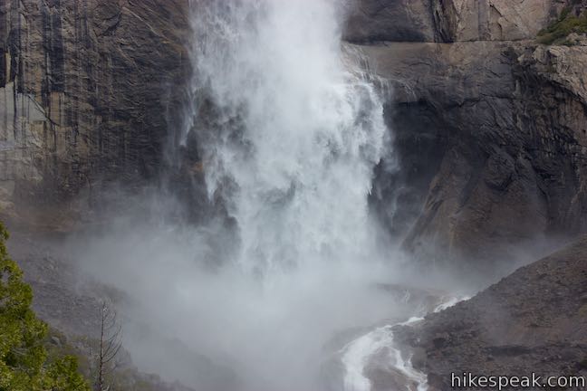
Yosemite Falls is usually at its fullest during the month of May, when snowmelt pours into Yosemite Creek. During spring months, the volume of creek increases the volume of the waterfall, creating a loud din of crashing water that reverberates off the granite.
Yosemite Falls Trail approaches an even bigger stretch of switchbacks. This is the next logical place to turn around on Yosemite Falls Trail, before the trail climbs another 1,500 feet to an overlook at the top of Upper Yosemite Fall, that it reaches 1 2/3 miles from the start of these upper switchbacks. The hike to views near the foot of Upper Yosemite Fall is 3.5 to 3.8 miles round trip with 1,200 feet of elevation change. Are you up for more?
Upper switchbacks to the top of Yosemite Falls
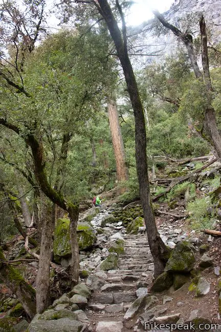
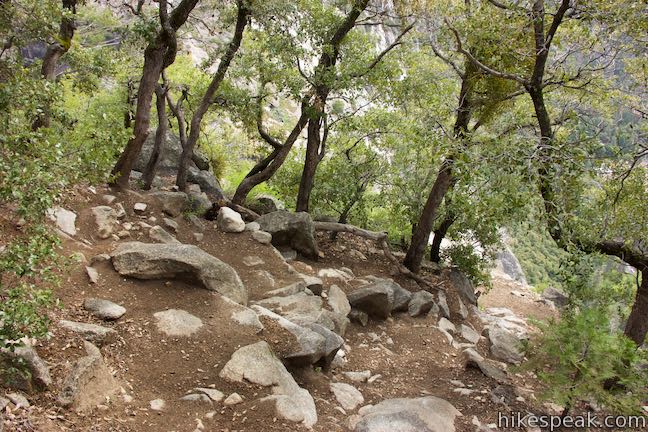
After crossing the exposed area near the base of Upper Yosemite Fall, the trail turns steeply uphill again, 1.85 miles from the start. The trail angles to the left to enter a forest where switchbacks ascend more stone steps. The waterfall views are cloaked by trees as the trail climbs through black oaks, white firs, and Jeffrey pines up a steep side canyon next to Upper Yosemite Fall.
Writer’s note: Sadly, this hiker decided to turn around early to avoid an oncoming thunderstorm (and a slippery descent of the granite steps).
The directions for the rest of Yosemite Falls Trail are as follows:
- Go up lots of strenuous steps and switchbacks
- As the trail levels out, come to a signed junction with Eagle Peak Trail (3.2 miles from the trailhead), and bear right to stay on Yosemite Falls Trail
- After another tenth of a mile, come to a junction near the high point of the hike and bear right again past a trail to Yosemite Point (a popular extension)
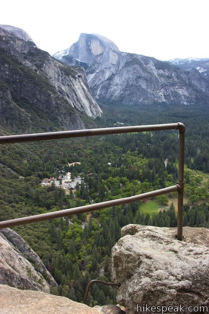
- Proceed down narrow and steep stone steps to a railing at a viewpoint by the top of Upper Yosemite Fall (where the trail ends, 3.5 miles from the start)
- Experience vertigo and incredible view looking straight down Upper Yosemite Fall and out across Yosemite Valley
- Hike back down Yosemite Falls Trail
Extensions: The trail to Yosemite Point splits off near the top of the trail, crosses Yosemite Creek, and continues 0.8 miles up to a panoramic 6,936-foot perch on the rim of Yosemite Valley. Eagle Peak is around 2.9 miles up Eagle Peak Trail from Yosemite Falls Trail, with additional connections to Tioga Road and El Capitan.
Final thoughts
Things aren’t easy breezy on the hike down Yosemite Falls Trail, since that direction has some uphill steps as well. Somehow the stone staircase of switchbacks at the bottom of the trail seems longer coming down than it did going up. You will definitely have tired legs when you get back to Camp 4.
Hiking any length of Yosemite Falls Trail creates an indelible Yosemite memory. Standing in front of Upper Yosemite Fall is one of the most awe-inspiring experiences that Yosemite National Park has to offer , (and the park offers many). The honorable hike halfway up Yosemite Falls Trail will not leave you feeling shortchanged, but will leave you eager to return to complete the ascent.
Dogs and bikes are not allowed on Yosemite Falls Trail (Upper Yosemite Fall Trail). This hike goes through Yosemite Wilderness, so wilderness permits are required for overnight stays. Day hikers do not need to acquire or carry permits. Yosemite National Park has an entrance fee.
To get to the trailhead: Make your way into Yosemite Valley, parking where available near Yosemite Village or Curry Village. Take the free park shuttle to Stop 7 for Camp 4.
Trailhead address: Camp 4 Campground, Northside Drive, Yosemite Valley, CA 95389
Trailhead coordinates: 37.7423, -119.6021 (37° 44′ 32.3″N 119° 36′ 07.6″W)
View Yosemite National Park in a larger map
Or view a regional map of surrounding Sierra Nevada trails and campgrounds.


 | Columbia Rock This 2.2-mile hike up the start of Yosemite Falls Trail reaches a perch with a sweeping perspective across Yosemite Valley that includes Half Dome. |
 | Lower Yosemite Fall Trail This 1.2-mile hike delivers visitors to the base of the tallest waterfall in North America. The experience is not to be missed. |
 | Bridalveil Fall Trail This easy paved half-mile trail visits the base of a 620-foot single-drop waterfall on the south side of Yosemite Valley. |
 | Mirror Lake This 2 to 2.8-mile hike visits a reflective pool on the east end of Yosemite Valley. |
 | Happy Isles This easy 0.75-mile hike explores a pair of islands in the Merced River at the east end of Yosemite Valley. |
 | Mist Trail This 1.8 to 6.1-mile hike takes an exciting course past Vernal Fall and Nevada Fall, two of Yosemite's prize waterfalls. |
 | Half Dome This epic 16-mile hike climbs 4,800 feet on one of Yosemite's most popular and most challenging trails. |
 | Panorama Trail This nearly 10-mile long one-way hike travels from Glacier Point down to Yosemite Valley in the most scenic way possible, ending with the Mist Trail. |
 | More trails in the Sierra Nevada Mountains Explore other destinations in Yosemite National Park and the rest of the range. |
 | Yosemite National Park Campgrounds Thirteen campgrounds with over 1,600 total sites are spread throughout the park to facilitate your visit, including Camp 4. |
 | Housekeeping Camp What's not a hotel and not a campground? Housekeeping Camp offers a different type of lodging in the middle of Yosemite Valley. |
The official National Park Service webpage for Yosemite Falls Trail
Yosemite Falls on wikipedia.org
Yosemite Falls Trail on yosemitehikes.com
Yosemite Falls Trail on travelerted.com
Yosemite Falls Trail on theoutbound.com
Yosemite Falls Trail on alltrails.com
Yosemite Falls Trail on hikingproject.com
Yosemite Falls Trail on yosemiteexplorer.com
Yosemite Falls Trail & Yosemite Point on earthtrekkers.com
Go the extra miles...
Submit a rating of this hike to go with your comment. Contribute to the average trail rating.