Sulphur Banks Trail – Crater Rim Trail Loop
in Hawai‘i Volcanoes National Park
Kīlauea Volcano underwent major transformations when it erupted in the summer of 2018. See changed landscapes in and around Kīlauea Caldera from Steaming Bluff, where steam escapes from hot spots just below your feet! Behind the bluff, a hydrothermal area called Sulphur Banks displays colorful mineral deposits, accompanied by eggy smells.
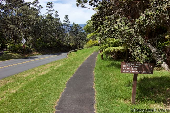
Sulphur Banks Trail – Crater Rim Trail Loop starts from Kīlauea Visitor Center, takes a boardwalk through the Sulphur Banks, stops at Steaming Bluff, and then circles back through rainforest along Crater Rim Trail. This outdoor course in volcanic activity is 1.6 miles long with 50 feet of elevation change.
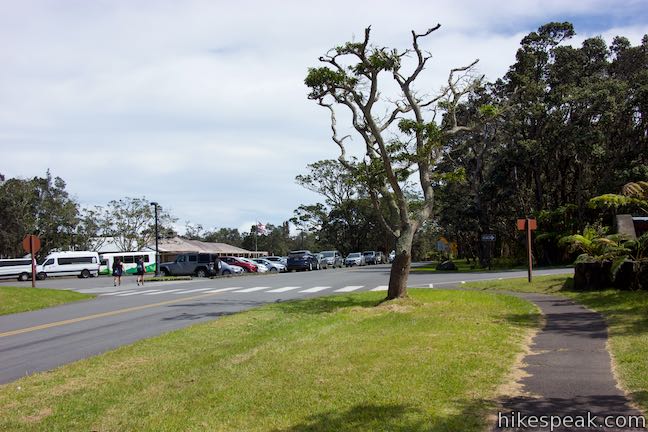
This Hawai‘i Volcanoes National Park hike begins from Kīlauea Visitor Center, located just beyond park entrance. Sulphur Banks Trail – Crater Rim Trail Loop is a great leg-stretcher just inside the park, with wild scenery.
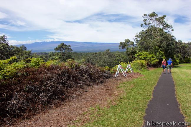
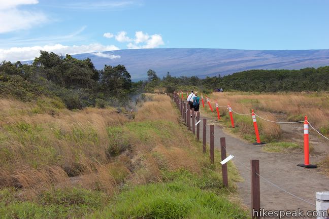
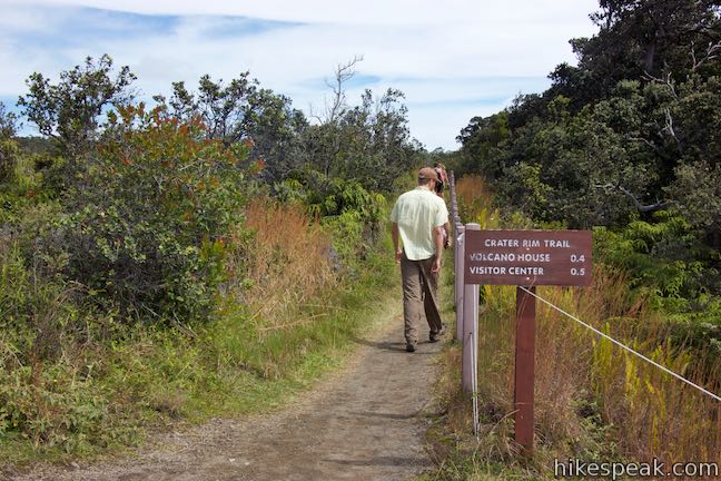
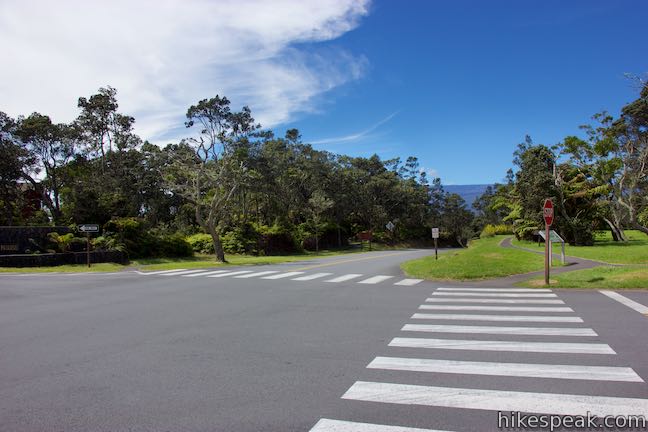
Walk out the front door of the visitor center and turn right. Pass the bathrooms and walk along the parking area west of the visitor center toward the art gallery. Curve left around the far end of the parking area to find the start of Sulphur Banks Trail (on the right) just before a crosswalk over Crater Rim Drive. Your return route, Crater Rim Trail, is on the far side of the road (unless you choose to hike the loop in the opposite direction).
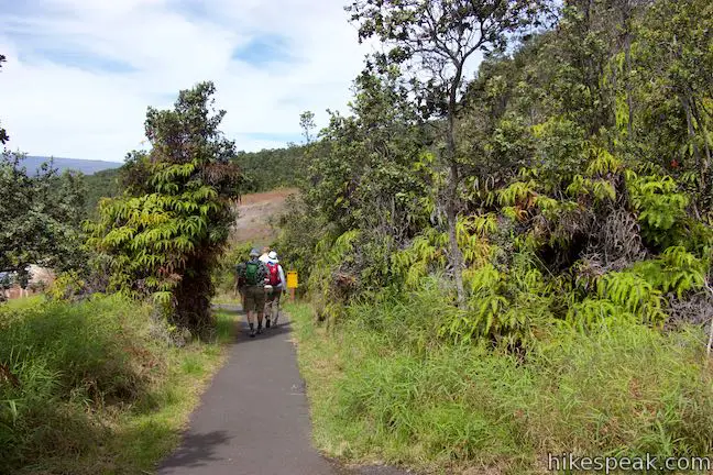
Turn right from the parking area to venture west on Sulphur Banks Trail, which is paved. On the right side of the trailhead is a carved rock sculpture called the Ulumau Pōhaku Pele. This “ever-growing rock” honors the Hawaiian god Pele and the sacred mountains Mauna Loa and Kīlauea.
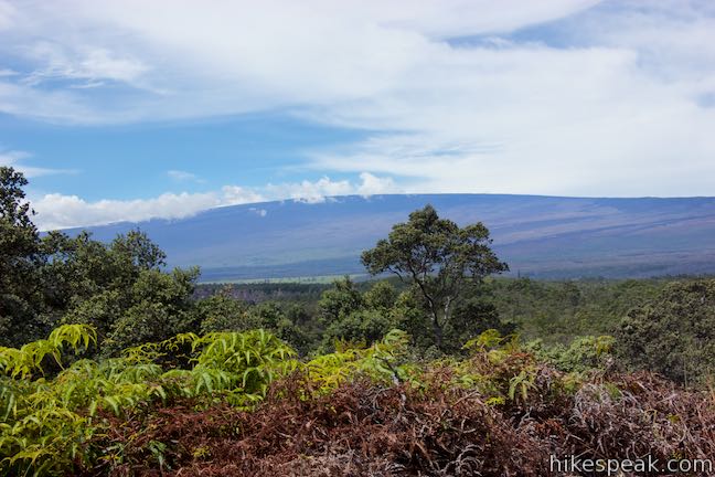
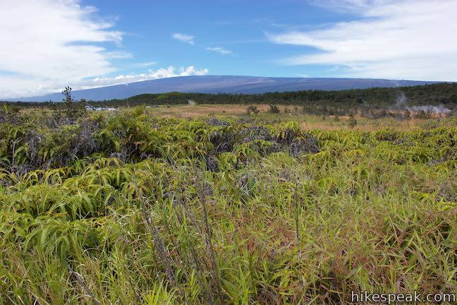
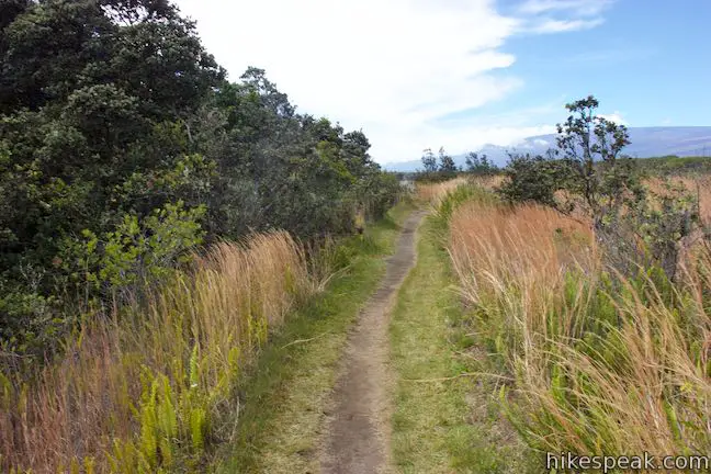
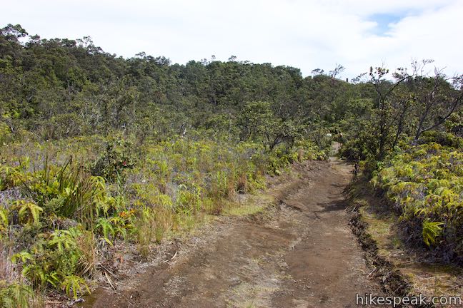
Follow Sulphur Banks Trail along the side of a field above Crater Rim Drive. Enjoy early sights of Mauna Loa, the broad 13,678-foot volcano rising to the northwest. Off the right side of the trail, a grassy platform for traditional Hawaiian dances, a Kahua Hula, stands just above the rest of the field.
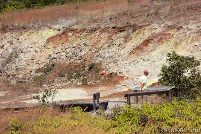
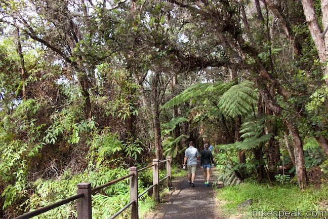
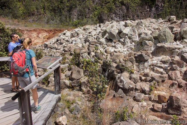
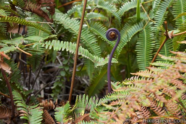
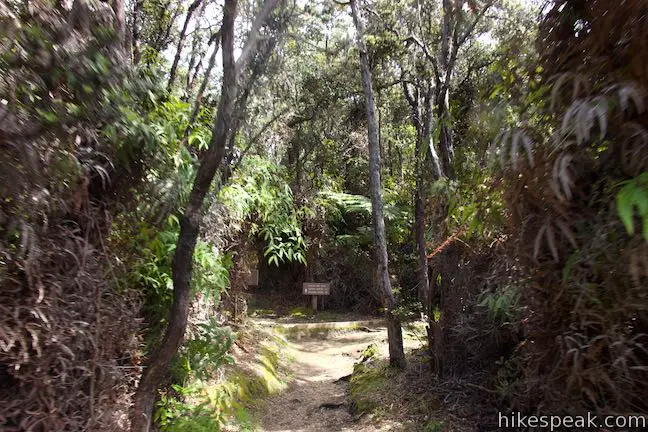
Sulphur Banks Trail curves to the right and passes a bench after a tenth of a mile. Here, the trail bends left and punches into a band of rainforest. Pass through the forest to arrive at the edge of the Sulphur Banks.
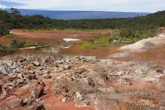
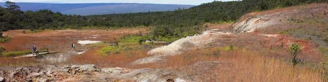
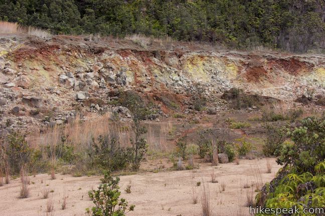
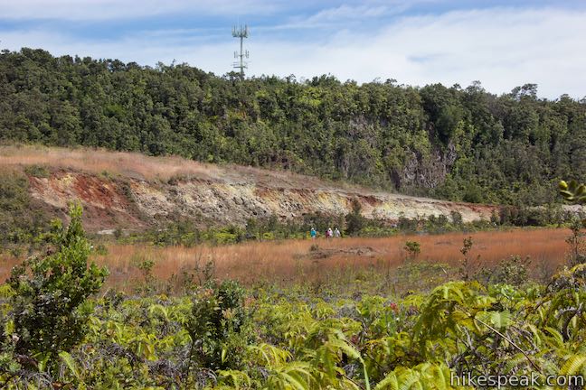
Sulphur Banks
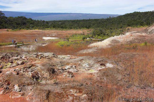
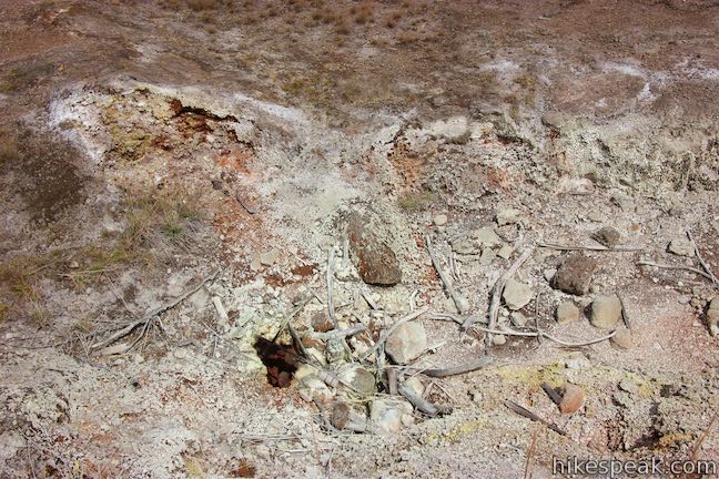
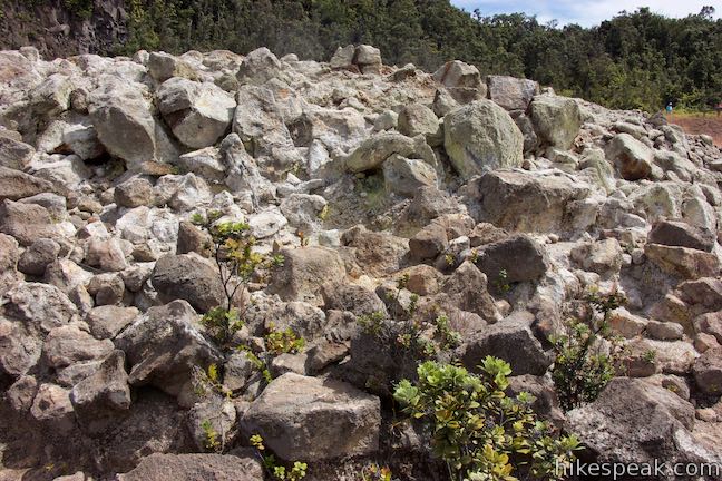
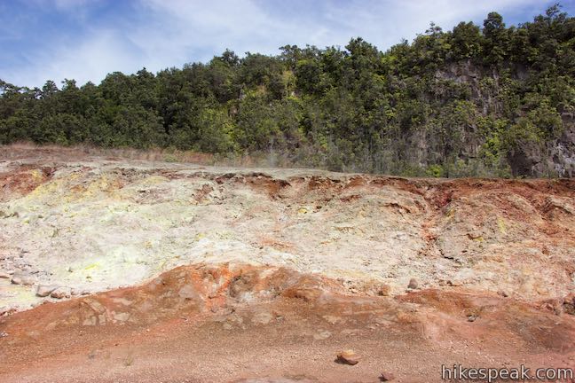
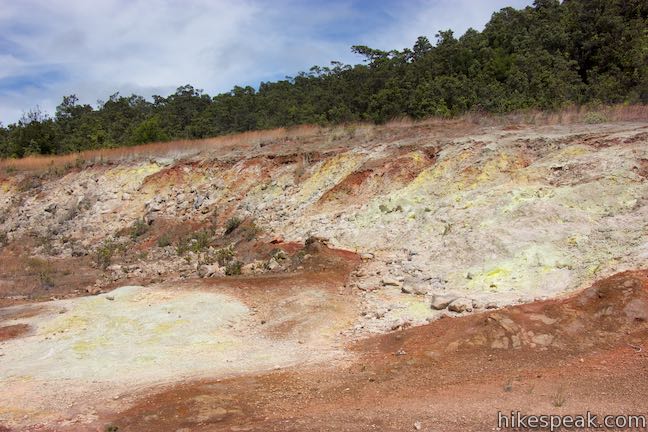
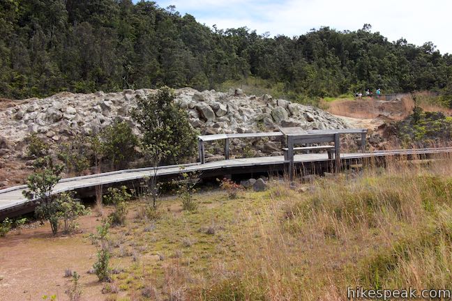
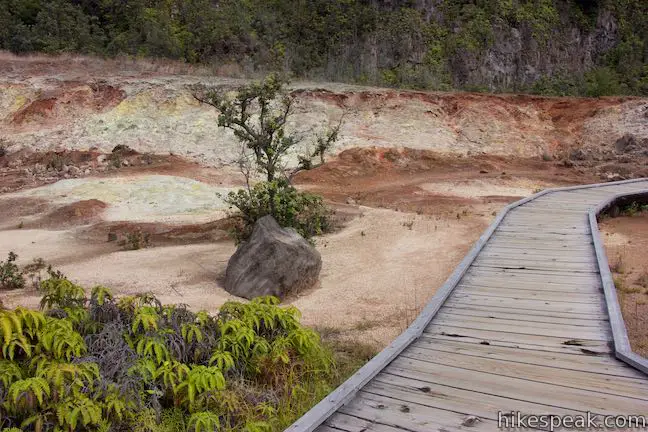
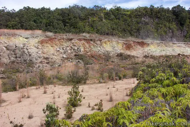
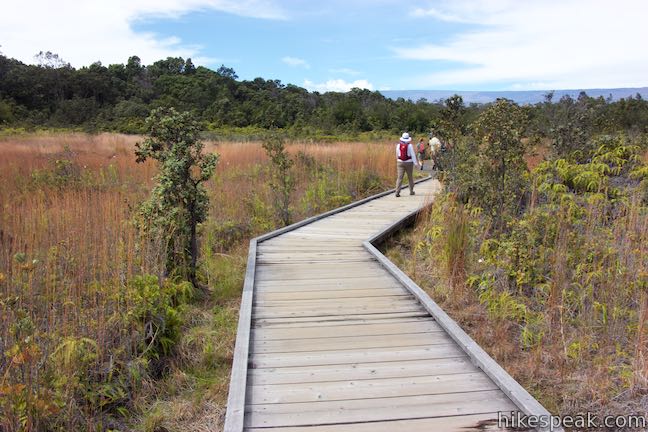
A boardwalk takes hikers across the hot, delicate crust of Sulphur Banks. Starting from the upper northeast slope, the boardwalk begins with a nice overview of this hydrothermal area. The forest greenery gives way to a landscape that is orange and brown with mineral patches of white, yellow, and red. The ground temperatures are so hot that tree roots can’t grow. Trees are absent at Sulphur Banks, but patches of grasses and other small plants somehow manage to live among the steaming rock piles and colorful mineral deposits.
A panel at the start of the boardwalk explains how Sulphur Banks was created:
Volcanic gasses rise to the surface here through deep faults and fractures produced by the collapse of Kīlauea’s summit, 500 years ago. Sulfur and other hot gases released from magma hinder plant growth and create a colorful landscape of corroded rock.
Sulphur Banks is located at the edge of Kīlauea Caldera, a large crater at the summit of Kīlauea created by a collapsed magma chamber. Cracks in the earth at Sulphur Banks provide paths for hydrothermal cycles. Water seeps down into the cracks where it meets burning hot rocks. The water turns to vapor and rises back to the surface – evident at several steaming features. Volcanic gasses also rise to the surface through deep fractures in the earth. Depending on the direction that the wind is blowing, you may smell the rotten egg aromas of sulfur dioxide produced by the Sulphur Banks even before you step foot on the boardwalk!
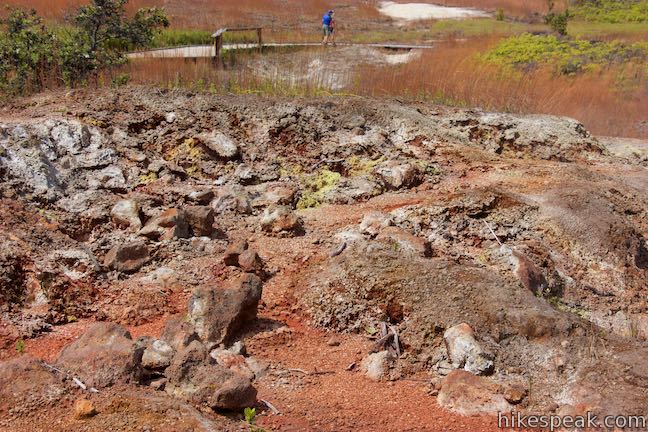
Walk down Sulphur Banks Boardwalk, curving down the strange terrace. In case it needs to be written… stay on the boardwalk and away from the seeps of volcanic gasses and hidden heat sources. You could get a serious burn by leaving the trail.
Approach the base of the terrace at the Sulphur Banks and examiner more panels to learn about the chemistry happening around the trail:
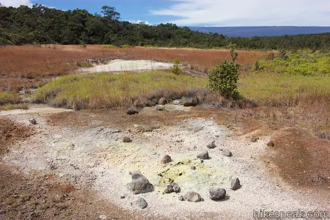
Fumes emitted here include sulfur dioxide (SO2) and hydrogen sulfide (H2S). These two gases react chemically to produce pure sulfur, a yellow mineral known to Hawaiians as kūkaepepe, the waste of Pele. Sulfur (S) is deposited on the rocks, covering them with feathery crystals, while water vapor (H2O) condenses to make steam. Scientists use this formula to show the chemical reaction:
SO2 + 2H2S = 3S + 2H2O
The rocks along the boardwalk display yellow sulfur crystals coated with sulfuric acid. Water vapor rises from the earth. Other gasses reach with the rainwater to create hydrofluoric acids that corrode rocks and create cracks and cavities for more steam. In addition to the sulfur crystals, white deposits of opal and the dark red of hematite are also present. The temperature underground is above 200 degrees Fahrenheit, which cooks the rocks and powers the hydrothermal activity.
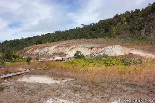
Proceed on the boardwalk as it weaves away from the Sulphur Banks through grasses below the terrace. Another panel explains that the Sulphur Banks where also called Ha‘akulamanu, a gathering place for birds. Nēnē (Hawaiian geese) and kōlea (Pacific golden plovers) once foraged in this treeless hot spot, but no longer visit Sulphur Banks because its pools of water disappeared and non-native grasses have overtaken native vegetation.
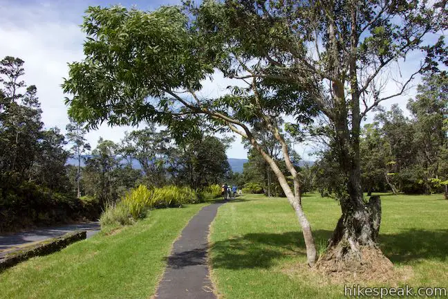
As you leave the hydrothermal area, the boardwalk ends, but Sulphur Banks Trail continues. The paved trail returns to forest, a quarter mile from the start of the boardwalk and half a mile from Kīlauea Visitor Center. Pause to look back at Sulphur Banks before entering the ferny grove.
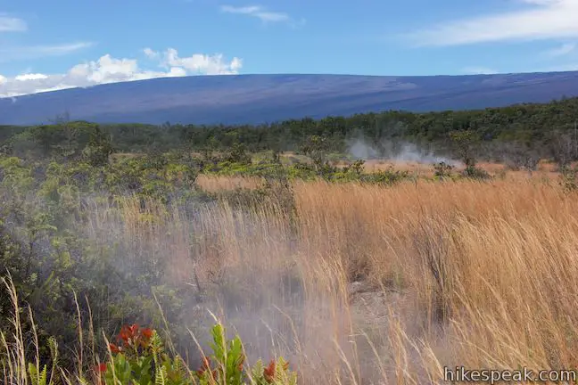
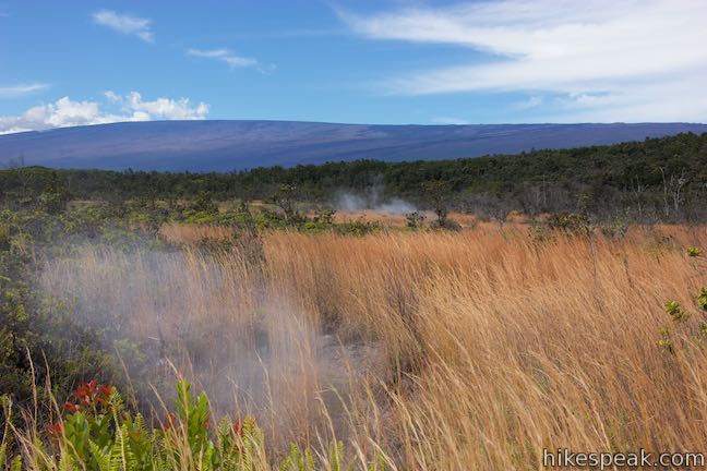
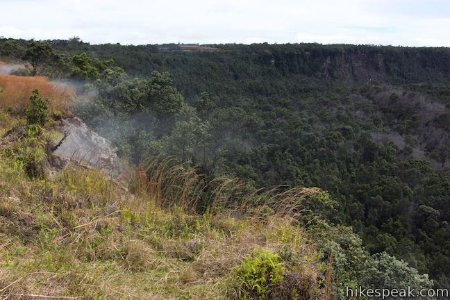
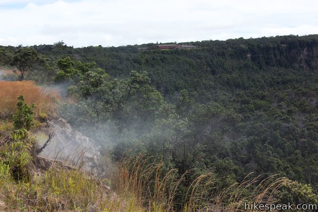
Walk through a short band of forest to a larger meadow alongside Kīlauea Caldera. This area has reason to be treeless. Steaming vents and fumaroles can be observed along the trail. The meadow also provides open views of Mauna Loa, so enjoy grand volcano vistas!
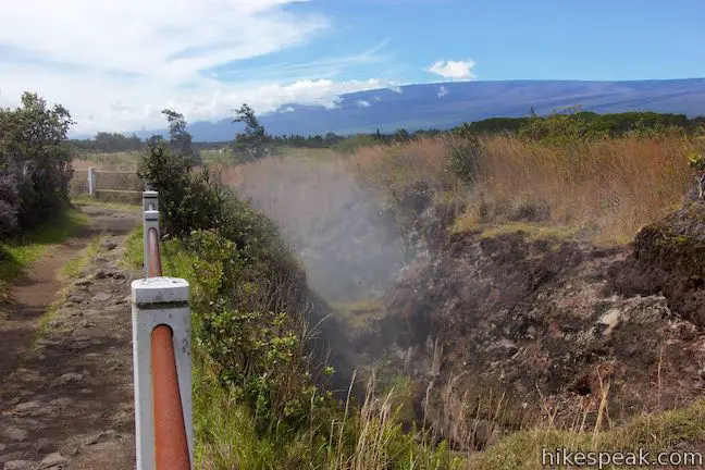
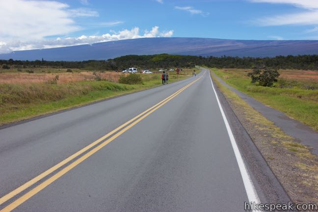
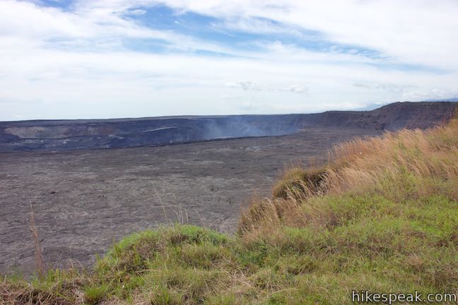
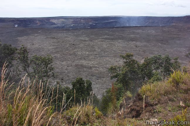
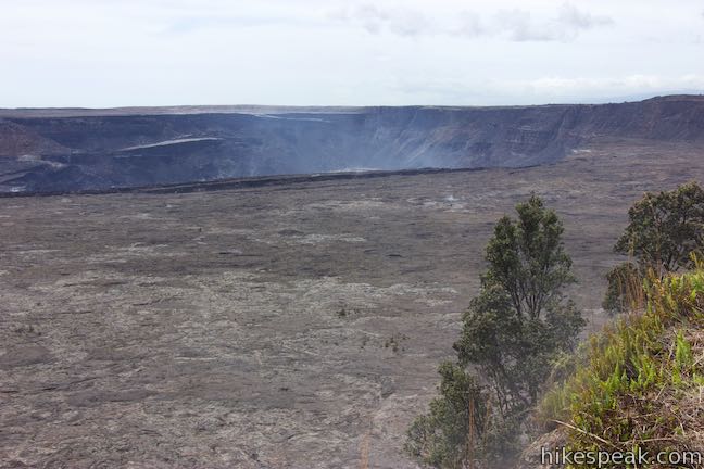
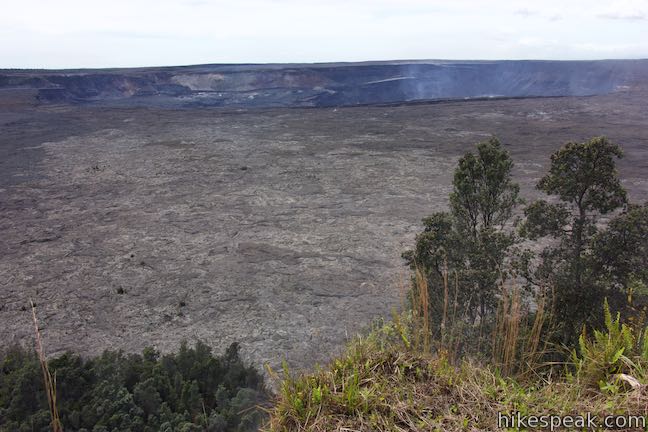
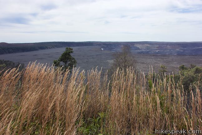
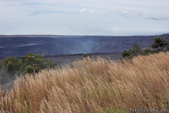
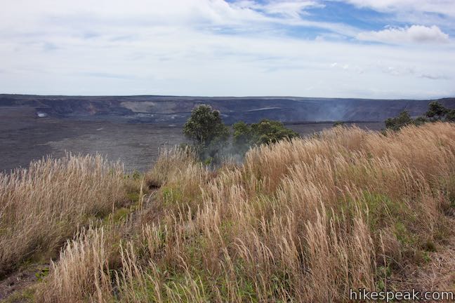
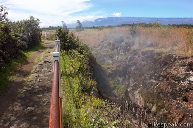
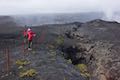
Next, Sulphur Banks Trail crosses Crater Rim Drive. When it is safe to do so, walk to the south side of the road, go another tenth of a mile, and come to a junction with Crater Rim Trail. This T-junction is 0.8 miles from the start of the hike. The route back to the visitor center is to the left. Before heading this direction, turn right to admire Kīlauea Caldera from Steaming Bluff.
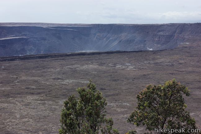
Steaming Bluff
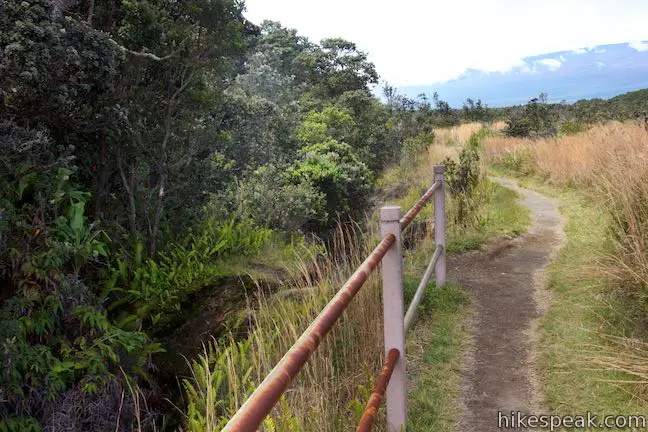
Hike along Crater Rim Trail for a tenth of a mile to a junction with a path from the Steam Vents Parking Area along Crater Rim Drive. Crater Rim Trail is set just a few feet back from the steep edge of Kīlauea Caldera. This area offers attractions near and distant.
Steam rises out of the ground along the trail. These vents create wafts of steam that drift across the trail. Look along Steaming Bluff to see vent after vent of steam escaping from the ground just below the trail. What is going on right under your feet?
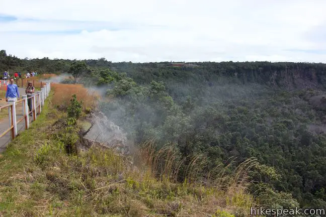
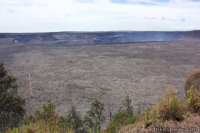
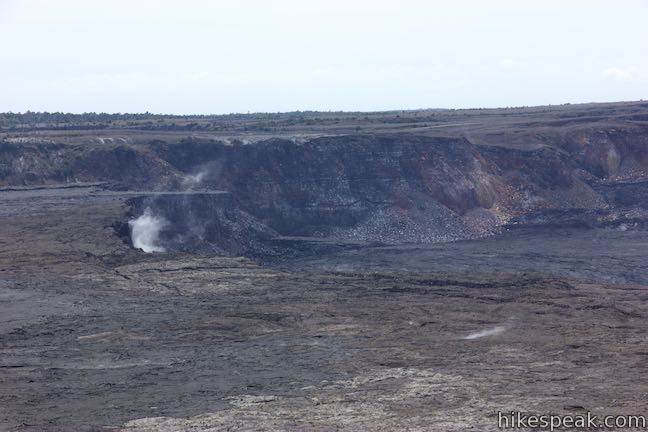
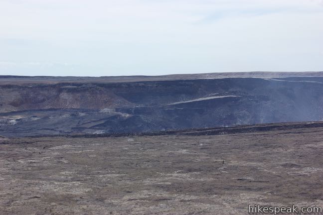
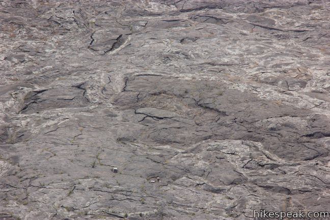
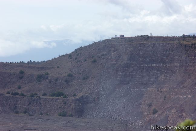
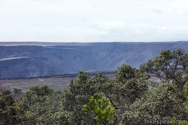
Crater Rim Trail has spectacular views across Kīlauea from the caldera’s edge. Look out over the vast and barren collapsed summit of Kīlauea Volcano. The far side of the caldera sinks even deeper at Halemaʻumaʻu Crater. This crater within Kīlauea Caldera was redefined by eruptions in the summer of 2018 – the most significant volcanic activity in the more than century long history of Hawai‘i Volcanoes National Park.
Halemaʻumaʻu Crater experienced major changes as Kīlauea went through dozens of enormous collapse explosions and generated tens of thousands of earthquakes. The crater is now 1,600 feet deeper than it was before 2018 and grew in volume from approximately 60 million cubic yards to 1.2 billion cubic yards. Look at Halemaʻumaʻu Crater, the deepest part of Kīlauea Caldera, and imagine it dropping by a greater height than the Empire State Building over an 8-week period. The profound changes were well documented by the National Park Service through before and after photos. What a volcano!
The expansion of Halemaʻumaʻu Crater shares similarities with the creation of the larger Kīlauea Caldera. One of the panels along Sulphur Banks Trail explains how a huge summit collapse created the caldera:
Magma stored inside Kīlauea supported the summit of the volcano. Large or long-lasting eruptions partially emptied the magma reservoir. The unsupported summit collapsed under its own weight, creating a caldera (large crater) at the top of Kīlauea. Continued loss of magma caused further collapse along deep faults. These down-dropped blocks form the “stair-step” cliffs you see around the caldera today.
The 2018 eruptions closed sections of Crater Rim Trail and other trails around Kīlauea. The hike outlined here turns around at the junction by Steam Vents Parking Area, but you could also choose to hike farther west along Crater Rim Trail.
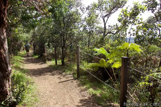
Backtrack to the junction with Sulphur Banks Trail. You have hiked a mile now and have 0.6 miles to go. Go through the junction and take Crater Rim Trail east along the side of the meadow behind the caldera’s edge.
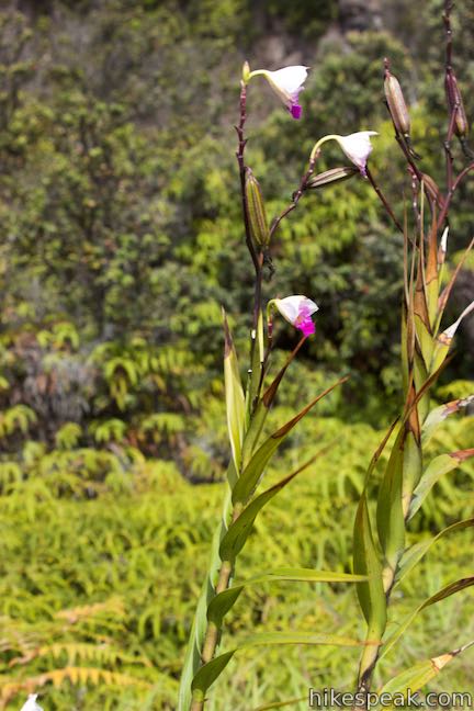
Gasses and steam escape from cracks and holes in the ground along the trail (atop fractures in the side of the caldera). The trail slips into rainforest and views of Kīlauea disappear, except for some windows in the trees, 0.2 miles past the junction. A small meadow also breaks up the rainforest hike, where bamboo orchids and other non-native and native plants may be observed.
Pass through two more marked junctions before returning to the visitor center. Stay to the left on Crater Rim Trail when it meets ‘Illiahi Trail (closed following the 2018 eruptions). Hike another 80 yards to the final junction. You could bear right to take Crater Rim Trail to Volcano House. Otherwise, turn left, following the sign for Kīlauea Visitor Center. The trail rises to Crater Rim Drive. Take the crosswalk to the north side of the road by the start of Sulphur Banks Trail and return to the visitor center parking area, completing the hike.
The basic directions for Sulphur Banks – Crater Rim Loop are:
- Start from Kīlauea Visitor Center and walk west along the parking area (0 miles)
- Begin up Sulphur Banks Trail, just north of Crater Rim Drive (0.05 miles)
- Enter Sulphur Banks Hydrothermal Area (0.25 miles)
- Leave Sulphur Banks Hydrothermal Area (0.5 miles)
- Safely cross Crater Rim Drive (0.7 miles)
- Meet Crater Rim Trail and turn right (0.8 miles)
- Meet the path from Steam Vents Parking Area, gaze into Kīlauea Caldera, and turn around (0.9 miles)
- Proceed straight past the end of Sulphur Banks Trail (1 mile)
- Stay to the left on Crater Rim Trail through a junction with ‘Illiahi Trail (1.45 miles)
- Come to another junction and turn left toward the visitor center (1.5 miles)
- Cross Crater Rim Drive near the start of Sulphur Banks Trail (1.55 miles)
- Return to Kīlauea Visitor Center (1.6 miles)
Those with wheelchairs can skip the visitor center side of the loop without missing much of the action. Sulphur Banks Hydrothermal Area is wheelchair accessible from the Steam Vents side via the level, paved trail and boardwalk. Parking is available at the Steam Vents Parking Area behind Steaming Bluff. Crater Rim Trail is not paved.
Because of the volcanic gasses that may be present at Sulphur Banks and Steaming Bluff, be sure to check on conditions at the visitor center before starting the hike. To be cautious, the park warns that, “visitors with heart or respiratory problems (such as asthma), pregnant women, infants, or young children should avoid this walk.”
Dogs, horses, and bikes are prohibited on Sulphur Banks Trail – Crater Rim Trail Loop. No permit is needed for this hike, but an entrance fee is charged to access Hawai‘i Volcanoes National Park.
To get to the trailhead: Take Hawaii Belt Road (Route 11) to the entrance of Hawaii Volcanoes National Park (which is 30 miles south of Hilo). The park entrance is on the left when traveling from Hilo.
Drive past an entrance station to the first intersection. Stay to the right on Crater Rim Drive and then pull into the parking area for Kīlauea Visitor Center. The parking area on the far side of the visitor center is closer to the trailheads.
Trailhead address: Kīlauea Visitor Center, 1 Crater Rim Drive, Hawaii Volcanoes National Park, HI 96785
Trailhead coordinates: 19.4296, -155.2575 (19° 25′ 46.6″N 155° 15′ 27.0″W)
View Hawai‘i Volcanoes National Park in a larger map
Or view a regional map of surrounding Hawaii trails and campgrounds.


 | Keanakāko‘i Crater & Overlook Trail This 2.15-mile hike follows eruption-damaged Crater Rim Drive to views into Keanakako'i Crater and the far grander Kilauea Summit. |
 | Kīpukapuaulu Trail This 1.2-mile nature trail loop visits a forest oasis within the lava flows below Mauna Loa in Hawaii Volcanoes National Park. |
 | Pu‘u Loa Petroglyphs Trail This 1.4-mile hike in Hawai‘i Volcanoes National Park traverses an old lava flow to a boardwalk loop within a special area of preserved petroglyphs. |
 | Hōlei Sea Arch This brief hike in Hawai‘i Volcanoes National Park crosses a basalt bluff to a landmark sea arch extending into the ocean. |
 | Rainbow Falls This 0.2-mile hike around Rainbow Falls Lookout explores a viewpoint facing a lovely waterfall and also ventures up to the top of the falls. |
 | Kaumana Caves This underground hike explores lava tubes on the edge of Hilo, created by an 1881 eruption of Mauna Loa. |
 | ‘Akaka Falls This short loop slips through a tropical valley to bold views of a 442-foot single-drop waterfall. |
 | Royal Grounds – Pu‘uhonua Loop This half-mile loop on the coast south of Kona explores Hawaiian royal grounds and a place of sanctuary in Pu‘uhonua O Hōnaunau National Historical Park. |
 | Trails in Hawaii Explore more hikes on the Big Island of Hawai‘i. |
Go the extra miles...
Submit a rating of this hike to go with your comment. Contribute to the average trail rating.