Sisar Canyon cuts into the mountains above Upper Ojai Valley, halfway between Ojai and Santa Paula. A wide dirt trail travels up the canyon toward Topatopa Ridge, a striking bluff of striped rock. Rather than taking Sisar Canyon Trail (also known as Sisar Canyon Road) deep into the Topatopa Mountains, turn around at an overlook 2.75 miles up the trail for a picturesque day hike. Limited parking at the trailhead on Sisar Road may encourage you set out from the bottom of Sisar Road along Route 150 and stroll half a mile up this paved country lane to the start of the dirt road. This extend the hike from 5.5 miles round trip with 1,125 feet of elevation change to 6.5 miles round trip with 1,200 feet of elevation change.
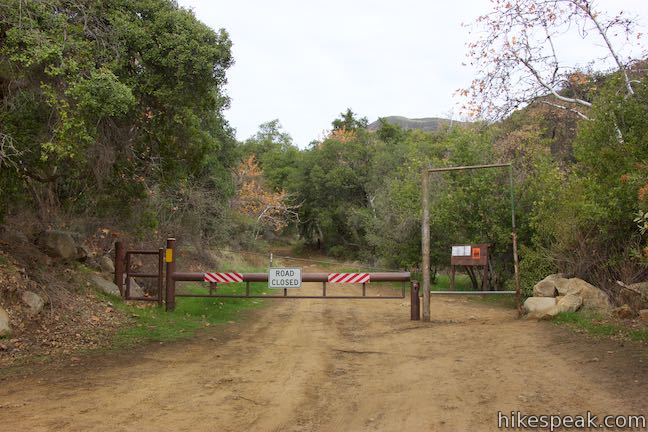
Note: Prior to March of 2017, vehicles were allowed to travel up the first half mile of Sisar Canyon Road to a trailhead parking area in front of a gate. The bottom of Sisar Canyon Road is now closed off to vehicles… so the hike has gotten longer! Keep this in mind if examining older trail guides and be prepared to go the extra mile.
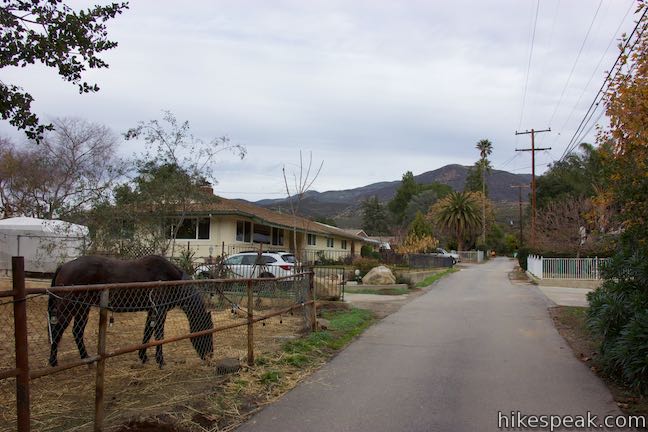
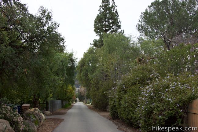
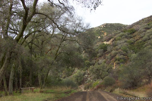
Those opting for the longer option will start from State Route 150 in the small community of Summit at the crest in the road midway from Ojai to Santa Paula. Park along the shoulder of SR 150 and begin walking north up Sisar Road. Make your way up this narrow lane, stepping over several speed bumps on this 10 mph road. Be respectful of quiet cabins, houses, and at least one horse corral. Sisar Road is quite straight, with one slight bend to the right before it comes to a split where unpaved Sisar Canyon Road begins on the right.
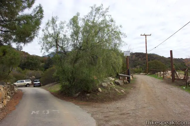
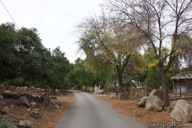
Just ahead, Sisar Road turns to the left and passes room for a couple cars to park on the shoulder on the outside of the curve. That’s the parking for the new trailhead.
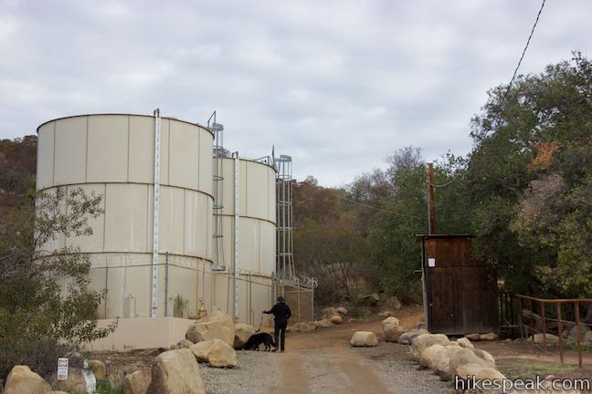
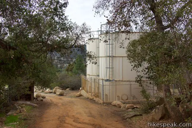
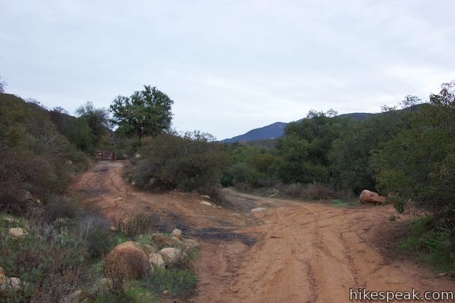
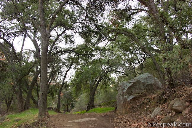
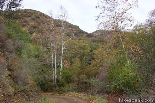
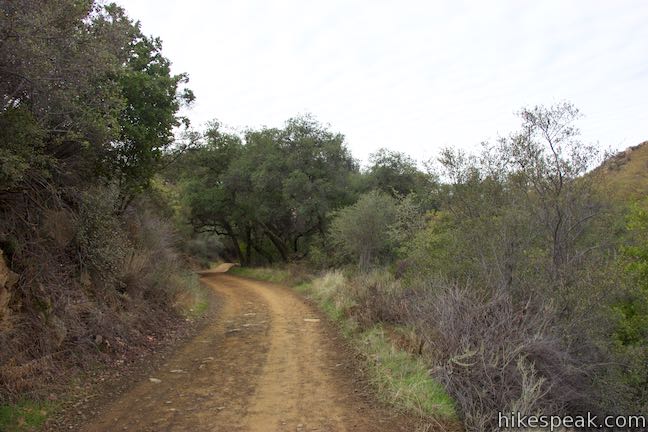
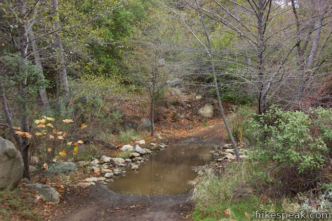
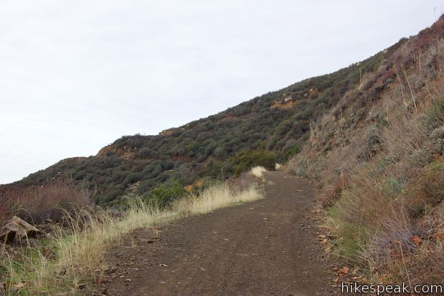
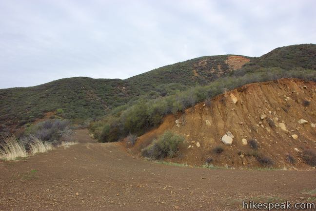
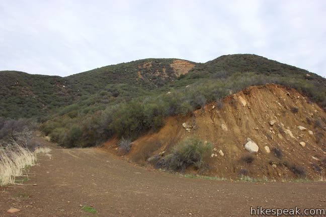
Leave Sisar Road and turn right up Sisar Canyon Road, beginning the on-dirt hiking. Pass a pair of holding tanks as Sisar Canyon Road pitches uphill and becomes rougher. The road comes to a split after just 1/8 of a mile. Avoid Fuel Break Road, which rises to the left, and stick with Sisar Canyon Road as it delves into Sisar Canyon.
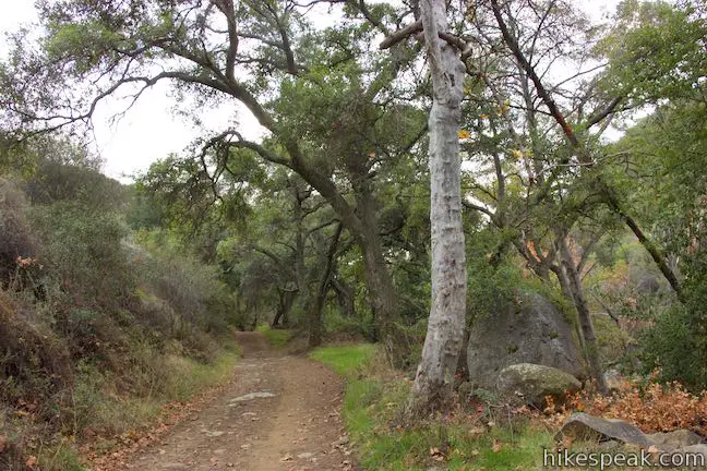
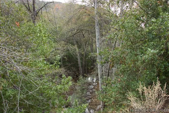
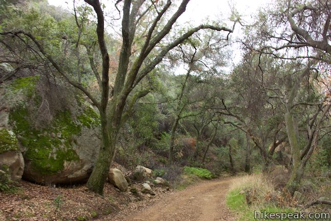
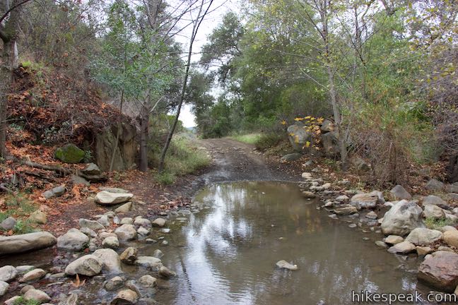
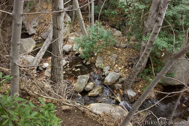
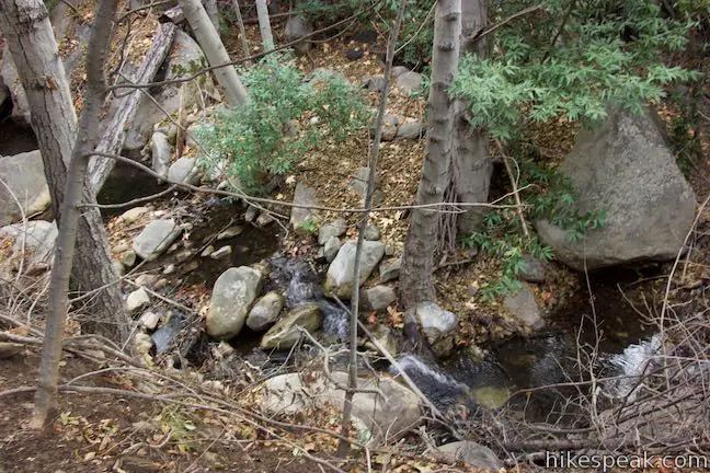
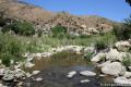
To your right, the terrain drops toward the boulder-filled trench at the bottom of the canyon where oaks, sycamores, and alders gather around Sisar Creek. The wide trail rises at an easy-going grade before briefly turning downhill to the former trailhead site, which has a gate and room for parking. This spot on Sisar Canyon Road is 1 mile from Route 150 and 2.25 miles from the overlook on Sisar Canyon Trail, with 950 left to ascend.
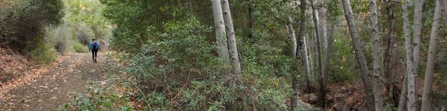
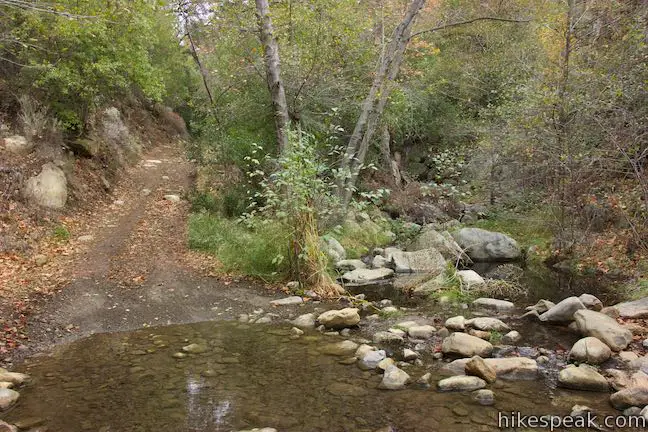
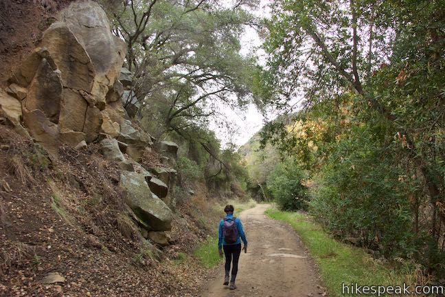
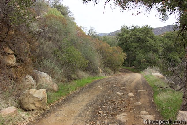
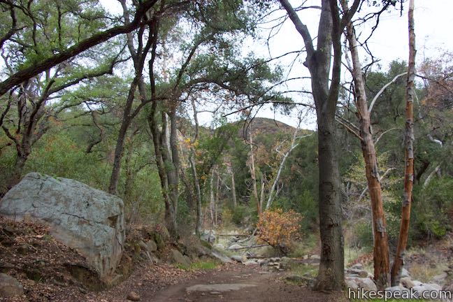
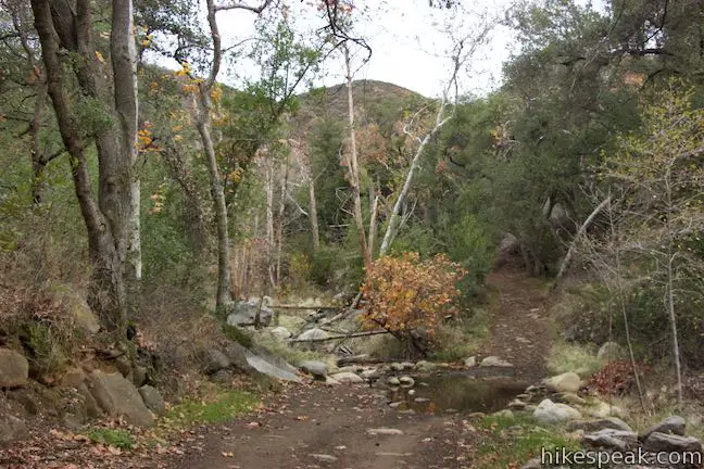
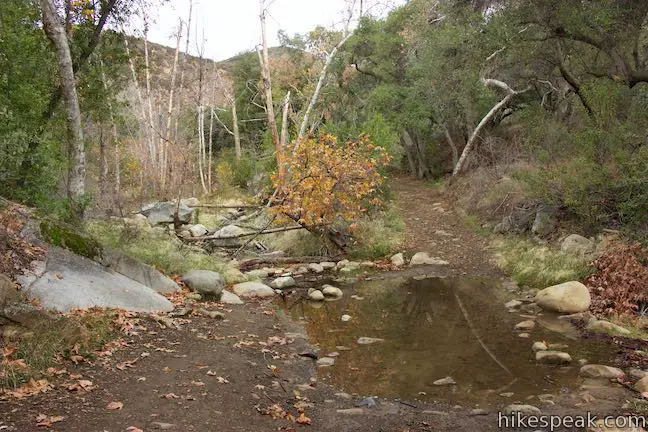
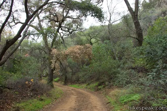
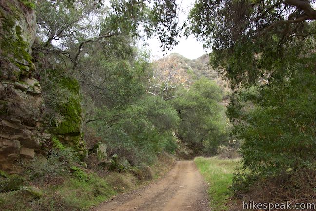
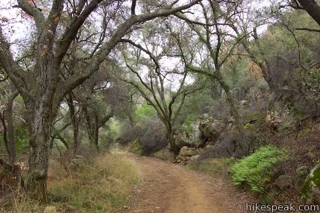
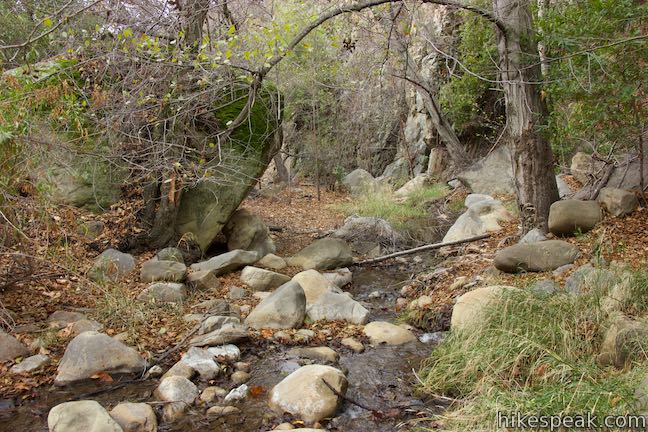
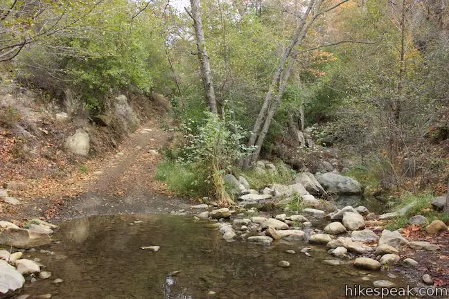
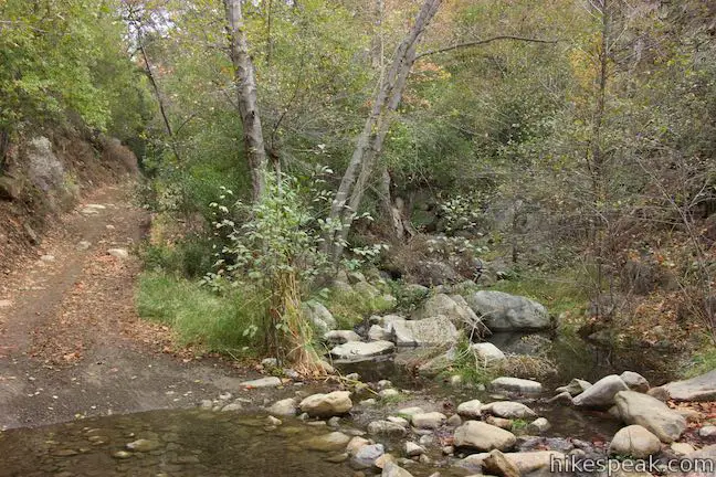
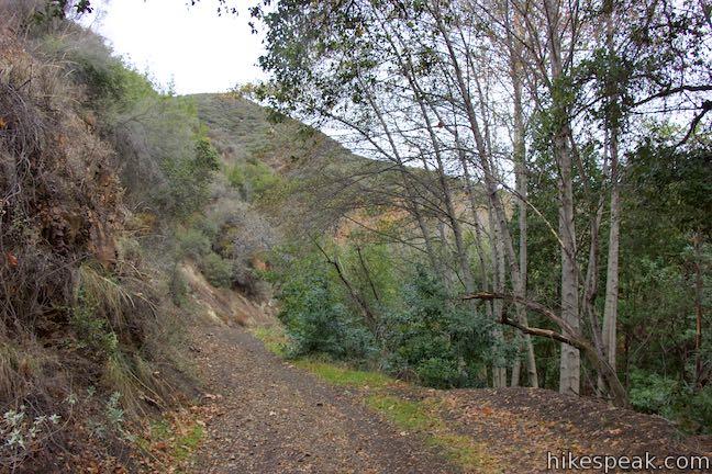
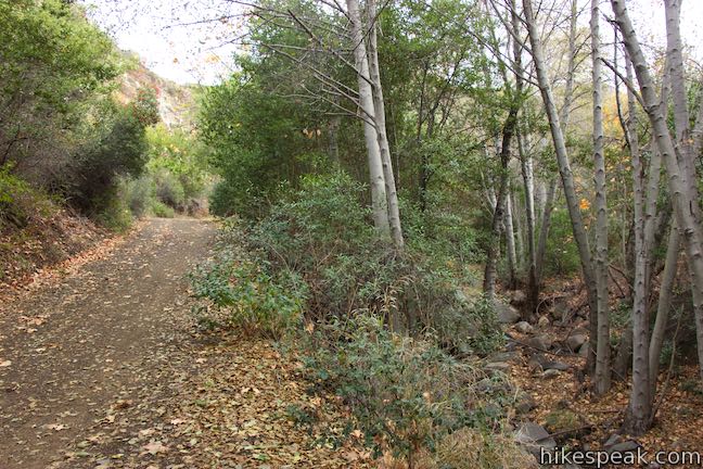
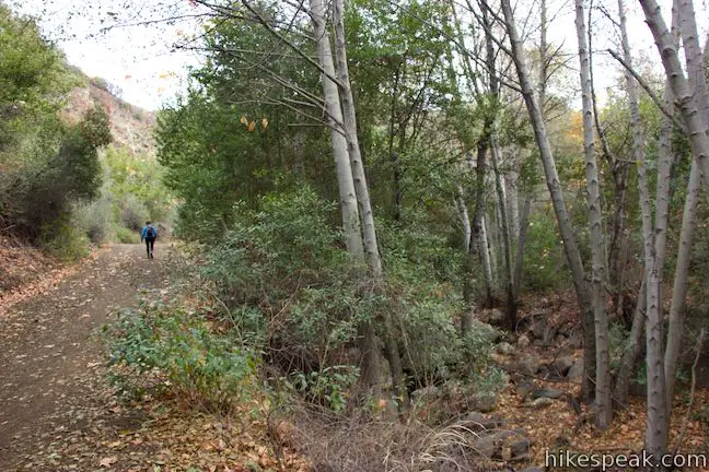
Walk past the gate and hike 1/8 of a mile to the first of two creek crossings. Rock hop across Sisar Creek to the east side of the canyon. Sisar Canyon Trail heads deeper into the canyon, going around a sweeping curve to the right, 0.8 miles up Sisar Canyon Road that leads you into an oak grove that is the densest woodland along the hike. Ferns adorn the slope of the canyon below the shaded oak canopy.
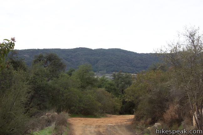
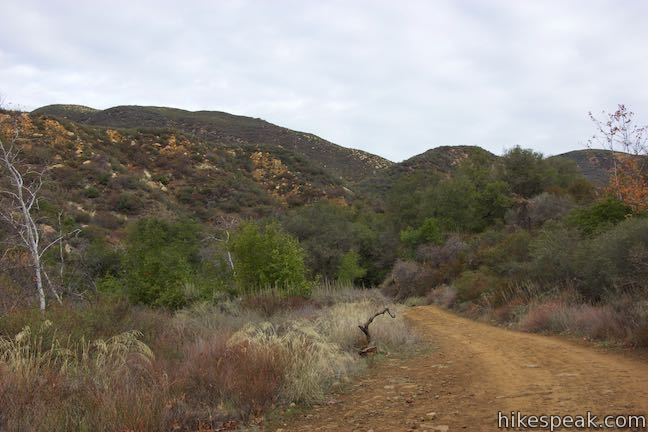
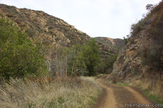
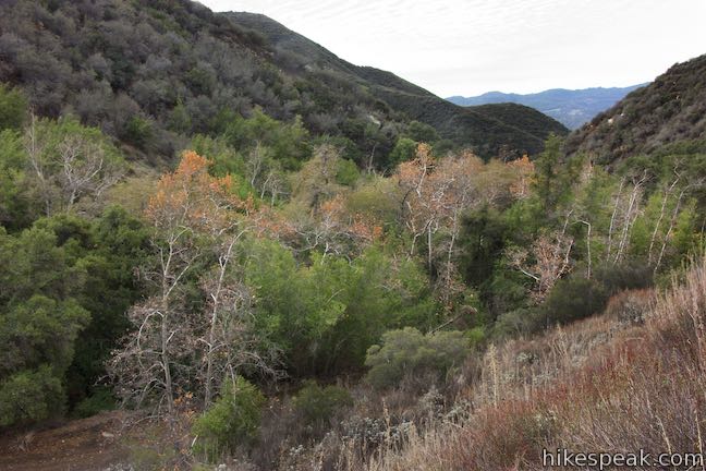
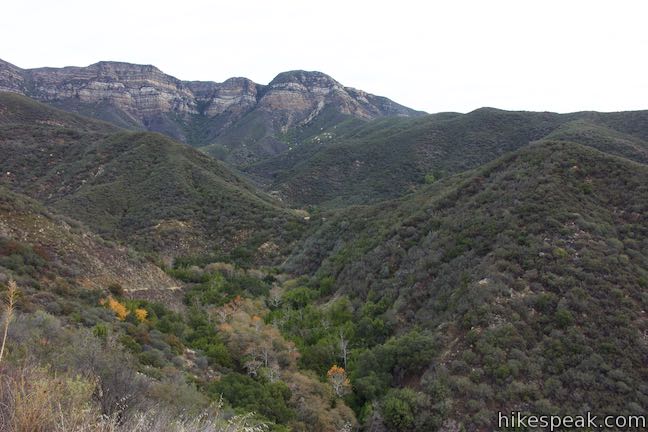
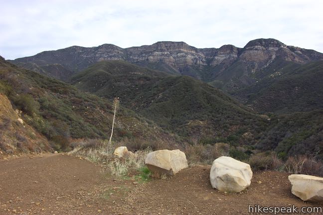
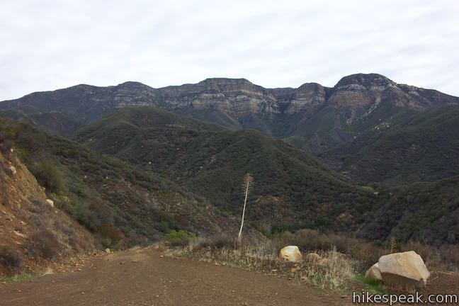
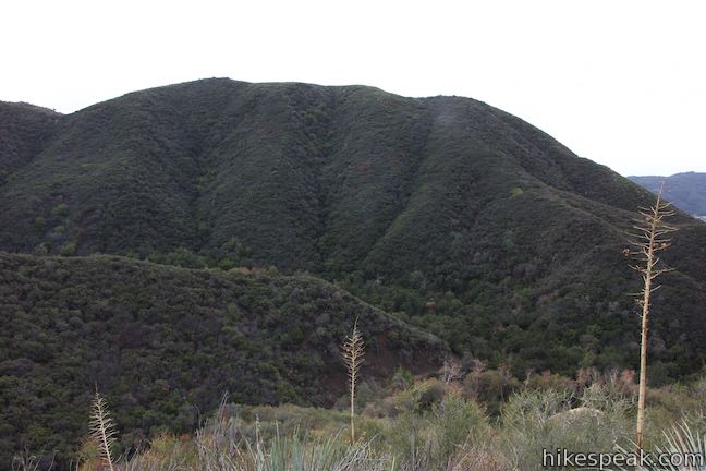
Leaving the trees, Sisar Canyon Trail passes through a wider section of the canyon. The creek to your left seems to disappear beneath boulders during this stretch of the hike. Looking up the canyon, you’ll see the canyon’s framing ridges where boulder outcroppings break up chaparral-laden slopes.
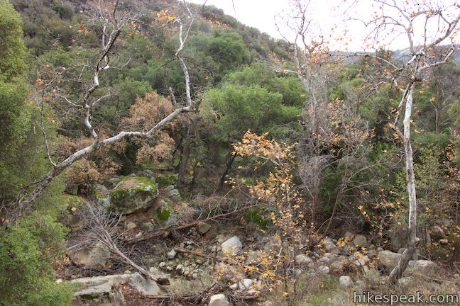
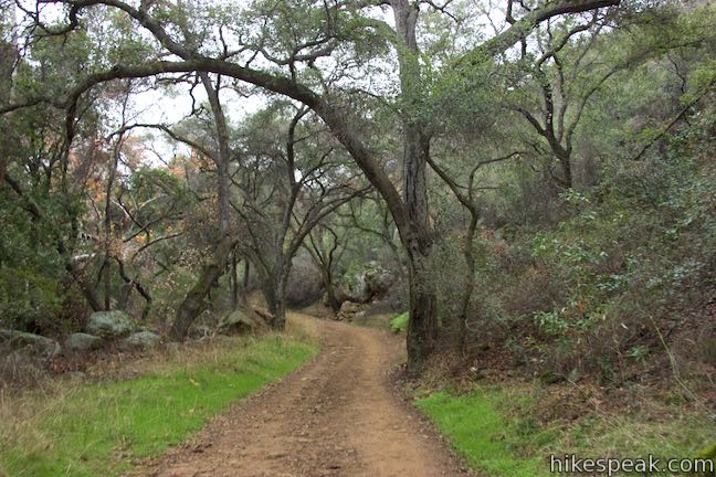
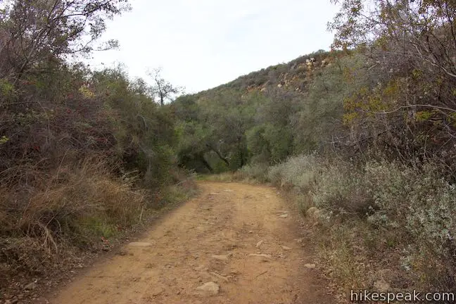
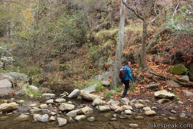
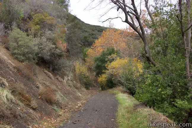
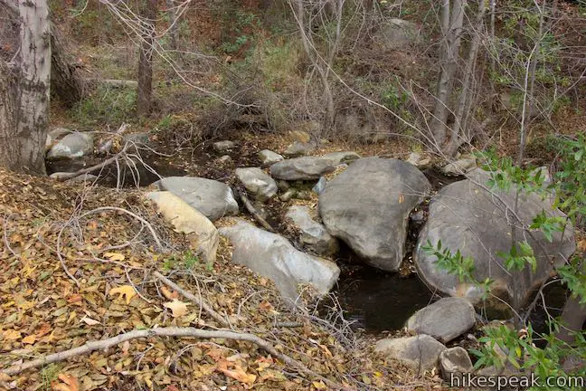
The canyon walls pinch tightly together as Sisar Canyon Trail drops to the creek again for a second crossing, 1.65 miles from Sisar Road. Glance up and down Sisar Creek, where water slides around boulders. Rock hop your way back to the west side of the canyon. The trail rises more steeply into the moderate trail’s most demanding stretch.
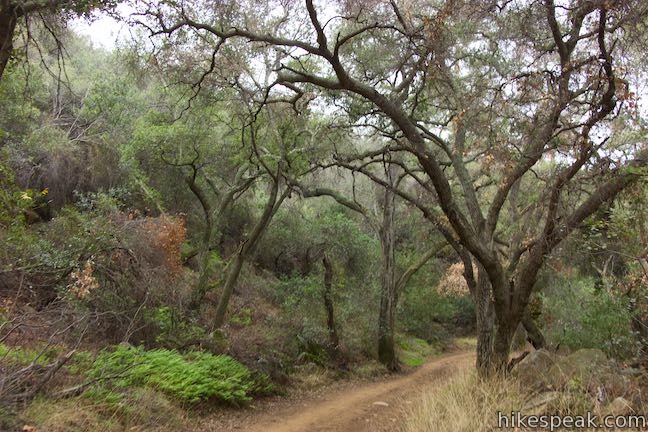
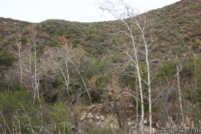
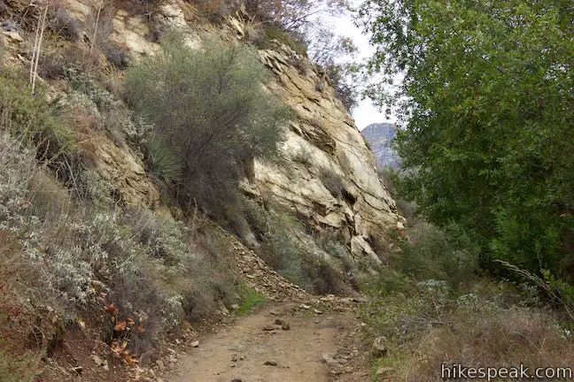
A steep wall of rock rises to your left, reverberating sounds of Sisar Creek, which tumbles over boulders to your right. Bay laurels become the dominant tree along the trail, adding a pleasant fragrance to the canyon.
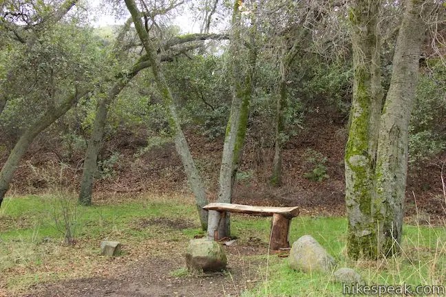
As you come over the top of a steeper pitch, some relief is offered in the form of a bench placed below an oak on the right side of the trail, 0.3 miles after the creek crossing. In another tenth of a mile, bear left at a split where a gated private road branches off and drops to the right.
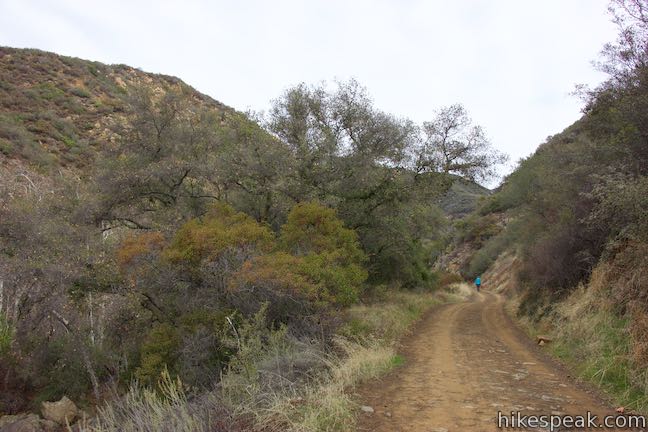
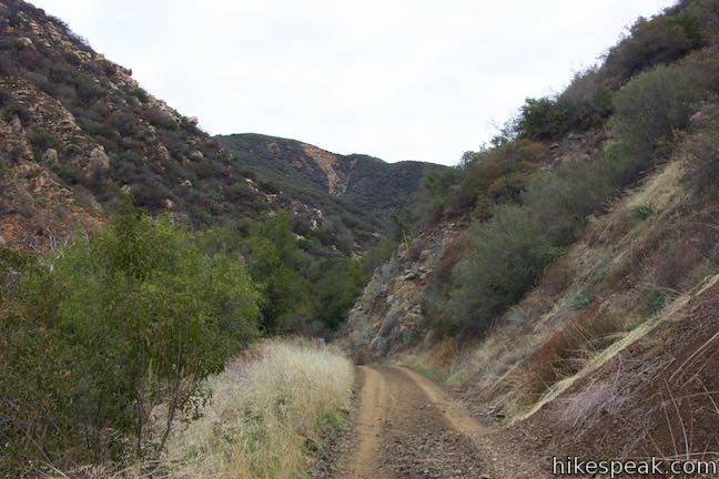
Sisar Canyon Road narrows a bit at this point, cutting across the bottom of the steep canyon wall, just above the dancing stream.
Sisar Canyon Trail makes a big sweeping curve to the left, 3/4 of a mile from the second creek crossing and rises out of the canyon away from Sisar Creek. This is the lone switchback on the ascent to the overlook.
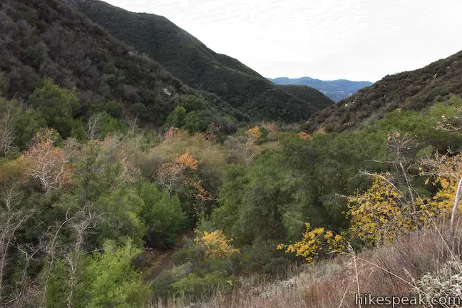
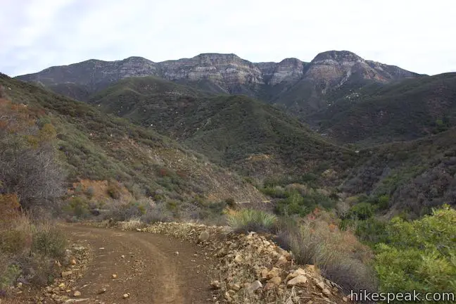
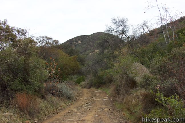
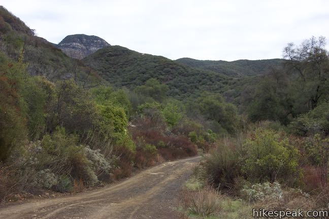
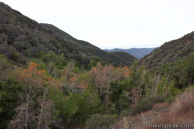
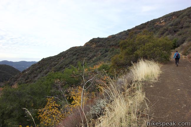
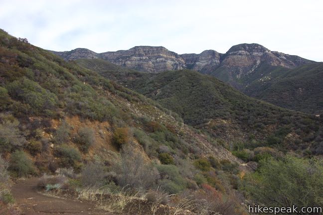
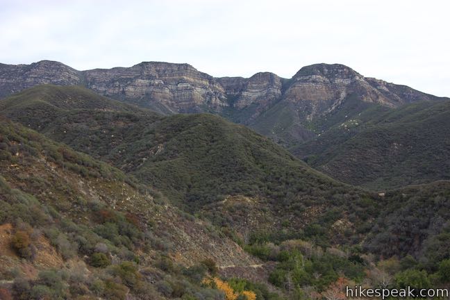
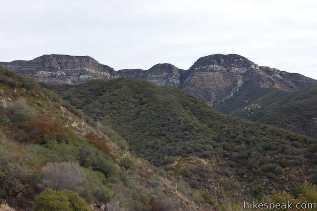
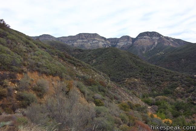
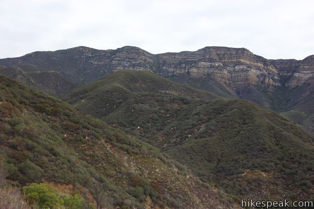
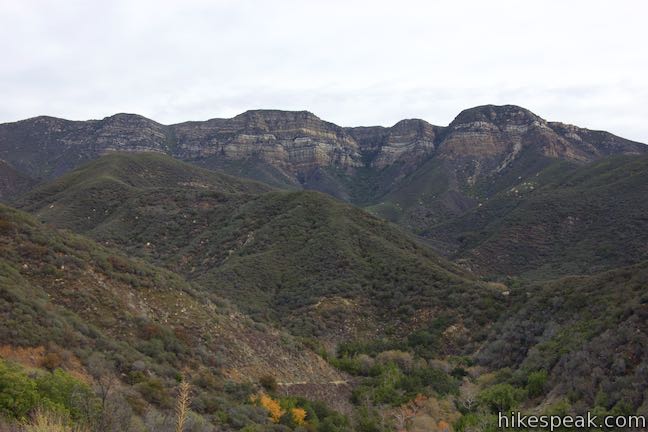
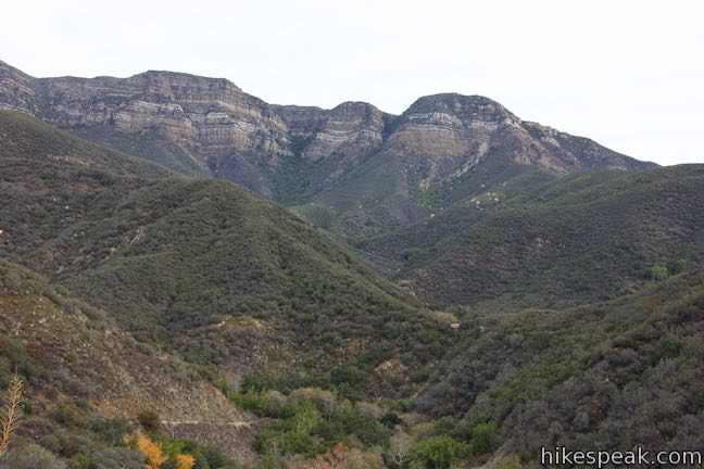
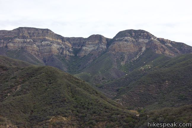
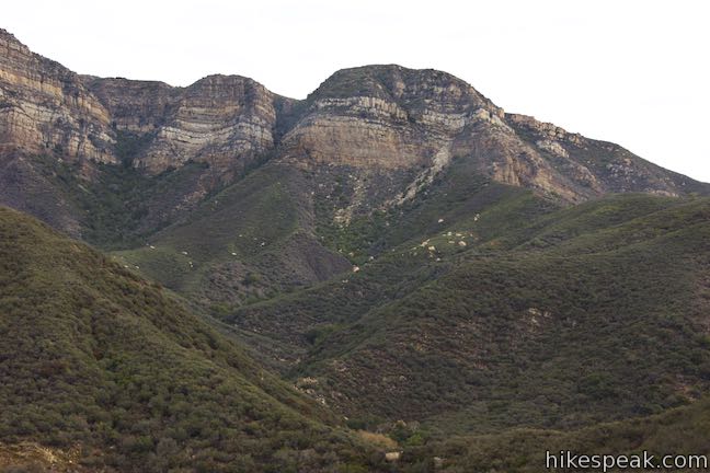
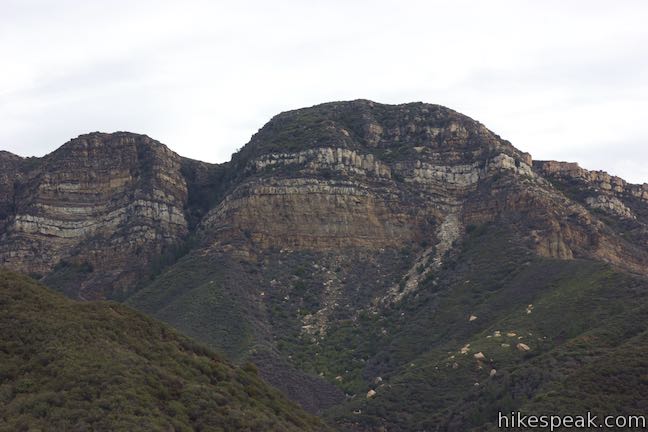
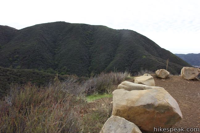
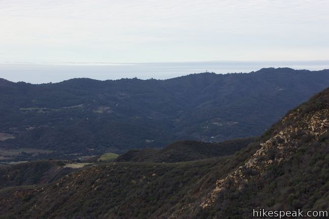
As the trail rises out of the canyon, doubling back in the direction you came, you’ll find views over the area you’ve been hiking in – a sanctuary of oaks, bays, and sycamores cradled by chaparral-covered ridges. Look over your shoulder for views of Topatopa Ridge, an impressive landform that bears a resemblance to the mountains in Zion National Park with lines of colored rock (although there’s much more green in the landscape here than in Zion Canyon).
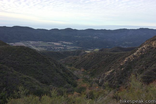
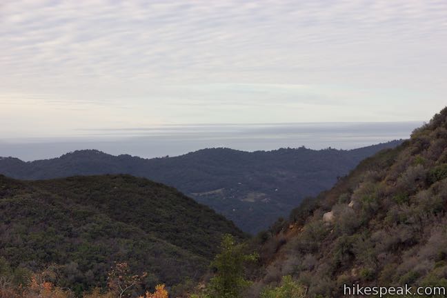
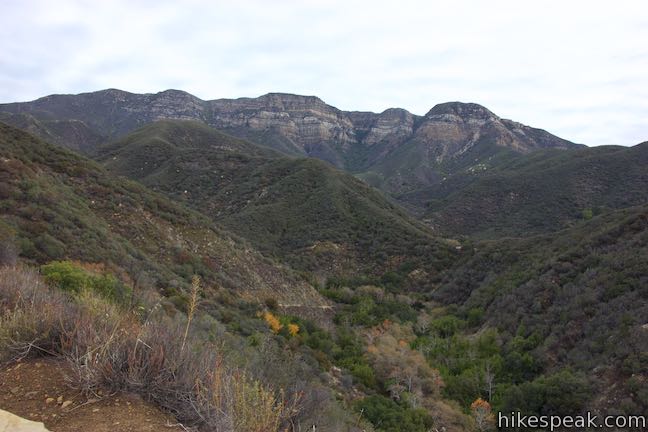
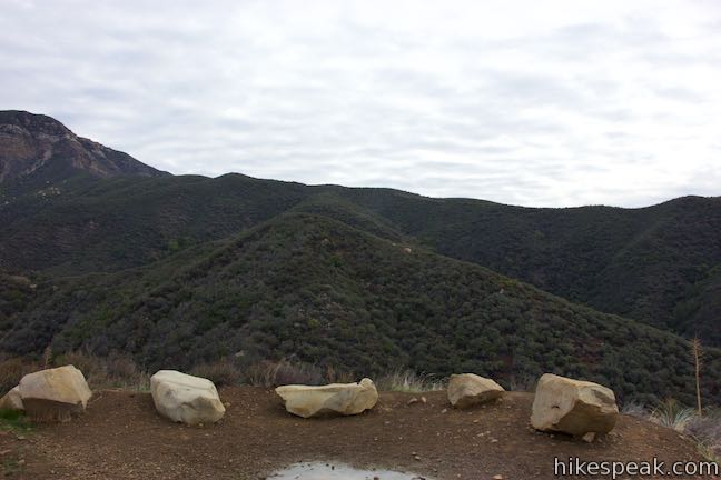
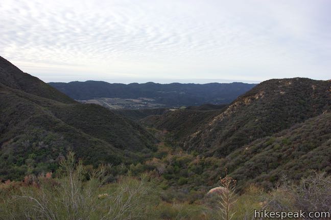
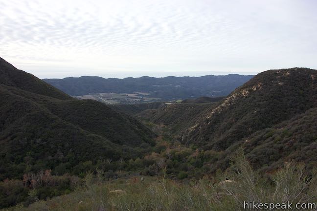
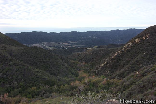
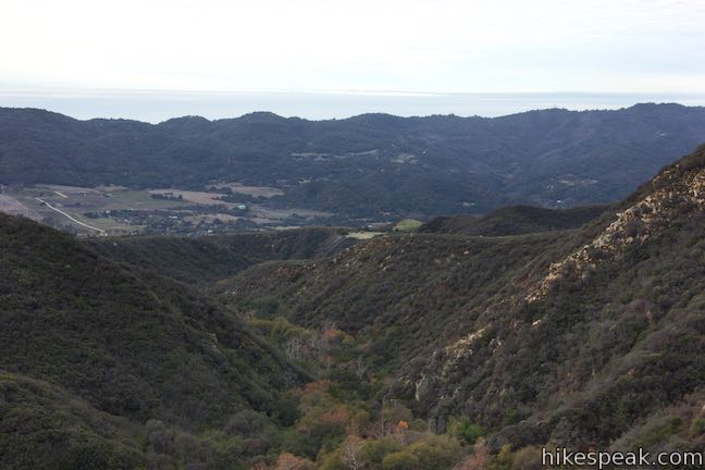
The perspective down Sisar Canyon over Upper Ojai Valley continues to expand as you approach the hike’s big vista. A third of a mile from the canyon floor and 2.75 miles from the start of Sisar Canyon Trail (3.25 miles from the bottom of Sisar Road), come to the overlook on Sisar Canyon Trail. A dirt landing off the side of the trail has a collection of boulders that invite you to take a seat and admire the surroundings.
Gaze down Sisar Canyon toward Upper Ojai Valley, which is backed by the long ridge of Sulphur Mountain. Behind you, Topatopa Ridge looks spectacular. The south face of this long, tall, segregated ridge has bands of beige and orange rock that stand out from the chaparral-green landscapes below.
Sitting on the rocks to reflect on your journey to this point, you may notice that you can still hear the creek flowing down the canyon, tumbling over boulders below you. This is a relaxing sound to compliment the nice view.
Sisar Canyon Trail continues above the overlook, rising another 3.5 miles to White Ledge Camp and higher points in the Topatopa Mountains.
Turn around at the overlook for a lovely day hike of 5.5 to 6.5 miles. Dogs and bikes are allowed on Sisar Canyon Trail (Sisar Canyon Road) in Los Padres National Forest. No permit is needed and no fee is required or to park along State Route 150 or hike up Sisar Canyon, so get out and enjoy!
To take nearby treks into the Topatopa Mountains, check out Horn Canyon Trail and Santa Paula Canyon Trail.
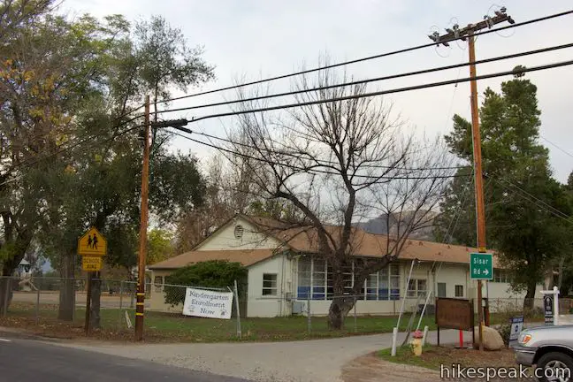
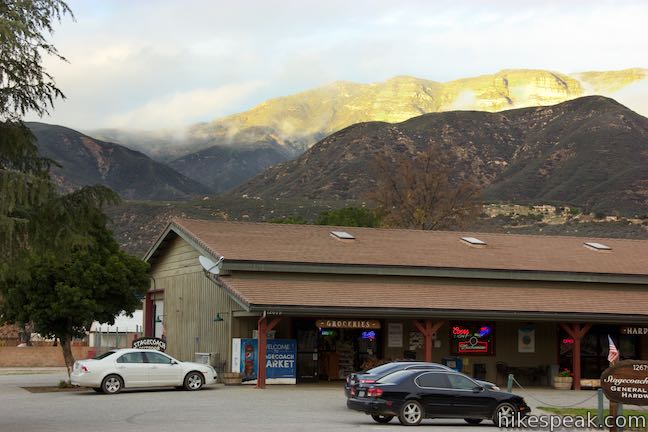
To get to the trailhead: From the intersection of Route 33 and Route 150 in Ojai, travel east on Route 150 for 8.9 miles. Enter the community of Summit at the top of Upper Ojai Valley. Sisar Road begins on the left, between Summit School and the Stagecoach Station General Store. Park along Route 150 and walk up Sisar Road or attempt to drive up the road for half a mile and park on the right just past the start of Sisar Canyon Road.
Coming from the east, from the intersection of Route 126 and Route 150 in Santa Paula, travel northwest up Route 150 for 8.9 miles. Sisar Road is on the right, a block after a fire station. Park along either side of Route 150 near the intersection.
Trailhead address: Sisar Road & Sisar Canyon Road, Ojai, CA 93023
Trailhead coordinates: 34.44338, -119.13567 (34° 26′ 36.16″N 119° 08′ 08.41″W)
View Sisar Canyon in the Topatopa Mountains in a larger map
Or view a regional map of surrounding Central Coast trails and campgrounds.


 | Santa Paula Canyon Trail to the Punchbowl This 8-mile hike ventures up rugged Santa Paula Canyon to a waterfall and a Punchbowl of pools and cascades in Santa Paula Creek by Big Cone Camp. |
 | Horn Canyon Trail This 2.9-mile hike in Ojai goes up a canyon in the frontcountry of the Topatopa Mountains and ventures off trail along the soothing waters of Thacher Creek. |
 | Wheeler Gorge This 1-mile loop explores the forest around this 70-site Campground. |
 | Rose Valley Falls This 1-mile round trip trail leads to the lower tier of a lovely two-tier 300-foot waterfall. |
 | Sespe Creek to Willett Hot Springs This 19-miles round trip follows Sespe Creek to a relaxing hot springs. |
 | Ocean's Edge and River's Edge Trails Loop This level and easy 1.5-mile loop in Emma Wood State Beach borders the Pacific Ocean, the Ventura River, and an estuary flocked by seabirds. |
 | More Central Coast Hikes Explore other destinations along the California coast between Ventura and Monterey, including trails in Los Padres National Forest. |
Sisar Canyon Trail on silenthiker.com
Sisar Canyon Trail to White Ledge Camp on nobodyhikesinla.com
Sisar Canyon Trail (and beyond) on calihike.blogspot.com
Sisar Canyon Trail on hikelospadres.com
Sisar Canyon - Red Reef Loop on mtbproject.com
The official Los Padres National Forest webpage for Sisar Canyon & Red Reef Trail
I was here yesterday (3/25/19) and the creek is still pretty full. make sure to bring proper waterproof footwear or you wont get very far on this hike.