
Searching for a short hike in the Portland area? Scouters Mountain Nature Park in Happy Valley makes a worthwhile destination for a 1.2-mile hike. Explore a forested cinder cone east of Portland, plotting your way through tall firs to a summit clearing with a direct sight of Mount Hood. If you work up an appetite, picnic under a pavilion at the top of Scouters Mountain. Abundant shade makes this a temperate summer hike, and the short length keeps the outing appealing in winter as well (or any time of year).
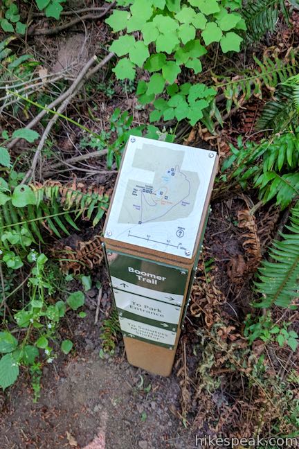
This short loop in Scouters Mountain Nature Park uses three trails: Boomer Trail, Lava Dome Trail, and Shelter Trail (most of the hike is on Boomer Trail).
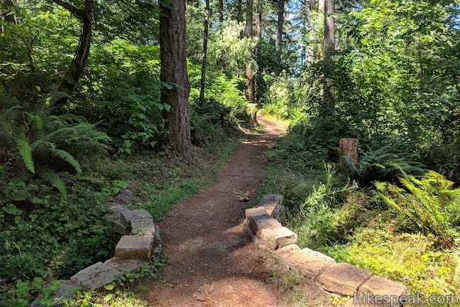
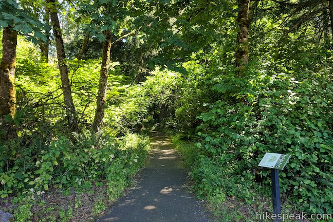
Start from a trailhead parking area just shy of the summit of Scouters Mountain. While you could simply walk 0.15 miles up to Scouters Mountain Shelter and enjoy the view of Mount Hood, why not save this for the end of the hike when the vista will be more climactic? Instead of walking south up Shelter Trail from the trailhead kiosk, cross the road and set out northeast down Boomer Trail.
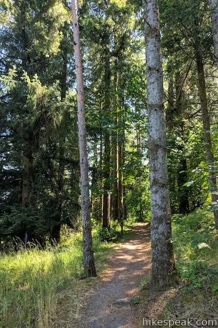
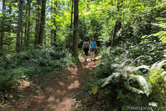
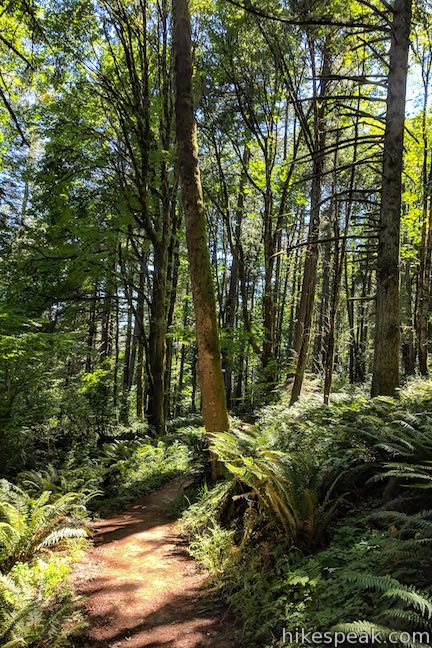
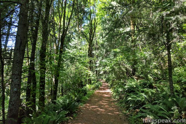
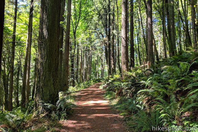
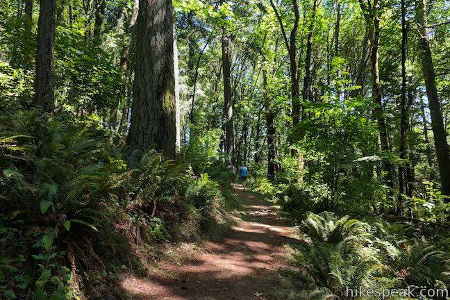
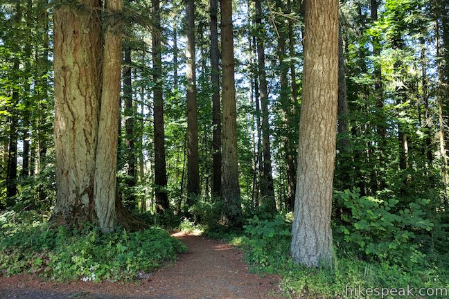
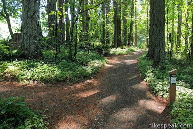
Boomer Trail goes through a switchback to the right, easing into a forest of Douglas firs accompanied by big leaf maples and Oregon white oaks. Some of the mature trees are over 200 years old. Make your way down the dirt single track, enjoying the forest surroundings. Sunlight slips through the canopy above.
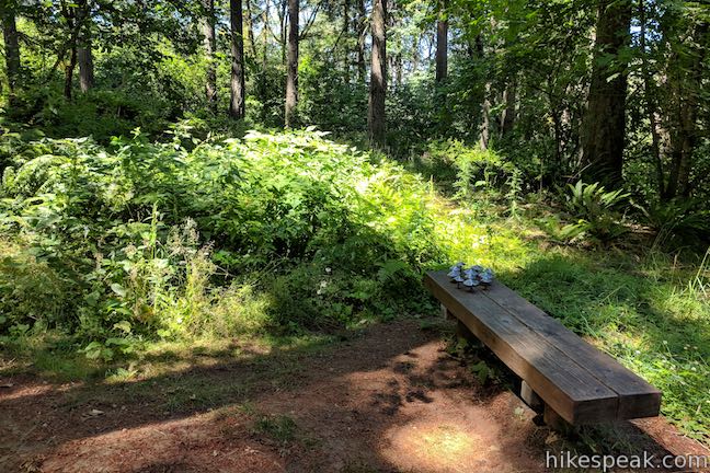
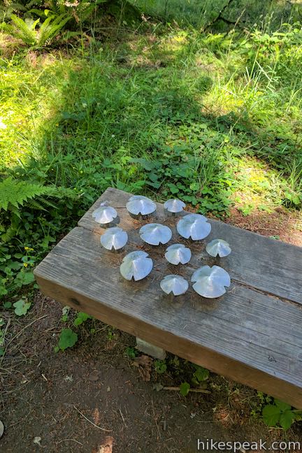
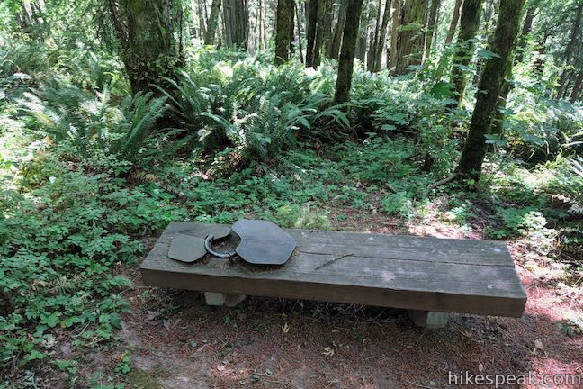
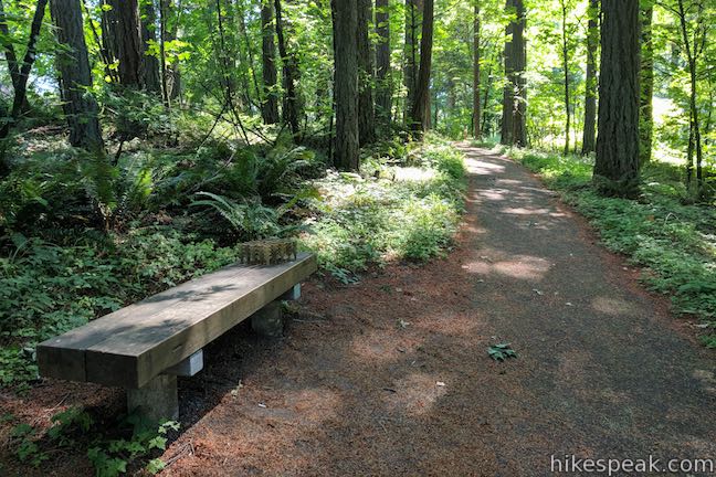
After 0.2 miles of hiking, pass a bench boasting a growth of metallic mushrooms. This is the first of four sculpture-bearing bench along the loop. Artist John Christensen created the unique benches. Built on salvaged timbers seats, the works enlarge small elements in the forest, encouraging hikers to appreciate the smaller details along the trail.
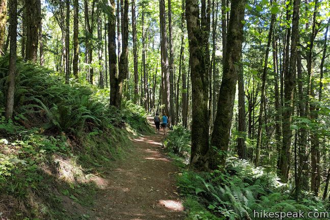
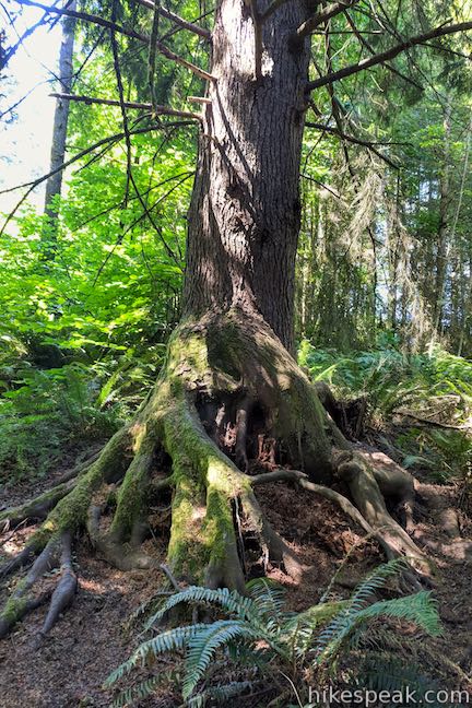
Boomer Trail heads south, gradually going down Scouters Mountain beneath Boy Scout Lodge Road. After a third of a mile of hiking, admire a large network of exposed tree roots rising from the right side of the trail.
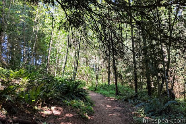
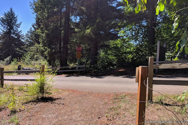
Proceed down Booomer Trail through sword ferns and more mossy tree trunks, passing a bench with a lichen pattern stamped on it. Approach the south end of the park, coming to a spot where Boomer Trail crosses Boy Scout Lodge Road. Safely make your way across to a kiosk that explains the origin of Boomer Trail’s name:
Beneath your feet, a boomer boom. A boomer might be crawling, eating, or sleeping right beneath your feet. Known as mountain beavers, boomers are actually primitive rodents closely related to squirrels. They dig intricate networks of tunnels as deep as ten feet below the Pacific Northwest’s moist forests. Tunnels typically branch out from a nest, with special chambers for eating, storing foot, and depositing droppings. Because they live out of sight, boomers are difficult to spot. Only rarely do they wander on the ground or climb in trees during daylight. But remember, Boomer Trail got its name for a reason – and one of these elusive creatures is probably nearby.
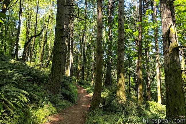
Having hiked 0.55 miles down Boomer Trail to the low spot of the loop, things flip for the next half mile as you gain 180 feet to the top of Scouters Mountain. For the upcoming 0.2 miles, Boomer Trail is wider than the previous single track, ascending a slope to the northeast.
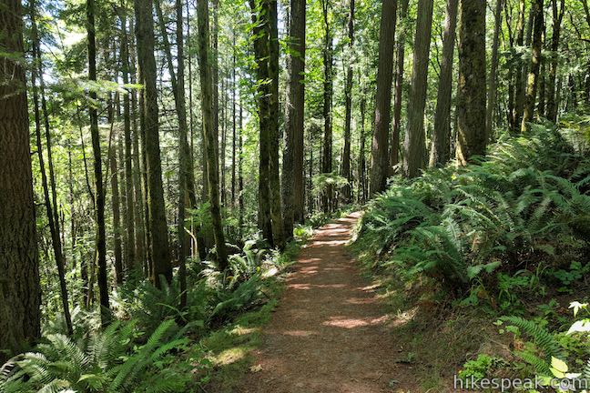
Approach a flight of stone steps to the right, alongside a trail marker. Although Boomer Trail appears to continue straight ahead (on a route that runs into a gate at the property boundary just ahead), Boomer Trail actually ascends to the right. Make your way up the steps and follow a single-track section of trail that swings around the south side of Scouters Mountain. The forest surroundings remain dense and delightful.
Pass a bench bearing a two-leaf sculpture as you approach the top of Boomer Trail. Slip out of the forest and come to a T-junction with Lava Dome Trail, 0.9 miles from the start of the hike. Follow the arrow on the trail marker, which points to the right, directing hikers toward the viewpoint.
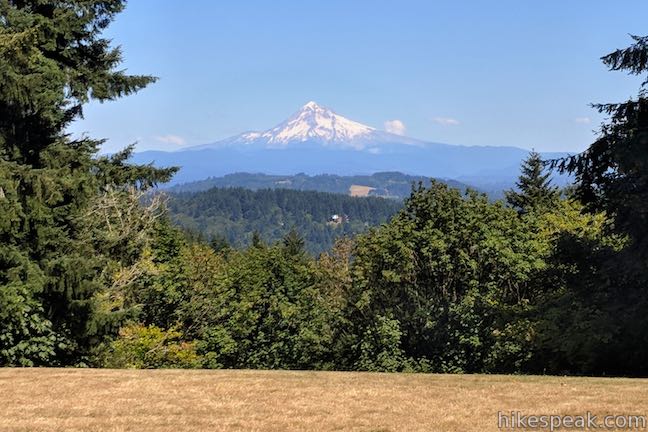
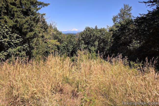
Scouters Mountain Shelter appears above a grassy slope to the left. Soon enough, you will arrive at a vista point for Mount Hood. A section of forest below the viewpoint has been cleared to present an open perspective of Mount Hood. Take a long look at this 11,249-foot snow-covered stratovolcano, which is the tallest mountain in Oregon. Scouters Mountain boasts one of the best views of Mount Hood in the Portland area.
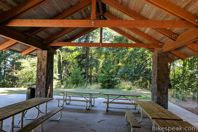
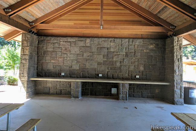
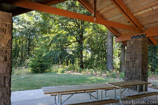
When the view has been fully enjoyed, continue on Lava Dome Trail to a crossing of a loop road between the trailhead parking area and the shelter (that can be used for dropping off passengers at the shelter). Across the road, Lava Dome Trail enters the trees and comes to a junction with Shelter Trail. A right turn at that junction leads back to the trailhead parking area, 120 yards away. Before returning to your vehicle, you may wish to wander south up to the top of the mountain where Scouters Mountain Shelter offers a shaded picnic area, as well as bathrooms, and more views of Mount Hood.
Scouters Mountain Nature Park, which opened in 2014, preserves land acquired from the Boy Scouts of America. Scouters Mountain Shelter was built using beams and stones from a Boy Scout lodge that stood on this site. The shelter is admirably built, and the accompanying views of Mount Hood are all too appealing. This is a fine place to linger with a packed lunch!
Leaving the shelter, cross the road and follow Shelter Trail north through the forest, passing the junction with Lava Dome Trail. Next to the junction is one last bench, decorated with a “moss group” sculpture. Return to the parking area where you began, completing this 1.2-mile loop with 180 feet of elevation change.
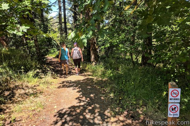
Scouters Mountain Nature Park is open daily from sunrise to sunset. Dogs and bikes are not allowed. No permit is required to go on this hike and the park is free to visit, so get out and enjoy!
To get to the trailhead: From the interchange between Interstate 84 and Interstate 205 in Portland, take Interstate 205 south for 6.7 miles. Get off at exit 14 for Sunnyside Road. At the top of the offramp, turn left onto Sunnyside Road. Drive east, crossing over the interstate, and travel 3 miles to an intersection with SE 152nd Drive. Turn left and follow 152nd for 0.8 miles, where it sweeps around a couple bends and becomes 147th Avenue. Drive half a mile to a traffic circle and take the first exit (like a right turn) onto SE Boy Scout Lodge Road. Go through a construction area (as of 2018), bear left at a split, and travel half a mile up to the trailhead parking area near the top of the mountain.
Trailhead address: Scouters Mountain Nature Park, SE Boy Scout Lodge Road, Happy Valley, OR 97086
Trailhead coordinates: 45.4468, -122.5078 (45° 26′ 48.5″N 122° 30′ 28.1″W)
View Scouters Mountain in a larger map
Or view a regional map of surrounding Oregon trails and campgrounds.


 | Powell Butte This 2.15-mile lollipop loop combines Mountain View Trail and Summit Lane to explore the top of Powell Butte and its big views from Southeast Portland. |
 | Canemah Bluff Nature Park This 1-7-mile hike explores wildflower fields and forests on a perch above the Willamette River near Oregon City. |
 | Camassia Natural Area This 0.8-mile loop tours wildflower-packed meadows and surrounding forests in a blossoming West Linn preserve. |
 | Trillium Trail in Tryon Creek State Natural Area This short nature trail is packed with plant-identifying panels as well as benches and viewing platforms. |
 | Two-Mile Loop in Tryon Creek State Natural Area Combine Old Main Trail, Red Fox Trail, Cedar Trail, Middle Creek Trail, and Maple Ridge Trail to loop through rolling woodland and across 3 bridges. |
 | Trails in Oregon Explore more hikes in Oregon in and beyond the Greater Portland Area. |
Can the picnic area be reserved for an event