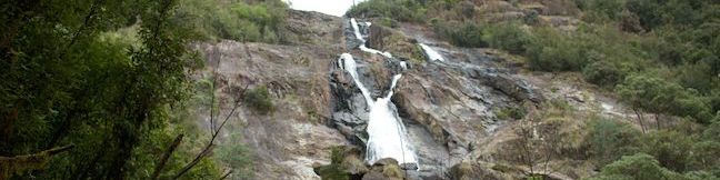
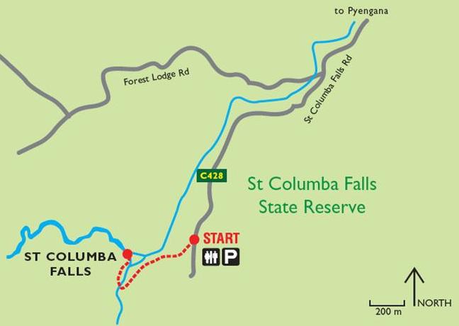
Saint Columba Falls Nature Walk offers an action-packed 1.2-kilometer (0.75-mile) round trip trek. Without the waterfall, this would be a pleasant hike through a charming Tasmanian rainforest. To put things over the top, this hike ends at a waterfall, and an impressive one at that. The walk terminates at a viewing platform below booming Saint Columba Falls, one of Tasmania’s tallest falls at 90 meters (295 feet). This walking track is located in Saint Columba Falls State Reserve in northeastern Tasmania near the town of Saint Helens.
Start from an easy-to-spot trailhead at the top of Saint Columba Falls Road. There’s a sign for Saint Columba Falls, One of Tasmania’s 60 Great Short Walks next to a wooden archway and an information kiosk. Begin down the trail, descending into a wooded canyon.
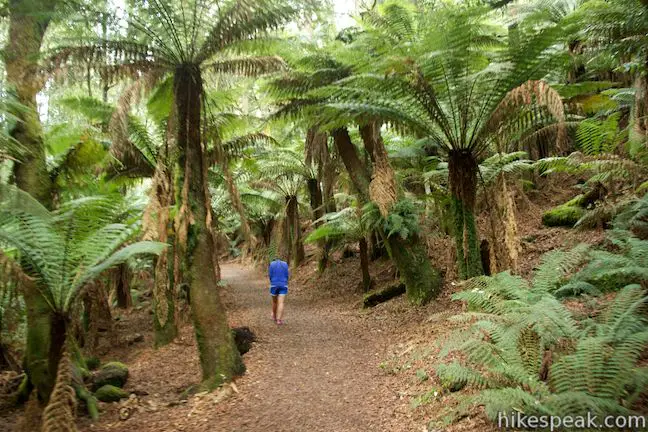
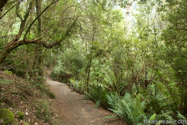
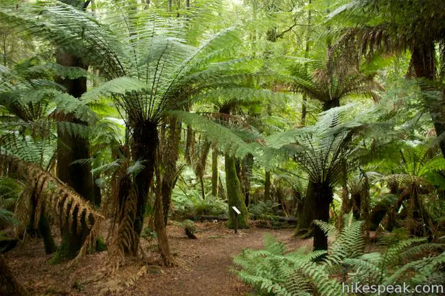
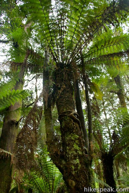
While airy at the top, the vegetation quickly builds into a dense shaded rainforest. The forest is dominated by blackwood, sassafras, and myrtle (the most common tree in Tasmania’s moderate rainforests). The most striking trees in the forest are probably the tree ferns, which grow to several meters trail, giving visitors the pleasure of walking beneath massive green fronds. A panel along the trail points out that some sassafras trees are epiphytes (plants that grow non-parasitically on another plant). Look for tree ferns sprouting out-of-place bushy spires. The extra growths are actually sassafras trees, and their roots can be seen wrapped around the trunks of the tree ferns. This combination occurs when sassafras seeds stick to the sides of tree ferns and germinate.
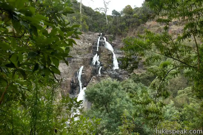
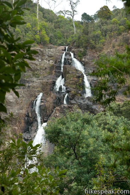
The trail descends 40 meters over the first 0.45 kilometers. There are three benches along the way in case you need a break (or need to catch your breath on the walk back). Around the second bench, look to your right for views through the trees toward the top tiers of Saint Columba Falls, which gushes down a wall of exposed granite on the opposite side of the canyon. These obscured views will only build your anticipation for the views of the waterfall at the end of the trail.
Also along the track, you’ll pass through a posted 25-meter long area with a small risk of landslide. The park asks hikers to “please reduce your exposure to this risk by not stopping on this section of the track.”
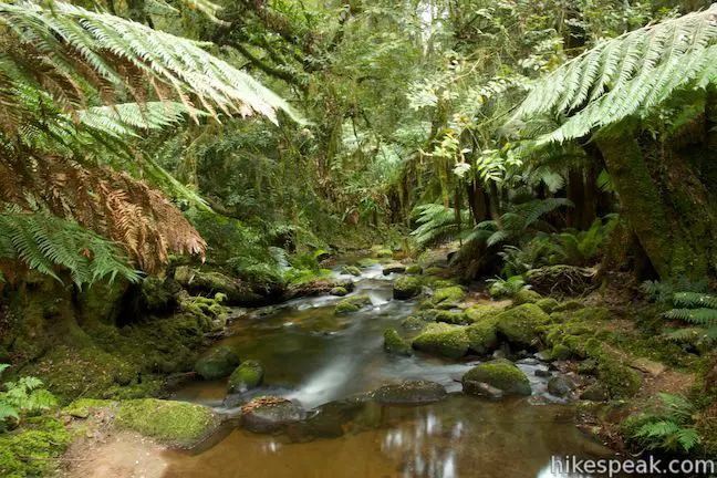
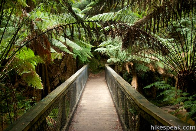
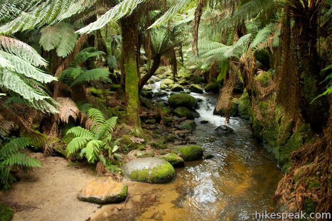
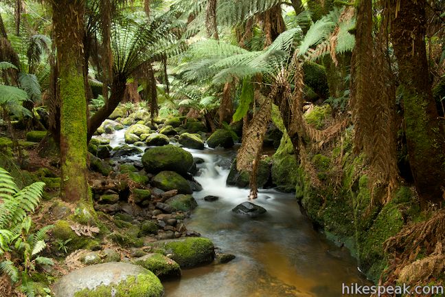
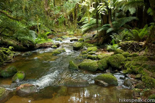
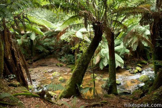
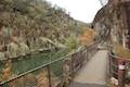
The trail levels out as you reach the bottom of the canyon, passing between the hikes tallest tree ferns in a truly enchanting environment. To make things more serene, there’s a stream flowing down the bottom of the canyon, a fork of the Gorges River, which you will cross on a wooden footbridge.
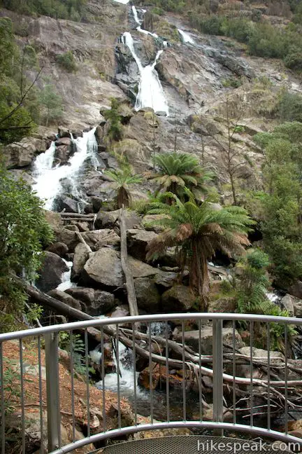
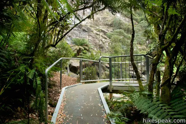
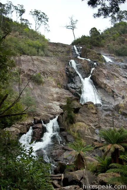
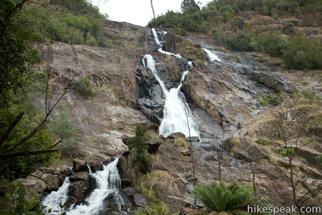
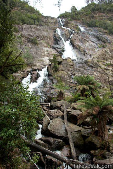
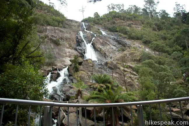
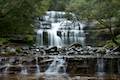
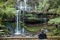
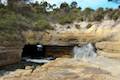
Across the bridge, the trail curves to the right along the picturesque stream, and then curves to the left to ascend a short distance to a fenced-in viewpoint below Saint Columba Falls. Water comes over the top of the falls and plunges down a granite wall with several steps that separate the falls into white fingers. The water comes back together to cascade right past the viewpoint, adding to the impressive volume of this powerful waterfall.
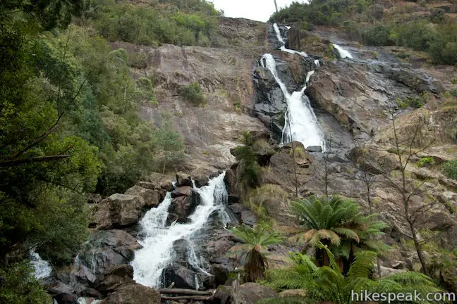
Water leaps over Saint Columba Falls at an average rate of 42,000 liters per minute. If you visit in the winter, the flow rate can exceed 200,000 liters per minute, showering visitors in mist and spray. The waterfall has never dried up (since it’s been observed) and should be rewarding to visit year round. A few tree ferns rise out of the rocks next to the falls to complete the rainforest scene.
When you’ve finished taking in the views, head back the way you came. For 0.15 kilometers, the trail will gradually descend back to the bridge, and then you will climb back up to the road over the next 0.45 kilometers. Dogs and bikes are not permitted, but no fee or permit is required to hike to Saint Columba Falls, so get out and enjoy!
Directions: Take Tasman Highway (A3) to Saint Columba Falls Road (C426), located 26 kilometers east of the town of Saint Helens and 75 kilometers west of Scottsdale. Turn south of Saint Columba Falls Road and drive 11 kilometers to the start of the walking track. There is a picnic area and toilets just past the trailhead at the end of Saint Columba Falls Road.
Trailhead address: Saint Columba Falls Road, Pyengana, TAS 7216, Australia
Trailhead coordinates: -41.321271, 147.926203 (41° 19′ 16.57″S 147° 55′ 34.33″E)
You may also view a regional map of surrounding Australian trails, campgrounds, and lodging.


 | Mount William This 3.6-kilometer out and back hike tops a short summit that is the high point of Mount William National Park with panoramic views over the coastline at the northeast corner of Tasmania. |
 | Apsley Waterhole & Lookout Track This 1.4-kilometer loop travels through a eucalyptus forest to a popular swimming hole on the Apsley River in Douglas-Apsley National Park. |
 | Friendly Beaches This hike explores a long, pristine beach on the east coast of Tasmania north of the Freycinet Peninsula. |
 | Cape Tourville This 0.6-kilometer circuit provides big views along the east coast of Freycinet Peninsula, circling 100-meter tall bluffs to reach the Cape Tourville Lighthouse. |
 | Wineglass Bay and Hazards Beach Circuit This approximately 12-kilometer loop takes a rewarding route through Freycinet National Park, visiting pristine light sand beaches at Hazards Beach and the renowned Wineglass Bay. |
 | Cataract Gorge This 3.4-kilometer loop combines Zig-Zag Track, Cataract Walk, and Bridge Walk to explore Cataract Gorge Reserve, an impressive natural area just outside the center of Launceston. |
 | Liffey Falls This 2.2-kilometer walk passes the Upper Cascades on the Liffey River to reach the base of lovely Liffey Falls, one of Tasmania's finest waterfalls. |
 | Russell Falls & Horseshoe Falls This hike in Mount Field National Park visits one of Tasmania's most famous and beautiful waterfalls and can be extended from 1.8 to 2.65 kilometers by venturing to the top of Russell Falls and nearby Horseshoe Falls. |
 | Pinnacles Boardwalk & Summit Trig The 0.3-kilometer round trip walk on Pinnacles Boardwalk can easily be extended to a 0.75-kilometer walk on the top of Mount Wellington, checking out another short boardwalk and the trig station at the summit. |
 | Octopus Tree and Circle Track This 1.1-kilometer loop in Hobart's Wellington Park reaches a unique eucalyptus tree with tentacles for roots that wrap around a boulder. |
 | Tasmans Arch & Devils Kitchen This 0.9-mile walk visits two impressive features on the coast of the Tasman Peninsula, a natural bridge and a chasm carved by the sea. |
 | Blowhole & Fossil Bay Lookout This short walk in Tasman National Park reaches a coastal vista point and a wave-carved tunnel through a rocky point that has the potential to spray up like a whale spout. |
 | Coal Mines Historic Site This 0.8-kilometer loop through the Convict Precinct explores the ruins of an old prison and coal mine that relied on convict laborers. |
 | Cape Raoul This 12 to 14-kilometer hike explores the pristine coastline at the southwest end of the Tasman Peninsula, reaching a cape with daunting 200-meter tall cliffs dropping to swirling seas. |
 | More trails in Australia Explore other destinations in Victoria and Tasmania, Australia. |
Saint Columba Falls on think-tasmania.com
Saint Columba Falls on northeasttasmania.com.au
Saint Columba Falls on world-of-waterfalls.com
The Tasmania Parks and Wildlife page for the 60 Great Short Walks
The Tasmania Parks and Wildlife page for Saint Columba Falls Nature Walk
The Tasmania Parks and Wildlife page for Saint Columba Falls State Reserve
Go the extra miles...
Submit a rating of this hike to go with your comment. Contribute to the average trail rating.