Saddle Mountain Trail
in Saddle Mountain State Natural Area
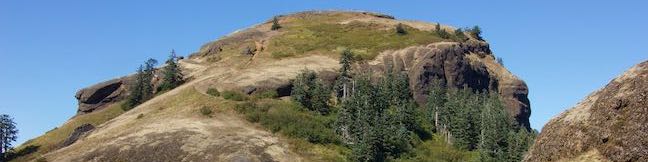
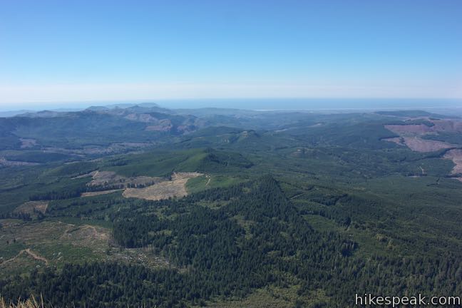
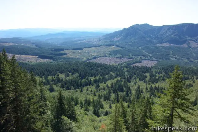
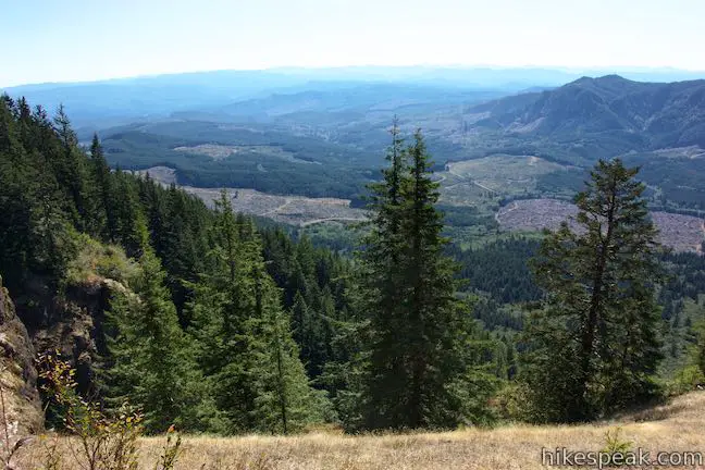
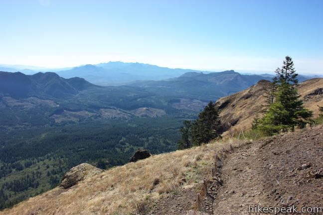
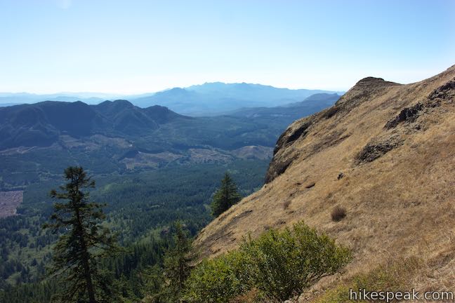
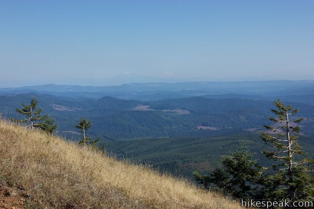
One hike in Northwest Oregon really rises above the rest. Saddle Mountain is the highest point in the northern half of the Coast Range with sweeping 360-degree from a 3,283-foot summit that look out over the Pacific Ocean, the Columbia River, and inland toward the Cascade Range. The hike up Saddle Mountain Trail is 5 miles round trip with 1,635 feet of elevation change (including steep passages). On the way to the basalt crown, the single-track trail passes through forests and grassy slopes that host crowd-gathering collections of wildflowers in early summer.
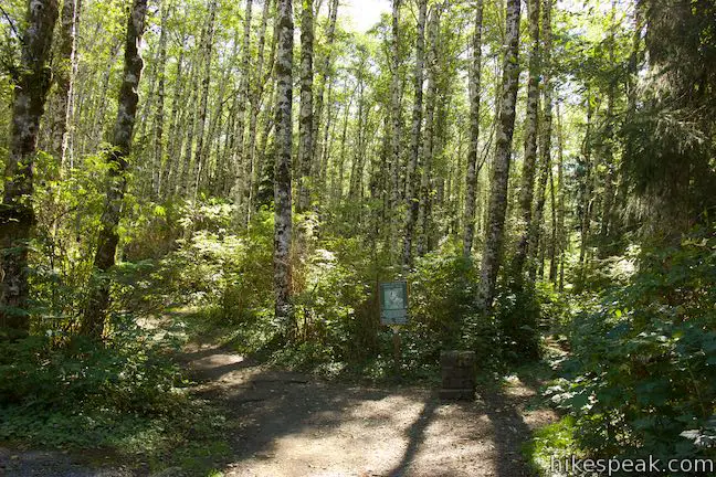
This hike is located within Saddle Mountain State Natural Area. The trailhead parking area offers bathrooms, picnic tables, and ten primitive campsites dispersed in the woods around the start of the trail. The summit is to the north, but Saddle Mountain Trail actually sets out to the southeast.
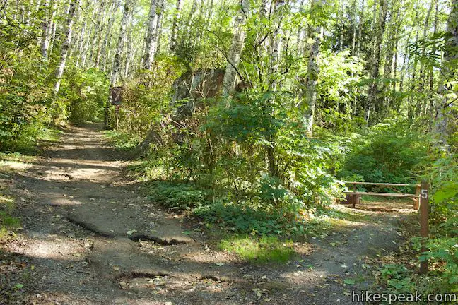
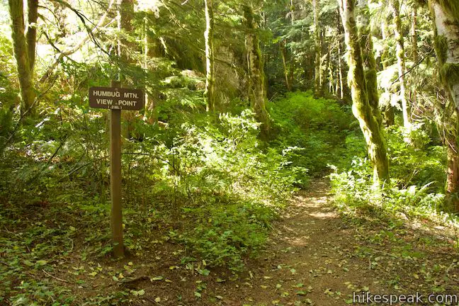
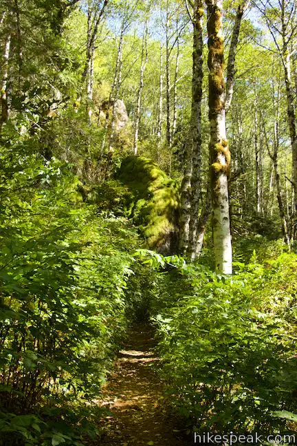
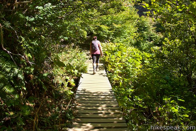
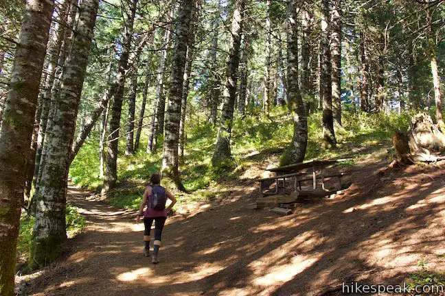
Get underway on Saddle Mountain Trail, ascending into a deciduous forest dominated by red alders. After a quarter mile, come to the trail’s one and only marked junction. A 0.16-mile long spur trail strays to the right toward Humbug Mountain Viewpoint. Unless you’re angling for this bonus view, stay to the left up Saddle Mountain Trail.
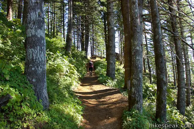
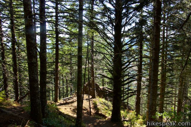
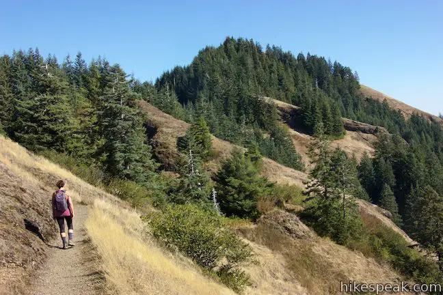
Leaving the junction, Saddle Mountain Trail curves to the left and travels northeast through more lush alder woodlands. In another quarter mile, the switchbacks begin as the trail rises into a conifers like Sitka spruce, western hemlock, and Douglas and noble firs. Amongst the ferny forest floor, spot spring and summer wildflowers like Pacific trillium, Pacific bleeding heart, glacier lilies, and pink fawn lilies. The biomes along the trail continue to shift as you rise toward the grassy summit “balds.”
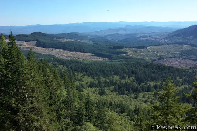
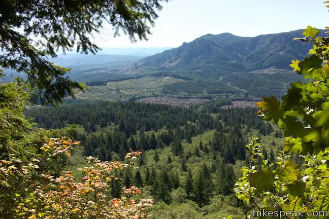
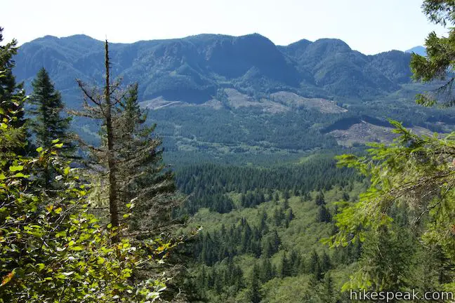
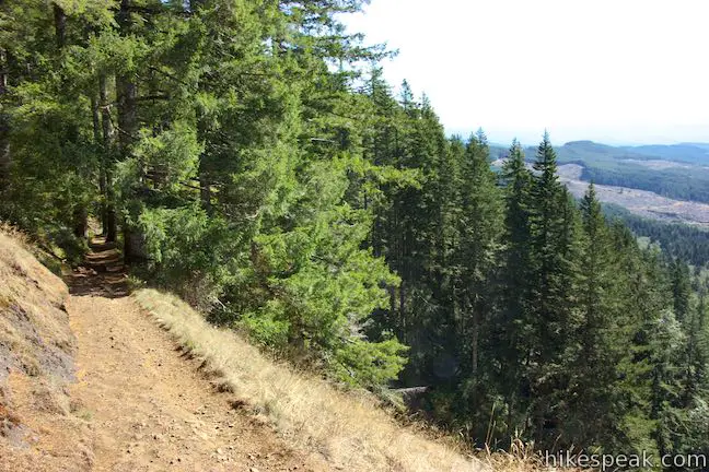
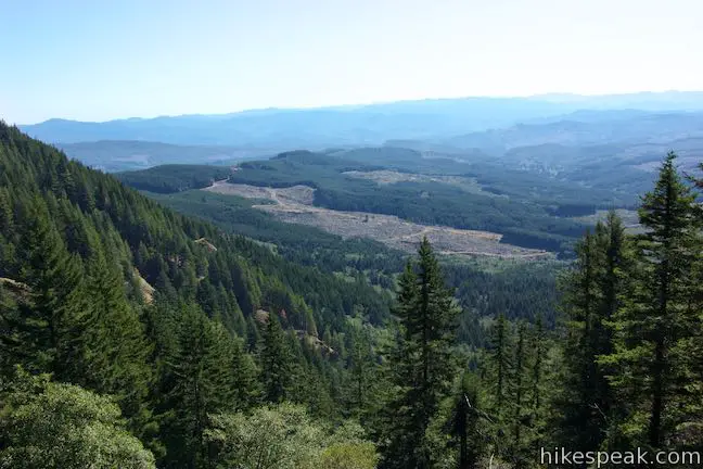
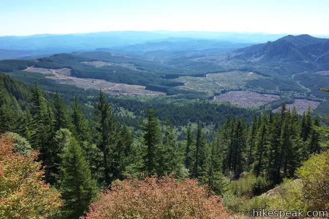
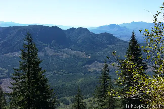
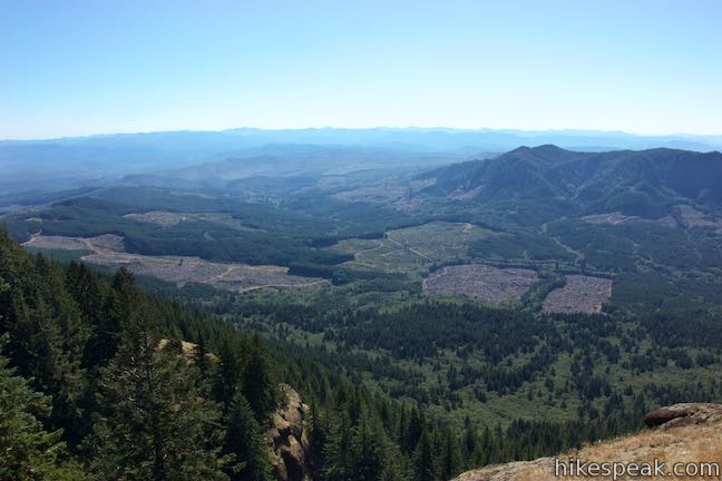
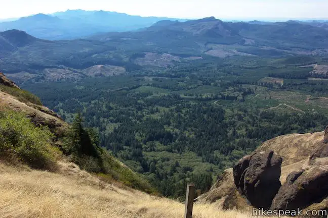
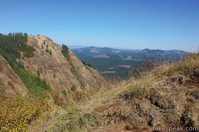
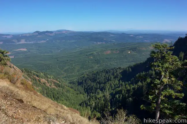
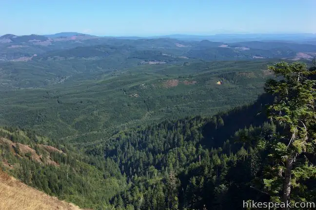
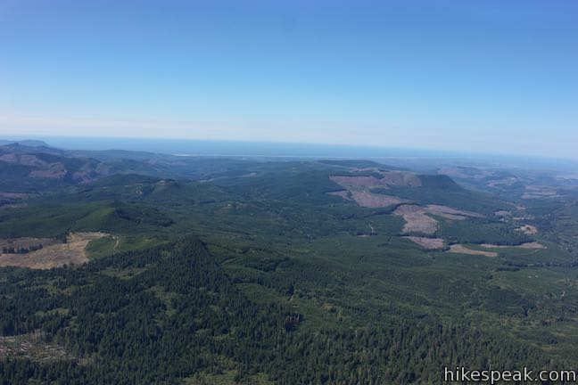
Saddle Mountain Trail was established by the Civilian Conservation Corps in the 1930s, so it ascends up the mountain with the well-plotted zigzags that you would expect from a CCC-built trail. After 3/4 of a mile of hiking, pass through couple forest opening. Take a moment to look out over the Coast Range to the south where timber-covered ridges are dissected by clearings.
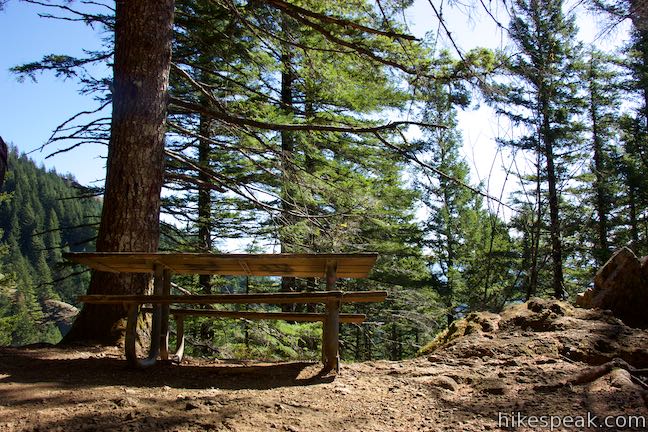
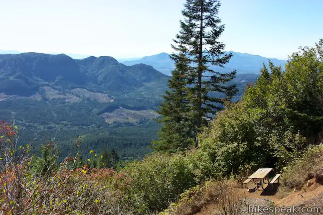
Proceed up through the forest of mature firs, crossing a log bridge shortly before the trail passes the first of two mileage markers. With one mile of hiking behind you, proceed another tenth of a mile to a great mid-ascent rest stop. As the trail makes a sharp bend to the left, find a picnic table positioned on the ridge. Pause and enjoy a refreshing breeze from the mountain’s updraft. You’ve ascended 750 feet from the trailhead to this 2,400-foot rest stop.
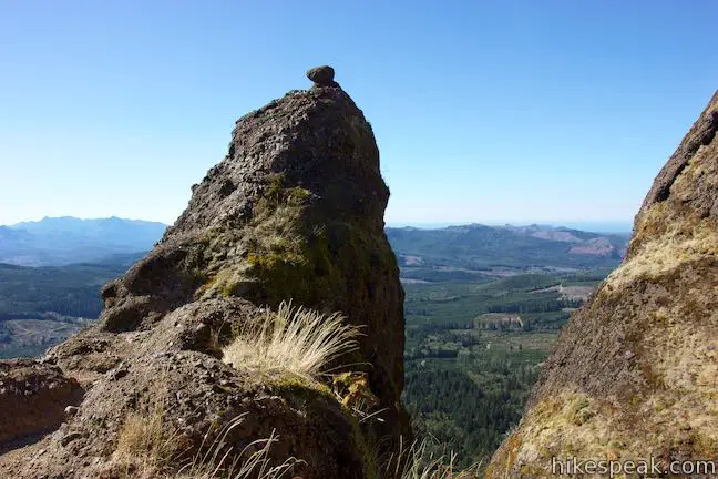
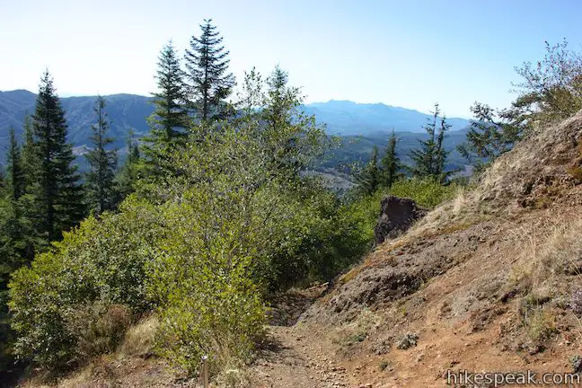
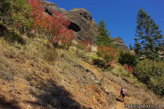
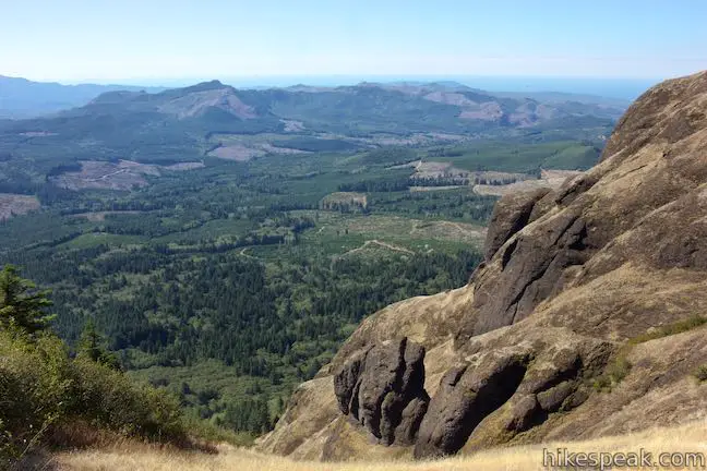
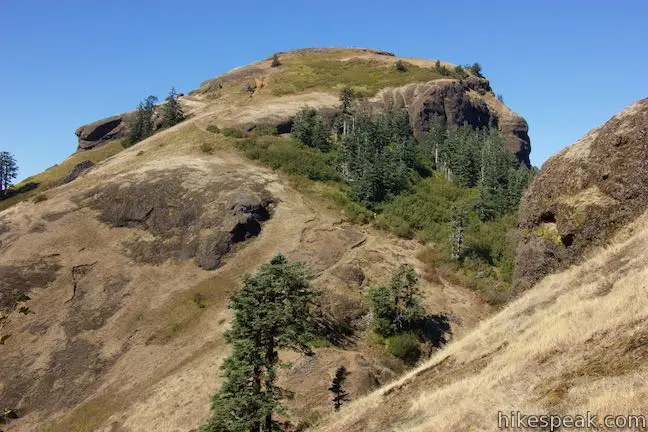
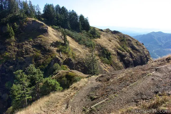
When you’re ready, proceed up switchbacks as the trail flirts with leaving the fir forest, leading you across rocky slopes draped in stonecrop (sedum), bittercress, Indian paintbrush, bushes, and mountain grasses. Rounding a switchback, 0.2 miles above the rest stop, the trail passes a distinct basalt pinnacles off the left side of the trail that rises to a point with a knob on top. This is probably the most interesting rock formation along the trail.
Just ahead, pass the second of three picnic tables along the trail. Explore the boundary between the forest and the exposed slopes above. The trail crosses a short wooden bridge and delves back into a lush fir forest. On your left, a small seep of water drips off the mountainside.
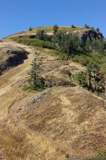
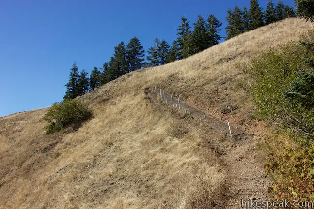
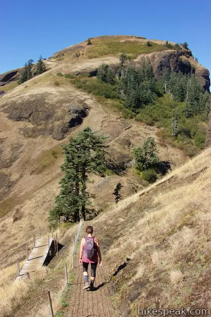
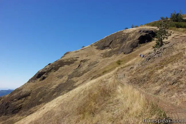
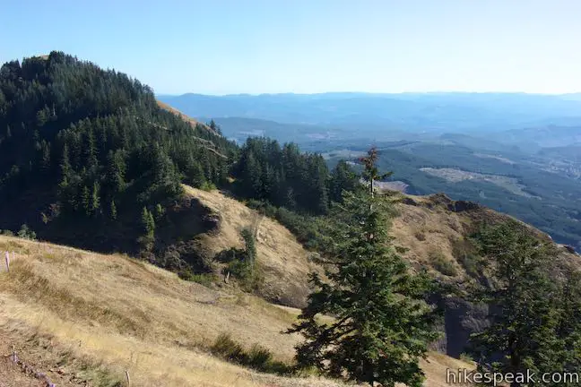
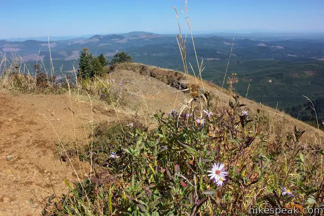
Grab a view to the southeast at the 1.6-mile point as the trail makes a sharp left turn. Pass the second mileage marker (1.75 miles from the trailhead) and go around a bend to find one last picnic table located beneath the trees just above the trail. Ahead, the trail rises out of the forest into the mountaintop grasslands. With 1.9 miles complete, only one small patch of forest remains to break up the next 0.6 miles, so prepare for sun-exposed slopes packed with open views and captivating spring and summer wildflowers.
May and June are the most popular hiking months for wildflower enthusiasts. Chocolate lilies, shooting stars, Martindale’s desert parsley, tough-leaf iris, fleabane, and many other flowers bring splashes of color to the mountain meadows along Saddle Mountain Trail. According to Oregon hiking expert William Sullivan, this is “the richest floral display in the entire Coast Range.”
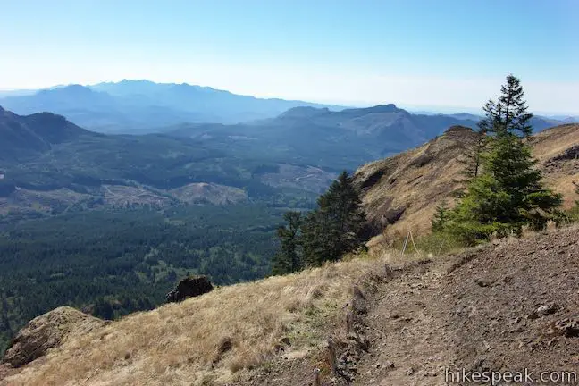
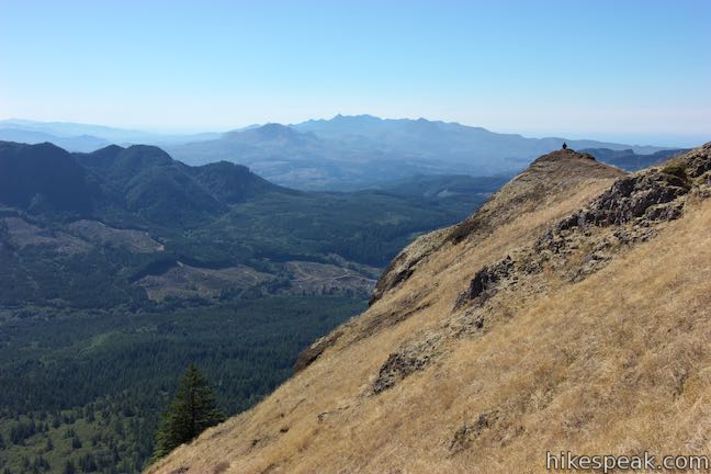
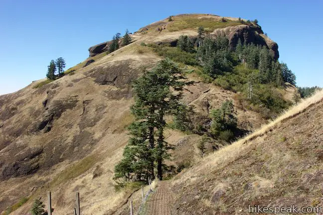
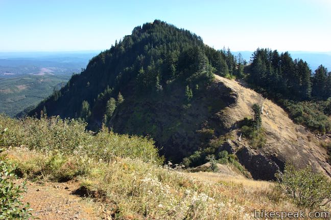
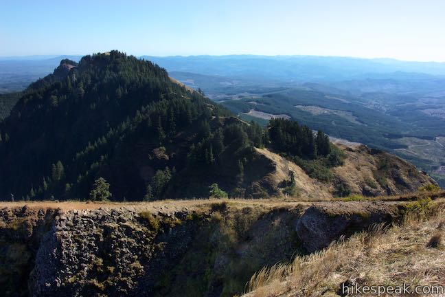
After a tenth of the mile on the open slopes, come to a rise where an unmarked spur parts to the left, following a ridgeline south out to a perch offering a sweeping view. To reach the summit, bear right and continue along the trail. Saddle Mountain Trail turns downhill for a stretch as it passes through a patch of forest.
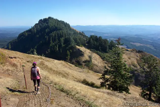
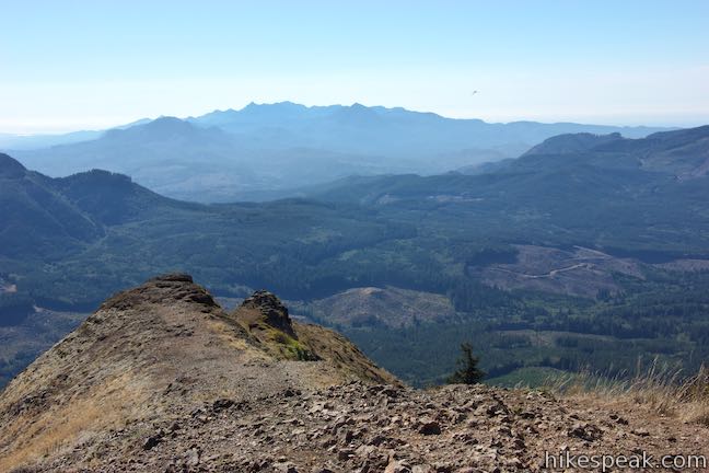
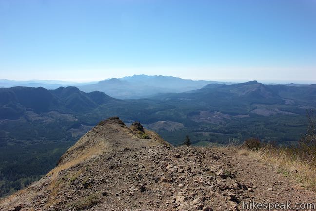
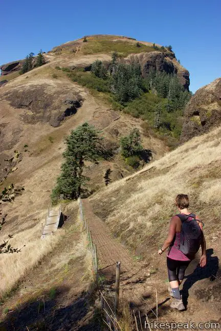
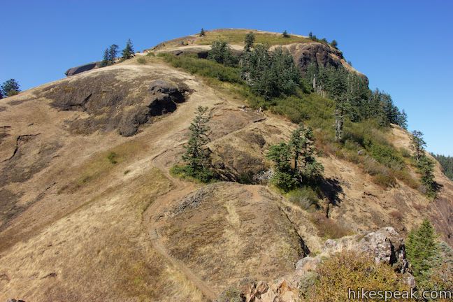
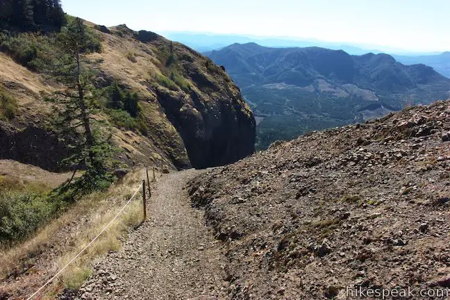
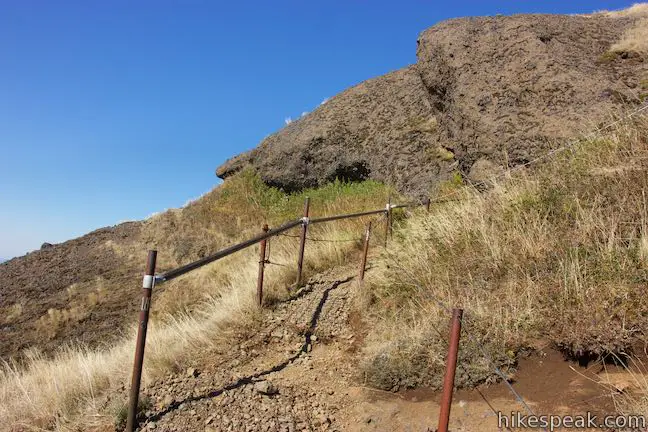
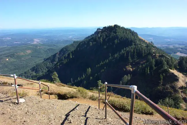
Descend just over a hundred feet into a dip between the two peaks on Saddle Mountain. This is the saddle that earns the mountain its name and creates its recognizable shape. Take a steep walkway down into the divide, enjoying views to the southwest.
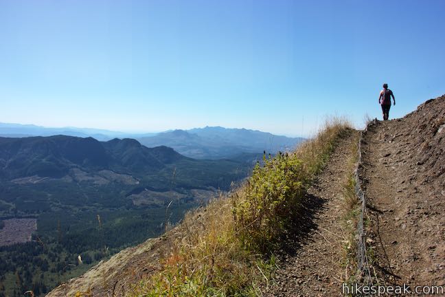
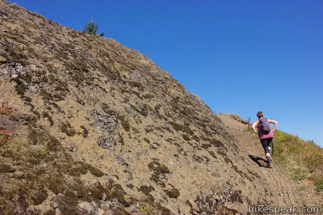
Cross the belly of the dip and begin the final push for the summit. Saddle Mountain Trail saves its steepest section for last, ascending 435 feet in the final 0.4 miles. The tapered switchbacks vanish at the top of the trail, so tackle the ascent head-on.
Push up the steep basalt slope through tufts of mountain grasses. If you need to stop to catch your breath, this may be a good time to ponder how the lumpy, basalt summit was formed. Saddle Mountain’s shape bear’s the signature of a lava flow that came into contact with water and cooled rapidly. A geology lesson in the Saddle Mountain Trail brochure explains:
The mountain formed when a large lava flow of Columbia River basalt touched the ancient sea. Steam explosions caused by the hot rock hitting the cold water broke the rock into a giant pile of basalt fragments.
Can you picture that wild creation? An enormous 15-million-year-old flow of lava traveled down the Columbia Basin from a volcano hundred of miles to the east and met the ocean at this spot.
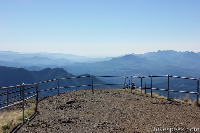
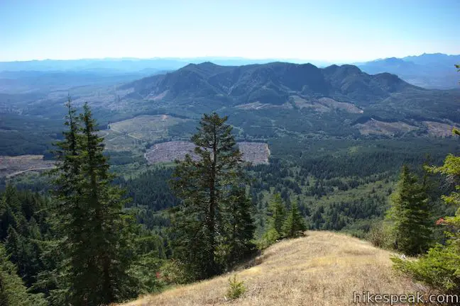
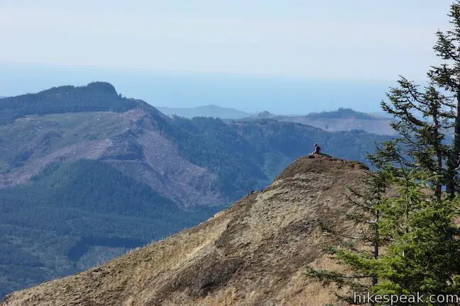
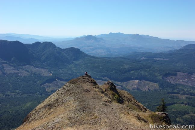
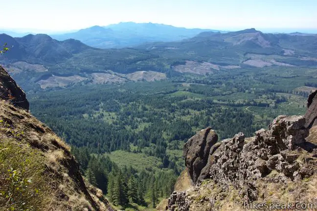
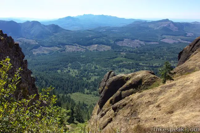
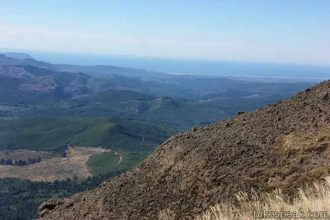
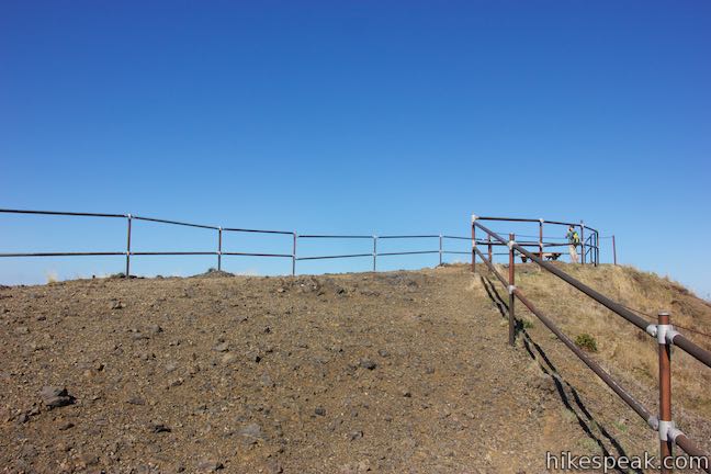
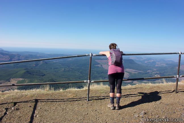
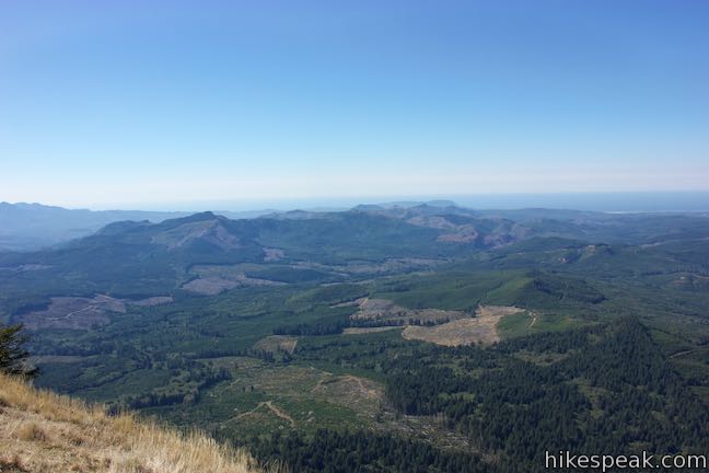
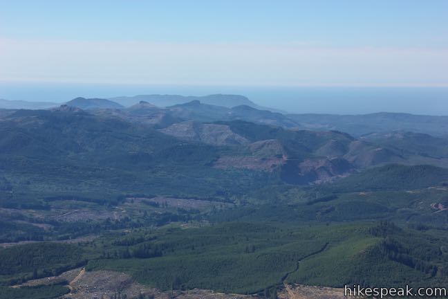
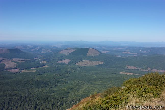
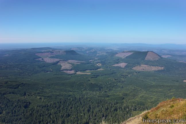
Climb to the viewpoint at the summit of the basalt mass. Wrapped by a metal railing, Saddle Mountain’s 3,283-foot summit boasts spectacular views. The perspective south over the Coast Range is familiar, but broader than those featured on the hike up. Look west toward the Pacific Ocean and miles and miles of beautiful coastline. To the north, the Columbia River meets the Pacific. Look down on the river-lining city of Astoria, where the Astoria Column should be visible, as well as the Astoria–Megler Bridge crossing into Washington.
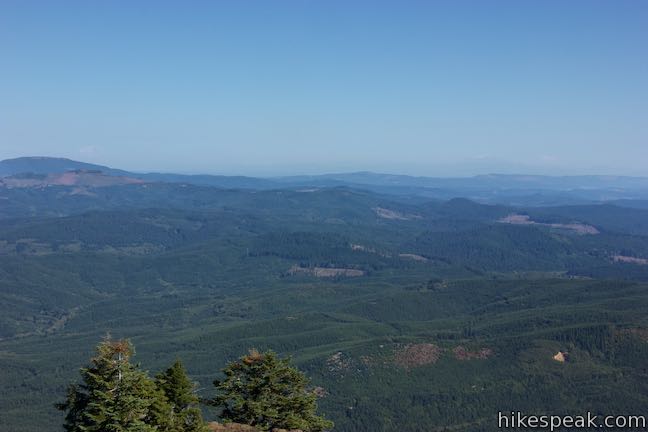
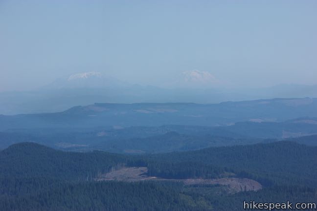
The summit sweep extends east toward the Cascade Range. How many mountains can you see? If it isn’t hazy, the large snowy masses of Mount Rainier, Mount Saint Helens, and Mount Adams should be visible, rising above hills on the Washington side of the Columbia River to the northeast. On the Oregon side of the range, Mount Hood and Mount Jefferson may also be seen from places on Saddle Mountain.
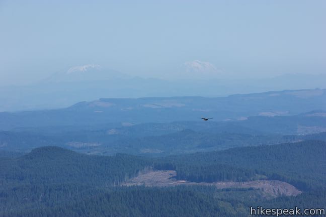
Have you noticed that it gets foggy on the Oregon coast? It does, and Saddle Mountain, likewise, has a habit of being enveloped by fog. Time your visit for a day that offers distant views or hike in the fog and appreciate the close-up beauty around the trail.
The views from the summit of Saddle Mountain are really quite sprawling, so spend some time exploring what’s visible. After taking in the majesty of the mountaintop, hike down the way you came. Once you cross the dip to the southeast side of the mountain, the remaining two miles are all downhill.
Mountain bikes are not allowed on Saddle Mountain Trail. Dogs are welcome on leashes. Bathrooms are available at the trailhead.
A 10-site primitive campground is also located at the start of Saddle Mountain Trail. This first-come first-served campground does not accept reservations and is open seasonally (usually from March to October). Each site has a short walk-in from the vehicle parking in the main parking lot. Campsites are $11 per night with a fee of $7 for additional vehicles (price as of 2018).
Day use at Saddle Mountain State Natural Area is free of charge, so hiking to the summit is free. and no permit is required to hike Saddle Mountain Trail.
To get to the trailhead: From Portland, travel 63 miles west on Route 26. At 7.5 past the Camp 18 restaurant, and just after a signed crossing of Necanicum River, make a sharp right on Saddle Mountain Road, following a sign for Saddle Mountain Natural Area. Drive 7 miles up this narrow road to trailhead parking at road’s end.
From the coast, take Highway 101 to the intersection with Route 26, between Cannon Beach and Seaside. Travel east on Route 26 (Sunset Highway) for 9 miles to an intersection with Route 53 (Necanicum Highway). The Hamlet Quick Stop here offers the closest services to Saddle Mountain State Natural Area. Drive another 3/4 of a mile east on Route 26 and turn left up Saddle Mountain Road. Drive the remaining 7 miles to the road’s end trailhead.
Trailhead address: Saddle Mountain Road, Seaside, OR 97138
Trailhead coordinates: 45.9628, -123.6899 (45° 57′ 46.1″N 123° 41′ 23.6″W)
View Saddle Mountain in a larger map
Or view a regional map of surrounding Oregon trails and campgrounds.


 | Ecola Point to Indian Beach This 2 2/3-mile round trip hike explores a wild and beautiful section of Oregon Coast Trail between Ecola Point and Indian Beach in Ecola State Park. |
 | Cape Meares Lighthouse & Octopus Tree This easy 0.8-mile hike in Cape Meares State Park visits a beautiful lighthouse and an equally impressive tree, exploring a coastal cape with tall cliffs and big ocean views. |
 | Oceanside Beach to Tunnel Beach This 0.8-mile beach walk comes with an adventurous twist, a man-made tunnel through a cliff that leads from one beautiful beach to a second, more secluded beach. |
 | Cape Lookout Trail This 5-mile round trip hike ventures down a promontory on the Oregon Coast with beautiful ocean views. |
 | Cape Kiwanda This short beach hike explores tide pools and sand dunes at a rugged headland on Oregon's coast near Pacific City. |
 | Munson Creek Falls Trail This short hike near Tillamook travels up a forest canyon to the tallest waterfall in Coastal Oregon. |
 | Whalen Island Loop Trail This 1.5-mile hike explores a lovely island-like park in Sand Lake Estuary with ocean and wetland views. |
 | Beaver Falls This short hike slips down through forest to a beautiful waterfall plunging over a basalt wall. |
 | Trails in Oregon Explore more hikes throughout the state of Oregon. |
 | Whalen Island County Campground This 33-site campground is a nice camping option on Whalen Island with easy access to estuary beaches and a loop hike. |
 | Cape Lookout State Park Campground This grand, oceanfront campground has over 200 sites right behind a big, beautiful beach. |
Saddle Mountain on oregonhikers.org
Saddle Mountain on wikipedia.org
Saddle Mountain on summitpost.org
Saddle Mountain on oregonhiking.com
Saddle Mountain on outdoorproject.com
Saddle Mountain on oregonlive.com
Saddle Mountain on wanderlusthiker.com
Saddle Mountain on alltrails.com
Go the extra miles...
Submit a rating of this hike to go with your comment. Contribute to the average trail rating.