Root Creek Trail
in Castle Crags State Park
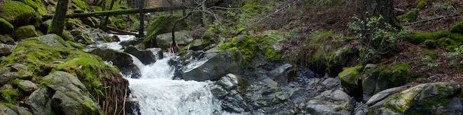
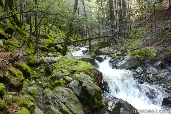
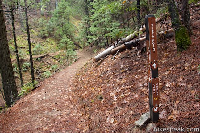
Root Creek Trail presents an easy 2.2-mile round trip hike, starting in Castle Crags State Park. Most of the trail is wheelchair-friendly, until it passes into Castle Crags Wilderness in Shasta-Trinity National Forest where the trail gets just a bit less maintained on the final push to Root Creek. When you reach the creek, you can relax and watch tumbling water cascade past mossy boulders and trees. This hike can be combined with nearby trails, like an even shorter hike to Vista Point or a longer hike up Crags Trail.
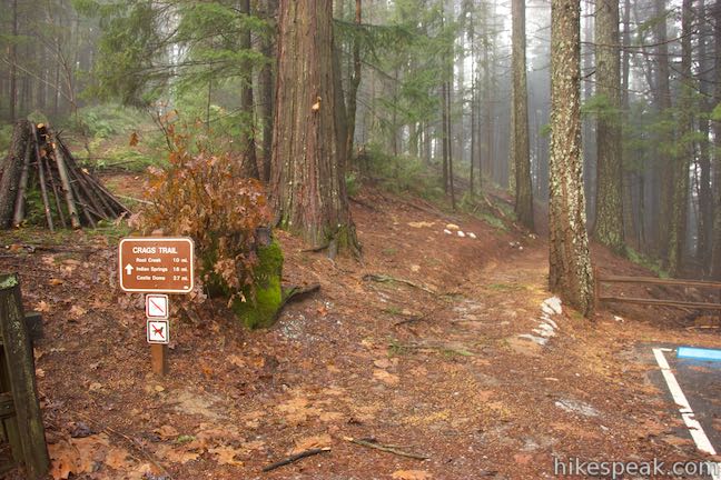
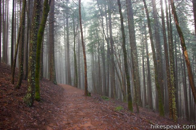
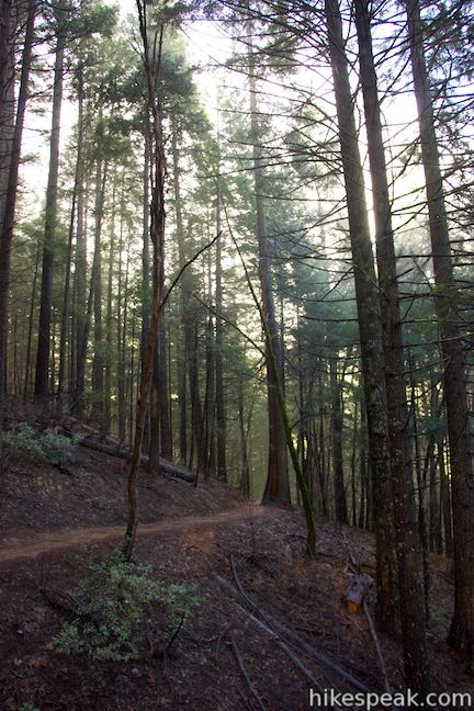
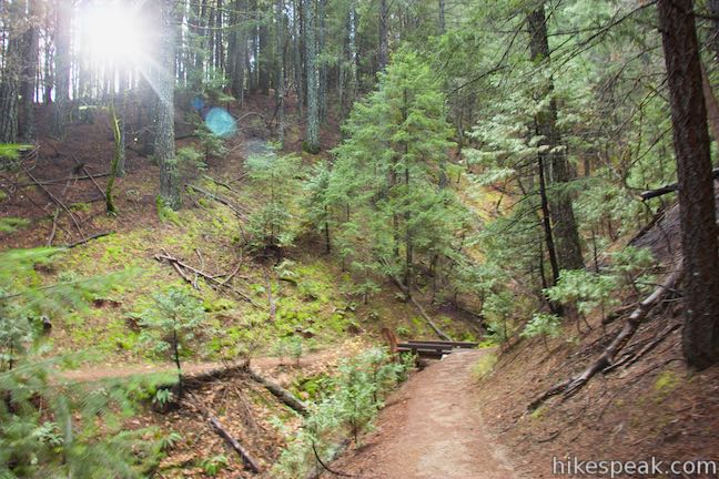
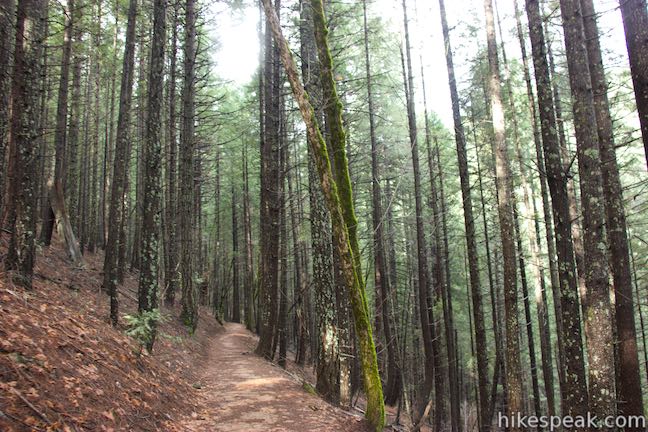
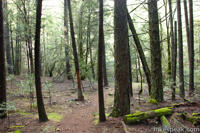
The hike to Root Creek actually begins on Crags Trail, which leaves Vista Point Road just before the large parking area at the end of the road. The trail to Vista Point is at the far end of the parking area, but to reach Crags Trail, you’ll need to head the other way and walk a short distance back down the road to the trailhead on the right. Start hiking up this nearly level trail, which heads northwest along the side of Kettlebelly Ridge. Tall pines surround Crags Trail to provide lots of shade.
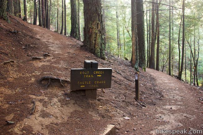
After a quarter mile, come to a marked junction. Crags Trail ascends to the left, while Root Creek Trail continues on a level course straight ahead. Proceed onto Root Creek Trail, which will then pass a pair of panels describing the area’s orchids and birds.
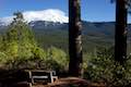
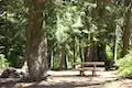
Walk past a bench before coming to a junction with Pacific Crest Trail, 0.35 miles from the start. Bear right onto the PCT, which temporarily overlaps Root Creek Trail. In another tenth of a mile, turn left on Root Creek Trail as it separates from Pacific Crest Trail. Who would have thought you could hike the PCT this quickly?
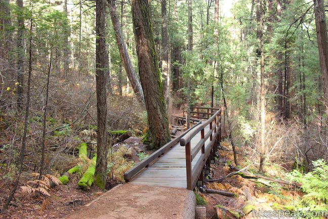
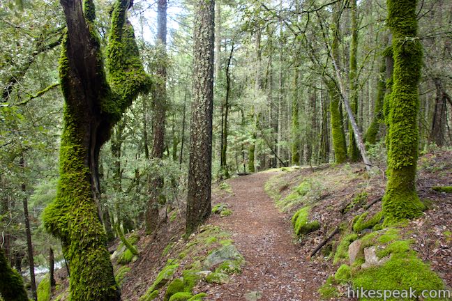
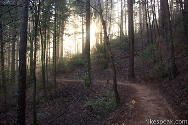
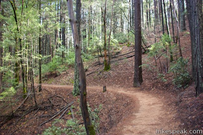
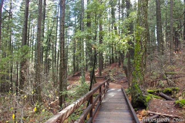
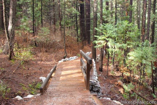
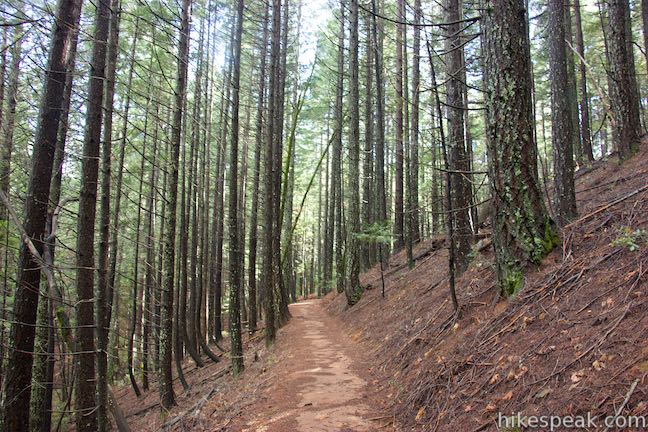
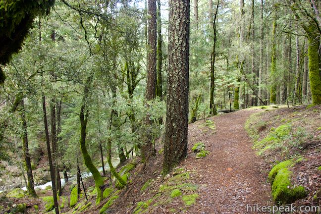
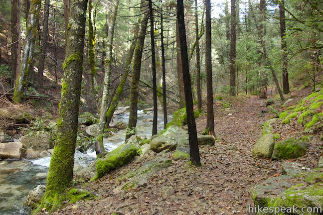
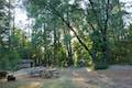
Leaving Pacific Crest Trail, Root Creek Trail continues another 0.65 miles to Root Creek. The trail gradually ascends for a bit, before easing back downhill again. Root Creek Trail is wide and well maintained. There are wooden boardwalks at potentially wet portions of the trail, like the crossing of Fern Springs, which comes 0.2 miles past Pacific Crest Trail.
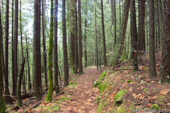
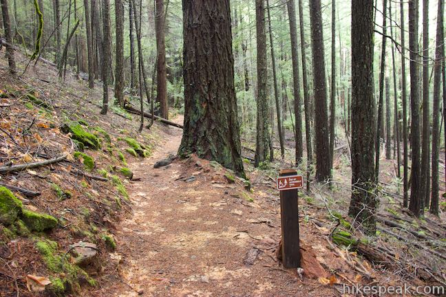
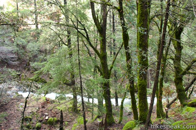
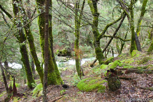
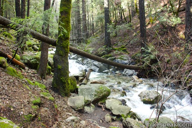
You will probably hear Root Creek running along the bottom of the canyon to you right before you can actually see it. Root Creek Trail is only wheelchair-friendly within Castle Crags State Park. A sign marks the end of the wheelchair-friendly section of the trail, about 0.2 miles from the end, as Root Creek Trail passes into Castle Crags Wilderness. The trail is a bit narrower and less maintained from this point on, although it stays fairly level, heading gradually downhill toward Root Creek, which appears through the trees as you continue down the trail.
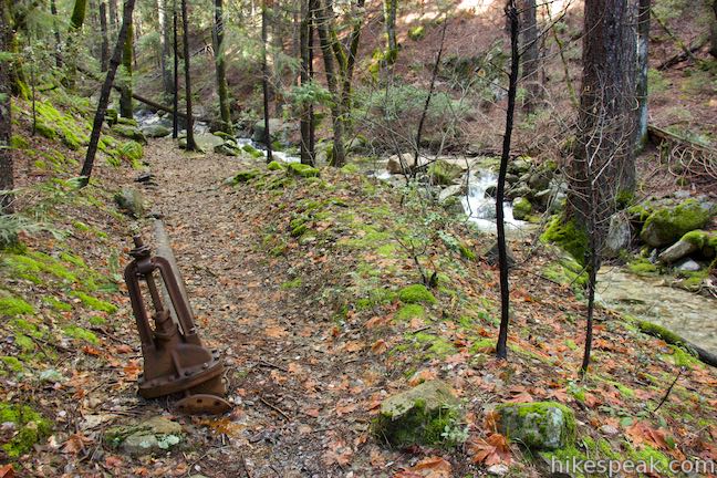
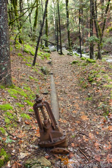
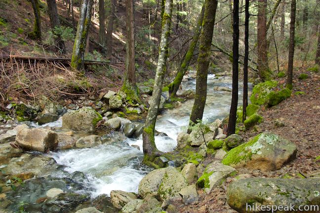
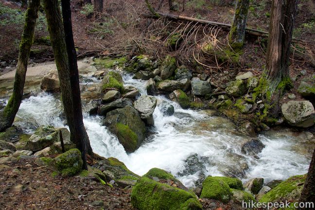
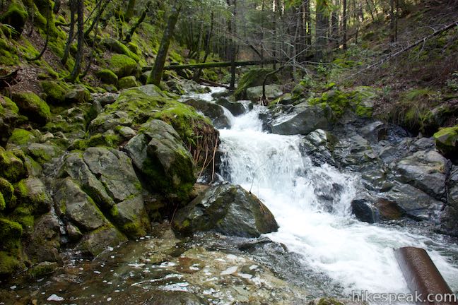
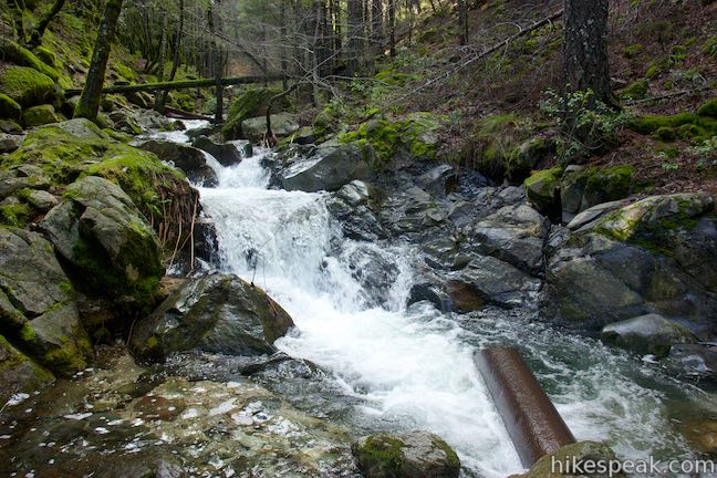
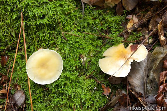
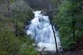
As you near the creek, you will pass some rusted piping running out of the stream. These abandoned pipes date back to the mining area at Castle Crags during the gold rush of the 1850s when Root Creek was used as a water source for a nearby mine. The trail ends at the edge of Root Creek, where water cascades down the rocky canyon bottom. The trees and boulders surrounding the creek are covered in bright green moss, creating a lovely setting.
A faint footpath continues up the left side of the stream. Adventurous hikers can head this way, forging a course farther up the canyon to a view of Root Creek Falls, where the creek cascades down a rock face from its source near Castle Dome. Otherwise, if you are satisfied with the trek, hike back the way you came up Root Creek Trail, completing this 2.2-mile round trip hike with 80 feet of elevation change. For a longer and steeper route to Root Creek, hikers can start from Soda Creek Trailhead where Pacific Crest Trail crosses Interstate 5 (exit 726) and hike almost two miles up PCT to Root Creek Trail. This alternate starting point is outside Castle Crags State Park and therefore avoids entrance fees. Otherwise, there is a park entrance fee to reach Root Creek from Vista Point Road ($10 as of 2015), but no permit is required to hike Root Creek Trail. Dogs and bikes are prohibited.
To get to the trailhead: Take Interstate 5 to exit 724 in Castella (located 14 miles south of Mount Shasta City and 44 miles north of Redding). At the bottom of the offramp, turn northwest onto Castle Creek Road. Drive 0.3 miles and turn right into the park entrance. Inside the park, bear right and drive almost two miles up Vista Point Road to the parking area at the road’s end. This road goes through the campground in Castle Crags State Park before heading up Kettlebelly Ridge. You will pass the start of Crags Trail just before reaching the parking area at the top of Vista Point Road.
Trailhead address: 20022 Castle Creek Road, Castella, CA 96017
Trailhead coordinates: 41.1597, -122.3068 (41° 09′ 34.92″N 122° 18′ 24.47″W)
You may also view a regional map of surrounding Northern California trails and campgrounds.
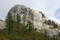 | Crags Trail to Castle Dome This 5.6-mile round trip hike in Castle Crags State Park ascends 2,150-feet through a garden of granite crags to the base of Castle Dome. This hike can be extended to 6 miles round trip by taking a worthy side trail to Indian Springs. |
 | Vista Point Trail This short hike reaches the principal viewpoint in Castle Crags State Park, which has a great perspective of granite peaks known as the Castle Crags, along with views of Mount Shasta and the surrounding wilderness. |
 | Bailey Cove Trail This easy 3.1-mile loop circles a hill-covered peninsula on the McCloud Arm of Shasta Lake, providing both lake views and shade. |
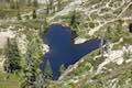 | Heart Lake and Little Castle Lake This 2 to 3-mile hike visits lakes in a beautiful area of Shasta-Trinity National Forest, including the charming-contoured waters of Heart Lake. |
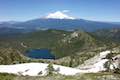 | Castle Peak and Heart Lake This approximately 3.2-mile hike ventures off trail above Heart Lake to a summit with extraordinary views of the Castle Crags and Mount Shasta. |
 | Lake Siskiyou Trail (South Shore Loop) This short and easy lakefront loop offers great views across Lake Siskiyou toward Mount Shasta and the surrounding evergreen wilderness. |
 | Faery Falls and Ney Springs This short hike travels along a creek up to an impressive 50-foot waterfall, passing the ruins of an old resort along the way. |
 | Spring Hill This 2.9-mile hike hits a short summit near Mount Shasta with excellent views of Mount Shasta, Black Butte, and the surroundings. |
 | More hikes in Northern California Explore more trails in Northern California, including redwood grove and oceanfront parks along the North Coast. |
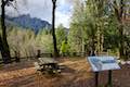
 | Castle Crags State Park Campground There are 76 developed campsites within this state park that are nestled within a pine forest with access to nearby trails. |
 | Castle Lake Campground This six-site campground in Castle Lake is shaded by conifers in Shasta-Trinity National Forest. |
 | Antlers Campground This well-shaded 59-site campground in Shasta-Trinity National Forest has level sites on a bluff next to Shasta Lake. |
Go the extra miles...
Submit a rating of this hike to go with your comment. Contribute to the average trail rating.