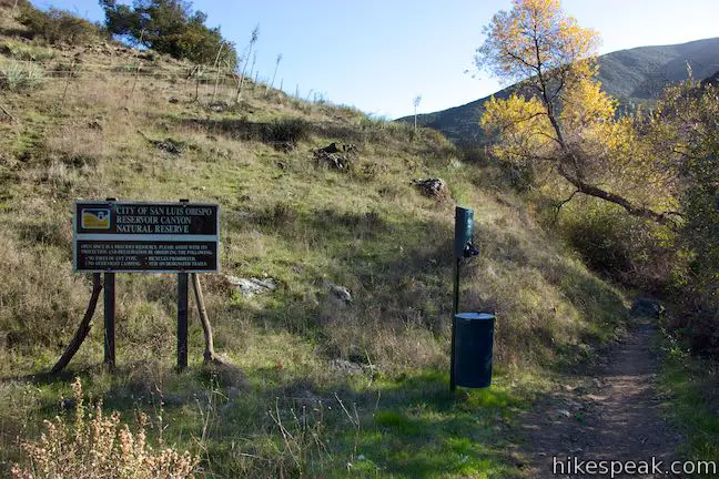
Reservoir Canyon Trail – Summit Trail Loop
in Reservoir Canyon Natural Reserve
If you’ve hiked up the hill east of downtown San Luis Obispo on Reservoir Canyon Trail or Summit Trail, you’ve probably pondered the prospect of connecting the two hikes in order to spend more time enjoying grand views over San Luis Obispo County. Follow Reservoir Canyon Trail up to a stone bench viewpoint, cross Ridge Trail to an old tower housing a bell, and descend Summit Trail to complete a 5.6-mile loop with 1,350 feet of elevation change.
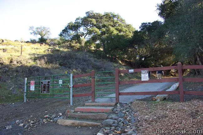
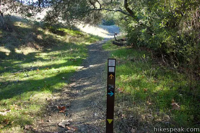
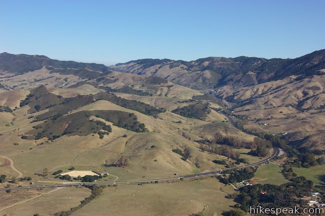
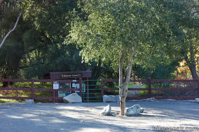
The loop begins from a trailhead at the end of Reservoir Canyon Road, just off Highway 101 near the base of Cuesta Grade. From the large (new) trailhead parking area, you can either begin up Reservoir Canyon Trail from the east side of the parking area (a straight shot off the end of the road) or set out from the kiosk at the west end of the parking area on a trail that heads first to Reservoir Creek Falls.
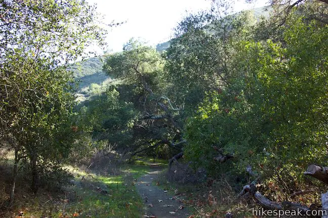
The waterfall can easily be visited at the end of this loop, so for now, hike straight from the parking area, through the gate onto Reservoir Canyon Trail, going south in line with the road you drove in on. Quickly meet a junction with a trail on the right that connects to a trail coming up from Reservoir Creek Falls and a bridge over the crek leading to Summit Trail. Pass through the junction and hike straight up Reservoir Canyon Trail, following a former municipal road that shrinks to a conduit that is perfect for foot traffic.
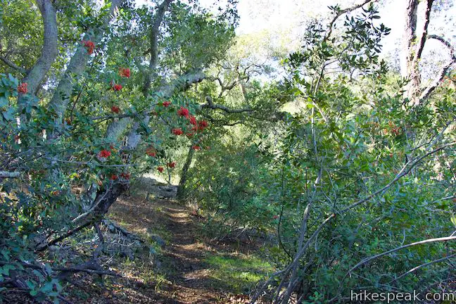
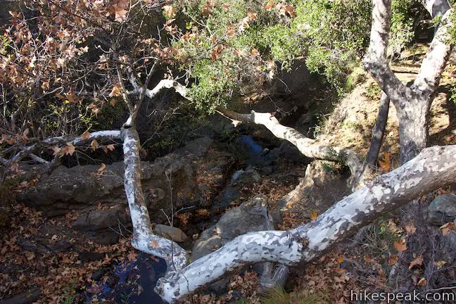
The first 1.25 miles of Reservoir Canyon Trail are quite level, gaining approximately 225 feet. The effort is made easier by abundant shade from overhanging oaks, sycamores, and smaller trees that thrive along Reservoir Creek, a year-round source of water. San Luis Obispo residents relied on this water a century ago, but the canyon has retired from providing drinking water.
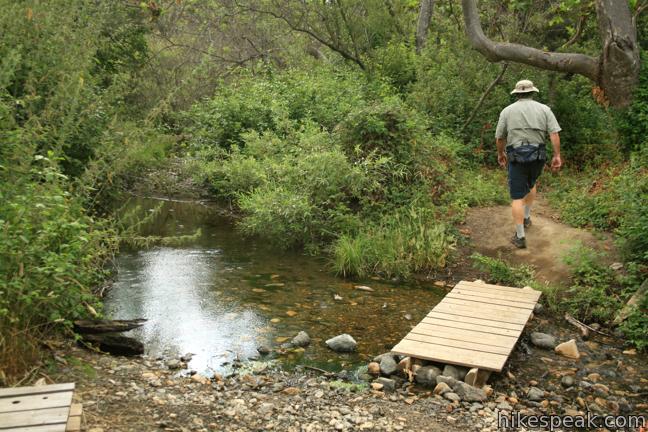
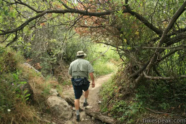
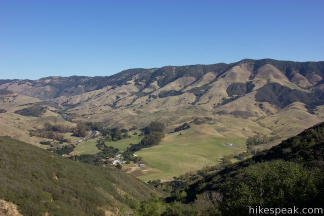
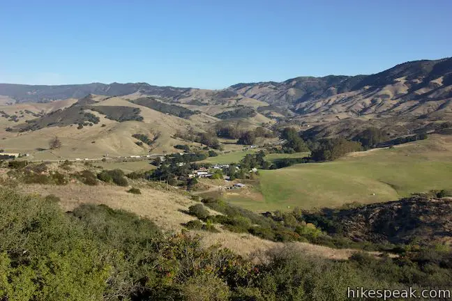
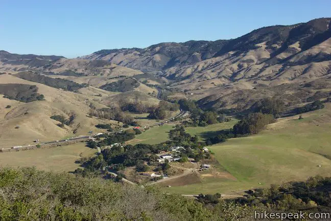
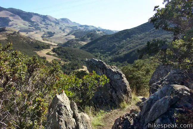
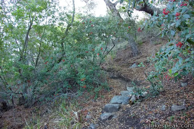
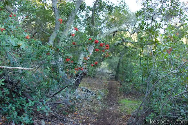
Cross several small wooden footbridges and come to a larger bridge to the right across the creek. Follow the trail up a fork in the canyon where you’ll sneak a glimpse over the trees toward Cuesta Grade and the Santa Lucia Mountains.
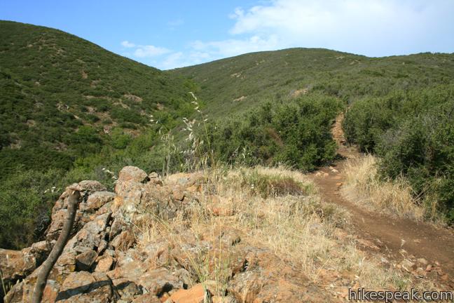
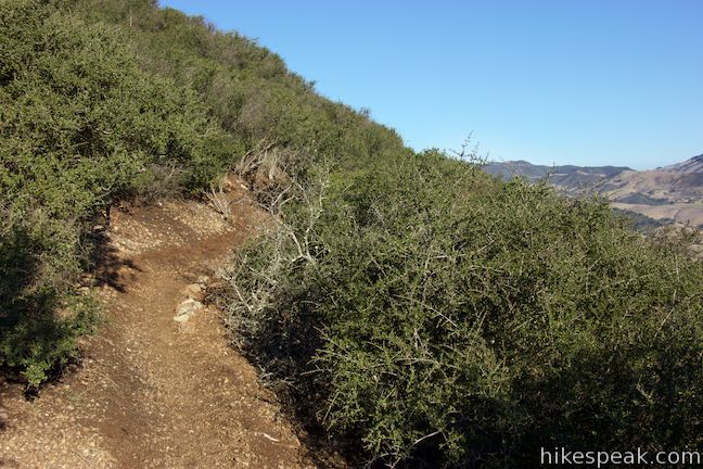
Half a mile from the bridge and approximately 1.25 miles from the start, the trail drops down to the bank of the creek. Rock hop to the other side and rise to a sharp turn to the right. The true climb on Reservoir Canyon Trail starts now, gaining 1,125 feet over the next 1.4 miles.
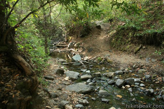
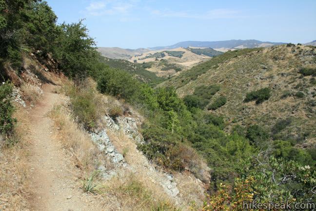
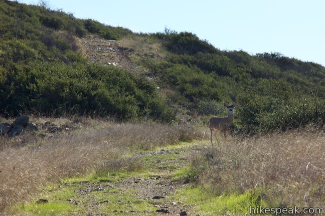
The sun-exposed single track ascends steadily up the side of the canyon. Be very careful as you hike up narrow segments on the trail. Trees give way to sloping grassland, which in turn give way to chest-high chaparral.
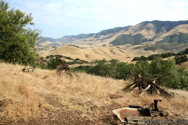
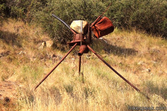
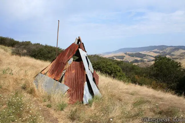
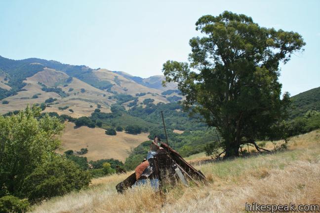
Just under half a mile from the creek, come to a peculiar collection of scrap metal sculptures that would look more at home in the Poly Canyon Design Village. These mysterious features look out of place on the mountain slope. The site is also inhabited by a grand eucalyptus tree with a swing. Cross through the camp of robotic-looking tripods toward a metal teepee at the continuation of the trail.
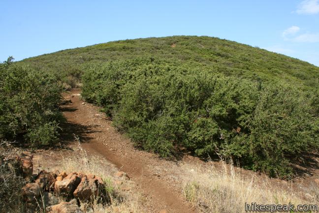
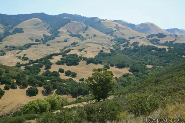
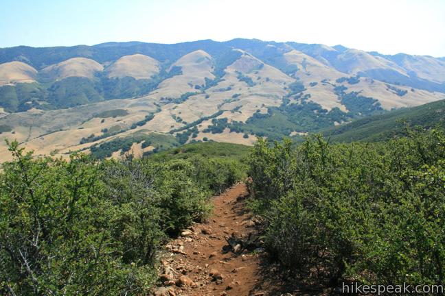
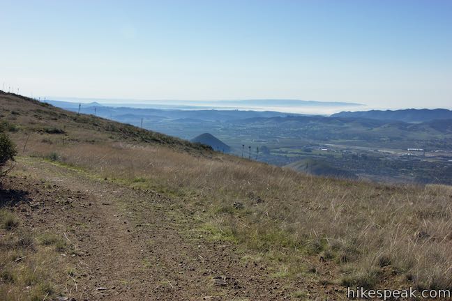
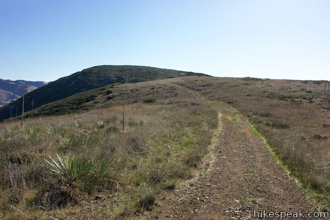
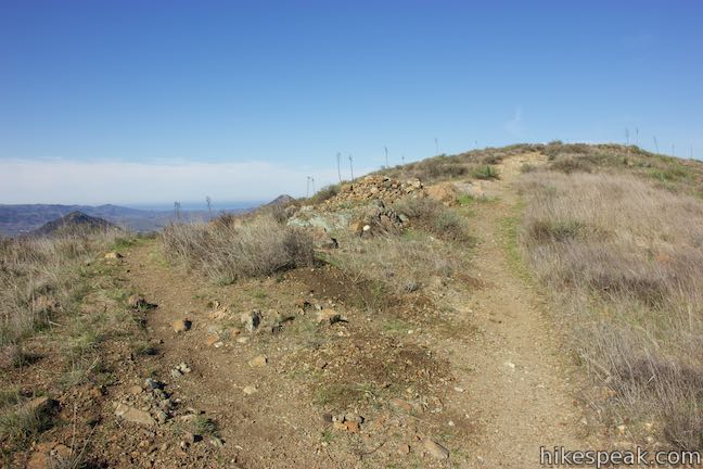
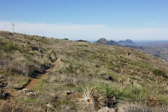
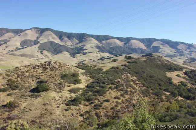
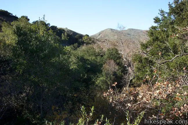
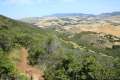
Press on as Reservoir Canyon Trail gets progressively steeper. Any time you need to pause and catch your breath, you’ll find views of the Santa Lucia Mountains. This is one of those trails where you will look up and think you are approaching the summit, only to discover (again and again) that the mountain extends itself just a bit farther. If the ascent appears relentless, don’t forget that excellent views are waiting from the top!
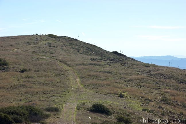
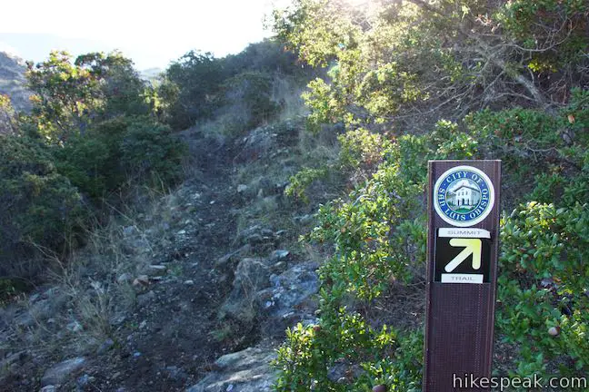
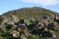
Reservoir Canyon Trail finally tapers out and reaches a small saddle north of the summit of Murray Hill (Unnamed Hill). At 2.65 miles from the trailhead, Reservoir Canyon Trail ends at a T-junction with Ridge Trail, an old jeep road along the hill’s main ridge. A short distance to the right is the top of Sydney Street Trail, which comes up from the city side of the ridge. Farther down Ridge Trail is the old tower housing the bell, which you will hike toward after visiting the nearby summit viewpoint.
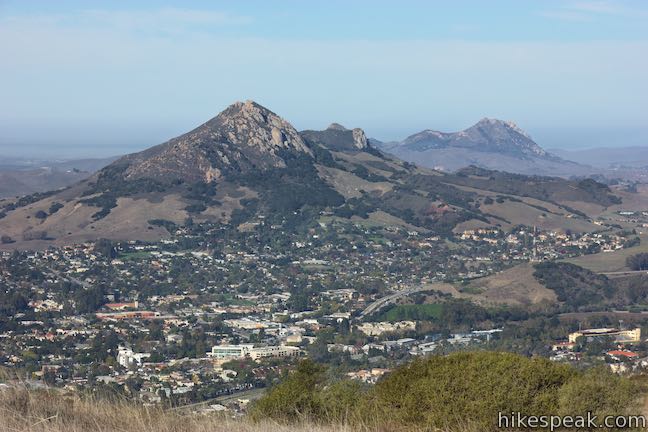
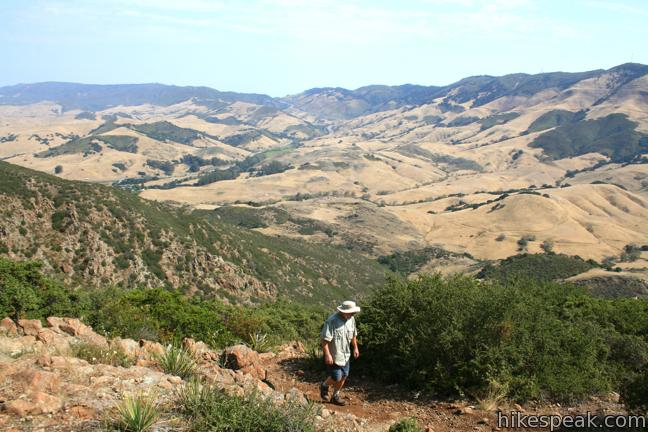
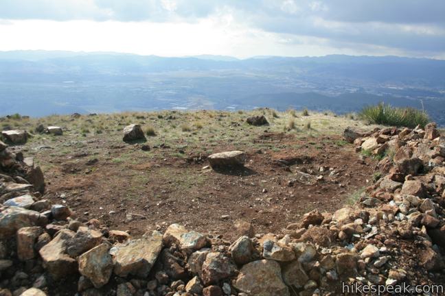
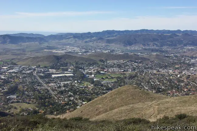
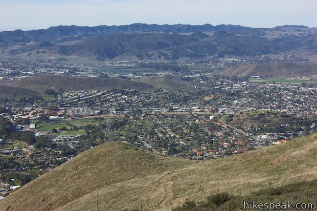
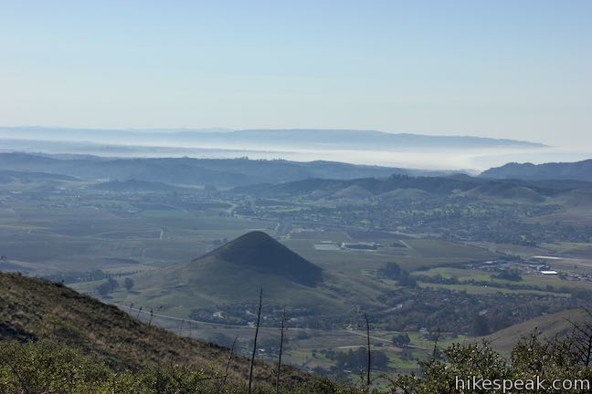
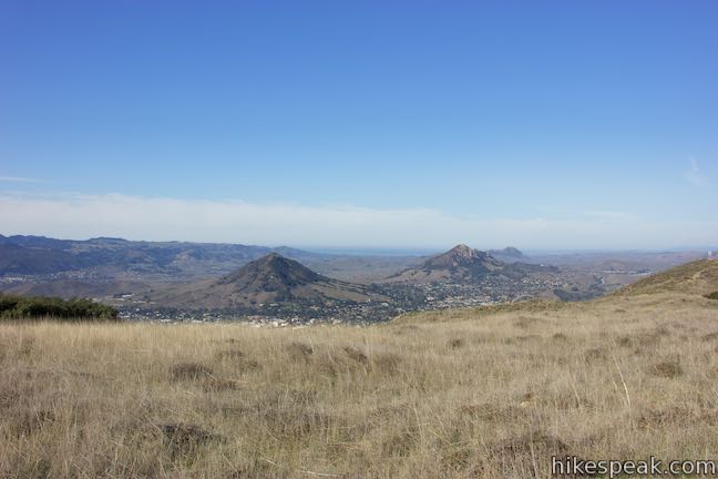
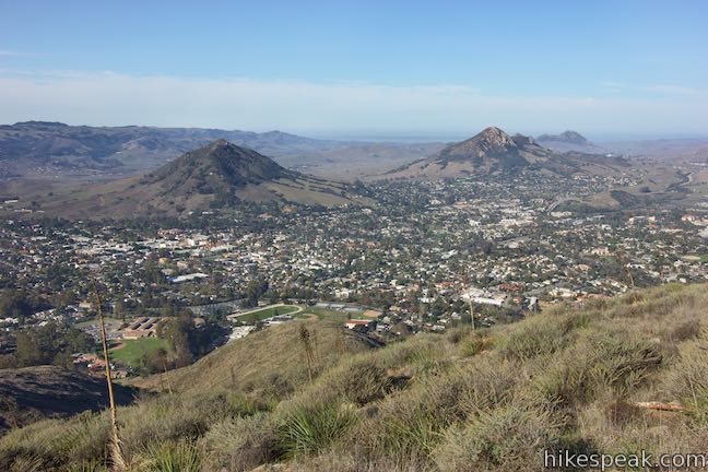
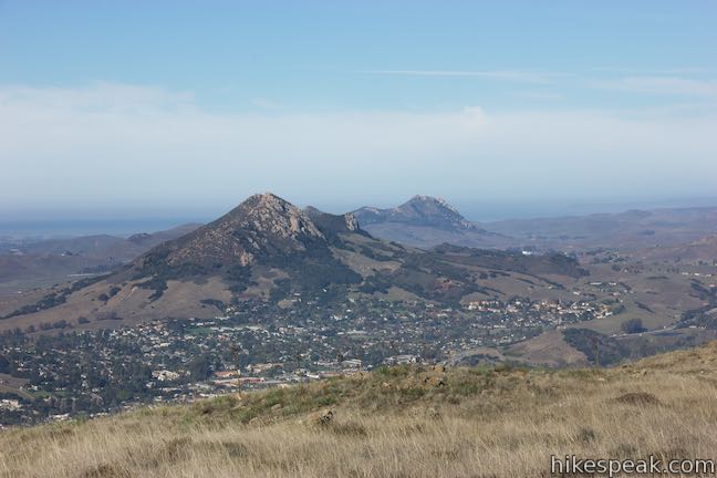
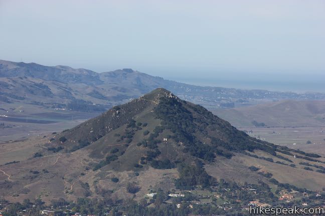
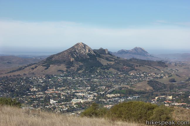
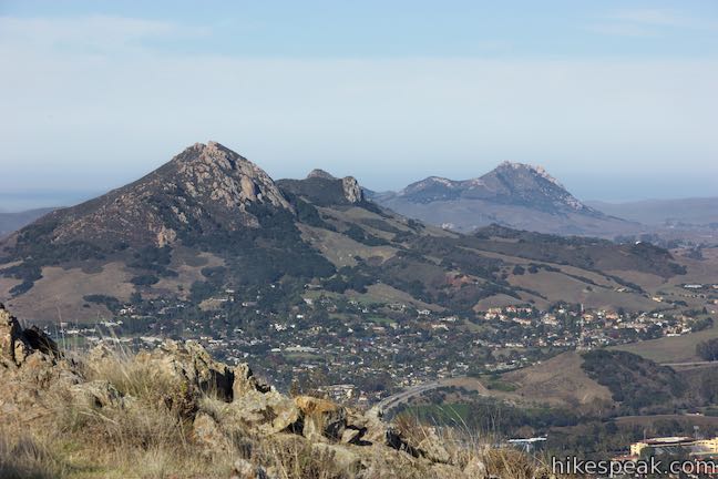
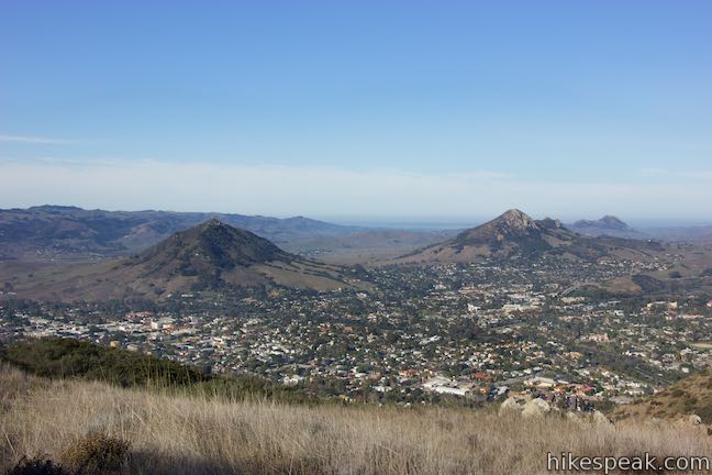
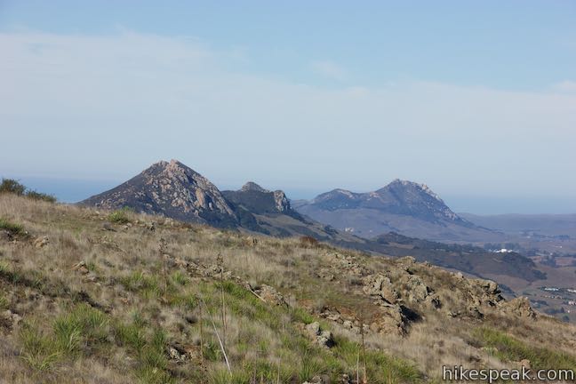
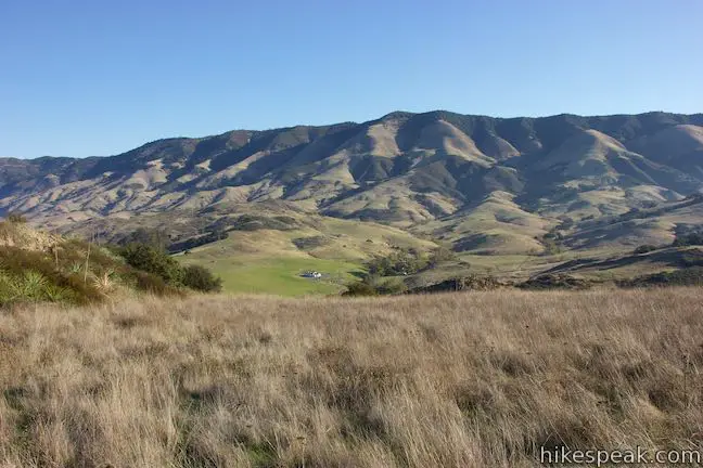
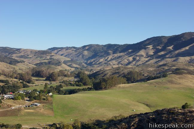
Skip Ridge Trail for now and make a sharp left (at a 45-degree angle) up another single track. Stride the final 90 yards to the summit of Murray Hill. The mountaintop has a stone memorial with U-shaped benches built into the ground that made ideal places to rest your legs and take in views over Edna Valley. Look farther to the south toward Pismo Dunes and Point Sal. Find three windows of ocean views in all: Pismo Beach to the south, Whalers Island in San Luis Bay (by Avila Beach) to the southwest, and Moro Bay to the west. The panorama does not stop there. Murray Hill looks east toward the Santa Lucia Mountains and west toward the Irish Hills and several jagged Morros, including the prominently displayed Cerro San Luis and Bishop Peak.
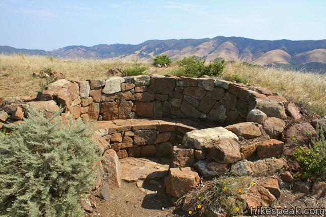
While many locals aren’t sure what to call the summit above Reservoir Canyon Trail (unlike the other peaks around), it can be called Murray Hill, taking its name from Judge Walter Murray who resided in San Luis Obispo in the 1800s. Murray took part in the California gold rush after fighting in the Mexican-American War and wrote for the San Luis Obispo Tribune.
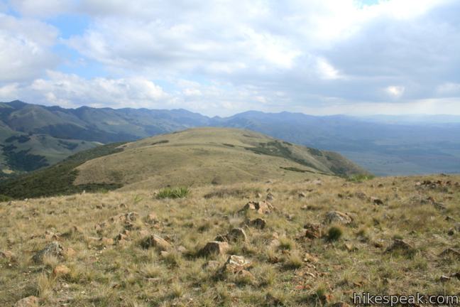
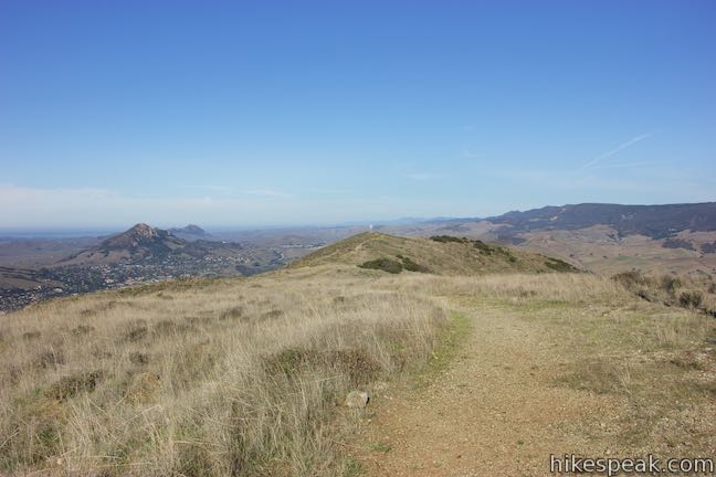
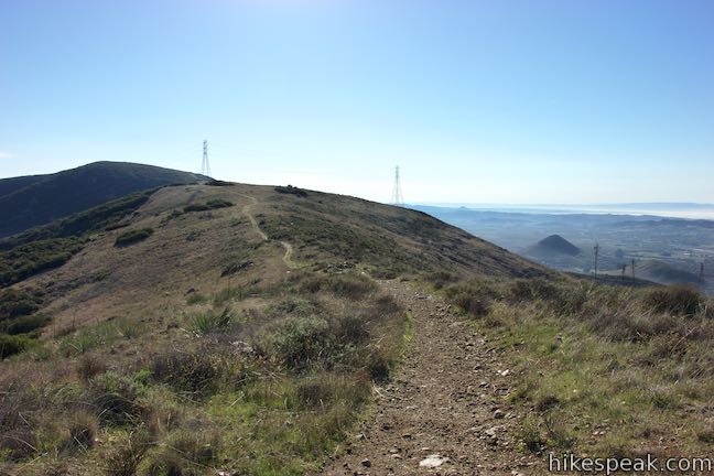
If you like the views and want more of the same, don’t simply hike back down Reservoir Canyon Trail. Instead, hike northwest on Ridge Trail, the old jeep road that runs past Reservoir Canyon Trail and the summit viewing area.
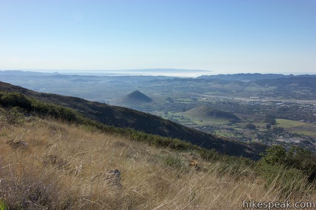
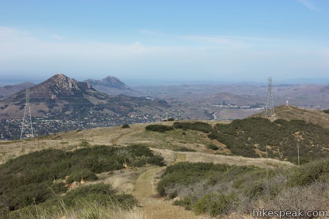
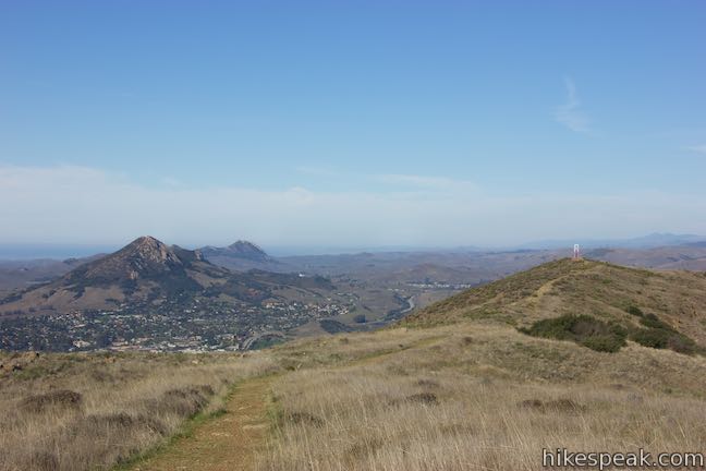
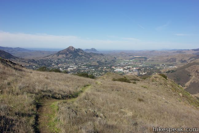
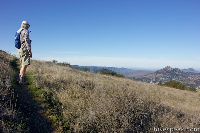
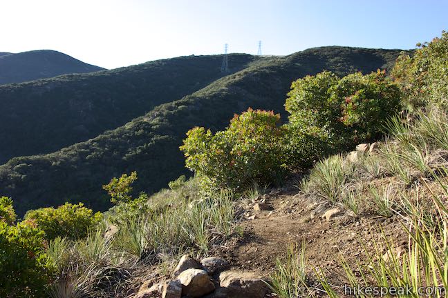
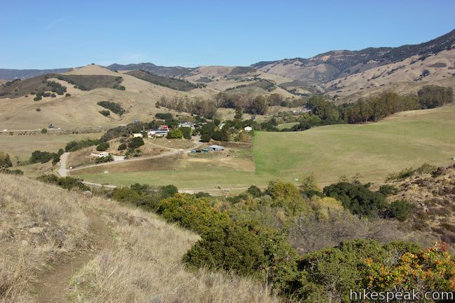
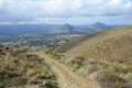
Walk a tenth of a mile up Ridge Trail to a junction with Sydney Street Trail, another wide dirt trail that descends to the left. Proceed on Ridge Trail as it rises over a crest. Views over Edna Valley and Islay Hill shift west toward move views of downtown San Luis Obispo, Cerro San Luis, and Bishop Peak. Over the rise after Sydney Street Trail, Ridge Trail rolls gradually downhill and delivers panoramic views.
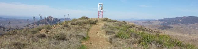
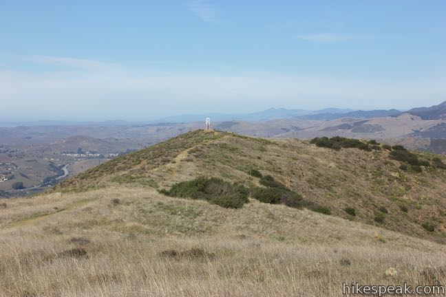
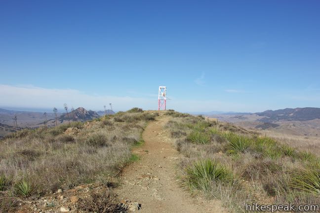
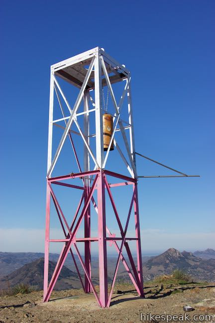
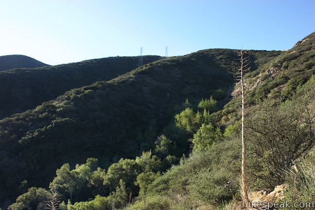
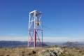
As you continue down the ridge, an old tower comes into view. The metal tower, which is painted white on the top and red on the bottom, served as an air traffic beacon during the World War II era.
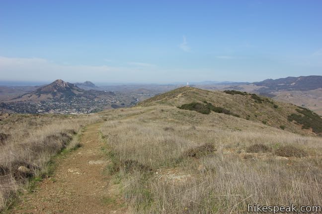
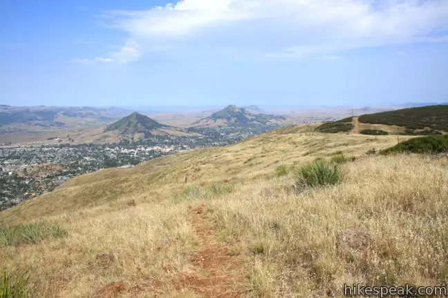
The tower stays in view until you cross a dip just before the end of the ridge where, after 3/4 of mile on Ridge Trail, you’ll pass the top of High School Hill Trail on the left. This trail provides an alternative route up to the tower, starting near San Luis Obispo High School. Hike another tenth of a mile on Ridge Trail to the tower and a junction with Summit Trail.
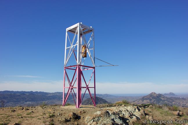
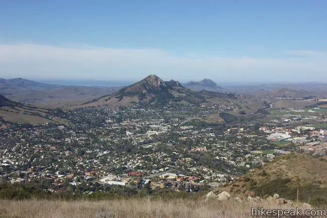
When you reach the tower, you’ll notice that a bell is suspended inside. Pick up a pebble and take aim. You can ring the bell by hitting it with a rock. When you’re not ringing the bell, you can enjoy a top-down perspective of downtown San Luis Obispo and gaze west toward Morros like Cerro San Luis, Bishop Peak, and Hollister Peak. The Pacific Ocean should be visible behind these volcanic plugs.
Having hiked 3.55 miles to get to the tower, you can now get back to Reservoir Canyon via a 2.05-mile descent on Summit Trail. Turn right off the end of Ridge Trail, taking the single-track Summit Trail northeast from the tower.
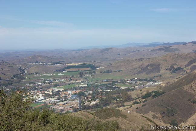
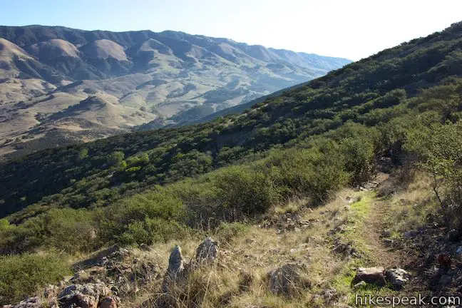
Summit Trail descends around switchbacks that offer additional views over San Luis Obispo, the campus of Cal Poly, and nearby mountains. The trail also looks north over Highway 101 as it makes its way toward Cuesta Grade.
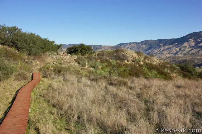
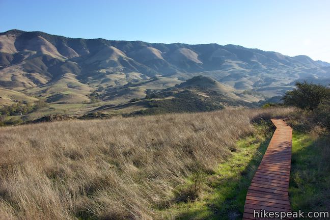
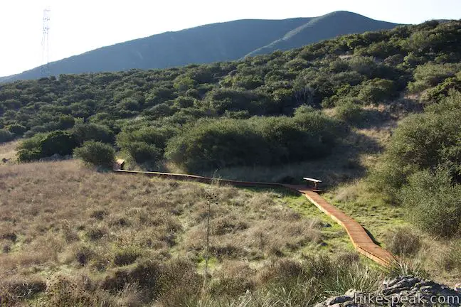
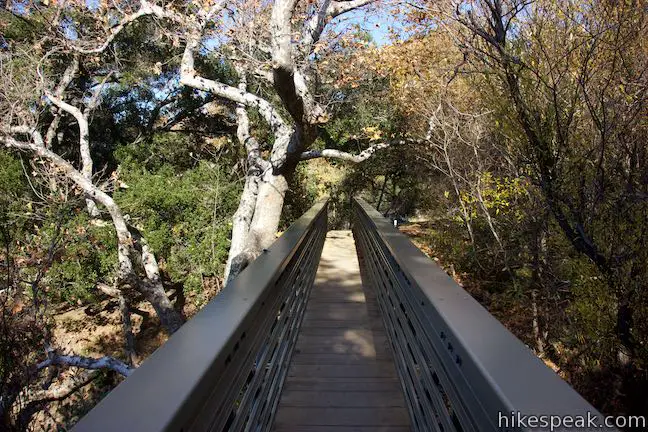
Peer into Reservoir Canyon as you descend around the ridge running northeast from the tower. At 1.4 miles below the tower, cross a boardwalk through a grassy flat area. Descend through more grasses and chaparral to a junction 0.4 miles below the boardwalk. Turn left to continue descending to Reservoir Canyon Trailhead. Creek Bypass Trail is to the right.
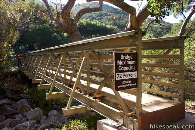
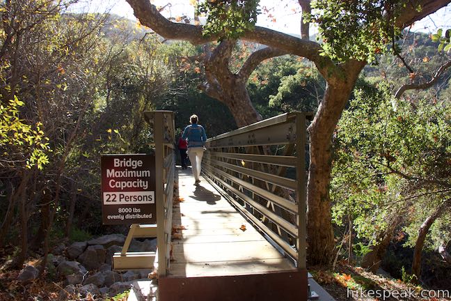
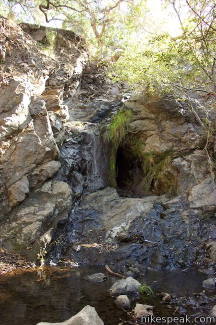
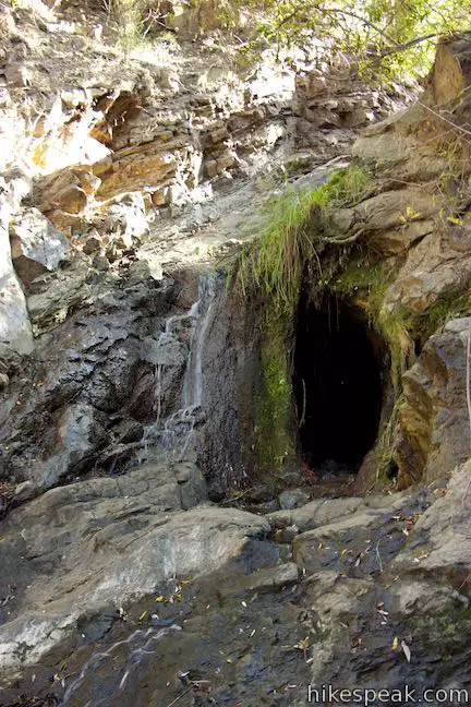
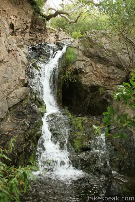
In the loop’s final quarter mile, drop into oaks and toyon. Follow the trail down through switchbacks toward Reservoir Creek. Delve through the riparian thicket and take the bridge across Reservoir Creek. Come to a junction on the far side of the bridge. The broad trail to the right connects to the start of Reservoir Canyon Trail. Turn left to take a trail downstream along a slope beside Reservoir Creek Falls.
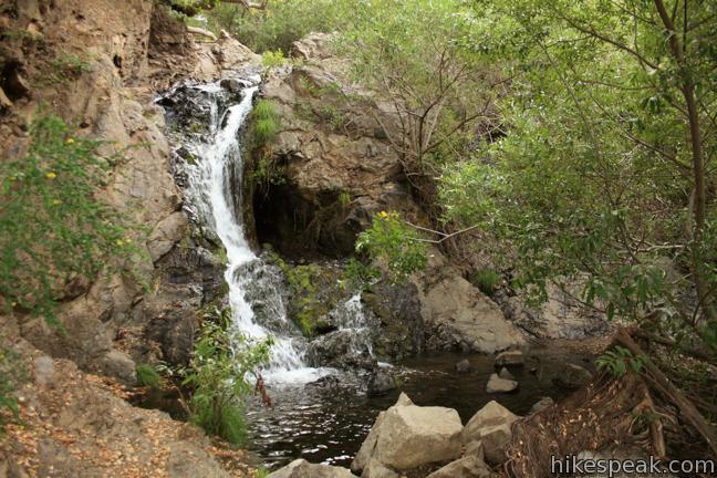
Watch Reservoir Creek Falls cascade some 15 to 20 feet into a shallow oak-shaded pool. Proceed past the waterfall to find a trail back to the trailhead parking area to complete the 5.6-mile loop.
Dogs are welcome on leashes on this hike, but mountain bikes are prohibited. No fee or permit is required to visit Reservoir Canyon Natural Reserve, so get out and enjoy!
To get to the trailhead: From downtown San Luis Obispo, take Highway 101 north for approximately two miles to Reservoir Canyon Road (an easy-to-miss road connecting to the freeway). Turn right and drive half a mile to the trailhead parking area at road’s end.
After the hike, exercise caution when getting back on the highway. It may be safer to drive north and turn around at another exit rather than cutting across northbound traffic to reach the southbound lanes to San Luis Obispo.
Trailhead address: Reservoir Canyon Road, San Luis Obispo, CA 93401
Trailhead coordinates: 35.29075, -120.62775 (35° 17′ 26.7″N 120° 37′ 39.9″W)
View Reservoir Canyon Trail in a larger map
Or view a regional map of surrounding Central Coast trails and campgrounds.


 | Reservoir Canyon Trail This 5.35-mile hike ascends 1,350 feet past a waterfall and a collection of junk sculptures on the way to a treeless summit overlooking San Luis Obispo. |
 | Reservoir Canyon Summit Trail This 4.1-mile hike ascends to a point on the northwest end of the ridge above Reservoir Canyon, presenting panoramic views over San Luis Obispo from the base of an old tower with a bell that can be rung with a thrown pebble. |
 | Creek Bypass Trail Loop This 1-mile hike takes the beginnings of Summit Trail and Reservoir Canyon Trail and connect them with a short trail boasting big canyon views. |
 | Murray Hill via Sydney Street Trail This 2.8-mile round trip hike rapidly ascends 1,275 feet up a rugged trail to a stone seating area at a summit with panoramic views. |
 | Cuesta Ridge Botanical Area This 6-mile round trip hike crosses a ridge in the Santa Lucia Mountains with panoramic views over San Luis Obispo, ascending to a grove of Sargent cypress in a botanical area in Los Padres National Forest. |
 | East Cuesta Ridge This wide dirt road offers an 8.4-mile hike to the top of Mount Lowe or a longer trek to the top of Lopez Canyon Trail, offering ocean views over San Luis Obispo and inland views over an evergreen wilderness. |
 | Cerro San Luis This 4-mile hike summits one of the Nine Sisters just west of downtown San Luis Obispo. |
 | Cerro San Luis from Laguna Lake Park This 5.7-mile hike reaches the summit from a nearby park. |
 | Bishop Peak This 3.5-mile hike ascends 950 feet to highest summit in the Nine Sisters, offering excellent views of San Luis Obispo and the surrounding Morros. |
 | Felsman Loop Trail This 2.7-mile loop crosses oak, sagebrush, and grass-covered slopes around the base of Bishop Peak, providing excellent views of that notable rocky summit and its San Luis Obispo surroundings. |
 | South Hills Ridge Trail This 1.5-mile round trip hike ascends 425 feet to the highest point in a cluster of hills near downtown San Luis Obispo, offering fine views over the city and surroundings. |
 | Poly Canyon Design Village This 2.5-mile hike visits an experimental architectural village designed by Cal Poly students at the base of the Santa Lucia Mountains. |
 | More hikes in San Luis Obispo Explore other trails around San Luis Obispo including Morro Bay State Park, Montaña de Oro, and the Morros. |
Go the extra miles...
Submit a rating of this hike to go with your comment. Contribute to the average trail rating.