Point San Luis Lighthouse via Pecho Coast Trail
in Avila Beach
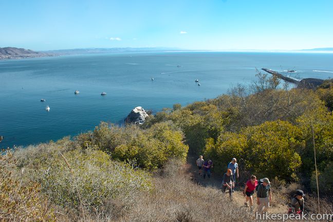
If you’re looking for a hike to a historic site on California’s Central Coast with abundant ocean views, check out the 3.6-mile round trip hike on Pecho Coast Trail to the Point San Luis Lighthouse. The hike near Avila Beach crosses land owned by PG&E that is accessible only with a trail guide on organized treks. On the way to the lighthouse, you’ll enjoy sweeping views over Avila Beach and San Luis Obispo Bay, while learning a bit about the area’s plants, geology, and history. The trail ends at the restored Point San Luis Lighthouse, where you can get a $5 tour that explores the tower and residence at the lighthouse.
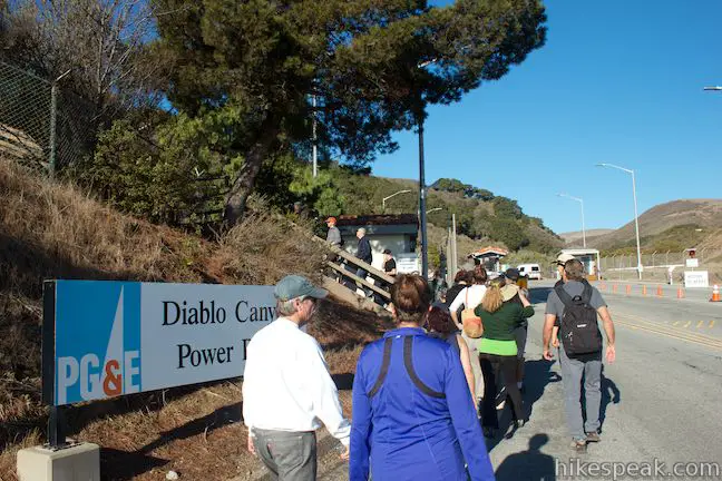
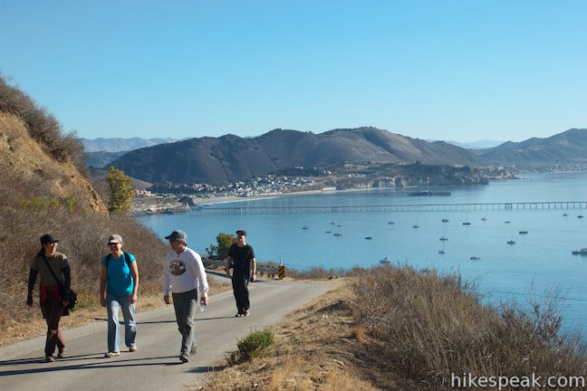
The hike starts from the Fisherman’s Memorial on Avila Beach Drive, just before the parking area by the Harford Pier at road’s end, where you’ll meet the trail docents for one of their scheduled outings on Wednesdays or Saturdays at 9 a.m. Space is limited so reservations are recommended. After signing in, you’ll be led to a trailhead at the start of the access road to the Diablo Canyon Nuclear Power Plant. Here the docents will unlock a gate and welcome you to the Pecho Coast Trail (which is closed to the public outside of these docent-led groups).
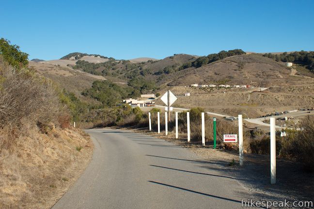
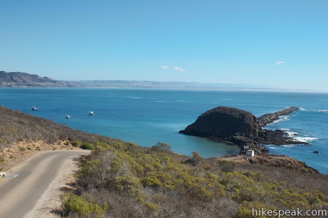
Since this hike is docent-led, you don’t actually need to know the trail directions in advance, but here they are anyway so that you know what you’re in for. After 0.15 miles ascending the dirt trail, you will reach a paved road and turn left. A trolley uses this road to bring non-hiking visitors to the Point San Luis Lighthouse. After half a mile on the paved road, you will come to a sign for Pecho Coast Trail and turn left, descending the coastal bluff. After 0.9 miles hiking over and across the coastal terrace, you will cross Lighthouse Road and hike a final tenth of a mile to the edge of the lighthouse grounds, where there are obvious routes to the lighthouse. In all, it’s about 1.75 miles from start to finish with 300 feet of rolling elevation change.
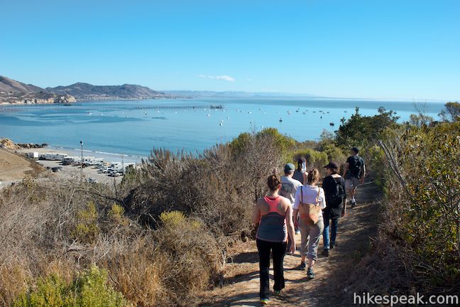
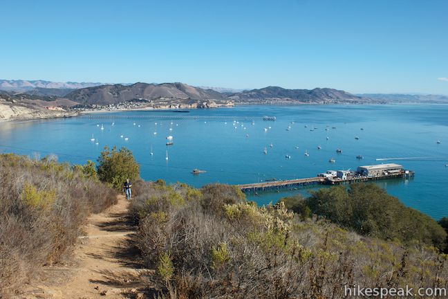
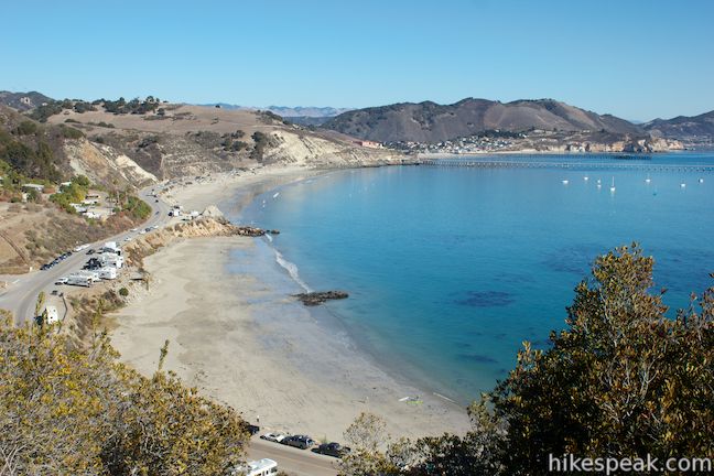
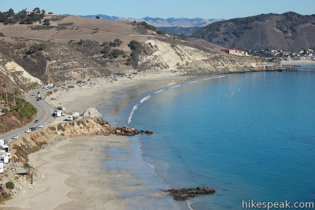
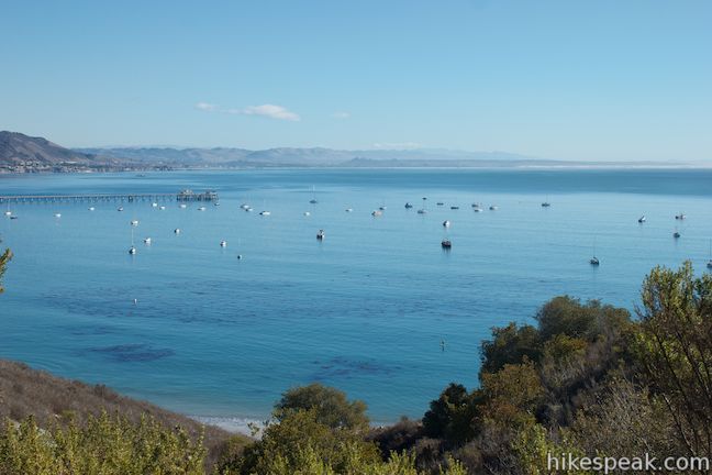
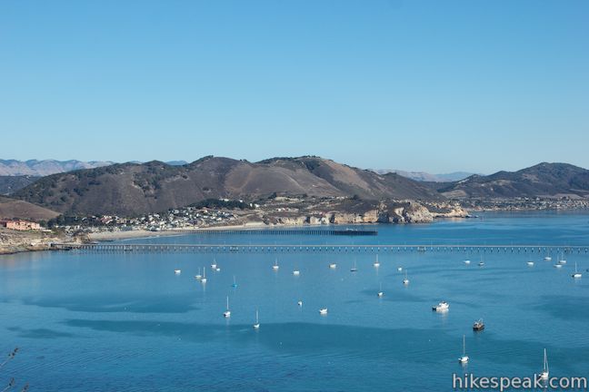
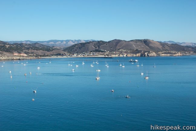
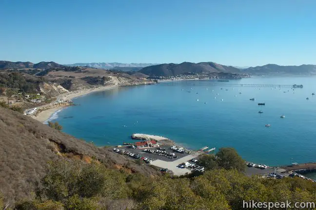
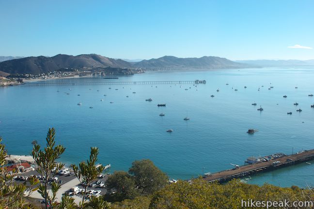
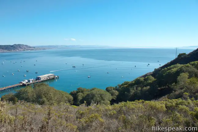
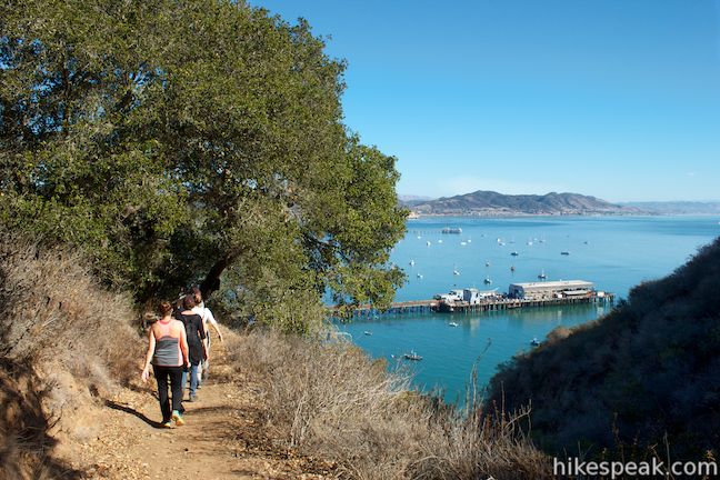
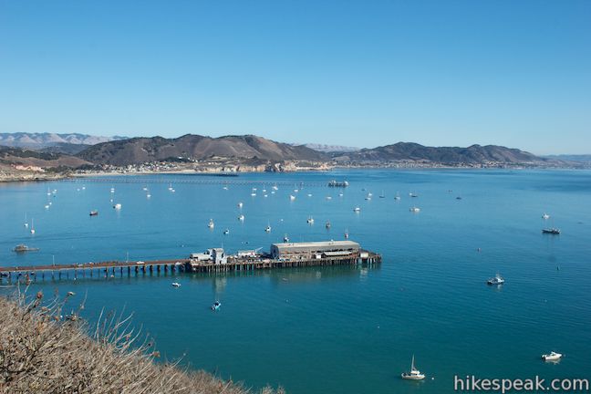
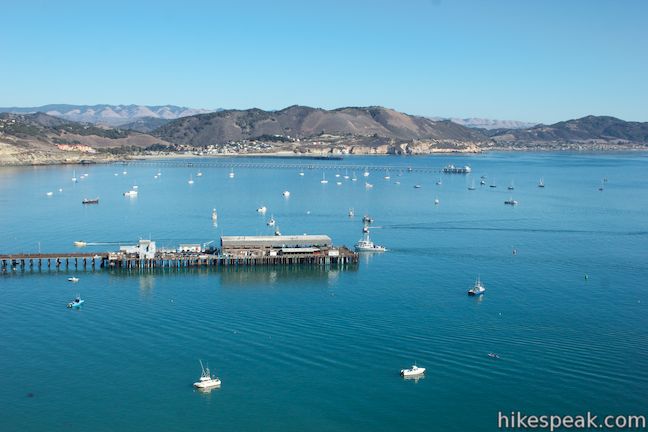
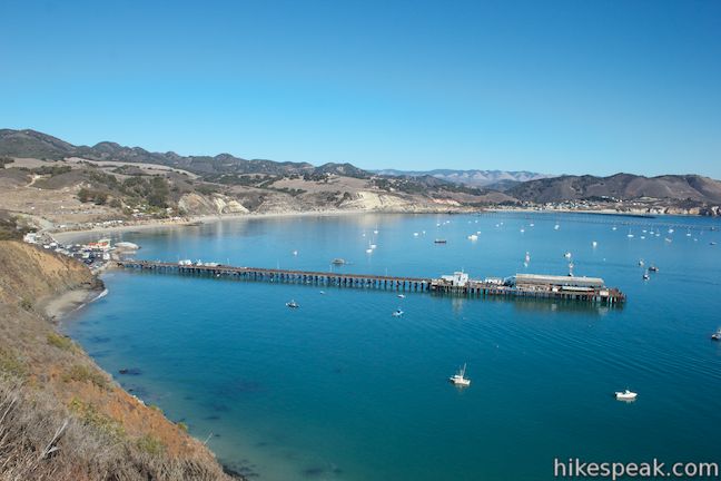
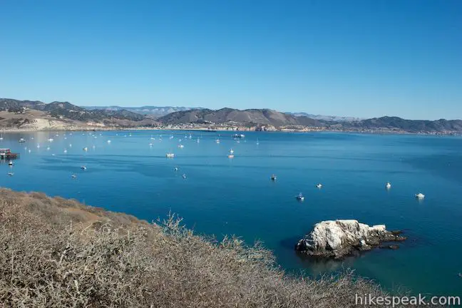
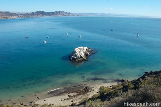
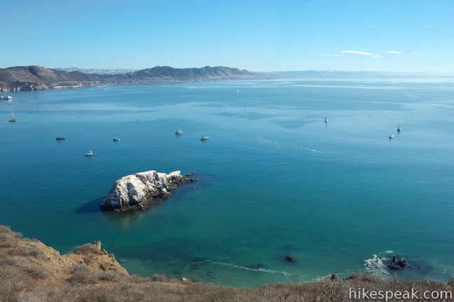
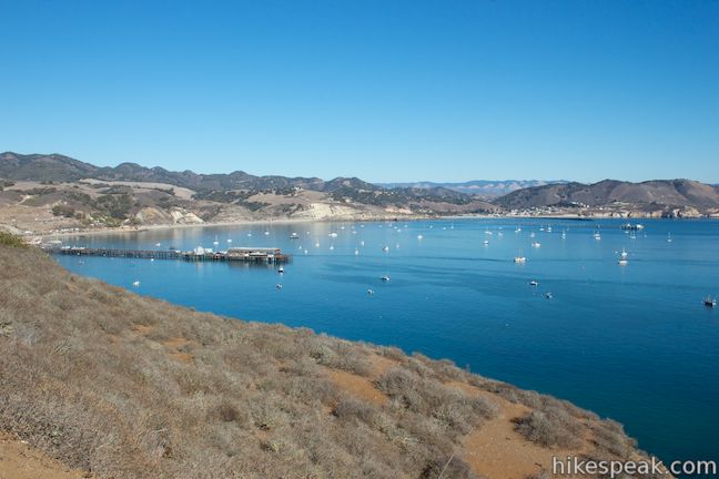
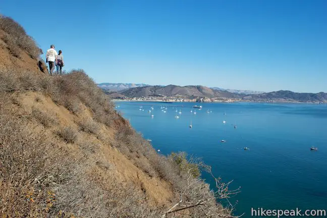
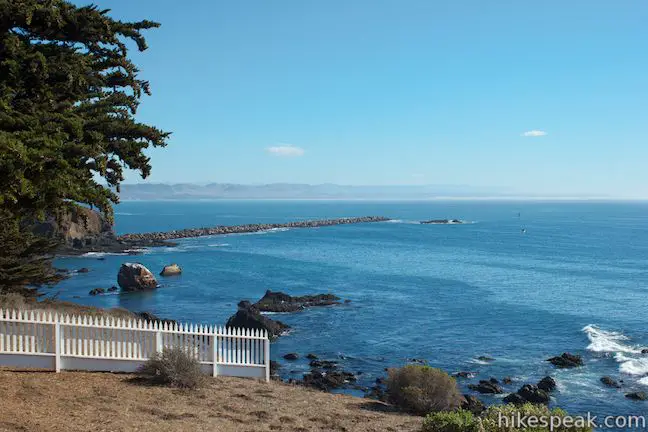
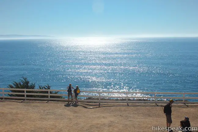
Around every turn, there are excellent views of Avila Beach and across San Luis Obispo Bay. You will have views of the three piers in the bay. The closest is Harford Pier at the Port San Luis, followed by a pier owned by Cal Poly and the Avila Pier. You can look down on the Harford Pier from nay angles as the main section of the trail crosses through chaparral atop dramatic coastal bluffs.
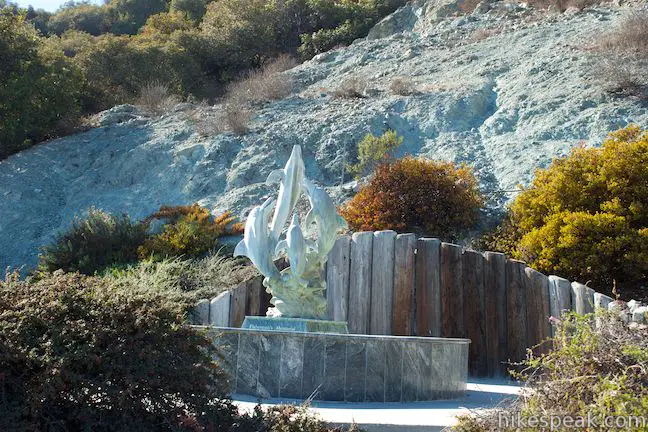
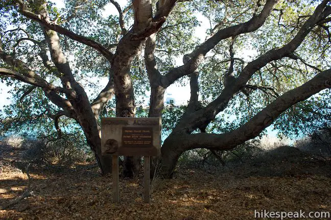
The trail passes through a small oak grove where there is a plaque dedicating the trail to Patsy Stow Stebbins who was instrumental in negotiating the creation of the Pecho Coast Trail through an agreement between the California Coastal Commission and PG&E, giving Californians greater access to this coastline. Unfortunately, Stebbins passed away before the trail was complete.
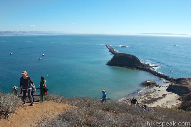
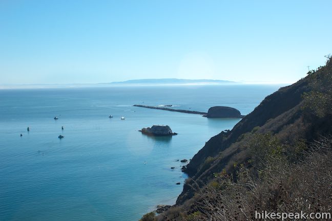
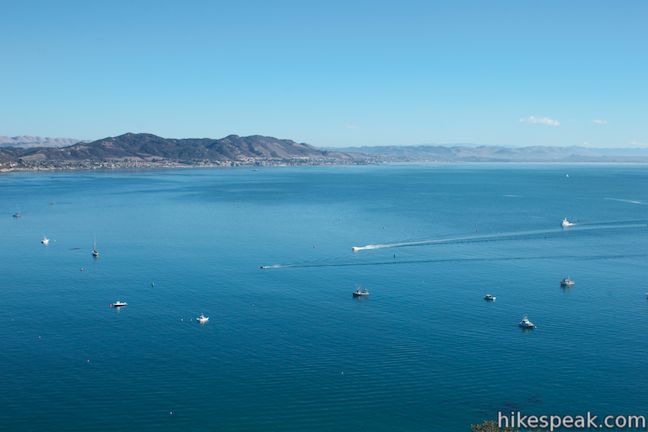
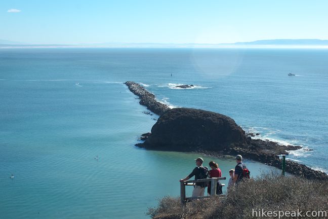
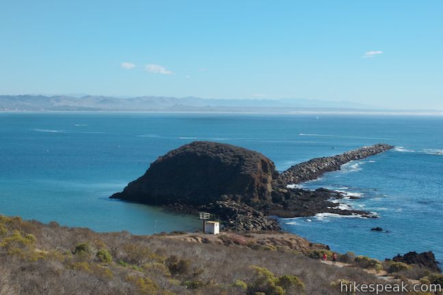
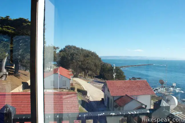
Continuing up the trail, you will find new views over the west end of San Luis Obispo Bay. Look down on Smith Island, a rock just off the coast that somehow housed five families at one time. The trail then approaches Whaler’s Island and the breakwater that calms the waters in San Luis Obispo Bay. Your docent will likely explain that the line of boulders forming the breakwater were taken from Morro Rock, first transported by train and then by boat from that famous rock in Morro Bay.
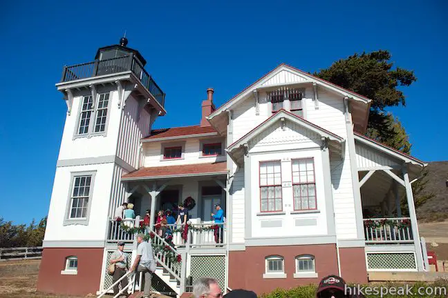
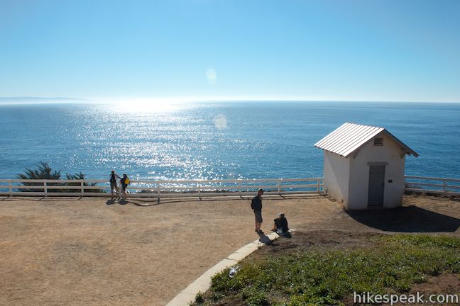
There is a bathroom and drinking fountain at trail’s end, where your docents will hand you off to new guides at the Point San Luis Obispo Lighthouse. You can explore the grounds for free, but you will need to pay $5 to see inside the old lighthouse and residence, a contribution that goes toward the preservation and restoration of the lighthouse.
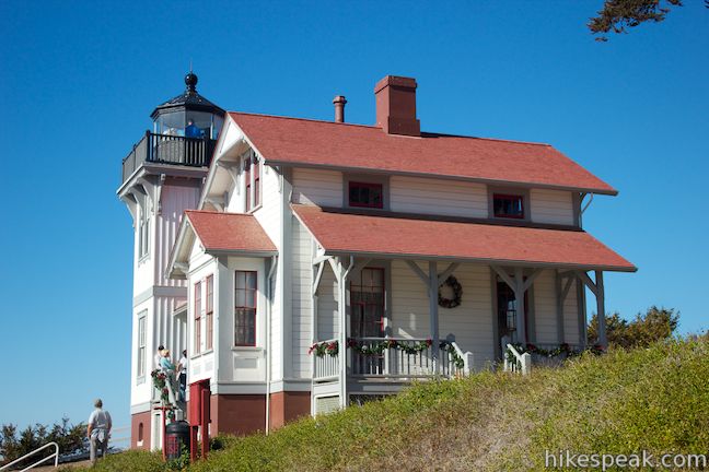
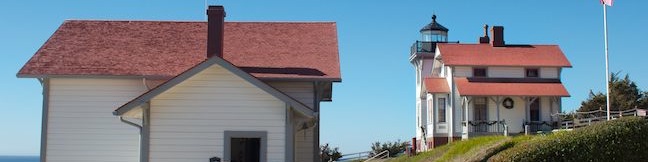
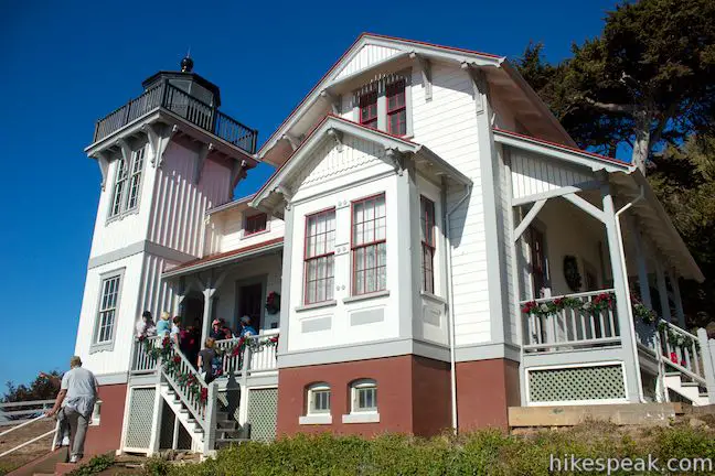
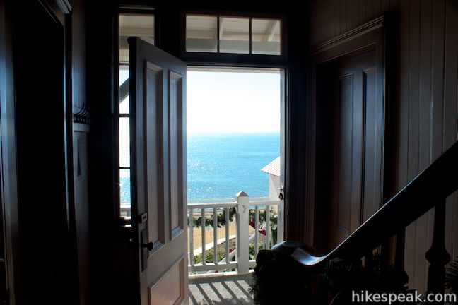
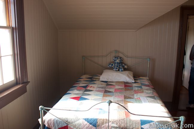
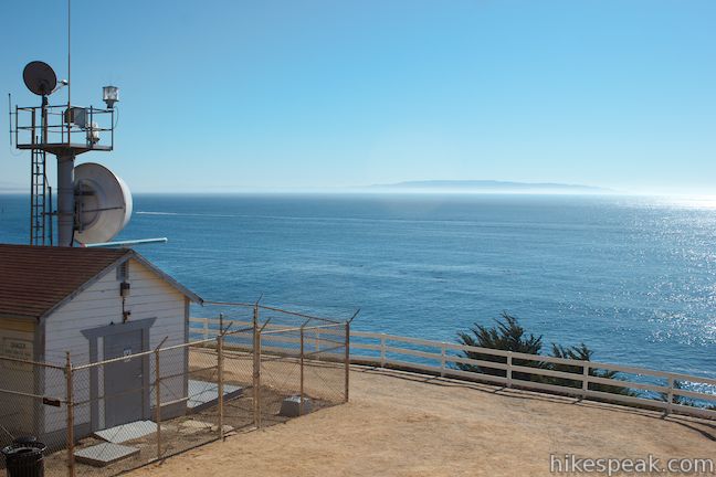
Point San Luis Obispo Lighthouse is a two-story Victorian home built with impressive redwood planks. The interior has been restored to how it may have looked when the lighthouse was built in 1890 and during other periods before it was decommissioned in 1974. The coastguard now uses a plastic beacon as a light for ships, which is as effect but far less impressive than the fourth-order Fresnel lens that is now on display in the fog signal building, which houses the old horn that would sound when the light could not reach the ships. The lens is about two and a half feet tall, standing on a turret that rotated when it was operational. If you’re a fan of lighthouse lenses, or just interested in cool pieces of glass, the Fresnel lens will definitely dazzle.

Construction of the Point San Luis Lighthouse began in 1889 after a ship called the Queen of the Pacific sank just 500 feet from the Harford Pier (luckily everyone survived and the ship was surfaced). Plans to build the lighthouse that had been halted due to high costs got fast-tracked after the ship sank and the lighthouse was operational by June of 1890, sending beams of light 17 nautical miles across the Pacific Ocean.
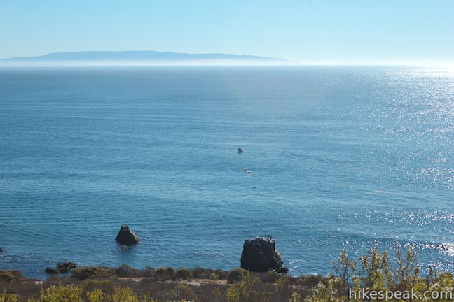
From Point San Luis, you can look up the coast toward Montaña de Oro State Park and southeast down the coast toward Point Sal and the sand dunes in Oceano and Nipomo. The lighthouse was well placed to protect passing ships and presents today’s visitors with panoramic views.
After completing your tour, meet back up the docents and begin the hike back along the Pecho Coast Trail. As you make your way back up the trail, you’ll have even more views of Avila Beach, backed by Ontario Ridge, and the coastal cities of Pismo Beach, Grover Beach, and Oceano, farther south across San Luis Obispo Bay.

Space is limited on the docent-led hikes, so make a reservation on the PG&E webpage for Pecho Coast Trail. The tours departing on Wednesdays at 9 a.m. have room for 20 hikers and the tours leaving on Saturdays at 9 a.m. have room for 40 hikers. You will finish with the hike by 1 p.m. The PG&E webpage for the Pecho Coast Trail explains that:
Reservations are strongly encouraged to avoid being turned away at the trailhead. Reservations need to be made two weeks in advance of the hike. For information regarding the 8 mile round trip hike to rattlesnake canyon and for information regarding special group hikes, please call 541-TREK.
Pets are not allowed and hikers must be at least 9 years old to hike Pecho Coast Trail. There is some loose and uneven terrain along the Pecho Coast Trail so wearing sturdy footwear like hiking boots is recommended.
If there are enough hikers, multiple groups will set out for the lighthouse. Each docent may cover different topics along the hike. If you have a greater interest in the area’s plants or its history, check to see what each docent will be focusing on and you may be able to pick a group that best matches your interests.
A $5 fee is required to enter the lighthouse, but children under 12 are free. If you want to visit the lighthouse without hiking, you can get there via a trolley ride that costs $20 per person and leaves from Avila Beach on Wednesdays at 12 p.m. and Saturdays at 12 p.m., 1 p.m., and 2 p.m. There is no cost for the docent-led hike on Pecho Coast Trail, so pick a date, make a reservation and enjoy!
To get to the trailhead: Take Highway 101 to exit 195 for Avila Beach Drive. Follow the road through Avila Beach to the parking area at Port San Luis Harbor. Park there for free and walk back along Avila Beach Drive toward the road into the Diablo Canyon Power Plant. Before reaching Diablo Canyon Road, you will find the spot where the gathering point for the group next to the Fisherman’s Memorial where there is a statue with several dolphins.
Trailhead address: Avila Beach Drive, San Luis Obispo, CA 93405
Trailhead coordinates: 35.174146, -120.756013 (35° 10′ 26.92″N 120° 45′ 21.64″W)
You may also view a regional map of surrounding Central Coast trails and campgrounds.


 | Point Buchon Trail This 1 1/3 to 6.8-mile hike explores the beautiful coastline south of Montaña de Oro State Park. |
 | Sycamore Crest Trail This 1.75-mile hike departs from Sycamore Mineral Springs Resort and ascends the north slope of Ontario Hill, arriving at a scenic ocean perch. Extend the hike down the ridge and create a 3.25-mile one-way hike. |
 | Shell Beach Bluff Trail - Ontario Ridge Trail Loop This 2.8-mile loop explores the coast between Shell Beach and Avila Beach, on and below a 700-foot ridge. |
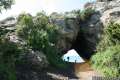 | Cave Landing This half-mile round trip hike descends 100 feet to a natural rock bridge at the end of a headland east of Avila Beach. |
 | Bob Jones Bike Trail This easy 5-mile round trip hike or ride follows San Luis Obispo Creek to Avila Beach. |
 | Oso Flaco Lake Trail This hike of 2 miles or more takes a boardwalk over a coastal lake and across sand dunes to an out-of-the-way beach. |
 | More hikes in San Luis Obispo Explore other trails around San Luis Obispo including Morro Bay State Park, Montaña de Oro State Park, and the Morros. |
Pecho Coast Trail Reservations on pge.com
The official website for the Point San Luis Lighthouse
A SFGate article on Point San Luis Lighthouse
Point San Luis Lighthouse on lighthousefriends.com
Point San Luis Lighthouse on lighthousesofcalifornia.blogspot.com
Pecho Coast Trail in California's Coastal Parks: A Day Hiker's Guide by John McKinney
Pecho Coast Trail on zimfamilycockers.com
This is awesome, I have always wanted to go out to the light house but havent yet. There is a great place to view sea lions on the pier below as well!
Do you have space available on Wednesday, Sept. 21,2016
Make a reservation with PG&E Pecho Coast Trail Reservations
Here is my take on this incredible hike/tour Read my blog with information and photos at https://adulthoodinslo.wordpress.com/2018/06/26/pecho-coast-trail-hike-and-san-luis-lighthouse-tour/
Would this hike be suitable as a summer field trip for approximately 40-50 students with 5 chaperones? If so, is there a contact number to ask additional questions?
How long is the hike to the lighthouse