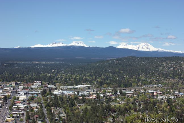
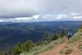
Pilot Butte is the biggest landmark in the city of Bend. This extinct cinder volcano is visible from almost everywhere in the city and its summit surpasses expectations with knock-out views of over Bend toward high desert landscapes and snowcapped Cascade Mountains. An extraordinary collection of mountains that includes Mount Hood, Mount Jefferson, Three Fingered Jack, the Three Sisters and Mount Bachelor are visible on clear days. A 0.9-mile long trail spirals up Pilot Butte, ascending 475 feet from the base to the top. Pilot Butte’s views of Bend and beyond make this 1.8-mile hike a Central Oregon must.
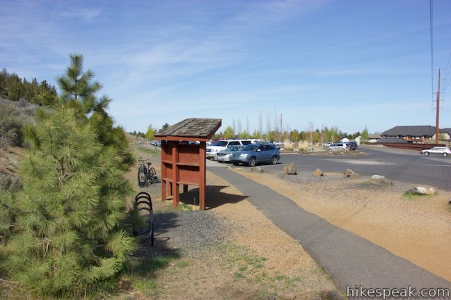
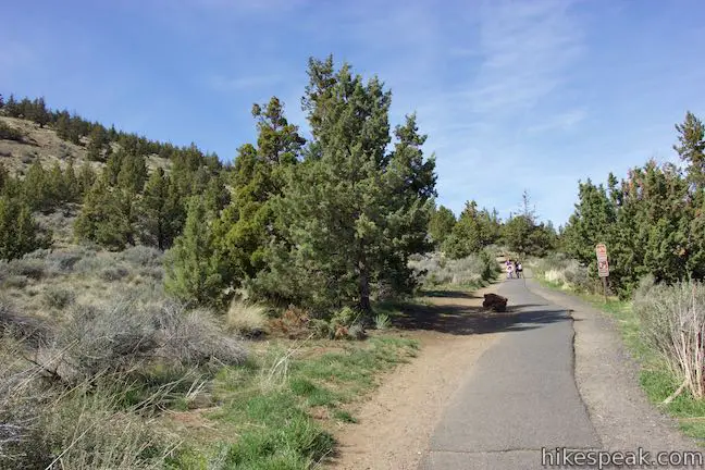
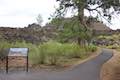
Set out from Pilot Butte Neighborhood Park on the east side of the mountain. Find the trailhead at the south end of a large parking area where a kiosk offers maps of the trail as well as this greeting:
Welcome to the ‘Stair Stepper of Bend.’ The trails on Pilot Butte provide an excellent way of getting exercise while enjoying some of the best views of Central Oregon.
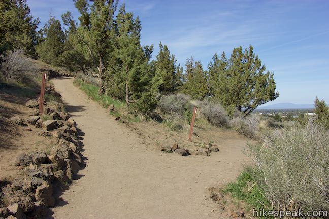
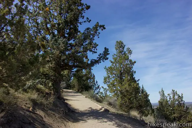
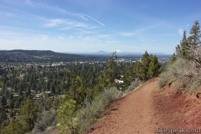
Pilot Butte Nature Trail is paved at the start, but this does not last. Walk through a fitness area and bear right up a curve through a junction with the base trail around Pilot Butte.
Keep going up to a second junction, 0.08 miles from the start. Bear right to continue heading north and leave the pavement for a dirt single track. After two hundred feet, bear left past a path dropping to the right (this is the other end of Base Trail) and stay on the established trail up the mountain. After this early barrage of junctions, you won’t have any more on the hike to the top.
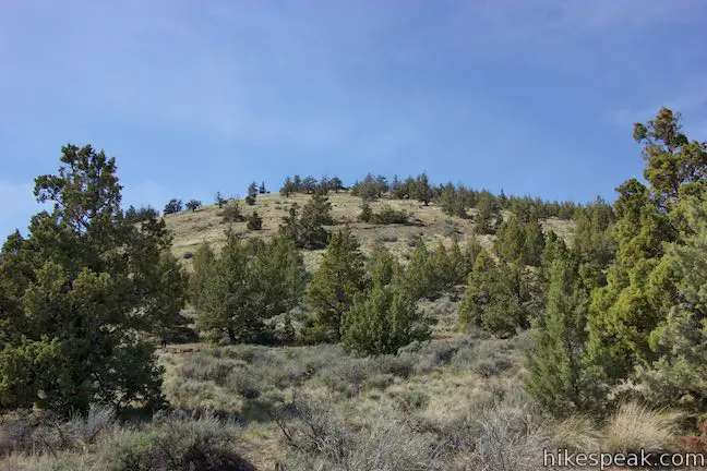
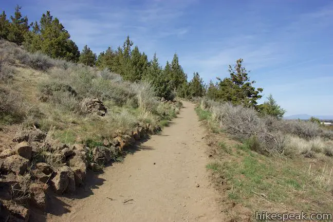
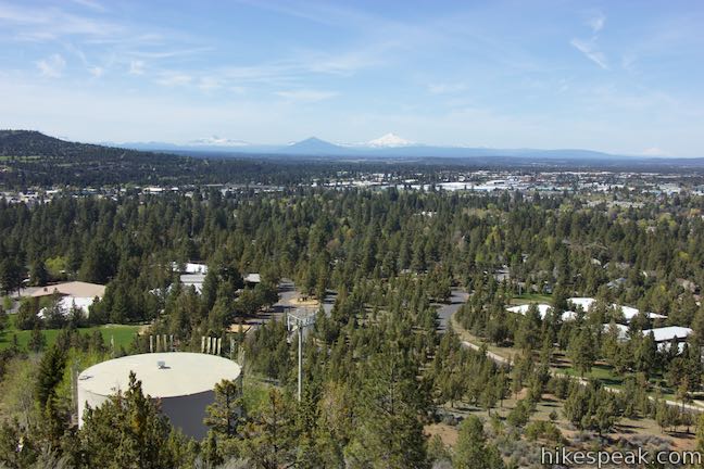
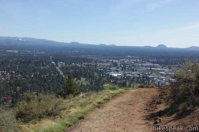
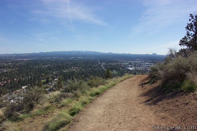
The hike makes a counter-clockwise spiral to ascend Pilot Butte. Curving around the mountain like this expands the views as you go. Eastward views lead to northward views that give way to perspectives west and south. Benches are placed along the trail at regular intervals (about every tenth mile), so there are lots of scenic spots to stop. Pilot Butte was created by an eruption of molten rock approximately 190,000 years ago that lasted somewhere between a few months to a couple years. Molten rock foamed violently with escaping steam and sprayed glowing cinder high in the air. Imagine the butte’s surge into existence as you continue up the trail.
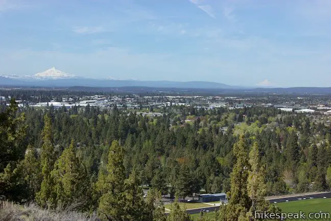
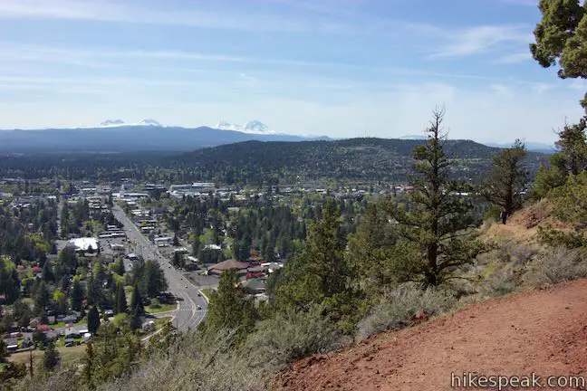
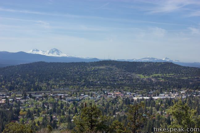
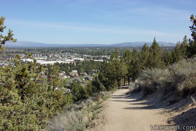
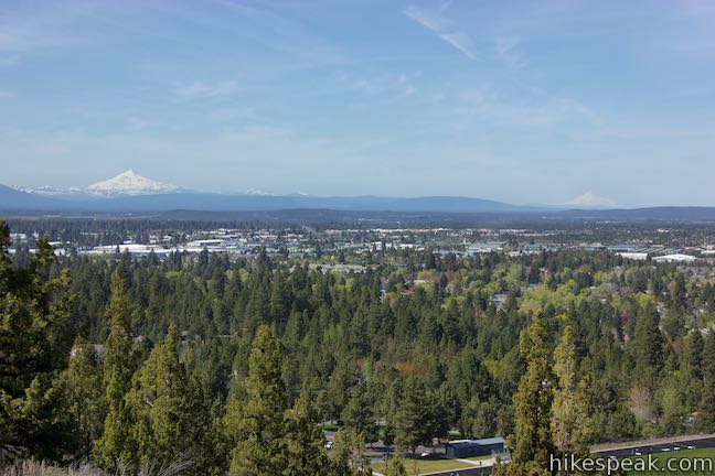
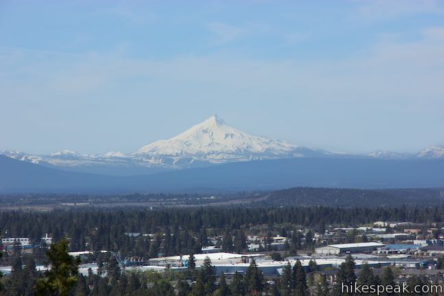
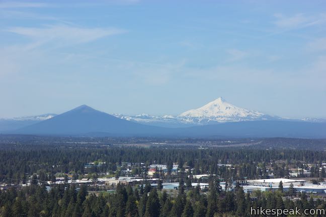
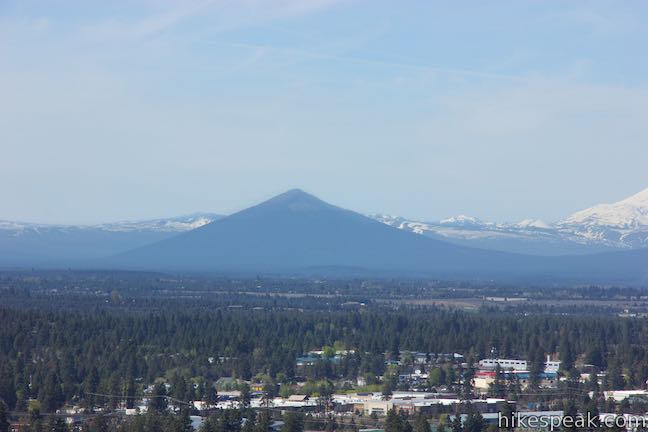
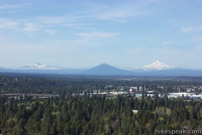
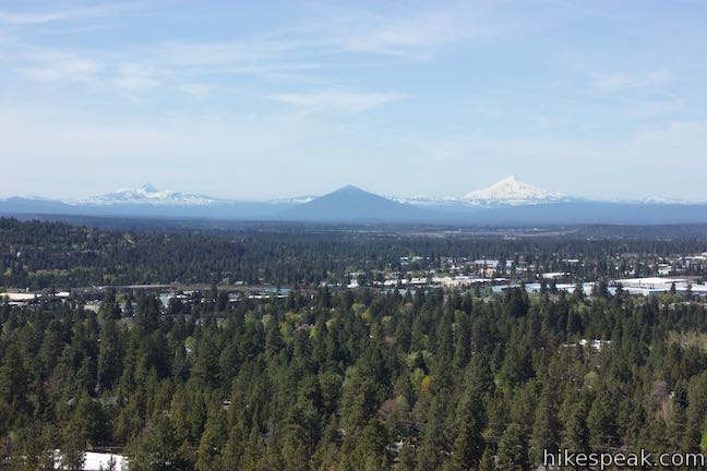
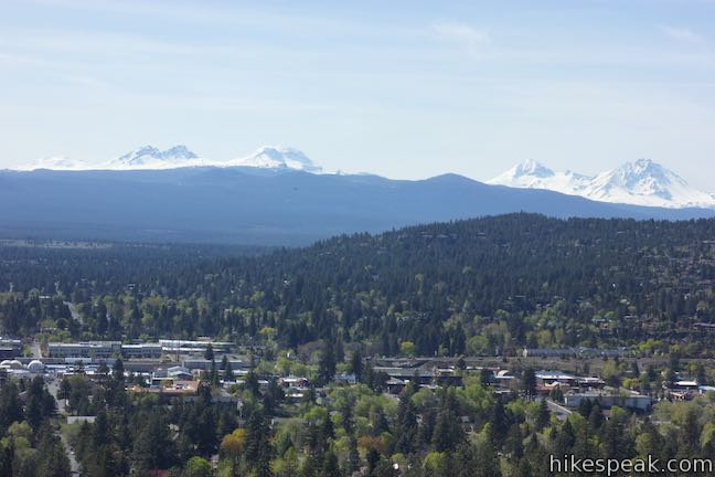
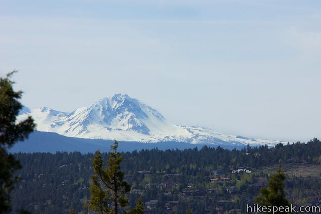
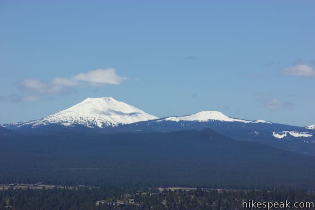
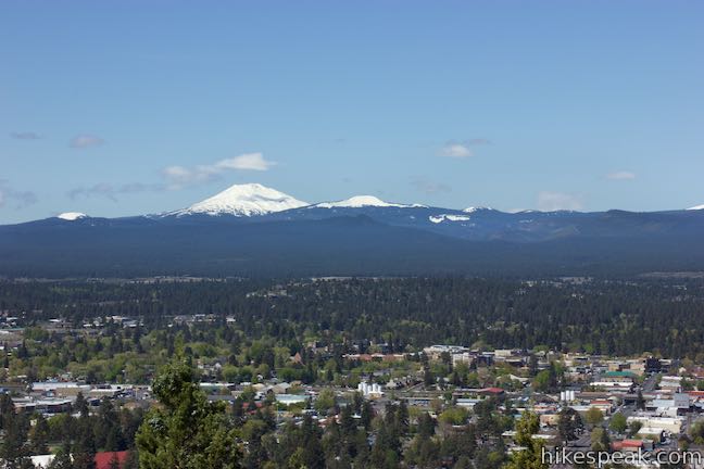
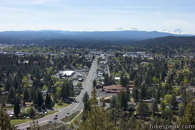
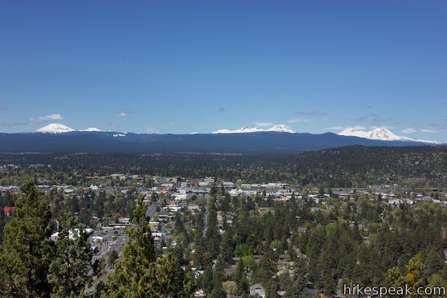
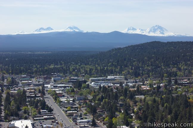
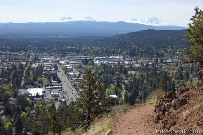
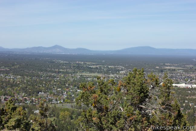
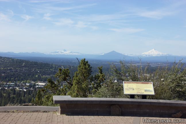
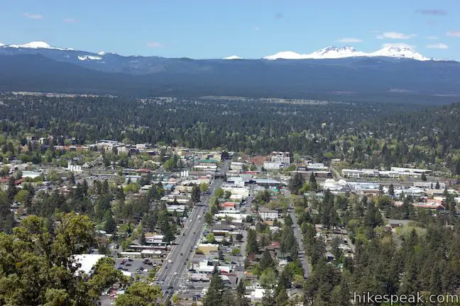
After a third of a mile of hiking, you’ll round the butte and discover north-facing views toward Mount Hood and Smith Rock. Mount Hood is 93 miles away and is Oregon’s tallest peak at 11,250 feet. Oregon’s second tallest point comes into view next. The snowcapped mass of Mount Jefferson rises behind Black Butte, a distinctly colored cinder cone that’s a pyramid of dark earth. Black Butte is just over 29 miles away and Mount Jefferson is less than 50 miles from Pilot Butte.
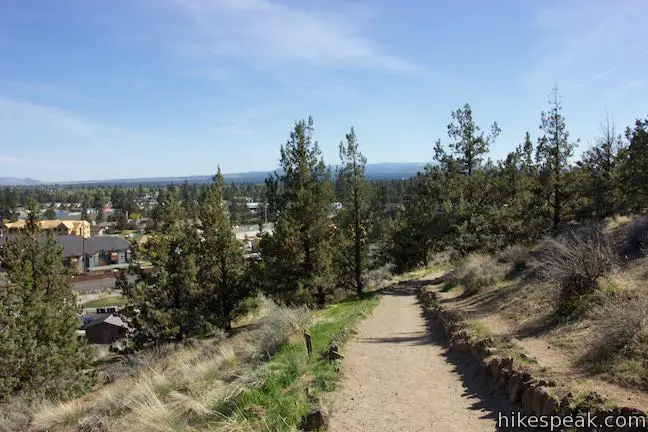
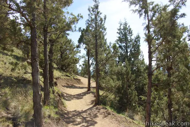
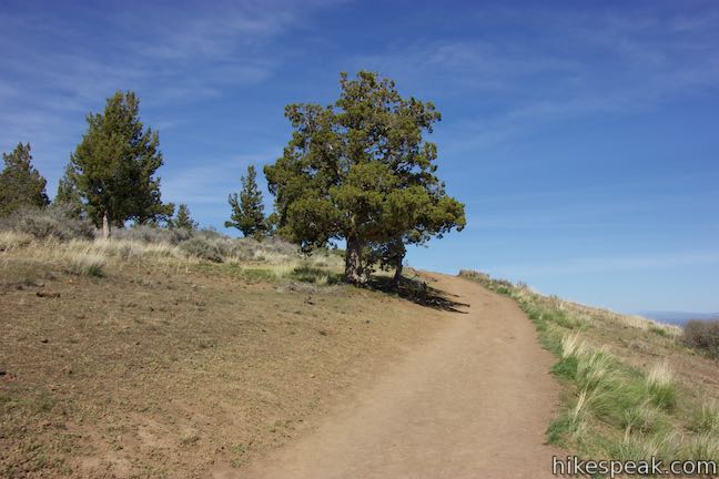
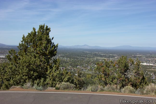
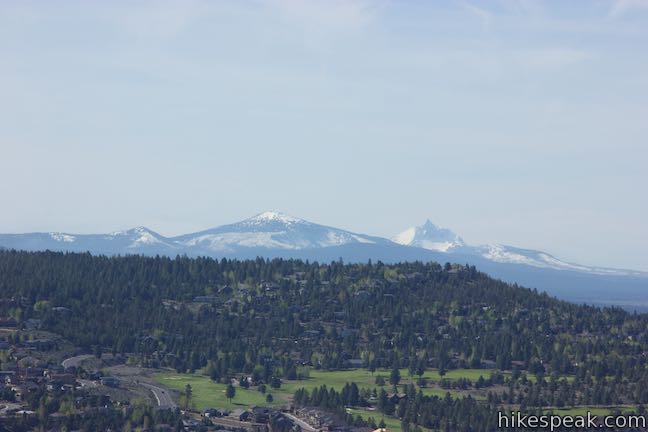
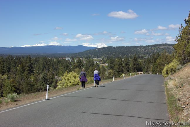
The dirt trail maintains a moderate ascent through grasses, juniper trees and other high desert vegetation. Come around to the west side of Pilot Butte for views over more awesome mountains like Three Fingered Jack (just to the left of Black Butte) and the Three Sisters, a trio of daunting volcanic peaks about 25 miles away.
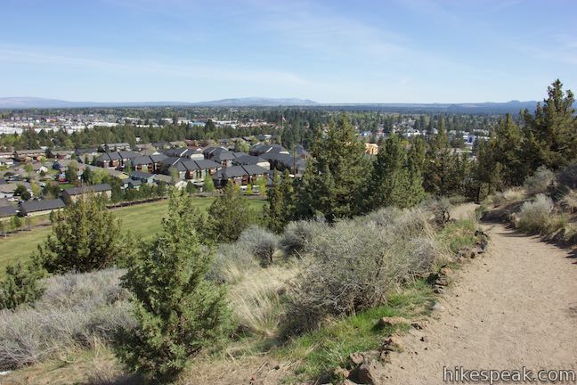
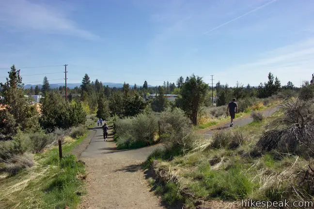
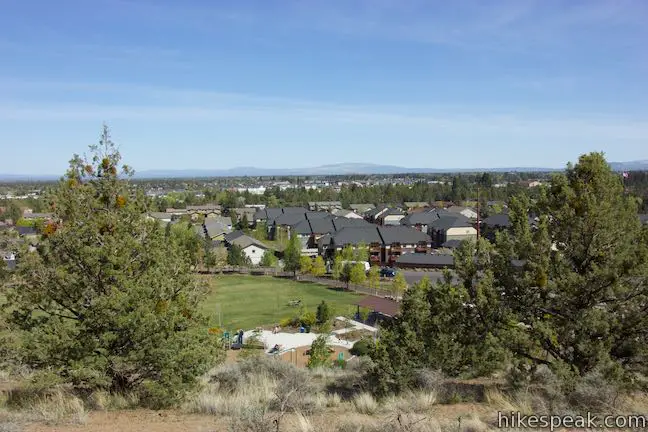
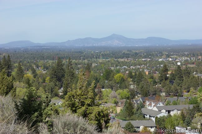
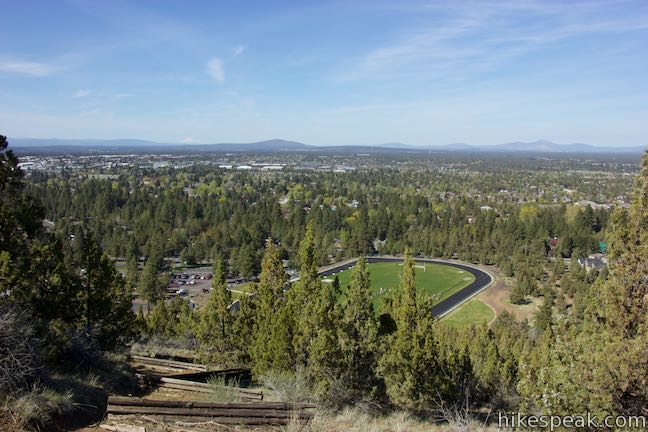
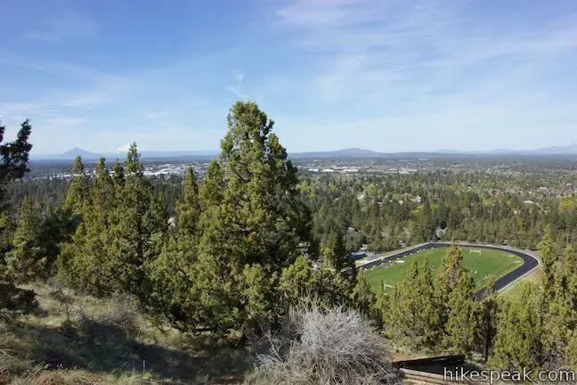
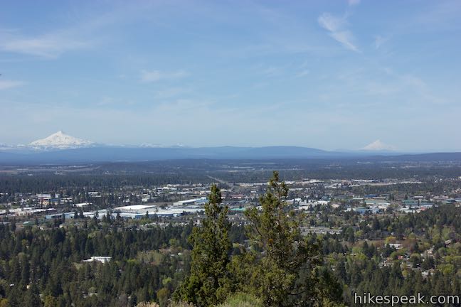
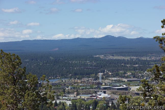
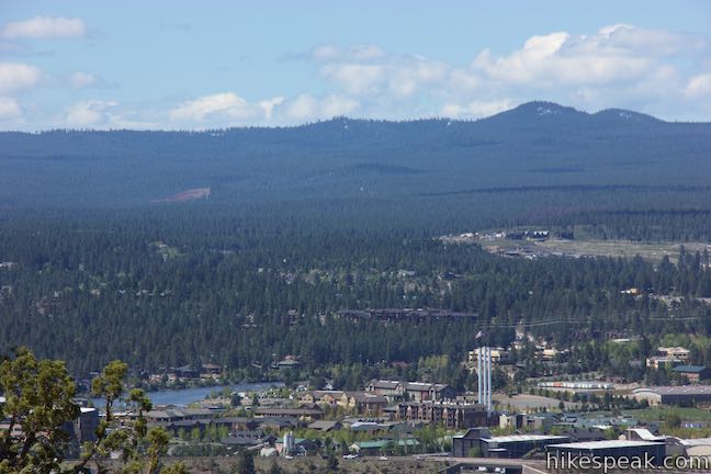
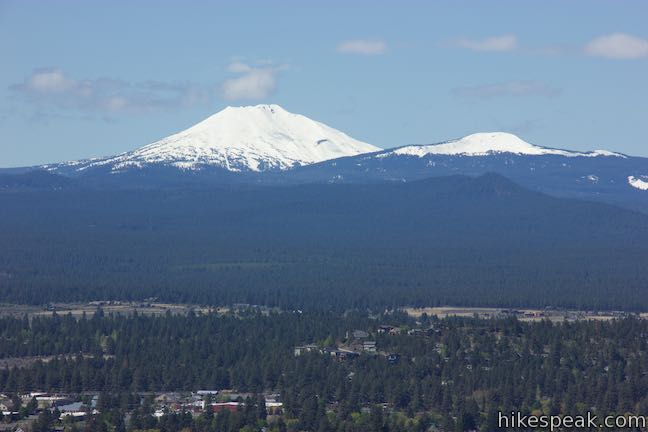
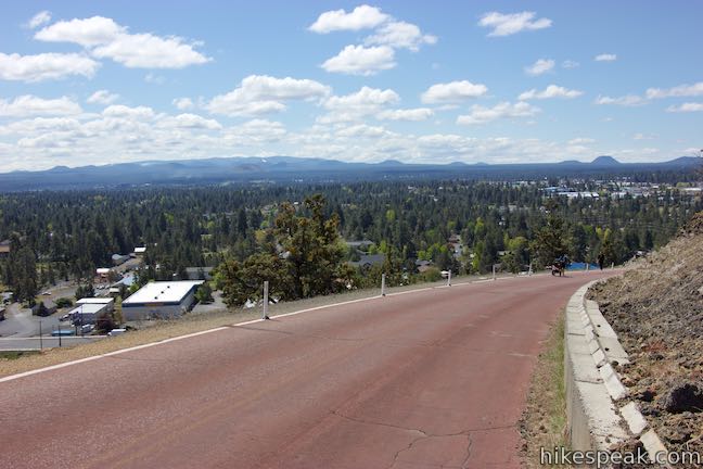
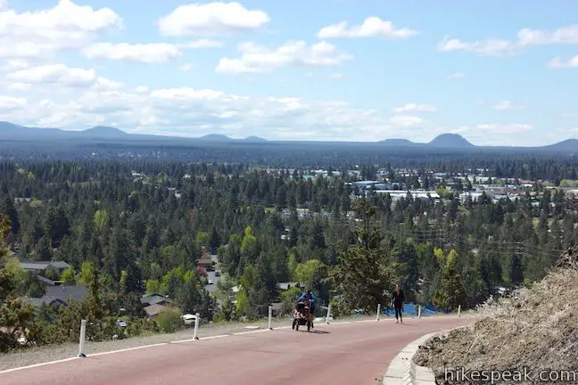
The city of Bend spreads out below the butte. Downtown and the Old Mill District should be easy to identify, cloaking the Deschutes River. Beyond the city to the southwest rises Mount Bachelor, the area’s premier skiing destination.
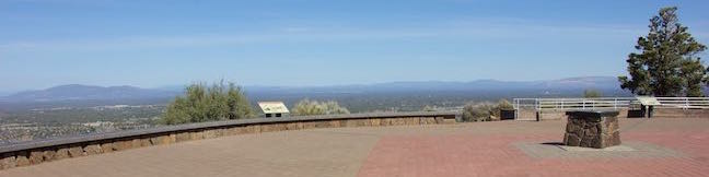
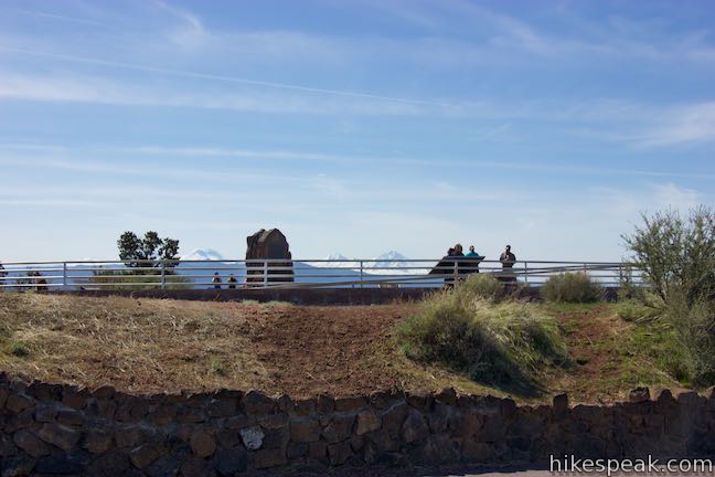
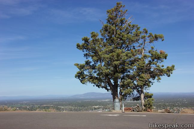
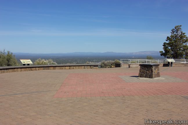
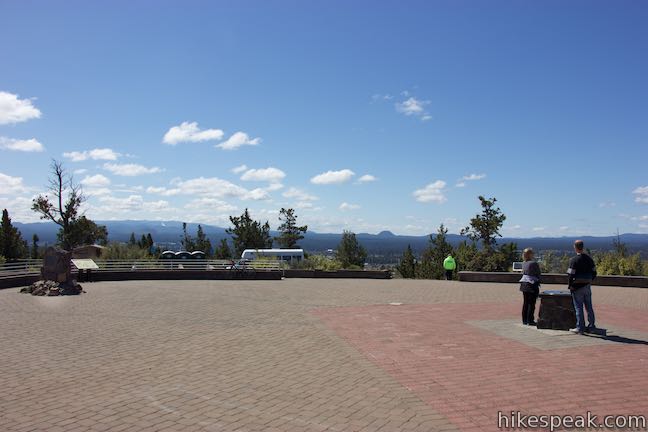
Nearing the top, the trail crosses the butte’s south face and turns left to ascend to the summit. At the end of the trail, cross a paved road that goes up to the summit, beginning from the western base and spiraling up Pilot Butte in a way that doesn’t overlap the trail. Cross the road and step up to the scenic viewpoint at the summit.
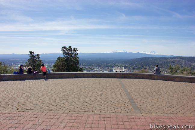
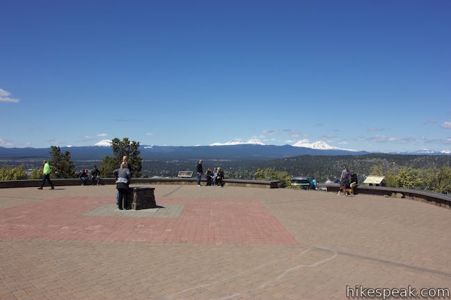
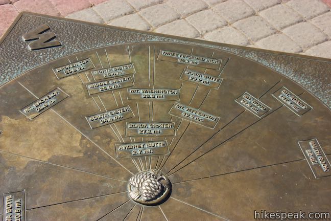
Round-the-compass views are accompanied by information panels that describe the landscapes in each direction. The Blue Mountains are to the northeast, barely in view but stretching 250 mountains to the northeast corner of the state near Idaho. Sage-covered plains in Oregon’s High Desert Province extend to the southeast, broken up by cinder buttes. The greatest views are to the west of the Cascade Range. These grand ice-carved towering volcanoes are Oregon’s high peaks. A panel at the summit offers this description:
The majestic Cascade Range is home to magnificent volcanic peaks, thousands of smaller volcanoes, hundreds of lakes, and remnants of Ice Age glaciers. Every hill or mountain you see is a volcano. All are members of the global Ring of Fire that surrounds the Pacific Ocean. Volcanoes built up the Oregon Cascades and glaciers eroded them. Many of the lofty peaks along the Cascade Crest, such as Mt. Jefferson, Three Fingered Jack, and Broken Top were deeply gouged out by long vanished glaciers.
These mountains began with volcanic eruptions 40 million years ago and grew into a massive mountain chain. More recently, about 18,000 years ago, the Cascade Mountains in Central Oregon were covered in hundreds of feet of ice. During the last ice age, glaciers gouged the Cascades, leaving behind profound canyons and ridges.
Look out from the summit on a clear day and it will be obvious why Pilot Butte is a such popular hiking destination. After taking in the sights, hike down the way you came for a 1.8-mile out and back trek. Pilot Butte State Park asks that hikers stay on trail and avoid damaging the butte’s fragile soils:
There are several species of grasses, wildflowers, and shrubs that make Pilot Butte their home. In addition to providing food and shelter for wildlife, they are also very important for controlling erosion on the slopes of the butte. The soils on Pilot Butte act like a very thin blanket covering the loose cinders and pumice underneath. The grasses and other vegetation are the only things holding the soil in place and preventing it from eroding down the hill. Walking off the trail tears into this thin blanket, exposing the loose pumice soil underneath. Once disturbed, it can take hundreds of years for the soil and plants to reestablish.
Dogs are allowed on Pilot Butte Nature Trail, but bikes are not (bikes can go up the paved road instead). Bathrooms are located at the trailhead and the summit. Parking at the trailhead is free and no permit is needed for this hike in Pilot Butte State Park, so get out and enjoy!
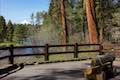
To get to the trailhead: Take Route 97 to Bend to exit 137 for NE Revere Avenue. At the end of the off ramp, drive east for several block to 8th Street. Turn right, head south for half a mile, and turn left on Greenwood Avenue (Highway 20). Turn left and drive past the south side of Pilot Butte. After 1 mile, turn left on NE Azure Drive. Go one block and turn left on Savannah Drive. At the next block, turn left on Linnea Drive. Take this for two blocks up to the large parking area in Pilot Butte Neighborhood Park, which borders Pilot Butte State Park. The trail starts from the southwest end of the lot, to the right of Larkspur Trail.
Trailhead address: NE Linnea Drive & Larkspur Trail, Bend, OR 97701
Trailhead coordinates: 44.0579, -121.2785 (44° 03′ 28.43″N 121° 16′ 42.59″W)
You may also view a regional map of surrounding Oregon trails and campgrounds.


Pilot Butte Road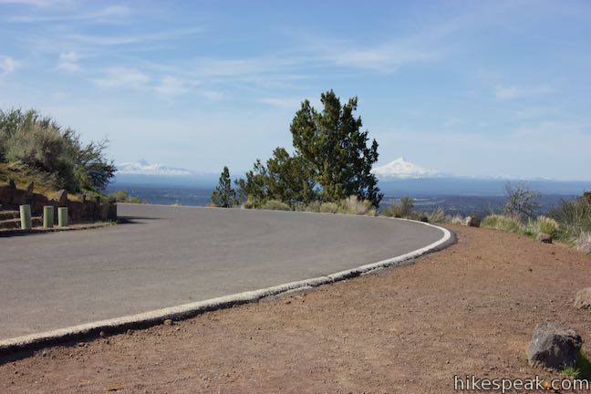


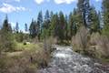 | Shevlin Loop Trail This 4.75-mile tour of Shevlin Park just a few miles east of Bend explores pine forests on both sides of Tumalo Creek. |
 | Archie Briggs Canyon Trail This 1.25-mile hike descends a ravine to clifftop views over a dramatic canyon on the Deschutes River. |
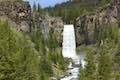 | Tumalo Falls See Bend's best waterfall on a short walk to a downstream viewpoint or a half-mile round trip hike to an overlook by the top of the falls. |
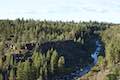
 | Tumalo Falls Loop This 7.4-mile circuit ventures above Tumalo Falls and explores numerous other waterfalls and cascades on Tumalo Creek, combining North Fork Trail, Swampy Lakes Trail, and Bridge Creek Trail. |
 | Black Butte The 4-mile hike summits one of the most identifiable peaks in Central Oregon, which has fire lookout towers and panoramic views of the Cascade Mountains. |
 | Head of the Metolius This 0.5-mile hike visits the surprising source of the Metolius River, a gushing spring accompanied by views of Mount Jefferson. |
 | West Metolius River Trail The 5.4-mile hike follows the west bank of the Metolius River to incredible gushing springs and a fish hatchery. |
 | Lava Butte This hike explores a cinder cone with a fire lookout tower and a crater-circling trail that offer panoramic views over Lava Butte Lava Flow and the Cascade Mountains. |
 | Trail of the Molten Land This 1.1-mile long paved partial loop cuts through Lava Butte Lave Flow and is packed with information and views. |
 | Trail of the Whispering Pines This interpretive botanical trail explores high desert plants on the edge of Lava Butte Lava Flow on a quarter-mile long path. |
 | Lava River Cave This underground hike explores a lava tube south of Bend that is filled with fascinating volcanic features. |
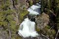
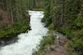 | Deschutes River Trail to Benham Falls This 1.9-mile hike follows a leisurely trail along the Deschutes River to aggressive cascades called Benham Falls where the river churns and tumbles through a gap between cliffs. |
 | More trails in Oregon Explore other hikes in Central Oregon, the Columbia River Gorge, and elsewhere. |
What do the numbered post mean going up the nature trail?
My main complaint is: Why are cars allowed on Pilot Butte? It is EXTREMELY unsafe when we (pedestrians) have to constantly dodge oncoming vehicles who are driving too fast and pushing us to the side of the road. It should be for pedestrians only as the nature walk as advertised. I feel unsafe walking on that road with oncoming vehicles. It should be as it was prior to April 2021 when vehicles weren’t allowed on that drive. It should be permanent year round.