Maple Ridge Loop
in Silver Falls State Park
Maple Ridge Loop travels behind two breathtaking waterfalls and goes through miles of wonderful forest in Silver Falls State Park. This 2.8-mile loop (with 375 feet of elevation change) is a combination of two trails, Canyon Trail and Maple Ridge Trail. Canyon Trail goes down the trough carved by South Fork Silver Creek, taking hikers amazingly close to South Falls and Lower South Falls. Maple Ridge Trail travels beside the canyon on its wooded rim. Silver Falls State Park has waterfall hikes of several lengths. When the Trail of Ten Falls Loop (7.9 miles) seems too long, but the South Falls Loop (1.1 miles) isn’t quite enough, Maple Ridge Loop makes an excellent middle option.
Note: The park guide proposes hiking Maple Ridge Loop in a clockwise direction, hiking down Canyon Trail and returning to the South Falls Day Use Area via Maple Ridge Trail. The loop can certainly be hiked this way (and going to the waterfalls first can be hard to resist). However, the instructions provided here take the loop in the opposite direction, following Maple Ridge Trail down into the canyon and then hiking up Canyon Trail to Lower South Falls and the even more impressive South Falls. Two reasons for this sequence are:
- Positioning the waterfalls to be seen head-on as you hike up Canyon Trail (requiring fewer over-the-shoulder glances toward the waterfalls).
- Placing the big switchbacks at the bottom of Maple Ridge Trail as a downhill experience instead of a climb.
The basic directions for Maple Ridge Loop are:
- Leave South Falls Trailhead (0 miles)
- Hike past South Falls Lodge to the Stone Circle Junction and turn left on Canyon Trail – alternatively continue straight through the South Falls Historical District (0.15 miles)
- Come to a junction with Maple Ridge Trail and turn right on Maple Ridge Trail, leaving Canyon Trail (0.2 miles)
- Pass the trail through South Falls Historical District, joining Maple Ridge Trail on the right (0.33 miles)
- Stay to the left as Maple Ridge Trail passes a fire road and turns downhill (0.75 miles)
- Pass the first of three bench-bearing switchbacks on the descent to Canyon Trail (0.95 miles)
- Turn left on Canyon Trail at the bottom of Maple Ridge Trail (1.3 miles)
- Follow Canyon Trail behind Lower South Falls and continue up stairs in the trail (1.55 miles)
- Stay right a junction beside the bridge below South Falls to hike up behind the falls or turn left to hike in front of the waterfall (2.2 miles)
- Continue up Canyon Trail when the trails reunite on the other side of South Falls (2.35 miles)
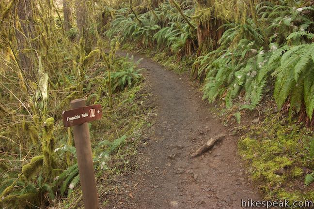
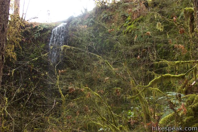
- Check out the spur on the left to Frenchie Falls and then continue up Canyon Trail (2.4 miles)
- Explore the trail on the right out to the viewpoint at the top of South Falls (2.55 miles)
- Stay to the right through the junction with Maple Ridge Trail where the loop began (2.6 miles)
- Turn right at the Stone Circle Junction (2.65 miles)
- Return to the parking lot for South Falls Day Use Area (2.8 miles)
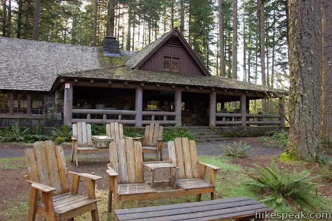
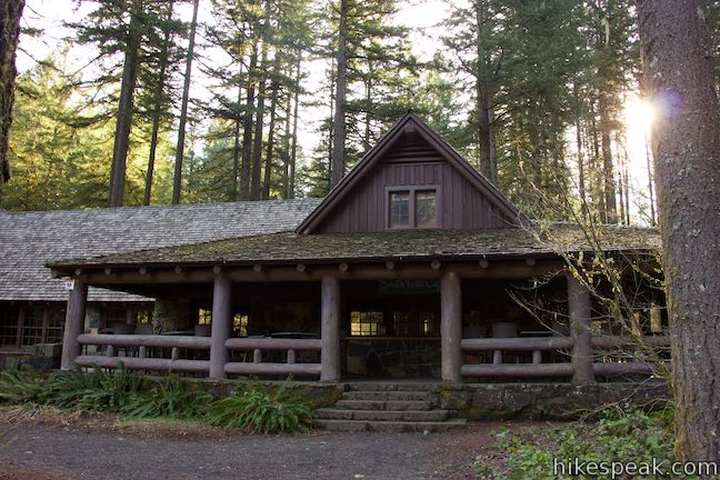
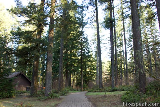
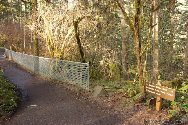
The hike begins from South Falls Trailhead, which is the main trailhead in Silver Falls State Park. The parking area is large, but manages to fill up on weekends. Hike north on Canyon Trail, which is a brick path that goes alongside South Falls Lodge. The Civilian Conservation Corps (CCC) and Works Projects Administration (WPA) built the lodge and completed many other projects, including impressive trail work, between 1935 and 1942 to create the long-standing infrastructure of Silver Falls State Park.
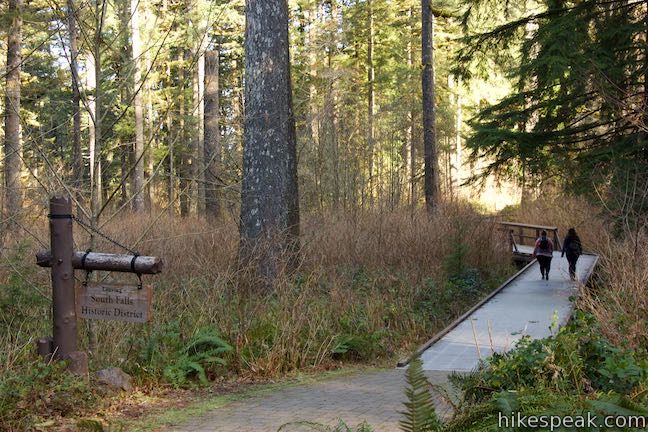
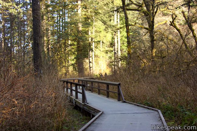
Come to a prominent trail junction called the Stone Circle Junction. You could continue straight to see more of South Falls Historical District and connect to Maple Trail farther ahead, but it is easiest to turn left on Canyon Trail.
You will only get a little bit closer to Upper South Falls before you come to another junction (0.2 miles from the trailhead) where Maple Ridge Trail parts to the right. Leave Canyon Trail for now and turn right onto Maple Ridge Trail to hike the loop in a counter-clockwise direction.
Maple Ridge Trail
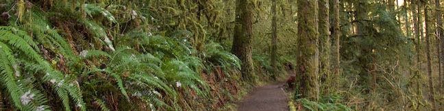
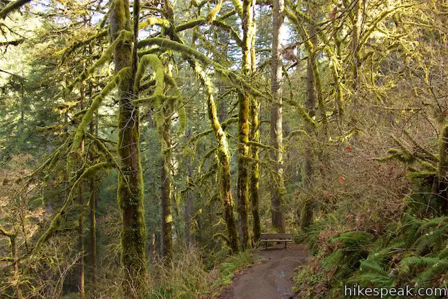
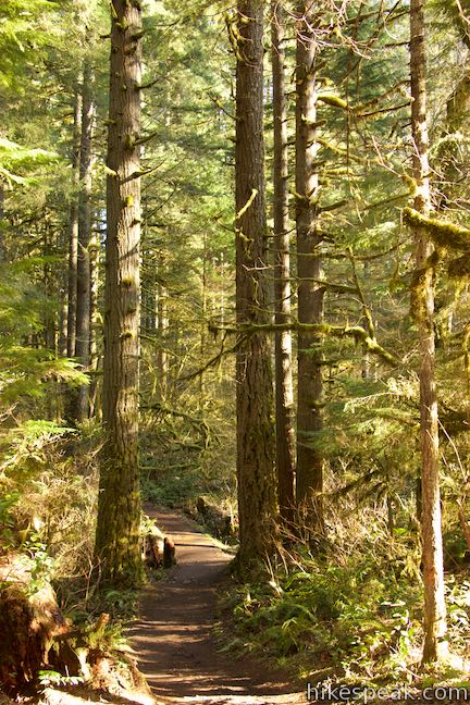
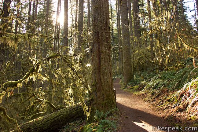
Leaving the area in front of South Falls Lodge, Maple Ridge Trail brings you into the forest on the ridge above South Fork Silver Creek. You won’t hike too far before coming to another junction (just 1/8 of a mile from the previous). Stay to the left on Maple Ridge Trail as it passes a trail that goes over to a parking area to the right. This side trail connects to the historical district (if you went straight through the Stone Circle Junction, this is the way to Maple Ridge Trail).
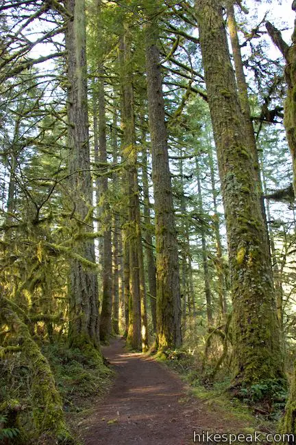
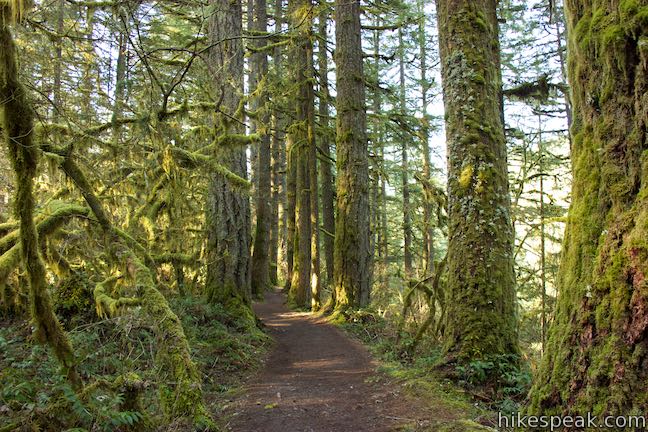
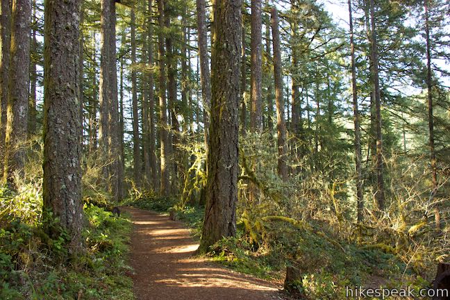
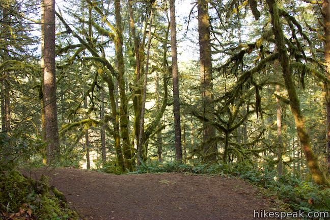
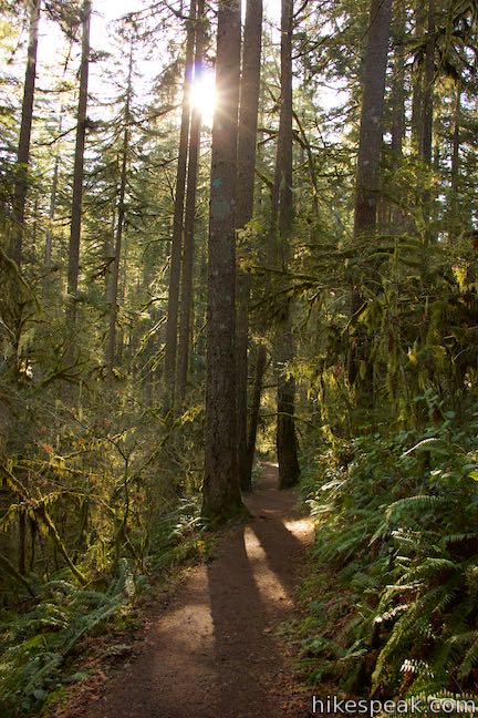
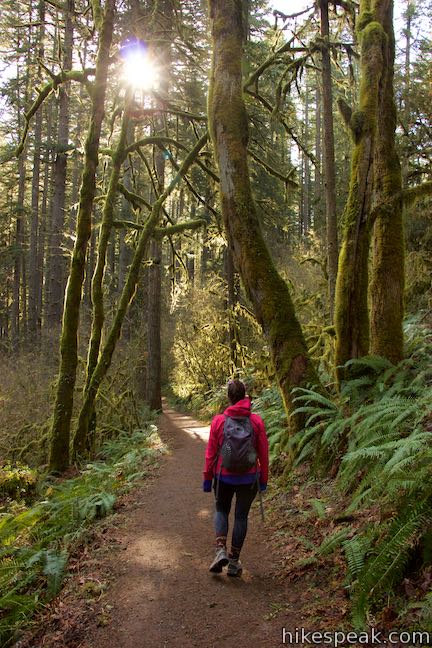
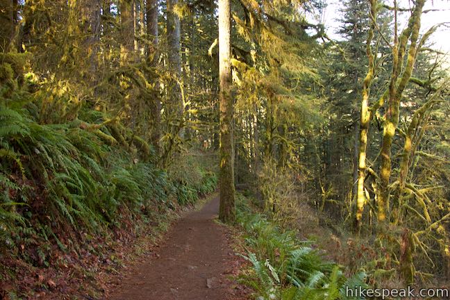
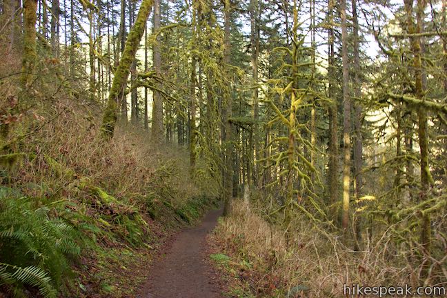
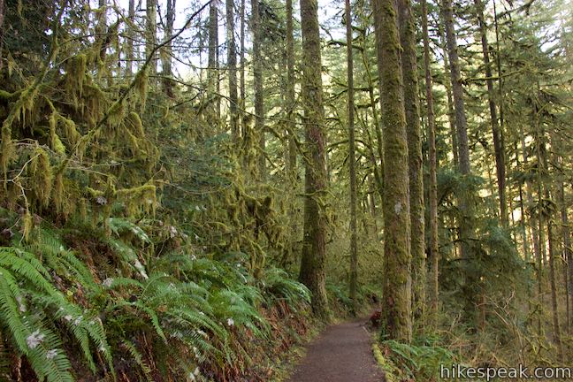
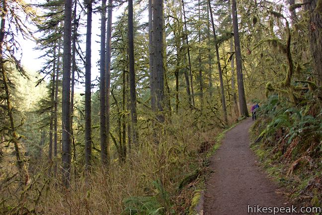
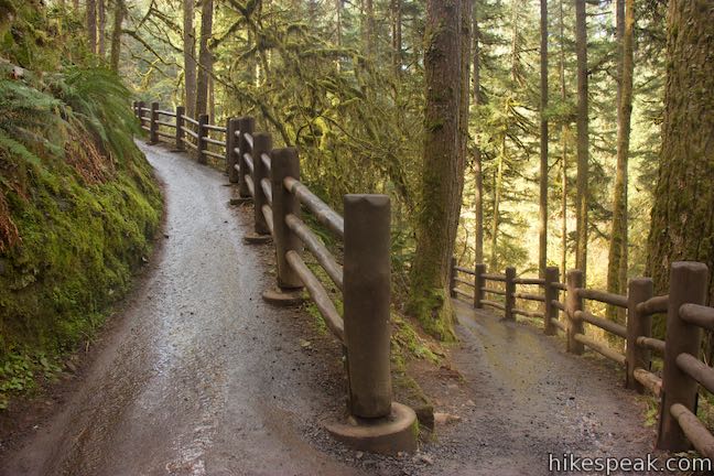
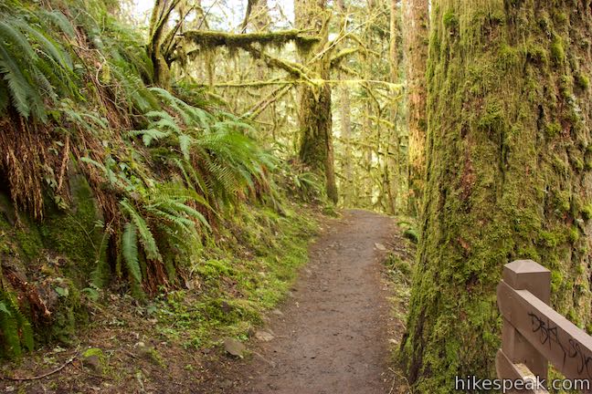
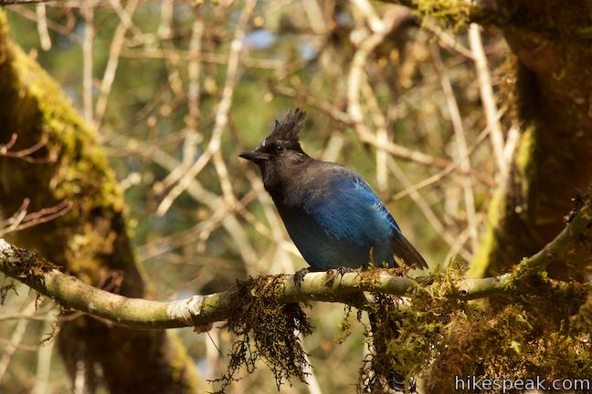
Later on the hike, you’ll be looking up at the tall waterfalls, so why not stretch your neck out a little bit now and look up the tall tree trunks bordering Maple Ridge Trail. The trail weaves through mature hemlocks and Douglas firs, and of course the grand maples for which the trail is named. The forest is lovely (probably especially so in the autumn). The trees grow tall and straight. Their trunks are covered with moss. Tinsel lichens hanging from low branches. The forest canopy provides plenty of shade for even more greenery along the trail, like salmonberry, sword ferns, Salal (Oregon wintergreen), Oregon grapes, and Pacific bleeding hearts. Enjoy a relaxing woodland hike on a wide, dirt single-track trail.
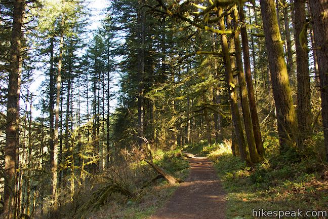
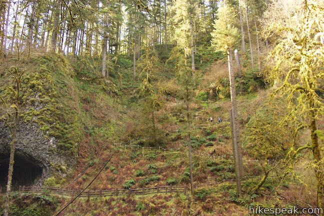
The first half of Maple Ridge Trail is relatively level with rolling terrain. The second half of the trail is a different story, dropping 300 feet down the side of the canyon. When you have hiked 0.55 miles on Maple Ridge Trail (3/4 of a mile from the trailhead), the trail passes a fire road on the right that parts to the east. Ahead, the trail tips downhill toward Canyon Trail.
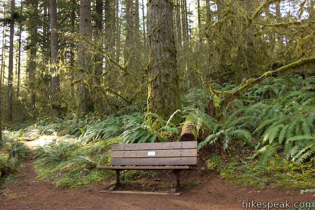
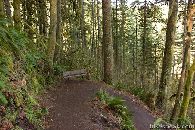
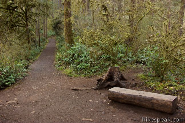
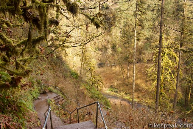
In another tenth of a mile, the trail curves to the right and becomes steeper. The descent is divided into switchbacks with three sharp turns. Hike a tenth of a mile down to the highest of three switchbacks. They each have a bench for resting weary legs.
From the top bench, it is another 0.35 miles down to Canyon Trail. Take your time and enjoy the views. Rest at any of the three benches if needed. The nice thing about hiking down Maple Ridge Trail instead of hiking up is that you don’t have to climb through these switchbacks (and can save the uphill side of the loop for Canyon Trail and it’s waterfall views).
Weave your way down to a landing at the bottom of Maple Ridge Trail at a junction with Canyon Trail. To the right, Canyon Trail ventures toward the North Fork of Silver Creek and the rest of Trail of Ten Falls Loop. Turn left on Canyon Trail to see the two beautiful waterfalls on South Fork Silver Creek.
Canyon Trail
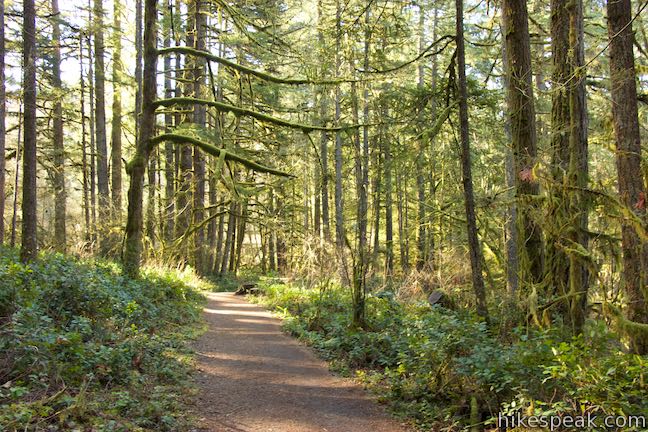
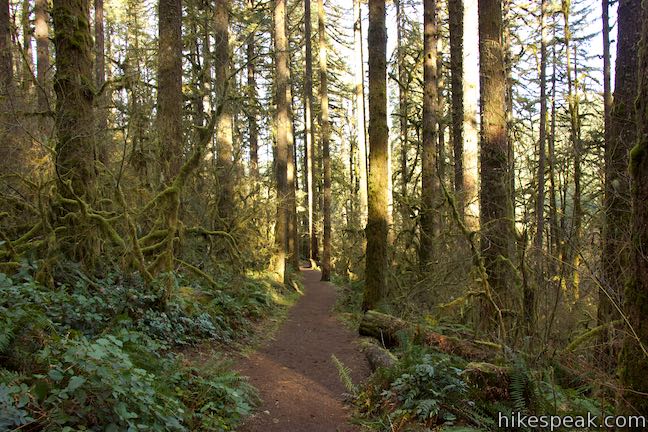
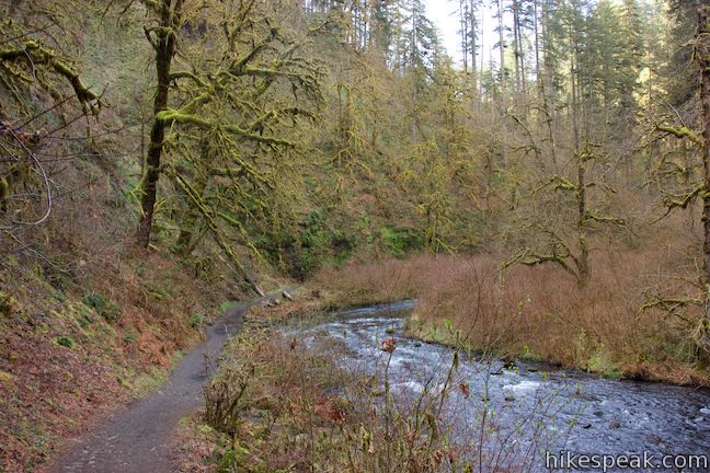
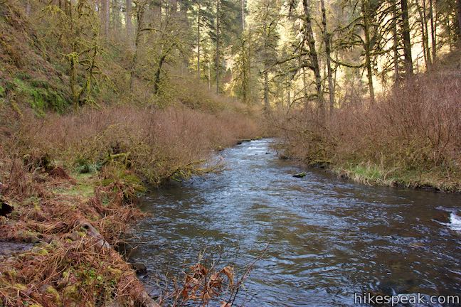
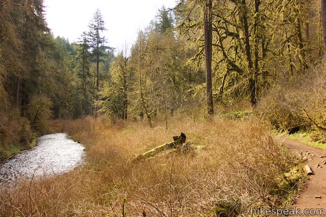
With 1.3 miles of Maple Ridge Loop complete, begin the next 1.5 miles on Canyon Trail. Although you might expect the descent to be finished, Canyon Trail actually goes downhill for a stretch as it moves away from Maple Ridge Trail. Canyon Trail joins the bank of South Fork Silver Creek alongside a lovely stretch of swift, rolling water. The trail goes gradually uphill now, moving upstream beside the creek.
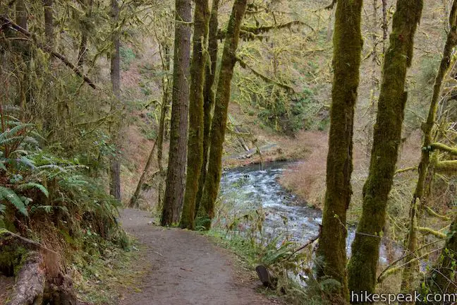
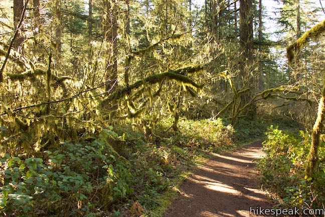
Hike up Canyon Trail through the forest along the creek – a mix of big-leaf maple, Douglas fir, western hemlock, red cedar, vine maple, alders, and cottonwoods. The forest gets about 80 inches of rain annually and is quite lush. The tree branches are covered with moss and lichens. Sword ferns, bleeding hearts, and Oregon grapes flourish along the trail.
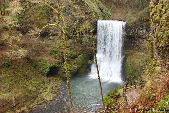
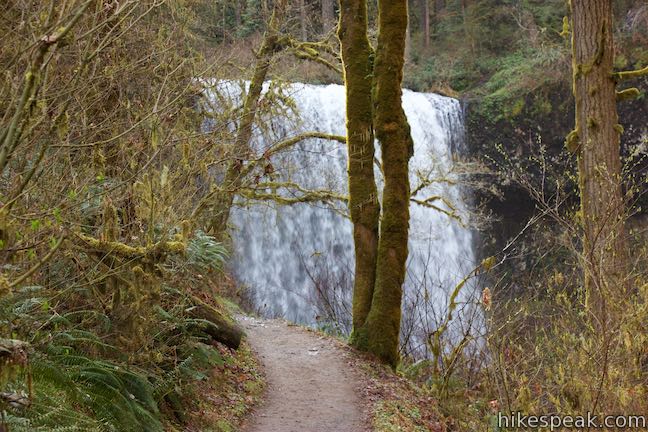
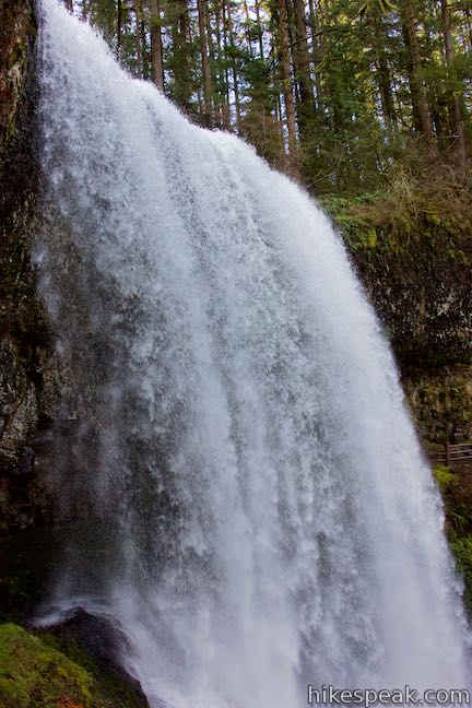
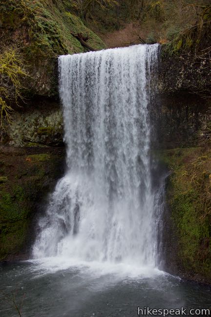
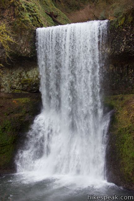
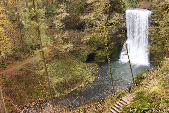
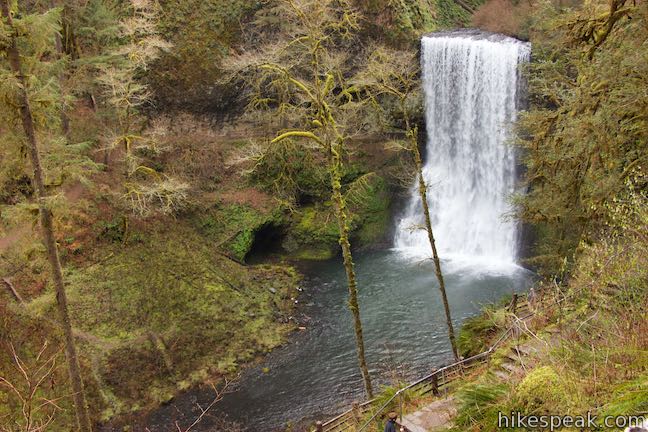
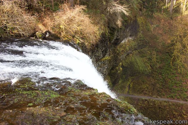
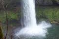
As you approach Lower South Falls, spot Canyon Trail zigzagging up the opposite (southern) side of the canyon. You will get there soon. Ahead of you, Lower South Falls appears, leaping 93 feet from a ledge into the canyon below. The waterfall is a broad white wall flashing down the front of a dark basalt overhang that is splattered by patches of moss and lichens.
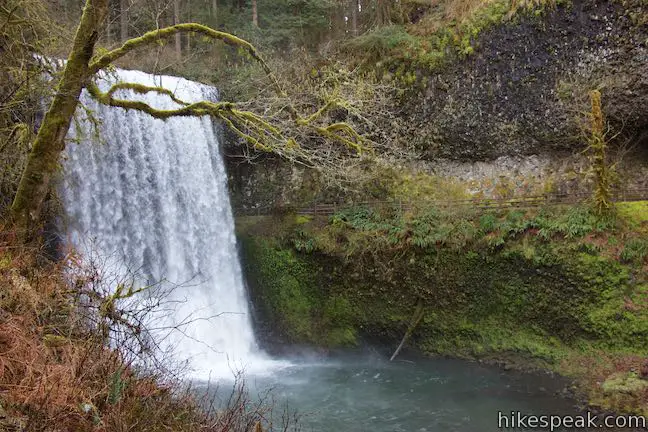
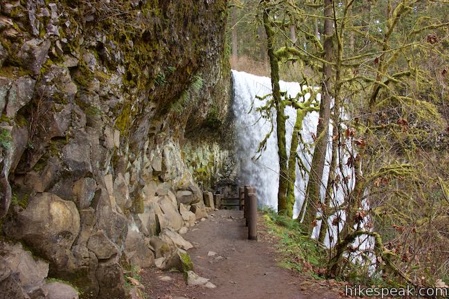
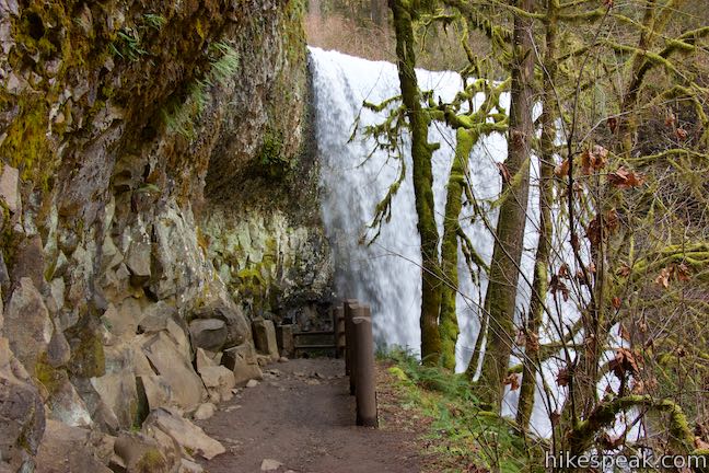
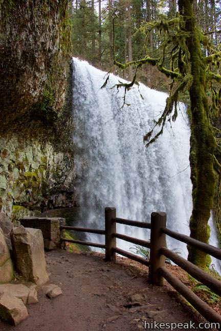
You’ve seen the other side of the trail and now you’ve seen the waterfall. What you haven’t seen is a bridge. That’s because Canyon Trail passes right behind the waterfall.
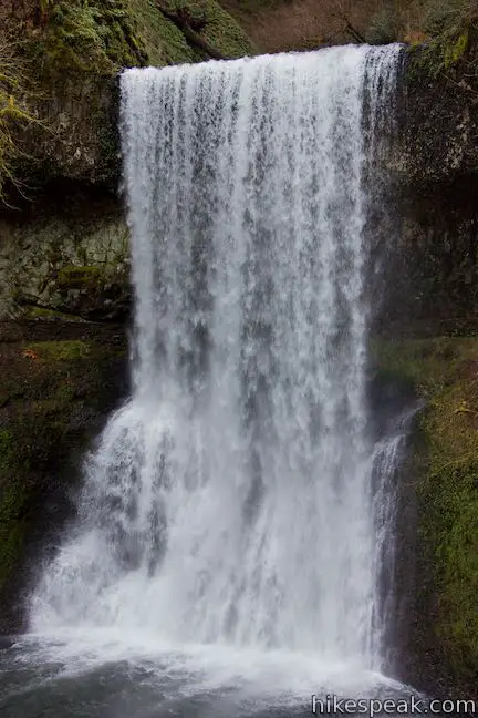
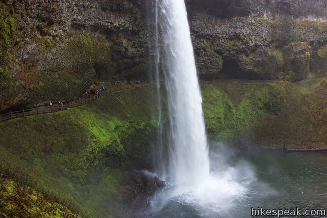
Canyon Trail cuts across the ledge behind Lower South Falls. The thundering water is little more than arm’s length away. Carefully make your way behind the beautiful waterfall. Watch out from slippery stones. If Lower South Falls is gushing, you are likely to get wet.
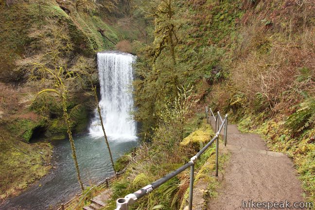
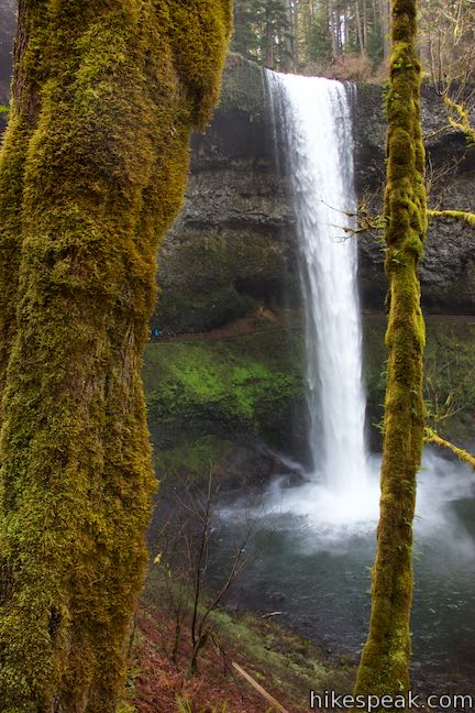
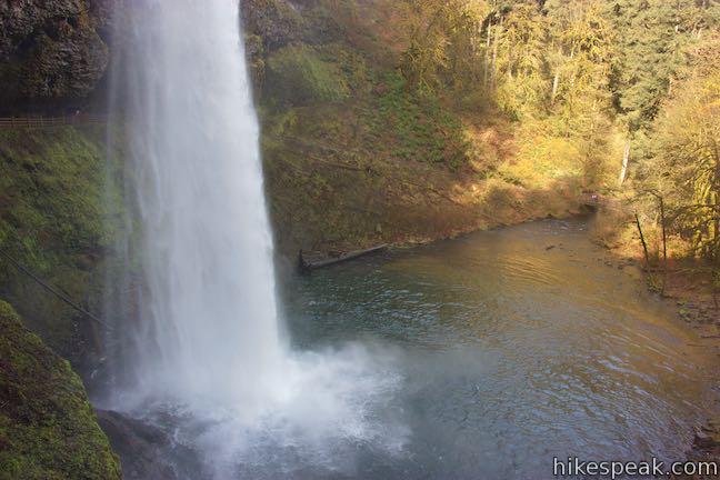
Coming out from behind the waterfall, the trail crosses the bank on the south side of the creek. For a short distance, the trail goes in a downstream direction, before changing course and climbing toward the creek above the waterfall. As you move away from Lower South Falls, be sure to pause and look down at the picturesque waterfall spilling over the ledge in the middle of the canyon and a U-shaped arc in the trail. The best views of Lower South Falls come from this side of the trail.
Take the zigzagging stone steps up the side of the canyon. Any time you need to catch your breath, just stop for a fresh perspective of Lower South Falls. At the top of the stone staircases, cross a bluff by the top of the waterfall. From here, the trail goes downhill for a short stretch to find the bank of South Fork Silver Creek.
The area of Canyon Trail between Lower South Falls and South Falls explores a lovely stretch of forest that wraps around winding bends in the creek. The trail hugs the creek, so the terrain is gradual and the surroundings are soothing.
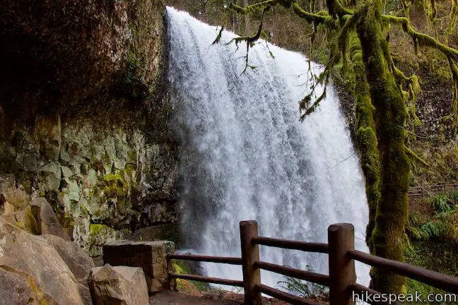
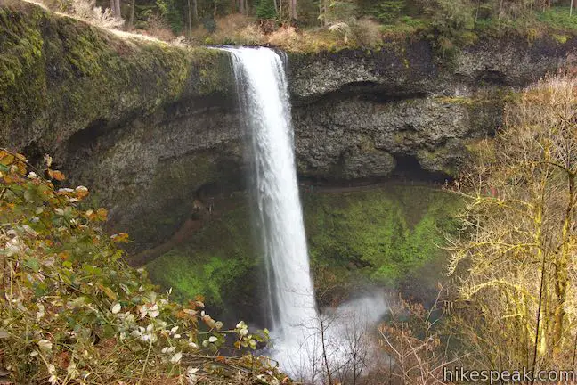
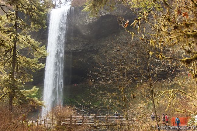
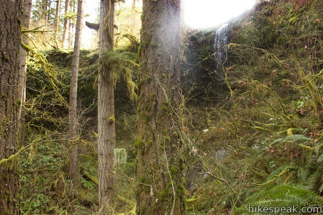
After 2 miles of hiking (and 0.7 miles on Canyon Trail), South Falls finally comes into view. As the waterfall becomes clearer to see, you will realize that South Falls is a beautiful behemoth.
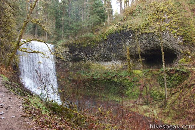
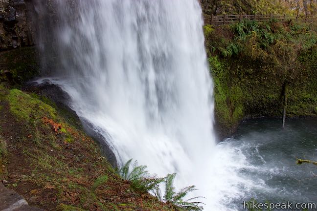
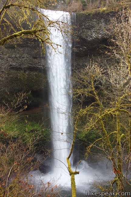
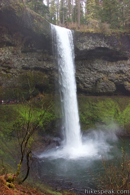
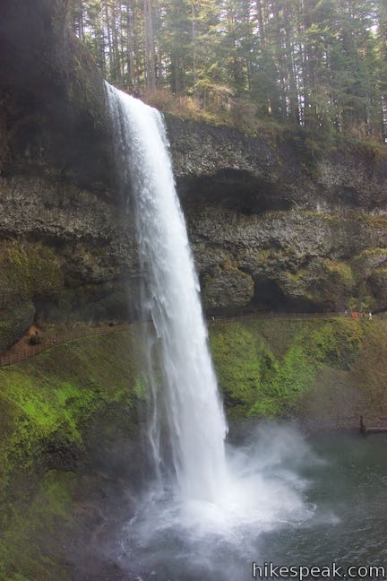
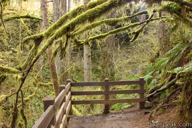
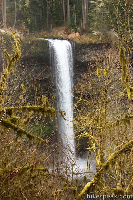
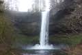
Come to a junction beside a bridge that crosses South Fork Silver Creek downstream from the waterfall. This is a great place to take photos and admire the waterfall. South Falls looks like a white tower. Its water plunges 177 feet from a major basalt overhang in one single, glorious drop.
Canyon Trail splits at the bridge. Straight ahead, the more exciting side of the trail continues up the south side of the canyon leading to a wild section of the trail that crosses ledges behind the waterfall! Across the bridge, the other side of the Canyon Trail goes up a few switchbacks through trees (and more views of South Falls) to reconnect with the branch of the trail crossing behind the waterfall. Taking the straight ahead option, it is 0.6 miles back to the trailhead. The branch to the left, across the bridge, is a tenth of a mile shorter.
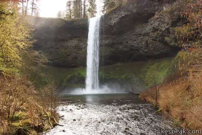
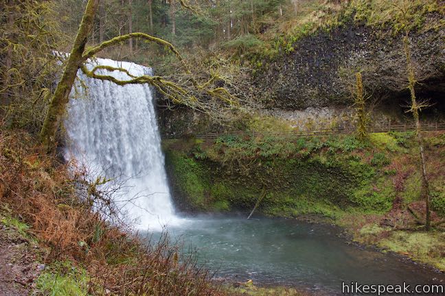
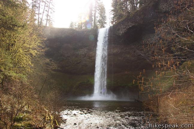
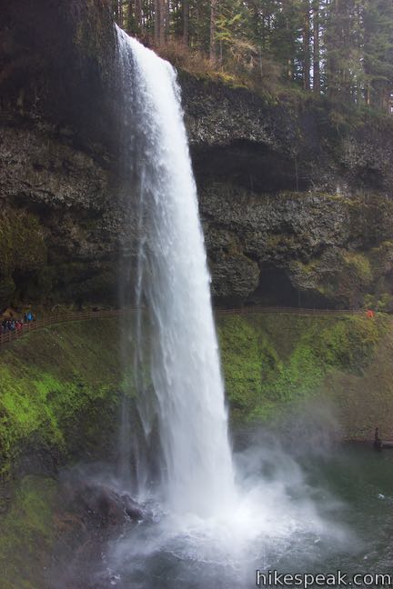
If you venture straight, the trail ascends along the bank beside the creek. The landscape has a bit of a bowl shape and the trail is swept by gusts of waterfall winds with water droplets. In front of you – what a view! The dramatic waterfall launches from a basalt overhang and drops and drops (and drops and drops) 177 feet in one big thundering plunge to the canyon bottom.
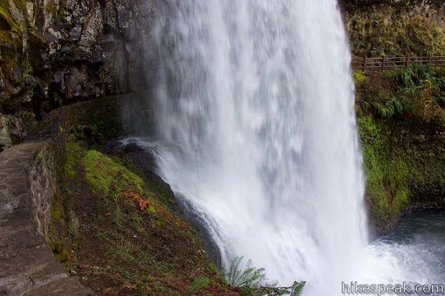
The trail gets closer and closer to South Falls and somehow finds a usable route across ledges in the cliffs behind the waterfall. Be prepared for spray from the waterfall, which will give you a quick shower as you pass behind South Falls. The trail around the back of the waterfall makes an awesome hiking experience!
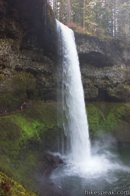
Come around to the other side of South Falls, admiring the single-drop waterfall from a different perspective. Reach a junction with the other side of Canyon Trail (coming up from the bridge, bypassing the route behind the waterfall). Turn right to continue ascending toward the South Falls Trailhead.
Hike a short distance up the combined trail to another junction (2.4 miles from the start of the hike). The 200-foot long spur trail to the left leads to a viewpoint for a small cascade named Frenchie Falls. Check out the waterfall and then return to Canyon Trail and continue the ascent.
Back on Canyon Trail, hike up to another junction. Canyon Trail proceeds straight ahead, but you will probably want to stray a bit to the right to South Falls Viewpoint. From this perch alongside the top of South Falls, you can watch the waterfall begin its big drop into the canyon. Look at the South Fork Silver Creek above the waterfall. It seems to flow so peacefully compared to what you know is below!
If you want, you can actually follow a trail from the brink of South Falls that goes along South Fork Silver Creek all the way to the parking area. Otherwise, backtrack to Canyon Trail and continue up the trail. Pass the start of Maple Ridge Trail on the left (you remember Maple Ridge Trail) to get back to the Stone Circle Junction. Turn right and walk over to the parking area.
Dogs and bikes are not allowed on Maple Ridge Loop. Silver Falls State Park charges a fee to park at the trailhead, which is $5 per vehicle for the day or $30 for an annual Oregon State Parks pass. Silver Falls State Park is located in Marion County, Oregon, about 25 miles from Salem. No permit is needed to hike Maple Ridge Loop, so get out and enjoy!
To get to the trailhead: Take Interstate 5 to exit 253 for Route 22 & 99E, following signs for Detroit Lake & Bend. (The exit is about 45 miles south of Portland.) Head east from the end of the offramp on Route 22 (99E). Drive 5 miles and take exit 7, which has a sign for Route 214 and Silver Falls State Park. At the end of the offramp, turn left onto Route 214. Follow Route 214 through several intersections for 16 miles and then turn left, following a sign for South Falls. Now within the park, you’ll make another left to reach the trailhead parking area.
Trailhead address: 20024 Silver Falls Hwy SE, Sublimity, OR 97385
Trailhead coordinates: 44.8776, -122.6556 (44° 52′ 39.4″N 122° 39′ 20.2″W)
View Silver Falls State Park in a larger map
Or view a regional map of surrounding Oregon trails and campgrounds.


 | Trail of Ten Falls This 7.9-mile loop passes ten acclaimed waterfalls in Silver Falls State Park for a picturesque and exciting hike that actually goes behind four of the waterfalls. |
 | South Falls This 1.1-mile hike goes up to and behind a 177-foot waterfall that is the jewel of Silver Falls State Park. |
 | Spencer Butte This 5.2-mile hike crosses a fern-covered forest to panoramic views from the crown of Spencer Butte. |
 | Terwilliger Hot Springs This 0.9-mile hike leads to a natural hot springs in Willamette National Forest where bathers can soak in a series of terraced pools. |
 | Trails in Oregon Explore more hikes throughout the state of Oregon. |
Go the extra miles...
Submit a rating of this hike to go with your comment. Contribute to the average trail rating.