Lava Butte
in Newberry National Volcanic Monument
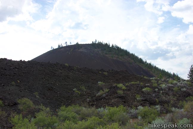
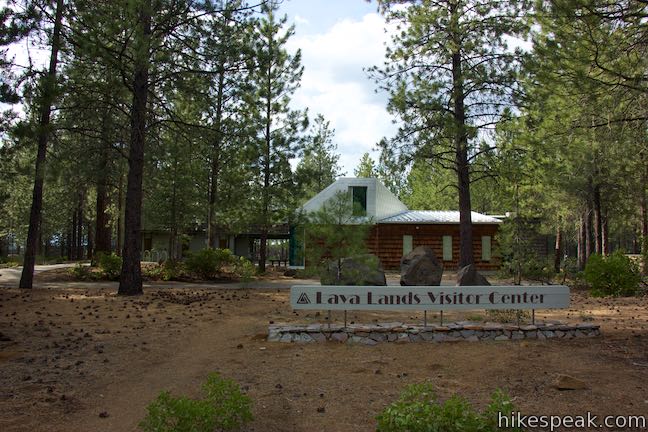
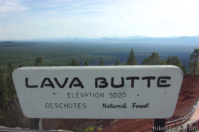
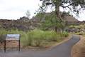
Lava Butte is a 500-foot tall cinder cone along the Northwest Rift of Newberry Volcano in Central Oregon. It rises prominently over Route 97 between Bend and Sunriver. A fire lookout tower sits atop Lava Butte and is joined by a rim trail that offers panoramic views over a dark volcanic landscape. Lava Butte also provides majestic views of the Cascade Mountains to the west. For a short hike, you can take transportation to the top of Lava Butte, check out the lookout tower and circle Lava Butte Trail for a 0.35-mile outing with 110 feet of elevation change. You may also hike up Lava Butte from Lava Lands Visitor Center for a more fulfilling 3.35 to 3.85-mile round trip hike with 520 feet of elevation change.
Red Cinder Road
From the beginning of May through Columbus Day Weekend, the easiest way to reach Lava Butte is to ride a shuttle or drive to the top of Lava Butte. Red Cinder Road begins beside Lava Lands Visitor Center, heads north, and spirals up Lava Butte. More information on vehicle and shuttle access is below.
For those hiking up Lava Butte, the best time to make the trek is in the hours before or after the shuttle and vehicle access hours, which are from 10 a.m. to 4 p.m. An early hike will offer the best views of the Cascade Mountains to the west, which become backlit in the late afternoon.
During the early and late hours that are most appealing, hikers must set out from a parking area on the southwest side of Lava Lands Visitor Center. From there, it is a 1.75-mile hike up to Lava Butte Trail on the top of Red Cinder Road. During the hours when the visitor center is open, a larger parking area on the north side of the visitor center can be used to trim the one-way distance up Red Cinder Road to 1.5 miles each way.
When the main entrance for Lava Lands Visitor Center is closed, early and late in the day, visitors can pull into a parking area off Crawford Road on the southwest side of the visitor center. Coincidentally, Sun-Lava Trail, Trail of the Whispering Pines, and Trail of the Molten Land are easy to reach from this lot as well.
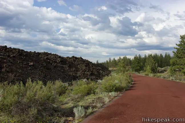
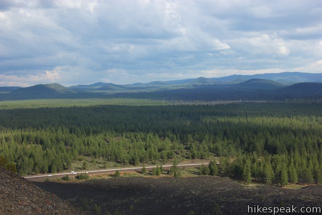
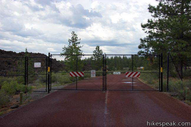
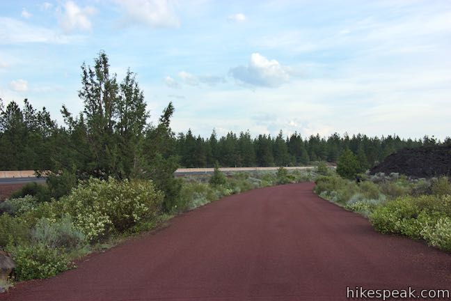
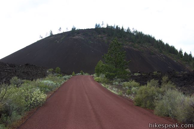
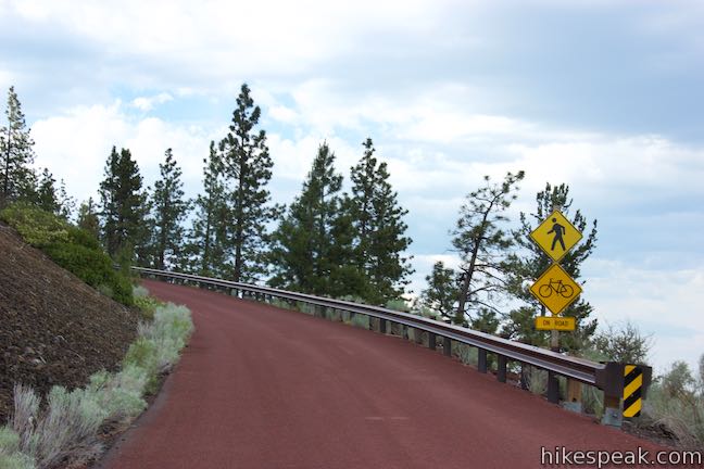
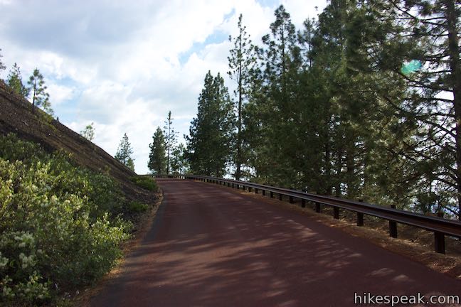
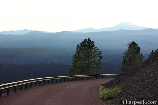
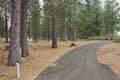
Take a sidewalk to Red Cinder Road, which heads north along the east side of Lava Lands Visitor Center, passing between the visitor center and the entrance booth. Walk up this level road made of red cinders. Pass a long parking area on your left that provides additional parking during operating hours. After that, and a quarter mile from Lava Lands Visitor Center, come to a gate used to restrict vehicle access. If the gate is closed, slip through the pedestrian entrance to proceed up the road.
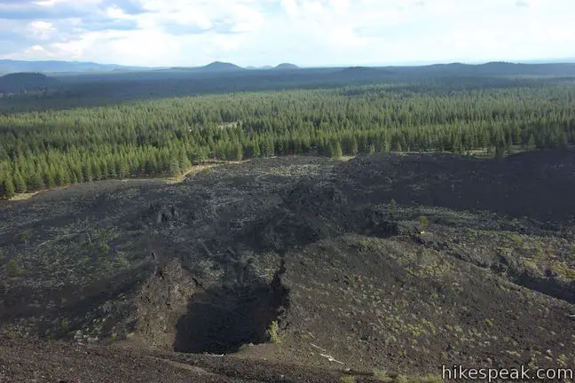
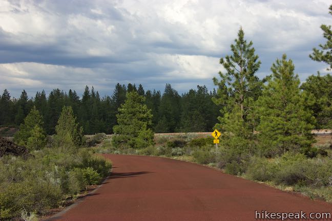
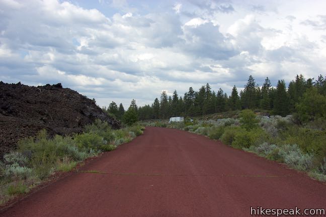
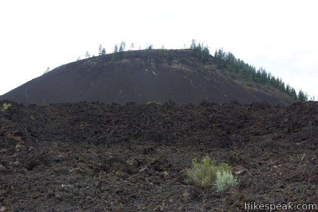
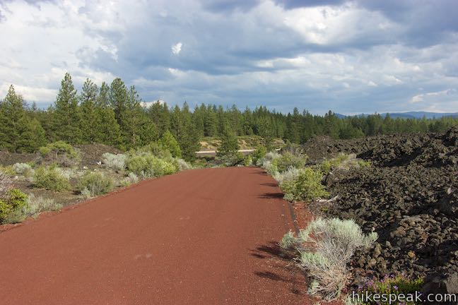
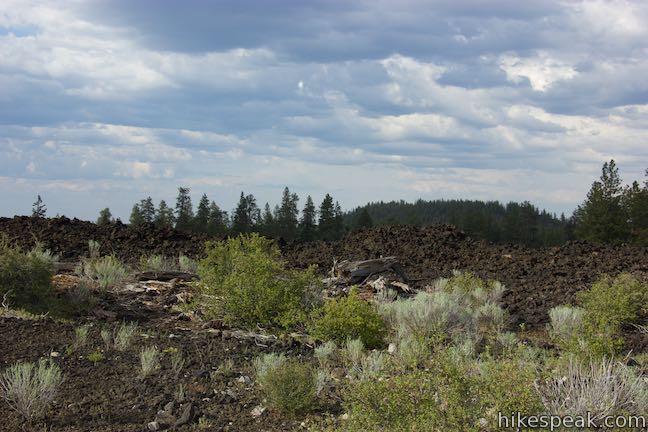
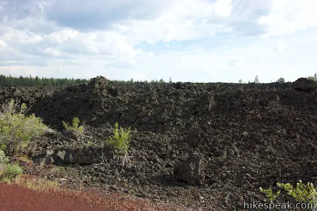
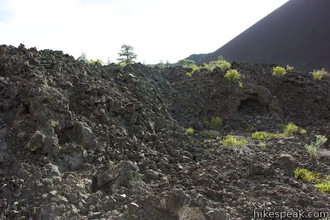
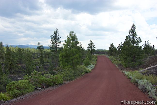
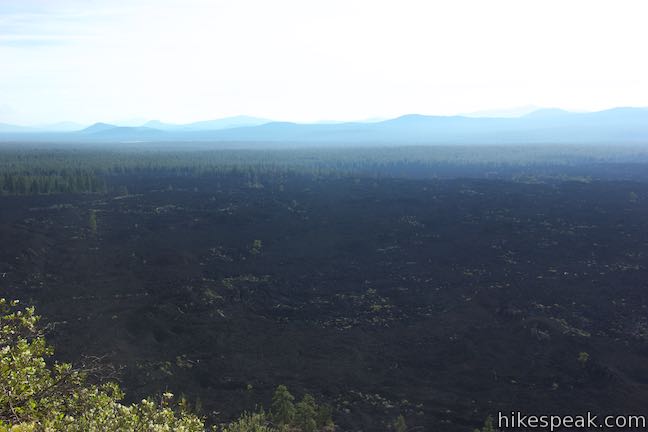
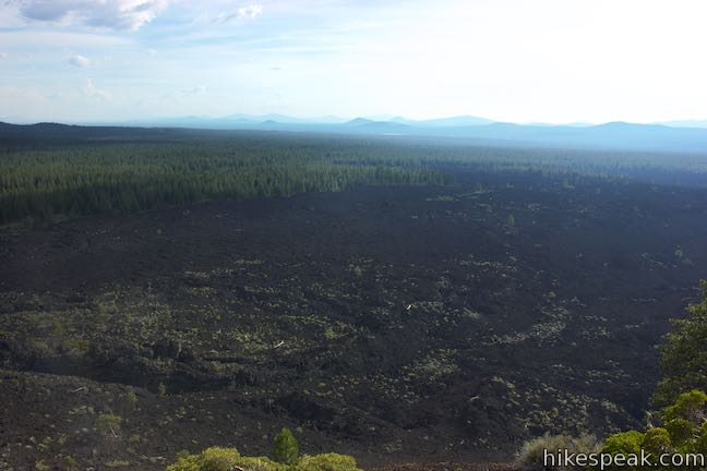
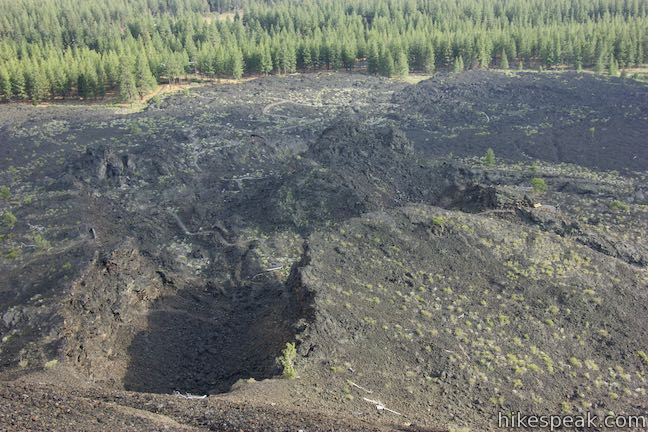
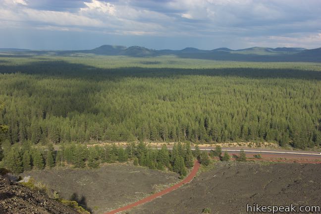
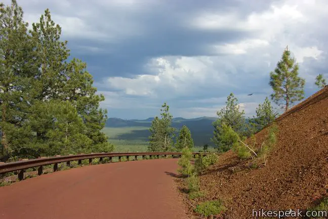
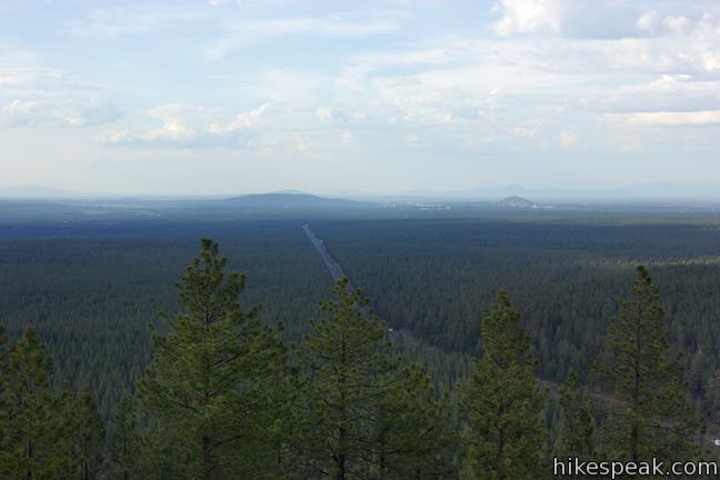
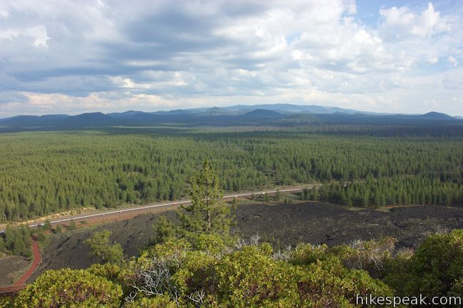
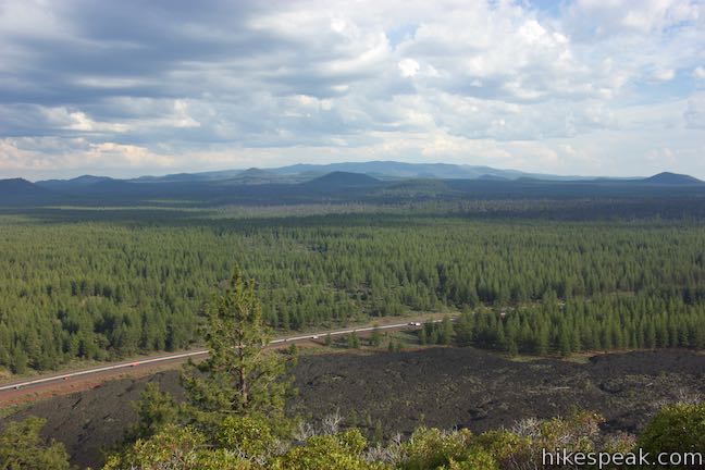
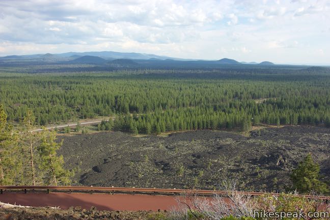
Red Cinder Road is bordered by Route 97 on the right, just beyond a strip of high desert vegetation. A ledge of misshapen basalt runs up to the left side of the road. This is the edge of Lava Butte Lava Flow. Proceed up Red Cinder Road along this short wall of volcanic material. Over the lip of the lava flow, you’ll see Lava Butte, which is a cone-shaped mass of maroon-colored cinders.
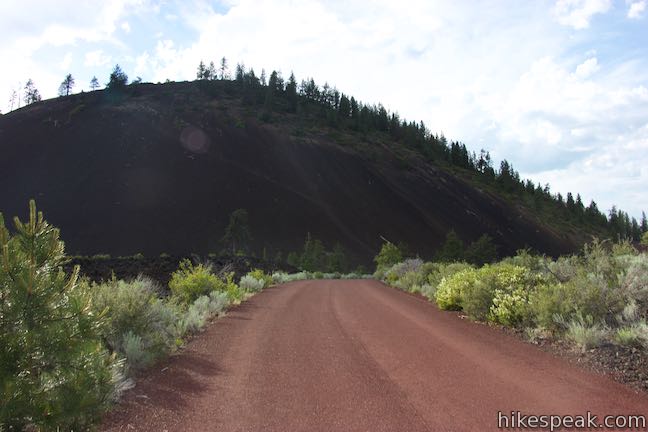
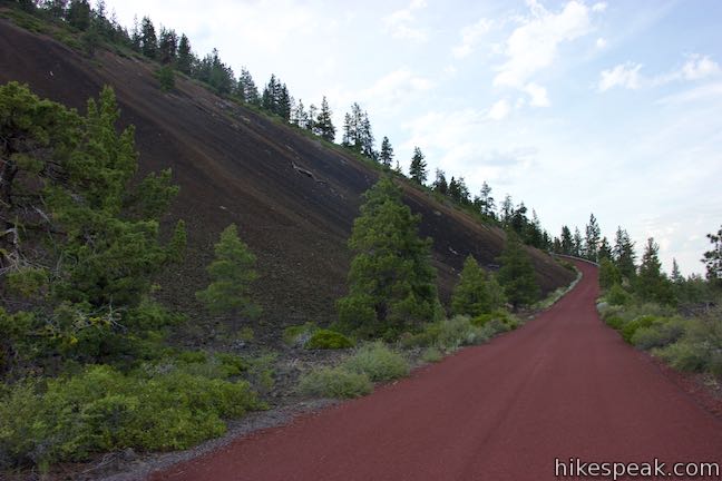
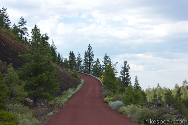
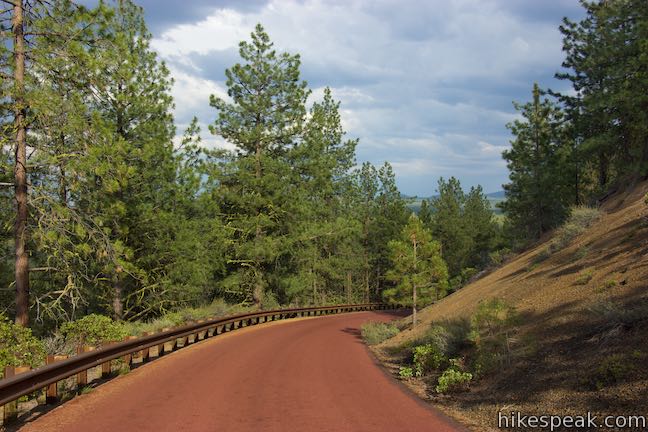
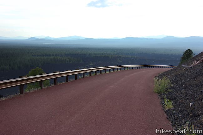
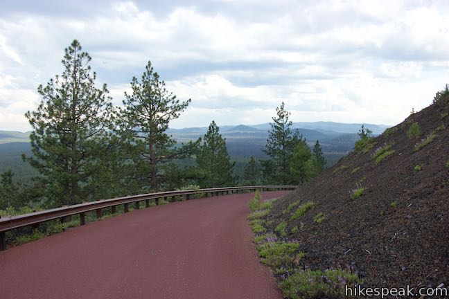
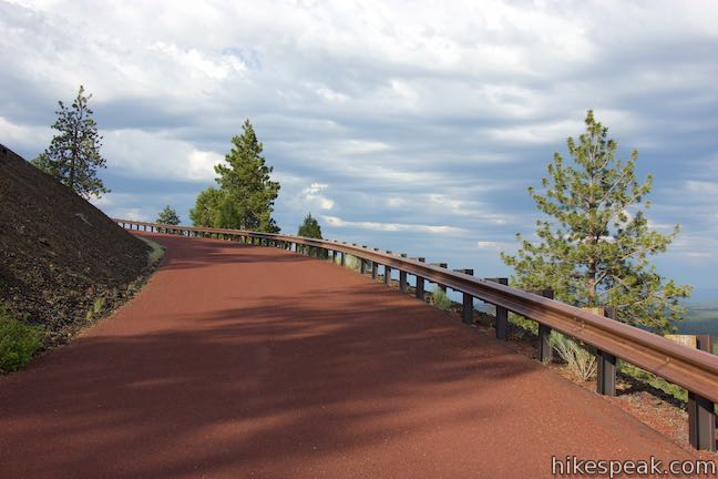
After a quarter mile, the road narrows and curves to the left toward Lava Butte. The road travels over the lava flow toward the base of Lava Butte, cutting between bizarre lava rocks. The trail curves to the right and begins up the side of Lava Butte, ascending 450 over the next mile. Red Cinder Road winds up Lava Butte in a counter-clockwise direction, going from the east side to the north, west, and south sides. The road revisits the east side of Lava Butte, higher up, and finishes on the north side of the crater at the top of Lava Butte. Red Cinder Road winds up Lava Butte much like the road up Pilot Butte, which you will soon spot rising above Bend to the north.
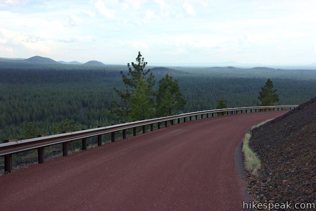
Red Cinder Road maintains a moderate grade of around 10 percent as it twists up Lava Butte. Conifers cover the northeast side of the butte, so you won’t get the broad view immediately.
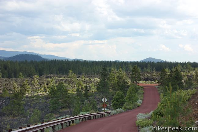
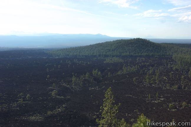
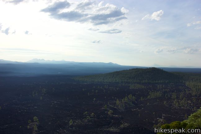
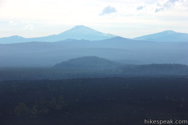
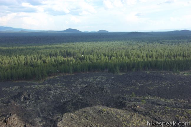
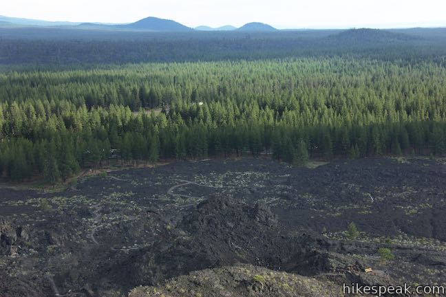
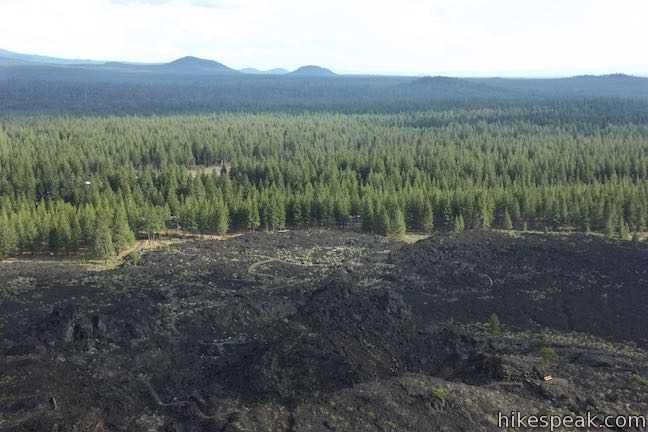
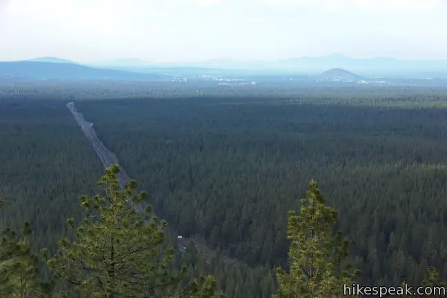
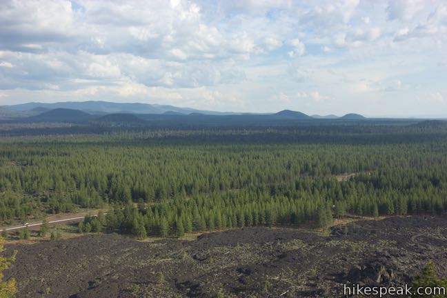
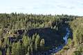
About half a mile from the start of the ascent (or 1.25 miles from Lava Lands Visitor Center), you’ll exit the trees on the west side of Lava Butte and gain a big perspective down the cinder slope on the side of Lava Butte over a stark and dark landscape freckled with a few trees and determined brush. Lava Butte Lava Flow covers nine and a half square miles. That volcanic rock originated from Lava Butte, punching through the south side of the cinder cone at a spot called “the Breach.” See if you can spot the Deschutes River to the west, whose course was altered by Lava Butte Lava Flow. If you take the nearby hike on Deschutes River Trail to Benham Falls, you’ll see the river’s current path along the edge of the lava flow.
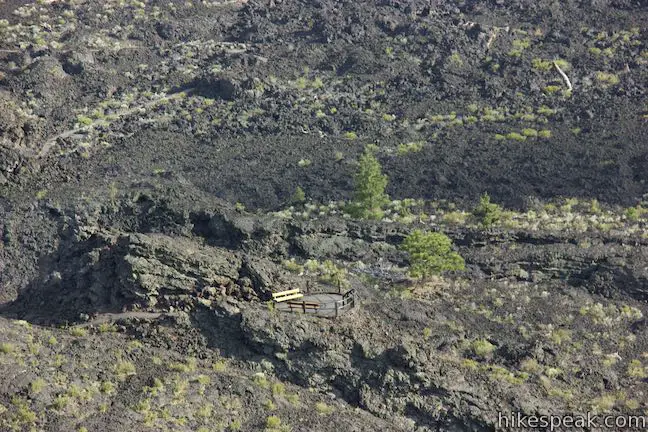
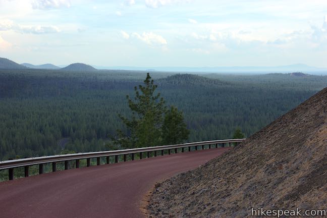
Continue to spiral up Lava Butte Trail and gaze out over more of the lava flow to the west and south. Come around to the south side of Lava Butte atop “the Breach,” where a now-closed hole leaked lava across the land. The paved path of Trail of the Molten Land explores the volcanic landscape below Lava Butte. Tucked within the trees on the edge of the lava flow, you’ll spot Lava Lands Visitor Center.
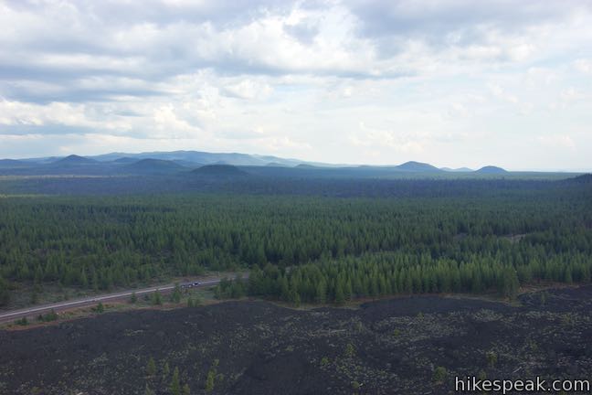
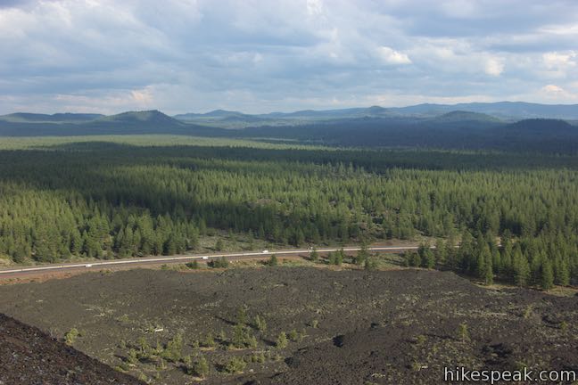
The road continues up Lava Butte, allowing you to look southeast over the bottom of Red Cinder Road. Beyond that, several smaller cinder cones rise from the pine forest to the southeast. Like Lava Butte, these buttes are part of the Northwest Rift Zone that extends southeast for 17 miles to Newberry Caldera. The rift is a fissure system that cracked the earth’s crush and made it easier for molten rock to reach the surface.
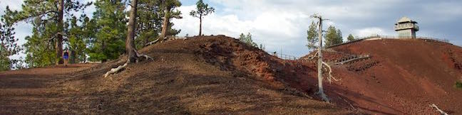
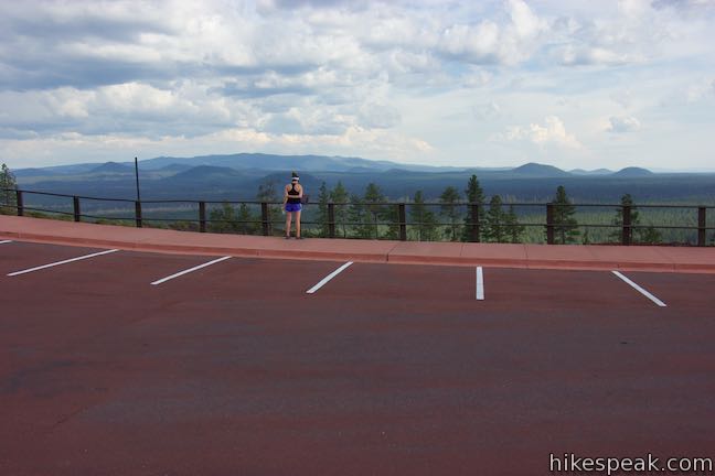
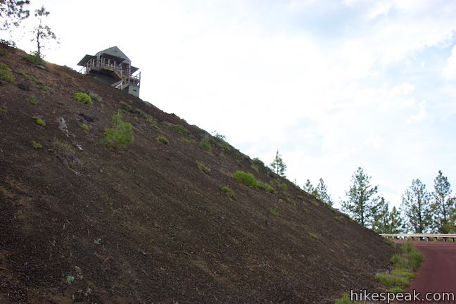
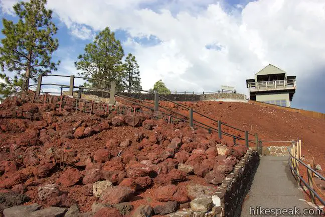
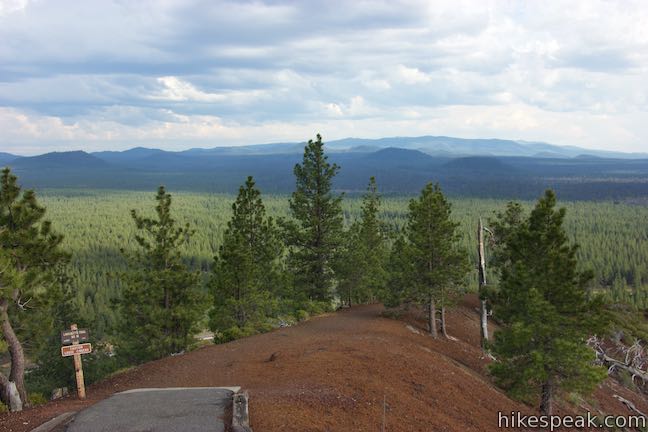
Red Cinder Road keeps curving to the left all the way up to a 10-space parking area at the edge of a crater at the top of Lava Butte. To explore Lava Butte from here, you’ll use a concrete path to Lava Butte Lookout and a cinder path around the rim.
Lava Butte Trail
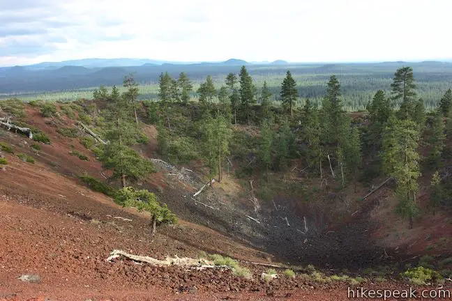
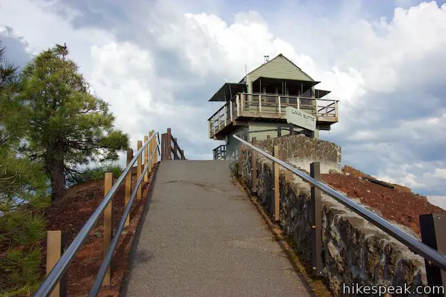
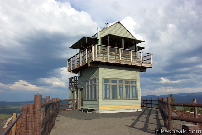
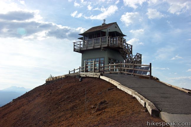
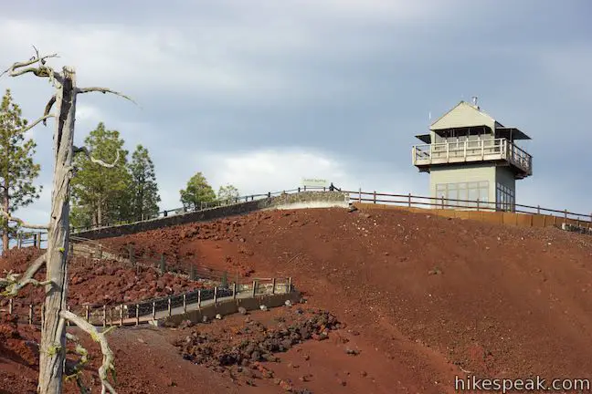
On the right (west) side of the parking area at the top of Red Cinder Road, you’ll find a bathroom and one end of Lava Butte Trail. You’ll be drawn to the left side of the parking area where a concrete path zigzags up to Lava Butte Lookout, built atop the highest spot on the rim of Lava Butte. Look into the crater in front of the parking area by a panel that tells the story of Lava Butte:
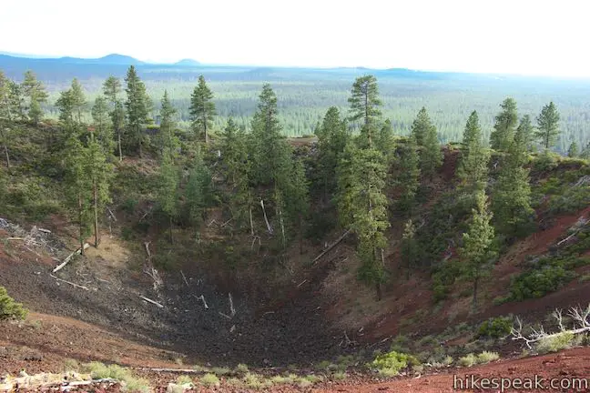
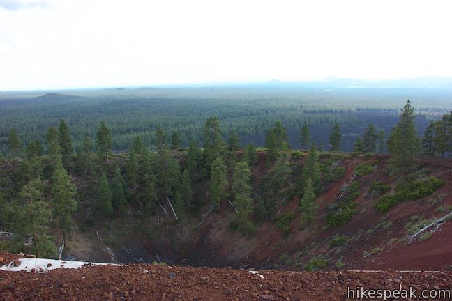
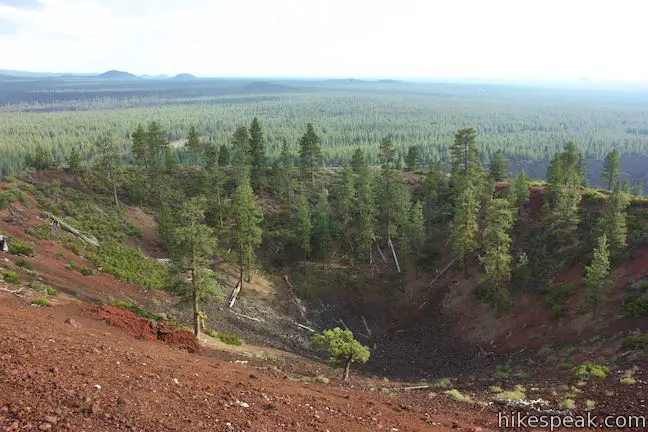
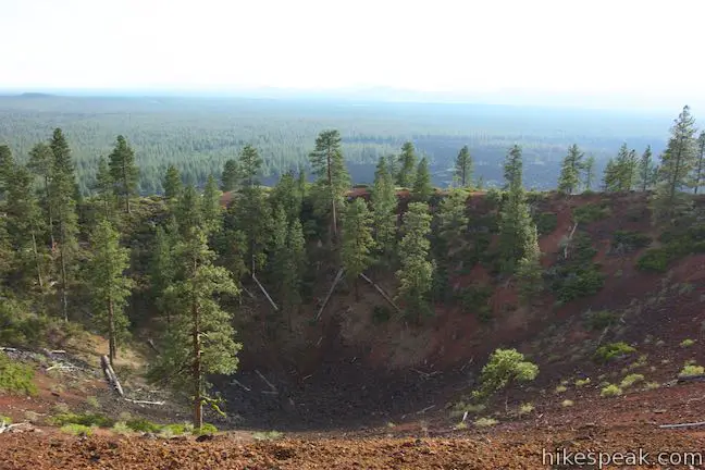
Lava Butte is just one of over 400 cinder and spatter cones of Newberry Volcano. The cinder cone rises 500 feet above the surrounding area, and the crater in front of you is 150 feet deep. A two-phase eruption formed Lava Butte around 7,000 years ago. The first phase sent gas-charged molten rock into the air where the material solidified, trapping gas bubbles to form cinders. The cinder piled into a cone … Due to the prevailing wind more cinders landed on the northeast side, making this side of Lava Butte higher and thicker. During the second phase, lava poured out of the thin south side of the cone and flowed west and north covering 6,100 acres of land.
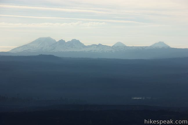
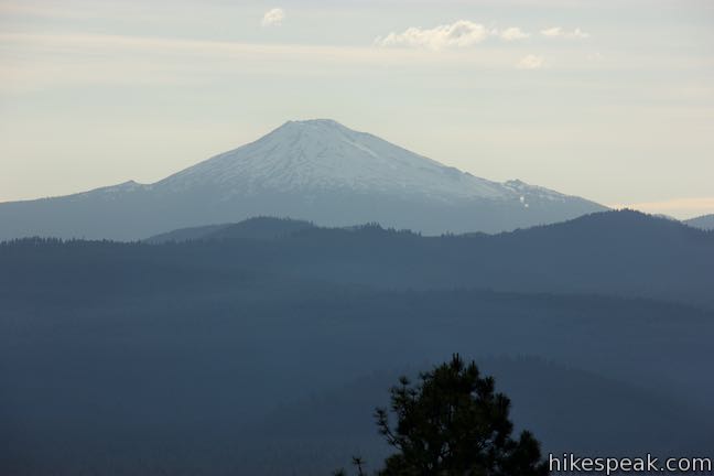
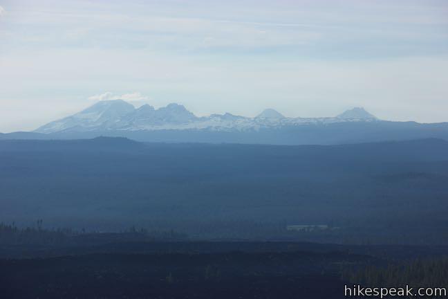
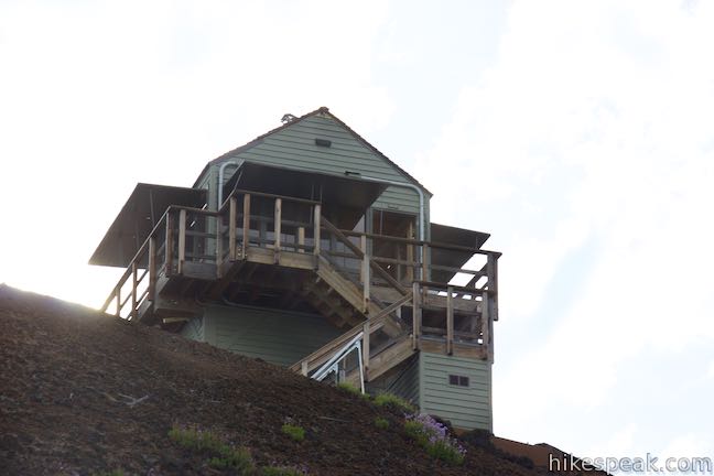
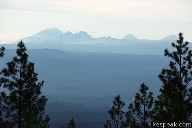
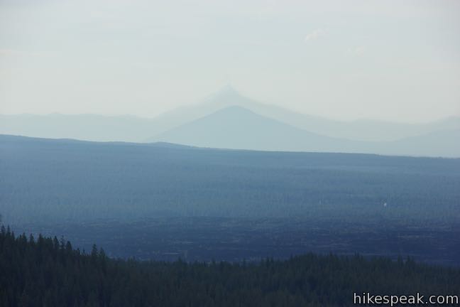
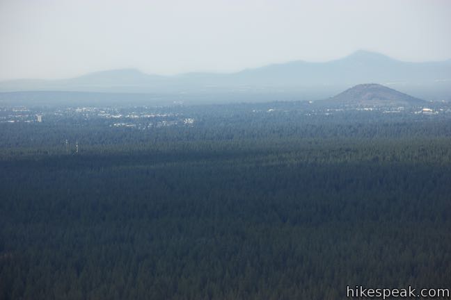
Walk up a switchback to Lava Butte Lookout, peering down into the crater as you go. When you reach the lookout, you’ll find towering views. Look north toward Bend, where the three smoke stacks of the old mill should be easy to identify. Pilot Butte rises over the east side of the city. Look north-northwest over pines toward a pair of notable summits in near perfect alignment. Black Butte rises like a pyramid and is backed by the sharper summit of Mount Jefferson in the Cascade Mountains. A wall of peaks in the Cascades rise to the west. Going from north to south, notable snow-capped summits are North Sister, Middle Sister, Broken Top, South Sister, and Mount Bachelor, rising to 10,985 feet, 10,047 feet, 8,175 feet, 10,358 feet, and 9,068 feet respectively.
Like Black Butte, Lava Butte received one of the first lookouts in Deschutes National Forest. The original Lava Butte Lookout was constricted in 1931. That lookout was replaced by three subsequent structures. Today’s Lava Butte Lookout was built in 1998 and is operated by the U.S. Forest Service. The lookout is not open to the public, but you can enjoy panoramic views from all around the base of the lookout.
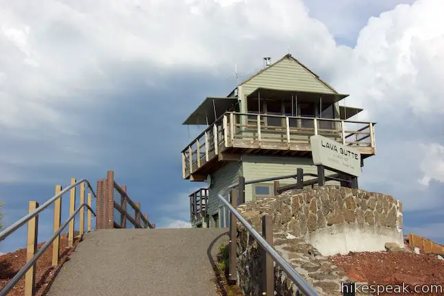
Proceed past Lava Butte Lookout and you’ll come to the end of the concrete at the start of Lava Butte Trail No. 18. This trail makes a 0.3-mile long course around the rim of Lava Butte, dropping just over 100 feet as it crosses the lower, south side of Lava Butte’s crater. Lava Butte Trail provides a loftier and abridged sample of the views available along Red Cinder Road.
Look southeast toward other cinder cones bumping out of the landscape in the Northwest Rift Zone. As Lava Butte Trail wraps around the south side of the butte, look out over the Lava Butte Lava Flow that originated from the Breach on Lava Butte. As you proceed along the trail, you can also look in over the crater toward Lava Butte Lookout. The trail finds pines on the west side of the butte and curves its way around to a bathroom at the edge of the parking area.

Lava Butte has panoramic views and an impressive origin story. If you started from Lava Lands Visitor Center, hike back down Red Cinder Road for a 3.85-mile round trip hike (or 3.35 miles if you began from the parking area closer to the gate). If you came to Lava Butte Trail by car or shuttle the hike around the rim is just 0.35 miles long. Dogs are welcome on Lava Butte Trail and Red Cinder Road, but bikes are not allowed.
Access Information
Red Cinder Road to Lava Butte is open from the start of May through Columbus Day Weekend in mid October. From Memorial Day Weekend to Labor Day Weekend, a shuttle travels between Lava Lands Visitor Center and the summit of Lava Butte, departing every 20 minutes on average. The round trip cost for the shuttle is $2 per person. The shuttle runs from 10 a.m. to 4 p.m. Other vehicle traffic is suspended while the shuttle is running. During the shuttle season, the visitor center is open from 9 a.m. to 5 p.m. Outside the summer period when the shuttle is running, visitors can drive their own vehicles to the summit on a first-come first-served basis, 10 vehicles at a time. Pick up a vehicle pass at the Lava Lands Visitor Center if you wish to drive up Lava Butte. The passes provide a 30-minute window in which to visit Lava Butte.
The road up Lava Butte is closed to vehicles after Columbus Day Weekend until the start of May. The parking area southwest of Lava Lands Visitor Center remains open year-round. Hikers can walk up Lava Butte at any time of the year (even when the road is closed to vehicles). Lava Lands Visitor Center is open from the May through October. Trails remain open in months when the visitor center is closed. A day use fee is charged during the season when the visitor center is open. The fee is $5 per vehicle (as of 2016). A Northwest Forest Pass or America the Beautiful public lands pass can be used in place of the day use fee.
To get to the trailhead: From Bend, travel south on US 97 for 11 miles. Take the Crawford Road exit, following a sign for Lava Lands Visitor Center and Benham Falls Trailhead. At the end of the offramp, come to an intersection and turn right to reach the entrance gate by Lava Lands Visitor Center. If that entrance is closed, drive another tenth of a mile down Crawford Road and turn right into the always-open parking area on the southwest side of Lava Lands Visitor Center.
From Sunriver, take US 97 north to exit 151. At the bottom of the offramp, turn right on Cottonwood Road and drive 2 miles to Crawford Road. Turn right for the main entrance or turn right for the off-hours parking.
Trailhead address: 58201 South Highway 97, Bend, OR 97707
Trailhead coordinates: 43.9093, -121.3576 (43° 54′ 33.48″N 121° 21′ 27.36″W)
View Lava Butte in a larger map
Or view a regional map of surrounding Oregon trails and campgrounds.


 | Trail of the Molten Land This 1.1-mile long paved partial loop cuts through Lava Butte Lave Flow and is packed with information and views. |
 | Trail of the Whispering Pines This interpretive botanical trail explores high desert plants on the edge of Lava Butte Lava Flow on a quarter-mile long path. |
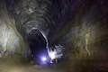 | Lava River Cave This underground hike explores a lava tube south of Bend that is filled with fascinating volcanic features. |
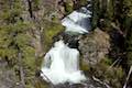
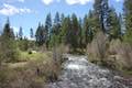
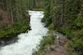 | Deschutes River Trail to Benham Falls This 1.9-mile hike follows a leisurely trail along the Deschutes River to aggressive cascades called Benham Falls where the river churns and tumbles through a gap between cliffs. |
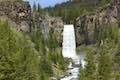 | Tumalo Falls See Bend's best waterfall on a short walk to a downstream viewpoint or a half-mile round trip hike to an overlook by the top of the falls. |
 | Tumalo Falls Loop This 7.4-mile circuit ventures above Tumalo Falls and explores numerous other waterfalls and cascades on Tumalo Creek, combining North Fork Trail, Swampy Lakes Trail, and Bridge Creek Trail. |
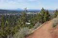 | Pilot Butte This 1.8-mile hike ventures up the dominant landmark in Bend to offer sweeping views of the majestic surroundings. |
 | Shevlin Loop Trail This 4.75-mile tour of Shevlin Park just a few miles east of Bend explores pine forests on both sides of Tumalo Creek. |
 | Archie Briggs Canyon Trail This 1.25-mile hike descends a ravine to clifftop views over a dramatic canyon on the Deschutes River. |
 | More trails in Oregon Explore other hikes in Central Oregon, the Columbia River Gorge, and elsewhere. |
Go the extra miles...
Submit a rating of this hike to go with your comment. Contribute to the average trail rating.